Roughly 4.2 billion years ago, Mars was a much different place than it is today. It's atmosphere was thicker and warmer and its surface much wetter. Unfortunately, the planet's atmosphere was stripped away by solar wind over the next 500 million years, causing the surface to become so cold and dry that it makes Antarctica look balmy by comparison!
As a result, most of Mars' water is currently locked away in its polar ice caps. But billions of years ago, water still flowed freely across the surface, forming ancient rivers and lakes. In fact,
new research
led by The University of Texas at Austin indicates that sometimes these lakes would fill so fast that they would overflow, causing massive floods that had a drastic impact on the surface.
The study which describes their findings, titled "
Incision of paleolake outlet canyons on Mars from overflow flooding
", recently appeared in the journal
Geology.
The study was led by Tim Goudge, a postdoctoral fellow from UTA's
Jackson School of Geosciences
(JSG), and included David Mohrig (the JSG Associate Dean for Research) and Caleb Fassett of NASA's Marshall Space Flight Center.
[caption id="attachment_140614" align="aligncenter" width="580"]
Satellite image of Jezero crater, showing the outlet canyon that was carved by overflow flooding (upper right side of the crater). Credit: NASA/Tim Goudge.[/caption]
Based on high-resolution photos taken by NASA's
*Mars Reconnaissance Orbiter*
(MRO), the team examined the topography of 24 "paleolakes" - craters on Mars which were once filled with water. In the past, scientists have noticed that many of these craters have outlets in their rims connected to canyon systems, which range from tens to hundreds of kilometers long and several kilometers wide.
While it was clear that these canyons were the result of outflow from the paleolakes, scientists were unclear as to whether they formed over the course of eons, or were carved rapidly by single floods. However, by examining the MRO's data, the team was able to find a correlation between the size of the outlets and the volume of water expected to be released during large flooding events.
These findings suggest that catastrophic geologic processes may have had a major role in shaping the landscape of Mars. As Goudge explained in a recent UT News
press release
:
"These breached lakes are fairly common and some of them are quite large, some as large as the Caspian Sea. So we think this style of catastrophic overflow flooding and rapid incision of outlet canyons was probably quite important on early Mars’ surface.”
[caption id="attachment_140615" align="aligncenter" width="580"]
The Palouse River Canyon in eastern Washington was carved by catastrophic flooding during the last ice age. Credit: Keith Ewing.[/caption]
On Earth, a similar process takes place where lakes that are dammed by glaciers break through and carve systems of canyons. Because of the similarities in shape, scientists have been able to deduce that much the same thing occurred on Mars billions of years ago. As Goudge
indicated
:
"This tells us that things that are different between the planets are not as important as the basic physics of the overflow process and the size of the basin. You can learn more about this process by comparing different planets as opposed to just thinking about what’s occurring on Earth or what’s occurring on Mars.”
A major difference, however, is the rate at which these processes take place on Earth compared to Mars. On Earth, changes in surface geology are the result of plate tectonics, which cause changes in surface features very slowly over the course of eons. On Mars, which is geologically inactive, massive floods and asteroid impacts cause rapid changes to the landscape that are near-permanent.
"The landscape on Earth doesn't preserve large lakes for a very long time,"
said
Fassett. "But on Mars … these canyons have been there for 3.7 billion years, a very long time, and it gives us insight into what the deep time surface water was like on Mars."
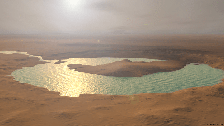
[caption id="attachment_140591" align="aligncenter" width="580"]
After 5 years and 60 candidates, NASA has chosen Jezero crater as the landing site for the Mars 2020 rover. Image Credit: NASA/JPL/JHUAPL/MSSS/Brown University[/caption]
One of the paleolakes examined by the team was the Jezero Crater, which was
recently selected
as the landing site for NASA's upcoming
*Mars 2020*
rover mission. Among the rover's main objectives is the search for signs of past life on Mars. Interestingly enough, Goudge and Fassett proposed the Jezero Crater based on previous studies that found that it held water for long periods in the past.
Because of this, Jezero is considered a good candidate for finding evidence of past life on Mars, as well as geological data that will shed light on how the surface has evolved over time. This is partly due to the presence of carbonate-bearing rocks and outcroppings of exposed clay minerals in the crater, the latter of which are considered to be a likely place to find preserved organics and other biogenic signatures.
This study, meanwhile, provides additional insight into how catastrophic geological processes could have played a major role in shaping the landscape of Mars. It's findings could also be applied to other worlds where
plate tectonics don't exist
, which currently account for every exoplanet discovered to date.
Over the course of the past few decades, scientists have learned much about the history of Mars - which have noted several striking similarities between Earth and Mars. In the coming years, scientists expect to learn a great deal more, like whether or not Mars once supported life and whether or not it could be related to life on Earth.