
Landsat 8 officially opened its eyes to Earth yesterday (May 30). Officials are promising the clearest views yet of the four-decade-old Landsat program, and luckily for people who love amazing Earth views, the images Landsat produces are free.
Before talking a bit about Landsat 8, here’s one way you can find the images: go to this website of raw Landsat data from the United States Geological Survey. In the menu tab “Collection”, go down to “Landsat Archive” and select “Landsat 8 OLI.” Then click a location on the map to see if it’s taken a picture of a spot you’re interested in.
Once you’ve selected it, hit “Add Scene”, then click on the scene list at the bottom right of the screen to download the product. (We’d strongly advise consulting the tutorial on that website for more help. You need to register as a user to download the high-resolution images.)
There isn’t much to see there yet, but over the next few months there should be a wealth of pictures to choose from. More spots where Landsat 8 data will appear are listed on this USGS page.
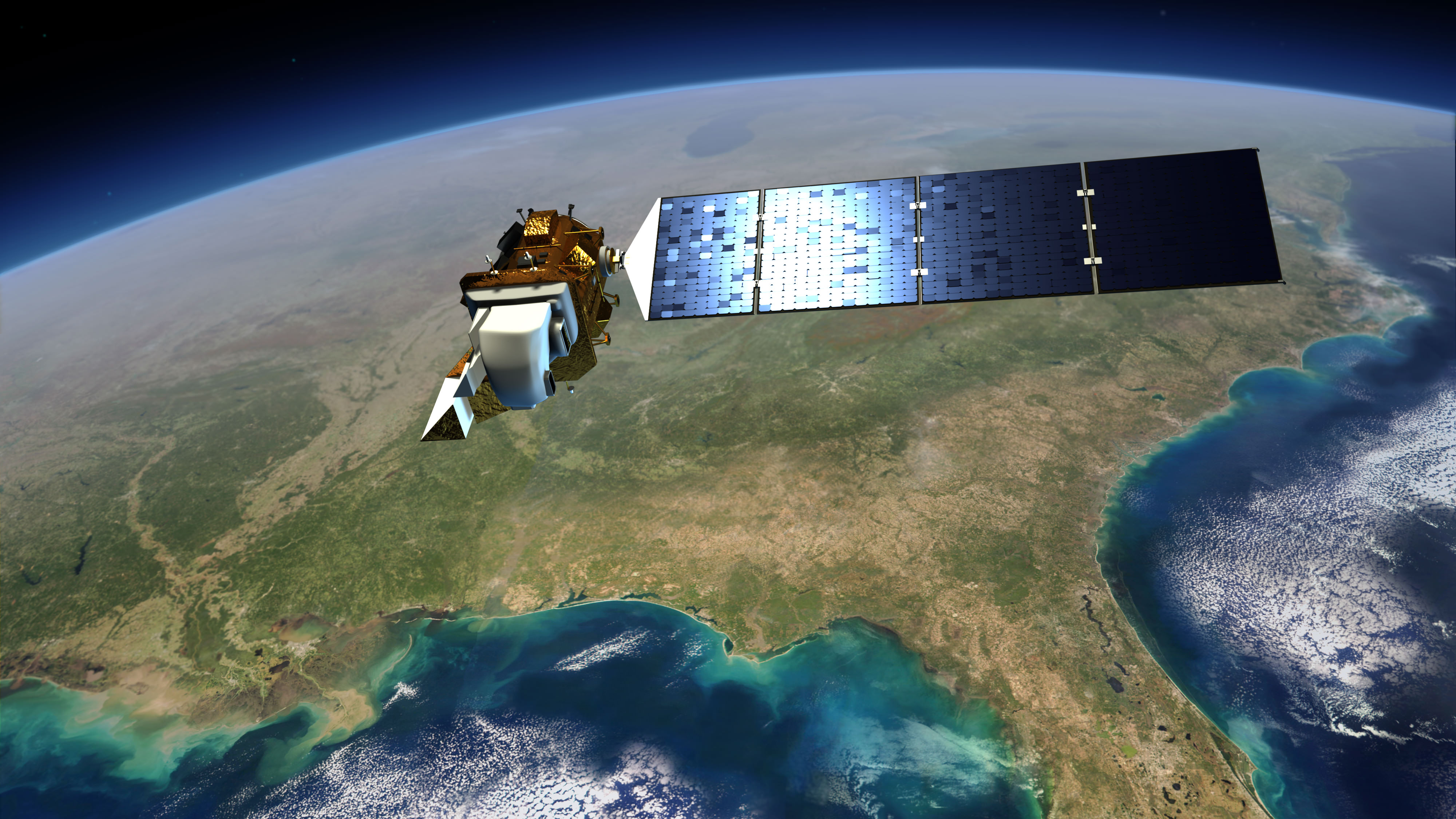
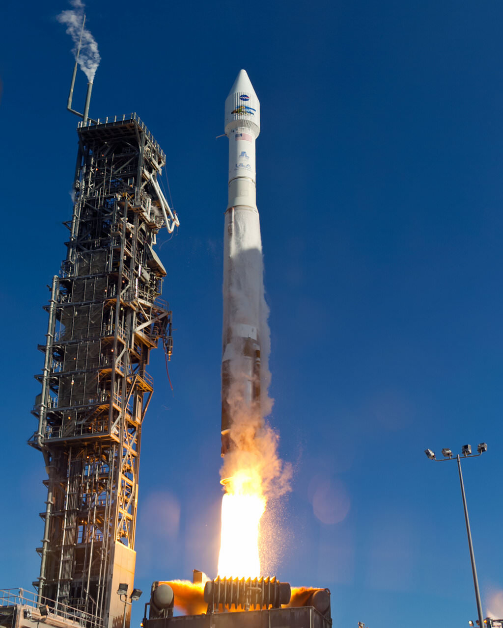
You may better recall Landsat 8 as the Landsat Data Continuity Mission. Launched on Feb. 11, it was first under the operational control of NASA as the agency put the satellite through its paces — placing it into the proper orbit (it circles in a near-polar orbit) and taking some test images of the planet, for example.
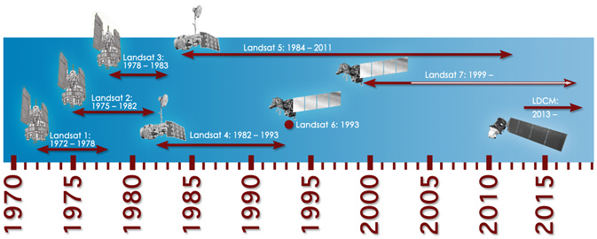
Now that the satellite is ready, the USGS has operational control and will add that to more than 40 years of data collected under the Landsat program. The aim, we assure you, is not just for pretty pictures.
Long Earth observation programs show changes in the land over time. We can see cities grow, observe forests shrink or deserts expand in response to human activity or climate change, and also gauge the impact of natural disasters. In the past, Landsat pictures have been used to map the impact of the Mount St. Helen’s eruption of 1980, and to respond to oil gas fires set in Kuwait during the Gulf War of 1991.
These are heavyweight satellites. The truck-sized Landsat 8 weighs 4,566 lbs (2,071 kg) fully loaded with fuel, excluding the weight of the instruments. Its operational land imager can take pictures in nine spectral bands, which is important because certain types of vegetation or land features show up better in different light spectra. (One application is to monitor the health of certain kind of plants in farmer fields, for example.) It also has two thermal infrared sensor bands that will show the heat signature of Earthly features.
For Landsat, officials needed to launch this satellite because its predecessor (Landsat 7)’s operational lifetime is in overtime. Should the satellite have failed before Landsat 8 arrived, 41 years of continuous Earth observations under the same program would have ceased.
Landsat 8 will circle the globe 14 times daily, will repeat its ground track every 16 days, and is expected to do this for at least five years. Check out this USGS feature story for more on how it will contribute to Earth observation.
I was expecting to be impressed with this, but I’m not. The images they actually present are low-res blocks, far less impressive than anything one could pull from Google Maps/Earth or a similar program.
You beat me by eight minutes!
Not near the speed and convenience of Google Earth, either!
– plus, on G.E. I can download and save my GPS treks, among dozens of other added functions it offers.
Apologies, I forgot a step that I’ve added now. Right-click on the image, select “Add Scene.” It should pop up in the scene list at the bottom part of your screen. Then download from the scene list.
@volkerball85:disqus and @zkank:disqus Making this look like Google Maps was likely never at the top of the USGS’s todo list. The reason is simple: it’s meant for a different audience. If they wanted, say, your mom to have easy access to the data then they would have gone the Google Maps route; instead, they’re more interested in letting people download the original data (which I think this does well.) The last thing Google wants is to have you downloading their maps, so Maps just presents pretty pictures.
And besides, compare the new site to the old way of getting data: I had to download tarballs of image data back in the late 90s; before that it was available only on tape. And you paid for it. What the USGS has done is admirable, to say the least. Making the original data easily available will enable a whole load of worthwhile studies that might not have a huge grant, to everyone from laypeople and undergraduates, to principal investigators with huge budgets, to farm owners who want to see where the water deficits on their properties to government techs.
My advice (should you want to hear it): start thinking of fun stuff to do with the data. It’s a fabulous resource.
If you’re unaware of how to download images from Google Earth or Maps, or any other site on the Internet, you’re not very computer tech savvy!
I think you missed the point, friend: yes, you can download the images from Google Maps and then you have… a bunch of images you can’t really use. It’s the Maps interface — the controls you work with — that make that site what it is. The USGS isn’t after that sort of usage pattern. They want people to download this data so they can apply whatever analysis techniques they need. In this case, the controls are with the user — and that’s the point.
But whatever — you still haven’t told us what you plan on doing with the data!
The Landsat satellite legacy has 40+ years of data. The Landsat 8 satellite is backward compatible with these older data sets as well as having many new advancements and enhancements (cirrus cloud detection, blue band for better water penetration, etc.). When doing time comparisons over the stretch of 40 years it is important to have fairly consistent data and fairly current temporal coverage. With the Landsat series there is nearly 8 day coverage through the 1990’s and nearly that often dating back to 1972. When looking at Landsat data it makes a nice image, good for mapping, but it can also be used for deriving vegetation indices thermal detection, evapotranspiration, geothermal studies, mineral exploitation, urban planning, crop yield and analysis, deforestation predictions, hazard recovery, and numerous other studies, none of which can be derived from Google maps. The importance of the Landsat satellite suites is not in what you see immediately from the browse images, but what scientists can do with these data after they have been downloaded.