Opportunity Rover Sidelined by Charged Particle Hit

MER's camera mast, which holds several cameras, may have been hit by a cosmic ray. Credit: NASA/JPL

[/caption]
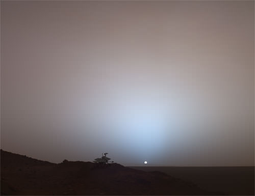
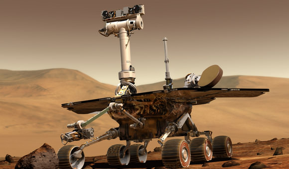
The Opportunity rover recently surpassed the five-year mark on Mars. And what did she get as a birthday present? A thorough zapping by a charged particle, perhaps a cosmic ray, which has sidelined the rover for the past several days. “Opportunity stood down for a few sols as a result of a PMA (Panoramic Mast Assembly) error,” said Scott Maxwell, one of the rover drivers for the two Mars Exploration Rovers, Opportunity and Spirit. “This turned out to be due to an SEU (Single-Event Upset), as reported by the on-board motor controller.” An SEU happens when a charged particle whizzes through a transistor on the rover and flips a bit somewhere inside. “Fortunately, the motor controllers can detect and report these events, so that the rover can safely stop,” Maxwell told Universe Today. “We have good reason to hope that Opportunity’s PMA is undamaged and that she’ll be back on the road shortly.” The PMA is the rover’s “neck and head;” it is the mast that holds the Panoramic Cameras, the Navigation Cameras and the Mini-Thermal Emission Spectrometer. It would be a critical blow to the mission to lose any or all of these instruments. The Spirit rover may also have been hit recently by a cosmic ray, causing her to “loose her memory” for a short period. The good news is that Spirit seems to be back to normal and has resumed driving again.

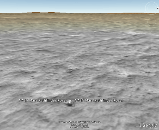
No images from the Pancams or Navcams have been downloaded to Earth for the past four days, since sol 1787 (today is sol 1791 for Opportunity.) Opportunity has been traversing quite quickly on her way to Endeavour Crater, about 12 kilometers (7 miles) away. That distance would match the total distance Opportunity traveled from 2004 to mid-2008. Even at the 100-meter plus pace each sol, which “Oppy” was able to do back in December, the journey could take two years.

“The terrain Opportunity is passing through is good driving terrain,” said Maxwell, “although not quite a parking lot, but nothing she can’t handle. With the help of our “Martian satellite navigation system” (that is, the beautiful high-resolution orbital images we get from MRO), we expect to continue making good time through this dune field on the way to Endeavour.”

We’ll keep you posted on Opportunity’s status.

Latest panorama from Opportunity from Sol 1770.  Credit: NASA/JP
Latest panorama from Opportunity from Sol 1770. Credit: NASA/JP

Spirit resumed driving Saturday, albeit just a short drive, after engineers performed diagnostic tests to determine the cause of “unusual behavior” by the rover last week. On Spirit’s Sol 1800, the rover did not save information into its non-volatile flash memory, so the information was lost when the rover next powered down. She also seemed to be disoriented, and was not able to locate the sun correctly.

“We may not find any data that will explain what happened on Sol 1800, but there’s no evidence that whatever happened then has recurred on subsequent sols,” said Jacob Matijevic of the rover engineering team at NASA’s Jet Propulsion Laboratory, Pasadena. One possibility is that a cosmic-ray hit could have temporarily put Spirit temporarily into a mode that disables use of the flash memory.

Spirit drove only about 30 centimeters (1 foot) Saturday, during the 1,806th Martian sol. The rover team had commanded a longer drive, but Spirit stopped short after its right-front wheel, which no longer turns, struck a partially buried rock. The rover drivers prepared commands Monday for the next drive in a slightly different direction to get around that rock.

Raw image from Spirit from her Sol 1806.  Credit: NASA/JPL
Raw image from Spirit from her Sol 1806. Credit: NASA/JPL


Spirit is just north of a low plateau called “Home Plate.” It spent 2008 on a north-facing slope on the edge of Home Plate so that its solar panels stayed tilted toward the winter sun for maximum electrical output.

Spirit drove down off Home Plate on Jan. 6, 2009. It subsequently checked whether a patch of nearby soil, called “Stapledon,” had a high concentration of silica, like a silica-rich patch of soil Spirit discovered east of Home Plate in 2007. The earlier discovery was interpreted as evidence left by a hot-spring or steam-vent environment. Examination with Spirit’s alpha particle X-ray spectrometer confirmed silica at Stapledon. This indicates that the environment that deposited the silica was not limited to the location found earlier.

Sources: JPL, email exchange with Scott Maxwell

HiRISE Captures Bolide Break-up and Impact on Mars

Bolide impact on Mars. Credit: NASA/JPL/University of Arizona

[/caption]
Incoming! Hundreds of small objects, mostly asteroid fragments, impact Mars every year. Sometimes, like on Earth, objects break up in the Martian atmosphere. But Mars’ atmosphere is much thinner than Earth’s, meaning more stuff hits the ground on the Red Planet. If a bolide breaks apart and but doesn’t disintegrate, the result can be a cluster of craters. The image here is an example of that, with this group of recently made small impact craters. Although small Martian crater clusters are common, this example is unusual because there is a dark line between the two largest craters. The HiRISE scientists hypothesize that atmospheric breakup created two nearly equal-size objects that impacted close together in space and time so the air blasts interacted with each other to disturb the dust along this line. Wow!

The impact occurred sometime between May 2003 and September 2007. A dark spot is not present in the previous image of this location with sufficient resolution to have detected it, acquired by the visible THEMIS camera on Mars Odyssey in May 2003. Check out the THEMIS site, where you can find images by clicking on a map of Mars. This impact was first discovered as a dark spot in an image taken by the Mars Reconnaissance Orbiter’s CTX (Context) Imager acquired in March 2008, but later found to be partly visible at the very edge of a CTX image acquired in September 2007. The CTX team has been discovering many new impact events on Mars, and then they request HiRISE follow-up imaging to confirm an impact origin and to identify and measure the craters.

Here’s the full HiRISE image:

Full HiRISE Image. Credit: NASA/JPL/University of Arizona

This area is just a few hundred meters wide.The dark markings are created by removing or disturbing the surficial dust cover, and so far new impact sites have been discovered only in dust-covered regions of Mars.

A comparable number of small objects impact Earth every year as on Mars, but most explode in the upper reaches of our atmosphere and provide us with “shooting stars.”

Source: HiRISE Site

New Robot Could Explore Treacherous Terrain on Mars

Axel concept as a tethered marsupial rover for steep terrain access. Credit: JPL

If you’ve looked at the high resolution HiRISE images from the Mars Reconnaissance Orbiter, or had the chance to explore the new Google Mars, you know Mars is fraught with craters, mountains, gullies, and all sorts of interesting – and dangerous – terrain. Areas such as these with layered deposits, sediments, fracturing and faulting are just the type of places to look for the sources of methane that is being produced on Mars.

But it’s much too risky to send our current style of rovers, including the 2011 Mars Science Laboratory (MSL), into treacherous terrain. But engineers from JPL, along with students at the California Institute of Technology have designed and tested a versatile, low-mass robot that could be added to larger rovers like MSL that can rappel off cliffs, travel nimbly over steep and rocky terrain, and explore deep craters.

This prototype rover, called Axel, might help future robotic spacecraft better explore and investigate foreign worlds such as Mars. On Earth, Axel might assist in search-and-rescue operations.

Watch a video showing an Axel test-run at the JPL Mars yard.

“Axel extends our ability to explore terrains that we haven’t been able to explore in the past, such as deep craters with vertically-sloped promontories,” said Axel’s principal investigator, Issa A.D. Nesnas, of JPL’s robotics and mobility section. “Also, because Axel is relatively low-mass, a mission may carry a number of Axel rovers. That would give us the opportunity to be more aggressive with the terrain we would explore, while keeping the overall risk manageable.”

Nesnas said Axel is like a yo-yo — it is on a tether attached to a larger rover and can go up and down the sides of craters, canyons and gullies, exploring regions not safe for other rovers.

Axel's tether system (and inside electronics) Credit: Axel website
Axel’s tether system (and inside electronics) Credit: Axel website

The simple and elegant design of Axel, which can operate both upside down and right side up, uses only three motors: one to control each of its two wheels and a third to control a lever. The lever contains a scoop to gather lunar or planetary material for scientists to study, and it also adjusts the robot’s two stereo cameras, which can tilt 360 degrees.

Axel's different possible configurations.  Credit: JPL
Axel’s different possible configurations. Credit: JPL

Axel’s cylindrical body has computing and wireless communications capabilities and an inertial sensor to operate autonomously. It also sports a tether that Axel can unreel to descend from a larger lander, rover or anchor point. The rover can use different wheel types, from large foldable wheels to inflatable ones, which help the rover tolerate a hard landing and handle rocky terrain.

Axel has been in development since 1999, and students from Caltech, Purdue University, and Arkansas Tech University have collaborated with JPL over the years to develop this versatile rover.

For more information on Axel, see JPL’s Axel page, and Caltech’s Axel website.

Google Oceans, Google Mars

The Mars feature of Google Earth 5.0 lets users see the Red Planet from the perspective of Rovers like the NASA Mars Pathfinder Rover. (Credit: NASA/Google/JPL/University of Arizona)

[/caption]
Google Earth now allows you to probe the depths of Earth’s oceans as well as fly through the giant canyons or volcanoes on Mars. Google Earth 5.0 was unveiled today, with substantial upgrades for both the Earth and the Red Planet. Google worked in conjunction with NOAA and NASA to incorporate data from our undersea explorations and the spacecraft orbiting Mars. For the first time, you’ll be able to look at the two-thirds of our planet covered by the oceans, take a tour below sea level, and even look at historical imagery to see things like coastal erosion. On Mars there’s a rich conglomeration of images, including the most recent from the Mars Reconnaissance Orbiter to provide an immersive 3D view of Mars. Marine scientists say the electronic images will boost awareness and increase public support for marine conservation, while NASA says the new features in Google Mars will aid public understanding of Mars science, while also providing researchers a platform for sharing data similar to what Google Earth provides for Earth scientists.

In Google Oceans, you can click a function called Touring and you can create narrated, illustrated tours, on land or above and below the sea surface, describing and showing things like a hike or scuba excursion, or even a research cruise on a deep-diving submarine.

A view of the coast of Maui, outside Lanai City, Hawaii, from the new version of Google Earth.

By choosing among 20 buttons holding archives of information, called “layers” by Google, a visitor can read logs of oceanographic expeditions, see old film clips from the heyday of Jacques-Yves Cousteau and check daily Navy maps of sea temperatures.

While only 5% of the ocean floor is mapped in detail, the replicated seas have detailed topography reflecting what is known about the abyss and continental shelves with rougher areas where little is known.

On Mars, you can enjoy a high-resolution, three-dimensional view of the Red Planet.

There is a mode that enables users to fly virtually through enormous canyons and scale huge mountains on Mars that are much larger than any found on Earth. Users also can explore the Red Planet through the eyes of the Mars rovers and other Mars missions, providing a unique perspective of the entire planet.

Clickable links allow you to learn about new discoveries and explore indexes of available Mars imagery. If you’re into working with the raw images from the Mars rovers or orbiting spacecraft, the new Mars mode also allows users to add their own 3D content to the Mars map to share with the world.

Since 2005, Google Earth has been downloaded on half a billion computers, and visitors spend one million hours a day perusing Google Earth and the related Google Maps.

Guess what I’ll be doing the next few hours!

Download Google Earth 5.0.

Sources: NASA, New York Times

Spirit Rover Having Memory, Mobility Problems

Special-Effects Spirit Silhouetted on "Jibsheet" Image Note: Rover model by Dan Maas; synthetic image by Koji Kuramura, Zareh Gorjian, Mike Stetson and Eric M. De Jong. Image credit: NASA/JPL-Caltech/Cornell

[/caption]

The Spirit rover appears to have some memory and mobility problems. Yes, she’s getting old, and it appears she has symptoms of aging similar to humans. On Sunday, during her 1,800th Martian day, or sol, information radioed from Spirit indicated the rover had received its driving commands for the day but had not moved. That can happen for many reasons, including the rover properly sensing that it is not ready to drive. However, other behavior on Sol 1800 was even more unusual: Spirit apparently did not record the day’s main activities into the non-volatile memory, the part of its memory that persists even when power is off. It’s almost five years to the day when Spirit had memory problems with her “flash drive,” but back then, she was just a youngster.

The team operating NASA’s Mars Exploration Rover Spirit plans diagnostic tests this week to see why she did not report some of its weekend activities, including a request to determine its orientation after an incomplete drive.

On Monday, Spirit’s controllers at NASA’s Jet Propulsion Laboratory in Pasadena, Calif., chose to command the rover on Tuesday, Sol 1802, to find the sun with its camera in order to precisely determine its orientation. Not knowing its orientation could have been one possible explanation for Spirit not doing its weekend drive. Early Tuesday, Spirit reported that it had followed the commands, and in fact had located the sun, but not in its expected location.

“We don’t have a good explanation yet for the way Spirit has been acting for the past few days,” said JPL’s Sharon Laubach, chief of the team that writes and checks commands for the rovers. “Our next steps will be diagnostic activities.”

Among other possible causes, the team is considering a hypothesis of transitory effects from cosmic rays hitting electronics. On Tuesday, Spirit apparently used its non-volatile memory properly.

Despite the rover’s unexplained behavior, Mars Exploration Rovers’ Project Manager John Callas of JPL said Wednesday, “Right now, Spirit is under normal sequence control, reporting good health and responsive to commands from the ground.”

Spirit has a history of being a drama queen, but just the same, I’m keeping my fingers crossed that she pulls through this latest mess alright.

Source: JPL

Lots of Pure Water Ice at Mars North Pole

Mars North Polar Ice Cap. Credit: NASA/JPL

[/caption]
Planum Boreum, Mar’s north polar cap contains water ice “of a very high degree of purity,” according to an international study. Using radar data from the SHARAD (SHAllow RADar) instrument on board the Mars Reconnaissance Orbiter (MRO), French researchers say the data point to 95 percent purity in the polar ice cap. The north polar cap is a dome of layered, icy materials, similar to the large ice caps in Greenland and Antarctica, consisting of layered deposits, with mostly ice and a small amount of dust. Combined, the north and south polar ice caps are believed to hold the equivalent of two to three million cubic kilometers (0.47-0.72 million cu. miles) of ice, making it roughly 100 times more than the total volume of North America’s Great Lakes, which is 22,684 cu. kms (5,439 miles).

The study was done by researchers at France’s National Institute of Sciences of the Universe (Insu), using the Italian built SHARAD radar sounder on the US built MRO. SHARAD looks for liquid or frozen water in the first few hundreds of feet (up to 1 kilometer) of Mars’ crust by using subsurface sounding. It can detect liquid water and profile ice.

Mars southern polar cap was once thought to be carbon dioxide ice, but ESA’s Mars Express confirmed that it is composed of a mixture of water and carbon dioxide.

The study on Mars north polar cap appears in the journal Geophysical Research Letters, published by the American Geophysical Union.

Source: PhysOrg

Mars Methane Movies

Nili Fossae on Mars where methane has been detected. Credit: NASA/JPL/University of Arizona

At NASA’s press conference last week about methane on Mars, NASA’s lead scientist for the Mars Program Michael Meyers said straight out, “These findings are not evidence for life, but evidence for active processes on Mars.” But seemingly, not everyone in the media took the high road in reporting about the methane news, with some claiming NASA had found life on Mars.

If you missed the news conference, or didn’t read the Universe Today article on the methane news, or would like further information straight from the scientists who have been working on the methane detection on Mars for several years, NASA has put together some videos, where you can get the news straight from the scientists. The first one is with Dr. Michael Mumma of NASA’s Goddard Space Flight Center. Take a look:

And there’s more:


If you click on the little video screens on the bottom after the first video is over, you can watch a series of videos from the press conference where the methane plumes news was discussed. Sometimes its best to hear it from the scientists first-hand.

If you want to read some of the more “titillating” versions of the methane news, Phil Plait has written an article about the Mars Methane Media Mess created by some over-zealous journalists (that includes a nice compliment on our article — thanks Phil!) and Dave Mosher at Discovery Space has a post about the Mars Methane Bomb on Earth.

Large Quantities of Methane Being Replenished on Mars

This image shows concentrations of Methane discovered on Mars in 2009, from an Earth-based observatory. Credit: NASA

[/caption]
Methane has been measured in large quantities in Mars atmosphere over several seasons, meaning Mars is active, either geologically or biologically. “We found methane,” said Dr. Geronimo Villanueva from the NASA Goddard Space Flight Center, one member of a team of scientists reporting on their research at a press conference today at NASA Headquarters. “We can measure not only the methane, but where it is coming from and when it is being released.” This is the first definitive detection of methane on Mars that includes maps identifying areas of active release. “Mars is active,” said Michael Meyers, lead NASA scientist for the Mars Program, “but we don’t know if it’s because of biology or geology or both.”

The methane on Mars was first detected in 1999, again in 2001 and 2003, which was widely reported, but not much was known about the origin or amount of the gas on Mars.

The research team found methane in the atmosphere of Mars by carefully observing the planet over several Mars years, and during all the Martian seasons with NASA’s Infrared Telescope Facility, run by the University of Hawaii, and the W. M. Keck telescope, both at Mauna Kea, Hawaii.

Measurements were made using spectroscopy by which light is split into its individual wavelengths, and then the “fingerprint” of individual molecules can be identified.

From Earth the aperture of the spectrometer is placed along the north-south direction of the planet, and during observations, the instrument can acquire between 30 and 50 individual spectra of Mars for every sixty seconds. Doing this they can build a map of the planet, as the planet rotates under the “slit” or aperture of the spectrometer.
In this illustration, subsurface water, carbon dioxide and the planet's internal heat combine to release methane. Although we don’t have evidence on Mars of active volcanoes today, ancient methane trapped in ice "cages" might now be released. Credit: NASA/Susan Twardy
The origin of methane could either be geologic where water reacts with hot rock and produces methane gas which escapes through pores in the planet’s surface in a process called serpentinization. Or it could be evidence of biology under the surface, where the methane generated by microbes could accumulate and then escape through the rocks.

Three regions of active release of methane were found and were seen over areas that show evidence of ancient ground ice or flowing water. The plumes of methane appeared over northern hemisphere regions such as east of Arabia Terra, the Nili Fossae region, and the south-east quadrant of Syrtis Major, an ancient volcano 1,200 kilometers (about 745 miles) across.

“We observed and mapped multiple plumes of methane on Mars, one of which released about 19,000 metric tons of methane,” said Villanueva. “The plumes were emitted during the warmer seasons — spring and summer — perhaps because the permafrost blocking cracks and fissures vaporized, allowing methane to seep into the Martian air. Curiously, some plumes had water vapor while others did not,” said Villanueva. The rate of release is about 1 pound per second or .6 kg per second.

“Methane is quickly destroyed in the Martian atmosphere in a variety of ways, so our discovery of substantial plumes of methane in the northern hemisphere of Mars in 2003 indicates some ongoing process is releasing the gas,” said Dr. Michael Mumma of NASA’s Goddard Space Flight Center in Greenbelt, Md. “At northern mid-summer, methane is released at a rate comparable to that of the massive hydrocarbon seep at Coal Oil Point in Santa Barbara, Calif.”

Another team member, Lisa Pratt, professor of geological sciences, Indiana University in
Bloomington, elaborated on whether the process creating the methane could be geological or biological. “If there is an “A” line of evidence that makes me think we need to seriously consider biology, it’s the processes in the subsurface that would allow for methane generation that seems slightly more plausible for biology than geochemistry,” she said. “Serpentinization is a simple water/rock reaction and is a process we see only in a few special places on Earth, usually associated with major fracturing and faulting that allows mantle like materials to be exposed to sea water and groundwater. That’s a process that ‘plugs up the plumbing’ and isolates the reactive site, and we don’t see a lot of evidence for major active, deep faulting and uplift that would bring these reactive materials into contact with water.”

While the team reported on results from observations in 2003 and 2006, they said they were not at liberty to discuss findings from subsequent observations, as the work to decipher the findings is still being done. But they hinted that relatively soon, more information would be available. They are also developing a strategy for further studies with ground-based telescopes, current spacecraft orbiting Mars, and future spacecraft such as the Mar Science Laboratory, as well as re-looking at data already obtained to see if more clues can be found as to the origin of the methane on Mars.

Sources: NASA press conference, NASA

Latest Images From HiRISE (More Eye Candy)

Gullies on the dunes of Russell Crater on Mars. Credit: NASA/JPL/University of Arizona

[/caption]
I don’t know about the rest of you, but I could look at images from the HiRISE camera on the Mars Reconnaissance Orbiter all day…and there are days I have spent a great deal of time perusing through the gorgeous, high-resolution images. Here are just a few of the latest images the HiRISE team has released. This first one is one of the most stunning yet. It’s part of a dune field in a crater called Russell Crater (53.3S and 12.9E.) The dune field itself is roughly 30 kilometers long, and appears to have formed from windblown material trapped by the local topography. The image was taken in October 2008, during the Mars’ southern hemisphere’s deep winter, where temperatures are low enough to allow the carbon dioxide frost to be stable. Looking closely, you can see the frost, visible on the slopes that don’t get full sunlight. The team says this region is the target of a long term monitoring program by HiRISE.

And there’s more…

Features in Moreau Crater. Credit: NASA/JPL/UA

This image is of a so called “flow feature” within Moreux Crater, located at 42N and 44.6E on the edge of Mars’ highlands/lowlands boundary. The crater itself is roughly 135 kilometers in diameter. During an impact event that creates a crater, central uplifts or mounds form on the floor of the crater in craters larger than 7km in diameter. This image focuses on a portion of the Moreux central uplift that apparently broke off and slid away, forming a type of giant landslide. Interesting hummocks, swirls and ridges are found on the surface of the landslide. There are also distinct, almost circular depressions of unknown origin near the foot of the flow. Both light and dark toned dunes later formed on this landform.
Features in a volcano, Hecates Tholus.  Credit: NASA/JPL/UA
Features in a volcano, Hecates Tholus. Credit: NASA/JPL/UA

This image shows features on a volcano called Hecates Tholus. This volcano is located in the northern hemisphere of Mars and is the northernmost of three volcanoes within Elysium Planitia. The “braided” channels seen in this image appear to have formed by water carving into young lava flows. Like braided rivers on Earth, they consist of a network of small channels, often separated by small streamlined “islands.” The fact that they are braided and have streamlined islands has led scientists to interpret these landforms as being created by water (fluvial) rather than by volcanic activity, and perhaps even more than one water-related event created these features, since there are fine sediments and multiple channels.

The water that potentially formed the braided channels may have been released when hot lava came into contact with ground ice.

For more images, as well as more information on these images and high resolution versions, see the HiRISE site. But watch out, you might be there for awhile — there’s lots to look at!

Source: HiRISE

A Cheap Solution for Getting to Mars?

Two shuttles on the pads in September 2008.Credit: NASA

[/caption]
The space shuttles are slated to be retired in September of 2010. NASA put out a call recently to ask what should be done with the shuttles post-retirement, and many think they should be put in museums or on display in rocket parks. But futurist and entrepreneur Eric Knight, (founder of UP Aerospace and Remarkable Technologies) has a somewhat novel idea of what to do with the shuttles after they are done with their current duties: Send them to Mars. He says his formula is simple and will allow humans to travel to Mars in years, not decades.

Knight’s proposal, which he calls “Mars on a Shoestring,” outlines two shuttles going into Earth orbit, hooking them together with a truss and strapping on a powerful enough propulsion system. And that’s pretty much it. A pressurized inflatable conduit would connect the two orbiters so the astronauts could go back and forth between the two shuttles.

Then comes the really cool part; a way to provide artificial gravity during the trip to Mars. From Knight’s webpage:

• Once the propulsion stage has accelerated this entire system on its trek to Mars, the truss is detached from the two orbiters and the truss-propulsion assembly is jettisoned.

• The two orbiters then separate to a distance of a few hundred feet, but remain connected — top to top — by a tether cable that is spooled out.

• During the separation, the accordion-style inflatable crew-transfer conduit equally elongates.

• Once the orbiters are at their maximum fixed distance apart, they would simultaneously fire their reaction control systems to set the pair into an elegant pirouette — creating a comfortable level of artificial gravity for the crew’s voyage to the red planet.

It gets a little dicey once the shuttles arrive at Mars, however. How would these huge spacecrafts get to Mars surface? Knight’s only proposal is separating the orbiters and each having a REALLY huge parachute. Right now, the largest parachute that’s been successfully tested is 150 ft (45 m) in diameter.

However, in an interview we did with JPL’s Rob Manning for a previous article on Universe Today (see “The Mars Landing Approach: Getting Large Payloads to the Surface of the Red Planet), Manning says there’s currently no way and there’s not a parachute big enough to allow a big spacecraft, even a high lift vehicle like a shuttle to land successfully on Mars. The atmosphere is too thin to provide any drag.

From our earlier article:

“Well, on Mars, when you use a very high lift to weight to drag ratio like the shuttle,” said Manning, “in order to get good deceleration and use the lift properly, you’d need to cut low into the atmosphere. You’d still be going at Mach 2 or 3 fairly close to the ground. If you had a good control system you could spread out your deceleration to lengthen the time you are in the air. You’d eventually slow down to under Mach 2 to open a parachute, but you’d be too close to the ground and even an ultra large supersonic parachute would not save you.”

Supersonic parachute experts have concluded that to sufficiently slow a large shuttle-type vehicle on Mars and reach the ground at reasonable speeds would require a parachute one hundred meters in diameter.

“That’s a good fraction of the Rose Bowl. That’s huge,” said Manning. “We believe there’s no way to make a 100-meter parachute that can be opened safely supersonically, not to mention the time it takes to inflate something that large. You’d be on the ground before it was fully inflated. It would not be a good outcome.”

So, while Knight’s proposal is interesting and perhaps forward-thinking, it would need quite a bit of work to actually be feasible. He admits as much, saying “This thought paper is certainly not meant to be the technical be all, end all on the topic — but merely a springboard to new thought. The science and topics touched on herein are superficial; the concepts are simply provided to fuel the imagination and promote discussion.”

Knight said he was inspired by Robert Zubrin’s Mars Direct concept, and he also wanted to “repurpose” the space shuttle fleet.

“In all, I hope that my thought paper provides a catalyst for additional thinking as we ponder our place in the universe — and the methods to transport us to new frontiers.”

Who knows? Many successful endeavors start out as crazy ideas. But first, someone has to have the idea.

Source: Remarkable Technologies