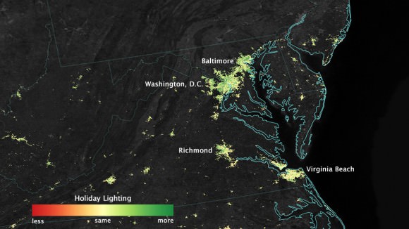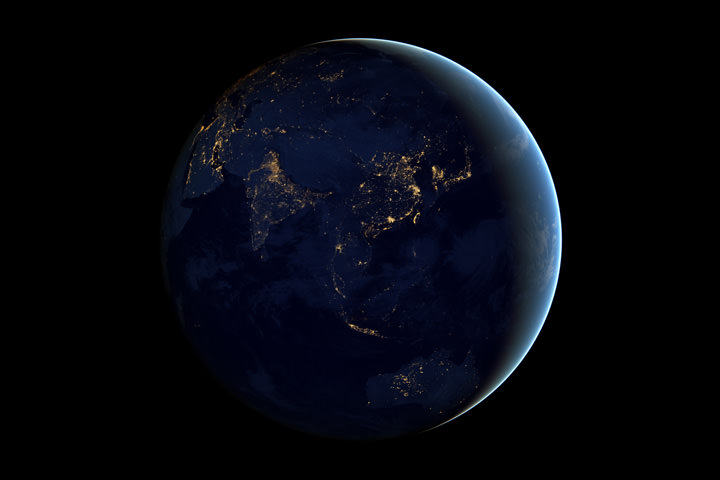
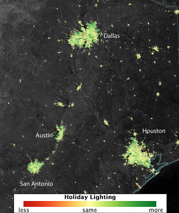
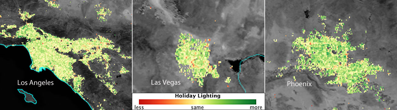
Call it holiday light creep. A NASA satellite has been tracking the spread of Christmas lighting from 512 miles up for the past three years and according to the data, nighttime lights around many major U.S. cities shine 20 to 50 percent brighter during Christmas and New Year’s when compared to light output during the rest of the year. Not surprisingly, most it comes from suburban areas.
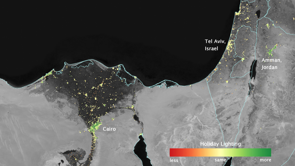
Christmas isn’t the only time holiday festivities spill into the cosmic night. In some Middle Eastern Cities nighttime lights shine more than 50 percent brighter during Ramadan than the rest of the year. Because snow reflects so much light, the researchers could only analyze snow-free cities lest they risk comparing apples to oranges. The team focused on the U.S. West Coast from San Francisco to Los Angeles and on cities south of a rough line from St. Louis to Washington, D.C.
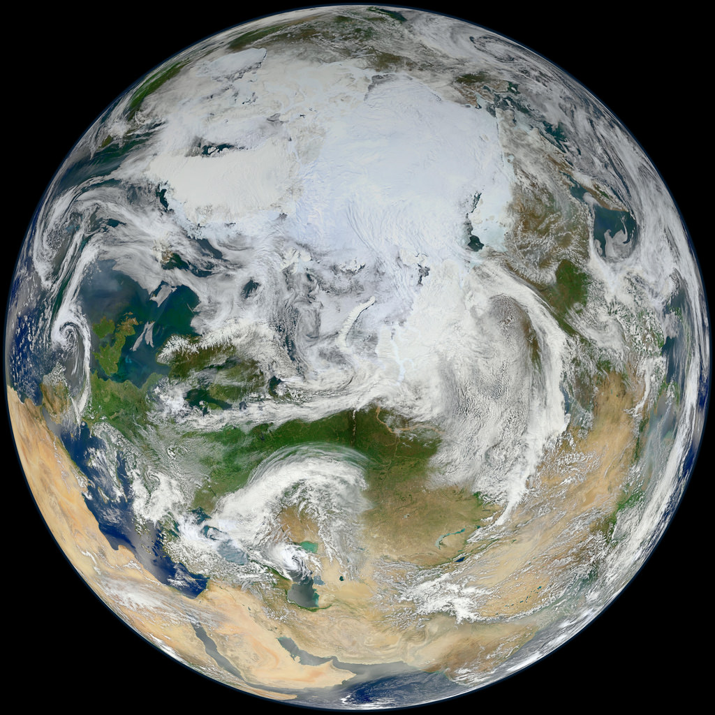
As someone who has spent many winter nights observing I can attest to snow being a major factor in nighttime sky brightness. Even downward shielded lighting must necessarily reflect upward and into the heavens when it strikes the snow below. Summer is a far darker time of year than winter across much of the northern U.S.
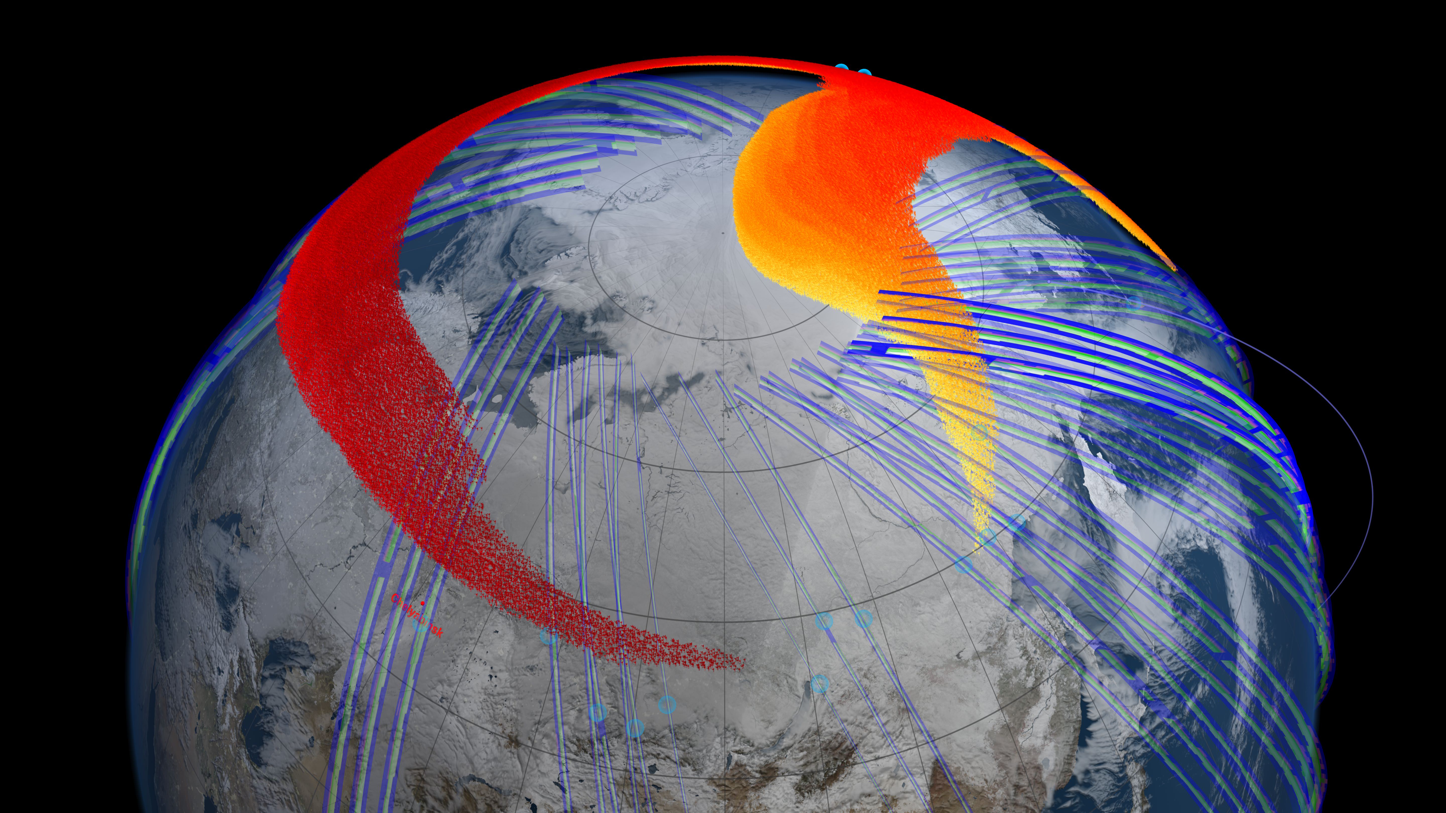
The orbital images were all taken by the Suomi NPP satellite, a joint NASA/National Oceanic and Atmospheric Administration mission, carries an instrument called the Visible Infrared Imaging Radiometer Suite (VIIRS) that detects light in a range of wavelengths from green to near-infrared as it flies over at roughly 1:30 a.m. and 1:30 p.m. each day. VIIRS has a low-light sensor that can distinguish night lights tens to hundreds of times better than previous satellites. In the U.S. the lights starting getting brighter the day after Thanksgiving and continued through News Year’s Day. Miguel Román, a scientist at NASA’s Goddard Space Flight Center and member of the Suomi NPP Land Discipline Team, made the discovery while researching urban energy use patterns in the context of greenhouse emissions. And you thought all those twinkly bulbs were just for fun.
NASA Sees Holiday Lights from Space
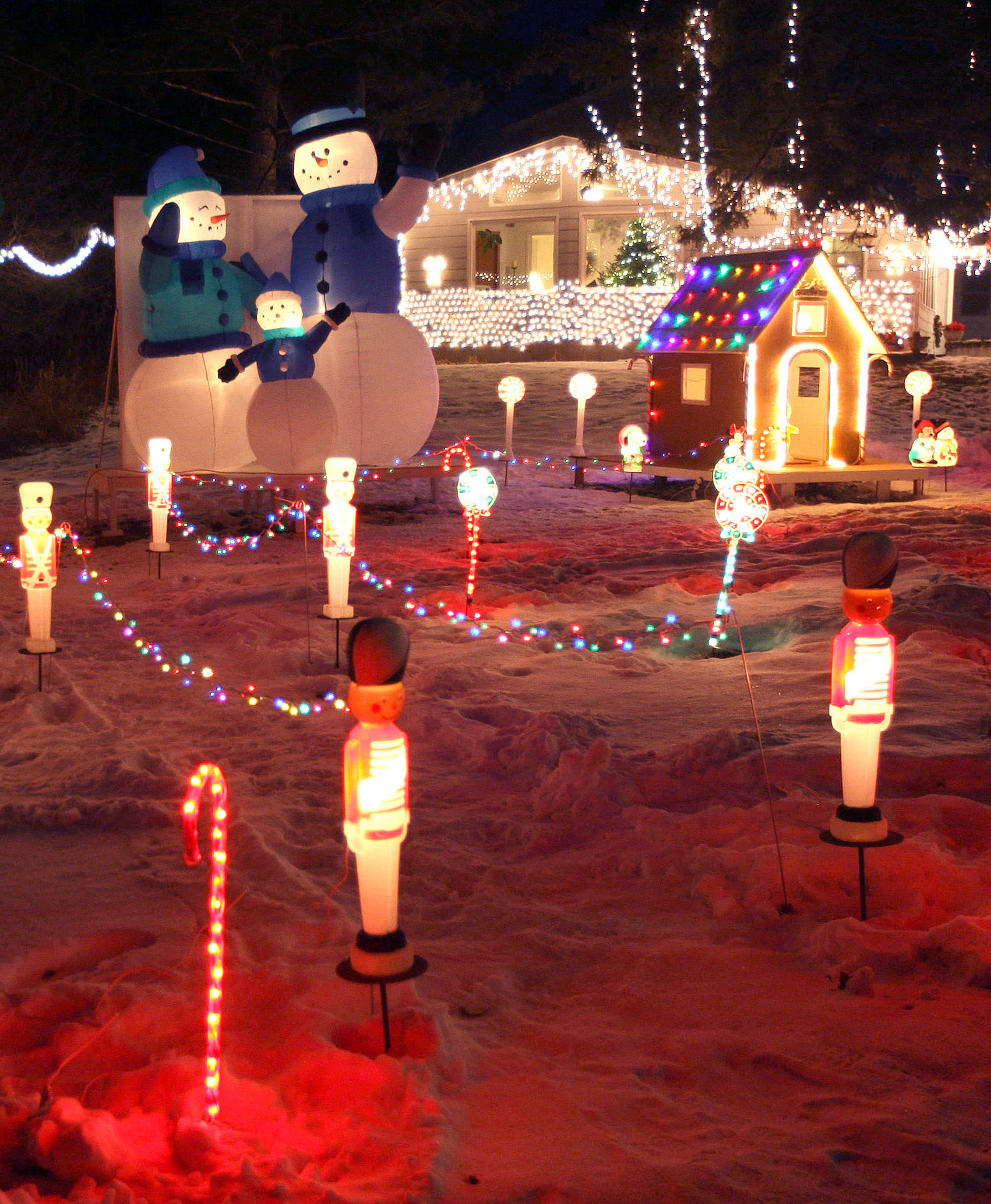
The science team found that light intensity increased by 30 to 50 percent in the suburbs and outskirts of major cities. Lights in the central urban areas didn’t increase as much as in the suburbs, but still brightened by 20 to 30 percent. This makes sense when you consider that folks in the ‘burbs not only decorate their homes but often extend Christmas displays across the yard and up into the trees.
Holiday lighting – a simple joy of the season. Yet it reflects both the hopes and wishes of human culture and the mundane facts of energy use. Through satellites, we can step back and watch the world change in ways never thought possible. We truly live in the Age of the Anthopocene, a newly designated era reflecting the profound effect our species has had and continues to have on the planet. To see all the holiday space photos, check out Goddard’s Flickr page.