Artist rendition of a future lunar base. (Credit: ESA - P. Carril)
As humanity returns to the Moon in the next few years, they’re going to need water to survive. While resupplies from Earth would work for a time, eventually the lunar base would have to become self-sustaining? So, how much water would be required to make this happen? This is what a recently submitted study hopes to address as a team of researchers from Baylor University explored water management scenarios for a self-sustaining moonbase, including the appropriate location of the base and how the water would be extracted and treated for safe consumption using appropriate personnel.
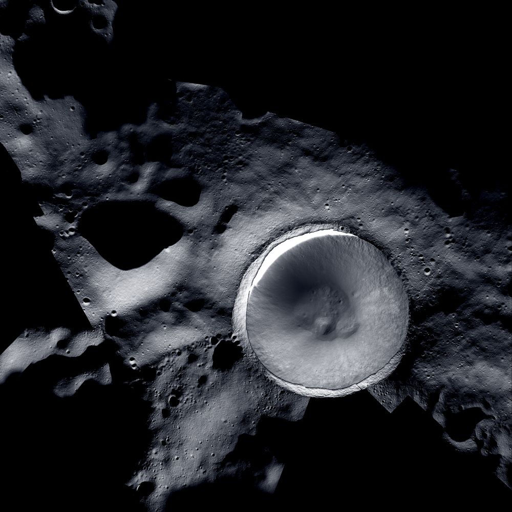
This new mosaic of Shackleton Crater on the Moon was obtained with a combination of images from NASA’s Lunar Reconnaissance Orbiter Camera (LROC) and ShadowCam. (Credit: Mosaic created by LROC (Lunar Reconnaissance Orbiter) and ShadowCam teams with images provided by NASA/KARI/ASU)
While the surface of the Moon has been mapped in incredible detail over the last several decades, one region has eluded orbital cameras due to the lack of sunlight, which are aptly called the permanently shadowed regions (PSRs) of the Moon. However, two cameras operating on two different lunar orbiters have recently worked in tandem to produce a stunning mosaic image of the lunar south pole’s Shackleton Crater, a portion of which resides directly on the lunar south pole and whose depths have been shrouded in complete darkness for possibly the last few billion years. As a result, scientists hypothesize that water ice could have accumulated within its dark depths that future astronauts could use for fuel and life support.
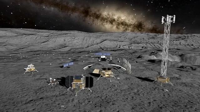
Artist rendition of potential future facilities on the lunar surface. (Credit: CFP)
Researchers from the Chinese Academy of Sciences and the Chinese National Space Administration recently published a study in the journal Space: Science & Technology outlining how the upcoming Chang’e-7 mission, due to launch in 2026, will use a combination of orbital observations and in-situ analyses to help identify the location, amount, and dispersion of water-ice in the permanently-shadowed regions (PSRs) of the Moon, specifically at the lunar south pole.
Images of the permanently shadowed wall and floor of Shackleton Crater captured by Lunar Reconnaissance Orbiter Camera (LROC) (left) and ShadowCam (right). Each panel shows an area that is 5,906 feet (1,800 meters) wide and 7,218 feet (2,200 meters) tall. Image Credit: NASA/KARI/ASU.
Shackleton Crater at the lunar south pole is one of the locations on NASA’s shortlist for human exploration with the future Artemis missions. But because craters at the lunar poles — like Shackleton — at have areas that are perpetually in shadow, known as permanently shadowed regions (PSRs), we don’t know for sure what lies inside the interior. However, a new spacecraft with a specialized instrument is about to change all that.
Artist's impression of astronauts on the lunar surface, as part of the Artemis Program. How will they store power on the Moon? 3D printed batteries could help. Credit: NASA
As Artemis 1 prepares for its maiden launch with the goal of putting astronauts back on the Moon’s surface within the next few years, the next question is how will astronauts live and survive its surface? Will we constantly ferry all the necessary supplies such as water and food from Earth, or could astronauts learn to survive on their own? These are questions that a discipline known as ISRU hopes to answer both now and in the years to come. But what is ISRU, and how will it help advance human space exploration as we begin to slowly venture farther away from the only home we’ve ever known?
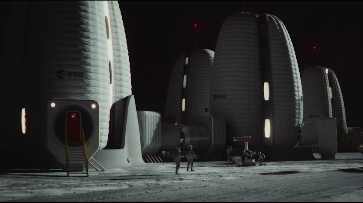
Between now and the end of this decade, multiple space agencies plan to send astronauts to the Moon for the first time since the Apollo Era. But whereas Apollo was a “footprints and flags” affair, the current proposals for lunar exploration call for the creation of infrastructure that allow for a sustained human presence there. In addition to NASA’s Artemis Program, the ESA is also working on a plan to create an “International Moon Village.”
For years, the ESA has released teasers as to what this “successor to the International Space Station” (ISS) might look like, the latest of which is on display at the La Biennale di Venezia museum in Venice. As part of the 17th International Architecture Exhibition, the architecture firm Skidmore, Owings & Merrill (SOM) showcased their design (with technical support from the ESA) for a semi-inflatable lunar habitat that could facilitate long-term lunar settlement.
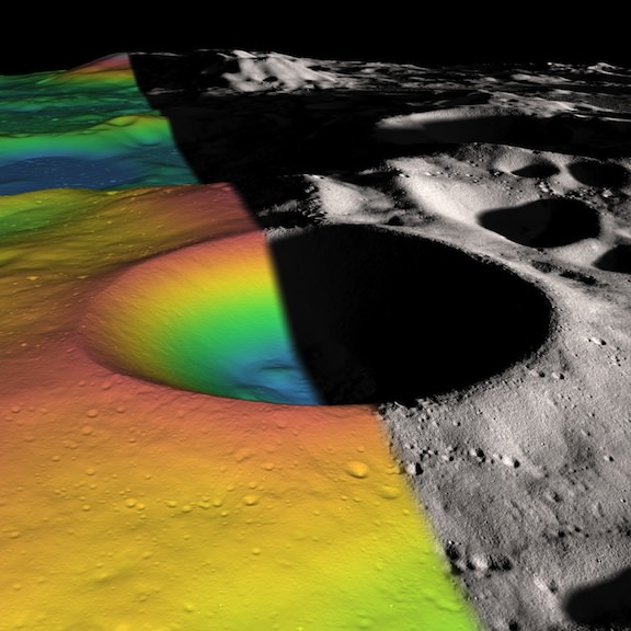
Shackleton crater on the Moon’s south pole has been somewhat of an enigma, as its permanently shadowed interior has made it difficult to detect what is inside. But with new observations using the laser altimeter on the Lunar Reconnaissance Orbiter (LRO) spacecraft, a team of researchers has essentially illuminated the crater’s interior with laser light, measuring its albedo, or natural reflectance. The scientists found that the crater’s floor is quite bright, an observation consistent with the presence of ice. In fact, ice may make up 22 percent of the material on the crater floor, with possibly more ice embedded within the crater walls.
“We decided we would study the living daylights out of this crater,” said Maria Zuber from the Massachuesetts Institute of Technology, who lead a team to study Shackleton Crater. “From the incredible density of observations we were able to make an extremely detailed topographic map.”
For laser altimeter observations, elevation maps can be created by measuring the time it takes for laser light to bounce down to the Moon’s surface and back to the instrument. The longer it takes, the lower the terrain’s elevation. Using these measurements, the group mapped the crater’s floor and the slope of its walls.
The team used over 5 million measurements to create their detailed map.
While the crater’s floor was relatively bright, Zuber and her colleagues observed that its walls were even brighter. The finding was at first puzzling. Scientists had thought that if ice were anywhere in a crater, it would be on the floor, where no direct sunlight penetrates. The upper walls of Shackleton crater are occasionally illuminated, which could evaporate any ice that accumulates. A theory offered by the team to explain the puzzle is that “moonquakes”– seismic shaking brought on by meteorite impacts or gravitational tides from Earth — may have caused Shackleton’s walls to slough off older, darker soil, revealing newer, brighter soil underneath. Zuber’s team’s ultra-high-resolution map provides strong evidence for ice on both the crater’s floor and walls.
“There may be multiple explanations for the observed brightness throughout the crater,” said Zuber. “For example, newer material may be exposed along its walls, while ice may be mixed in with its floor.”
The crater, named after the Antarctic explorer Ernest Shackleton, is nearly 20 km (more than 12 miles) wide and over 3 km (2 miles) deep — about as deep as Earth’s oceans. Zuber described the crater’s interior as “extremely rugged … It would not be easy to crawl around in there.”
She added that the new topographic map will help researchers understand crater formation and study other uncharted areas of the moon.
“I will never get over the thrill when I see a new terrain for the first time,” Zuber said. “It’s that sort of motivation that causes people to explore to begin with. Of course, we’re not risking our lives like the early explorers did, but there is a great personal investment in all of this for a lot of people.”
Ben Bussey, staff scientist at Johns Hopkins University’s Applied Physics Laboratory, said the new evidence for ice in Shackleton crater may indeed help determine the course for future lunar missions.
“Ice in the polar regions has been sort of an enigmatic thing for some time … I think this is another piece of evidence for the possibility of ice,” Bussey says. “To truly answer the question, we’ll have to send a lunar lander, and these results will help us select where to send a lander.”
And for any humans explorers, a crater like Shackleton at the lunar poles may well be the best location for a base, as the poles contain regions of near-permanent sunlight needed for power, and regions of near-permanent darkness containing ice — both of which would be essential resources for any lunar colony.
The team’s research was published today in the Journal Nature.
Lead image caption: Elevation (left) and shaded relief (right) image of Shackleton, a 21-km-diameter (12.5-mile-diameter) permanently shadowed crater adjacent to the lunar south pole. The structure of the crater’s interior was revealed by a digital elevation model constructed from over 5 million elevation measurements from the Lunar Orbiter Laser Altimeter. Credit: NASA/Zuber, M.T. et al., Nature, 2012
Second image caption: This is an elevation map of Shackleton crater made using LRO Lunar Orbiter Laser Altimeter data. The false colors indicate height, with blue lowest and red/white highest. Credit: NASA/Zuber, M.T. et al., Nature, 2012