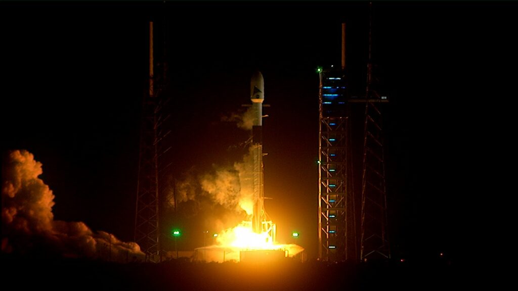
NASA's PACE mission launches from Cape Canaveral on Feb. 9th, 2024. Credit: NASA
NASA’s Plankton, Aerosol, Climate, ocean Ecosystem (PACE) satellite successfully launched and reached on Thursday, February 10th. The mission took off from Space Launch Complex 40 at Cape Canaveral Space Force Station in Florida, at 1:33 am EST 10:33 pm (PST) atop a SpaceX Falcon 9 rocket. About five minutes after launch, NASA confirmed that ground stations on Earth had acquired a signal from the satellite and were receiving data on its operational status and capabilities post-launch. For the next three years, the mission will monitor Earth’s ocean and atmosphere and study the effects of climate change.
Landsat 8 is the United States Geological Survey’s most recently launched satellite, and it holds the powerful Operational Land Imager (OLI.) The OLI is a powerful multi-spectral imager with a wide dynamic range.
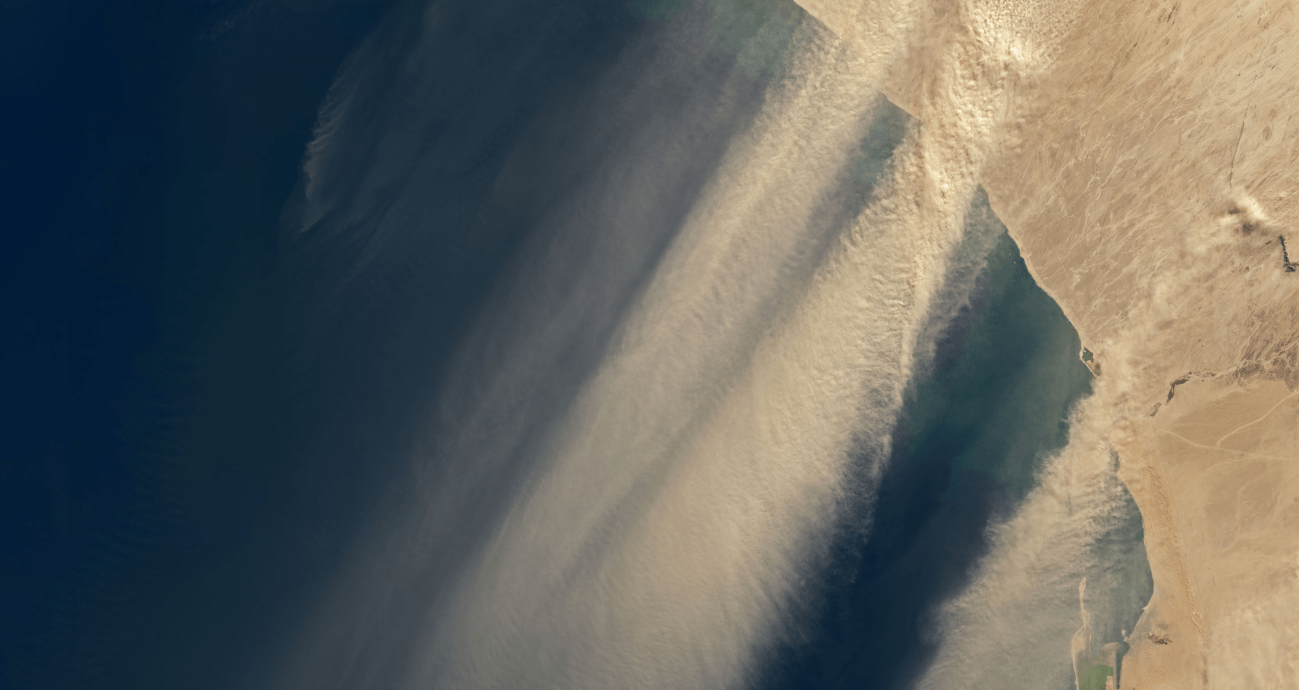
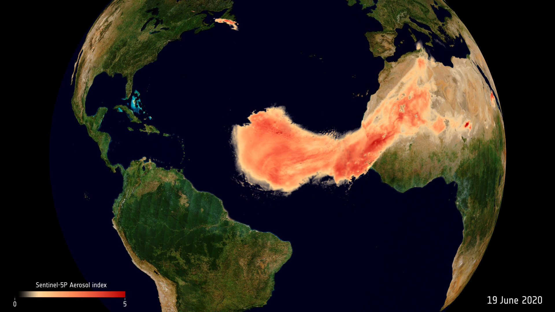
The OLI does a great job of keeping an eye on Earth, and now its captured images of winds in Namibia picking dust up and carrying it out over the Atlantic Ocean.
The Saharan dust plume over the Atlantic Ocean. Image Credit: contains modified Copernicus Sentinel data (2020), processed by ESA, CC BY-SA 3.0 IGO
Dust plumes are a natural phenomena, part of Earth’s nutrient cycle. They occur when high-velocity winds pick up tiny dry particles from the Earth’s surface and carry them long distances. Every summer, dust plumes from Africa’s Sahara desert travel across the Atlantic Ocean.
They’re usually not this big, and they often sink into the ocean. But this one’s coming right to America.
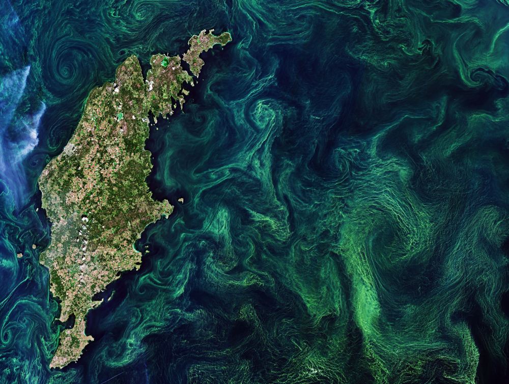
One of the most fascinating things about planet Earth is the way that life shapes the Earth and the Earth shapes life. We only have to look back to the Great Oxygenation Event (GOE) of 2.4 billion years ago to see how lifeforms have shaped the Earth. In that event, phytoplanktons called cyanobacteria pumped the atmosphere with oxygen, extinguishing most life on Earth, and paving the way for the development of multicellular life.
Early Earth satisfied the initial conditions for life to appear, and now, lifeforms shape the atmosphere, the landscape, and the oceans in many different ways.
At the base of many of these changes is phytoplankton.
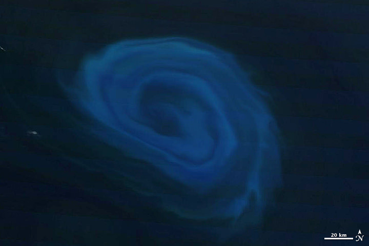
A 150-km (93-mile) - wide eddy in the southern Indian Ocean. (NASA/Terra-MODIS)
[/caption]
A serpentine eddy swirls in the southern Indian Ocean several hundred kilometers off the coast of South Africa in this natural-color image, acquired by NASA’s Terra satellite on December 26, 2011.
The blue color is created by blooms of phytoplankton, fertilized by the nutrient-rich deep water drawn up by the 150-km-wide eddy.
The counter-clockwise anticyclonic structure of the eddy may resemble a hurricane or typhoon, but unlike those violent storms eddies bring nourishment rather than destruction.
“Eddies are the internal weather of the sea,” said Dennis McGillicuddy, an oceanographer at the Woods Hole Oceanographic Institution in Massachusetts.
And also unlike atmospheric storms, ocean eddies can last for months, even up to a year. The largest ones can contain up to 1,200 cubic miles (5,000 cubic kilometers) of water.
The nutrient-drawing power of eddies can supply the relatively barren waters of the open ocean with nutrients, creating “oases in the oceanic desert,” according to McGillicuddy.
The eddy imaged here likely peeled off from the Agulhas Current, which flows along the southeastern coast of Africa and around the tip of South Africa. Agulhas eddies tend to be among the largest in the world.
The image below shows the eddy in context with the surrounding area:
Eddy off the coast of South Africa. December 26, 2011. (NASA/Terra-MODIS)
MODIS (or Moderate Resolution Imaging Spectroradiometer) is a key instrument aboard NASA’s Terra (EOS AM) satellite. Terra MODIS views the entire Earth’s surface every 1 to 2 days, acquiring data in 36 spectral bands. These data improve our understanding of global dynamics and processes occurring on the land, in the ocean, and in the lower atmosphere.