Student Alert: GRAIL Naming Contest – Essay Deadline November 11

NASA announces student Essay Naming Contest for the twin GRAIL Lunar spaceships. The essay writing contest is open to students in Grades K - 12 at schools in the United States. Submission Deadline is November 11, 2011. GRAIL A & B are twin science robots that will explore the gravity field of the moon like never before.

[/caption]

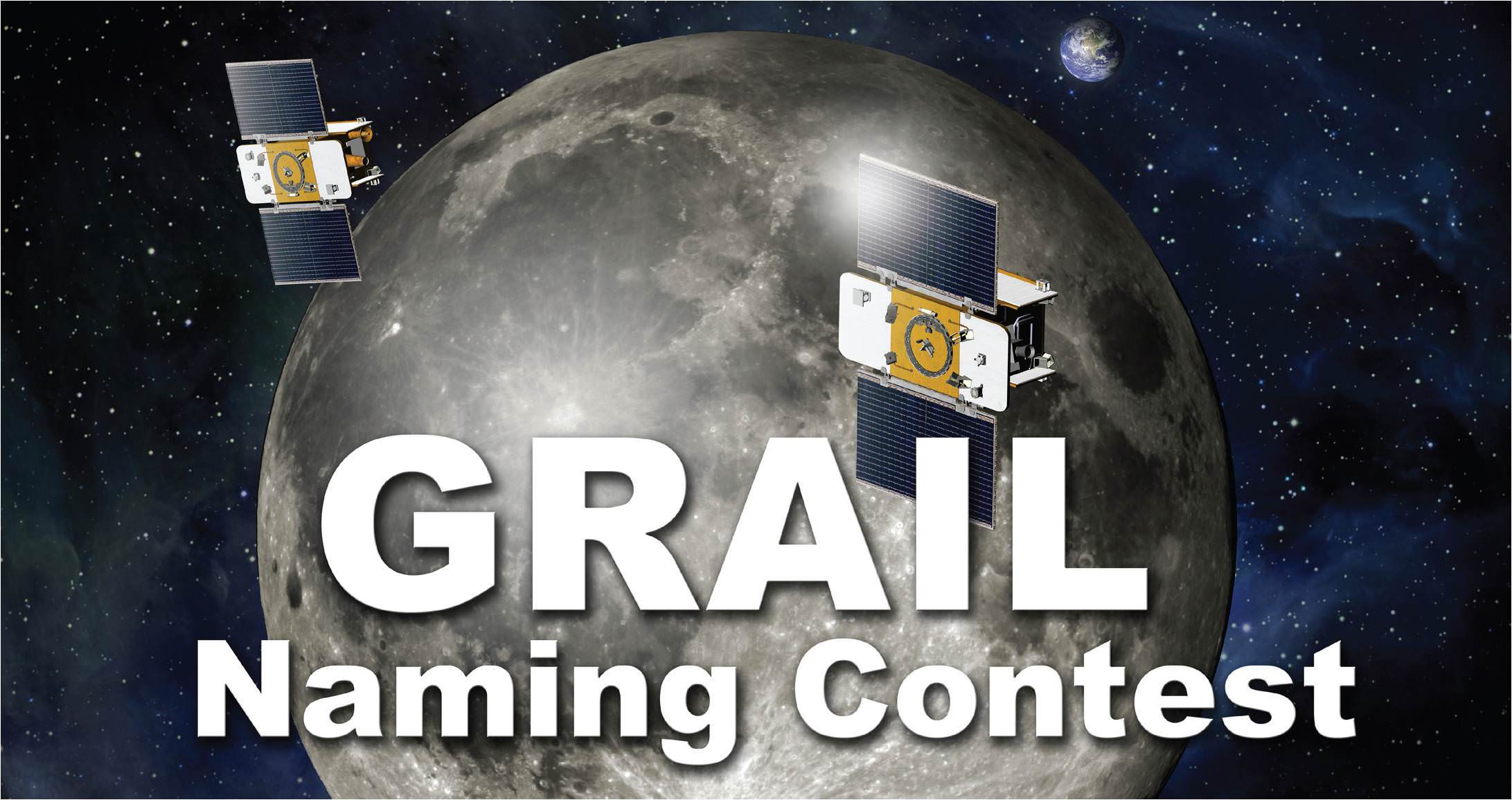
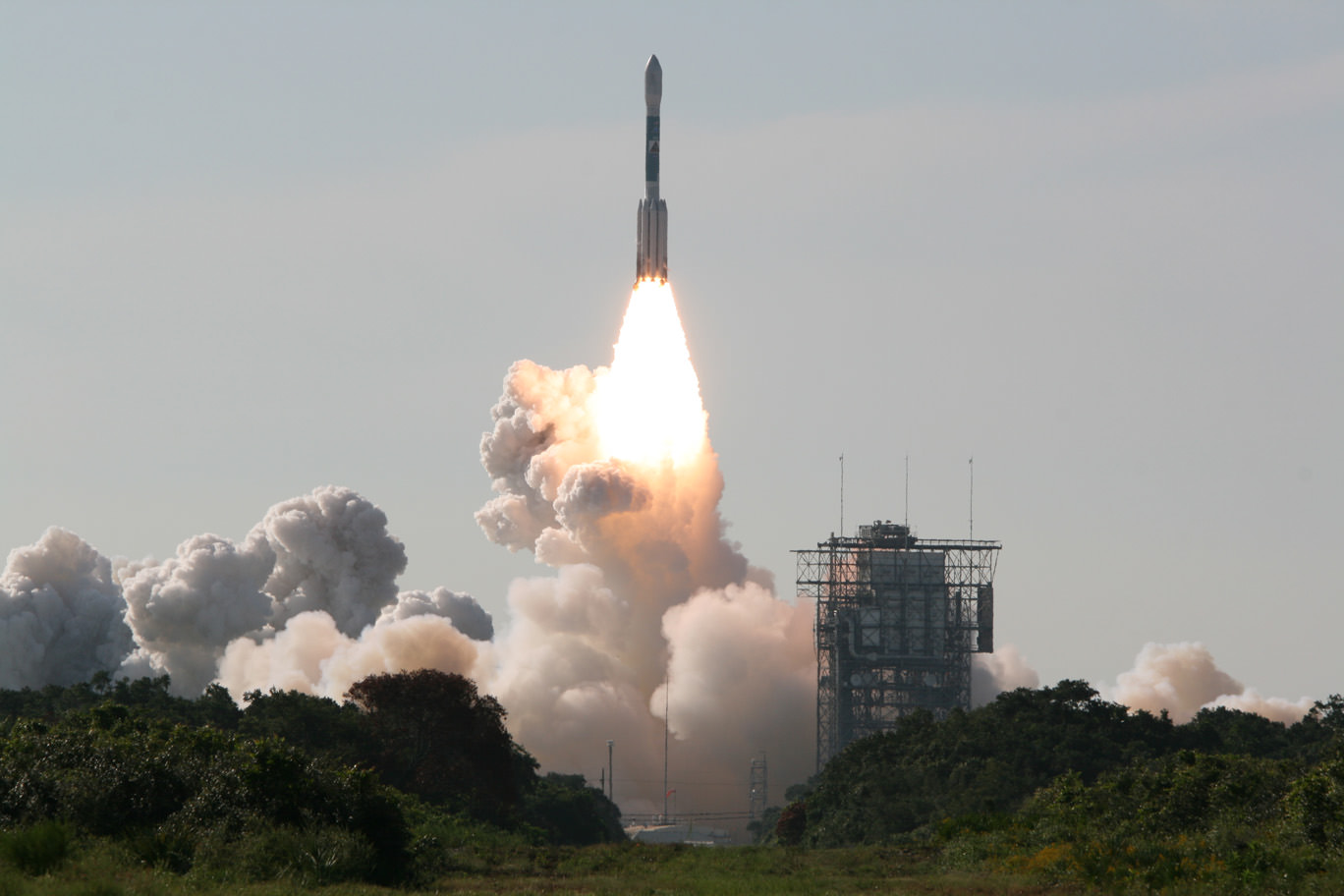
Student Alert ! – Here’s your once in a lifetime chance to name Two NASA robots speeding at this moment to the Moon on a super science mission to map the lunar gravity field. They were successfully launched from the Earth to the Moon on September 10, 2011. Right now the robots are called GRAIL A and GRAIL B. But, they need real names that inspire. And they need those names real soon. The goal is to “capture the spirit and excitement of lunar exploration”, says NASA – the US Space Agency.

NASA needs your help and has just announced an essay writing contest open to students in Grades K – 12 at schools in the United States. The deadline to submit your essay is November 11, 2011. GRAIL stands for “Gravity Recovery And Interior Laboratory.”

The rules state you need to pick two names and explain your choices in 500 words or less in English. Your essay can be any length up to 500 words – even as short as a paragraph. But, DO NOT write more than 500 words or your entry will be automatically disqualified.

Learn more about the GRAIL Essay Naming Contest here:

Read all the Official Contest Rules here:

Download the Naming Contest Submission Form here:

Students: NASA Wants You to Name that GRAIL !
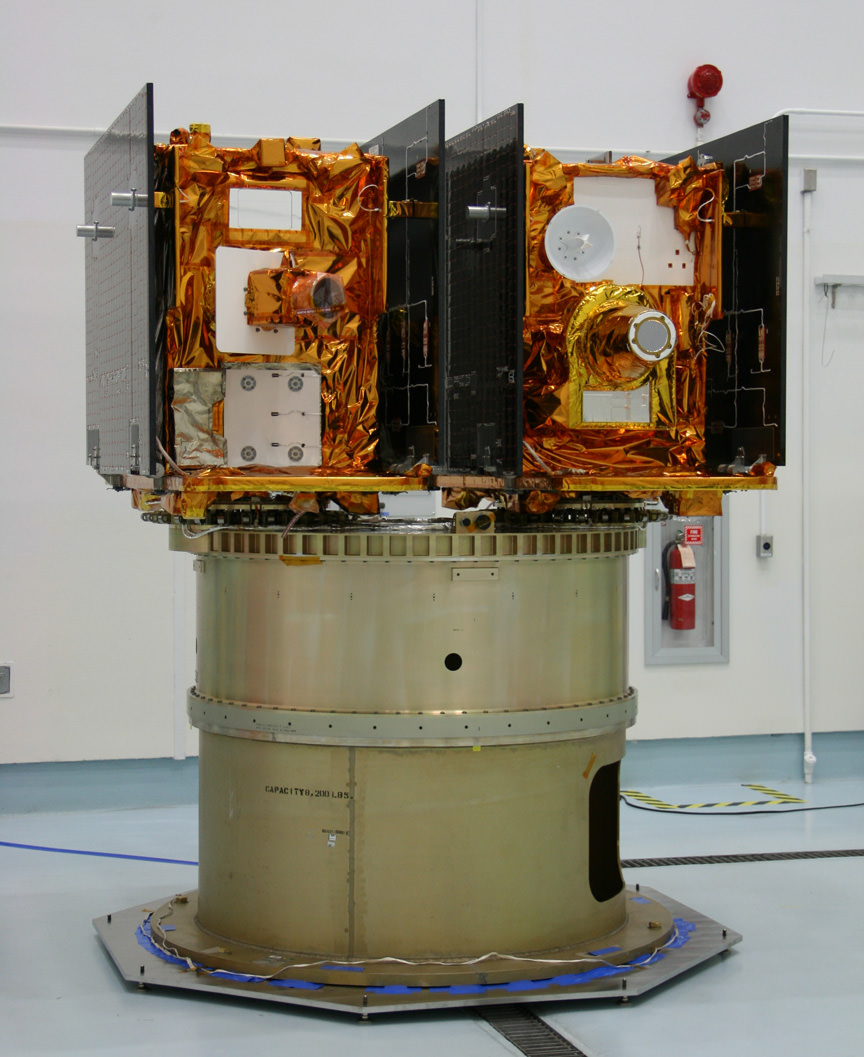
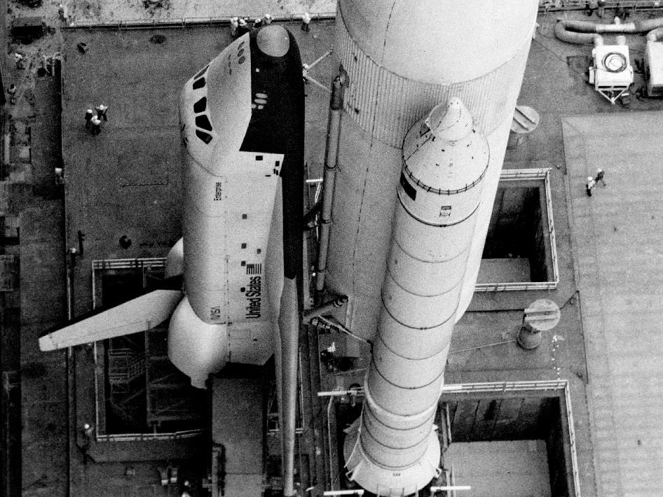
Write an Essay and name these twin Lunar mapping satellites. NASA’s twin GRAIL A & B science probes are now streaking to the Moon and arrive on New Year’s Day 2012. This picture shows how they looked, mounted side by side, during launch preparations prior to blasting off for the Moon on Sept. 10, 2011 from Florida. Credit: Ken Kremer

The GRAIL A and B lunar spaceships are twins – just like those other awe inspiring robots “Spirit” and “Opportunity” , which were named by a 10 year old girl student and quickly became famous worldwide and forever because of their exciting science missions of Exploration and Discovery.They arrive in Lunar Orbit on New Year’s Day 2012.

Blastoff of twin GRAIL A and B lunar gravity mapping spacecraft on a Delta II Heavy rocket on Sept. 10 from Pad 17B Cape Canaveral Air Force Station in Florida at 9:08 a.m. EDT. Credit: Ken Kremer

And there is another way that students can get involved in NASA’s GRAIL mission.

GRAIL A & B are both equipped with four student-run MoonKAM cameras. Students can suggest targets for the cameras. Then the cameras will take close-up views of the lunar surface, taking tens of thousands of images and sending them back to Earth.

“Over 1100 middle schools have signed up to participate in the MoonKAM education and public outreach program to take images and engage in exploration,” said Prof. Maria Zuber of MIT.

Prof. Zuber is the top scientist on the mission and she was very excited to announce the GRAIL Essay Naming contest right after the twin spaceships blasted off to the Moon on Sep 10, 2011 from Cape Canaveral in Florida.

What is the purpose of GRAIL ?

“GRAIL simply put, is a ‘Journey to the Center of the Moon’,” says Dr. Ed Weiler, NASA Associate Administrator of the Science Mission Directorate in Washington, DC.

“It will probe the interior of the moon and map its gravity field by 100 to 1000 times better than ever before. We will learn more about the interior of the moon with GRAIL than all previous lunar missions combined. Precisely knowing what the gravity fields are will be critical in helping to land future human and robotic spacecraft. The moon is not very uniform. So it’s a dicey thing to fly orbits around the moon.”

“There have been many missions that have gone to the moon, orbited the moon, landed on the moon, brought back samples of the moon,” said Zuber. “But the missing piece of the puzzle in trying to understand the moon is what the deep interior is like.”

So, what are you waiting for.

Start thinking and writing. Students – You can be space explorers too !

Read Ken’s continuing features about GRAIL
GRAIL Lunar Blastoff Gallery
GRAIL Twins Awesome Launch Videos – A Journey to the Center of the Moon
NASA launches Twin Lunar Probes to Unravel Moons Core
GRAIL Unveiled for Lunar Science Trek — Launch Reset to Sept. 10
Last Delta II Rocket to Launch Extraordinary Journey to the Center of the Moon on Sept. 8
NASAs Lunar Mapping Duo Encapsulated and Ready for Sept. 8 Liftoff
GRAIL Lunar Twins Mated to Delta Rocket at Launch Pad
GRAIL Twins ready for NASA Science Expedition to the Moon: Photo Gallery

Opportunity spotted Exploring vast Endeavour Crater from Mars Orbit

Opportunity captured at Endeavour Crater rim on Sept 10, 2011, Sol 2712. Opportunity is visible at the end of the white arrow, sitting atop some light toned outcrops on the rim of Endeavour Crater located at the southern tip of a rim segment named Cape York. Opportunity is ascending Endeavour at Cape York ridge and positioned to the right of the small crater named Odyssey. This image was taken by the HiRISE camera aboard NASA’s Mars Reconnaissance Orbiter (MRO), Opportunity travelled nearly three years to reach this rim because it contains rocks even more ancient than the rocks of Meridiani Planum, which the rover has been exploring since 2004, and hence may teach us something about an even more ancient era in Martian history. Click to enlarge. Credit: NASA/JPL/University of Arizona

[/caption]

Opportunity has just been imaged in high resolution at Endeavour crater by a powerful NASA camera orbiting overhead in Mars orbit. The new image (see above) was snapped while NASA’s long lived robot was climbing a hilltop offering spectacular panoramic vistas peering into the vast crater which is some 14 miles (22 km) wide.

The HiRiSE camera aboard NASA’s Mars Reconnaissance Orbiter photographed Opportunity and her wheel tracks on September 10, 2011, or Martian Sol 2712 for a mission warrentied to last only 90 Sols ! The rover is sitting to the right of another small crater known as Odyssey. Click to enlarge the image.

Look very closely and you’ll even be able to easily discern the rovers pair of tire tracks showing the path traversed by the robot as she explores the crater and the ejecta rocks and boulders excavated and strewn about by an ancient impact.

Opportunity imaged at Endeavour crater rim with wheel tracks exploring Odyssey crater, rocks and boulders climbing up Cape York ridge. Credit: NASA/JPL/University of Arizona

Opportunity is ascending up the rim of Endeavour crater at the southern tip of a low ridge dubbed Cape York – a location that has already yielded a bonanza of new science data since her recent arrival in August 2011 after a more than 20 mile (33 km) epic trek.

The intrepid rover discovered a rock unlike any other since she safely landed at the Meridiani Planum region of Mars nearly eight years ago on Jan. 24, 2004.

Opportunity is now searching Endeavour crater and Cape York for signatures of phyllosilicates – clay minerals that formed in the presence of pH neutral water flowing on Mars surface billions of years ago.

Cape York ridge at Endeavour Crater - From Orbit
This image taken from Mars orbit shows the path driven by NASA's Mars Exploration Rover Opportunity in the weeks around the rover's arrival at the rim of Endeavour crater and up to Sol 2688. Opportunity has since driven a short distance to the right. Credit: NASA/JPL-Caltech/University of Arizona

Endeavour Crater Panorama from Opportunity, Sol 2681, August 2011
Opportunity arrived at the rim of Endeavour on Sol 2681, August 9, 2011 and climbed up the ridge known as Cape York. Odyssey crater is visible at left. Opportunity has since driven a short distance beyond Odyssey crater and was photographed from Mars orbit on Sept. 10, 2011.
Mosaic Credit: NASA/JPL/Cornell/Marco Di Lorenzo/Kenneth Kremer

Read Ken’s continuing features about Curiosity and Opportunity starting here:
Opportunity spotted Exploring vast Endeavour Crater from Mars Orbit
Twin Towers 9/11 Tribute by Opportunity Mars Rover
NASA Robot arrives at ‘New’ Landing Site holding Clues to Ancient Water Flow on Mars
Opportunity Arrives at Huge Martian Crater with Superb Science and Scenic Outlook
Opportunity Snaps Gorgeous Vistas nearing the Foothills of Giant Endeavour Crater
Dramatic New NASA Animation Depicts Next Mars Rover in Action
Opportunity Rover Heads for Spirit Point to Honor Dead Martian Sister; Science Team Tributes

Dramatic 3 D Imagery Showcases Vesta’s Pockmarked, Mountainous and Groovy Terrain

3 D Anaglyph of Craters at Rheasilvia - the South Polar Region of Vesta. This 3-D image shows the topography, craters and grooves of Vesta’s south polar region obtained by the framing camera instrument aboard NASA’s Dawn spacecraft on Aug. 23 and 28, 2011. The image has a resolution of about 260 meters per pixel.

[/caption]

Try not to plummet off a steep crater cliff or be buried under a landslide while gazing at the irresistibly alluring curves of beautiful Rheasilvia – the mythical mother of Romulus and Remus – whose found a new home at the South Pole of the giant Asteroid Vesta.

3 D is undoubtedly the best way to maximize your pleasure. So whip out your cool red-cyan anaglyph glasses to enhance your viewing experience of Rheasilvia, the Snowman and more – and maximize your enjoyment of this new 3 D collection showcasing the heavily cratered, pockmarked, mountainous and groovy terrain replete at Vesta.

3D Details of Wave-Like Terrain in the South Pole of Vesta
This image was obtained by NASA’s Dawn spacecraft from an orbit of about 1,700 miles (2,700 kilometers) above the surface of the giant asteroid Vesta. Topography in the area surrounding Vesta's south pole area shows impact craters, ridges and grooves. These images in 3D provide scientists with a realistic impression of the solid surface of the celestial body.
Credit: NASA/JPL-Caltech/UCLA/MPS/DLR/IDA
Can you find the location of the 3 D image above in the 2 D South Pole image below?

Scientists and mortals have been fascinated by the enormous impact crater Rheasilvia and central mountain unveiled in detail by NASA’s Dawn Asteroid Orbiter recently arrived at Vesta, the 2nd most massive object in the main asteroid belt. Ceres is the largest object and will be Dawn’s next orbital target in 2015 after departing Vesta in 2012.

3D - A Big Mountain at Asteroid Vesta’s South Pole
Scientists were fascinated by this enormous mound inside a big circular depression at the south pole- dubbed Rheasilvia. This stereo image was recorded from an altitude of about 1,700 miles (2,700 kilometers) above the surface and shows the structure of the mountain, displayed in the right half of this 3D image. The base of the mountain has a diameter of about 125 miles (200 kilometers), and its altitude above the surroundings is about 9 miles (15 kilometers). The vicinity of the peak of the mountain shows landslides that occurred when material from the flanks of the mountain were slipping down. Also visible are tectonic structures from tension in Vesta's crust. Credit: NASA/JPL-Caltech/UCLA/MPS/DLR/IDA

Vesta is the smallest terrestrial planet in our Solar System”, said Chris Russell in an interview with Universe Today. “We do not have a good analog to Vesta anywhere else in the Solar System.”

And the best is yet to come. In a few days, Dawn begins snapping images from a much lower altitude at the HAMO mapping orbit of ca. 685 km vs the initial survey orbit of ca, 2700 km. where most of these images were taken.

Can you find the location of the 3 D South Pole images above in the 2 D South Pole image below?

Topography of Densely Cratered Deformed Terrain
This 3 D anaglyph image shows the topography of Vesta's densely cratered terrain obtained by the framing camera instrument aboard NASA's Dawn spacecraft on August 6, 2011. Credit: NASA/JPL-Caltech/UCLA/MPS/DLR/IDA
Anaglyph of the ‘Snowman' Crater. This anaglyph image shows the topography of Vesta's three craters, informally named the "Snowman," obtained by the framing camera instrument aboard Dawn on August 6, 2011. The camera has a resolution of about 260 meters per pixel. Credit: NASA/JPL-Caltech/UCLA/MPS/DLR/IDA
Vesta's Ancient, Cratered Surface in 3D
This image of the giant asteroid Vesta obtained by NASA's Dawn spacecraft shows the surface of the asteroid from an orbit of about 1,700 miles (2,700 kilometers) above the surface. Numerous impact craters illustrate the asteroid's violent youth. By counting craters on distinct geological surfaces scientists can deduce relative ages of the asteroid's surface. This 3D view provides scientists the opportunity to learn more about the morphology of craters on asteroids and physical properties of the material at Vesta's surface.. Image resolution is about 260 meters per pixel. Credit: NASA/JPL-Caltech/UCLA/MPS/DLR/IDA
Viewing the South Pole of Vesta and Rheasilvia Impact Basin
This image obtained by Dawns framing camera shows the south pole of the giant asteroid Vesta. Scientists are discussing whether the Rheasilvia circular structure that covers most of this image originated by a collision with another asteroid, or by internal processes early in the asteroid's history. Images in higher resolution from Dawn's next lowered orbit might help answer that question. The image was recorded from a distance of about 1,700 miles (2,700 kilometers). The image resolution is about 260 meters per pixel. Credit: NASA/JPL-Caltech/UCLA/MPS/DLR/IDA
Rhea Silvia, torso from the amphitheatre at Cartagena in Spain that was rediscovered in 1988. Rhea Silvia was the mother of Romulus and Remus, the mythical founders of Rome. Source: Wikipedia

Read Ken’s continuing features about Dawn and Vesta

Rheasilvia – Super Mysterious South Pole Basin at Vesta
Space Spectacular — Rotation Movies of Vesta
3 D Alien Snowman Graces Vesta
NASA Unveils Thrilling First Full Frame Images of Vesta from Dawn
Dawn Spirals Down Closer to Vesta’s South Pole Impact Basin
First Ever Vesta Vistas from Orbit – in 2D and 3D
Dawn Exceeds Wildest Expectations as First Ever Spacecraft to Orbit a Protoplanet – Vesta
Dawn Closing in on Asteroid Vesta as Views Exceed Hubble
Dawn Begins Approach to Asteroid Vesta and Snaps First Images
Revolutionary Dawn Closing in on Asteroid Vesta with Opened Eyes

UARS: When and Where Did It Go Down?

Credit: NASA

[/caption]
After a night of changing predictions and hopes of many to see a fireball in the sky, the UARS (Upper Atmosphere Research Satellite) finally met it’s fiery demise.

The decommissioned, 6.5 ton satellite is believed to have re-entered the Earths atmosphere over the Pacific Ocean, and in it’s death throes the massive satellite broke up, and the surviving debris likely landed in the ocean, off of the West coast of North America.

In regard to the exact re-entry point and position of the debris field, Nicholas Johnson, chief orbital debris scientist at NASA’s Johnson Space Center, said “We don’t know where the debris field might be… We may never know.”

The US Department of Defense’s Joint Space Operations Center at Vandenberg Air Force Base in California and the U.S. Strategic Command radar tracking assessed that the satellite reentered the atmosphere sometime between 0323 and 0509 GMT on September 24, 2011 (the Strategic Command predicted it would re-enter at 04:16 GMT). During this period, the satellite was heading across the Pacific Ocean on a southwest-to-northeast trajectory approaching Canada’s west coast. The mid-point of that groundtrack and a possible reentry location is 31 N latitude and 219 E longitude (green circle marker on the above map).

“If the re-entry point was at the time of 04:16 GMT, then all that debris wound up in the Pacific Ocean,” Johnson said during a media briefing on Saturday. “If the re-entry point occurred earlier than that, practically the entire pass before 04:16 was over water. So the only way debris could have probably reached land would be if the re-entry occurred after 04:16.”

NASA says there are no reports of damage or injury caused by the surviving components that made it to the surface, and there are so far no credible visual reports of anyone seeing the UARS satellite burning up.

The Earth-observing satellite was in orbit for 20 years and 10 days.

Credit: NASA

Finding NEEMO: NASA’s Underwater Simulations Focus on Human Asteroid Mission

NEEMO engineering crew diver simulates anchoring to an asteroid surface. Image credit: NASA

[/caption]
The sight of NASA mission specialists performing mission training underwater has been fairly common over the years. On October 15th, NASA astronaut and former ISS crew member Shannon Walker will lead a different kind of underwater training mission. Walker will be leading the 15th expedition of NASA Extreme Environment Mission Operations (NEEMO), and interestingly, the crew includes Steve Squyres, head of the Mars Rover Exploration Project.

What makes NEEMO different from the other NASA underwater training simulations we’ve seen in the past?

Think asteroid.

With manned exploration of an asteroid on NASA’s roadmap, new technologies and procedures need to be created in order to ensure astronaut safety and achieve mission science goals. The NEEMO program at NASA will be putting experts to the task of developing solutions to the new challenges presented with near-Earth asteroid exploration. During NEEMO 15, NASA will test new tools, techniques and communication technologies.

Before now, NASA hasn’t given much thought to the operations necessary for a manned mission to an asteroid. With the nearly non-existent surface gravity of an asteroid, astronauts won’t be able to walk on the surface. One idea being tested is for the astronauts to anchor themselves to the asteroid. One difficulty with using anchors is that not all asteroids are made of the same materials – some asteroids are mostly metal, others are loose rubble and some are a mix of rock, metal and dust. Underwater testing on the ocean floor provides an environment that is perfectly suited for the NEEMO 15 mission, allowing NASA to simulate an environment with weak gravity and diverse materials.

Artist's concept of anchoring to the surface of an asteroid. Image credit: NASA

There are three main goals for the NEEMO 15 mission. First NASA will test methods for anchoring to the surface of the asteroid. Moving on the surface of an asteroid will require a method of connecting multiple anchors. The second major goal of the mission is to determine the best way to connect the anchor system. The third major goal will explore methods of collecting samples on the surface of an asteroid.

In addition to mission leader Shannon Walker, and Steve Squyres, the crew of NEEMO 15 includes astronaut Takuya Onishi (Japan Aerospace Exploration Agency) and David Saint-Jacques (Canadian Space Agency). Also joining the astronauts on the NEEMO 15 crew are: James Talacek and Nate Bender (University of North Carolina). Squyres is principal investigator for the Mars Exploration Rover (Spirit and Opportunity) mission, while Talacek and Bender are professional aquanauts.

Serving as support crew, NASA astronauts Stan Love, Richard Arnold and Mike Gernhardt, will participate in the NEEMO mission from the DeepWorker submersible, which they will pilot. NASA is using the DeepWorker submarine as an underwater stand-in for the Space Exploration Vehicle (SEV) which NASA has been testing separately in the “Desert RATS” field trial mission.

If you’d like to learn more about NASA’s NEEMO field test mission, visit: http://www.nasa.gov/neemo

You can view information on the NEEMO 15 crew at: http://www.nasa.gov/mission_pages/NEEMO/NEEMO15/crew.html, and follow the mission on Twitter and Facebook

Source: NASA NEEMO Press Release

What Does NASA Sound Like?

Atlantis launches one last time on July 8, 2011. Credit: Alan Walters (awaltersphoto.com) for Universe Today.

[/caption]

When you think of NASA, do certain sounds and/or soundbites come to mind?

“3…2…1…0 and Liftoff!”

“That’s one small step,….”

“Ignition sequence start…”

“We’re on our way Houston!”

You can now listen to a collection of distinct NASA sounds at the NASA Sounds website where you can download various clips for ringtones, or for your computer errors, alarms and notifications, or just add to your audio collection.

“NASA has been making historic sounds for over 50 years,” said Jerry Colen, NASA App project manager at the agency’s Ames
Research Center in Moffett Field, Calif. “Now we’re making some of these memorable sounds easy to find and use.”

The NASA sounds are available in both MP3 and M4R (iPhone) files, and also includes the sounds of spacecraft beeping and crackling. NASA will update the collection as new sounds become available.

Rheasilvia – Super Mysterious South Pole Basin at Vesta is Named after Romulus and Remus Roman Mother

A False-Color Topography of Vesta's South Pole. This false-color map of the giant asteroid Vesta was created from stereo images obtained by the framing camera aboard NASA’s Dawn spacecraft. The image shows the elevation of surface structures with a horizontal resolution of about 750 meters per pixel. The terrain model of Vesta's southern hemisphere shows a big circular structure with a diameter of about 300 miles (500 kilometers), its rim rising above the interior of the structure for more than 9 miles (15 kilometers.) Image credit: NASA/JPL-Caltech/UCLA/MPS/DLR/IDA

Video caption: Rheasilvia Impact Basin and Vesta shape model. This false-color shape model video of the giant asteroid Vesta was created from images taken by the framing camera aboard NASA’s Dawn spacecraft. Rheasilvia – South Pole Impact Basin – shown at bottom (left) and head on (at right). Credit: NASA/JPL-Caltech/UCLA/MPS/DLR/IDA

‘Rheasilvia’ – that’s the brand new name given to the humongous and ever more mysterious South Pole basin feature being scrutinized in detail by Dawn, according to the missions top scientists in a Universe Today exclusive. Dawn is NASA’s newly arrived science orbiter unveiling the giant asteroid Vesta – a marvelously intriguing body unlike any other in our Solar System.

What is Rheasilvia? An impact basin? A crater remnant? Tectonic action? A leftover from internal processes? Or something completely different? That’s the hotly debated central question consuming loads of attention and sparking significant speculation amongst Dawn’s happily puzzled international science team. There is nothing closely analogous to Vesta and Rhea Silvia – and thats a planetary scientists dream come true.

“Rheasilvia – One thing that we all agree on is that the large crater should be named ‘Rheasilvia’ after the mother of Romulus and Remus, the mythical mother of the Vestals,” said Prof. Chris Russell, Dawns lead scientist, in an exclusive interview with Universe Today. Russell, from UCLA, is the scientific Principal Investigator for Dawn.

“Since we have never seen any crater just like this one it is difficult for us to decide exactly what did happen,” Russell told me. “The name ‘Rheasilvia’ has been approved by the IAU and the science team is using it.”

Craters on Vesta are being named after the Vestal Virgins—the priestesses of the Roman goddess Vesta. Other features will be named for festivals and towns of that era. Romulus and Remus were the mythical founders of Rome.
[/caption]

‘Rheasilvia’ has the science team in a quandary, rather puzzled and reevaluating and debating long held theories as they collect reams of new data from Dawn’s three science instruments – provided by the US, Germany and Italy. That’s the scientific method in progress and it will take time to reach a consensus.

Prior to Dawn’s orbital insertion in July 2011, the best views of Vesta were captured by the Hubble Space Telescope and clearly showed it wasn’t round. Scientists interpreted the data as showing that Vesta’s southern hemisphere lacked a South Pole! And, that it had been blasted away eons ago by a gargantuan cosmic collision that excavated huge amounts of material that nearly utterly destroyed the asteroid.

The ancient collision left behind a colossal 300 mile (500 km) diameter and circular gaping hole in the southern hemisphere – nearly as wide as the entire asteroid (530 km) and leaving behind an as yet unexplained and enormous central mountain peak, measuring some 9 miles (15 km) high and over 125 miles (200 km) in diameter. The mountain has one of the highest elevations in the entire solar system.

“We are trying to understand the high scarps that we see and the scarps that should be there and aren’t,” Russell explained. “We are trying to understand the landslides we think we see and why the land slid. We see grooves in the floor of the basin and want to interpret them.

“And the hill in the center of the crater remains as mysterious today as when we first arrived.”

Viewing the South Pole of Vesta and Rheasilvia Impact Basin
This image obtained by Dawns framing camera and shows the south pole of the giant asteroid Vesta. Scientists are discussing whether the Rheasilvia circular structure that covers most of this image originated by a collision with another asteroid, or by internal processes early in the asteroid's history. Images in higher resolution from Dawn's lowered orbit might help answer that question. The image was recorded from a distance of about 1,700 miles (2,700 kilometers). The image resolution is about 260 meters per pixel. Credit: NASA/JPL-Caltech/UCLA/MPS/DLR/IDA

Another top Dawn scientist described Rheasilvia in this way:

“I would say that the floor of the impact feature contains chaotic terrain with multiple sets of intersecting grooves, sometimes fairly straight and often curvy, said Carol Raymond to Universe Today. Raymond is Dawn’s Deputy Principal Investigator from NASA’s Jet Propulsion Laboratory in Pasadena, Calif.

“The crater rim is not well-expressed”, Raymond told me. “We see strong color variations across Vesta, and the south pole impact basin appears to have a distinct spectral signature.

“The analysis is still ongoing,” Russell said.


“The south is distinctly different than the north. The north has a varied spectrum and the south has a distinct spectral feature but it has little variation.” Time will tell as additional high resolution measurements are collected from the forthcoming science campaign at lower orbits.

Russell further informed that the team is rushing to pull all the currently available data together in time for a science conference and public briefing in mid-October.

“We have set ourselves a target to gather everything we know about the south pole impact feature and expect to have a press release from what ever we conclude at the GSA (Geological Society of America) meeting on October 12. “We will tell the public what the options are.”

“We do not have a good analog to Vesta anywhere else in the Solar System and we’ll be studying it very intently.”

Impressive South Pole MountainTop at Rheasilvia Crater on Vesta
This mountain, which measures about 125 miles (200 kilometers) in diameter at its base, is one of the highest elevations on all known bodies with solid surfaces in the solar system. The image has been recorded with the framing camera aboard NASA's Dawn spacecraft from a distance of about 1,700 miles (2,700 kilometers). The image resolution is about 260 meters per pixel. Credit: NASA/JPL-Caltech/UCLA/MPS/DLR/IDA

Right now Dawn is using its ion propulsion system to spiral down four times closer to Vesta, as it descends from the initlal survey orbit(about 2700 km, 1700 mi) to the new science orbit, elegantly named HAMO – or High Altitude Mapping Orbit (about 685 km.)

“Our current plan is to begin HAMO on Sept. 29, but we will not finalize that plan until next week,” Dr. Marc Rayman told Universe Today. Rayman, of NASA’s JPL, is Dawn’s Chief Engineer.

“Dawn’s mean altitude today (Sept. 20) is around 680 km (420 miles),” said Rayman .

“Dawn successfully completed the majority of the planned ion thrusting needed to reach its new science orbit and navigators are now measuring its orbital parameters precisely so they can design a final maneuver to ensure the spacecraft is in just the orbit needed to begin its intensive mapping observations next week.”

Watch for lots more stories upcoming on Vesta and the Dawn mission

Read Ken’s continuing features about Dawn
Space Spectacular — Rotation Movies of Vesta
3 D Alien Snowman Graces Vesta
NASA Unveils Thrilling First Full Frame Images of Vesta from Dawn
Dawn Spirals Down Closer to Vesta’s South Pole Impact Basin
First Ever Vesta Vistas from Orbit – in 2D and 3D
Dawn Exceeds Wildest Expectations as First Ever Spacecraft to Orbit a Protoplanet – Vesta
Dawn Closing in on Asteroid Vesta as Views Exceed Hubble
Dawn Begins Approach to Asteroid Vesta and Snaps First Images
Revolutionary Dawn Closing in on Asteroid Vesta with Opened Eyes

Space Shuttle Enterprise Unveiled 35 Years Ago to Star Trek Fanfare

The Shuttle Enterprise. In 1976, NASA's space shuttle Enterprise rolled out of the Palmdale manufacturing facilities and was greeted by NASA officials and cast members from the 'Star Trek' television series. From left to right they are: NASA Administrator Dr. James D. Fletcher; DeForest Kelley, who portrayed Dr. "Bones" McCoy on the series; George Takei (Mr. Sulu); James Doohan (Chief Engineer Montgomery "Scotty" Scott); Nichelle Nichols (Lt. Uhura); Leonard Nimoy (Mr. Spock); series creator Gene Rodenberry; an unnamed NASA official; and, Walter Koenig (Ensign Pavel Chekov). Credit: NASA

[/caption]

‘Enterprise’, the first of NASA’s Space Shuttle orbiters to be assembled, was unveiled 35 Years ago on Sept. 17, 1976 to the soaring theme song and fanfare of the immortal science fiction television series – ‘Star Trek’. Members of the original cast (photo above) were on hand for the celebratory rollout at the Rockwell International manufacturing plant in Palmdale, California.

Today, the Enterprise is housed as the centerpiece at the Smithsonian’s National Air & Space Museum (NASM) Udvar-Hazy Annex in Chantilly, Virginia.

Check out these webcams for live views of shuttle Enterprise at NASM from the front and aft.

Space Shuttle Enterprise on display at the Smithsonian’s National Air & Space Museum Udvar-Hazy Annex in Chantilly, Virginia

NASA originally selected ‘Constitution’ as the orbiter’s name – in honor of the U.S. Constitution’s Bicentennial . That was until avid fans of ‘Star Trek’ mounted a successful letter writing campaign urging the White House to select the name ‘Enterprise’ – in honor of the popular TV shows starship of exploration. The rest is history.

Many scientists and space enthusiasts found inspiration from Star Trek and were motivated to become professional researchers by the groundbreaking science fiction show.

Space Shuttle Enterprise on display as the centerpiece at the Smithsonian’s National Air & Space Museum Udvar-Hazy Annex in Chantilly, Virginia. Credit: NASA

Enterprise was a prototype orbiter, designated as OV-101, and not built for spaceflight because it lacked the three space shuttle main engines necessary for launch and the thermal protection systems required for reentry into the Earth’s atmosphere.

Enterprise did however play a very key role in preparing NASA’s other shuttles for eventual spaceflight. The orbiter was tested in free flight when it was released from a Boeing 747 Shuttle Carrier Aircraft for a series of five critical approach and landing tests in 1977.I was fortunate to see Enterprise back in 1977 on top of a 747 during a cross country stop near the Johnson Space Center.

Enterprise in free flight during approach and landing test in 1977

In 1979 Enterprise was mated to an External Tank and a pair of Solid Rocket Boosters for several weeks of fit checks and procedural test practice in launch configuration at Launch Complex 39 at NASA’s Kennedy Space Center in Florida.

These efforts helped pave the way for the first ever flight of a space shuttle by her sister orbiter ‘Columbia’ on the STS-1 mission by John Young and Bob Crippen. Columbia blasted off on April 12, 1981 on a gutsy 54 hour test flight.

Enterprise in free flight during approach and landing test in 1977

In 1984, the Enterprise was ferried to Vandenberg Air Force Base for similar pad configuration checks at Space Launch Complex- 6 (SLC-6) for what was then planned to be the shuttle’s west coast launch site. All California launches were cancelled following the destruction of Space Shuttle Challanger in Jan 1986.

After three decades of flight, the Space Shuttle Era came to a historic end with the majestic predawn touchdown of Space Shuttle Atlantis on Jul 21, 2011. The STS-135 mission was the Grand Finale of NASA’s three decade long Shuttle program.

Following the retirement of all three remaining shuttle orbiters, Enterprise will soon be moved to her new permanent home at the Intrepid Air, Sea and Space Museum in New York City to make way for NASA’s new gift of Space Shuttle Discovery.

First Appearance of Enterprise
Space shuttle Enterprise made its first appearance mated to supportive propellant containers/boosters cluster, as it was rolled from the Vehicle Assembly Building at Kennedy Space Center en route to the launch pad, some 3.5 miles away, on May 1, 1979. Enterprise underwent several weeks of fit and function checks on the pad in preparation for STS-1, on which its sister craft Columbia took astronauts John Young and Robert Crippen into space for a 54-hour test mission. Credit: NASA
First Appearance of Enterprise
Space Shuttle Enterprise at Space Launch Complex 6 (SLC-6 ) at Vandenberg Air Force Base, on February 1, 1985. Credit: Tech. Sgt. Bill Thompson/USAF

Read Ken’s continuing features here about Discovery, Endeavour and Atlantis
Send Ken your pictures of Enterprise to publish at Universe Today.

Cassini’s Majestic Saturn Moon Quintet

A quintet of Saturn's moons come together in the Cassini spacecraft's field of view for this portrait. From left to right: Janus, Pandora, Enceladus, Mimas and Rhea. Credit: NASA/JPL-Caltech/Space Science Institute

[/caption]

Check out this gorgeous new portrait of a Saturnian moon quintet taken by Earths’ emissary – NASA’s Cassini Orbiter. The moons are majestically poised along a backdrop of Saturn’s rings, fit for an artist’s canvas.

Janus, Pandora, Enceladus, Mimas and Rhea are nearly lined up (from left to right) in this view acquired by Cassini at a distance of approximately 684,000 miles (1.1 million kilometers) from Rhea and 1.1 million miles (1.8 million kilometers) from Enceladus.

The newly released image was taken by Cassini’s narrow angle camera on July 29, 2011. Image scale is about 4 miles (7 kilometers) per pixel on Rhea and 7 miles (11 kilometers) per pixel on Enceladus.

Cassini will stage a close flyby of Enceledus – Satarn’s geyser spewing moon – in about two weeks, swooping within 99 km

Moon Facts from JPL:
Janus (179 kilometers, or 111 miles across) is on the far left. Pandora (81 kilometers, or 50 miles across) orbits between the A ring and the thin F ring near the middle of the image. Brightly reflective Enceladus (504 kilometers, or 313 miles across) appears above the center of the image. Saturn’s second largest moon, Rhea (1,528 kilometers, or 949 miles across), is bisected by the right edge of the image. The smaller moon Mimas (396 kilometers, or 246 miles across) can be seen beyond Rhea also on the right side of the image.

This view looks toward the northern, sunlit side of the rings from just above the ring plane. Rhea is closest to Cassini here. The rings are beyond Rhea and Mimas. Enceladus is beyond the rings.

The simple graphic below shows dozens of Saturn’s moons – not to scale. So far 62 have been discovered and 53 have been officially named.

Saturn’s moons. Click on link below to learn more about each moon. Credit: NASA/JPL

Learn more about Saturn’s moons at this link

List of Saturn’s officially named moons:
Aegaeon, Aegir, Albiorix, Anthe, Atlas, Bebhionn, Bergelmir, Bestla, Calypso, Daphnis, Dione, Enceladus, Epimetheus, Erriapus, Farbauti, Fenrir, Fornjot, Greip, Hati, Helene, Hyperion, Hyrrokkin, Iapetus, Ijiraq, Janus, Jarnsaxa, Kari, Kiviuq, Loge, Methone, Mimas, Mundilfari, Narvi, Paaliaq, Pallene, Pan, Pandora, Phoebe, Polydeuces, Prometheus, Rhea, Siarnaq, Skadi, Skoll, Surtur, Suttung, Tarqeq, Tarvos, Telesto, Tethys, Thrym, Titan and Ymir.

Dramatic Videos of Station Undocking, Gorgeous Earth Descent and Soyuz Touchdown by Russian American Trio

Soyuz Lands with the Moon as backdrop. Credit: NASA/Bill Ingalls


Video Caption: Soyuz Trio Lands in Kazakhstan – The Soyuz spacecraft carrying NASA astronaut Ron Garan and his fellow Expedition 28 flight engineers returned safely to Earth on Sept. 16 with a landing on the steppe of Kazakhstan. Garan and cosmonauts Andrey Borisenko, and Alexander Samokutyaev had been on the International Space Station since April 6. Their journey home was delayed just over a week by the failure of the Progress 44 cargo craft to reach the station. Remaining on the orbiting laboratory is NASA’s Mike Fossum and his two Expedition 28/29 colleagues, Russian Sergei Volkov, and Satoshi Furukawa of the Japanese Aerospace Exploration Agency

Check out this collection of dramatic videos of the departure, descent and safe touchdown of the trio of Russian and American space flyers aboard the Soyuz TMA 21 spacecraft in the remote steppes of Kazakhstan on Sept. 16, 2011.

The first video above is a compilation of all the key events from the Soyuz spacecraft undocking from the International Space Station (ISS) to landing and gives the complete picture. Be sure to watch the Soyuz flying away like a bird with the gorgeous Earth in the background. Observe the crew being extracted like fish from the capsule.

The rest of the videos are shorter and break down the story to focus on the key individual events of the crews remaining final hours aboard the station and in space.

This video records the “Change of Command” as Mike Fossum takes over the helm of the ISS

Video Caption: NASA’s Fossum Given ISS Command – In a ceremony conducted 230 miles above the Earth on Sept. 14, the “helm” of the International Space Station was handed over by Expedition 28 Commander Andrey Borisenko to NASA astronaut, Mike Fossum, who takes command of the orbiting laboratory on Expedition 29.

Hatch Closure and Bidding Farewell

Video Caption: Hatch Closes as Soyuz Crew Bids Farewell – The Expedition 28 crew of Soyuz Commander Alexander Samokutyaev, NASA Flight Engineer Ron Garan and off-going station Commander Andrey Borisenko said their goodbyes to the remaining residents of the International Space Station before closing the hatch on their vehicle and preparing to undock for their return home to Earth on Sept. 16

This video highlights the ISS undocking sequence

Video Caption: Soyuz Undocks from ISS – The Soyuz TMA-21 spacecraft that’ll carry Commander Alexander Samokutyaev, NASA Flight Engineer Ron Garan and off-going station Commander Andrey Borisenko back to Earth undocks from the International Space Station and begins its return journey home.

[/caption]

Read Ken’s Soyuz landing story for further details:
Expedition 28 Soyuz Crew Lands Safely in Kazakhstan