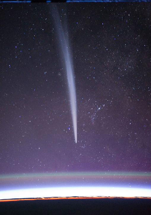
NASA Showcases ‘Spinoff’ Technologies

Orbital Technologies Corporation developed vortex combustion technology representing a new approach to rocket engine design. Orbital’s NASA work led to advancements in fire suppression systems. Image credit: NASA/HMA Fire.

[/caption]
Contrary to popular belief, Tang, Velcro and Teflon (along with the zero-gravity “space” pen) aren’t derived from NASA technology. NASA has, however, developed numerous technologies over the years, which are featured in annual “Spinoff” reports. Yes, “memory” foam mattresses are in fact one such product developed from NASA technologies.

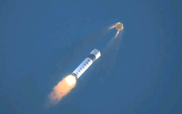
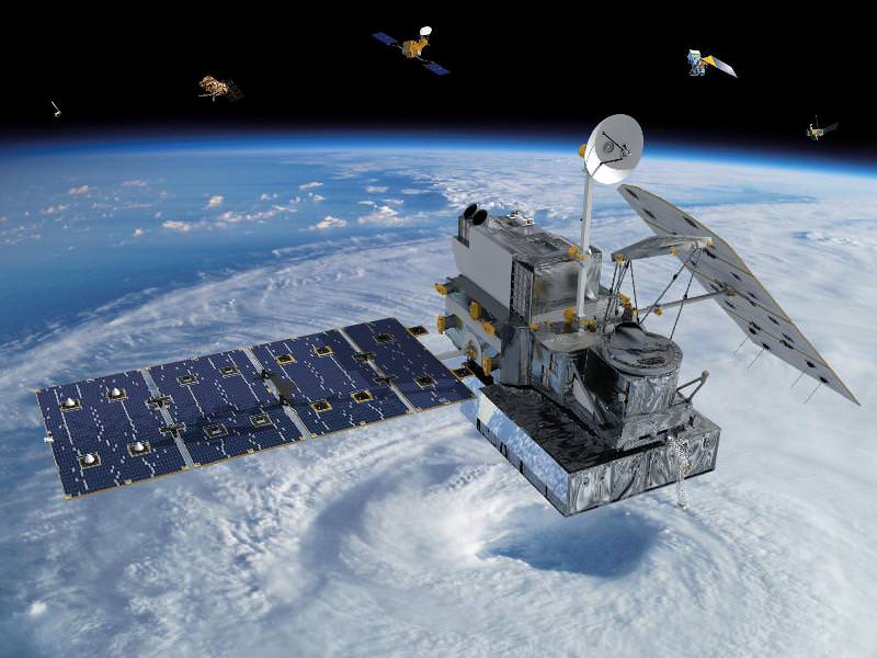
NASA’s latest Spinoff edition features over forty of NASA’s most innovative technologies. The origins of each technology within NASA missions are provided, as well as their “spinoff” to the public as commercial products and/or technologies beneficial to society.

What new technologies have made their way this year from NASA labs and into our homes?

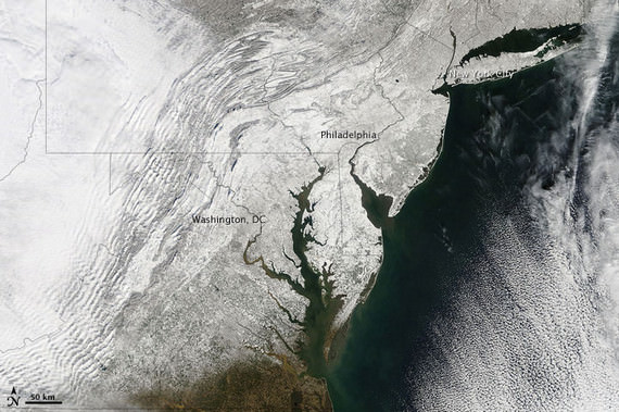
Generally, NASA spinoff technologies have proven useful in health and medicine, transportation, public safety, and consumer goods. Additional benefits from NASA spinoff technology can be found in the environment, information technology, and industrial productivity sectors. Experience has shown that these NASA technologies can help stimulate the economy and create new jobs and businesses in the private sector.

NASA Administrator Charles Bolden states, “This year’s Spinoff demonstrates once again how through productive and innovative partnerships, NASA’s aerospace research brings real returns to the American people in the form of tangible products, services and new jobs. For 35 years, Spinoff has been the definitive resource for those who want to learn how space exploration benefits life on Earth.”

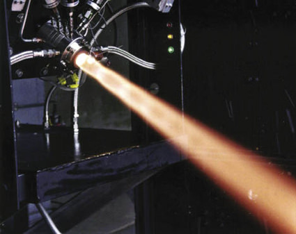
A few highlights from NASA’s “Spinoff 2011” include:

  • A new firefighting system, influenced by a NASA-derived rocket design that extinguishes fires more quickly than traditional systems, saving lives and property.
  • Software employing NASA-invented tools to help commercial airlines fly shorter routes and help save millions of gallons of fuel each year, reducing costs to airlines while benefiting the environment.
  • A fitness monitoring technology developed with the help of NASA expertise that, when fitted in a strap or shirt, can be used to measure and record vital signs. The technology is now in use to monitor the health of professional athletes and members of the armed services.
  • An emergency response software tool that can capture, analyze and combine data into maps, charts and other information essential to disaster managers responding to events such as wildfires, floods or Earthquakes. This technology can save millions of dollars in losses from disasters and, more importantly, can help save lives when tragedy strikes.
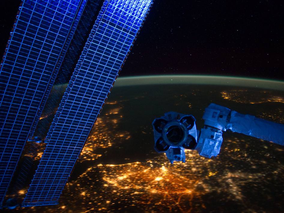
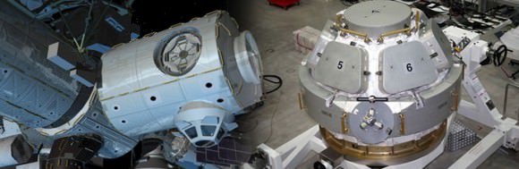
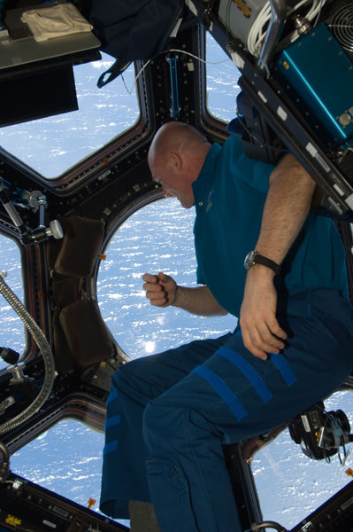
  • The 2011 spinoff report also includes a special section celebrating commercial technologies derived from NASA’s Space Shuttle Program. Additionally, NASA lists spinoff technologies based on the construction of the International Space Station and work aboard the station. One other section in the report outlines potential benefits of NASA’s future technology investments.

    “NASA’s Office of the Chief Technologist has more than a thousand projects underway that will create new knowledge and capabilities, enabling NASA’s future missions,” NASA Chief Technologist Mason Peck adds. “As these investments mature, we can expect new, exciting spinoff technologies transferring from NASA to the marketplace, providing real returns on our investments in innovation.”

    If you’d like to learn more about NASA’s “Spinoff” program, visit: http://spinoff.nasa.gov/

    Curious about what NASA technologies affect your daily life? Visit: http://www.nasa.gov/city

    Source: NASA Spinoff Press Release

    China Unveils High Resolution Global Moon Map

    China Publishes High Resolution Full Moon map from Chang'e-2 Lunar Orbiter. Chinese scientists assembled a full moon map using images captured by the Chang’e-2 spacecraft with an an unprecedented resolution of 7-meters. Credit: China Space Program

    [/caption]

    Chinese scientists have assembled the highest resolution map ever created of the entire Moon and unveiled a series of global Moon images on Monday, Feb. 6.

    The composite Lunar maps were created from over 700 individual images captured by China’s Chang’e-2 spacecraft and released by the country’s State Administration of Science, Technology and Industry for National Defence (SASTIND), according to reports from the state run Xinhua and CCTV new agencies.

    “The map and images are the highest-resolution photos of the entirety of the Moon’s surface to be published thus far,” said Liu Dongkui, deputy chief commander of China’s lunar probe project, reports Xinhua.

    Of course there are much higher resolution photos of numerous individual locations on the Moon taken from orbit by the spacecraft of other countries and from the surface by NASA’s Apollo lunar landing astronauts as well as unmanned Russian & American lunar landers and rovers.

    China unveils High Resolution Global Moon map from Chang'e-2 Lunar Orbiter
    Credit: China Space Program

    Chang’e-2 is China’s second lunar probe and achieved orbit around our nearest neighbor in space in October 2010. It was launched on Oct. 1, 2010 and is named after a legendary Chinese moon goddess.

    The images were snapped between October 2010 and May 2011 using a charge-coupled device (CCD) stereo camera as the spacecraft flew overhead in a highly elliptical orbit ranging from 15 km to 100 km altitude.

    The Chang’e-2 maps have a resolution of 7 meters, which is 17 times greater than from China’s first lunar orbiter; Chang’e-1, launched in 2007.

    Global Lunar Map from China’s Chang'e-2 Lunar Orbiter. Credit: China Space Program

    In fact the maps are detailed enough that Chinese scientists were able to detect traces of the Apollo landers, said Yan Jun, chief application scientist for China’s lunar exploration project.


    Chang’e-2 also captured high resolution photos of the “Sinus Iridum”area , or Bay of Rainbows, where China may land their next Moon mission. The camera had the ability to resolve features as small as 1 meter across at the lowest altitude.

    The satellite left lunar orbit in June 2011 and is currently orbiting the moon’s second Lagrange Point (L2), located more than 1.5 million km away from Earth.

    Chinese space program officials hope for a 2013 liftoff of the Chang’e-3 lunar rover, on what would be China’s first ever landing on another celestial body. China’s next step beyond the rover may be to attempt a lunar sample return mission in 2017.

    Demonstrating the ability to successfully conduct an unmanned lunar landing is a key milestone that must be achieved before China can land astronauts on the Moon, perhaps within the next decade.

    NASA’s twin GRAIL spacecraft recently achieved Lunar orbit over the New Year’s weekend. The duo of probes were just renamed as “Ebb and Flow” – the winning entries in an essay naming contest submitted by 4th Grade US students from Bozeman, Montana.

    At this time NASA does not have the funding or an approved robotic lunar landing mission, due to severe budget cuts.And even worse NASA cuts will be announced shortly !

    Russia hopes to send the Lunar Glob spacecraft to land on the Moon around 2015.

    Since the United States has unilaterally scuttled its plans to return American astronauts to the Moon’s surface, it’s very possible that the next flag planted on the Moon by humans will be Chinese.

    ISS Night Flight in “Real Time”

    We’ve featured wonderful time-lapse videos taken from the Space Station many times and each one is amazing to watch, but here’s something a little different: by taking photos at the rate of one per second and assembling them into a time-lapse, we can get a sense of what it’s like to orbit the planet at 240 miles up, 17,500 mph… in real time. Absolutely amazing!

    Continue reading “ISS Night Flight in “Real Time””

    Asteroid Vesta Floats in Space in High Resolution 3-D

    Vesta’s Eastern Hemisphere Floats in Space in 3-D. This anaglyph shows the varied topography of Vesta’s eastern hemisphere from craters in the north, the equatorial troughs and the huge mountain at the Souh Pole. Credit: NASA/JPL-Caltech/UCLA/MPS/DLR/IDA.

    [/caption]

    The giant Asteroid Vesta literally floats in space in a new high resolution 3-D image of the battered bodies Eastern Hemisphere taken by NASA’s Dawn Asteroid Orbiter.

    Haul out your red-cyan 3-D anaglyph glasses and lets go whirling around Vesta and sledding down mountains to greet the alien Snowman! The sights are fabulous !

    The Dawn imaging group based at the German Aerospace Center (DLR), in Berlin, Germany and led by team member Ralf Jaumann has released a trio of new high resolution 3-D images that are the most vivid anaglyphs yet published by the international science team.

    The lead anaglyph shows the highly varied topography of the Eastern Hemisphere of Vesta and was taken during the final approach phase as Dawn was about 5,200 kilometers (3,200 miles) away and preparing to achieve orbit in July 2011.

    The heavily cratered northern region is at top and is only partially illuminated because of Vesta’s tilted angle to the Sun at that time of year. Younger craters are overlain onto many older and more degraded craters. The equatorial region is dominated by the mysterious troughs which encircle most of Vesta and may have formed as a result of a gargantuan gong, eons ago.

    The southern hemisphere exhibits fewer craters than in the northern hemisphere. Look closely at the bottom left and you’ll see the huge central mountain complex of the Rheasilvia impact basin visibly protruding out from Vesta’s south polar region.

    This next 3-D image shows a close-up of the South Pole Mountain at the center of the Rheasilvia Impact basin otherwise known as the “Mount Everest of Vesta”.

    The Mount Everest of Vesta in 3-D
    This anaglyph shows the central complex and huge mountain in Vesta’s Rheasilvia impact basin at the South Pole. Does water ice lurk beneath the South Pole ?
    Credit: NASA/JPL-Caltech/UCLA/MPS/DLR/IDA.

    The central complex is approximately 200 kilometers (120 miles) in diameter and is approximately 20 kilometers (12 miles) tall and is therefore about two and a half times taller than Earth’s Mount Everest!

    Be sure to take a long look inside the deep craters and hummocky terrain surrounding “Mount Everest”.

    A recent study concludes that, in theory, Vesta’s interior is cold enough for water ice to lurk beneath the North and South poles.

    Finally lets gaze at the trio of craters that make up the “Snowman” in the 3-D image snapped in August 2011 as Dawn was orbiting at about 2,700 kilometers (1,700 miles) altitude. The three craters are named Minucia, Marcia and Calpurnia from top to bottom. Their diameters respectively are; 24 kilometers (15 miles), 53 kilometers (33 miles) and 63 kilometers (40 miles).

    3-D image of Vesta’s “Snowman” craters
    The three craters are named Minucia, Marcia and Calpurnia from top to bottom. They are 24 kilometers (15 miles), 53 kilometers (33 miles) and 63 kilometers (40 miles) in diameter, respectively. Image resolution is about 250 meters (820 feet) per pixel. Credit: NASA/JPL-Caltech/UCLA/MPS/DLR/IDA.

    It is likely that Marcia and Calpurnia formed from the impact of a binary asteroid and that Minucia formed in a later impact. The smooth region around the craters is the ejecta blanket.

    Dawn Orbiting Vesta above the “Snowman” craters
    This artist's concept shows NASA's Dawn spacecraft orbiting the giant asteroid Vesta above the Snowman craters. The depiction of Vesta is based on images obtained by Dawn's framing cameras. Dawn is an international collaboration of the US, Germany and Italy. Credit: NASA/JPL-Caltech

    Vesta is the second most massive asteroid in the main Asteroid Belt between Mars and Jupiter. It is 330 miles (530 km) in diameter.

    Dawn is the first spacecraft from Earth to visit Vesta. It achieved orbit in July 2011 for a year long mission. Dawn will fire up its ion propulsion thrusters in July 2012 to spiral out of orbit and sail to Ceres, the biggest asteroid of them all !

    Vesta and Ceres are also considered to be protoplanets.

    Super Bowl Cities Seen From Space

    Satellite image of RI and portions of southeastern Massachusetts. Credit: NASA/GSFC/Landsat 7

    [/caption]

    If you live in or are from the US, you probably know that today is Super Bowl Sunday. Whatever you happen to be doing, be it tailgating in Indianapolis, getting together with friends and family (and plenty of hot wings and nachos) in your living room or just waiting for all the fuss to be over, remember that, high above, NASA Earth-observing satellites are working hard doing what they do best: observing the Earth. Chances are they’ve imaged your home town many times.

    Whichever team you’re rooting for, here’s a little bit of space science fun: the folks over at Goddard Space Flight Center in Greenbelt, MD, have shared some Landsat images of the home cities of this year’s big game.

    The image above shows the central and northern RI and southeastern Massachusetts area, with Providence and Pawtucket seen as the densely-built central region and Foxborough, MA, where the Patriots’ home stadium is located, is just to the north of the image. This image was acquired by Landsat 7 in July 2002.

    (Being of my home state, I admit I’m partial to that particular shot. I was down there somewhere!)

    The NYC area seen from satellite. Credit: NASA/GSFC/Landsat 7

    If you’re a die-hard Giants fan, you may recognize this area… you may even be in it! It’s a Landsat 7 image of the New York metro area acquired on August 8, 2002. Manhattan is in the center, most easily recognizable from space by the green rectangle of Central Park. New Jersey is on the left side, and Brooklyn on the center-right with Long Island stretching away to the east.

    Indianapolis from Landsat 7 satellite. Credit: NASA/GSFC/Landsat 7

    If you’re lucky enough to have tickets to the big game, you may be here: it’s a Landsat image of Indianapolis, IN acquired on July 11, 2001. The Colts may not have made it this year but right now the city is definitely “ready for some football!”

    Of course, team and town loyalty aside, this gorgeous image from Expedition 30 crew members aboard the ISS shows everyone all in one place on the night of January 29, 2012 – with a nice touch of northern lights thrown in for good measure:

    US East Coast on Jan. 29, 2012. (NASA)

    Bright lights, big cities… but a small world, when you think about it. And remember, whichever team comes out on top today, tomorrow we’re all winners. (Until next season, of course!)

    You can see these and more images from Goddard Space Flight Center on their Flickr album, and find out more about Landsat and how it benefits people around the world.

    And you can follow Super Bowl XLVI news – and watch online – on the official NFL site here.

    Cities at Night Panorama of Millions of US East Coast Earthlings

    Nighttime Panorama of US East Coast from the ISS. Astronauts aboard the International Space Station (ISS) captured this stunning nighttime panorama of the major cities along the East Coast of the United States on Jan. 29. Credit: NASA

    [/caption]

    Do you live here?

    Tens of millions of Earthlings live and work in the bustling and seemingly intertwined American mega-metropolis of the Philadelphia-New York City-Boston corridor (bottom-center splotch) captured in this stunning “Cities at Night” panorama of the East Coast of the United States along the Atlantic seaboard (image above).

    Look northward and you’ll see the home to millions more Earthlings inhabiting the brilliantly lit Canadian cities of Toronto (launch site for “Lego Man in Space“) and Montreal to the west of Lake Ontario (dark oval at left-center).

    The gorgeous panorama showing a portion of the Earth at Night and the atmospheric limb and light activity from the Aurora Borealis was snapped by the Expedition 30 crew living and working aboard the million pound International Space Station (ISS) on Jan. 29.

    Lately, the 6 man international crew of Expedition 30 from Russia, Holland and the US have been on a roll taking one after another magnificent Nighttime pictures of our Home Planet, Auroras’ and celestial wonders like Comet Lovejoy.

    Be sure to take a comparative look at the recent panorama of Western Europe at Night snapped by the ISS crew a week before on Jan 22 – here.

    To test your geography smarts, here’s a map of the US East Coast highlighting much of what’s visible in the ISS panorama.

    This Earthling has lived in cities on the US East Coast and Western Europe – images above and below

    Western Europe at Night
    European ‘Cities at Night’ from the ISS with station solar arrays and robotic hand in foreground. Credit: NASA

    Two years ago in Feb. 2010, the US East Coast was struck by “Snowmageddon”, and this is how we looked from space

    Meanwhile, two of the Expedition 30 crew members, Russian Flight Engineers Oleg Kononenko and Anton Shkaplerov, are preparing for a spacewalk on Friday, Feb. 16. They will be installing equipment outside the ISS on the Russian Pirs, Poisk and Zvezda modules.

    SpaceX Test Fires SuperDraco Abort Engines Critical To Astronaut Launch Safety

    SpaceX test-fires its SuperDraco engine that powers the manned Dragon spacecraft launch escape system critical for Astronaut safety during launch to orbit. Credit: SpaceX

    [/caption]

    Space Exploration Technologies (SpaceX) has test fired a prototype of its new SuperDraco engine that will be critical to saving the lives of astronauts flying aboard a manned Dragon spacecraft soaring to orbit in the event of an in-flight emergency.

    The successful full-duration, full-thrust firing of the new SuperDraco engine prototype was completed at the company’s Rocket Development Facility in McGregor, Texas. The SuperDraco is a key component of the launch abort system of the Dragon spacecraft that must fire in a split second to insure crew safety during launch and the entire ascent to orbit.

    The Dragon spacecraft is SpaceX’s entry into NASA’s commercial crew development program – known as CCDEV2 – that seeks to develop a commercial ‘space taxi’ to launch human crews to low Earth orbit and the International Space Station (ISS).

    The engine fired for 5 seconds during the test, which is the same length of time the engines need to burn during an actual emergency abort to safely thrust the astronauts away.

    Watch the SpaceX SuperDraco Engine Test Video:

    Nine months ago NASA awarded $75 million to SpaceX to design and test the Dragon’s launch abort system . The SuperDraco firing was the ninth of ten milestones that are to be completed by SpaceX by around May 2012 and that were stipulated and funded by a Space Act Agreement (SAA) with NASA’s Commercial Crew Program (CCP).

    “SpaceX and all our industry partners are being extremely innovative in their approaches to developing commercial transportation capabilities,” said Commercial Crew Program Manager Ed Mango in a NASA statement. “We are happy that our investment in SpaceX was met with success in the firing of its new engine.”

    Dragon will launch atop the Falcon 9 rocket, also developed by SpaceX.

    SpaceX test-fires its SuperDraco engine that will eventually power the manned Dragon spacecrafts launch escape system critical for Astronaut safety during launch to orbit. Credit: SpaceX

    “Eight SuperDracos will be built into the sidewalls of the Dragon spacecraft, producing up to 120,000 pounds of axial thrust to quickly carry astronauts to safety should an emergency occur during launch,” said Elon Musk, SpaceX chief executive officer and chief technology officer in a statement. “Those engines will have the ability to deep throttle, providing astronauts with precise control and enormous power.”

    “Crews will have the unprecedented ability to escape from danger at any point during the launch because the launch abort engines are integrated into the side walls of the vehicle,” Musk said. “With eight SuperDracos, if any one engine fails the abort still can be carried out successfully.”

    SuperDraco engines will power the launch escape system of SpaceX’s Dragon. Eight SuperDraco engines built into the side walls of the Dragon spacecraft will produce up to 120,000 pounds of axial thrust to carry astronauts to safety should an emergency occur during launch. Credit: SpaceX

    SpaceX is one of four commercial firms working to develop a new human rated spacecraft with NASA funding. The other firms vying for a commercial crew contract are Boeing, Sierra Nevada and Blue Origin.

    “SuperDraco engines represent the best of cutting edge technology,” says Musk. “These engines will power a revolutionarylaunch escape system that will make Dragon the safest spacecraft in history and enable it to land propulsively on Earth or another planet with pinpoint accuracy.”

    The privately developed space taxi’s will eventually revive the capability to ferry American astronauts to and from the ISS that was totally lost when NASA’s Space Shuttle orbiters were forcibly retired before a replacement crew vehicle was ready to launch.

    Because the US Congress slashed NASA’s commercial crew development funding by more than 50% -over $400 million – the first launch of a commercial space taxi is likely to be delayed several more years to about 2017. Until that time, all American astronauts must hitch a ride to the ISS aboard Russian Soyuz capsules.

    This week the Russian manned space program suffered the latest in a string of failures when when technicians performing a crucial test mistakenly over pressurized and damaged the descent module of the next manned Soyuz vehicle set to fly to the ISS in late March, thereby forcing about a 45 day delay to the launch of the next manned Soyuz from Kazakhstan.

    Getting to the Core of Earth’s Falling Snow

    Visualization of the GPM Core Observatory and Partner Satellites. Credit: NASA

    [/caption]

    An international plan is unfolding that will launch satellites into orbit to study global snowfall precipitation with unprecedented detail. With the upcoming Global Precipitation Measurement (GPM) satellites, for the first time we will know when, where and how much snow falls on Earth, allowing greater understanding of energy cycles and how best to predict extreme weather.

    Snow is more than just a pretty winter decoration… it’s also a very important contributor to fresh water supply in many regions around the world, especially those areas that rely on spring runoff from mountains.

    The snowmelt from the Sierra Nevadas, for example, accounts for a third of the water supply for California.

    But changing climate and recent drought conditions have affected how much snow the mountains receive in winter… and thus how much water is released in the spring. Unfortunately, as of now there’s no reliable way to comprehensively detect and measure falling snow from space… whether in the Sierras or the Andes or the Alps.

    Engineers are building and testing the GPM Core Observatory at Goddard Space Flight Center. (NASA/GSFC)

    The GPM Core satellite, slated to launch in 2014, will change that.

    “The GPM Core, with its ability to detect falling snows, it’s one of the very first times that we’ve put sensors in space to specifically look at falling snow,” said GPM Deputy Project Scientist Gail Skofronick-Jackson in an online video. “We’re at that edge where rain was fifty years ago. We’re still figuring out how to measure snow.”

    And why is snow such a difficult subject to study?

    “Rain tends to be spherical like drops,” says Skofronick-Jackson. “But if you’ve ever been out in a snowfall and you’ve looked at your shirt, you see the snow comes in all different forms.”

    Once GPM scientists calculate all the various types of snowflake shapes, the satellite will be able to detect them from orbit.

    “The GPM Core, with its additional frequencies and information on the sensors, is going to be able to provide us for the first time a lot more information about falling snow than we’ve ever done before.”

    Knowing where and how much snow and rain falls globally is vital to understanding how weather and climate impact both our environment and Earth’s energy cycles, including effects on agriculture, fresh water availability, and responses to natural disasters.

    Snowfall is a missing part of the puzzle, and GPM will fill those pieces in.

    Find out more about the GPM program at pmm.nasa.gov/GPM.

    GPM Core is currently being assembled at NASA’s Goddard Space Flight Center and scheduled to launch in 2014 on a Japanese H-IIA rocket.  Initiated by NASA and the Japanese Aerospace Exploration Agency (JAXA), GPM consists of a consortium of international agencies, including the Centre National d’Études Spatiales (CNES), the Indian Space Research Organization (ISRO), the National Oceanic and Atmospheric Administration (NOAA), the European Organization for the Exploitation of Meteorological Satellites (EUMETSAT), and others. 

    Colbert Does PSA for NASA

    ISS Node 3: Will it be Colbert?

    In what might be the most unusual public service announcement for NASA, comedian Stephen Colbert uses his unique sense of humor to spread the word about the great things NASA is doing, especially on the International Space Station. But then, he WOULD support the ISS since NASA named an ISS treadmill after him when his name received the most entries in a contest to name Node 3. Since NASA doesn’t usually name anything after living people, they named the node Tranquility and then used their incredible acronym-creating abilities to come up with the “Combined Operational Load-Bearing External Resistance Treadmill” (COLBERT).

    Amazing Panorama of Western Europe at Night from Space Station

    Western Europe at Night With hardware from the Earth-orbiting International Space Station appearing in the near foreground, a night time European panorama reveals city lights from Belgium and the Netherlands at bottom center. the British Isles partially obscured by solar array panels at left, the North Sea at left center, and Scandinavia at right center beneath the end effector of the Space Station Remote Manipulator System or Canadarm2. This image was taken by the station crew on Jan. 22, 2012. Credit: NASA

    [/caption]

    An amazing panorama revealing Western Europe’s ‘Cities at Night’ with hardware from the stations robotic ‘hand’ and solar arrays in the foreground was captured by the crew in a beautiful new image showing millions of Earth’s inhabitants from the Earth-orbiting International Space Station (ISS).

    The sweeping panoramic vista shows several Western European countries starting with the British Isles partially obscured by twin solar arrays at left, the North Sea at left center, Belgium and the Netherlands (Holland) at bottom center, and the Scandinavian land mass at right center by the hand, or end effector, of the Canadian-built ISS robotic arm known as the Space Station Remote Manipulator System (SSRMS) or Canadarm2.

    European Space Agency astronaut Andre Kuipers gazing at Earth from the Cupola dome of the ISS

    Coincidentally European Space Agency astronaut Andre Kuipers from Holland (photo at left) is currently aboard the ISS, soaring some 400 kilometers (250 miles) overhead.

    The panoramic image was taken by the ISS residents on January 22, 2012.

    The Expedition 30 crew of six men currently serving aboard the ISS (photo below) hail from the US, Russia and Holland.

    NASA astronaut Dan Burbank is the commander of Expedition 30 and recently snapped awesome photos of Comet Lovejoy.

    “Cities at Night” – Here’s a portion of a relevant ISS Blog post from NASA astronaut Don Pettit on Jan. 27, 2012:

    “Cities at night are different from their drab daytime counterparts. They present a most spectacular display that rivals a Broadway marquee. And cities around the world are different. Some show blue-green, while others show yellow-orange. Some have rectangular grids, while others look like a fractal-snapshot from Mandelbrot space.”

    “Patterns in the countryside are different in Europe, North America, and South America. In space, you can see political boundaries that show up only at night. As if a beacon for humanity, Las Vegas is truly the brightest spot on Earth. Cities at night may very well be the most beautiful unintentional consequence of human activity,” writes NASA astronaut Don Pettit currently residing aboard the ISS.

    Comet Lovejoy on 22 Dec. 2011 from the International Space Station. Comet Lovejoy is visible near Earth’s horizon in this nighttime image photographed by NASA astronaut Dan Burbank, Expedition 30 commander, onboard the International Space Station on Dec. 22, 2011. Credit: NASA/Dan Burbank
    Expedition 30 Crew: Pictured on the front row are NASA astronaut Dan Burbank, commander; and Russian cosmonaut Oleg Kononenko, flight engineer. Pictured from the left (back row) are Russian cosmonauts Anton Shkaplerov and Anatoly Ivanishin; along with European Space Agency astronaut Andre Kuipers and NASA astronaut Don Pettit, all flight engineers. Photo credit: NASA and International Space Station partners