Where Will President-Elect Trump Take American Space Endeavours?

Given the fiscal policies of his party, and his own stances on Climate Change, there is concern about how a Trump administration will affect NASA. Credit: Wikipedia Commons/Gage Skidmore

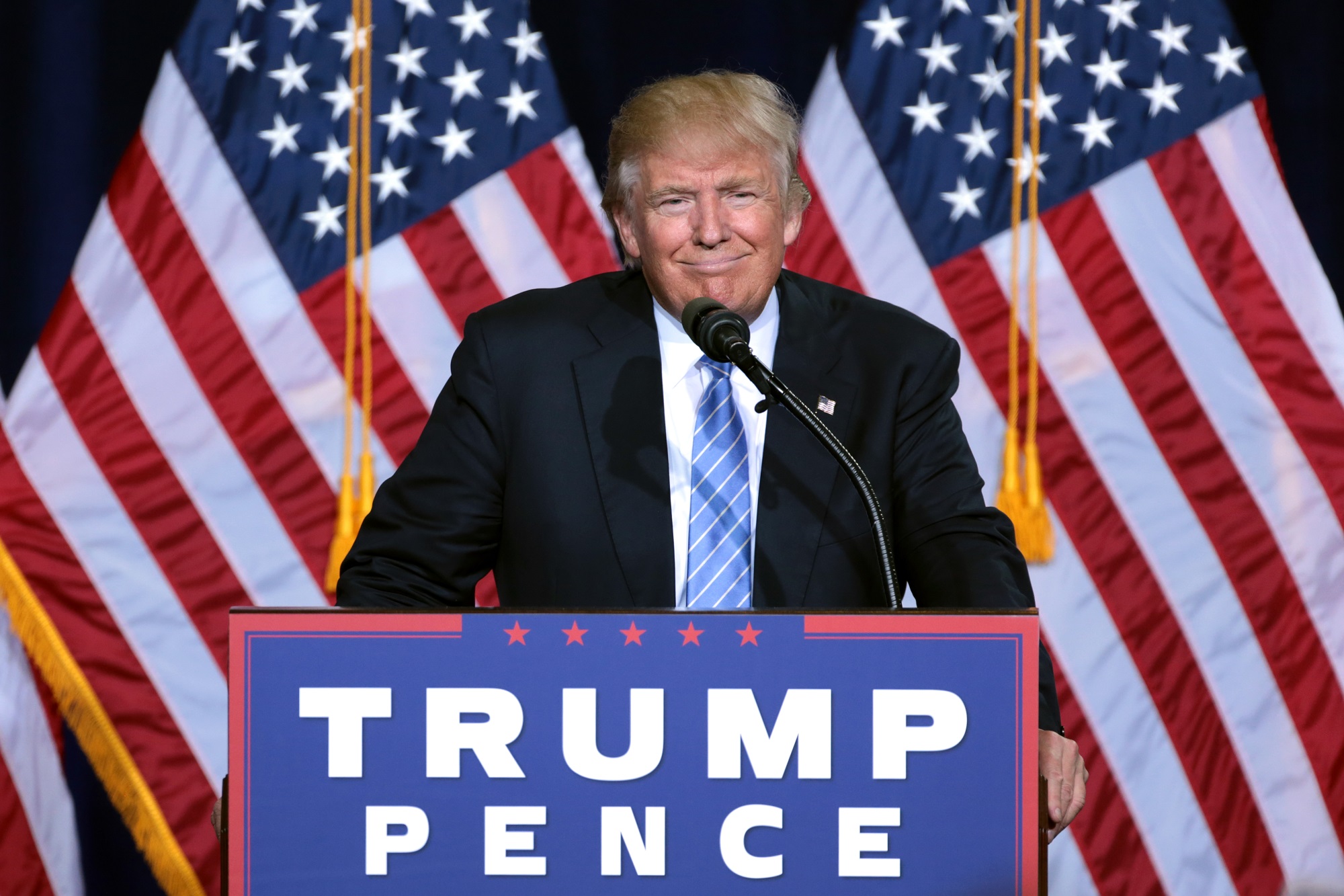
With the 2016 election now finished and Donald Trump confirmed as the president-elect of the United States, there are naturally some concerns about what this could means for the future of NASA. Given the administration’s commitment to Earth science, and its plans for crewed missions to near-Earth Orbit and Mars, there is understandably some worry that the budget environment might be changing soon.

At this juncture, it is not quite clear how a Trump presidency will affect NASA’s mandate for space exploration and scientific research. But between statements made by the president-elect in the past, and his stances on issues like climate change, it seems clear that funding for certain types of research could be threatened. But there is also reason to believe that larger exploration programs might be unaffected.

Back in September, the Senate Committee on Commerce, Science, and Transportation passed the NASA Transition Authorization Act of 2016. This bill granted $19.5 billion in funding for NASA for fiscal year 2017, thus ensuring that NASA’s proposed activities would not be affected by the transition in power. Central to this bill was the continued funding of operations that NASA considered to be central to its “Journey to Mars“.

Looking forward, it is unclear how the new administration will affect NASA's plans for space exploration. Credit: NASA/AESP
Looking forward, it is unclear how the new administration will affect NASA’s plans for space exploration. Credit: NASA/AESP

Beyond FY 2017, though, the picture is unclear. When it comes to things like NASA’s Earth Science program, the administration of a president that denies the existence of Climate Change is expected to mean budget cuts. For instance, back in May, Trump laid out his vision for an energy policy. Central to this was a focus on oil, natural gas and coal, the cancellation of the Paris Agreement, and the cessations of all payments to the UN Green Climate Fund.

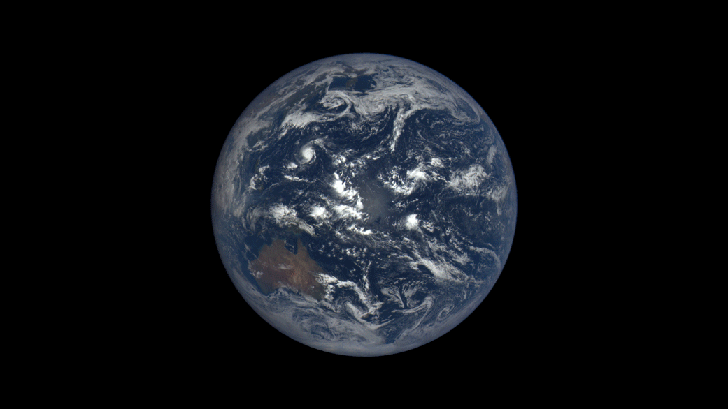
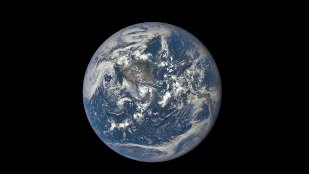
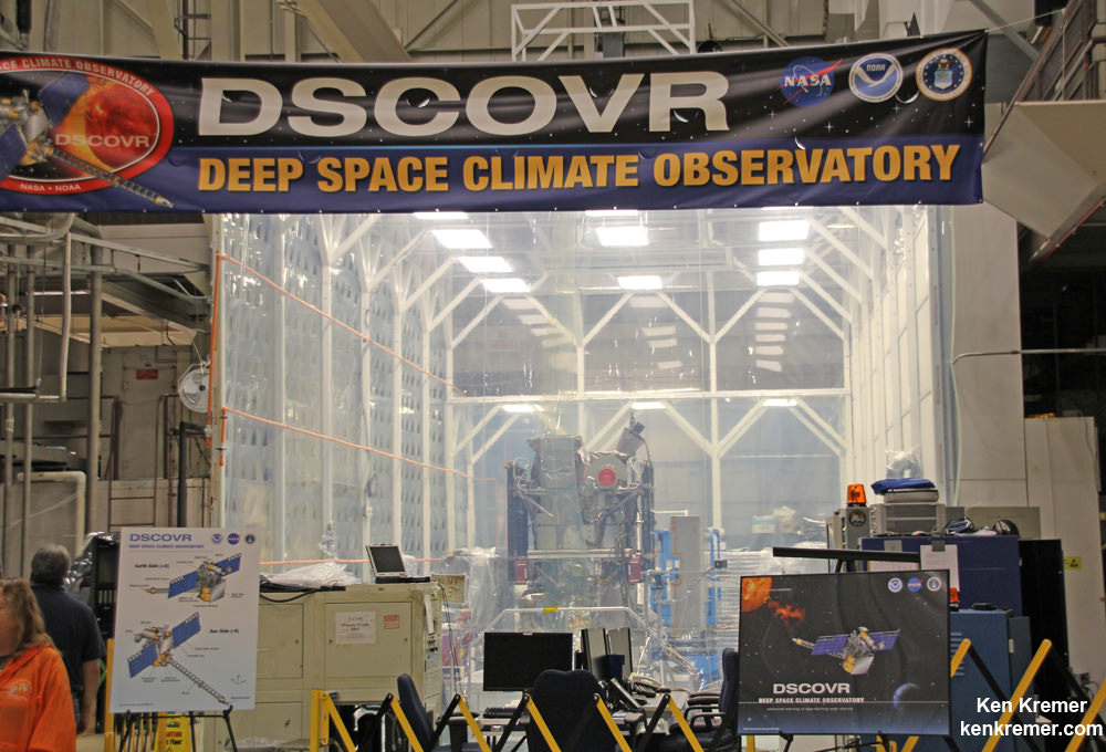
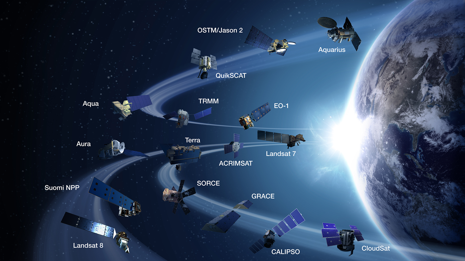
This could signal a possible reverse of policies initiated by the Obama administration, which increased funding for Earth science research by about 50 percent. And as NASA indicated in a report issued on Nov. 2nd by the Office of the Inspect General – titled “NASA’s Earth Science Mission Portfolio” – this has resulted in some very favorable developments.

Foremost among these has been the increased in the number of products delivered to users by NASA, going from 8.14 million in 2000 to 1.42 billion in 2015. In other words, usage of NASA resources has increased by a factor of 175, and in the space of just 15 years (much of that in the last 8). Another major benefit has been the chance for collaboration and lucrative partnerships. From the report:

“Government agencies, scientists, private entities, and other stakeholders rely on NASA to process raw information received from Earth observation systems into useable data. Moreover, NASA’s Earth observation data is routinely used by government agencies, policy makers, and researchers to expand understanding of the Earth system and to enhance economic competitiveness, protect life and property, and develop policies to help protect the planet. Finally, NASA is working to address suggestions that it use commercially provided data to augment its Earth observation data. However, NASA must reconcile its policy that promotes open sharing of data at minimal cost to users with a commercial business model under which fees may create a barrier to use.”
Much of NASA's research into Climate Change takes place through the Earth Sciences Directorate. Credit: NASA
Much of NASA’s research into Climate Change takes place through the Earth Science division of the Mission Directorate. Credit: NASA

Unfortunately, it has been this same increase in funding that prompted Congressional Republicans, in the name of fiscal responsibility, to demand changes and new standards. These sentiments were voiced back in March of 2015 during NASA’s budget request for 2016. As Senator Ted Cruz – currently one of the Trump campaign’s backers – said at the time:

“We’ve seen a disproportionate increase in the amount of federal funds going to the earth sciences program at the expense of funding for exploration and space operations, planetary sciences, heliophysics, and astrophysics, which I believe are all rooted in exploration and should be central to NASA’s core mission. We need to get back to the hard sciences, to manned space exploration, and to the innovation that has been integral to NASA.

While Trump himself has little to say about space during his long campaign, his team did manage to recruit Robert Walker – a former Republican congressman from Pennsylvania – this past October to draft a policy for them. In an op-ed to SpaceNews in late October, he echoed Cruz’s sentiments about cutting back on Earth sciences to focus on space exploration:

“NASA should be focused primarily on deep space activities rather than Earth-centric work that is better handled by other agencies. Human exploration of our entire solar system by the end of this century should be NASA’s focus and goal. Developing the technologies to meet that goal would severely challenge our present knowledge base, but that should be a reason for exploration and science.”

“It makes little sense for numerous launch vehicles to be developed at taxpayer cost, all with essentially the same technology and payload capacity. Coordinated policy would end such duplication of effort and quickly determine where there are private sector solutions that do not necessarily require government investment.

NASA's Journey to Mars. NASA is developing the capabilities needed to send humans to an asteroid by 2025 and Mars in the 2030s. Credit: NASA/JPL
NASA is developing the capabilities needed to send humans to an asteroid by 2025 and Mars in the 2030s. Credit: NASA/JPL

Next, there is the issue of NASA’s long-term goals, which (as noted) seem more secure for the time being. In May of 2016, Trump was issued the Aerospace America Questionnaire – a series of ten questions issued by NASA to determine the stances of the candidates on space exploration. On the subject of a crewed mission to Mars in the future, Trump’s campaign indicated that things would depend upon the state of the country’s economy:

“A lot of what my administration would recommend depends on our economic state. If we are growing with all of our people employed and our military readiness back to acceptable levels, then we can take a look at the timeline for sending more people into space.

However, they also professed an admiration for NASA and a commitment to its overall goal:

“NASA has been one of the most important agencies in the United States government for most of my lifetime. It should remain so. NASA should focus on stretching the envelope of space exploration for we have so much to discover and to date we have only scratched the surface.”

From all of this, a general picture of what NASA’s budget environment will look like in the near future begins to emerge. In all likelihood, the Earth Science division (and other parts of NASA) are likely to find their budgets being scrutinized based on newly-developed criteria. Essentially, unless it benefits space exploration and research beyond Earth, it’s not likely to see continued funding.

NASA Administrator Charles Bolden. Credit: NASA

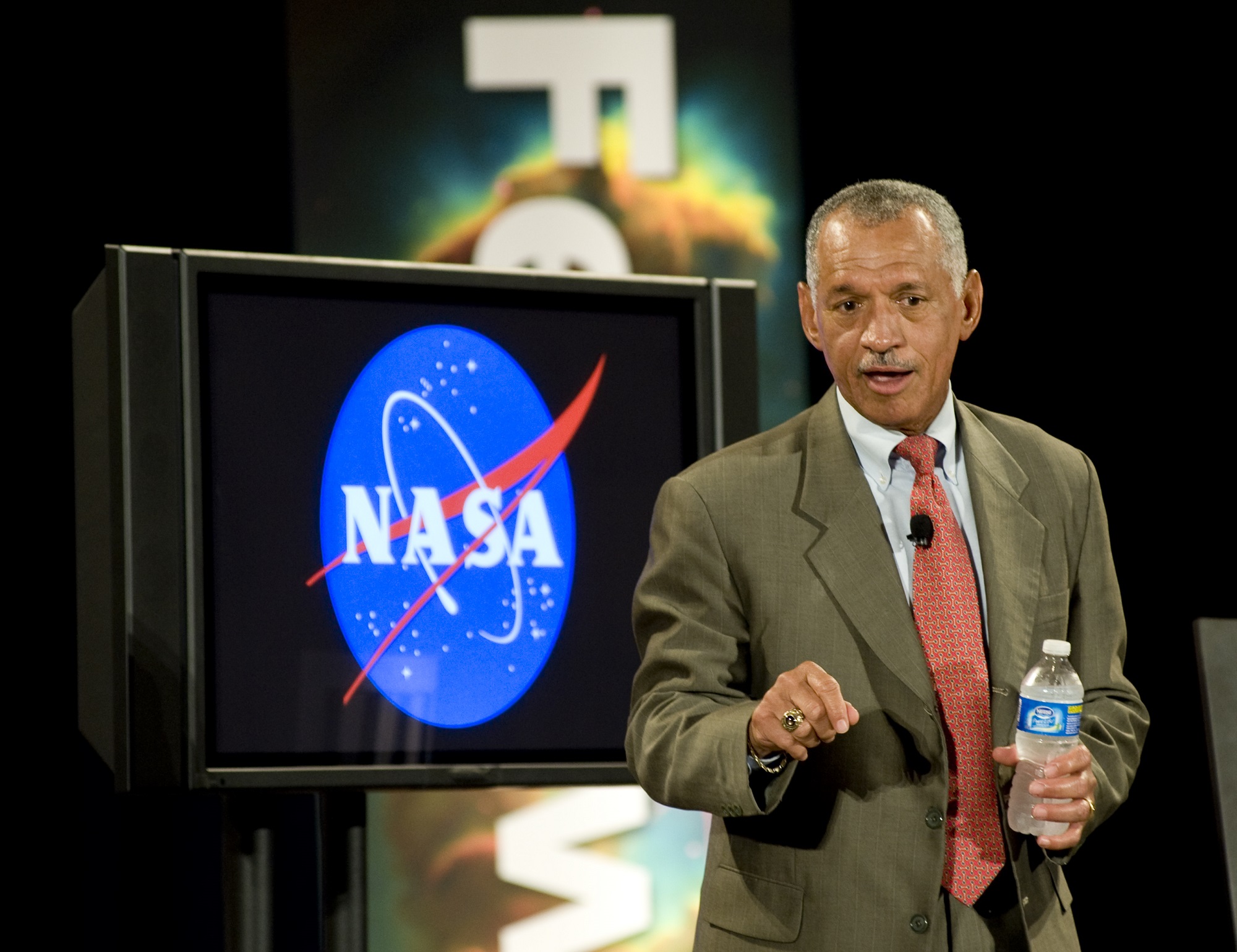
But regardless of the results of the election, it appears at this juncture that NASA is looking forward with cautious optimism. Addressing the future, NASA Administrator Charles Bolden issued an internal memo on Wednesday, Nov. 9th. Titled “Reaching for New Heights in 2017 and Beyond“, Bolden expressed positive thoughts about the transition of power and what it would mean:

“In times when there has been much news about all the things that divide our nation, there has been noticeable bipartisan support for this work, our work – support that not only reaches across the aisle, but across the public, private, academic and non-profit sectors.

“For this reason, I think we can all be confident that the new Trump Administration and future administrations after that will continue the visionary course on which President Barack Obama has set us, a course that all of you have made possible.”

For NASA’s sake, I hope Bolden’s words prove to be prophetic. For no matter who holds of the office of the President of the United States, the American people – and indeed, all the world’s people – depend upon the continued efforts of NASA. As the leader in space exploration, their presence is essential to humanity’s return to space!

Further Reading: Planetary Society

See EPIC Views of Rotating Earth Daily from NASA’s New DSCOVR Observatory Website

Earth rotates through an entire day as captured in this animation of 22 still images taken on Sept. 17, 2015 by NASA’s Earth Polychromatic Imaging Camera (EPIC) camera on the Deep Space Climate Observatory (DSCOVR) spacecraft. Credits: NASA

At long last, beautiful new high resolution views of the rotating Earth can be seen daily by everyone at a new NASA website – all courtesy of images taken by NASA’s EPIC camera on board the Deep Space Climate Observatory (DSCOVR) spacecraft. And as seen in the time-lapse animation above, they provide a wonderful new asset for students everywhere to learn geography that’s just a finger tip away!

The EPIC camera, which stands for Earth Polychromatic Imaging Camera (EPIC), is located a million miles away on the DSCOVR real time space weather monitoring satellite and is designed to take full disk color images of the sunlit side of our home planet multiple times per day.

The EPIC NASA images are literally just a finger tip away, after a 17 year wait to get the satellite into the launch queue since it was first proposed by former VP Al Gore. They are all easily viewed at NASA’s new EPIC camera website which went online today, Monday, October 19, 2015.

To see the daily sequence of rotating images, visit the EPIC website link: http://epic.gsfc.nasa.gov/

This EPIC image was taken on Oct.17 and shows the Australian continent and a portion of Asia.

EPIC image taken on Oct. 17, 2015 showing the continent of Australia and a portion of Asia. Credit: NASA

An annotated guide map illustration identifying the visible land masses accompanies each EPIC image and follows along as the Earth rotates daily.

What a great geography learning tool for student classrooms worldwide!

Annotated guide map identifying the visible land masses accompanies each EPIC image. Credit: NASA

DSCOVR is a joint mission between NOAA, NASA, and the U.S Air Force (USAF) that is managed by NOAA. The satellite and science instruments were provided by NASA and NOAA.

EPIC is a four megapixel CCD camera and telescope mounted on DSCOVR and orbiting around the L1 Lagrange Point – a neutral gravity point that lies on the direct line between Earth and the sun.

NASA says that once per day they will post “at least a dozen new color images of Earth acquired from 12 to 36 hours earlier” taken by the agency’s EPIC camera. The EPIC images will be stored in an archive searchable by date and continent.

The image sequence will show “the Earth as it rotates, thus revealing the whole globe over the course of a day.”

“The effective resolution of the DSCOVR EPIC camera is somewhere between 6.2 and 9.4 miles (10 and 15 kilometers),” said Adam Szabo, DSCOVR project scientist at NASA’s Goddard Space Flight Center, Greenbelt, Maryland, in a statement.

“The color Earth images are created by combining three separate single-color images to create a photographic-quality image equivalent to a 12-megapixel camera. The camera takes a series of 10 images using different narrowband filters — from ultraviolet to near infrared — to produce a variety of science products. The red, green and blue channel images are used to create the color images. Each image is about 3 megabytes in size.”

EPIC will capture “a constant view of the fully illuminated Earth as it rotates, providing scientific observations of ozone, vegetation, cloud height and aerosols in the atmosphere.”

Technician works on NASA Earth science instruments and Earth imaging EPIC camera (white circle) housed on NOAA/NASA Deep Space Climate Observatory (DSCOVR) inside NASA Goddard Space Flight Center clean room in November 2014.  Credit: Ken Kremer/kenkremer.com
Technician works on NASA Earth science instruments and Earth imaging EPIC camera (white circle) housed on NOAA/NASA Deep Space Climate Observatory (DSCOVR) inside NASA Goddard Space Flight Center clean room in November 2014. Credit: Ken Kremer/kenkremer.com

The couch sized probe was launched atop a SpaceX Falcon 9 on Feb. 11, 2015 from Cape Canaveral, Florida, to start the million mile journey to its deep space observation post at L1. The rocket was funded by the USAF.

The primary goal of the $340 million DSCOVR satellite is to monitor the solar wind and aid very important forecasts of space weather at Earth from L1.

L1 is located 1.5 million kilometers (932,000 miles) sunward from Earth. At L1 the gravity between the sun and Earth is perfectly balanced and the DSCOVR satellite orbits about that spot just like a planet.

The mission is vital because its solar wind observations are crucial to maintaining accurate space weather forecasts to protect US infrastructure such as power grids, aviation, planes in flight, all types of Earth orbiting satellites for civilian and military needs, telecommunications, ISS astronauts and GPS systems.

This animation shows images of the far side of the moon, illuminated by the sun, as it crosses between the DISCOVR spacecraft's Earth Polychromatic Imaging Camera (EPIC) camera and telescope, and the Earth - one million miles away.  Credit: NASA/NOAA
This animation shows images of the far side of the moon, illuminated by the sun, as it crosses between the DISCOVR spacecraft’s Earth Polychromatic Imaging Camera (EPIC) camera and telescope, and the Earth – one million miles away. Credit: NASA/NOAA

DSCOVR was first proposed in 1998 by then US Vice President Al Gore as the low cost ‘Triana’ satellite to take near continuous views of the Earth’s entire globe to feed to the internet as a means of motivating students to study math and science.

It was also dubbed “Goresat.”

The probe was eventually resurrected and partially rebuilt at NASA Goddard Space Flight Center as a much more capable Earth science satellite that would also conduct the space weather observations.

But Triana was shelved for purely partisan political reasons and the satellite was placed into storage at NASA Goddard.

Thus the practical and teachable science and daily scenes of the gorgeously rotating Earth were lost – until now!

Former VP Al Gore was clearly delighted with today’s launch of NASA’s EPIC website in this pair of tweets:

“Today @NASA launched its site for #DSCOVR’s daily images. I look forward to seeing more from #DSCOVR,” tweeted Al Gore.

“DSCOVR’s site displaying new daily images of Earth from L1 was launched today! Congratulations to all those who made this happen!”

Stay tuned here for Ken’s continuing Earth and planetary science and human spaceflight news.

Ken Kremer

NOAA/NASA Deep Space Climate Observatory (DSCOVR) undergoes processing in NASA Goddard Space Flight Center clean room. Solar wind instruments at right. DSCOVER will launch in February 2015 atop SpaceX Falcon 9 rocket.  Credit: Ken Kremer/kenkremer.com
NOAA/NASA Deep Space Climate Observatory (DSCOVR) undergoes processing in NASA Goddard Space Flight Center clean room. Solar wind instruments at right. DSCOVER launched in February 2015 atop SpaceX Falcon 9 rocket. Credit: Ken Kremer/kenkremer.com
NOAA/NASA/USAF Deep Space Climate Observatory (DSCOVR) undergoes processing in NASA Goddard Space Flight Center clean room.  Probe will launch in February atop SpaceX Falcon 9 rocket.  Credit: Ken Kremer - kenkremer.com
NOAA/NASA/USAF Deep Space Climate Observatory (DSCOVR) undergoes processing in NASA Goddard Space Flight Center clean room. Probe launched in February 2015 atop SpaceX Falcon 9 rocket. Credit: Ken Kremer/kenkremer.com

NASA’s RapidScat Ocean Wind Watcher Starts Earth Science Operations at Space Station

ISS-RapidScat data on a North Atlantic extratropical cyclone, as seen by the National Centers for Environmental Prediction Advanced Weather Interactive Processing System used by weather forecasters at the National Oceanic and Atmospheric Administration's Ocean Prediction Center. Image Credit: NASA/JPL-Caltech/NOAA

Barely two months after being launched to the International Space Station (ISS), NASA’s first science payload aimed at conducting Earth science from the station’s exterior has started its ocean wind monitoring operations two months ahead of schedule.

Data from the ISS Rapid Scatterometer, or ISS-RapidScat, payload is now available to the world’s weather and marine forecasting agencies following the successful completion of check out and calibration activities by the mission team.

Indeed it was already producing high quality, usable data following its power-on and activation at the station in late September and has monitored recent tropical cyclones in the Atlantic and Pacific Oceans prior to the end of the current hurricane season.

RapidScat is designed to monitor ocean winds for climate research, weather predictions, and hurricane monitoring for a minimum mission duration of two years.

“RapidScat is a short mission by NASA standards,” said RapidScat Project Scientist Ernesto Rodriguez of JPL.

“Its data will be ready to help support U.S. weather forecasting needs during the tail end of the 2014 hurricane season. The dissemination of these data to the international operational weather and marine forecasting communities ensures that RapidScat’s benefits will be felt throughout the world.”

ISS-RapidScat instrument, shown in this artist's rendering, was launched to the International Space Station aboard the SpaceX CRS-4 mission on Sept. 21, 2014 and attached at ESA’s Columbus module.  It will measure ocean surface wind speed and direction and help improve weather forecasts, including hurricane monitoring. Credit: NASA/JPL-Caltech/Johnson Space Center.
ISS-RapidScat instrument, shown in this artist’s rendering, was launched to the International Space Station aboard the SpaceX CRS-4 mission on Sept. 21, 2014, and attached at ESA’s Columbus module. It will measure ocean surface wind speed and direction and help improve weather forecasts, including hurricane monitoring. Credit: NASA/JPL-Caltech/Johnson Space Center.

The 1280 pound (580kilogram) experimental instrument was developed by NASA’s Jet Propulsion Laboratory. It’s a cost-effective replacement to NASA’s former QuikScat satellite.

The $26 million remote sensing instrument uses radar pulses reflected from the ocean’s surface at different angles to calculate the speed and direction of winds over the ocean for the improvement of weather and marine forecasting and hurricane monitoring.

The RapidScat, payload was hauled up to the station as part of the science cargo launched aboard the commercial SpaceX Dragon CRS-4 cargo resupply mission that thundered to space on the company’s Falcon 9 rocket from Space Launch Complex-40 at Cape Canaveral Air Force Station in Florida on Sept. 21.

ISS-RapidScat is NASA’s first research payload aimed at conducting near global Earth science from the station’s exterior and will be augmented with others in coming years.

ISS-RapidScat viewed the winds within post-tropical cyclone Nuri as it moved parallel to Japan on Nov. 6, 2014 05:30 UTC. Image Credit: NASA/JPL-Caltech
ISS-RapidScat viewed the winds within post-tropical cyclone Nuri as it moved parallel to Japan on Nov. 6, 2014, 05:30 UTC. Image Credit: NASA/JPL-Caltech

It was robotically assembled and attached to the exterior of the station’s Columbus module using the station’s robotic arm and DEXTRE manipulator over a two day period on Sept 29 and 30.

Ground controllers at Johnson Space Center intricately maneuvered DEXTRE to pluck RapidScat and its nadir adapter from the unpressurized trunk section of the Dragon cargo ship and attached it to a vacant external mounting platform on the Columbus module holding mechanical and electrical connections.

The nadir adapter orients the instrument to point its antennae at Earth.

The couch sized instrument and adapter together measure about 49 x 46 x 83 inches (124 x 117 x 211 centimeters).

“The initial quality of the RapidScat wind data and the timely availability of products so soon after launch are remarkable,” said Paul Chang, ocean vector winds science team lead at NOAA’s National Environmental Satellite, Data and Information Service (NESDIS)/Center for Satellite Applications and Research (STAR), Silver Spring, Maryland.

“NOAA is looking forward to using RapidScat data to help support marine wind and wave forecasting and warning, and to exploring the unique sampling of the ocean wind fields provided by the space station’s orbit.”

A SpaceX Falcon 9 rocket carrying a Dragon cargo capsule packed with science experiments and station supplies blasts off from Space Launch Complex 40 at Cape Canaveral Air Force Station, Florida, at 1:52 a.m. EDT on Sept. 21, 2014 bound for the ISS.  Credit: Ken Kremer/kenkremer.com
A SpaceX Falcon 9 rocket carrying a Dragon cargo capsule packed with science experiments and station supplies blasts off from Space Launch Complex 40 at Cape Canaveral Air Force Station, Florida, at 1:52 a.m. EDT on Sept. 21, 2014, bound for the ISS. Credit: Ken Kremer/kenkremer.com

This has been a banner year for NASA’s Earth science missions. At least five missions will be launched to space within a 12 month period, the most new Earth-observing mission launches in one year in more than a decade.

ISS-RapidScat is the third of five NASA Earth science missions scheduled to launch over a year.

NASA has already launched the of the Global Precipitation Measurement (GPM) Core Observatory, a joint mission with the Japan Aerospace Exploration Agency, in February and the Orbiting Carbon Observatory-2 (OCO-2) carbon observatory in July 2014.

Stay tuned here for Ken’s continuing Earth and Planetary science and human spaceflight news.

Ken Kremer

NASA Inaugurates New Space Station Era as Earth Science Observation Platform with RapidScat Instrument

ISS-RapidScat instrument, shown in this artist's rendering, was launched to the International Space Station aboard the SpaceX CRS-4 mission on Sept. 21, 2014 and attached at ESA’s Columbus module. It will measure ocean surface wind speed and direction and help improve weather forecasts, including hurricane monitoring. Credit: NASA/JPL-Caltech/Johnson Space Center.

NASA inaugurated a new era of research for the International Space Station (ISS) as an Earth observation platform following the successful installation and activation of the ISS-RapidScat science instrument on the outposts exterior at Europe’s Columbus module.

The ISS Rapid Scatterometer, or ISS-RapidScat, is NASA’s first research payload aimed at conducting near global Earth science from the station’s exterior and will be augmented with others in coming years.

RapidScat is designed to monitor ocean winds for climate research, weather predictions, and hurricane monitoring.

The 1280 pound (580 kilogram) experimental instrument is already collecting its first science data following its recent power-on and activation at the station.

“Its antenna began spinning and it started transmitting and receiving its first winds data on Oct.1,” according to a NASA statement.

The first image from RapidScat was released by NASA on Oct. 6, shown below, and depicts preliminary measurements of global ocean near-surface wind speeds and directions.

Launched Sept. 21, 2014, to the International Space Station, NASA's newest Earth-observing mission, the International Space Station-RapidScat scatterometer to measure global ocean near-surface wind speeds and directions, has returned its first preliminary images.  Credit: NASA-JPL/Caltech
Launched Sept. 21, 2014, to the International Space Station, NASA’s newest Earth-observing mission, the International Space Station-RapidScat scatterometer to measure global ocean near-surface wind speeds and directions, has returned its first preliminary images. Credit: NASA-JPL/Caltech

The $26 million remote sensing instrument uses radar pulses to observe the speed and direction of winds over the ocean for the improvement of weather forecasting.

“Most satellite missions require weeks or even months to produce data of the quality that we seem to be getting from the first few days of RapidScat,” said RapidScat Project Scientist Ernesto Rodriguez of NASA’s Jet Propulsion Laboratory, Pasadena, California, which built and manages the mission.

“We have been very lucky that within the first days of operations we have already been able to observe a developing tropical cyclone.

“The quality of these data reflect the level of testing and preparation that the team has put in prior to launch,” Rodriguez said in a NASA statement. “It also reflects the quality of the spare QuikScat hardware from which RapidScat was partially assembled.”

RapidScat, payload was hauled up to the station as part of the science cargo launched aboard the commercial SpaceX Dragon CRS-4 cargo resupply mission that thundered to space on the company’s Falcon 9 rocket from Space Launch Complex-40 at Cape Canaveral Air Force Station in Florida on Sept. 21.

Dragon was successfully berthed at the Earth-facing port on the station’s Harmony module on Sept 23, as detailed here.

It was robotically assembled and attached to the exterior of the station’s Columbus module using the station’s robotic arm and DEXTRE manipulator over a two day period on Sept 29 and 30.

Ground controllers at Johnson Space Center intricately maneuvered DEXTRE to pluck RapidScat and its nadir adapter from the unpressurized trunk section of the Dragon cargo ship and attached it to a vacant external mounting platform on the Columbus module holding mechanical and electrical connections.

Fascinating: #Canadarm & Dextre installed the #RapidScat Experiment on Columbus! @ISS_Research @NASAJPL @csa_asc. Credit: ESA/NASA/Alexander Gerst

The nadir adapter orients the instrument to point at Earth.

The couch sized instrument and adapter together measure about 49 x 46 x 83 inches (124 x 117 x 211 centimeters).

Engineers are in the midst of a two week check out process that is proceeding normally so far. Another two weeks of calibration work will follow.

Thereafter RapidScat will begin a mission expected to last at least two years, said Steve Volz, associate director for flight programs in the Earth Science Division, NASA Headquarters, Washington, at a prelaunch media briefing at the Kennedy Space Center.

RapidScat is the forerunner of at least five more Earth science observing instruments that will be added to the station by the end of the decade, Volz explained.

The second Earth science instrument, dubbed CATS, could be added by year’s end.

The Cloud-Aerosol Transport System (CATS) is a laser instrument that will measure clouds and the location and distribution of pollution, dust, smoke, and other particulates in the atmosphere.

CATS is slated to launch on the next SpaceX resupply mission, CRS-5, currently targeted to launch from Cape Canaveral, FL, on Dec. 9.

A SpaceX Falcon 9 rocket carrying a Dragon cargo capsule packed with science experiments and station supplies blasts off from Space Launch Complex 40 at Cape Canaveral Air Force Station, Florida, at 1:52 a.m. EDT on Sept. 21, 2014 bound for the ISS.  Credit: Ken Kremer/kenkremer.com
A SpaceX Falcon 9 rocket carrying a Dragon cargo capsule packed with science experiments and station supplies blasts off from Space Launch Complex 40 at Cape Canaveral Air Force Station, Florida, at 1:52 a.m. EDT on Sept. 21, 2014, bound for the ISS. Credit: Ken Kremer/kenkremer.com

This has been a banner year for NASA’s Earth science missions. At least five missions will be launched to space within a 12 month period, the most new Earth-observing mission launches in one year in more than a decade.

ISS-RapidScat is the third of five NASA Earth science missions scheduled to launch over a year.

NASA has already launched the Global Precipitation Measurement (GPM) Core Observatory, a joint mission with the Japan Aerospace Exploration Agency in February, and the Orbiting Carbon Observatory-2 (OCO-2) carbon observatory in July 2014.

NASA managers show installed location of ISS-RapidScat instrument on the Columbus module on an ISS scale model at the Kennedy Space Center press site during launch period for the SpaceX CRS-4 Dragon cargo mission.  Posing are Steve Volz, associate director for flight programs in the Earth Science Division, NASA Headquarters, Washington and Howard Eisen, RapidScat Project Manager.  Credit: Ken Kremer - kenkremer.com
NASA managers show installed location of ISS-RapidScat instrument on the ESA Columbus module on an ISS scale model at the Kennedy Space Center press site during launch period for the SpaceX CRS-4 Dragon cargo mission. Posing are Steve Volz, associate director for flight programs in the Earth Science Division, NASA Headquarters, Washington, and Howard Eisen, RapidScat Project Manager. Credit: Ken Kremer – kenkremer.com

Stay tuned here for Ken’s continuing Earth and Planetary science and human spaceflight news.

Ken Kremer

…………….

Learn more about Commercial Space Taxis, Orion and NASA Human and Robotic Spaceflight at Ken’s upcoming presentations:

Oct 14: “What’s the Future of America’s Human Spaceflight Program with Orion and Commercial Astronaut Taxis” & “Antares/Cygnus ISS Rocket Launches from Virginia”; Princeton University, Amateur Astronomers Assoc of Princeton (AAAP), Princeton, NJ, 7:30 PM

Oct 23/24: “Antares/Cygnus ISS Rocket Launch from Virginia”; Rodeway Inn, Chincoteague, VA