New Study Could Help Locate Subsurface Deposits of Water Ice on Mars

Mars Express' view of Meridiani Planum. Credits: ESA/DLR/FU Berlin (G. Neukum)

It is a well-known fact that today, Mars is a very cold and dry place. Whereas the planet once had a thicker atmosphere that allowed for warmer temperatures and liquid water on its surface, the vast majority of water there today consists of ice that is located in the polar regions. But for some time, scientists have speculated that there may be plenty of water in subsurface ice deposits.

If true, this water could be accessed by future crewed missions and even colonization efforts, serving as a source of rocket fuel and drinking water. Unfortunately, a new study led by scientists from the Smithsonian Institution indicates that the subsurface region beneath Meridiani Planum could be ice-free. Though this may seem like bad news, the study could help point the way towards accessible areas of water ice on Mars.

This study, titled “Radar Sounder Evidence of Thick, Porous Sediments in Meridiani Planum and Implications for Ice-Filled Deposits on Mars“, recently appeared in the Geophysical Research Letters. Led by Dr. Thomas R. Watters, the Senior Scientist with the Center for Earth and Planetary Studies at the Smithsonian Institution, the team examined data collected by the ESA’s Mars Express mission in the Meridiani Planum region.

Artist’s impression of a global view of Mars, centered on the Meridiani Planum region. Credit: Air and Space Museum/Smithsonian Institution

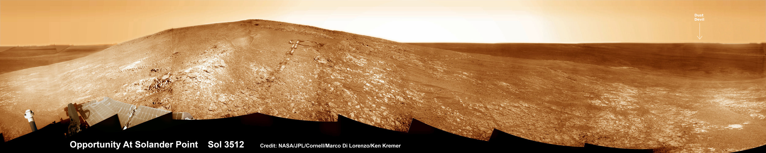
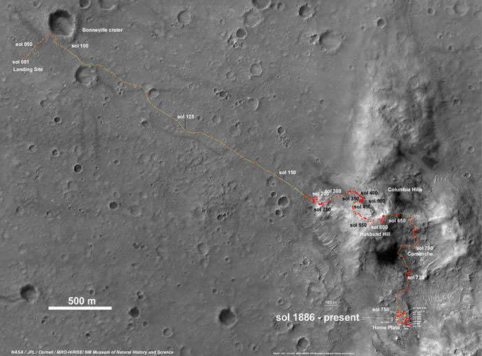
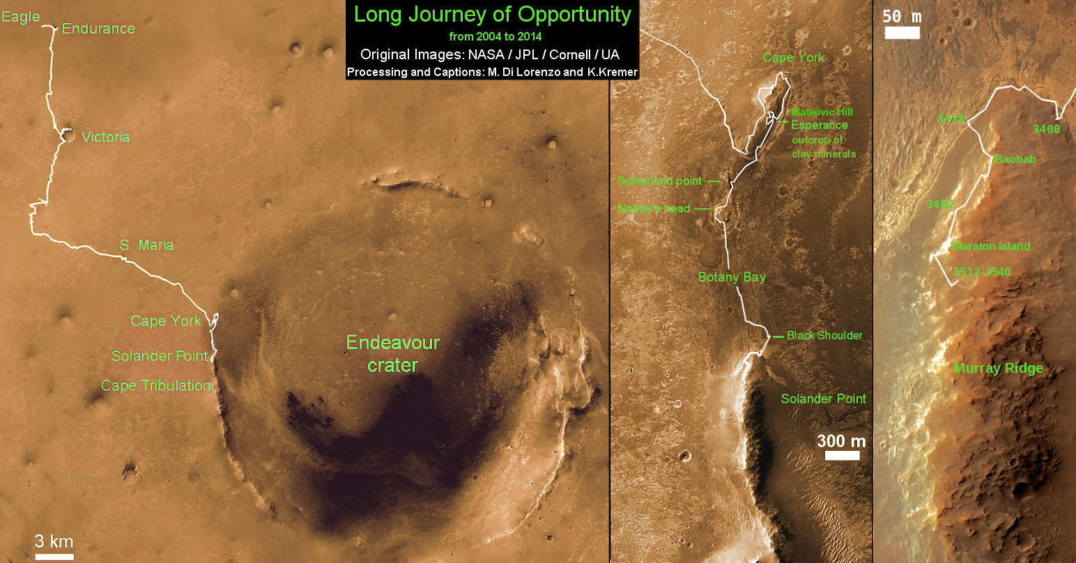
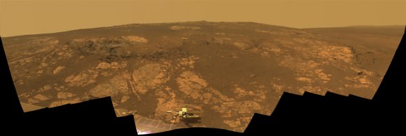
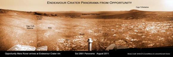
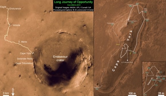
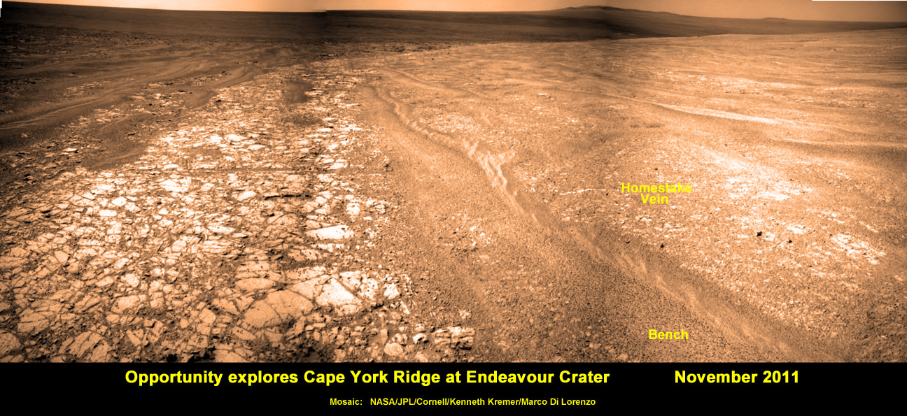
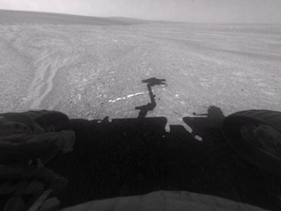
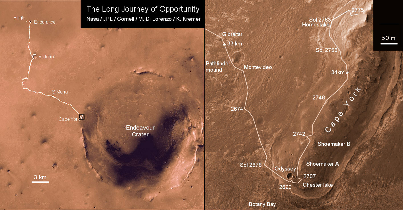
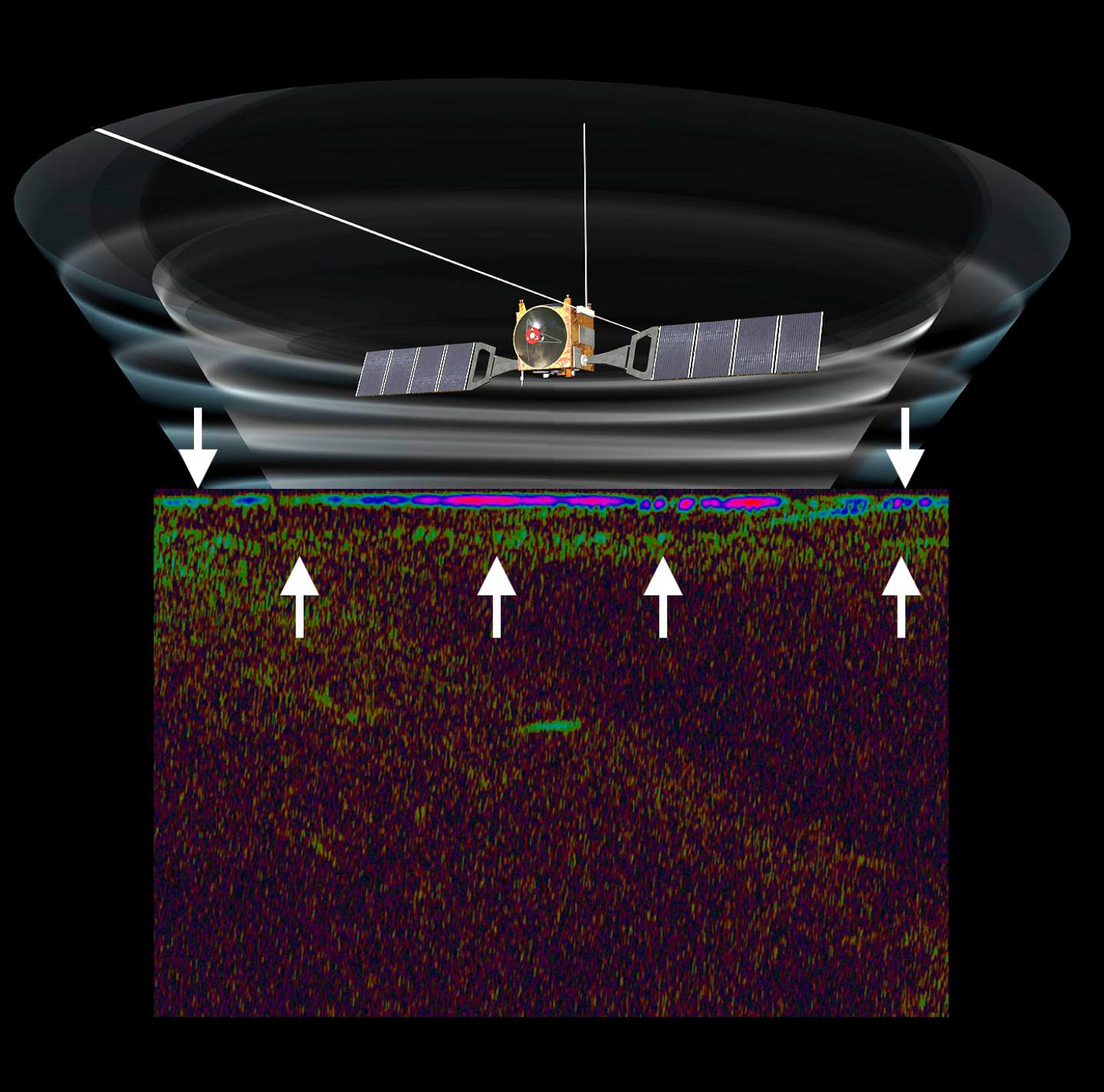
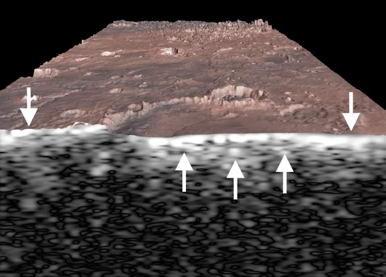
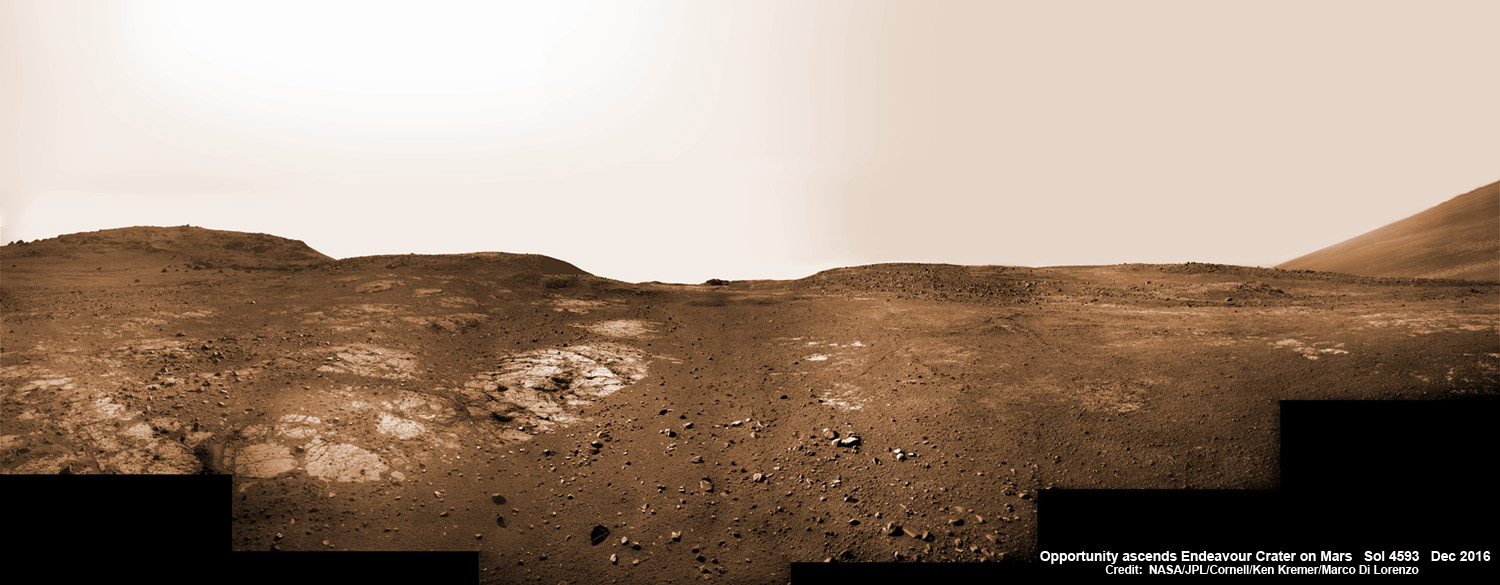
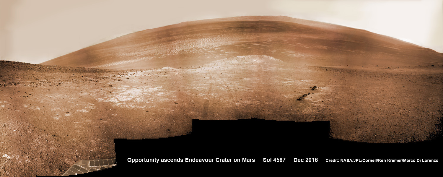
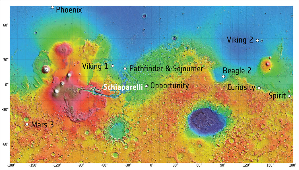
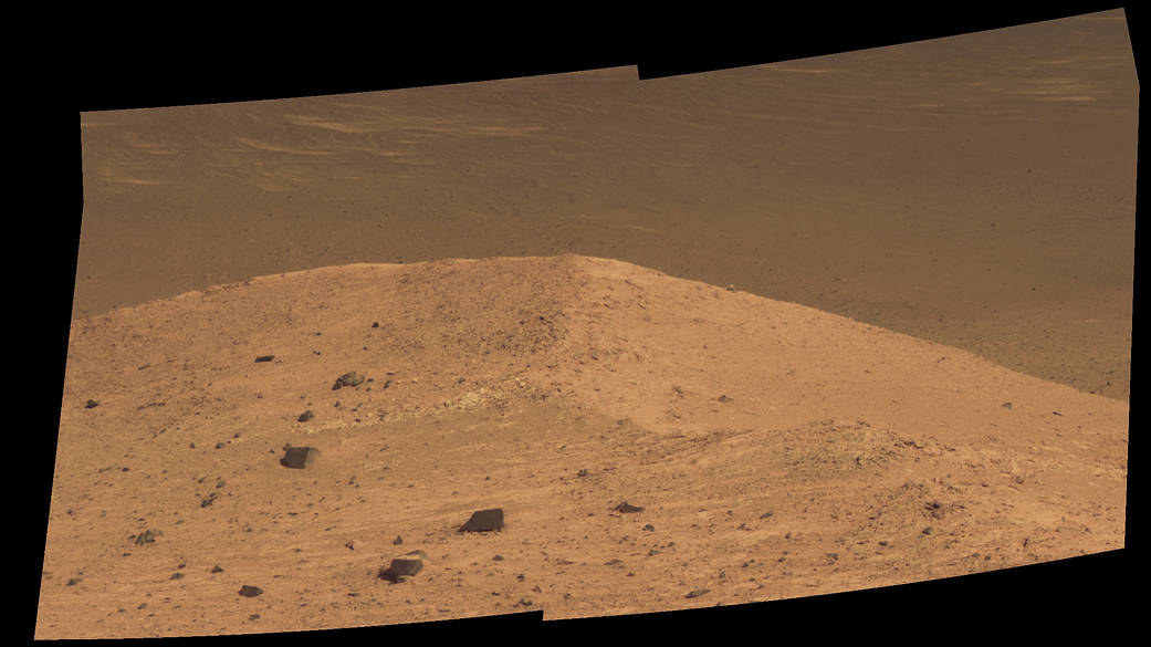
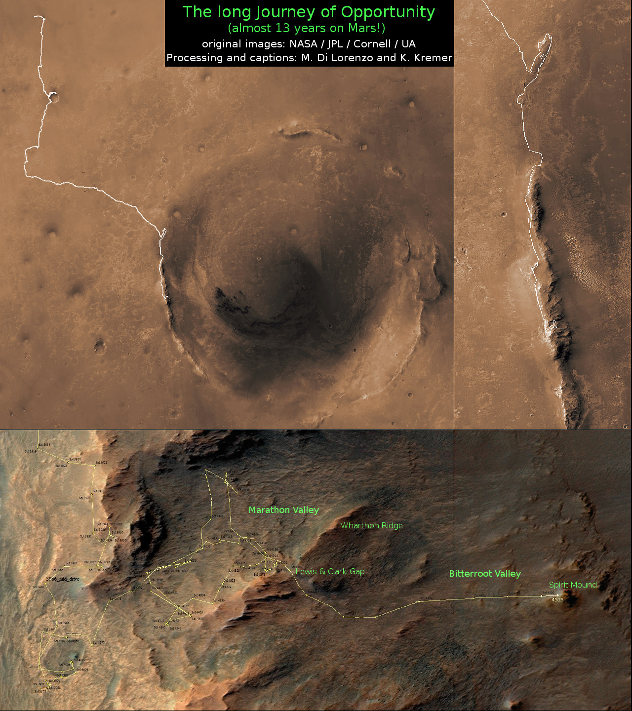
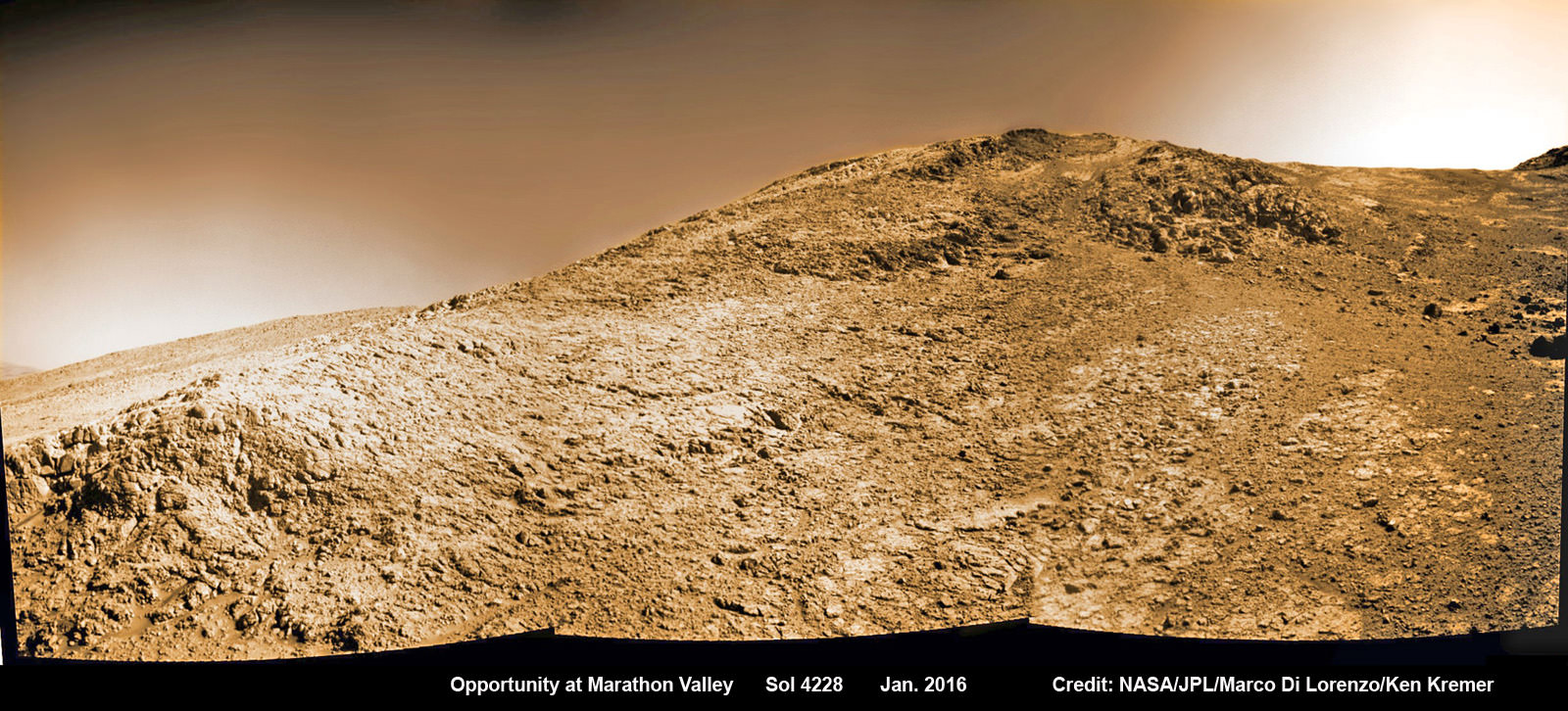
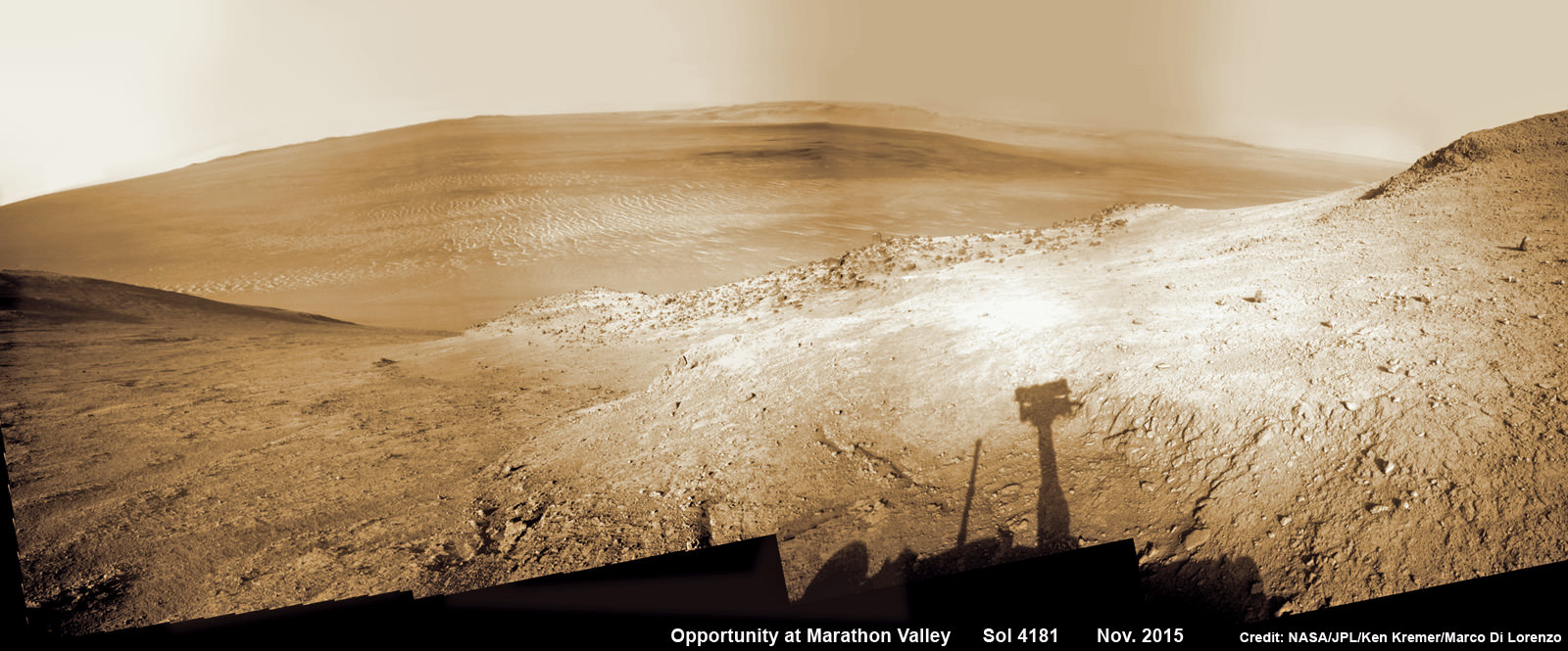
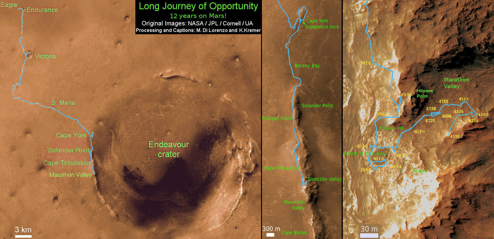
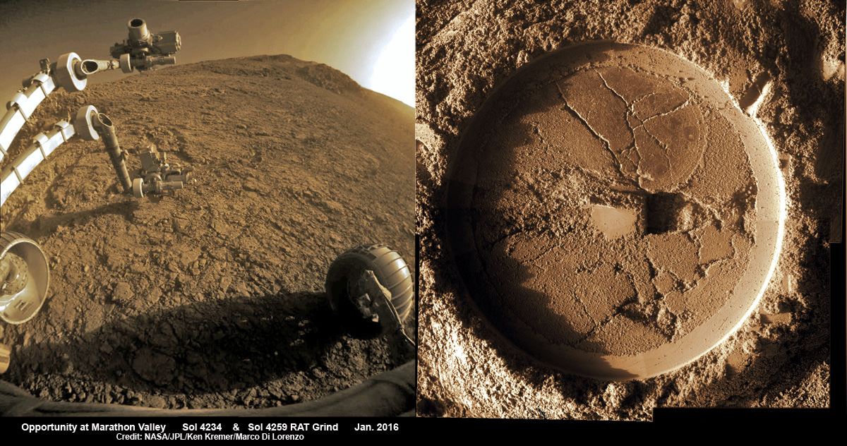
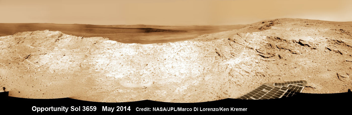
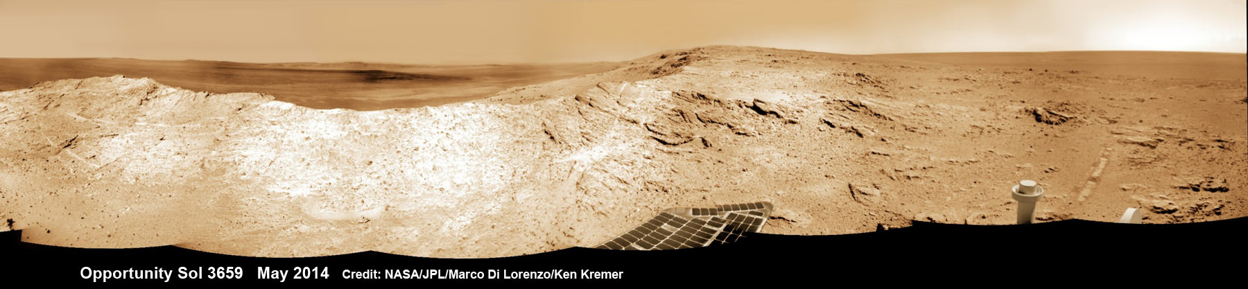
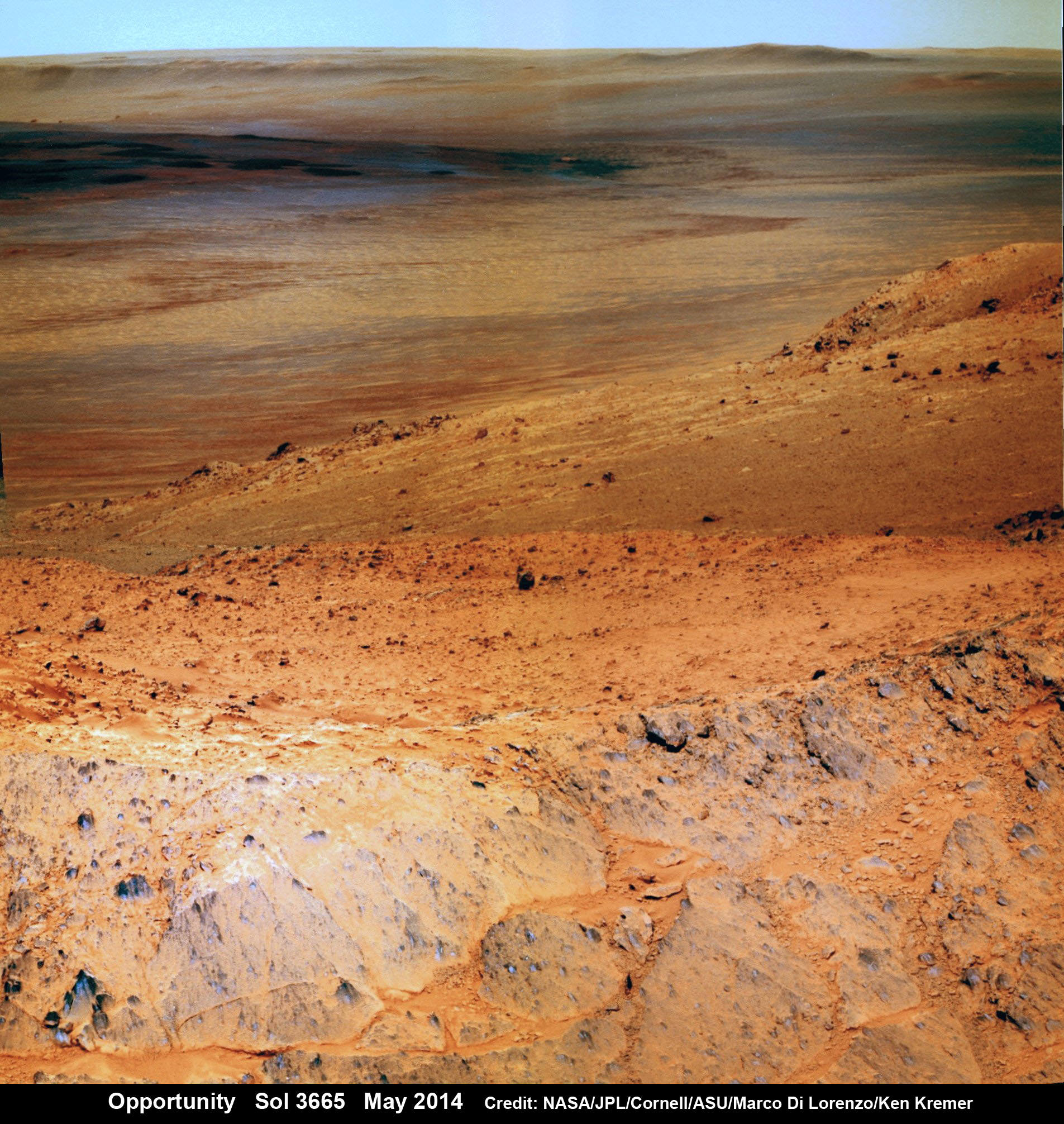
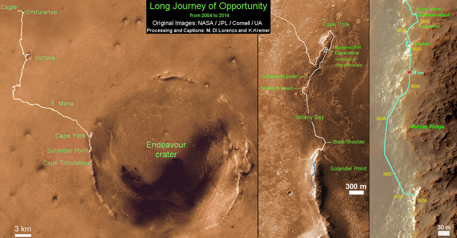
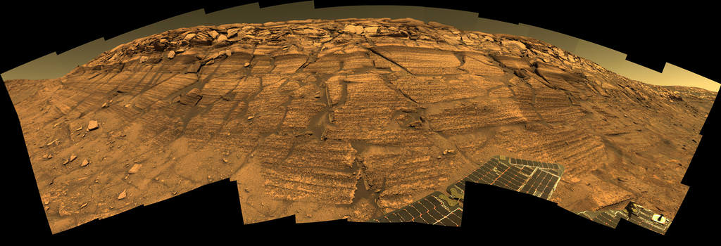
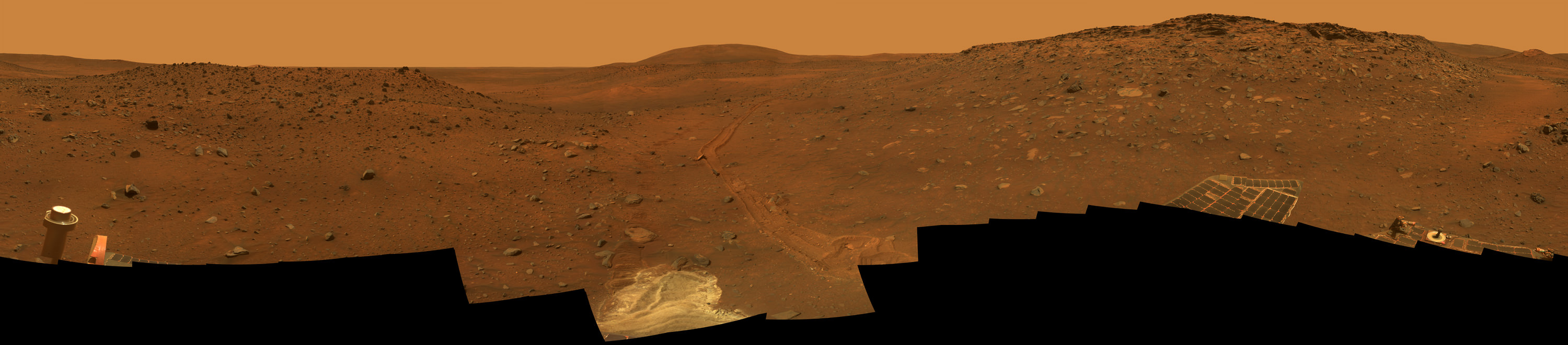
Despite being one of the most intensely explored regions on Mars, particularly by missions like the Opportunity rover, the subsurface structure of Meridiani Planum has remained largely unknown. To remedy this, the science team led by Dr. Watters examined data that had been collected by the Mars Advanced Radar for Subsurface and Ionospheric Sounding (MARSIS) instrument aboard the ESA’s Mars Express orbiter.

Developed by researchers at the University of Rome in partnership with NASA’s Jet Propulsion Laboratory (and with the help of private contractors), this device used low-frequency radio pulses to study Mars’ ionosphere, atmosphere, surface, and interior structure. The way these pulses penetrated into certain materials and were reflected back to the orbiter was then used to determine the bulk density and compositions of those materials.

After examining the Meridiani Planum region, the Mars Express probe obtained readings that indicated that the subsurface area had a relatively low dielectric constant. In the past, these kinds of readings have been interpreted as being due to the presence of pure water ice. And in this case, the readings seemed to indicate that the subsurface was made up of porous rock that was filled with water ice.

However, with the help of newly-derived compaction models for Mars, the team concluded that these signals could be the result of ice-free, porous, windblown sand (aka. eolian sands). They further theorized that the Meridiani Planum region, which is characterized by some rather unique physiographic and hydrologic features, could have provided an ideal sediment trap for these kinds of sands.

Artist’s impression of the Mars Express rover, showing radar returns from its MARSIS instrument. Credit: ESA/NASA/JPL/KU/Smithsonian

“The relatively low gravity and the cold, dry climate that has dominated Mars for billions of years may have allowed thick eolian sand deposits to remain porous and only weakly indurated,” they concluded. “Minimally compacted sedimentary deposits may offer a possible explanation for other nonpolar region units with low apparent bulk dielectric constants.”

As Watters also indicated in a Smithsonian press statement:

“It’s very revealing that the low dielectric constant of the Meridiani Planum deposits can be explained without invoking pore-filling ice. Our results suggest that caution should be exercised in attributing non-polar deposits on Mars with low dielectric constants to the presence of water ice.”

On its face, this would seem like bad news to those who were hoping that the equatorial regions on Mars might contain vast deposits of accessible water ice. It has been argued that when crewed missions to Mars begin, this ice could be accessed in order to supply water for surface habitats. In addition, ice that didn’t need to come from there could also be used to manufacture hydrazine fuel for return missions.

This would reduce travel times and the cost of mounting missions to Mars considerably since the spacecraft would not need to carry enough fuel for the entire journey, and would therefore be smaller and faster. In the event that human beings establish a colony on Mars someday, these same subsurface deposits could also used for drinking, sanitation, and irrigation water.

A subsurface view of Miyamoto crater in Meridiani Planum from the MARSIS radar sounder. . Credit: ESA/NASA/JPL/KU/Smithsonian

As such, this study – which indicates that low dielectric constants could be due to something other than the presence of water ice – places a bit of a damper on these plans. However, understood in context, it provides scientists with a means of locating subsurface ice. Rather than ruling out the presence of subsurface ice away from the polar regions entirely, it could actually help point the way to much-needed deposits.

One can only hope that these regions are not confined to the polar regions of the planet, which would be far more difficult to access. If future missions and (fingers crossed!) permanent outposts are forced to pump in their water, it would be far more economical to do from underground sources, rather than bringing it in all the way from the polar ice caps.

Further Reading: Smithsonian NASM, Geophysical Research Letters

Outstanding Opportunity Rover Making ‘Amazing New Discoveries’ 13 Years After Mars Touchdown – Scientist Tells UT

13 Years on Mars! On Christmas Day 2016, NASA’s Opportunity rover scans around vast Endeavour crater as she ascends steep rocky slopes on the way to reach a water carved gully along the eroded craters western rim. This navcam camera photo mosaic was assembled from raw images taken on Sol 4593 (25 Dec. 2016) and colorized. Credit: NASA/JPL/Cornell/Ken Kremer/kenkremer.com/Marco Di Lorenzo
13 Years on Mars!
On Christmas Day 2016, NASA’s Opportunity rover scans around vast Endeavour crater as she ascends steep rocky slopes on the way to reach a water carved gully along the eroded craters western rim. This navcam camera photo mosaic was assembled from raw images taken on Sol 4593 (25 Dec. 2016) and colorized. Credit: NASA/JPL/Cornell/Ken Kremer/kenkremer.com/Marco Di Lorenzo

NASA’s truly outstanding Opportunity rover continues “making new discoveries about ancient Mars” as she commemorates 13 Years since bouncing to a touchdown on Mars, in a feat that is “truly amazing” – the deputy chief scientist Ray Arvidson told Universe Today exclusively.

Resilient Opportunity celebrated her 13th birthday on Sol 4623 on January 24, 2017 PST while driving south along the eroded rim of humongous Endeavour crater – and having netted an unfathomable record for longevity and ground breaking scientific discoveries about the watery environment of the ancient Red Planet.

“Reaching the 13th year anniversary with a functioning rover making new discoveries about ancient Mars on a continuing basis is truly amazing,” Ray Arvidson, Opportunity Deputy Principal Investigator of Washington University in St. Louis, told Universe Today.

Put another way Opportunity is 13 YEARS into her 3 MONTH mission! And still going strong!

During the past year the world famous rover discovered “more extensive aqueous alteration within fractures and more mild alteration within the bedrock outcrops” at Endeavour crater, Arvidson elaborated.

And now she is headed to her next target – an ancient water carved gully!

The gully is situated about 0. 6 mile (1.6 km) south of the robots current location.

But to get there she first has to heroically ascend steep rocky slopes inclined over 20 degrees along the eroded craters western rim – and it’s no easy task! Slipping and sliding along the way and all alone on difficult alien terrain.

Furthermore she is 51 times beyond her “warrantied” life expectancy of merely 90 Sols promised at the time of landing so long ago – roving the surface of the 4th rock from the Sun during her latest extended mission; EM #10.

How was this incredible accomplishment achieved?

“Simply a well-made and thoroughly tested American vehicle,” Arvidson responded.

NASA’s Opportunity rover scans around and across to vast Endeavour crater on Dec. 19, 2016, as she climbs steep slopes on the way to reach a water carved gully along the eroded craters western rim. Note rover wheel tracks at center. This navcam camera photo mosaic was assembled from raw images taken on Sol 4587 (19 Dec. 2016) and colorized. Credit: NASA/JPL/Cornell/Ken Kremer/kenkremer.com/Marco Di Lorenzo

The six wheeled rover landed on Mars on January 24, 2004 PST on the alien Martian plains at Meridiani Planum -as the second half of a stupendous sister act.

Her twin sister Spirit, had successfully touched down 3 weeks earlier on January 3, 2004 inside 100-mile-wide Gusev crater and survived more than six years.

NASA’s Opportunity explores Spirit Mound after descending down Marathon Valley and looks out across the floor of vast Endeavour crater. This navcam camera photo mosaic was assembled from raw images taken on Sol 4505 (25 Sept 2016) and colorized. Credit: NASA/JPL/Cornell/ Ken Kremer/kenkremer.com/Marco Di Lorenzo

Opportunity concluded 2016 and starts 2017 marching relentlessly towards an ancient water carved gully along the eroded rim of vast Endeavour crater – the next science target on her heroic journey traversing across never before seen Red Planet terrains.

Huge Endeavour crater spans some 22 kilometers (14 miles) in diameter.

Throughout 2016 Opportunity was investigating the ancient, weathered slopes around the Marathon Valley location in Endeavour crater. The area became a top priority science destination after the slopes were found to hold a motherlode of ‘smectite’ clay minerals based on data from the CRISM spectrometer circling overhead aboard a NASA Mars orbiter.

The smectites were discovered via extensive, specially targeted Mars orbital measurements gathered by the CRISM (Compact Reconnaissance Imaging Spectrometer for Mars) spectrometer on NASA’s Mars Reconnaissance Orbiter (MRO) – accomplished earlier at the direction of Arvidson.

Opportunity was descending down Marathon Valley the past year to investigate the clay minerals formed in water. They are key to helping determine the habitability of the Red Planet when it was warmer and wetter billions of years ago.

What did Opportunity accomplish scientifically at Marathon Valley during 2016?

“Key here is the more extensive aqueous alteration within fractures and more mild alteration within the bedrock outcrops,” Arvidson explained to me.

“Fractures have red pebbles enhanced in Al and Si (likely by leaching out more soluble elements), hematite, and in the case of our scuffed fracture, enhanced sulfate content with likely Mg sulfates and other phases. Also the bedrock is enriched in Mg and S relative to other Shoemaker rocks and these rocks are the smectite carrier as observed from CRISM ATO data.”

Marathon Valley measures about 300 yards or meters long. It cuts downhill through the west rim of Endeavour crater from west to east – the same direction in which Opportunity drove downhill from a mountain summit area atop the crater rim.

Opportunity has been exploring Endeavour since arriving at the humongous crater in 2011. Endeavour crater was formed when it was carved out of the Red Planet by a huge meteor impact billions of years ago.

“Endeavour crater dates from the earliest Martian geologic history, a time when water was abundant and erosion was relatively rapid and somewhat Earth-like,” explains Larry Crumpler, a science team member from the New Mexico Museum of Natural History & Science.

Opportunity has been climbing up very steep and challenging slopes to reach the top of the crater rim. Then she will drive south to Cape Byron and the gully system.

“We have had some mobility issues climbing steep, rocky slopes. Lots of slipping and skidding, but evaluating the performance of the rover on steep, rocky and soil-covered slopes was one of the approved extended mission objectives,” Arvidson explained.

“We are heading out of Cape Tribulation, driving uphill to the southwest to reach the Meridiani plains and then to drive to the western side of Cape Byron to the head of a gully system.”

What’s ahead for 2017? What’s the importance of exploring the gully?

“Finish up work on Cape Tribulation, traverse to the head of the gully system and head downhill into one or more of the gullies to characterize the morphology and search for evidence of deposits,” Arvidson elaborated.

“Hopefully test among dry mass movements, debris flow, and fluvial processes for gully formation. The importance is that this will be the first time we will acquire ground truth on a gully system that just might be formed by fluvial processes. Will search for cross bedding, gravel beds, fining or coarsening upward sequences, etc., to test among hypotheses.”

How long will it take to reach the gully?

“Months to the gully,” replied Arvidson. After arriving at the top of the crater rim, the rover will actually drive part of the way on the Martian plains again during the southward trek to the gully.

“And we will be driving on the plains to drive relatively long distances with an intent of getting to the gully well before the winter season.”

As of today, Jan 31, 2017, long lived Opportunity has survived 4630 Sols (or Martian days) roving the harsh environment of the Red Planet.

Opportunity has taken over 216,700 images and traversed over 27.26 miles (43.87 kilometers) – more than a marathon.

NASA’s Opportunity rover discovers a beautiful Martian dust devil moving across the floor of Endeavour crater as wheel tracks show robots path today exploring the steepest ever slopes of the 13 year long mission, in search of water altered minerals at Knudsen Ridge inside Marathon Valley on 1 April 2016. This navcam camera photo mosaic was assembled from raw images taken on Sol 4332 (1 April 2016) and colorized. Credit: NASA/JPL/Cornell/ Ken Kremer/kenkremer.com/Marco Di Lorenzo

See our updated route map below. It shows the context of the rovers over 13 year long traverse spanning more than the 26 mile distance of a Marathon runners race.

The rover surpassed the 27 mile mark milestone on November 6, 2016 (Sol 4546).

The power output from solar array energy production is currently 416 watt-hours, before heading into another southern hemisphere Martian winter in 2017. It will count as Opportunities 8th winter on Mars.

Meanwhile Opportunity’s younger sister rover Curiosity traverses and drills into the lower sedimentary layers at the base of Mount Sharp.

Stay tuned here for Ken’s continuing Earth and planetary science and human spaceflight news.

Ken Kremer

13 Year Traverse Map for NASA’s Opportunity rover from 2004 to 2017. This map shows the entire 43 kilometer (27 mi) path the rover has driven on the Red Planet during more than 13 years and more than a marathon runners distance for over 4614 Sols, or Martian days, since landing inside Eagle Crater on Jan 24, 2004 – to current location at the western rim of Endeavour Crater. After descending down Marathon Valley and after studying Spirit Mound, the rover is now ascending back uphill on the way to a Martian water carved gully. Rover surpassed Marathon distance on Sol 3968 after reaching 11th Martian anniversary on Sol 3911. Opportunity discovered clay minerals at Esperance – indicative of a habitable zone – and searched for more at Marathon Valley. Credit: NASA/JPL/Cornell/ASU/Marco Di Lorenzo/Ken Kremer/kenkremer.com

We Land on Mars in Just 2 days!

Artist's view of the Schiaparelli lander descending to Mars on October 19. Credit: ESA


Watch how Schiaparelli will land on Mars. Touchdown will occur at 10:48 a.m. EDT (14:48 GMT) Wednesday Oct. 19.

Cross your fingers for good weather on the Red Planet on October 19. That’s the day the European Space Agency’s Schiaparelli lander pops open its parachute, fires nine, liquid-fueled thrusters and descends to the surface of Mars. Assuming fair weather, the lander should settle down safely on the wide-open plains of Meridiani Planum near the Martian equator northwest of NASA’s Opportunity rover. The region is rich in hematite, an iron-rich mineral associated with hot springs here on Earth.

On 19 October 2016, the ExoMars 2016 entry, descent, and landing demonstrator module, known as Schiaparelli, will land on Mars in a region known as Meridiani Planum. The landing sites of the seven rovers and landers that have reached the surface of Mars and successfully operated there are indicated on this map. The background image is a shaded relief map of Mars, based on data from the Mars Orbiter Laser Altimeter (MOLA) instrument, on NASA’s Mars Global Surveyor spacecraft.
On Wednesday, October 19, the ExoMars 2016 entry, descent and landing demonstrator module, named Schiaparelli, will land on Mars in Meridiani Planum not far from the Opportunity rover. The map shows the seven rovers and landers that have reached the surface of Mars and successfully operated there. The background image is a shaded relief map of Mars created using data from NASA’s Mars Global Surveyor spacecraft.

The 8-foot-wide probe will be released three days earlier from the Trace Gas Orbiter (TGO) and coast toward Mars before entering its atmosphere at 13,000 mph (21,000 km/hr). During the 6-minute-long descent, Schiaparelli will decelerate gradually using the atmosphere to brake its speed, a technique called aerobraking. Not only is Meridiani Planum flat, it’s low, which means the atmosphere is thick enough to allow Schiaparelli’s heat shield to reduce its speed sufficiently so the chute can be safely deployed. The final firing of its thrusters will ensure a soft and controlled landing.

Artist's impression depicting the separation of the ExoMars 2016 entry, descent and landing demonstrator module, named Schiaparelli, from the Trace Gas Orbiter, and heading for Mars. Credit: ESA/ATG medialab
Artist’s impression showing Schiaparelli separating from the Trace Gas Orbiter and heading for Mars. The lander is named for late 19th century Italian astronomer Giovanni Schiaparelli, who created a detailed telescopic map of Mars. The orbiter will sniff out potentially biological gases such as methane in Mars’ atmosphere and track its sources and seasonal variations. Credit: ESA/ATG medialab

The lander is one-half of the ExoMars 2016 mission, a joint venture between the European Space Agency and Russia’s Roscosmos. The Trace Gas Orbiter (TGO) will fire its thrusters to place itself in orbit about the Red Planet the same day Schiparelli lands. Its job is to inventory the atmosphere in search of organic molecules, methane in particular. Plumes of methane, which may be biological or geological (or both) in origin, have recently been detected at several locations on Mars including Syrtis Major, the planet’s most prominent dark marking. The orbiter will hopefully pinpoint the source(s) as well as study seasonal changes in locations and concentrations.

This image, taken by the High Resolution Stereo Camera (HRSC) on board ESA’s Mars Express spacecraft, shows what appears to be a dust-covered frozen sea near the Martian equator. It shows a flat plain, part of the Elysium Planitia, that is covered with irregular blocky shapes. They look just like the rafts of fragmented sea ice that lie off the coast of Antarctica on Earth. Raised levels of methane were detected here by ESA's Mars Express orbiter. Copyright: ESA/DLR/FU Berlin (G. Neukum)
This image, taken by ESA’s Express spacecraft, shows what appears to be a dust-covered frozen sea near the Martian equator. Located in Elysium Planitia, the flat plain is covered with irregular blocky shapes. They look just like the rafts of fragmented sea ice that lie off the coast of Antarctica on Earth. Raised levels of methane were detected here by ESA’s Mars Express orbiter. Copyright: ESA/DLR/FU Berlin (G. Neukum)

Methane (CH4) has long been associated with life here on Earth. More than 90% of the colorless, odorless gas is produced by living organisms, primarily bacteria. Sunlight breaks methane down into other gases over a span of about 300 years. Because the gas relatively short-lived, seeing it on Mars implies an active, current source. There may be several:

  • Long-extinct bacteria that released methane that became trapped in ice or minerals in the upper crust. Changing temperature and pressure could stress the ice and release that ancient gas into today’s atmosphere.
  • Bacteria that are actively producing methane to this day.
  • Abiological sources. Iron can combine with oxygen in terrestrial hot springs and volcanoes to create methane. This gas can also become trapped in solid forms of water or ‘cages’ called clathrate hydrates that can preserve it for a long time. Olivine, a common mineral on Earth and Mars, can react with water under the right conditions to form another mineral called serpentine. When altered by heat, water and pressure, such in environments such as hydrothermal springs, serpentine can produce methane.

Will it turn out to be burping bacteria or mineral processes? Let’s hope TGO can point the way.

This image illustrates possible ways methane might get into Mars’ atmosphere and also be removed from it: microbes (left) under the surface that release the gas into the atmosphere, weathering of rock (right) and stored methane ice called a clathrate. Ultraviolet light can work on surface materials to produce methane as well as break it apart into other molecules (formaldehyde and methanol) to produce carbon dioxide. Credit: NASA/JPL-Caltech/SAM-GSFC/Univ. of Michigan

The Trace Gas Orbiter will also use the Martian atmosphere to slow its speed and trim its orbital loop into a 248-mile-high (400 km) circle suitable for science observations. But don’t expect much in the way of scientific results right away; aerobraking maneuvers will take about a year, so TGO’s job of teasing out atmospheric ingredients won’t begin until December 2017. The study runs for 5 years.

The orbiter will also examine Martian water vapor, nitrogen oxides and other organics with far greater accuracy than any previous probe as well as monitor seasonal changes in the atmosphere’s composition and temperature. And get this — its instruments can map subsurface hydrogen, a key ingredient in both water and methane, down to a depth of a meter (39.4 inches) with greater resolution compared to previous studies. Who knows? We may discover hidden ice deposits or methane sinks that could influence where future rovers will land. Additional missions to Mars are already on the docket, including ExoMars 2020. More about that in a minute.

Schiaparelli, the
This artist’s view shows Schiaparelli, the entry, descent and landing demonstrator module, using its thrusters to make a soft landing on Mars on October 19 at 10:48 a.m. EDT (14:48 GMT). Credit: ESA/ATG medialab

While TGO’s mission will require years, the lander is expected to survive for only four Martian days (called ‘sols’) by using the excess energy capacity of its batteries. A set of scientific sensors will measure wind speed and direction, humidity, pressure and electric fields on the surface. A descent camera will take pictures of the landing site on the way down; we’ll should see those photos the very next day. Data and imagery from the lander will be transmitted to ESA’s Mars Express and a NASA Relay Orbiter, then relayed to Earth.


This animation shows the paths of the Trace Gas Orbiter and Schiaparelli lander on Oct. 19 when they arrive at Mars.

If you’re wondering why the lander’s mission is so brief, it’s because Schiaparelli is essentially a test vehicle. Its primary purpose is to test technologies for landing on Mars including the special materials used for protection against the heat of entry, a parachute system, a Doppler radar device for measuring altitude and liquid-fueled braking thrusters.

Martian dust storms can be cause for concern during any landing attempt. Since it’s now autumn in the planet’s northern hemisphere, a time when storms are common, there’s been some finger-nail biting of late. The good news is that storms of recent weeks have calmed and Mars has entered a welcome quiet spell.

To watch events unfold in real time, check out ESA’s live stream channel, Facebook page and Twitter updates. The announcement of the separation of the lander from the orbiter will be made around 11 a.m. Eastern Time (15:00 GMT) Sunday October 16.  Live coverage of the Trace Gas Orbiter arrival and Schiaparelli landing on Mars runs from 9-11:15 a.m. Eastern (13:00-15:15 GMT) on Wednesday October 19. Photos taken by Schiaparelli’s descent camera will be available starting at 4 a.m. Eastern (8:00 GMT) on October 20. More details here. We’ll also keep you updated on Universe Today.

The ExoMars 2016 mission will pave the way for a rover mission to the Red Planet in 2020. Credit: ESA

Everything we learn during the current mission will be applied to planning and executing the next —  ExoMars 2020, slated to launch in 2020. That venture will send a rover to the surface to search and chemically test for signs of life, present or past.  It will collect samples with a drill at various depths and analyze the fines for bio-molecules. Getting down deep is important because the planet’s thin atmosphere lets through harsh UV light from the sun, sterilizing the surface.

Are you ready for adventure? See you on Mars (vicariously)!

Opportunity Blazes Through 4500 Sunsets on Mars and Gullies are Yet to Come!

NASA’s Opportunity explores Spirit Mound after descending down Marathon Valley and looks out across the floor of vast Endeavour crater. This navcam camera photo mosaic was assembled from raw images taken on Sol 4505 (25 Sept 2016) and colorized. Credit: NASA/JPL/Cornell/ Ken Kremer/kenkremer.com/Marco Di Lorenzo
NASA’s Opportunity explores Spirit Mound after descending down Marathon Valley and looks out across the floor of vast Endeavour crater.  This navcam camera photo mosaic was assembled from raw images taken on Sol 4505 (25 Sept 2016) and colorized.  Credit: NASA/JPL/Cornell/ Ken Kremer/kenkremer.com/Marco Di Lorenzo
NASA’s Opportunity explores Spirit Mound after descending down Marathon Valley and looks out across the floor of vast Endeavour crater. This navcam camera photo mosaic was assembled from raw images taken on Sol 4505 (25 Sept 2016) and colorized. Credit: NASA/JPL/Cornell/ Ken Kremer/kenkremer.com/Marco Di Lorenzo

The longest living Martian rover ever – Opportunity – has just surpassed another unfathomable milestone – 4500 Sols (or days) exploring the Red Planet !! That’s 50 times beyond her “warrantied” life expectancy of merely 90 Sols.

And as we are fond of reporting – the best is yet to come. After experiencing 4500 Martian sunsets, Opportunity has been granted another mission extension and she is being targeted to drive to an ancient gully where life giving liquid water almost certainly once flowed on our solar systems most Earth-like planet.

See Opportunity’s current location around ‘Spirit Mound” – illustrated in our new photo mosaic panoramas above and below.

NASA’s Opportunity rover scans ahead to Spirit Mound and vast Endeavour crater as she celebrates 4500 sols on the Red Planet after descending down Marathon Valley. This navcam camera photo mosaic was assembled from raw images taken on Sol 4500 (20 Sept 2016) and colorized.  Credit: NASA/JPL/Cornell/ Ken Kremer/kenkremer.com/Marco Di Lorenzo
NASA’s Opportunity rover scans ahead to Spirit Mound and vast Endeavour crater as she celebrates 4500 sols on the Red Planet after descending down Marathon Valley. This navcam camera photo mosaic was assembled from raw images taken on Sol 4500 (20 Sept 2016) and colorized. Credit: NASA/JPL/Cornell/ Ken Kremer/kenkremer.com/Marco Di Lorenzo

After a scorching ‘6 minutes of Terror’ plummet through the thin Martian atmosphere, Opportunity bounced to an airbag cushioned landing on the plains of Meridiani Planum on January 24, 2004 – nearly 13 years ago!

Opportunity was launched on a Delta II rocket from Cape Canaveral Air Force Station in Florida on July 7, 2003.

“We have now exceeded the prime-mission duration by a factor of 50,” noted Opportunity Project Manager John Callas of NASA’s Jet Propulsion Laboratory, Pasadena, California.

“Milestones like this are reminders of the historic achievements made possible by the dedicated people entrusted to build and operate this national asset for exploring Mars.”

The newest 2 year extended mission phase just began on Oct. 1 as the rover was stationed at the western rim of Endeavour crater at the bottom of Marathon Valley at a spot called “Bitterroot Valley.”

And at this moment, as Opportunity reached and surpassed the 4500 Sol milestone, she is investing an majestic spot dubbed “Spirit Mound” – and named after her twin sister “Spirit” – who landed 3 weeks earlier!

This scene from the panoramic camera (Pancam) on NASA's Mars Exploration Rover Opportunity shows "Spirit Mound" overlooking the floor of Endeavour Crater. The mound stands near the eastern end of "Bitterroot Valley" on the western rim of the crater, and this view faces eastward. The component images for this mosaic were taken on Sept. 21, 2016, during the 4,501st Martian day, or sol, of Opportunity's work on Mars. Credit: NASA/JPL-Caltech/Cornell/Arizona State Univ.
This scene from the panoramic camera (Pancam) on NASA’s Mars Exploration Rover Opportunity shows “Spirit Mound” overlooking the floor of Endeavour Crater. The mound stands near the eastern end of “Bitterroot Valley” on the western rim of the crater, and this view faces eastward. The component images for this mosaic were taken on Sept. 21, 2016, during the 4,501st Martian day, or sol, of Opportunity’s work on Mars. Credit: NASA/JPL-Caltech/Cornell/Arizona State Univ.

Endeavour crater spans some 22 kilometers (14 miles) in diameter. Opportunity has been exploring Endeavour since arriving at the humongous crater in 2011.

Endeavour crater was formed when it was carved out of the Red Planet by a huge meteor impact billions of years ago.

But now for the first time she will explore the craters interior, after spending 5 years investigating the exterior and climbing to a summit on the rim and spending several year exploring the top before finally descending down the Marathon Valley feature to investigate clay minerals formed in water.

“The longest-active rover on Mars also will, for the first time, visit the interior of the crater it has worked beside for the last five years,” said NASA officials.

Marathon Valley measures about 300 yards or meters long. It cuts downhill through the west rim of Endeavour crater from west to east – the same direction in which Opportunity drove downhill from a mountain summit area atop the crater rim. See our route map below showing the context of the rovers over dozen year long traverse spanning more than the 26 mile distance of a Marathon runners race.

Opportunity is now being targeted to explore a gully carved out by water.

“We are confident this is a fluid-carved gully, and that water was involved,” said Opportunity Principal Investigator Steve Squyres of Cornell University, Ithaca, New York.

“Fluid-carved gullies on Mars have been seen from orbit since the 1970s, but none had been examined up close on the surface before. One of the three main objectives of our new mission extension is to investigate this gully. We hope to learn whether the fluid was a debris flow, with lots of rubble lubricated by water, or a flow with mostly water and less other material.”

Furthermore, in what’s a very exciting announcement the team “intends to drive Opportunity down the full length of the gully, onto the crater floor” – if the rover continues to function well during the two year extended mission which will have to include enduring her 8th frigid Martian winter in 2017.

And as is always the case, scientists will compare these interior crater rocks to those on the exterior for clues into the evolution, environmental and climatic history of Mars over billions of years.

“We may find that the sulfate-rich rocks we’ve seen outside the crater are not the same inside,” Squyres said. “We believe these sulfate-rich rocks formed from a water-related process, and water flows downhill. The watery environment deep inside the crater may have been different from outside on the plain — maybe different timing, maybe different chemistry.”

NASA’s Opportunity rover discovers a beautiful Martian dust devil moving across the floor of Endeavour crater as wheel tracks show robots path today exploring the steepest ever slopes of the 13 year long mission, in search of water altered minerals at Knudsen Ridge inside Marathon Valley on 1 April 2016. This navcam camera photo mosaic was assembled from raw images taken on Sol 4332 (1 April 2016) and colorized.  Credit: NASA/JPL/Cornell/ Ken Kremer/kenkremer.com/Marco Di Lorenzo
NASA’s Opportunity rover discovers a beautiful Martian dust devil moving across the floor of Endeavour crater as wheel tracks show robots path today exploring the steepest ever slopes of the 13 year long mission, in search of water altered minerals at Knudsen Ridge inside Marathon Valley on 1 April 2016. This navcam camera photo mosaic was assembled from raw images taken on Sol 4332 (1 April 2016) and colorized. Credit: NASA/JPL/Cornell/ Ken Kremer/kenkremer.com/Marco Di Lorenzo

As of today, Sol 4522, Oct 12, 2016, Opportunity has taken over 214,400 images and traversed over 26.99 miles (43.44 kilometers) – more than a marathon.

The power output from solar array energy production is currently 472 watt-hours, before heading into another southern hemisphere Martian winter in 2017.

Meanwhile Opportunity’s younger sister rover Curiosity traverses and drills into the basal layers at the base of Mount Sharp.

Stay tuned here for Ken’s continuing Earth and planetary science and human spaceflight news.

Ken Kremer

12 Year Traverse Map for NASA’s Opportunity rover from 2004 to 2016. This map shows the entire path the rover has driven on the Red Planet during more than 12 years and more than a marathon runners distance for over 4514 Sols, or Martian days, since landing inside Eagle Crater on Jan 24, 2004 - to current location at the western rim of Endeavour Crater after descending down Marathon Valley. Rover surpassed Marathon distance on Sol 3968 and marked 11th Martian anniversary on Sol 3911. Opportunity discovered clay minerals at Esperance – indicative of a habitable zone - and searched for more at Marathon Valley and is now at Spirit Mound on the way to a Martian gully.  Credit: NASA/JPL/Cornell/ASU/Marco Di Lorenzo/Ken Kremer/kenkremer.com
12 Year Traverse Map for NASA’s Opportunity rover from 2004 to 2016. This map shows the entire path the rover has driven on the Red Planet during more than 12 years and more than a marathon runners distance for over 4515 Sols, or Martian days, since landing inside Eagle Crater on Jan 24, 2004 – to current location at the western rim of Endeavour Crater after descending down Marathon Valley. Rover surpassed Marathon distance on Sol 3968 and marked 11th Martian anniversary on Sol 3911. Opportunity discovered clay minerals at Esperance – indicative of a habitable zone – and searched for more at Marathon Valley and is now at Spirit Mound on the way to a Martian gully. Credit: NASA/JPL/Cornell/ASU/Marco Di Lorenzo/Ken Kremer/kenkremer.com

Opportunity Discovers Dust Devil, Explores Steepest Slopes on Mars

NASA’s Opportunity rover discovers a beautiful Martian dust devil moving across the floor of Endeavour crater as wheel tracks show robots path today exploring the steepest ever slopes of the 13 year long mission, in search of water altered minerals at Knudsen Ridge inside Marathon Valley on 1 April 2016. This navcam camera photo mosaic was assembled from raw images taken on Sol 4332 (1 April 2016) and colorized. Credit: NASA/JPL/Cornell/ Ken Kremer/kenkremer.com/Marco Di Lorenzo
NASA’s Opportunity rover discovers a beautiful Martian dust devil moving across the floor of Endeavour crater as wheel tracks show robots path today exploring the steepest ever slopes of the 13 year long mission, in search of water altered minerals at Knudsen Ridge inside Marathon Valley on 1 April 2016. This navcam camera photo mosaic was assembled from raw images taken on Sol 4332 (1 April 2016) and colorized.  Credit: NASA/JPL/Cornell/ Ken Kremer/kenkremer.com/Marco Di Lorenzo
NASA’s Opportunity rover discovers a beautiful Martian dust devil moving across the floor of Endeavour crater as wheel tracks show robots path today exploring the steepest ever slopes of the 13 year long mission, in search of water altered minerals at Knudsen Ridge inside Marathon Valley on 1 April 2016. This navcam camera photo mosaic was assembled from raw images taken on Sol 4332 (1 April 2016) and colorized. Credit: NASA/JPL/Cornell/ Ken Kremer/kenkremer.com/Marco Di Lorenzo

A “beautiful dust devil” was just discovered today, April 1, on the Red Planet by NASA’s long lived Opportunity rover as she is simultaneously exploring water altered rock outcrops at the steepest slopes ever targeted during her 13 year long expedition across the Martian surface. Opportunity is searching for minerals formed in ancient flows of water that will provide critical insight into establishing whether life ever existed on the fourth rock from the sun.

“Yes a beautiful dust devil on the floor of Endeavour Crater,” Ray Arvidson, Opportunity Deputy Principal Investigator of Washington University in St. Louis, confirmed to Universe Today. Spied from where “Opportunity is located on the southwest part of Knudsen Ridge” in Marathon Valley.

The new dust devil – a mini tornado like feature – is seen scooting across the ever fascinating Martian landscape in our new photo mosaic illustrating the steep walled terrain inside Marathon Valley and overlooking the crater floor as Opportunity makes wheel tracks at the current worksite on a crest at Knudsen Ridge. The colorized navcam camera mosaic combines raw images taken today on Sol 4332 (1 April 2016) and stitched by the imaging team of Ken Kremer and Marco Di Lorenzo.

“The dust devils have been kind to this rover,” Jim Green, Director of NASA Planetary Sciences at NASA HQ, said in an exclusive interview with Universe Today. They are associated with prior periods of solar array cleansing power boosts that contributed decisively to her longevity.

“Oppy’s best friend is on its way!”

Spotting dust devils has been relatively rare for Opportunity since landing on Mars on Jan. 24, 2004.

“There are 7 candidates, 6 of which are likely or certain,” Mark Lemmon, rover science team member from Texas A & M University, told Universe Today. “Most were seen in, on the rim of, or adjacent to Endeavour.”

Starting in late January, scientists commanded the golf cart sized Opportunity to drive up the steepest slopes ever attempted by any Mars rover in order to reach rock outcrops where she can conduct breakthrough science investigations on smectite (phyllosilicate) clay mineral bearing rocks yielding clues to Mars watery past.

“We are beginning an imaging and contact science campaign in an area where CRISM spectra show evidence for deep absorptions associated with Fe [Iron], Mg [Magnesium] smectites,” Arvidson explained.

A shadow and tracks of NASA's Mars rover Opportunity appear in this March 22, 2016, image, which has been rotated 13.5 degrees to adjust for the tilt of the rover. The hillside descends to the left into "Marathon Valley." The floor of Endeavour Crater is seen beneath the underside of a solar panel.  Credits: NASA/JPL-Caltech
A shadow and tracks of NASA’s Mars rover Opportunity appear in this March 22, 2016, image, which has been rotated 13.5 degrees to adjust for the tilt of the rover. The hillside descends to the left into “Marathon Valley.” The floor of Endeavour Crater is seen beneath the underside of a solar panel. Credits: NASA/JPL-Caltech

This is especially exciting to researchers because the phyllosilicate clay mineral rocks formed under water wet, non-acidic conditions that are more conducive to the formation of Martian life forms – billions of years ago when the planet was far warmer and wetter.

“We have been in the smectite [phyllosilicate clay mineral] zone for months, ever since we entered Marathon Valley.”

The smectites were discovered via extensive, specially targeted Mars orbital measurements gathered by the CRISM (Compact Reconnaissance Imaging Spectrometer for Mars) spectrometer on NASA’s Mars Reconnaissance Orbiter (MRO) – accomplished earlier at the direction of Arvidson.

So the ancient, weathered slopes around Marathon Valley became a top priority science destination after they were found to hold a motherlode of ‘smectite’ clay minerals based on the CRISM data.

“Marathon Valley is unlike anything we have ever seen. Looks like a mining zone!”

At this moment, the rover is driving to an alternative rock outcrop located on the southwest area of the Knudsen Ridge hilltops after trying three times to get within reach of the clay minerals by extending her instrument laden robotic arm.

NASA’s Opportunity rover images current worksite at Knudsen Ridge on Sol 4228 where the robot is grinding into rock targets inside Marathon Valley during 12th Anniversary of touchdown on Mars in Jan. 2016.  Credit: NASA/JPL/Cornell/Marco Di Lorenzo/Ken Kremer/kenkremer.com
NASA’s Opportunity rover images current worksite at Knudsen Ridge on Sol 4228 where the robot is grinding into rock targets inside Marathon Valley during 12th Anniversary of touchdown on Mars in Jan. 2016. Credit: NASA/JPL/Cornell/Marco Di Lorenzo/Ken Kremer/kenkremer.com

Unfortunately, but not unexpectedly, the rover kept slipping on the steep walled slopes – tilted as much as 32 degrees – while repeatedly attempting close approaches to the intended target. Ultimately she came within 3 inches of the surface science target ‘Pvt. Joseph Whitehouse’ – named after a member of the Corps of Discovery.

In fact despite rotating her wheels enough to push uphill about 66 feet (20 meters) if there had been no slippage, engineers discerned from telemetry that slippage was so great that “the vehicle progressed only about 3.5 inches (9 centimeters). This was the third attempt to reach the target and came up a few inches short,” said NASA.

“The rover team reached a tough decision to skip that target and move on.”

So they backed Opportunity downhill about 27 feet (8.2 meters), then drove about 200 feet (about 60 meters) generally southwestward and uphill, toward the next target area.

NASA officials noted that “the previous record for the steepest slope ever driven by any Mars rover was accomplished while Opportunity was approaching “Burns Cliff” about nine months after the mission’s January 2004 landing on Mars.”

Marathon Valley measures about 300 yards or meters long. It cuts downhill through the west rim of Endeavour crater from west to east – the same direction in which Opportunity is currently driving downhill from a mountain summit area atop the crater rim. See our route map below showing the context of the rovers over dozen year long traverse spanning more than the 26 mile distance of a Marathon runners race.

Endeavour crater spans some 22 kilometers (14 miles) in diameter. Opportunity has been exploring Endeavour since arriving at the humongous crater in 2011.

NASA’s Opportunity rover peers outwards across to the vast expense of Endeavour Crater from current location descending along steep walled Marathon Valley in early November 2015. Marathon Valley holds significant deposits of water altered clay minerals holding clues to the planets watery past.  Shadow of Pancam Mast assembly and robots deck visible at right. This navcam camera photo mosaic was assembled from images taken on Sol 4181 (Oct. 29, 2015) and colorized.  Credit: NASA/JPL/Cornell/Ken Kremer/kenkremer.com/Marco Di Lorenzo
NASA’s Opportunity rover peers outwards across to the vast expense of Endeavour Crater from current location descending along steep walled Marathon Valley in early November 2015. Marathon Valley holds significant deposits of water altered clay minerals holding clues to the planets watery past. Shadow of Pancam Mast assembly and robots deck visible at right. This navcam camera photo mosaic was assembled from images taken on Sol 4181 (Oct. 29, 2015) and colorized. Credit: NASA/JPL/Cornell/Ken Kremer/kenkremer.com/Marco Di Lorenzo

Why are the dust devils a big deal?

Offering more than just a pretty view, the dust devils actually have been associated with springtime Martian winds that clear away the dust obscuring the robots life giving solar panels.

“Opportunity is largely in winter mode sitting on a hill side getting maximum power. But it is in a better power status than in many past winters,” Jim Green, Director of NASA Planetary Sciences at NASA HQ, told Universe Today exclusively.

“I think I know the reason. As one looks across the vistas of Mars in this mosaic Oppys best friend is on its way.”

“The dust devils have been kind to this rover. Even I have a smile on my face when I see what’s coming.”

12 Year Traverse Map for NASA’s Opportunity rover from 2004 to 2016. This map shows the entire path the rover has driven during almost 12 years and more than a marathon runners distance on Mars for over 4332 Sols, or Martian days, since landing inside Eagle Crater on Jan 24, 2004 - to current location at the western rim of Endeavour Crater and descending into Marathon Valley. Rover surpassed Marathon distance on Sol 3968 and marked 11th Martian anniversary on Sol 3911. Opportunity discovered clay minerals at Esperance – indicative of a habitable zone - and is currently searching for more at Marathon Valley.  Credit: NASA/JPL/Cornell/ASU/Marco Di Lorenzo/Ken Kremer/kenkremer.com
12 Year Traverse Map for NASA’s Opportunity rover from 2004 to 2016. This map shows the entire path the rover has driven during almost 12 years and more than a marathon runners distance on Mars for over 4332 Sols, or Martian days, since landing inside Eagle Crater on Jan 24, 2004 – to current location at the western rim of Endeavour Crater and descending into Marathon Valley. Rover surpassed Marathon distance on Sol 3968 and marked 11th Martian anniversary on Sol 3911. Opportunity discovered clay minerals at Esperance – indicative of a habitable zone – and is currently searching for more at Marathon Valley. Credit: NASA/JPL/Cornell/ASU/Marco Di Lorenzo/Ken Kremer/kenkremer.com

As of today, Sol 4332, Apr. 1, 2016, Opportunity has taken over 209,200 images and traversed over 26.53 miles (42.69 kilometers) – more than a marathon.

The power output from solar array energy production has climbed to 576 watt-hours, now just past the depths of southern hemisphere Martian winter.

Meanwhile Opportunity’s younger sister rover Curiosity traverses and drills into the basal layers at the base of Mount Sharp.

This March 21, 2016, image from the navigation camera on NASA's Mars rover Opportunity shows streaks of dust or sand on the vehicle's rear solar panel after a series of drives during which the rover was pointed steeply uphill. The tilt and jostling of the drives affected material on the rover deck.  Credits: NASA/JPL-Caltech
This March 21, 2016, image from the navigation camera on NASA’s Mars rover Opportunity shows streaks of dust or sand on the vehicle’s rear solar panel after a series of drives during which the rover was pointed steeply uphill. The tilt and jostling of the drives affected material on the rover deck. Credits: NASA/JPL-Caltech

Stay tuned here for Ken’s continuing Earth and planetary science and human spaceflight news.

Ken Kremer

………….

Learn more about NASA Mars rovers, Orion, SLS, ISS, Orbital ATK, ULA, SpaceX, Boeing, Space Taxis, NASA missions and more at Ken’s upcoming outreach events:

Apr 9/10: “NASA and the Road to Mars Human Spaceflight programs” and “Curiosity explores Mars” at NEAF (NorthEast Astronomy and Space Forum), 9 AM to 5 PM, Suffern, NY, Rockland Community College and Rockland Astronomy Club – http://rocklandastronomy.com/neaf.html

Apr 12: Hosting Dr. Jim Green, NASA, Director Planetary Science, for a Planetary sciences talk about “Ceres, Pluto and Planet X” at Princeton University; 7:30 PM, Amateur Astronomers Assoc of Princeton, Peyton Hall, Princeton, NJ – http://www.princetonastronomy.org/

Apr 17: “NASA and the Road to Mars Human Spaceflight programs”- 1:30 PM at Washington Crossing State Park, Nature Center, Titusville, NJ – http://www.state.nj.us/dep/parksandforests/parks/washcros.html

A shadow and tracks of NASA's Mars rover Opportunity appear in this March 22, 2016, colorized hazcam camera image, which has been rotated 13.5 degrees to adjust for the tilt of the rover. The hillside descends to the left into "Marathon Valley." The floor of Endeavour Crater is seen beneath the underside of a solar panel.  Credits: NASA/JPL-Caltech/Marco Di Lorenzo/Ken Kremer/kenkremer.com
A shadow and tracks of NASA’s Mars rover Opportunity appear in this March 22, 2016, colorized hazcam camera image, which has been rotated 13.5 degrees to adjust for the tilt of the rover. The hillside descends to the left into “Marathon Valley.” The floor of Endeavour Crater is seen beneath the underside of a solar panel. Credits: NASA/JPL-Caltech/Marco Di Lorenzo/Ken Kremer/kenkremer.com
Composite hazcam camera image (left) shows the robotic arm in motion as NASA’s Mars Exploration Rover Opportunity places the tool turret on the target named “Private John Potts” on Sol 4234 to brush away obscuring dust. Rover is actively working on the southern side of “Marathon Valley” which slices through western rim of Endeavour Crater. On Sol 4259 (Jan. 16, 2016), Opportunity completed grinds with the Rock Abrasion Tool (RAT) to exposure rock interior for elemental analysis, as seen in mosaic (right) of four up close images taken by Microscopic Imager (MI). Credit: NASA/JPL/Cornell/Ken Kremer/kenkremer.com/Marco Di Lorenzo

Spirit Rover Touchdown 12 Years Ago Started Spectacular Martian Science Adventure

Twelve Years Ago, Spirit Rover Lands on Mars. This mosaic image taken on Jan. 4, 2004, by the navigation camera on the Mars Exploration Rover Spirit, shows a 360 degree panoramic view of the rover on the surface of Mars. Spirit operated for more than six years after landing in January 2004 for what was planned as a three-month mission. Credit: NASA/JPL
Twelve Years Ago, Spirit Rover Lands on Mars . This mosaic image taken on Jan. 4, 2004, by the navigation camera on the Mars Exploration Rover Spirit, shows a 360 degree panoramic view of the rover on the surface of Mars.   Spirit operated for more than six years after landing in January 2004 for what was planned as a three-month mission. Credit: NASA/JPL
Twelve Years Ago, Spirit Rover Lands on Mars . This mosaic image taken on Jan. 4, 2004, by the navigation camera on the Mars Exploration Rover Spirit, shows a 360 degree panoramic view of the rover on the surface of Mars. Spirit operated for more than six years after landing in January 2004 for what was planned as a three-month mission. Credit: NASA/JPL

Exactly 12 Years ago this week, NASA’s now famous Spirit rover touched down on the Red Planet, starting a spectacular years long campaign of then unimaginable science adventures that ended up revolutionizing our understanding of Mars due to her totally unexpected longevity.

For although she was only “warrantied” to function a mere 90 Martian days, or sols, the six wheeled emissary from Earth survived more than six years – and was thus transformed into the world renowned robot still endearing to humanity today. Continue reading “Spirit Rover Touchdown 12 Years Ago Started Spectacular Martian Science Adventure”

Opportunity Overlooks Ridge for Spectacular Vista of Vast Martian Crater and Habitable Zone Ahead

NASA’s Opportunity Mars rover captures sweeping panoramic vista near the ridgeline of 22 km (14 mi) wide Endeavour Crater’s western rim. The center is southeastward and also clearly shows the distant rim. See the complete panorama below. This navcam panorama was stitched from images taken on May 10, 2014 (Sol 3659) and colorized. Credit: NASA/JPL/Cornell/Marco Di Lorenzo/Ken Kremer-kenkremer.com

NASA’s Opportunity Mars rover captures sweeping panoramic vista near the ridgeline of 22 km (14 mi) wide Endeavour Crater’s western rim. The center is southeastward and also clearly shows the distant rim. See the complete panorama below. This navcam panorama was stitched from images taken on May 10, 2014 (Sol 3659) and colorized. Credit: NASA/JPL/Cornell/Marco Di Lorenzo/Ken Kremer-kenkremer.com
More mosaics and 10 year route map below[/caption]

NASA’s incredibly long lived Opportunity rover has driven to the ridgeline of a Martian mountain and captured spectacular panoramic vistas peering down into the vast expanse of huge Endeavour crater and out along the jagged rim segments leading to her next target – which scientists believe holds minerals indicative of a habitable zone. See mosaic views above and below.

Since departing the world famous ‘Jelly Doughnut’ rock by the summit of ‘Solander Point’ in February, Opportunity has spent the past several months driving south and exploring intriguing rock outcrops on ‘Murray Ridge’ located along the eroded western rim of Endeavour Crater.

The renowned robot is now exploring a region of outcrops atop the rims ridge that’s a possible site harboring deposits of hydrated clay minerals, formed in the ancient past when Mars was warmer and wetter.

The ten year old Red Planet rover first reached the rim of Endeavour Crater in August 2011. She has captured numerous sweeping gorgeous vistas during her first of its kind expedition on the surface of another planet by an alien probe from Earth.

Read my earlier story detailing the top 10 discoveries from twin sisters Spirit and Opportunity according to Deputy Principal Investigator Prof. Ray Arvidson – here.

The gigantic crater spans 14 miles (22 kilometers) in diameter.

So there is endless enthralling terrain to investigate – for at least another 10 years!

The floor of Endeavour crater is filled with dark sand, brighter dust, and, in the distance, dusty haze, says NASA.

This vista of the Endeavour Crater rim was acquired by NASA's Mars Exploration Rover Opportunity's panoramic camera on April 18, 2014, from the southern end of "Murray Ridge" on the western rim of the crater. In mid-May, the rover approached the dark outcrops on the flank of the hill at right. The high peak in the distance on the right is informally named "Cape Tribulation" and is about 1.2 miles (2 kilometers) to the south of Opportunity's position when this view was recorded Credit: NASA/JPL-Caltech/Cornell Univ./Arizona State Univ.
This vista of the Endeavour Crater rim was acquired by NASA’s Mars Exploration Rover Opportunity’s panoramic camera on April 18, 2014, from the southern end of “Murray Ridge” on the western rim of the crater. In mid-May, the rover approached the dark outcrops on the flank of the hill at right. The high peak in the distance on the right is informally named “Cape Tribulation” and is about 1.2 miles (2 kilometers) to the south of Opportunity’s position when this view was recorded Credit: NASA/JPL-Caltech/Cornell Univ./Arizona State Univ.

Opportunity’s goal all the while has been to doggedly trek southwards towards exposures of aluminum-rich clays detected from orbit by NASA’s powerful Martian ‘Spysat’ – the Mars Reconnaissance Orbiter (MRO) – while gathering context data at rock outcrops at Murray Ridge along the winding way.

These aluminum-rich clay minerals, or phyllosilicates, likely formed billions of years ago in flowing liquid neutral water which is more conducive to life, compared to more acidic environments explored earlier in the mission, and is therefore potentially indicative of a Martian habitable zone and a scientific goldmine.

The science and engineering team has used the high resolution MRO spectral and imaging data to more efficiently direct Opportunity southwards along the Endeavour crater rim and towards the biggest caches of the clay minerals – which were detected at a mountainous rim segment called ‘Cape Tribulation’ and which is seen in the panoramic vistas.

Although Cape Tribulation still lies some 1.2 miles (2 kilometers) further south, the rover has just arrived at a region which the team believes shows the first signatures of the clay minerals.

NASA’s Opportunity Mars rover captures sweeping panoramic vista near the ridgeline of 22 km (14 mi) wide Endeavour Crater's western rim. The center is southeastward and the distant rim is visible in the center. An outcrop area targeted for the rover to study is at right of ridge.  This navcam panoram was stitched from images taken on May 10, 2014 (Sol 3659) and colorized.  Credit: NASA/JPL/Cornell/Marco Di Lorenzo/Ken Kremer-kenkremer.com
NASA’s Opportunity Mars rover captures sweeping panoramic vista near the ridgeline of 22 km (14 mi) wide Endeavour Crater’s western rim. The center is southeastward and the distant rim is visible in the center. An outcrop area targeted for the rover to study is at right of ridge. This navcam panorama was stitched from images taken on May 10, 2014 (Sol 3659) and colorized. Credit: NASA/JPL/Cornell/Marco Di Lorenzo/Ken Kremer-kenkremer.com

“The rover is exploring the region of aluminum-hydroxyl clay minerals seen from orbit,” said NASA in a mission update.

The six wheeled robot will utilize her mast mounted cameras and arm mounted microscopic imager (MI) and APXS spectrometer to gather images and measurements to unlock the mysteries of Mars ability to support life – past or present.

“The more we explore Mars, the more interesting it becomes. These latest findings present yet another kind of gift that just happens to coincide with Opportunity’s 10th anniversary on Mars,” said Michael Meyer, lead scientist for NASA’s Mars Exploration Program.

“We’re finding more places where Mars reveals a warmer and wetter planet in its history. This gives us greater incentive to continue seeking evidence of past life on Mars.”

Opportunity Mars rover peers over mountain ridge for gorgeous vista into floor and out to distant rim of 22 km (14 mi) wide Endeavour Crater.  This pancam camera view was assembled from images taken on May 16, 2014 (Sol 3665) with false color sky.  Credit: NASA/JPL/Cornell/Marco Di Lorenzo/Ken Kremer-kenkremer.com
Opportunity Mars rover peers over mountain ridge for gorgeous vista into floor and out to distant rim of 22 km (14 mi) wide Endeavour Crater. This pancam camera view was assembled from images taken on May 16, 2014 (Sol 3665) with false color sky. Credit: NASA/JPL/Cornell/Marco Di Lorenzo/Ken Kremer-kenkremer.com

And Opportunity is now power-rich following a series of fortuitous wind cleaning events that substantially cleared the dust off the power generating solar wing arrays.

The solar array energy production has reached 761 watt-hours compared to about 900 watt-hours at landing in 2004 and only about 270 watt-hours just before Christmastime in December 2013.

“Solar panels [are] cleanest since about sol 1600 [September 2008],” says mission science team member Larry Crumpler.

More power means more work time and more bonus science studies and data return.

So the robot survived magnificently through her 6th harsh Martian winter with plenty of science rich targets planned ahead during the southern hemisphere Martian spring and summer.

Opportunity by Solander Point peak – 2nd Mars Decade Starts here!  NASA’s Opportunity rover captured this panoramic mosaic on Dec. 10, 2013 (Sol 3512) near the summit of “Solander Point” on the western rim of Endeavour Crater where she starts Decade 2 on the Red Planet. She is currently investigating outcrops of potential clay minerals formed in liquid water on her 1st mountain climbing adventure. Assembled from Sol 3512 navcam raw images. Credit: NASA/JPL/Cornell/Marco Di Lorenzo/Ken Kremer-kenkremer.com
Opportunity by Solander Point peak – 2nd Mars Decade Starts here!
NASA’s Opportunity rover captured this panoramic mosaic on Dec. 10, 2013 (Sol 3512) near the summit of “Solander Point” on the western rim of Endeavour Crater where she starts Decade 2 on the Red Planet. She is currently investigating outcrops of potential clay minerals formed in liquid water on her 1st mountain climbing adventure. Assembled from Sol 3512 navcam raw images. Credit: NASA/JPL/Cornell/Marco Di Lorenzo/Ken Kremer-kenkremer.com

Today, May 24, marks Opportunity’s 3673nd Sol or Martian Day roving Mars – compared to a warranty of just 90 Sols.

So far she has snapped over 192,600 amazing images on the first overland expedition across the Red Planet.

Her total odometry stands at over 24.49 miles (39.41 kilometers) since touchdown on Jan. 24, 2004 at Meridiani Planum.

Meanwhile on the opposite side of Mars, Opportunity’s younger sister rover Curiosity is trekking towards gigantic Mount Sharp and just drilled into her 3rd Red Planet rock at Kimberley.

Stay tuned here for Ken’s continuing Curiosity, Opportunity, Orion, SpaceX, Boeing, Orbital Sciences, MAVEN, MOM, Mars and more planetary and human spaceflight news.

Ken Kremer

Traverse Map for NASA’s Opportunity rover from 2004 to 2014 - A Decade on Mars.  This map shows the entire path the rover has driven during a decade on Mars and over 3660 Sols, or Martian days, since landing inside Eagle Crater on Jan 24, 2004 to current location along Murray Ridge south of Solander Point summit at the western rim of Endeavour Crater and heading to clay minerals at Cape Tribulation.  Opportunity discovered clay minerals at Esperance - indicative of a habitable zone.  Credit: NASA/JPL/Cornell/ASU/Marco Di Lorenzo/Ken Kremer
Traverse Map for NASA’s Opportunity rover from 2004 to 2014 – A Decade on Mars
This map shows the entire path the rover has driven during a decade on Mars and over 3660 Sols, or Martian days, since landing inside Eagle Crater on Jan 24, 2004 to current location along Murray Ridge south of Solander Point summit at the western rim of Endeavour Crater and heading to clay minerals at Cape Tribulation. Opportunity discovered clay minerals at Esperance – indicative of a habitable zone. Credit: NASA/JPL/Cornell/ASU/Marco Di Lorenzo/Ken Kremer

Spirit and Opportunity Top 10 Decade 1 Discoveries – Top Rover Scientist Tells Universe Today

Carbonate-Containing Martian Rocks discovered by Spirit Mars Rover. Spirit collected data in late 2005 which confirmed that the Comanche outcrop contains magnesium iron carbonate, a mineral indicating the past environment was wet and non-acidic, possibly favorable to life. This view was captured during Sol 689 on Mars (Dec. 11, 2005). The find at Comanche is the first unambiguous evidence from either Spirit or Opportunity for a past Martian environment that may have been more favorable to life than the wet but acidic conditions indicated by the rovers' earlier finds. Credit: NASA/JPL-Caltech/Cornell University

A Top 10 Decade 1 Discovery by NASA’s Twin Mars Exploration Rovers
Carbonate-Containing Martian Rocks discovered by Spirit Mars Rover
Spirit collected data in late 2005 which confirmed that the Comanche outcrop contains magnesium iron carbonate, a mineral indicating the past environment was wet and non-acidic, possibly favorable to life. This view was captured during Sol 689 on Mars (Dec. 11, 2005). The find at Comanche is the first unambiguous evidence from either Spirit or Opportunity for a past Martian environment that may have been more favorable to life than the wet but acidic conditions indicated by the rovers’ earlier finds. Credit: NASA/JPL-Caltech/Cornell University
Story updated[/caption]

January 2014 marks the 10th anniversary since the nail biting and history making safe landings of NASA’s renowned Mars Explorations Rovers – Spirit and Opportunity – on the Red Planet barely three weeks apart during January 2004.

Due to their completely unforeseen longevity, a decade of spectacular and groundbreaking scientific discoveries continuously flowed from the robot sisters that have graced many articles, magazine covers, books, documentaries and refereed scientific papers.

What are the Top 10 Decade 1 discoveries from Spirit and Opportunity?

Find out below what a top Mars rover team scientist told Universe Today!

Ray Arvidson, the rovers Deputy Principal Investigator and professor at Washington University in St. Louis, has kindly shared with me his personal list of the Top 10 discoveries from Spirit and Opportunity for the benefit of readers of Universe Today.

The Top 10 list below are Ray’s personal choices and does not necessarily reflect the consensus of the Mars Explorations Rover (MER) team.

First some background.

The dynamic duo were launched on their interplanetary voyages from Cape Canaveral Florida atop Delta II rockets during the summer of 2003.

The now legendary pair landed on opposite sides of the Red Planet. Spirit landed first on Jan. 3 inside Gusev Crater and twin sister Opportunity landed second on Jan. 24 on the dusty plains of Meridiani Planum.

A Moment Frozen in Time On May 19th, 2005, NASA's Mars Exploration Rover Spirit captured this stunning view as the Sun sank below the rim of Gusev crater on Mars. This Panoramic Camera (Pancam) mosaic was taken around 6:07 in the evening of Sol 489. The terrain in the foreground is the rock outcrop "Jibsheet," a feature that Spirit has been investigating for several weeks (rover tracks are dimly visible leading up to "Jibsheet"). The floor of Gusev crater is visible in the distance, and the Sun is setting behind the wall of Gusev some 80 km (50 miles) in the distance. Credit: NASA/JPL-Caltech/Texas A&M/Cornell
A Moment Frozen in Time
On May 19th, 2005, NASA’s Mars Exploration Rover Spirit captured this stunning view as the Sun sank below the rim of Gusev crater on Mars. This Panoramic Camera (Pancam) mosaic was taken around 6:07 in the evening of Sol 489. The terrain in the foreground is the rock outcrop “Jibsheet,” a feature that Spirit has been investigating for several weeks (rover tracks are dimly visible leading up to “Jibsheet”). The floor of Gusev crater is visible in the distance, and the Sun is setting behind the wall of Gusev some 80 km (50 miles) in the distance. Credit: NASA/JPL-Caltech/Texas A&M/Cornell

The goal was to “follow the water” as a potential enabler for past Martian microbes if they ever existed.

Together, the long-lived, golf cart sized robots proved that early Mars was warm and wet, billions of years ago – a key finding in the search for habitats conducive to life beyond Earth.

The solar powered robo duo were expected to last a mere three months – with a ‘warrenty’ of 90 Martian days (Sols).

Spirit endured the utterly extreme Red Planet climate for more than six years until communications ceased in 2010.

Last View from Spirit rover on Mars.  Spirit’s last panorama from Gusev Crater was taken during February 2010 before her death from extremely low temperatures during her 4th Martian winter.  Spirit was just 500 feet from her next science target - dubbed Von Braun – at center, with Columbia Hills as backdrop.  Mosaic Credit: Marco Di Lorenzo/ Kenneth Kremer/ NASA/JPL/Cornell University.  Mosaic featured on Astronomy Picture of the Day (APOD) on 30 May 2011 - http://apod.nasa.gov/apod/ap110530.html
Last View from Spirit rover on Mars
Spirit’s last panorama from Gusev Crater was taken during February 2010 before her death from extremely low temperatures during her 4th Martian winter. Spirit was just 500 feet from her next science target – dubbed Von Braun – at center, with Columbia Hills as backdrop. Mosaic Credit: Marco Di Lorenzo/ Kenneth Kremer/ NASA/JPL/Cornell University.
Mosaic featured on Astronomy Picture of the Day (APOD) on 30 May 2011 – http://apod.nasa.gov/apod/ap110530.html

Opportunity lives on TODAY and is currently exploring by the summit of Solander Point on the western rim of a vast crater named Endeavour that spans some 22 kilometers (14 miles) in diameter.

“Because of the rovers’ longevity, we essentially got four different landing sites for the price of two,” says the rovers’ Principal Investigator, Steve Squyres of Cornell University, Ithaca, N.Y.

Here are the Top 10 MER discoveries from Ray Arvidson, Deputy Principal Investigator

1. Opportunity: Ancient Acidic Martian Lakes

The Meridiani plains Burns formation as sulfate-rich sandstones with hematitic concretions formed in ancient acidic and oxidizing shallow lakes and reworked into sand dunes and cemented by rising groundwaters.

'Burns Cliff' Color Panorama Opportunity captured this view of "Burns Cliff" after driving right to the base of this southeastern portion of the inner wall of "Endurance Crater." The view combines frames taken by Opportunity's panoramic camera between the rover's 287th and 294th martian days (Nov. 13 to 20, 2004). The mosaic spans more than 180 degrees side to side. Credit: NASA/JPL-Caltech/Cornell
‘Burns Cliff’ Color Panorama Opportunity captured this view of “Burns Cliff” after driving right to the base of this southeastern portion of the inner wall of “Endurance Crater.” The view combines frames taken by Opportunity’s panoramic camera between the rover’s 287th and 294th martian days (Nov. 13 to 20, 2004). The mosaic spans more than 180 degrees side to side. Credit: NASA/JPL-Caltech/Cornell

2. Opportunity: Phyllosilicate Clays at ‘Whitewater Lake’ at Endeavour Crater indicate Ancient Habitable Zone

At the rim of Endeavour crater and the Cape York rim segment the discovery of ferric and aluminous smectite [phyllosilicate] clays in the finely-layered Matijevic formation rocks that pre-exist the Endeavour impact event.

Pancam false-color view acquired on Sol 3066 (Sept. 8 2012) of fine-scale layering in the Whitewater Lake locality that is indicative of an ancient aqueous environment on Mars. Veneers have been resistant to wind erosion and enhanced the layered appearance of the outcrop. Layers are typically several millimeters thick.  Credit: NASA/JPL-Caltech/Cornell/Arizona State University
Pancam false-color view acquired on Sol 3066 (Sept. 8 2012) of fine-scale layering in the Whitewater Lake locality that is indicative of an ancient aqueous environment on Mars. Veneers have been resistant to wind erosion and enhanced the layered appearance of the outcrop. Layers are typically several millimeters thick. Credit: NASA/JPL-Caltech/Cornell/Arizona State University

Alteration in moderately acidic and reducing waters, perhaps mildly oxidizing for ferric smectites. These are the oldest rocks examined by Opportunity and the waters are much more habitable than waters that led to Burns formation.

Opportunity rover discovered phyllosilicate clay minerals and calcium sulfate veins at the bright outcrops of ‘Whitewater Lake’, at right, imaged by the Navcam camera on Sol 3197 (Jan. 20, 2013, coinciding with her 9th anniversary on Mars.  “Copper Cliff” is the dark outcrop, at top center. Darker “Kirkwood” outcrop, at left, is site of mysterious “newberries” concretions. This panoramic view was snapped from ‘Matijevic Hill’ on Cape York ridge at Endeavour Crater. Credit: NASA/JPL-Caltech/Cornell/Marco Di Lorenzo/Ken Kremer
Opportunity rover discovered phyllosilicate clay minerals and calcium sulfate veins at the bright outcrops of ‘Whitewater Lake’, at right, imaged by the Navcam camera on Sol 3197 (Jan. 20, 2013, coinciding with her 9th anniversary on Mars. “Copper Cliff” is the dark outcrop, at top center. Darker “Kirkwood” outcrop, at left, is site of mysterious “newberries” concretions. This panoramic view was snapped from ‘Matijevic Hill’ on Cape York ridge at Endeavour Crater. Credit: NASA/JPL-Caltech/Cornell/Marco Di Lorenzo/Ken Kremer

3. Opportunity: Martian Meteorites

Many meteorites were found [throughout the long traverse] that are dispersed across the Meridiani plains landing site

4. Opportunity: Wind-blown sand ripples

Wind-blown sand ripples throughout the Meridiani plains relict from the previous wind regime, probably when Mars spin axis tilt was different than today’s value

5. Spirit: Opaline silica indicates Ancient Hydrothermal system

Discovery of Opaline silica at Home Plate, Gusev Crater. This formed in volcanic fumeroles and/or hydrothermal vents indicating that water was interacting with magma.

Spirit acquired this mosaic on Sol 1202  (May 21, 2007), while investigating the area east of the elevated plateau known as "Home Plate" in the "Columbia Hills." The mosaic shows an area of disturbed soil, nicknamed "Gertrude Weise" by scientists, made by Spirit's stuck right front wheel. The trench exposed a patch of nearly pure silica, with the composition of opal. It could have come from either a hot-spring environment or an environment called a fumarole, in which acidic, volcanic steam rises through cracks. Either way, its formation involved water, and on Earth, both of these types of settings teem with microbial life. Credit: NASA/JPL-Caltech/Cornell
Spirit acquired this mosaic on Sol 1202 (May 21, 2007), while investigating the area east of the elevated plateau known as “Home Plate” in the “Columbia Hills.” The mosaic shows an area of disturbed soil, nicknamed “Gertrude Weise” by scientists, made by Spirit’s stuck right front wheel. The trench exposed a patch of nearly pure silica, with the composition of opal. It could have come from either a hot-spring environment or an environment called a fumarole, in which acidic, volcanic steam rises through cracks. Either way, its formation involved water, and on Earth, both of these types of settings teem with microbial life. Credit: NASA/JPL-Caltech/Cornell

6. Spirit: Carbonates at Comanche – see lead image above

The discovery of Fe-Mg [iron-magnesium] carbonates at the Comanche outcrop on Husband Hill, Gusev Crater, again showing that water interacted with magma.

Note: Carbonates form in neutral, non-acid water. This was the first time they were found and investigated examined on the surface Mars during Dec. 2005.

7. Spirit: Ferric sulfates moved by modern water

Ferric sulfates moved down the soil column by modern waters at Troy and Husband Hill in Gusev Crater.

'Calypso' Panorama of Spirit's View from 'Troy'. This full-circle view from the panoramic camera (Pancam) on NASA's Mars Exploration Rover Spirit shows the terrain surrounding the location called "Troy," where Spirit became embedded in soft soil during the spring of 2009. The hundreds of images combined into this view were taken beginning on the 1,906th Martian day (or sol) of Spirit's mission on Mars (May 14, 2009) and ending on Sol 1943 (June 20, 2009). Credit: NASA/JPL-Caltech/Cornell University
‘Calypso’ Panorama of Spirit’s View from ‘Troy’. This full-circle view from the panoramic camera (Pancam) on NASA’s Mars Exploration Rover Spirit shows the terrain surrounding the location called “Troy,” where Spirit became embedded in soft soil during the spring of 2009. The hundreds of images combined into this view were taken beginning on the 1,906th Martian day (or sol) of Spirit’s mission on Mars (May 14, 2009) and ending on Sol 1943 (June 20, 2009). Credit: NASA/JPL-Caltech/Cornell University

8. Spirit: Modern water alters rocks

Complex coatings on olivine basalts on the Gusev Crater plains showing modern water or frost has altered rock surfaces

9. Both rovers: Martian Dust Devils

The finding [and imaging] of dust devil frequency and dynamics, showing how dust and sand are moved by wind in the very thin Martian atmosphere.

Note: Wind action occasionally cleaning off the solar panels led to their unexpected longevity

See a dust devil imaged in our Solander Point mosaic below

Spirit Mars rover - view from Husband Hill summit - panels cleaned by wind action Spirit snapped this unique self portrait view from the summit of Husband Hill inside Gusev crater on Sol 618 on 28 September 2005.  The rovers were never designed or intended to climb mountains. It took more than 1 year for Spirit to scale the Martian mountain.  This image was created from numerous raw images by an international team of astronomy enthusiasts and appeared on the cover of the 14 November 2005 issue of Aviation Week & Space Technology magazine and the April 2006 issue of Spaceflight magazine.  Also selected by Astronomy Picture of the Day (APOD) on 28 November 2005. Credit: NASA/JPL/Cornell/ Marco Di Lorenzo/Doug Ellison/Bernhard Braun/Ken Kremer
Spirit Mars rover – view from Husband Hill summit – panels cleaned by wind action
Spirit snapped this unique self portrait view from the summit of Husband Hill inside Gusev crater on Sol 618 on 28 September 2005. The rovers were never designed or intended to climb mountains. It took more than 1 year for Spirit to scale the Martian mountain. This image was created from numerous raw images by an international team of astronomy enthusiasts and appeared on the cover of the 14 November 2005 issue of Aviation Week & Space Technology magazine and the April 2006 issue of Spaceflight magazine. Also selected by Astronomy Picture of the Day (APOD) on 28 November 2005. Credit: NASA/JPL/Cornell/ Marco Di Lorenzo/Doug Ellison/Bernhard Braun/Ken Kremer – kenkremer.com

10. Both rovers: Atmospheric Argon measurements

Argon gas was used as a tracer of atmospheric dynamics by both rovers. It was measured by using the APXS (Alpha Particle X-Ray Spectrometer) on the robotic arm to measure the Martian atmosphere and detect argon

Another major discovery by Opportunity was the finding of hydrated mineral veins of calcium sulfate in the bench surrounding Cape York. The vein discovery is another indication of the ancient flow of liquid water in this region on Mars.

Opportunity discovers hydrated Mineral Vein at Endeavour Crater - November 2011. Opportunity determined that the ‘Homestake’ mineral vein was composed of calcium sulfate,or gypsum, while exploring around the base of Cape York ridge at the western rim of Endeavour Crater.  The vein discovery indicates the ancient flow of liquid water at this spot on Mars. This panoramic mosaic of images was taken on Sol 2761, November 2011, and illustrates the exact spot of the mineral vein discovery. Featured on NASA Astronomy Picture of the Day (APOD) on 12 Dec 2011 -  http://apod.nasa.gov/apod/ap111212.html. Credit: NASA/JPL/Cornell/Kenneth Kremer/Marco Di Lorenzo.
Opportunity discovers hydrated Mineral Vein at Endeavour Crater – November 2011. Opportunity determined that the ‘Homestake’ mineral vein was composed of calcium sulfate,or gypsum, while exploring around the base of Cape York ridge at the western rim of Endeavour Crater. The vein discovery indicates the ancient flow of liquid water at this spot on Mars. This panoramic mosaic of images was taken on Sol 2761, November 2011, and illustrates the exact spot of the mineral vein discovery. Featured on NASA Astronomy Picture of the Day (APOD) on 12 Dec 2011 – http://apod.nasa.gov/apod/ap111212.html. Credit: NASA/JPL/Cornell/Kenneth Kremer/Marco Di Lorenzo.

Altogether, Spirit snapped over 128,000 raw images, drove 4.8 miles (7.7 kilometers) and ground into 15 rock targets.

MER10-SpiritAndOpportunity_ByTheNumbers[1]

Opportunity is currently investigating a new cache of exposed clay mineral outcrops by the summit of Solander Point, a rim segment just south of Cape York and Matejivic Hill.

These new outcrops at ‘Cape Darby’ like those at ‘Esperance’ at Matijevic Hill were detected based on spectral observations by the CRISM spectrometer aboard NASA’s Mars Reconnaissance Orbiter (MRO) circling overhead, Arvidson told me.

Opportunity by Solander Point peak – 2nd Mars Decade Starts here!  NASA’s Opportunity rover captured this panoramic mosaic on Dec. 10, 2013 (Sol 3512) near the summit of “Solander Point” on the western rim of vast Endeavour Crater where she starts Decade 2 on the Red Planet. She is currently investigating summit outcrops of potential clay minerals formed in liquid water on her 1st mountain climbing adventure. See wheel tracks at center and dust devil at right. Assembled from Sol 3512 navcam raw images. Credit: NASA/JPL/Cornell/Marco Di Lorenzo/Ken Kremer-kenkremer.com
Opportunity by Solander Point peak – 2nd Mars Decade Starts here!
NASA’s Opportunity rover captured this panoramic mosaic on Dec. 10, 2013 (Sol 3512) near the summit of “Solander Point” on the western rim of vast Endeavour Crater where she starts Decade 2 on the Red Planet. She is currently investigating summit outcrops of potential clay minerals formed in liquid water on her 1st mountain climbing adventure. See wheel tracks at center and dust devil at right. Assembled from Sol 3512 navcam raw images. Credit: NASA/JPL/Cornell/Marco Di Lorenzo/Ken Kremer-kenkremer.com

Today, Jan. 31, marks Opportunity’s 3563rd Sol or Martian Day roving Mars – for what was expected to be only a 90 Sol mission.

So far she has snapped over 188,200 amazing images on the first overland expedition across the Red Planet.

Her total odometry stands at over 24.07 miles (38.73 kilometers) since touchdown on Jan. 24, 2004 at Meridiani Planum.

Read more about sister Spirit – here and here.

Meanwhile on the opposite side of Mars, Opportunity’s younger sister rover Curiosity is trekking towards gigantic Mount Sharp. She celebrated 500 Sols on Mars on New Years Day 2014.

And a pair of new orbiters are streaking to the Red Planet to fortify Earth’s invasion fleet- NASA’s MAVEN and India’s MOM.

What’s Ahead for Opportunity in Decade 2 on Mars ?

Many more ground breaking discoveries surely lie ahead for Opportunity since she is currently exploring ancient terrain at Endeavour crater that’s chock full of minerals indicative of a Martian habitable zone.

She remains healthy and the solar panels are generating enough power to actively continue science investigations throughout her 6th frigid Martian winter!

NASA's Opportunity Mars rover recorded the component images for this self-portrait near the peak of Solander Point and about three weeks before completing a decade of work on Mars. The rover's panoramic camera (Pancam) took the images during the interval Jan. 3, 2014, to Jan. 6, 2014.  Credit: NASA/JPL-Caltech/Cornell/Arizona State University
NASA’s Opportunity Mars rover recorded the component images for this self-portrait near the peak of Solander Point and about three weeks before completing a decade of work on Mars. The rover’s panoramic camera (Pancam) took the images during the interval Jan. 3, 2014, to Jan. 6, 2014. Credit: NASA/JPL-Caltech/Cornell/Arizona State University

Therefore – Stay tuned here for Ken’s continuing Opportunity, Curiosity, Chang’e-3, LADEE, MAVEN, Mars rover and MOM news.

Ken Kremer

Spirit Rover traverse map from Gusev Crater landing site to Home Plate: 2004 to 2011
Traverse Map for NASA’s Opportunity rover from 2004 to 2014  This map shows the entire path the rover has driven during a decade on Mars and over 3560 Sols, or Martian days, since landing inside Eagle Crater on Jan 24, 2004 to current location by Solander Point summit at the western rim of Endeavour Crater. Rover will spend 6th winter here atop Solander. Opportunity discovered clay minerals at Esperance – indicative of a habitable zone. Credit: NASA/JPL/Cornell/ASU/Marco Di Lorenzo/Ken Kremer – kenkremer.com
Traverse Map for NASA’s Opportunity rover from 2004 to 2014
This map shows the entire path the rover has driven during a decade on Mars and over 3560 Sols, or Martian days, since landing inside Eagle Crater on Jan 24, 2004 to current location by Solander Point summit at the western rim of Endeavour Crater. Rover will spend 6th winter here atop Solander. Opportunity discovered clay minerals at Esperance – indicative of a habitable zone. Credit: NASA/JPL/Cornell/ASU/Marco Di Lorenzo/Ken Kremer – kenkremer.com

Opportunity Rover Starts Year 10 on Mars with Remarkable Science Discoveries

Image caption: Opportunity Celebrates 9 Years and 3200 Sols on Mars snapping this panoramic view from her current location on ‘Matijevic Hill’ at Endeavour Crater. The rover discovered phyllosilicate clay minerals and calcium sulfate veins at the bright outcrops of ‘Whitewater Lake’, at right, imaged by the Navcam camera on Sol 3197 (Jan. 20, 2013). “Copper Cliff” is the dark outcrop, at top center. Darker “Kirkwood” outcrop, at left, is site of mysterious “newberries” concretions. Credit: NASA/JPL-Caltech/Cornell/Marco Di Lorenzo/Ken Kremer

9 Years ago, NASA’s pair of identical twin sister rovers – christened Spirit & Opportunity- bounced to daunting airbag-cushioned landings on opposite sides of the Red Planet for what was supposed to be merely 90 day missions, or maybe a little bit longer scientists hoped.

Today, Opportunity celebrates a truly unfathomable achievement, starting Year 10 on Mars since she rolled to a bumpy stop on January 24, 2004 inside tiny Eagle crater. And she’s now at a super sweet spot for science (see our photo mosaic above) loaded with clays and veined minerals and making the most remarkable findings yet about the planets watery past – thus building upon a long string of previously unthinkable discoveries due to her totally unforeseen longevity.

“Regarding achieving nine years, I never thought we’d achieve nine months!” Principal Investigator Prof. Steve Squyres of Cornell University told Universe Today for this article commemorating Opportunity’s 9th anniversary.

Opportunity reached 3200 Sols, or Martian days, and counting , by her 9th birthday. She is now 108 months into the 3 month primary mission – that’s 36 times longer than the 3 month “warranty.”

“Every sol is a gift,” Squyres told me. He always refers to the rovers as our “Priceless assets on Mars”, that have to be taken good care of to wring out the maximum science data possible and for as long as humanly, or more aptly, robotically possible.

PIA16703_Sol3137B_Matijevic_Pan_L257atc_br2

Image Caption: ‘Matijevic Hill’ Panorama for Rover’s Ninth Anniversary. As Opportunity neared the ninth anniversary of its landing on Mars, the rover was working in the ‘Matijevic Hill’ area seen in this view from Opportunity’s panoramic camera (Pancam). Two of the features investigated at Matijevic Hill are “Copper Cliff,” the dark outcrop in the left center of the image, and “Whitewater Lake,” the bright outcrop on the far right. The component images for this mosaic were taken from Sol 3137 (Nov. 19, 2012) through Sol 3150 (Dec. 3, 2012). Credit: NASA/JPL-Caltech/Cornell/Arizona State Univ.

The resilient, solar powered Opportunity robot begins her 10th year roving around beautifully Earth-like Martian terrain where where she proved that potentially life sustaining liquid water once flowed billions of years ago when the planet was warmer and wetter.

Opportunity is healthy and has driven over 22 miles (35 kilometers )- marking the first overland expedition on another planet. See our photo mosaics and route map by Ken Kremer and Marco Di Lorenzo.

She is now working at the inboard edge of “Cape York” – a hilly segment of the eroded rim of 14 mile (22 km) wide Endeavour Crater, featuring terrain with older rocks than previously inspected and unlike anything studied before. It’s a place no one ever dared dream of reaching prior to launch in the summer of 2003 and landing on the Meridiani Planum region of Mars.

“It’s like a whole new mission since we arrived at Cape York,” says Squyres.

Opportunity Sol 3182_3Ba_Ken Kremer

Image caption: Opportunity Celebrates 9 Years on Mars snapping this panoramic view of the vast expanse of 14 mile (22 km) wide Endeavour Crater from atop ‘Matijevic Hill’ on Sol 3182 (Jan. 5, 2013). The rover then drove 43 feet to arrive at ‘Whitewater Lake’ and investigate clay minerals. Photo mosaic was stitched from Navcam images and colorized. Credit: NASA/JPL-Caltech/Cornell/Ken Kremer/Marco Di Lorenzo

Today Opportunity is poised for breakthrough science at deposits of phyllosilicates – clay minerals which stem from an earlier epoch when liquid water flowed on Mars eons ago and perhaps may have been more favorable to sustaining microbial life because they form in more neutral pH water. Endeavour Crater is more than 3 Billion years old.

I asked Squyres to discuss the discovery of the phyllosilicates – which have never before been analyzed up close on the Martian surface and are actually a main target of NASA’s new Curiosity rover at Gale Crater.

“We have found the phyllosilicates at Cape York: they’re in the Whitewater Lake materials,” Squyres explained. Spectral data collected from Mars orbit by the CRISM spectrometer aboard NASA’s MRO circling spacecraft allowed the researchers to direct Opportunity to this exact spot.

“Whitewater Lake” is an area of bright local outcrops currently being investigated and providing information about a different and apparently less acidic environment compared to other areas and craters visited earlier in the mission – and potentially more conducive to life.

Opportunity also discovered more mineral veins at “Whitewater Lake”, in addition to those hydrated mineral veins discovered earlier at Cape York at a spot named “Homestake” – see our mosaic below.

“We have investigated the veins in these materials, and we have determined that they are calcium sulfate,” Squyres confirmed to me.

Opportunity Sol 2761_2a_Ken Kremer

Image caption: Opportunity discovers hydrated Mineral Vein at Endeavour Crater – November 2011. Opportunity determined that the ‘Homestake’ mineral vein was composed of calcium sulfate,or gypsum, while exploring around the base of Cape York ridge at the western rim of Endeavour Crater. The vein discovery indicates the ancient flow of liquid water at this spot on Mars. This panoramic mosaic of images was taken on Sol 2761, November 2011, and illustrates the exact spot of the mineral vein discovery. Featured on NASA Astronomy Picture of the Day (APOD) on 12 Dec 2011. Credit: NASA/JPL/Cornell/Kenneth Kremer/Marco Di Lorenzo.

How do the new mineral veins compare to those at ‘Homestake’ and those just found by Curiosity at Yellowknife Bay inside Gale crater? I asked Sqyures.

“Much narrower, and possibly older,” he said compared to the Homestake calcium sulfate veins .

“It’s too early to say how they compare to the veins at Gale, though.”

The local area at “Cape York” is called “Matijevic Hill” – in honor of a recently deceased team member who played a key role on NASA’s Mars rovers.

The rover has already spent a few months at “Matijevic Hill” on a ‘walk about’ scouting survey and also found concretions dubbed “newberries” that are different from the “blueberry” concretions found earlier in the mission.

How widespread are the phyllosilicates ?

“Matijevic Hill is the only exposure of phyllosilicates we know of at Cape York, so in order to find more we’re going to have to go elsewhere,” Squyres replied. “We haven’t figured out what the “newberries” are yet, but attempting to do that will be our next task.”

It is likely to take many more weeks and even months to “figure out” what this all means for science.

Therefore, no one should expect the robot to move much in the near future. Since the rover made landfall at the western rim of Endeavour crater at Spirit Point in August 2011, she has been circling around Cape York ever since.

Opportunity Sol 2678c_Ken Kremer

Image caption: Opportunity rover first arrived at the western rim of Endeavour Crater (14 miles, 22 km wide) in August 2011. This photo mosaic of navcam images shows portions of the segmented rim of Endeavour crater on Sol 2678. Large ejecta blocks from a smaller nearby crater are visible in the middle. At Endeavour, Opportunity will investigate the oldest minerals deposits she has ever visited from billions of years ago and which may hold clues to environments that were potentially habitable for microbial life. The rover may eventually drive to Cape Tribulation at right if she survives. Credit: NASA/JPL/Cornell/Marco Di Lorenzo/Ken Kremer (kenkremer.com)

What is the next destination for Opportunity?

“Once we’re done at Cape York, our next destination will be Solander Point [to the south],” Squyres confirmed. It’s the next rim segment south of Cape York (see map).

Eventually, if Opportunity continues to function and survives the next Martian winter, she may be directed several miles even further south, along the crater rim to a spot called Cape Tribulation – because it also harbors caches of phyllosilicate clay minerals. But there is no telling when that might be.

“One step at a time,” said Squyres as always. He is not making any guesses or predictions. The mission is totally discovery driven.

Well after so many great science discoveries over the past 9 years, I asked Squyres to describe the context and significance of the phyllosilicates discovery?

“Impossible to say, I’m afraid… we’re still figuring this place out; I can’t put it in context yet,” Squyres concluded.

Thus, there is still so much more bountiful science research still to be done by Opportunity – and nobody is making any forecasts on how long she might yet survive.

So just keep praying to the Martian weather gods for occasional winds and “dust devils” to clean off those life giving solar panels – and to the US Congress to provide the essential funding.

Ken Kremer

Opportunity Sol 2852a_Ken Kremer

Image caption: Opportunity Phones Home – Dusty Self Portrait from Endeavour Crater on Mars on Sol 2852, February 2012. NASA’s rover Opportunity snaps self-portrait where she endured 5th frigid Martian winter at Greeley Haven. Opportunity is currently investigating Cape York ridge and Matijevic Hill at right. Vast expanse of Endeavour Crater and rim in background with dusty solar panels and full on view of the High Gain Antenna (HGA) in the foreground. Mosaic: NASA/JPL/Cornell/ASU/Marco Di Lorenzo/Ken Kremer

Opportunity Sol 2681a_annotated_Ken Kremer

Image caption: Endeavour Crater Panorama from Opportunity, Sol 2681, August 2011 on arrival at the rim of Endeavour and Cape York ridge. Odyssey crater visible at left. Mineral veins were later found to surround Cape York. Credit: NASA/JPL/Cornell/Marco Di Lorenzo/Ken Kremer

Opportunity Route map_3187s_Ken Kremer

Image caption: Traverse Map for NASA’s Opportunity rover from 2004 to 2013 – shows the entire path the rover has driven over 9 years, 3200 Sols and more than 22 miles (35 km) from Eagle Crater landing site to current location at Cape York ridge at Endeavour Crater. Credit: NASA/JPL/Cornell/ASU/Marco Di Lorenzo/Ken Kremer (kenkremer.com)

Opportunity Discovers Most Powerful Evidence Yet for Martian Liquid Water

Opportunity discovers Water related mineral vein at Endeavour Crater - November 2011. Opportunity rover discovered Gypsum at the Homestake mineral vein, while exploring around the base of Cape York ridge at the rim of Endeavour Crater. The vein is composed of calcium sulfate and indicates the ancient flow of liquid water at this spot on Mars. Opportunity drove North (ahead) from here in search of a sunny winter haven. Credit: NASA/JPL/Cornell/Kenneth Kremer/Marco Di Lorenzo

[/caption]

NASA’s long lived Opportunity rover has discovered the most scientifically compelling evidence yet for the flow of liquid water on ancient Mars. The startling revelation comes in the form of a bright vein of the mineral gypsum located at the foothills of an enormous crater named Endeavour, where the intrepid robot is currently traversing. See our mosaic above, illustrating the exact spot.

Update: ‘Homestake’ Opportunity Mosaic above has just been published on Astronomy Picture of the Day (APOD) – 12 Dec 2011 (by Ken Kremer and Marco Di Lorenzo)

Researchers trumpeted the significant water finding this week (Dec. 7) at the annual winter meeting of the American Geophysical Union (AGU) in San Francisco.

“This gypsum vein is the single most powerful piece of evidence for liquid water at Mars that has been discovered by the Opportunity rover,” announced Steve Squyres of Cornell University, Ithaca, N.Y., Principal Investigator for Opportunity, at an AGU press conference.

The light-toned vein is apparently composed of the mineral gypsum and was deposited as a result of precipitation from percolating pools of liquid water which flowed on the surface and subsurface of ancient Mars, billions of years ago. Liquid water is an essential prerequisite for life as we know it.

“This tells a slam-dunk story that water flowed through underground fractures in the rock,” said Squyres. “This stuff is a fairly pure chemical deposit that formed in place right where we see it. That can’t be said for other gypsum seen on Mars or for other water-related minerals Opportunity has found. It’s not uncommon on Earth, but on Mars, it’s the kind of thing that makes geologists jump out of their chairs.”

'Homestake' Vein in Color and Close-up
This color view of a mineral vein called "Homestake" was taken by the panoramic camera (Pancam) on NASA's Mars Exploration Rover Opportunity. The vein is about the width of a thumb and about 18 inches (45 centimeters) long. Opportunity examined it in November 2011 and found it to be rich in calcium and sulfur, possibly the calcium-sulfate mineral gypsum.

The light-toned vein is informally named “Homestake”, and was examined up close by Opportunity’s cameras and science instruments for several weeks this past month in November 2011, as the rover was driving northwards along the western edge of a ridge dubbed ‘Cape York’ – which is a low lying segment of the eroded rim of Endeavour Crater.

Veins are a geologic indication of the past flow of liquid water

Opportunity just arrived at the rim of the 14 mile (22 kilometere) wide Endeavour Crater in mid-August 2011 following an epic three year trek across treacherous dune fields from her prior investigative target at the ½ mile wide Victoria Crater.

“It’s like a whole new mission since we arrived at Cape York,” said Squyres.

‘Homestake’ is a very bright linear feature.

“The ‘Homestake’ vein is about 1 centimeter wide and 40 to 50 centimeters long,” Squyres elaborated. “It’s about the width of a human thumb.”

Opportunity's Approach to 'Homestake'
This view from the front hazard-avoidance camera on NASA's Mars Exploration Rover Opportunity shows the rover's arm's shadow falling near a bright mineral vein informally named Homestake. The vein is about the width of a thumb and about 18 inches (45 centimeters) long. Opportunity examined it in November 2011 and found it to be rich in calcium and sulfur, possibly the calcium-sulfate mineral gypsum. Opportunity took this image on Sol 2763 on Mars (Nov. 7, 2011). Credit: NASA/JPL-Caltech

Homestake protrudes slightly above the surrounding ground and bedrock and appears to be part of a system of mineral veins running inside an apron (or Bench) that in turn encircles the entire ridge dubbed Cape York.

In another first, no other veins like these have been seen by Opportunity throughout her entire 20 miles (33 kilometers) and nearly eight year long Martian journey across the cratered, pockmarked plains of Meridiani Planum, said Squyres.

The veins have also not been seen in the higher ground around the rim at Endeavour crater.

“We want to understand why these veins are in the apron but not out on the plains,” said the mission’s deputy principal investigator, Ray Arvidson, of Washington University in St. Louis. “The answer may be that rising groundwater coming from the ancient crust moved through material adjacent to Cape York and deposited gypsum, because this material would be relatively insoluble compared with either magnesium or iron sulfates.”

Opportunity was tasked to engage her Microscopic Imager and Alpha Particle X-ray Spectrometer (APXS) mounted on the terminus of the rover’s arm as well as multiple filters of the mast mounted Panoramic Camera to examine ‘Homestake’.

“The APXS spectrometer shows ’Homestake’ is chock full of Calcium and Sulfur,” Squyres gushed.

Microscopic Close-up View of 'Homestake' Vein
This close-up view of a mineral vein called Homestake comes from the microscopic imager on Opportunity. The vein is about the width of a thumb and about 18 inches (45 centimeters) long. Opportunity examined it in November 2011 and found it to be rich in calcium and sulfur, possibly the calcium-sulfate mineral gypsum. Homestake is near the edge of the "Cape York" segment of the western rim of Endeavour Crater. This view blends three exposures taken by the microscopic imager during the 2,765th and 2,766th Martian days, or sols, of Opportunity's career on Mars (Nov. 3 and 4, 2011). Credit: NASA/JPL-Caltech/Cornell/USGS

The measurements of composition with the APXS show that the ratio points to it being relatively pure calcium sulfate, Squyres explained. “One type of calcium sulfate is gypsum.”

Calcium sulfate can have varying amounts of water bound into the minerals crystal structure.

The rover science team believes that this form of gypsum discovered by Opportunity is the dihydrate; CaSO4•2H2O. On Earth, gypsum is used for making drywall and plaster of Paris.

The gypsum was formed in the exact spot where Opportunity found it – unlike the sulfate minerals previously discovered which were moved around by the wind and other environmental and geologic forces.

“There was a fracture in the rock, water flowed through it, gypsum was precipitated from the water. End of story,” Squyres noted. “There’s no ambiguity about this, and this is what makes it so cool.”

At Homestake we are seeing the evidence of the ground waters that flowed through the ancient Noachian rocks and the precipitation of the gypsum, which is the least soluble of the sulfates, and the other magnesium and iron sulfates which Opportunity has been driving on for the last 8 years.

Opportunity Traverse Map 2004 to 2011
Traverse map showing the 8 Year Journey of Opportunity from Eagle Crater landing site Sol 1 (Jan. 24, 2004) to Sol 2775 (November 2011). Map shows rover location around Homestake water related mineral on Sol 2763 (November 2011) at Cape York ridge at Endeavour Crater rim. Endeavour Crater is 14 miles or 22 kilometers in diameter. Opportunity has driven more than 21 miles (34 km).
Credit: NASA/JPL/Cornell/Marco Di Lorenzo/Kenneth Kremer

“Here, both the chemistry, mineralogy, and the morphology just scream water,” Squyres exclaimed. “This is more solid than anything else that we’ve seen in the whole mission.”

It’s inconceivable that the vein is something else beside gypsum, said Squyres.

As Opportunity drove from the plains of Meridiani onto the rim of Endeavour Crater and Cape York, it crossed a geologic boundary and arrived at a much different and older region of ancient Mars.

The evidence for flowing liquid water at Endeavour crater is even more powerful than the silica deposits found by Spirit around the Home Plate volcanic feature at Gusev Crater a few years ago.

“We will look for more of these veins in the [Martian] springtime,” said Squyres.

If a bigger, fatter vein can be found, then Opportunity will be directed to grind into it with her still well functioning Rock Abrasion Tool, or RAT.

Homestake was crunched with the wheels – driving back and forth over the vein – to break it up and expose the interior. Opportunity did a triple crunch over Homestake, said Arvidson.

Homestake was found near the northern tip of Cape York, while Opportunity was scouting out a “Winter Haven” location to spend the approaching Martian winter.

Arvidson emphasized that the team wants Opportunity to be positioned on a northerly tilted slope to catch the maximum amount of the sun’s rays to keep the rover powered up for continuing science activities throughout the fast approaching Martian winter.

“Martian winter in the southern hemisphere starts on March 29, 2012. But, Solar power levels already begin dropping dramatically months before Martian winter starts,” said Alfonso Herrera to Universe Today, Herrera is a Mars rover mission manager at NASA’s Jet Propulsion Laboratory in Pasadena, Calif.

“Opportunity is in excellent health,” said Bruce Banerdt, the Project Scientist for the Mars rover mission at JPL.

“This has been a very exciting time. We’ll head back south in the springtime and have a whole bunch of things to do with a very capable robot,” Squyres concluded.

'Botany Bay' and 'Cape York' with Vertical Exaggeration
This graphic combines a perspective view of the "Botany Bay" and "Cape York" areas of the rim of Endeavour Crater on Mars, and an inset with mapping-spectrometer data. Major features are labeled. In the perspective view, the landscape's vertical dimension is exaggerated five-fold compared with horizontal dimensions. NASA's Mars Exploration Rover Opportunity examined targets in the Cape York area during the second half of 2011. The perspective view was generated by producing an elevation map from a stereo pair of images from the High Resolution Imaging Science Experiment (HiRISE) camera on NASA's Mars Reconnaissance Orbiter, then draping one of the HiRISE images over the elevation model. The inset presents data from the Compact Reconnaissance Imaging Spectrometer for Mars (CRISM) instrument on the Mars Reconnaissance Orbiter. In this CRISM observation, taken on March 29, 2011 Thermal inertia estimates from observations by the Thermal Emission Imaging System on NASA's Mars Odyssey orbiter indicate that Botany Bay is a region with extensive outcrop exposures. Credit: NASA/JPL-Caltech/UA/JHUAPL

Meanwhile, NASA’s next leap in exploring potential Martian habitats for life – the car sized Curiosity Mars Science Lab rover – is speeding towards the Red Planet.

Read Ken’s continuing features about Opportunity starting here:

NASA Robot seeks Goldmine of Science and Sun at Martian Hill along vast Crater
Opportunity spotted Exploring vast Endeavour Crater from Mars Orbit
Twin Towers 9/11 Tribute by Opportunity Mars Rover
NASA Robot arrives at ‘New’ Landing Site holding Clues to Ancient Water Flow on Mars
Opportunity Arrives at Huge Martian Crater with Superb Science and Scenic Outlook
Opportunity Snaps Gorgeous Vistas nearing the Foothills of Giant Endeavour Crater