Opportunity Discovers Dust Devil, Explores Steepest Slopes on Mars

NASA’s Opportunity rover discovers a beautiful Martian dust devil moving across the floor of Endeavour crater as wheel tracks show robots path today exploring the steepest ever slopes of the 13 year long mission, in search of water altered minerals at Knudsen Ridge inside Marathon Valley on 1 April 2016. This navcam camera photo mosaic was assembled from raw images taken on Sol 4332 (1 April 2016) and colorized. Credit: NASA/JPL/Cornell/ Ken Kremer/kenkremer.com/Marco Di Lorenzo
NASA’s Opportunity rover discovers a beautiful Martian dust devil moving across the floor of Endeavour crater as wheel tracks show robots path today exploring the steepest ever slopes of the 13 year long mission, in search of water altered minerals at Knudsen Ridge inside Marathon Valley on 1 April 2016. This navcam camera photo mosaic was assembled from raw images taken on Sol 4332 (1 April 2016) and colorized.  Credit: NASA/JPL/Cornell/ Ken Kremer/kenkremer.com/Marco Di Lorenzo
NASA’s Opportunity rover discovers a beautiful Martian dust devil moving across the floor of Endeavour crater as wheel tracks show robots path today exploring the steepest ever slopes of the 13 year long mission, in search of water altered minerals at Knudsen Ridge inside Marathon Valley on 1 April 2016. This navcam camera photo mosaic was assembled from raw images taken on Sol 4332 (1 April 2016) and colorized. Credit: NASA/JPL/Cornell/ Ken Kremer/kenkremer.com/Marco Di Lorenzo

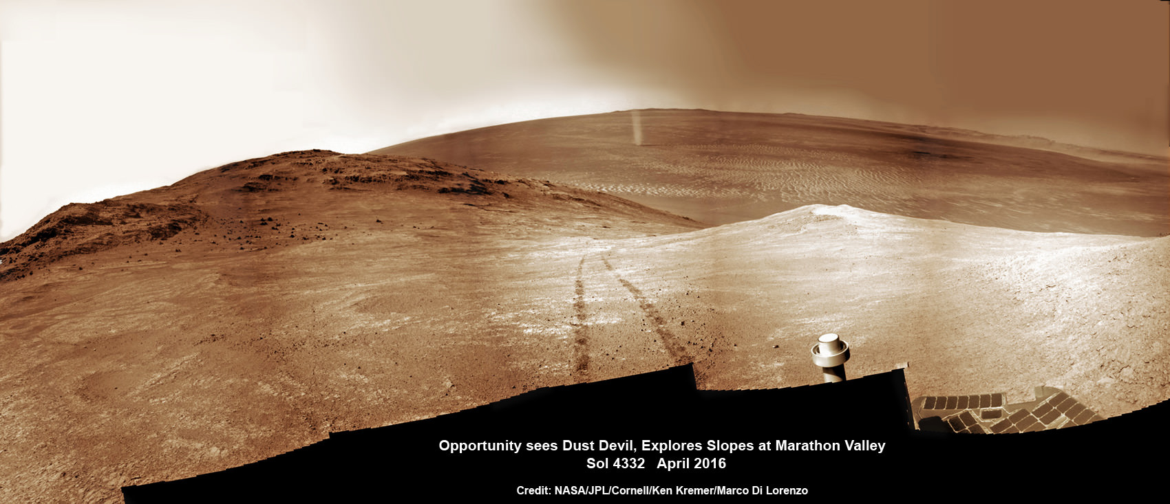
A “beautiful dust devil” was just discovered today, April 1, on the Red Planet by NASA’s long lived Opportunity rover as she is simultaneously exploring water altered rock outcrops at the steepest slopes ever targeted during her 13 year long expedition across the Martian surface. Opportunity is searching for minerals formed in ancient flows of water that will provide critical insight into establishing whether life ever existed on the fourth rock from the sun.

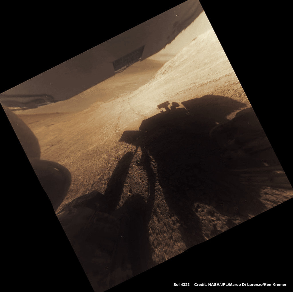
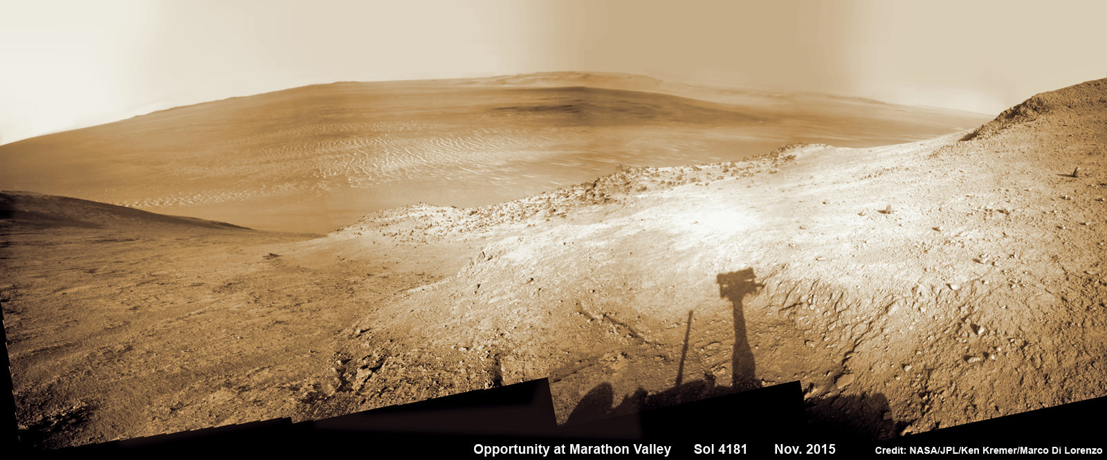
“Yes a beautiful dust devil on the floor of Endeavour Crater,” Ray Arvidson, Opportunity Deputy Principal Investigator of Washington University in St. Louis, confirmed to Universe Today. Spied from where “Opportunity is located on the southwest part of Knudsen Ridge” in Marathon Valley.

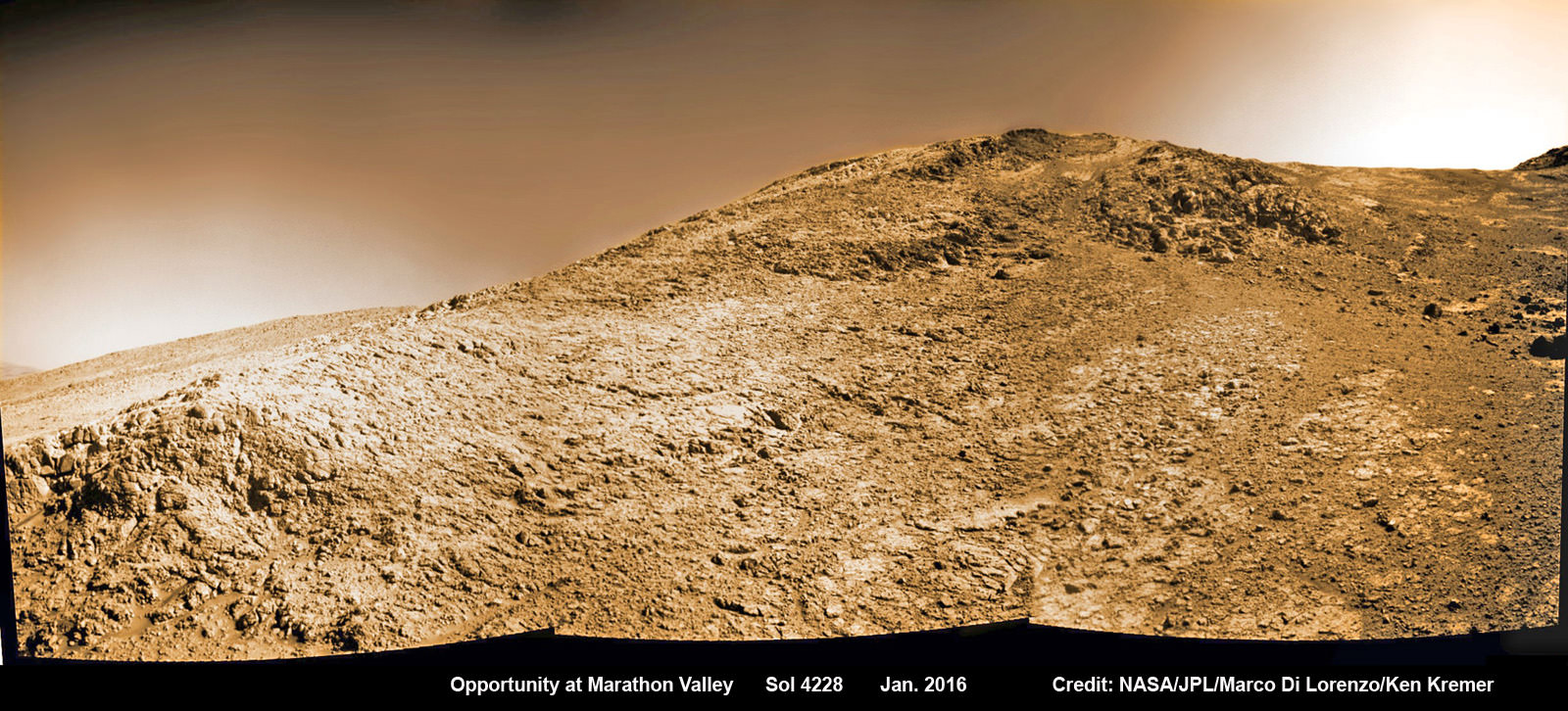
The new dust devil – a mini tornado like feature – is seen scooting across the ever fascinating Martian landscape in our new photo mosaic illustrating the steep walled terrain inside Marathon Valley and overlooking the crater floor as Opportunity makes wheel tracks at the current worksite on a crest at Knudsen Ridge. The colorized navcam camera mosaic combines raw images taken today on Sol 4332 (1 April 2016) and stitched by the imaging team of Ken Kremer and Marco Di Lorenzo.

“The dust devils have been kind to this rover,” Jim Green, Director of NASA Planetary Sciences at NASA HQ, said in an exclusive interview with Universe Today. They are associated with prior periods of solar array cleansing power boosts that contributed decisively to her longevity.

“Oppy’s best friend is on its way!”

Spotting dust devils has been relatively rare for Opportunity since landing on Mars on Jan. 24, 2004.

“There are 7 candidates, 6 of which are likely or certain,” Mark Lemmon, rover science team member from Texas A & M University, told Universe Today. “Most were seen in, on the rim of, or adjacent to Endeavour.”

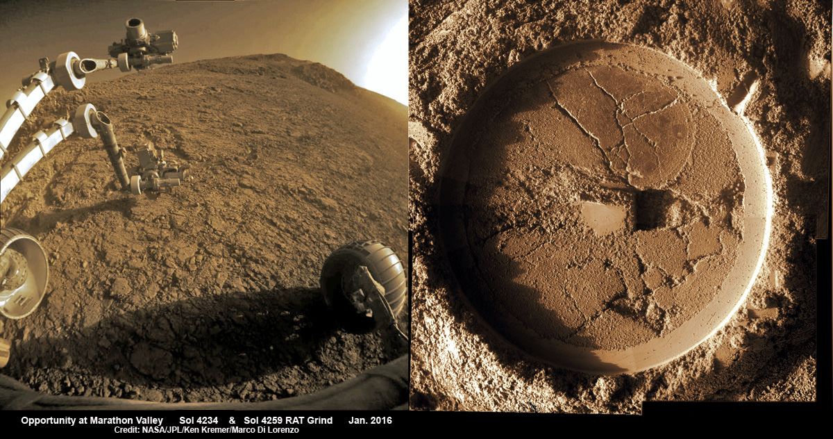
Starting in late January, scientists commanded the golf cart sized Opportunity to drive up the steepest slopes ever attempted by any Mars rover in order to reach rock outcrops where she can conduct breakthrough science investigations on smectite (phyllosilicate) clay mineral bearing rocks yielding clues to Mars watery past.

“We are beginning an imaging and contact science campaign in an area where CRISM spectra show evidence for deep absorptions associated with Fe [Iron], Mg [Magnesium] smectites,” Arvidson explained.

A shadow and tracks of NASA's Mars rover Opportunity appear in this March 22, 2016, image, which has been rotated 13.5 degrees to adjust for the tilt of the rover. The hillside descends to the left into "Marathon Valley." The floor of Endeavour Crater is seen beneath the underside of a solar panel.  Credits: NASA/JPL-Caltech
A shadow and tracks of NASA’s Mars rover Opportunity appear in this March 22, 2016, image, which has been rotated 13.5 degrees to adjust for the tilt of the rover. The hillside descends to the left into “Marathon Valley.” The floor of Endeavour Crater is seen beneath the underside of a solar panel. Credits: NASA/JPL-Caltech

This is especially exciting to researchers because the phyllosilicate clay mineral rocks formed under water wet, non-acidic conditions that are more conducive to the formation of Martian life forms – billions of years ago when the planet was far warmer and wetter.

“We have been in the smectite [phyllosilicate clay mineral] zone for months, ever since we entered Marathon Valley.”

The smectites were discovered via extensive, specially targeted Mars orbital measurements gathered by the CRISM (Compact Reconnaissance Imaging Spectrometer for Mars) spectrometer on NASA’s Mars Reconnaissance Orbiter (MRO) – accomplished earlier at the direction of Arvidson.

So the ancient, weathered slopes around Marathon Valley became a top priority science destination after they were found to hold a motherlode of ‘smectite’ clay minerals based on the CRISM data.

“Marathon Valley is unlike anything we have ever seen. Looks like a mining zone!”

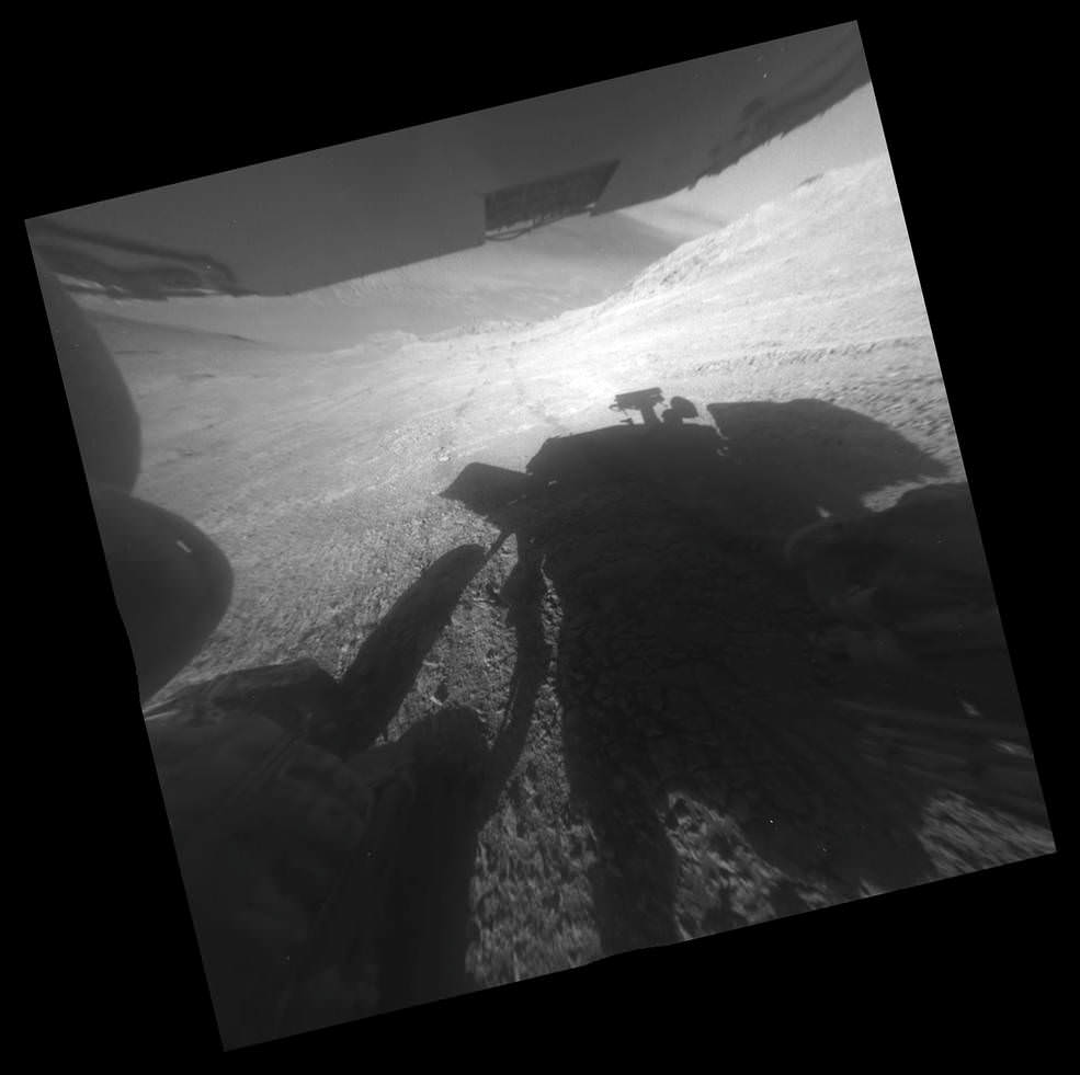
At this moment, the rover is driving to an alternative rock outcrop located on the southwest area of the Knudsen Ridge hilltops after trying three times to get within reach of the clay minerals by extending her instrument laden robotic arm.

NASA’s Opportunity rover images current worksite at Knudsen Ridge on Sol 4228 where the robot is grinding into rock targets inside Marathon Valley during 12th Anniversary of touchdown on Mars in Jan. 2016.  Credit: NASA/JPL/Cornell/Marco Di Lorenzo/Ken Kremer/kenkremer.com
NASA’s Opportunity rover images current worksite at Knudsen Ridge on Sol 4228 where the robot is grinding into rock targets inside Marathon Valley during 12th Anniversary of touchdown on Mars in Jan. 2016. Credit: NASA/JPL/Cornell/Marco Di Lorenzo/Ken Kremer/kenkremer.com

Unfortunately, but not unexpectedly, the rover kept slipping on the steep walled slopes – tilted as much as 32 degrees – while repeatedly attempting close approaches to the intended target. Ultimately she came within 3 inches of the surface science target ‘Pvt. Joseph Whitehouse’ – named after a member of the Corps of Discovery.

In fact despite rotating her wheels enough to push uphill about 66 feet (20 meters) if there had been no slippage, engineers discerned from telemetry that slippage was so great that “the vehicle progressed only about 3.5 inches (9 centimeters). This was the third attempt to reach the target and came up a few inches short,” said NASA.

“The rover team reached a tough decision to skip that target and move on.”

So they backed Opportunity downhill about 27 feet (8.2 meters), then drove about 200 feet (about 60 meters) generally southwestward and uphill, toward the next target area.

NASA officials noted that “the previous record for the steepest slope ever driven by any Mars rover was accomplished while Opportunity was approaching “Burns Cliff” about nine months after the mission’s January 2004 landing on Mars.”

Marathon Valley measures about 300 yards or meters long. It cuts downhill through the west rim of Endeavour crater from west to east – the same direction in which Opportunity is currently driving downhill from a mountain summit area atop the crater rim. See our route map below showing the context of the rovers over dozen year long traverse spanning more than the 26 mile distance of a Marathon runners race.

Endeavour crater spans some 22 kilometers (14 miles) in diameter. Opportunity has been exploring Endeavour since arriving at the humongous crater in 2011.

NASA’s Opportunity rover peers outwards across to the vast expense of Endeavour Crater from current location descending along steep walled Marathon Valley in early November 2015. Marathon Valley holds significant deposits of water altered clay minerals holding clues to the planets watery past.  Shadow of Pancam Mast assembly and robots deck visible at right. This navcam camera photo mosaic was assembled from images taken on Sol 4181 (Oct. 29, 2015) and colorized.  Credit: NASA/JPL/Cornell/Ken Kremer/kenkremer.com/Marco Di Lorenzo
NASA’s Opportunity rover peers outwards across to the vast expense of Endeavour Crater from current location descending along steep walled Marathon Valley in early November 2015. Marathon Valley holds significant deposits of water altered clay minerals holding clues to the planets watery past. Shadow of Pancam Mast assembly and robots deck visible at right. This navcam camera photo mosaic was assembled from images taken on Sol 4181 (Oct. 29, 2015) and colorized. Credit: NASA/JPL/Cornell/Ken Kremer/kenkremer.com/Marco Di Lorenzo

Why are the dust devils a big deal?

Offering more than just a pretty view, the dust devils actually have been associated with springtime Martian winds that clear away the dust obscuring the robots life giving solar panels.

“Opportunity is largely in winter mode sitting on a hill side getting maximum power. But it is in a better power status than in many past winters,” Jim Green, Director of NASA Planetary Sciences at NASA HQ, told Universe Today exclusively.

“I think I know the reason. As one looks across the vistas of Mars in this mosaic Oppys best friend is on its way.”

“The dust devils have been kind to this rover. Even I have a smile on my face when I see what’s coming.”

12 Year Traverse Map for NASA’s Opportunity rover from 2004 to 2016. This map shows the entire path the rover has driven during almost 12 years and more than a marathon runners distance on Mars for over 4332 Sols, or Martian days, since landing inside Eagle Crater on Jan 24, 2004 - to current location at the western rim of Endeavour Crater and descending into Marathon Valley. Rover surpassed Marathon distance on Sol 3968 and marked 11th Martian anniversary on Sol 3911. Opportunity discovered clay minerals at Esperance – indicative of a habitable zone - and is currently searching for more at Marathon Valley.  Credit: NASA/JPL/Cornell/ASU/Marco Di Lorenzo/Ken Kremer/kenkremer.com
12 Year Traverse Map for NASA’s Opportunity rover from 2004 to 2016. This map shows the entire path the rover has driven during almost 12 years and more than a marathon runners distance on Mars for over 4332 Sols, or Martian days, since landing inside Eagle Crater on Jan 24, 2004 – to current location at the western rim of Endeavour Crater and descending into Marathon Valley. Rover surpassed Marathon distance on Sol 3968 and marked 11th Martian anniversary on Sol 3911. Opportunity discovered clay minerals at Esperance – indicative of a habitable zone – and is currently searching for more at Marathon Valley. Credit: NASA/JPL/Cornell/ASU/Marco Di Lorenzo/Ken Kremer/kenkremer.com

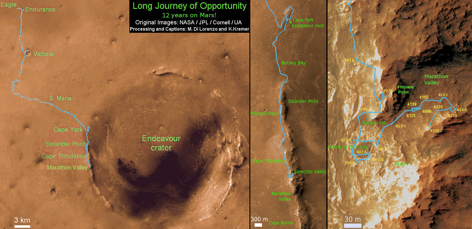
As of today, Sol 4332, Apr. 1, 2016, Opportunity has taken over 209,200 images and traversed over 26.53 miles (42.69 kilometers) – more than a marathon.

The power output from solar array energy production has climbed to 576 watt-hours, now just past the depths of southern hemisphere Martian winter.

Meanwhile Opportunity’s younger sister rover Curiosity traverses and drills into the basal layers at the base of Mount Sharp.

This March 21, 2016, image from the navigation camera on NASA's Mars rover Opportunity shows streaks of dust or sand on the vehicle's rear solar panel after a series of drives during which the rover was pointed steeply uphill. The tilt and jostling of the drives affected material on the rover deck.  Credits: NASA/JPL-Caltech
This March 21, 2016, image from the navigation camera on NASA’s Mars rover Opportunity shows streaks of dust or sand on the vehicle’s rear solar panel after a series of drives during which the rover was pointed steeply uphill. The tilt and jostling of the drives affected material on the rover deck. Credits: NASA/JPL-Caltech

Stay tuned here for Ken’s continuing Earth and planetary science and human spaceflight news.

Ken Kremer

………….

Learn more about NASA Mars rovers, Orion, SLS, ISS, Orbital ATK, ULA, SpaceX, Boeing, Space Taxis, NASA missions and more at Ken’s upcoming outreach events:

Apr 9/10: “NASA and the Road to Mars Human Spaceflight programs” and “Curiosity explores Mars” at NEAF (NorthEast Astronomy and Space Forum), 9 AM to 5 PM, Suffern, NY, Rockland Community College and Rockland Astronomy Club – http://rocklandastronomy.com/neaf.html

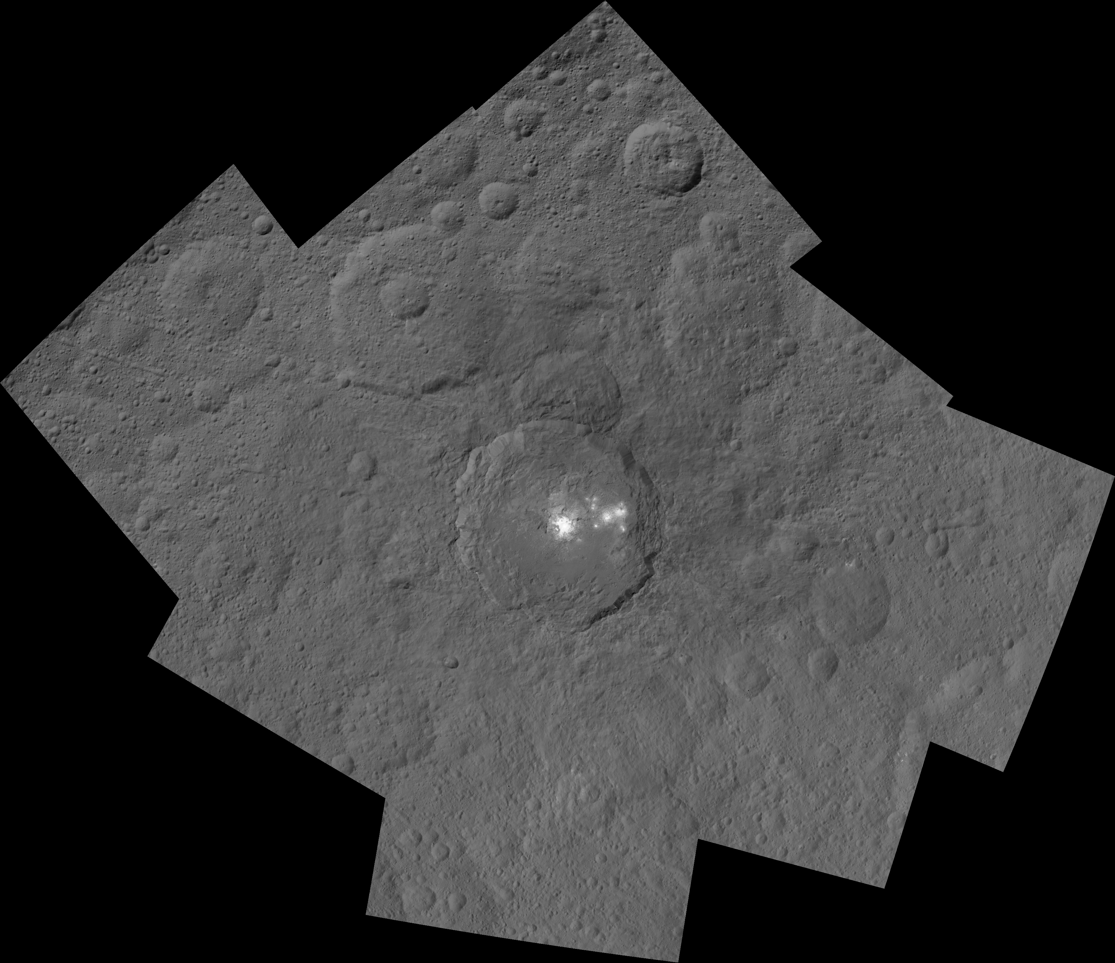
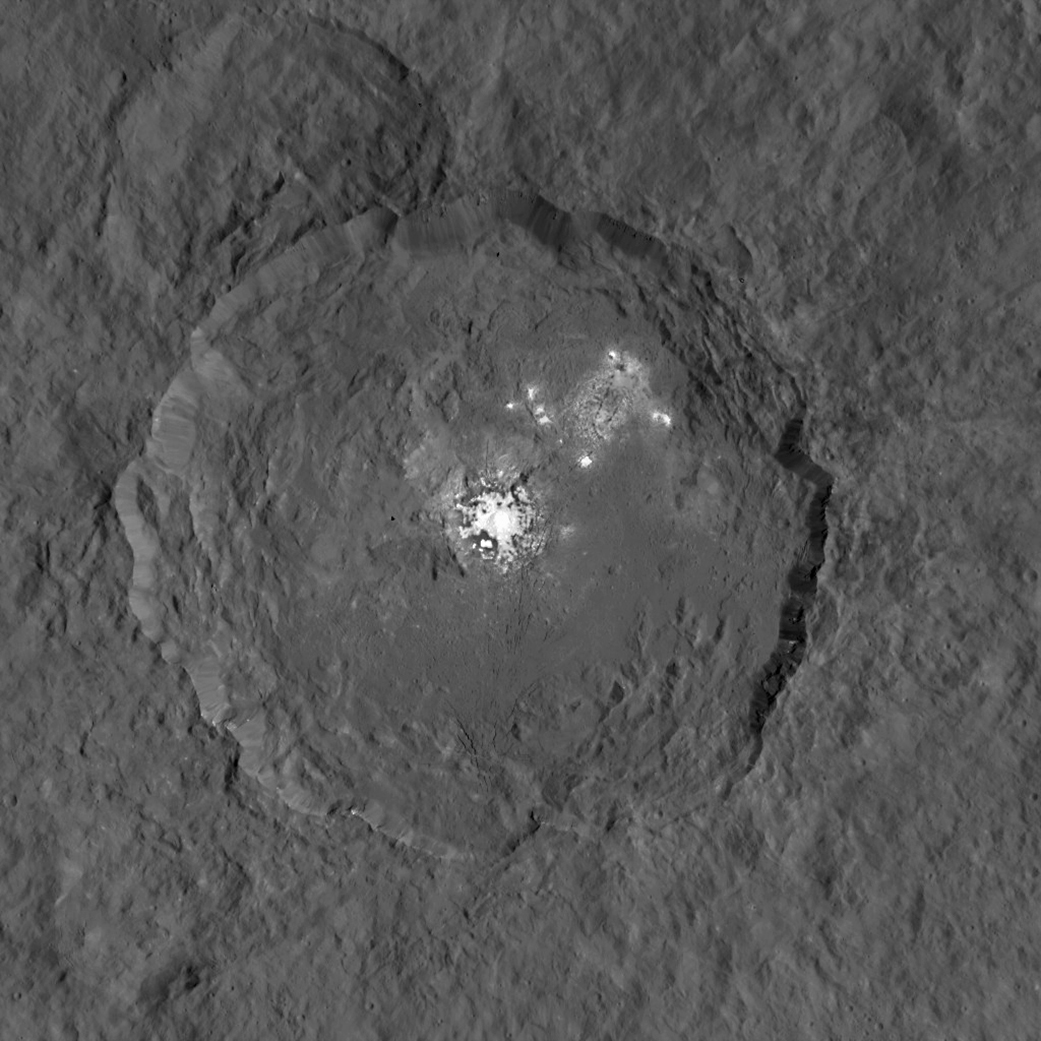
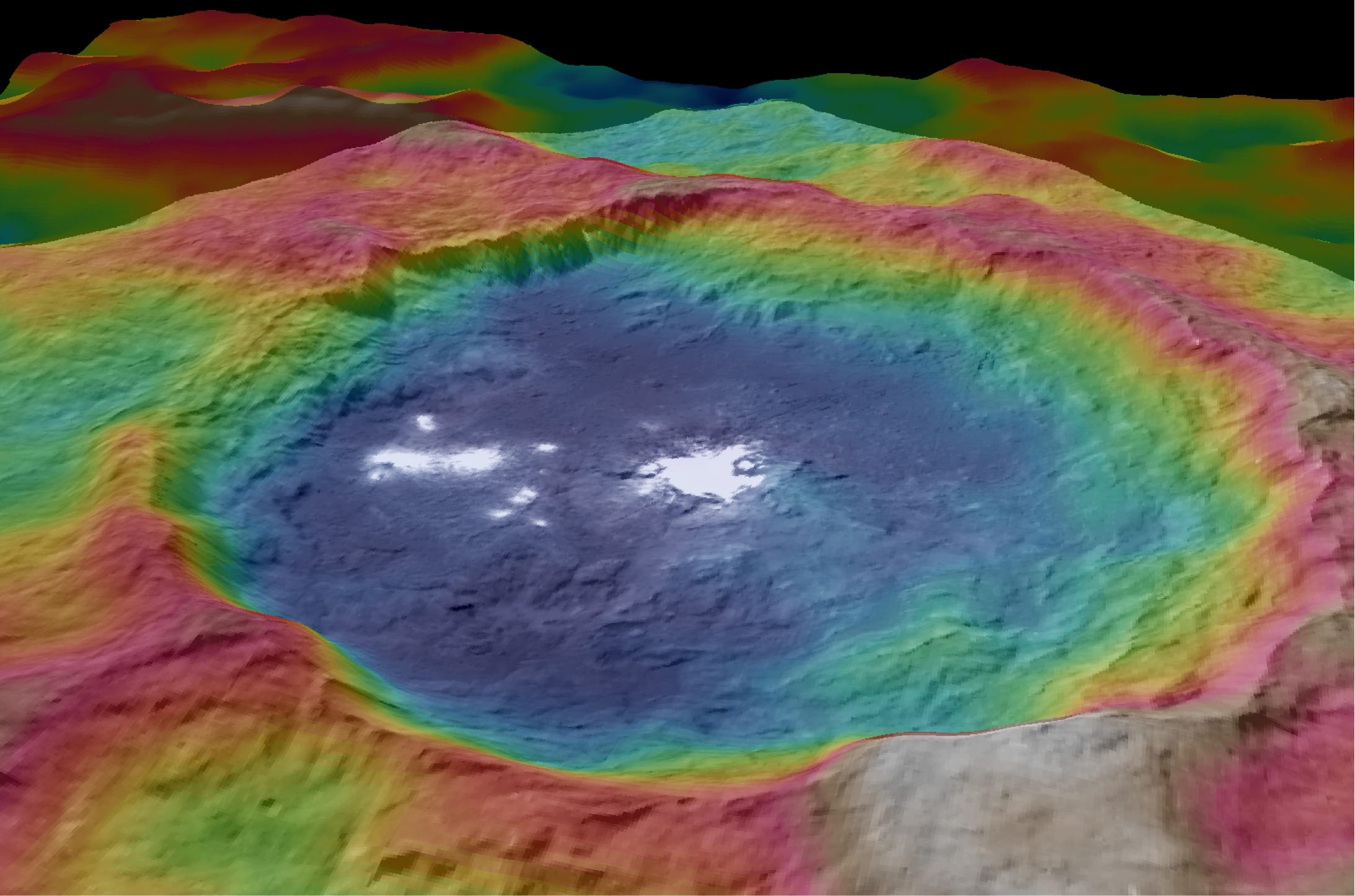
Apr 12: Hosting Dr. Jim Green, NASA, Director Planetary Science, for a Planetary sciences talk about “Ceres, Pluto and Planet X” at Princeton University; 7:30 PM, Amateur Astronomers Assoc of Princeton, Peyton Hall, Princeton, NJ – http://www.princetonastronomy.org/

Apr 17: “NASA and the Road to Mars Human Spaceflight programs”- 1:30 PM at Washington Crossing State Park, Nature Center, Titusville, NJ – http://www.state.nj.us/dep/parksandforests/parks/washcros.html

A shadow and tracks of NASA's Mars rover Opportunity appear in this March 22, 2016, colorized hazcam camera image, which has been rotated 13.5 degrees to adjust for the tilt of the rover. The hillside descends to the left into "Marathon Valley." The floor of Endeavour Crater is seen beneath the underside of a solar panel.  Credits: NASA/JPL-Caltech/Marco Di Lorenzo/Ken Kremer/kenkremer.com
A shadow and tracks of NASA’s Mars rover Opportunity appear in this March 22, 2016, colorized hazcam camera image, which has been rotated 13.5 degrees to adjust for the tilt of the rover. The hillside descends to the left into “Marathon Valley.” The floor of Endeavour Crater is seen beneath the underside of a solar panel. Credits: NASA/JPL-Caltech/Marco Di Lorenzo/Ken Kremer/kenkremer.com
Composite hazcam camera image (left) shows the robotic arm in motion as NASA’s Mars Exploration Rover Opportunity places the tool turret on the target named “Private John Potts” on Sol 4234 to brush away obscuring dust. Rover is actively working on the southern side of “Marathon Valley” which slices through western rim of Endeavour Crater. On Sol 4259 (Jan. 16, 2016), Opportunity completed grinds with the Rock Abrasion Tool (RAT) to exposure rock interior for elemental analysis, as seen in mosaic (right) of four up close images taken by Microscopic Imager (MI). Credit: NASA/JPL/Cornell/Ken Kremer/kenkremer.com/Marco Di Lorenzo

NASA Says “No Chance” Small Asteroid Will Hit Earth On March 5th

Artist's impression of a Near-Earth Asteroid passing by Earth. Credit: ESA

On October 6th, 2013, the Catalina Sky Survey discovered a small asteroid which was later designated as 2013 TX68. As part Apollo group this 30 meter (100 ft) rock is one of many Near-Earth Objects (NEOs) that periodically crosses Earth’s orbit and passes close to our planet. A few years ago, it did just that, flying by our planet at a safe distance of about 2 million km (1.3 million miles).

And according to NASA’s Center for NEO Studies (CNEOS) at the Jet Propulsion Laboratory, it will be passing us again in a few weeks time, specifically between March 2nd and 6th. Of course, asteroids pass Earth by on a regular basis, and there is very rarely any cause for alarm. However, there is some anxiety about 2013 TX68’s latest flyby, mainly because its distance could be subject to some serious variation.

Continue reading “NASA Says “No Chance” Small Asteroid Will Hit Earth On March 5th”

Opportunity Robustly in Action on 12th Anniversary of Red Planet Touchdown

Composite hazcam camera image (left) shows the robotic arm in motion as NASA’s Mars Exploration Rover Opportunity places the tool turret on the target named “Private John Potts” on Sol 4234 to brush away obscuring dust. Rover is actively working on the southern side of “Marathon Valley” which slices through western rim of Endeavour Crater. On Sol 4259 (Jan. 16, 2016), Opportunity completed grinds with the Rock Abrasion Tool (RAT) to exposure rock interior for elemental analysis, as seen in mosaic (right) of four up close images taken by Microscopic Imager (MI). Credit: NASA/JPL/Cornell/Ken Kremer/kenkremer.com/Marco Di Lorenzo
Composite hazcam camera image (left) shows the robotic arm in motion as NASA’s Mars Exploration Rover Opportunity places the tool turret on the target named "Private John Potts" on Sol 4234 to brush away obscuring dust.  Rover is actively working on the southern side of "Marathon Valley" which slices through western rim of Endeavour Crater.  On Sol 4259 (Jan. 16,  2016), Opportunity completed grinds with the Rock Abrasion Tool (RAT) to exposure rock interior for elemental analysis, as seen in mosaic (right) of four up close images taken by  Microscopic Imager (MI).  Credit: NASA/JPL/Cornell/Ken Kremer/kenkremer.com/Marco Di Lorenzo
Composite hazcam camera image (left) shows the robotic arm in motion as NASA’s Mars Exploration Rover Opportunity places the tool turret on the target named “Private John Potts” on Sol 4234 to brush away obscuring dust. Rover is actively working on the southern side of “Marathon Valley” which slices through western rim of Endeavour Crater. On Sol 4259 (Jan. 16, 2016), Opportunity completed grinds with the Rock Abrasion Tool (RAT) to exposure rock interior for elemental analysis, as seen in mosaic (right) of four up close images taken by Microscopic Imager (MI). Credit: NASA/JPL/Cornell/Ken Kremer/kenkremer.com/Marco Di Lorenzo

NASA’s world famous Mars Exploration Rover Opportunity continues blazing a daily trail of unprecedented science first’s, still swinging her robotic arm robustly into action at a Martian “Mining Zone” on the 12th anniversary of her hair-raising Red Planet touchdown this week, a top rover scientist told Universe Today.

“Looks like a mining zone!” Opportunity Deputy Principal Investigator Ray Arvidson, of Washington University in St. Louis, explained to Universe Today. On Jan. 24 the rover marked 4267 Sols and a dozen years and counting exploring Mars. Continue reading “Opportunity Robustly in Action on 12th Anniversary of Red Planet Touchdown”

Dawn Unveils New Bright Features on Ceres in Striking Close-Ups

This image from NASA's Dawn spacecraft shows Kupalo Crater, one of the youngest craters on Ceres. The crater has bright material exposed on its rim and walls, which could be salts. Its flat floor likely formed from impact melt and debris. Credits: NASA/JPL-Caltech/UCLA/MPS/DLR/IDA
This image from NASA's Dawn spacecraft shows Kupalo Crater, one of the youngest craters on Ceres. The crater has bright material exposed on its rim and walls, which could be salts. Its flat floor likely formed from impact melt and debris.  Credits: NASA/JPL-Caltech/UCLA/MPS/DLR/IDA
This image from NASA’s Dawn spacecraft shows Kupalo Crater, one of the youngest craters on Ceres. The crater has bright material exposed on its rim and walls, which could be salts. Its flat floor likely formed from impact melt and debris. Credits: NASA/JPL-Caltech/UCLA/MPS/DLR/IDA

NASA’s Dawn spacecraft has unveiled a new patch of intriguing bright features in the most recent series of striking close-up images taken just after the probe reached the lowest altitude it will ever reach during the mission.

From Dawn’s current altitude of 240 miles (385 kilometers) above Ceres, every image taken from now on of the “unique landforms” will be of the highest resolution attainable since the ship will never swoop down closer to the pockmarked surface for science. Continue reading “Dawn Unveils New Bright Features on Ceres in Striking Close-Ups”

Curiosity Celebrates Christmas at Red Planet Paradise at Namib Dune with 1st Mastcam Self-portrait

Curiosity explores Red Planet paradise at Namib Dune during Christmas 2015 - backdropped by Mount Sharp. Curiosity took first ever self-portrait with Mastcam color camera after arriving at the lee face of Namib Dune. This photo mosaic shows a portion of the full self portrait and is stitched from Mastcam color camera raw images taken on Sol 1197, Dec. 19, 2015. Credit: NASA/JPL/MSSS/Ken Kremer/kenkremer.com/Marco Di Lorenzo

Just in time for the holidays, NASA’s Curiosity rover is celebrating Christmas 2015 at a Red Planet Paradise – spectacular “Namib Dune.” And she marked the occasion by snapping her first ever color self-portrait with the mast mounted high resolution Mastcam 34 mm camera.

Heretofore Curiosity has taken color self portraits with the MAHLI camera mounted at the end of the 7-foot-long (2-meter-long) robotic arm, and black and white self portraits with the mast mounted navcam camera. Continue reading “Curiosity Celebrates Christmas at Red Planet Paradise at Namib Dune with 1st Mastcam Self-portrait”

2016 Launch of NASA’s InSight Mars Lander Postponed Due to Instrument Vacuum Leak

This artist's concept depicts the InSight lander on Mars after the lander's robotic arm has deployed a seismometer and a heat probe directly onto the ground. InSight is the first mission dedicated to investigating the deep interior of Mars. The findings will advance understanding of how all rocky planets, including Earth, formed and evolved. NASA approved a new launch date in May 2018. Credits: NASA/JPL-Caltech

NASA managers have just made the difficult but unavoidable decision to scrub the planned March 2016 launch of the InSight lander, the agency’s next mission to Mars, by at least two years because of a vacuum leak that was just detected in the probes flawed seismometer instrument which cannot be fixed in time.

The leak, if uncorrected, would render the probe useless to carry out the unprecedented scientific research foreseen to measure the planets seismic activity and sense for “Marsquakes” to determine the nature of the Red Planets’ deep interior. Continue reading “2016 Launch of NASA’s InSight Mars Lander Postponed Due to Instrument Vacuum Leak”

Dawn Spacecraft Unraveling Mysteries of Ceres Intriguing Bright Spots as Sublimating Salt Water Residues

This representation of Ceres' Occator Crater in false colors shows differences in the surface composition. Occator measures about 60 miles (90 kilometers) wide. Credits: NASA/JPL-Caltech/UCLA/MPS/DLR/IDA
This representation of Ceres' Occator Crater in false colors shows differences in the surface composition. Red corresponds to a wavelength range around 0.97 micrometers (near infrared), green to a wavelength range around 0.75 micrometers (red, visible light) and blue to a wavelength range of around 0.44 micrometers (blue, visible light). Occator measures about 60 miles (90 kilometers) wide. Credits: NASA/JPL-Caltech/UCLA/MPS/DLR/IDA
This representation of Ceres' Occator Crater in false colors shows differences in the surface composition. Occator measures about 60 miles (90 kilometers) wide. Credits: NASA/JPL-Caltech/UCLA/MPS/DLR/IDA
This representation of Ceres’ Occator Crater in false colors shows differences in the surface composition. Red corresponds to a wavelength range around 0.97 micrometers (near infrared), green to a wavelength range around 0.75 micrometers (red, visible light) and blue to a wavelength range of around 0.44 micrometers (blue, visible light). Occator measures about 60 miles (90 kilometers) wide. Credits: NASA/JPL-Caltech/UCLA/MPS/DLR/IDA

With NASA’s Dawn spacecraft set to enter its final and lowest orbit around the dwarf planet Ceres, spectral measurements are enabling researchers to gradually unravel the nature of the numerous mysterious and intriguing bright spots recently discovered, and now they conclude that briny mixtures of ice and salts apparently reside just beneath certain patches of the pockmarked surface and that “water is sublimating” from the surface of an “active crater”.

Indeed, excited scientists report that high resolution images and spectra from Dawn indicate that Ceres is an active world even today, according to a pair of newly published scientific papers in the journal Nature. Continue reading “Dawn Spacecraft Unraveling Mysteries of Ceres Intriguing Bright Spots as Sublimating Salt Water Residues”

Dawn Starts Steep Descent to Most Dazzling Orbit of Ceres

This mosaic shows Ceres' Occator crater and surrounding terrain from an altitude of 915 miles (1,470 kilometers), as seen by NASA's Dawn spacecraft. Occator is about 60 miles (90 kilometers) across and 2 miles (4 kilometers) deep. Credits: NASA/JPL-Caltech/UCLA/MPS/DLR/IDA

The most dazzling views ever seen of dwarf planet Ceres and its mysterious bright spots are what’s on tap by year’s end as NASA’s amazing Dawn spacecraft starts a gradual but steep descent over the next two months to its lowest and final orbit around the bizarre icy body.

Engineers at NASA’s Jet Propulsion Laboratory (JPL) successfully fired up the probes exotic ion propulsion system to begin lowering Dawn’s orbital altitude to less than a quarter of what it has been for the past two months of intense mapping operations.

On Oct. 23, Dawn began a seven-week-long dive that uses ion thruster #2 to reduce the spacecrafts vantage point from 915 miles (1,470 kilometers) at the High Altitude Mapping Orbit (HAMO) down to less than 235 miles (380 kilometers) above Ceres at the Low Altitude Mapping Orbit (LAMO).

Dawn is slated to arrive at LAMO by mid-December, just in time to begin delivering the long awaiting Christmas treats.

Ceres has absolutely tantalized researchers far beyond their wildest expectations.

When Dawn arrives at LAMO it will be the culmination of an eight year interplanetary voyage that began with a blastoff on September 27, 2007 by a United Launch Alliance (ULA) Delta II Heavy rocket from Space Launch Complex-17B (SLC-17B) at Cape Canaveral Air Force Station, Florida.

LAMO marks Dawn’s fourth, lowest and final science orbit at Ceres where the highest resolution observations will be gathered and images from the framing camera will achieve a resolution of 120 feet (35 meters) per pixel.

Dawn’s low altitude mapping orbit LAMO. This shows how the orbit naturally shifts slightly (relative to the sun) during the three months of LAMO, starting in blue and ending in red. The spacecraft completes each revolution in 5.5 hours, and Ceres rotates in 9.1 hours, so Dawn will be able to view the entire surface. Credit: NASA/JPL

At LAMO, researchers hope to finally resolve the enduring mystery of the nature of the bright spots that have intrigued science and the general public since they were first glimpsed clearly early this year as Dawn was on its final approach to Ceres.

Dawn arrived in orbit this past spring on March 6, 2015.

This image was taken by NASA's Dawn spacecraft of dwarf planet Ceres on Feb. 19 from a distance of nearly 29,000 miles (46,000 km). It shows that the brightest spot on Ceres has a dimmer companion, which apparently lies in the same basin. See below for the wide view. Credit: NASA/JPL-Caltech/UCLA/MPS/DLR/IDA
This image was taken by NASA’s Dawn spacecraft of dwarf planet Ceres on Feb. 19 from a distance of nearly 29,000 miles (46,000 km). It shows that the brightest spot on Ceres has a dimmer companion, which apparently lies in the same basin. See below for the wide view. Credit: NASA/JPL-Caltech/UCLA/MPS/DLR/IDA

The science team has just released a new mosaic of the brightest spots on Ceres found at Occator crater and the surrounding terrain – see above.

The images were taken from the HAMO altitude of 915 miles (1,470 kilometers) during the first of six mapping cycles. They have a resolution of 450 feet (140 meters) per pixel.

Occator measures about 60 miles (90 kilometers) across and 2 miles (4 kilometers) deep.

This image, made using images taken by NASA's Dawn spacecraft during the mission's High Altitude Mapping Orbit (HAMO) phase, shows Occator crater on Ceres, home to a collection of intriguing bright spots.  Credits: NASA/JPL-Caltech/UCLA/MPS/DLR/IDA
This image, made using images taken by NASA’s Dawn spacecraft during the mission’s High Altitude Mapping Orbit (HAMO) phase, shows Occator crater on Ceres, home to a collection of intriguing bright spots. Credits: NASA/JPL-Caltech/UCLA/MPS/DLR/IDA

Because the spots are so bright they are generally overexposed. Therefore the team took two sets of images, with shorter and longer exposure times, to maximize the details of the interior of Occator.

“This view uses a composite of two images of Occator: one using a short exposure that captures the detail in the bright spots, and one where the background surface is captured at normal exposure.”

The bright spots at Occator crater remain the biggest Cerean mystery.

So far the imagery and other science data may point to evaporation of salty water from the interior as the source of the bright spots.

“Occasional water leakage on to the surface could leave salt there as the water would sublime,” Prof. Chris Russell, Dawn principal investigator told Universe Today exclusively.

“The big picture that is emerging is that Ceres fills a unique niche.”

“Ceres fills a unique niche between the cold icy bodies of the outer solar system, with their rock hard icy surfaces, and the water planets Mars and Earth that can support ice and water on their surfaces,” Russell, of the University of California, Los Angeles, told me.

Dawn has peeled back Ceres secrets as the spacecraft orbits lower and lower. Detailed measurements gathered to date have yielded global mineral and topographic maps from HAMO with the best resolution ever as the science team painstakingly stitched together the probes spectral and imaging products.

And the best is yet to come at LAMO.

At HAMO, Dawn’ instruments, including the Framing Camera and Visible and Infrared Spectrometer (VIR) were aimed at slightly different angles in each mapping cycle allowing the team to generate stereo views and construct 3-D maps.

“The emphasis during HAMO is to get good stereo data on the elevations of the surface topography and to get good high resolution clear and color data with the framing camera,” Russell explained.

This view from NASA's Dawn spacecraft is a color-coded topographic map of Occator crater on Ceres. Blue is the lowest elevation, and brown is the highest. The crater, which is home to the brightest spots on Ceres, is approximately 56 miles (90 kilometers wide).  Credits: NASA/JPL-Caltech/UCLA/MPS/DLR/IDA
This view from NASA’s Dawn spacecraft is a color-coded topographic map of Occator crater on Ceres. Blue is the lowest elevation, and brown is the highest. The crater, which is home to the brightest spots on Ceres, is approximately 56 miles (90 kilometers wide). Credits: NASA/JPL-Caltech/UCLA/MPS/DLR/IDA

Dawn is Earth’s first probe in human history to explore any dwarf planet, the first to explore Ceres up close and the first to orbit two celestial bodies.

The asteroid Vesta was Dawn’s first orbital target where it conducted extensive observations of the bizarre world for over a year in 2011 and 2012.

Ceres is a Texas-sized world, ranks as the largest object in the main asteroid belt between Mars and Jupiter, and may have a subsurface ocean of liquid water that could be hospitable to life.

This map-projected view of Ceres was created from images taken by NASA's Dawn spacecraft during its high-altitude mapping orbit, in August and September, 2015.  This color coded map can provide valuable insights into the mineral composition of the surface, as well as the relative ages of surface features.  Credits: NASA/JPL-Caltech/UCLA/MPS/DLR/IDA
This map-projected view of Ceres was created from images taken by NASA’s Dawn spacecraft during its high-altitude mapping orbit, in August and September, 2015. This color coded map can provide valuable insights into the mineral composition of the surface, as well as the relative ages of surface features. Credits: NASA/JPL-Caltech/UCLA/MPS/DLR/IDA

The mission is expected to last until at least March 2016, and possibly longer, depending upon fuel reserves.

“It will end some time between March and December,” Dr. Marc Rayman, Dawn’s chief engineer and mission director based at NASA’s Jet Propulsion Laboratory, Pasadena, California, told Universe Today.

Stay tuned here for Ken’s continuing Earth and planetary science and human spaceflight news.

Ken Kremer

Dawn at Ceres
An artist’s conception shows NASA’s Dawn spacecraft flying above Ceres. This view incorporates actual imagery from the Dawn mission. Credit: NASA/JPL-Caltech/UCLA/MPS/DLR/IDA

Boulder Extraction and Robotic Arm Mechanisms For NASA’s Asteroid Redirect Mission Start Rigorous Testing at NASA Goddard

Robotic sampling arm and capture mechanism to collect a multi-ton boulder from an asteroid are under development at NASA Goddard and other agency centers for NASA’s unmanned Asteroid Redirect Vehicle and eventual docking in lunar orbit with Orion crew vehicle by the mid 2020s. Credit: Ken Kremer/kenkremer.com

NASA GODDARD SPACE FLIGHT CENTER, MD – Rigorous testing has begun on the advanced robotic arm and boulder extraction mechanisms that are key components of the unmanned probe at the heart of NASA’s Asteroid Redirect Robotic Mission (ARRM) now under development to pluck a multi-ton boulder off a near-Earth asteroid so that astronauts visiting later in an Orion crew capsule can harvest a large quantity of samples for high powered scientific analysis back on Earth. Universe Today inspected the robotic arm hardware utilizing “leveraged robotic technology” during an up close visit and exclusive interview with the engineering development team at NASA Goddard.

“The teams are making great progress on the capture mechanism that has been delivered to the robotics team at Goddard from Langley,” NASA Associate Administrator Robert Lightfoot told Universe Today.

“NASA is developing these common technologies for a suite of missions like satellite servicing and refueling in low Earth orbit as well as autonomously capturing an asteroid about 100 million miles away,” said Ben Reed, NASA Satellite Servicing Capabilities Office (SSCO) Deputy Project Manager, during an exclusive interview and hardware tour with Universe Today at NASA Goddard in Greenbelt, Maryland, regarding concepts and goals for the overall Asteroid Redirect Mission (ARM) initiative.

NASA is leveraging technology originally developed for satellite servicing such as with the Robotic Refueling Mission (RRM) currently on board the International Space Station (ISS) and repurposing them for the asteroid retrieval mission.

“Those are our two near term mission objectives that we are developing these technologies for,” Reed explained.

ARRM combines both robotic and human missions to advance the new technologies required for NASA’s agency wide ‘Journey to Mars’ objective of sending a human mission to the Martian system in the 2030s.

The unmanned Asteroid Redirect Robotic Mission (ARRM) to grab a boulder is the essential first step towards carrying out the follow on sample retrieval with the manned Orion Asteroid Redirect Mission (ARM) by the mid-2020s.

ARRM will use a pair of highly capable robotic arms to autonomously grapple a multi-ton (> 20 ton) boulder off the surface of a large near-Earth asteroid and transport it to a stable, astronaut accessible orbit around the Moon in cislunar space.

“Things are moving well. The teams have made really tremendous progress on the robotic arm and capture mechanism,” Bill Gerstenmaier, NASA Associate Administrator for Human Exploration and Operations, told Universe Today.

Then an Orion crew capsule can fly to it and the astronauts will collect a large quantity of rock samples and gather additional scientific measurements.

“We are working on a system to rendezvous, capture and service different [target] clients using the same technologies. That is what we are working on in a nut shell,” Reed said.

This engineering design unit of the robotic servicing arm is under development to autonomously extract a boulder off an asteroid for NASA’s asteroid retrieval mission and  is being tested at NASA Goddard.   It has seven degrees of freedom and mimics a human arm.   Credit: Ken Kremer/kenkremer.com
This engineering design unit of the robotic servicing arm is under development to autonomously extract a boulder off an asteroid for NASA’s asteroid retrieval mission and is being tested at NASA Goddard. It has seven degrees of freedom and mimics a human arm. Credit: Ken Kremer/kenkremer.com

“Right now the plan is to launch ARRM by about December 2020,” Reed told me. But a huge amount of preparatory work across the US is required to turn NASA’s plan into reality.

Key mission enabling technologies are being tested right now with a new full scale engineering model of the ‘Robotic Servicing Arm’ and a full scale mockup of the boulder snatching ARRM Capture Module at NASA Goddard, in a new facility known as “The Cauldron.”

Capture Module comprising two robotic servicing arms and three boulder grappling contact and restraint system legs for NASA’s Asteroid Redirect Robotic Mission (ARRM).   Credit: NASA
Capture Module comprising two robotic servicing arms and three boulder grappling contact and restraint system legs for NASA’s Asteroid Redirect Robotic Mission (ARRM). Credit: NASA
The ARRM capture module is comprised of two shorter robotic arms (separated by 180 degrees) and three lengthy contact and restraint system capture legs (separated by 120 degrees) attached to a cradle with associated avionics, computers and electronics and the rest of the spacecraft and solar electric power arrays.

“The robotic arm we have here now is an engineering development unit. The 2.2 meter-long arms can be used for assembling large telescopes, repairing a failed satellite, removing orbital debris and capturing an asteroid,” said Reed.

“There are two little arms and three big capture legs.”

“So, we are leveraging one technology development program into multiple NASA objectives.”

“We are working on common technologies that can service a legacy orbiting satellite, not designed to be serviced, and use those same technologies with some tweaking that we can go out with 100 million miles and capture an asteroid and bring it back to the vicinity of the Moon.”

“Currently the [capture module] system can handle a boulder that’s up to about 3 x 4 x 5 meters in diameter.”

Artists concept of NASA’s Asteroid Redirect Robotic Mission capturing an asteroid boulder before redirecting it to a astronaut-accessible orbit around Earth's moon.  Credits: NASA
Artists concept of NASA’s Asteroid Redirect Robotic Mission capturing an asteroid boulder before redirecting it to a astronaut-accessible orbit around Earth’s moon. Credits: NASA

The Cauldron is a brand new Goddard facility for testing technologies and operations for multiple exploration and science missions, including satellite servicing and ARRM that just opened in June 2015 for the centers Satellite Servicing Capabilities Office.

Overall project lead for ARRM is the Jet Propulsion Laboratory (JPL) with numerous contributions from other NASA centers and industrial partners.

“This is an immersive development lab where we bring systems together and can do lifetime testing to simulate what’s in space. This is our robotic equivalent to the astronauts NBL, or neutral buoyancy lab,” Reed elaborated.

“So with this same robotic arm that can cut wires and thermal blankets and refuel an Earth sensing satellite, we can now have that same arm go out on a different mission and be able to travel out and pick up a multi-ton boulder and bring it back for astronauts to harvest samples from.”

“So that’s quite a technical feat!”

The Robotic Servicing Arm is a multi-jointed powerhouse designed to function like a “human arm” as much as possible. It builds on extensive prior research and development investment efforts conducted for NASA’s current Red Planet rovers and a flight-qualified robotic arm developed for the Defense Advanced Research Projects Agency (DARPA).

“The arm is capable of seven-degrees-of-freedom to mimic the full functionally of a human arm. It has heritage from the arm on Mars right now on Curiosity as well as ground based programs from DARPA,” Reed told me.

“It has three degrees of freedom at our shoulder, two at our elbow and two more at the wrist. So I can hold the hand still and move the elbow.”

The arm will also be equipped with a variety of interchangeable “hands” that are basically tools to carry out different tasks with the asteroid such as grappling, drilling, sample gathering, imaging and spectrometric analysis, etc.

View of the robotic arm above and gripper tool below that initially grabs the asteroid boulder before the capture legs wrap around as planned for NASA’s upcoming unmanned ARRM Asteroid Redirect Robotic Mission that will later dock with an Orion crew vehicle. Credit: Ken Kremer/kenkremer.com

The ARRM spacecraft will carefully study, characterize and photograph the asteroid in great detail for about a month before attempting the boulder capture.

Why does the arm need all this human-like capability?

“When we arrive at an asteroid that’s 100 million miles away, we are not going to know the fine local geometry until we arrive,” Reed explained to Universe Today.

“Therefore we need a flexible enough arm that can accommodate local geometries at the multi-foot scale. And then a gripper tool that can handle those geometry facets at a much smaller scale.”

“Therefore we chose seven-degrees-of-freedom to mimic humans very much by design. We also need seven-degrees-of-freedom to conduct collision avoidance maneuvers. You can’t do that with a six-degree-of-freedom arm. It has to be seven to be a general purpose arm.”

How will the ARRM capture module work to snatch the boulder off the asteroid?

“So the idea is you come to the mother asteroid and touch down and make contact on the surface. Then you hold that position and the two arms reach out and grab the boulder.”

“Once its grabbed the boulder, then the legs straighten and pull the boulder off the surface.”

“Then the arms nestle the asteroid onto a cradle. And the legs then change from a contact system to become a restraint system. So the legs wrap around the boulder to restrain it for the 100 million mile journey back home.

“After that the little arms can let go – because the legs have wrapped around and are holding the asteroid.”

“So now the arm can also let go of the gripper system and pick up a different tool to do other things. For example they can collect a sample with another tool. And maybe assist an astronaut after the crew arrives.”

“During the 100 million mile journey back to lunar orbit they can be also be preparing the surface and cutting into it for later sample collection by the astronauts.”

Be sure to watch this video animation:

Since the actual asteroid encounter will occur very far away, the boulder grappling will have to be done fully autonomously since there will be no possibility for real time communications.

“The return time for communications is like about 30 minutes. So ‘human in the loop’ control is out of the question.

“Once we get into hover position over the landing site we hit the GO button. Then it will be very much like at Mars and the seven minutes of terror. It will take awhile to find out if it worked.”

Therefore the team at Goddard has already spent years of effort and practice sessions just to get ready for working with the early engineering version of the arm to maximize the probability of a successful capture.

“In this facility we put systems together to try and practice and rehearse and simulate as much of the mission as is realistically possible.”

“It took a lot of effort to get to this point, in the neighborhood of four years to get the simulation to behave correctly in real time with contact dynamics and the robotic systems. So the arm has to touch the boulder with force torque sensors and feed that into a computer to measure that and move the actuators to respond accordingly.”

“So the capture of the boulder is autonomous. The rest is teleoperated from the ground, but not the capture itself.”

How realistic are the rehearsals?

“We are practicing here by reaching out with the arm to grasp the client target using autonomous capture [procedures]. In space the client [target] is floating and maybe tumbling. So when we reach out with the arm to practice autonomous capture we make the client tumble and move – with the inertial properties of the target we are practicing on.”

“Now for known objects like satellites we know the mass precisely. And we can program all that inertial property data in very accurately to give us much more realistic simulations.”

“We learned from all our astronaut servicing experiences in orbit is that the more we know for the simulations, the easier and better the results are for the astronauts during an actual mission because you simulated all the properties.”

“But with this robotic mission to an asteroid there is no backup like astronauts. So we want to practice here at Goddard and simulate the space environment.”

ARRM will launch by the end of 2020 on either an SLS, Delta IV Heavy or a Falcon Heavy. NASA has not yet chosen the launch vehicle.

Several candidate asteroids have already been discovered and NASA has an extensive ongoing program to find more.

Orion crew capsule docks to NASA’s asteroid redirect vehicle grappling captured asteroid boulder orbiting the Moon. Credit: NASA

Again, this robotic technology was selected for development for ARRM because it has a lot in common with other objectives like fixing communications satellites, refueling satellites and building large telescopes in the future.

NASA is also developing other critical enabling technologies for the entire ARM project like solar electric propulsion that will be the subject of another article.

Therefore NASA is leveraging one technology development program into multiple spaceflight objectives that will greatly assist its plans to send ‘Humans to Mars’ in the 2030s with the Orion crew module launched by the monster Space Launch System (SLS) rocket.

The maiden uncrewed launch of the Orion/SLS stack is slated for November 2018.

Stay tuned here for Ken’s continuing Earth and Planetary science and human spaceflight news.

Ken Kremer

At NASA Goddard robotics lab Ben Reed/NASA Satellite Servicing Capabilities Office (SSCO) Deputy Project Manager and Ken Kremer/Universe Today discuss the robotic servicing arm and asteroid boulder capture mechanism being tested for NASA’s upcoming unmanned ARRM Asteroid Redirect Robotic Mission that will dock with an Orion crew vehicle in lunar orbit by the mid 2020s for sample return collection. Credit: Ken Kremer/kenkremer.com