New Images of Mars From China’s Rover

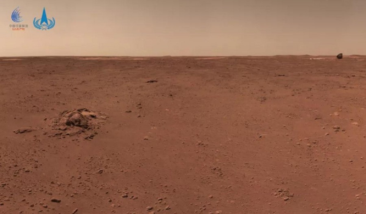
On May 14th, 2021, the China National Space Agency (CNSA) achieved another major milestone when the Tianwen-1 lander successfully soft-landed on Mars, making China the second nation in the world to land a mission on Mars and establish communications from the surface. Shortly thereafter, China National Space Agency (CNSA) shared the first images taken by the Tianwen-1 lander.

By May 22nd, 2021, the Zhurong rover descended from its lander and drove on the Martian surface for the first time. Since then, the rover has spent 63 Earth days conducting science operations on the surface of Mars and has traveled over 450 meters (1475 feet). On Friday, July 9th, and again on July 15th, the CNSA released new images of the Red Planet that were taken by the rover as it made its way across the surface.

Continue reading “New Images of Mars From China’s Rover”

This is Mawrth Vallis on Mars, and it’s Positively Bursting with Evidence of Past Water Action on Mars

This image shows a small portion of Mawrth Vallis, one of the many outflow channels feeding north into the Chryse Basin. This ancient valley once hosted flowing water. The erosive power of the flowing water rapidly cut down into the underlying layers of rock to expose a host of diverse geologic landforms visible today. Image Credit: NASA/JPL/UArizona

Here on Earth, geologists seek out deep channels into Earth’s rock, carved over the ages by flowing water. The exposed rock walls are like a visual timeline of a region’s geological history. On Mars, the surface water is long gone. But it flowed long enough to expose layers of rock just like here on Earth.

One of those water-exposed areas on Mars is Mawrth Vallis, an outflow channel that feeds into the Chryse Basin.

Continue reading “This is Mawrth Vallis on Mars, and it’s Positively Bursting with Evidence of Past Water Action on Mars”

Sediments on Mars, Created By Blowing Wind or Flowing Water

The HiRISE Picture of the Day from May 9th 2020. Sedimentary rocks in and impact crater on Mars. Image Credit: NASA/JPL/UArizona

The HiRISE (High-Resolution Imaging Science Experiment) instrument on NASA’s Mars Reconnaissance Orbiter (MRO) has given us a steady stream of images of the Martian surface. It’s been in orbit around Mars since March 2006, and has greatly outlived its intended mission length.

One of the latest Hi-PODs, or HiRISE Pictures of the Day, is this one, of sedimentary rock on Mars being eroded away.

Continue reading “Sediments on Mars, Created By Blowing Wind or Flowing Water”