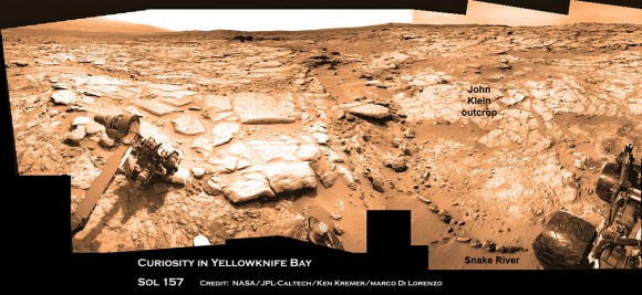
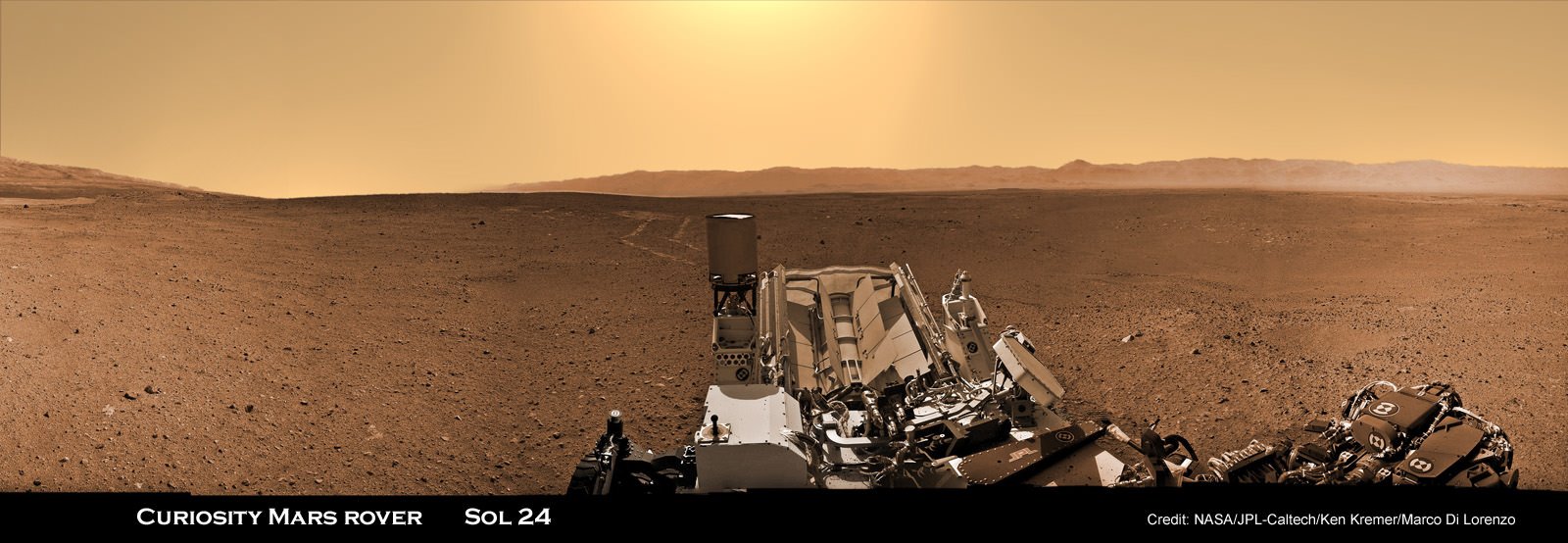
Image caption: Curiosity is taking the first ever radiation measurements from the surface of another planet in order to determine if future human explorers can live on Mars – as she traverses the terrain of the Red Planet. Curiosity is looking back to her rover tracks and the foothills of Mount Sharp and the eroded rim of Gale Crater in the distant horizon on Sol 24 (Aug. 30, 2012). This panorama is featured on PBS NOVA ‘Ultimate Mars Challenge’ documentary which premiered on PBS TV on Nov. 14. RAD is located on the rover deck in this colorized mosaic stitched together from Navcam images by the image processing team of Ken Kremer & Marco Di Lorenzo. Credit: NASA / JPL-Caltech / Ken Kremer / Marco Di Lorenzo
Metallic robots constructed by ingenious humans can survive on Mars. But what about future human astronauts?
NASA’s plucky Mars Exploration Rover Opportunity has thrived for nearly a decade traversing the plains of Meridiani Planum despite the continuous bombardment of sterilizing cosmic and solar radiation from charged particles thanks to her radiation hardened innards.
How about humans? What fate awaits them on a bold and likely year’s long expedition to the endlessly extreme and drastically harsh environment on the surface of the radiation drenched Red Planet – if one ever gets off the ground here on Earth? How much shielding would people need?
Answering these questions is one of the key quests ahead for NASA’s SUV sized Curiosity Mars rover – now 100 Sols, or Martian days, into her 2 year long primary mission phase.
Preliminary data looks promising.
Curiosity survived the 8 month interplanetary journey and the unprecedented sky crane rocket powered descent maneuver to touch down safely inside Gale Crater beside the towering layered foothills of 3 mi. (5.5 km) high Mount Sharp on Aug. 6, 2012.
Now she is tasked with assessing whether Mars and Gale Crater ever offered a habitable environment for microbial life forms – past or present. Characterizing the naturally occurring radiation levels stemming from galactic cosmic rays and the sun will address the habitability question for both microbes and astronauts. Radiation can destroy near-surface organic molecules.
Researchers are using Curiosity’s state-of-the-art Radiation Assessment Detector (RAD) instrument to monitor high-energy radiation on a daily basis and help determine the potential for real life health risks posed to future human explorers on the Martian surface.
“The atmosphere provides a level of shielding, and so charged-particle radiation is less when the atmosphere is thicker,” said RAD Principal Investigator Don Hassler of the Southwest Research Institute in Boulder, Colo. See the data graphs herein.
“Absolutely, the astronauts can live in this environment. It’s not so different from what astronauts might experience on the International Space Station. The real question is if you add up the total contribution to the astronaut’s total dose on a Mars mission can you stay within your career limits as you accumulate those numbers. Over time we will get those numbers,” Hassler explained.
The initial RAD data from the first two months on the surface was revealed at a media briefing for reporters on Thursday, Nov. 15 and shows that radiation is somewhat lower on Mars surface compared to the space environment due to shielding from the thin Martian atmosphere.

Image caption: Longer-Term Radiation Variations at Gale Crater. This graphic shows the variation of radiation dose measured by the Radiation Assessment Detector on NASA’s Curiosity rover over about 50 sols, or Martian days, on Mars. (On Earth, Sol 10 was Sept. 15 and Sol 60 was Oct. 6, 2012.) The dose rate of charged particles was measured using silicon detectors and is shown in black. The total dose rate (from both charged particles and neutral particles) was measured using a plastic scintillator and is shown in red. Credit: NASA/JPL-Caltech/ SwRI
RAD hasn’t detected any large solar flares yet from the surface. “That will be very important,” said Hassler.
“If there was a massive solar flare that could have an acute effect which could cause vomiting and potentially jeopardize the mission of a spacesuited astronaut.”
“Overall, Mars’ atmosphere reduces the radiation dose compared to what we saw during the cruise to Mars by a factor of about two.”
RAD was operating and already taking radiation measurements during the spacecraft’s interplanetary cruise to compare with the new data points now being collected on the floor of Gale Crater.
Mars atmospheric pressure is a bit less than 1% of Earth’s. It varies somewhat in relation to atmospheric cycles dependent on temperature and the freeze-thaw cycle of the polar ice caps and the resulting daily thermal tides.
“We see a daily variation in the radiation dose measured on the surface which is anti-correlated with the pressure of the atmosphere. Mars atmosphere is acting as a shield for the radiation. As the atmosphere gets thicker that provides more of a shield. Therefore we see a dip in the radiation dose by about 3 to 5%, every day,” said Hassler.

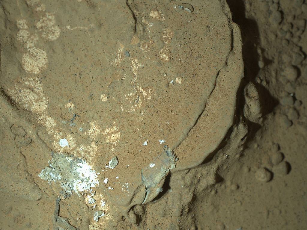
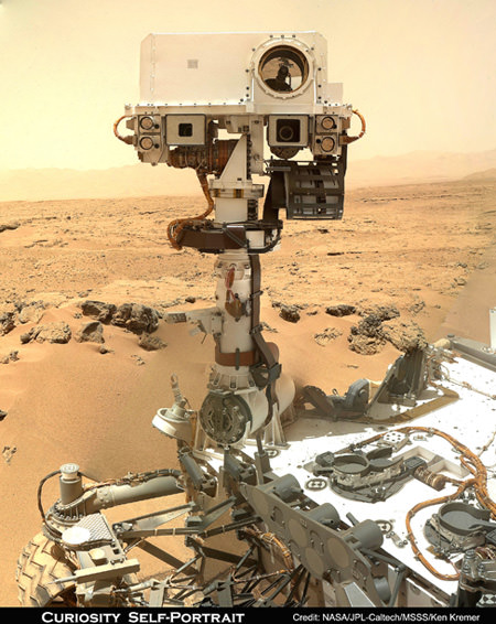
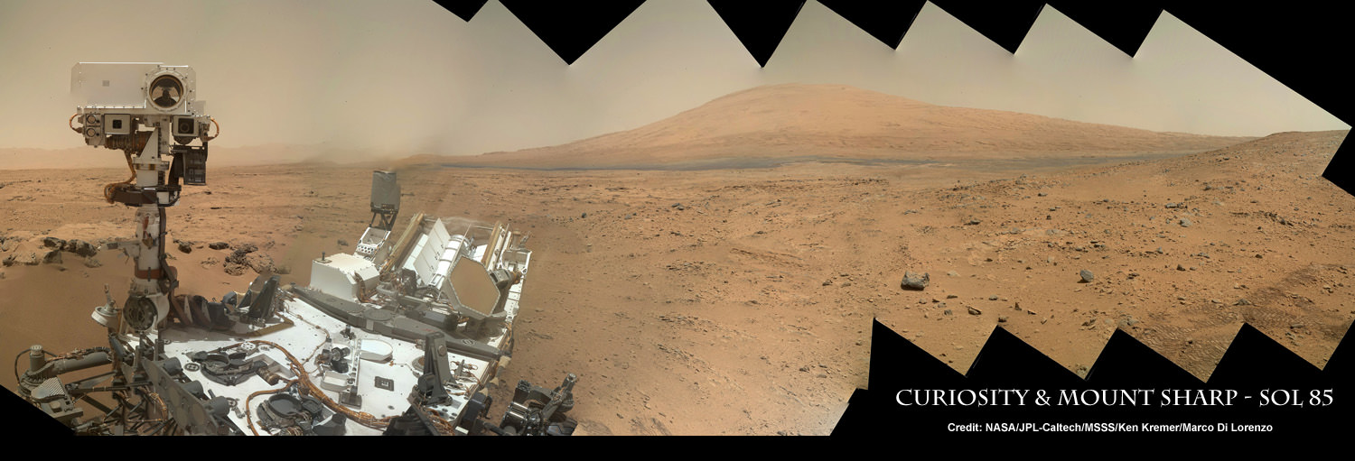
Image Caption: Curiosity Self Portrait with Mount Sharp at Rocknest ripple in Gale Crater. Curiosity used the Mars Hand Lens Imager (MAHLI) camera on the robotic arm to image herself and her target destination Mount Sharp in the background. Mountains in the background to the left are the northern wall of Gale Crater. This color panoramic mosaic was assembled from raw images snapped on Sol 85 (Nov. 1, 2012). Credit: NASA/JPL-Caltech/MSSS/Ken Kremer/Marco Di Lorenzo
There are also seasonal changes in radiation levels as Mars moves through space.
The RAD team is still refining the radiation data points.
“There’s calibrations and characterizations that we’re finalizing to get those numbers precise. We’re working on that. And we’re hoping to release that at the AGU [American Geophysical Union] meeting in December.”

Image caption: Daily Cycles of Radiation and Pressure at Gale Crater. This graphic shows the daily variations in Martian radiation and atmospheric pressure as measured by NASA’s Curiosity rover. As pressure increases, the total radiation dose decreases. When the atmosphere is thicker, it provides a better barrier with more effective shielding for radiation from outside of Mars. At each of the pressure maximums, the radiation level drops between 3 to 5 percent. The radiation level goes up at the end of the graph due to a longer-term trend that scientists are still studying. Credit: NASA/JPL-Caltech/SwRI
Radiation is a life limiting factor to habitability. RAD is the first science instrument to directly measure radiation from the surface of a planet other than Earth.
“Curiosity is finding that the radiation environment on Mars is sensitive to Mars weather and climate,” Hassler concluded.
Unlike Earth, Mars lost its magnetic field some 3.5 billion years ago – and therefore most of its shielding capability from harsh levels of energetic particle radiation from space.
Much more data will need to be collected by RAD before any final conclusions on living on Mars, and for how long and in which type habitats, can be drawn.
Learn more about Curiosity and NASA missions at my upcoming free public presentations:
And be sure to watch the excellent PBS NOVA Mars documentary – ‘Ultimate Mars Challenge’ – which also features Curiosity mosaics created by the imaging team of Ken Kremer & Marco Di Lorenzo.
Ken Kremer
…..
Dec 6: Free Public lecture titled “Atlantis, The Premature End of America’s Shuttle Program and What’s Beyond for NASA” including Curiosity, Orion, SpaceX and more by Ken Kremer at Brookdale Community College/Monmouth Museum and STAR Astronomy club in Lincroft, NJ at 8 PM
Dec 11: Free Public lecture titled “Curiosity and the Search for Life on Mars (in 3 D)” and more by Ken Kremer at Princeton University and the Amateur Astronomers Association of Princeton (AAAP) in Princeton, NJ at 8 PM.