Mars rover Scooping in Search of Pristine material at Rocknest

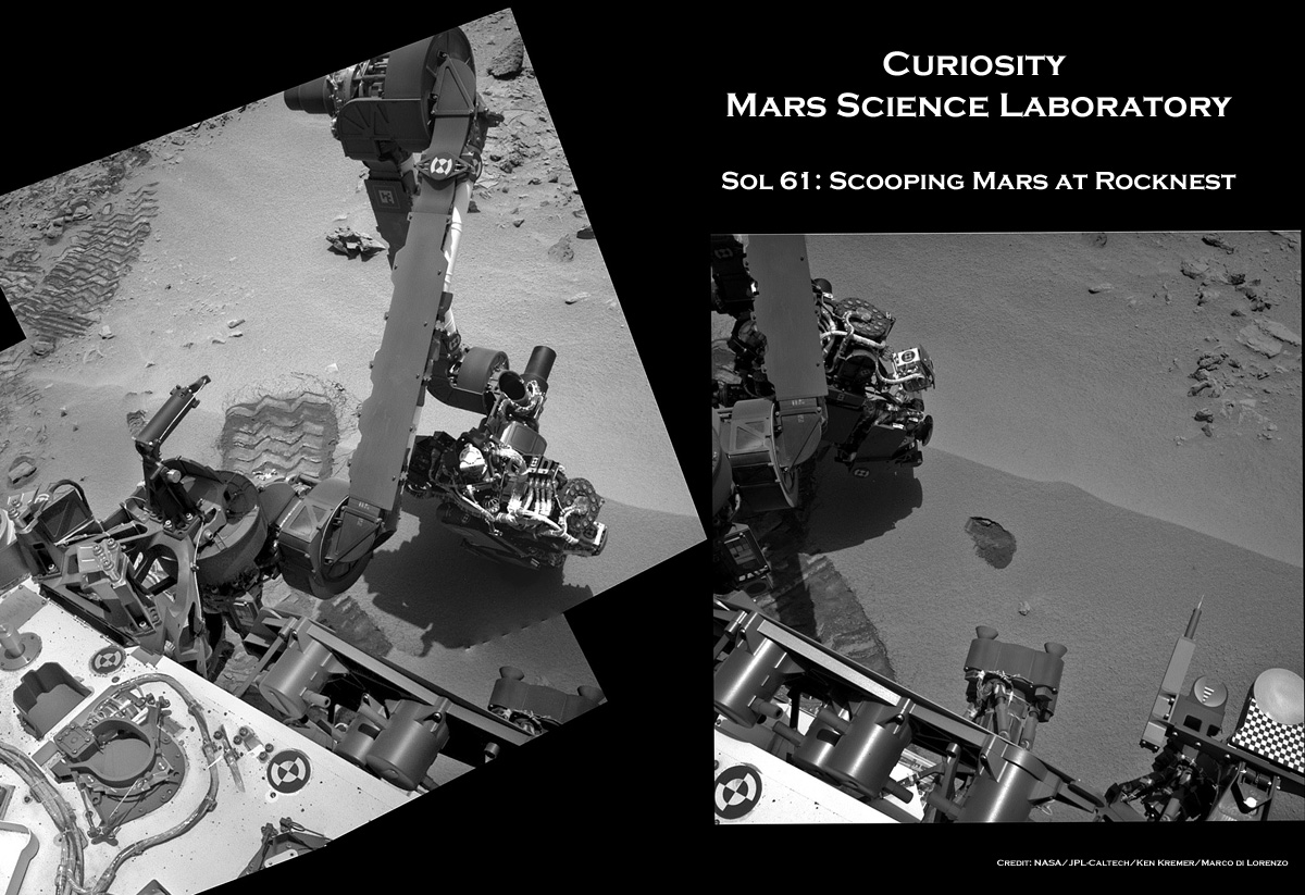
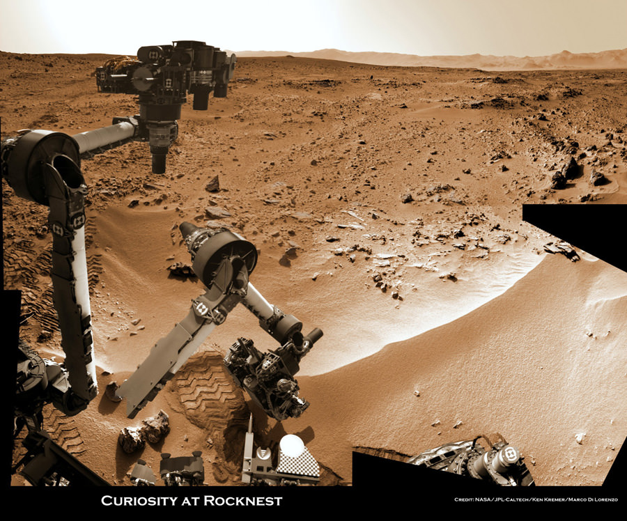
Image caption: Time lapse context view of Curiosity maneuvering her robotic arm. Curiosity conducts a close- up examination of windblown ‘Rocknest’ ripple site and inspects sandy material at “bootlike” wheel scuff mark with the APXS (Alpha Particle X-Ray Spectrometer) and MAHLI (Mars Hand Lens Imager) instruments positioned on the rotatable turret at the arm’s terminus. Colorized mosaic was stitched together from Sol 57 & 58 Navcam raw images shows the arm in action just prior to 1st sample scooping here. Surrounding terrain and eroded rim of Gale Crater rim is visible on the horizon. Credit: NASA/JPL-Caltech/Ken Kremer/Marco Di Lorenzo

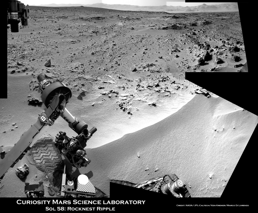
NASA’s Curiosity rover is actively searching for uncontaminated Martian soil after finding new flecks of “bright material” of unknown origin in the windblown sands at “Rocknest” ripple.

The team leading the Curiosity Mars Science Lab (MSL) mission decided to dump the second scoopful of dusty material collected last week on Sol 66 (Oct. 12). Instead they will search for pristine Martian sand to pour into the rover’s critical sample-processing mechanisms to use as a decontamination agent for cleansing the interior chambers and walls of Earthly residues.

Image Caption: Bright Particle of Martian Origin in Scoop Hole. This image contributed to an interpretation by NASA’s Mars rover Curiosity science team that some of the bright particles on the ground near the rover are native Martian material. Other light-toned material nearbyhas been assessed as small debris from the spacecraft. Curiosity’s Mars Hand Lens Imager (MAHLI) camera took this image on Sol 66 (Oct. 12, 2012) showing part of the hole or bite left in the ground when Curiosity collected its first scoop of Martian soil five sols earlier. A clod of soil near the top center of the image contains a light-toned particle. The observation that the particle is embedded in the clod led scientists to assess this particle as Martian material, not something from the spacecraft. This assessment prompted the mission to continue scooping in the area, despite observations of a few light-toned particles in the area being scooped. The image shows an area about 2 inches (5 centimeters) across. It is brightened to improve visibility in the shaded area. Credit: NASA/JPL-Caltech/MSSS

The science team is proceeding with appropriate caution – just as they indicated at press briefings – so as not to gum up the sample processing system with material that could give false positive readings for organic compounds or compromise the integrity of the rover’s delicate sample handling and delivery system.

“Concerns that the bright spot is more material shed from the flight system, and that some of this terrestrial material is in the scooped dirt, led the tactical team to decide to dump the scoop and take MAHLI images of the scoop targets first,” wrote MSL scientist Ken Herkenhoff in a rover team update.

The second scoopful of Martian sand from Rocknest was intentionally discarded on Sol 67 (Oct.13) after up close imaging by the MAHLI microscopic imaging camera revealed several specks of bright material that could be debris from the landing system or the rover itself or possibly even native Martian material.

The third test sample will be carefully analyzed by MAHLI, ChemCam and Mastcam and verified to be free of FOD before the team decides to pour the new processed sand into the processing system and eventually into the Sample Analysis at Mars (SAM) and Chemistry and Mineralogy (CheMin) analytical chemistry instruments on the rover deck.

Image Caption: Small Debris on the Ground Beside Curiosity – This image from the Mars Hand Lens Imager (MAHLI) camera on NASA’s Mars rover Curiosity shows a small bright object on the ground beside the rover at the “Rocknest” site about half an inch (1.3 centimeters) long. The rover team has assessed this object as debris from the spacecraft, possibly from the events of landing on Mars. The image was taken on Sol 65 (Oct. 11, 2012). Credit: NASA/JPL-Caltech/MSSS

Progress has been slowed somewhat by communications glitches with a radio transmitter at a Deep Space Network ground station and an unrelated new problem with NASA’s Mars Reconnaissance Orbiter (MRO) which went into “safe mode” on Sol 69. MRO serves as the highest volume communications relay for Curiosity’s images and scientific and engineering data.

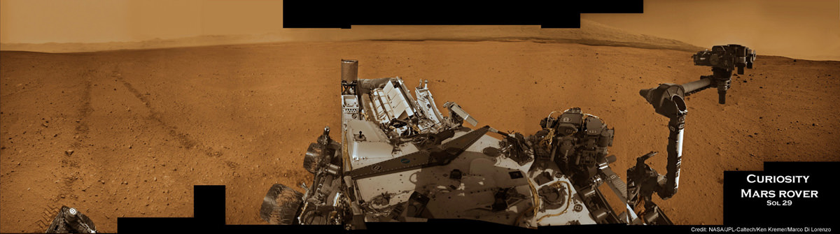
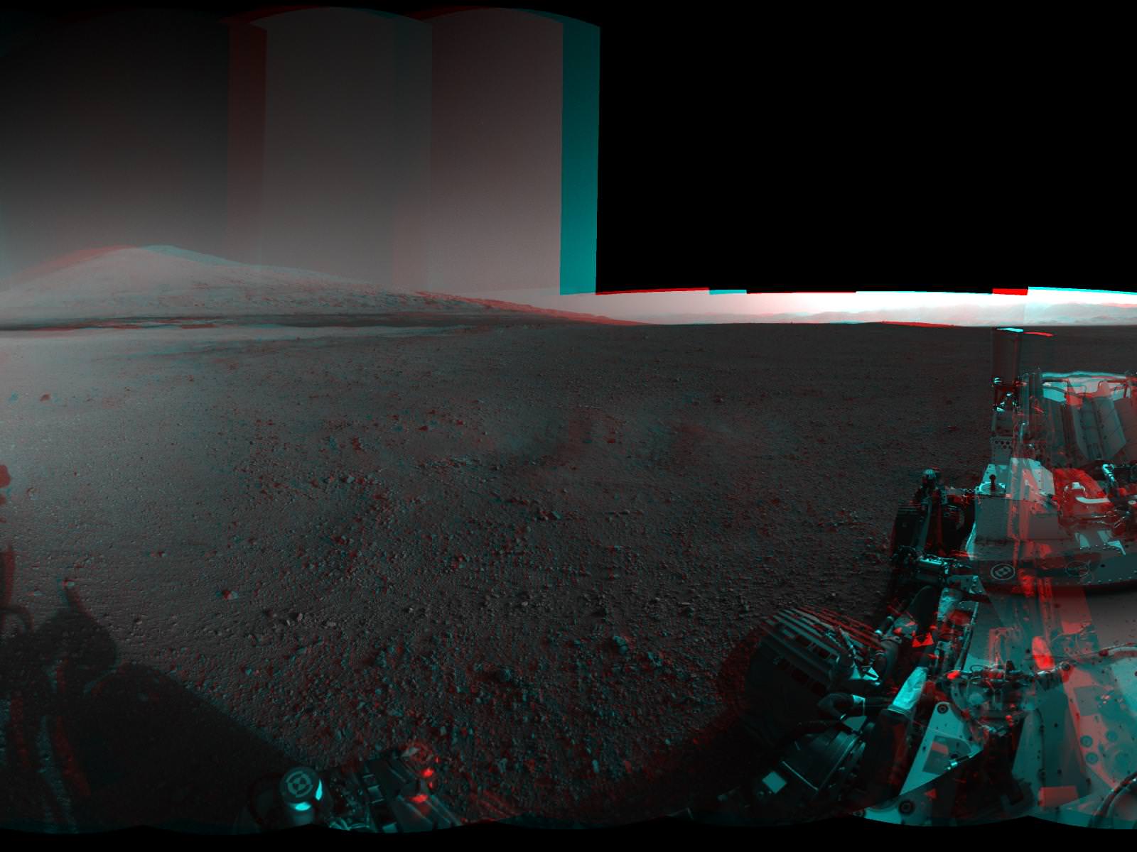
Tosol is Sol 71 and Curiosity is now 10 weeks into her two year long mission to investigate whether Mars ever had conditions sufficient to sustain microbial life forms.

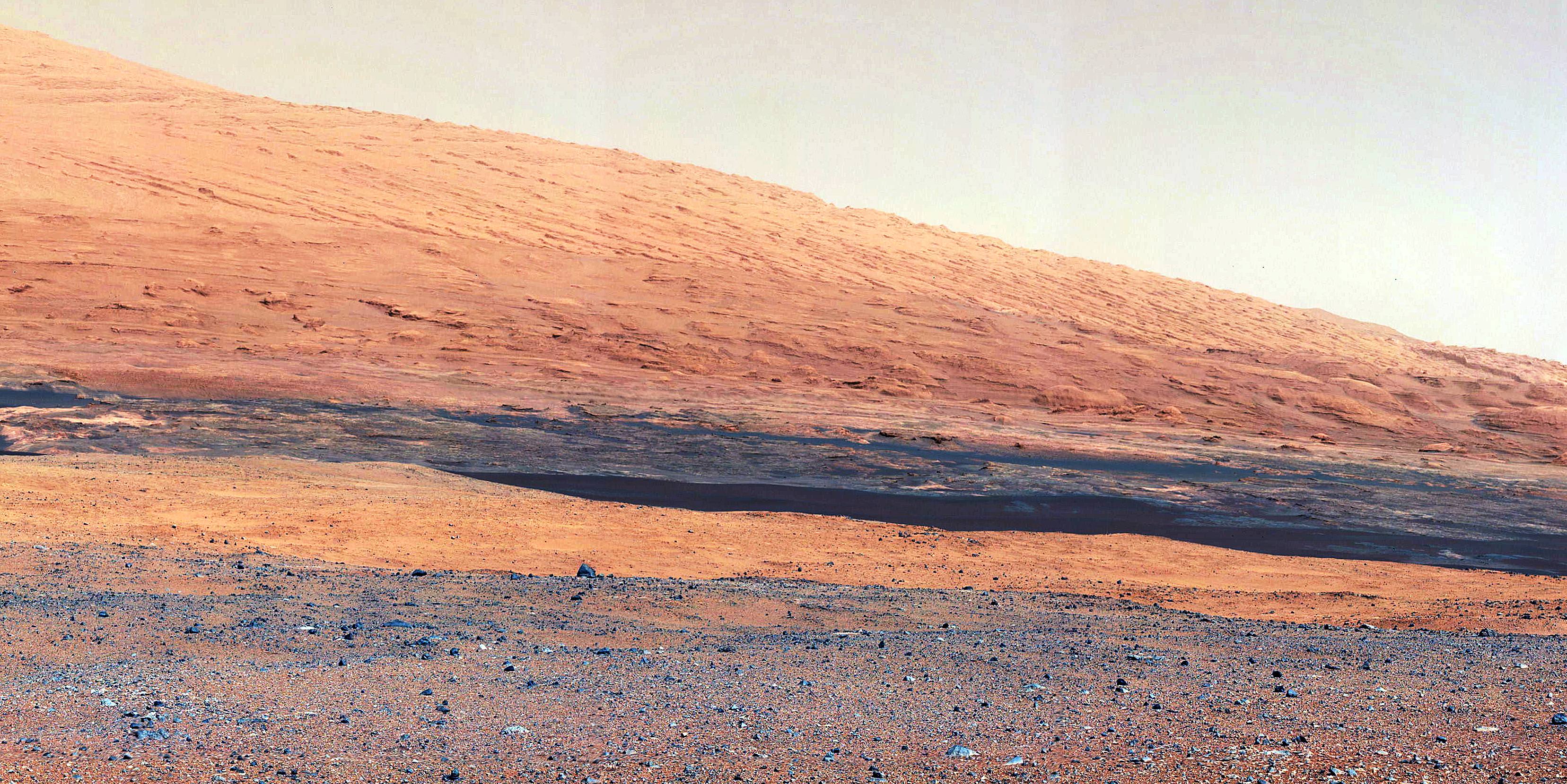
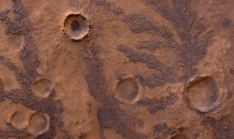
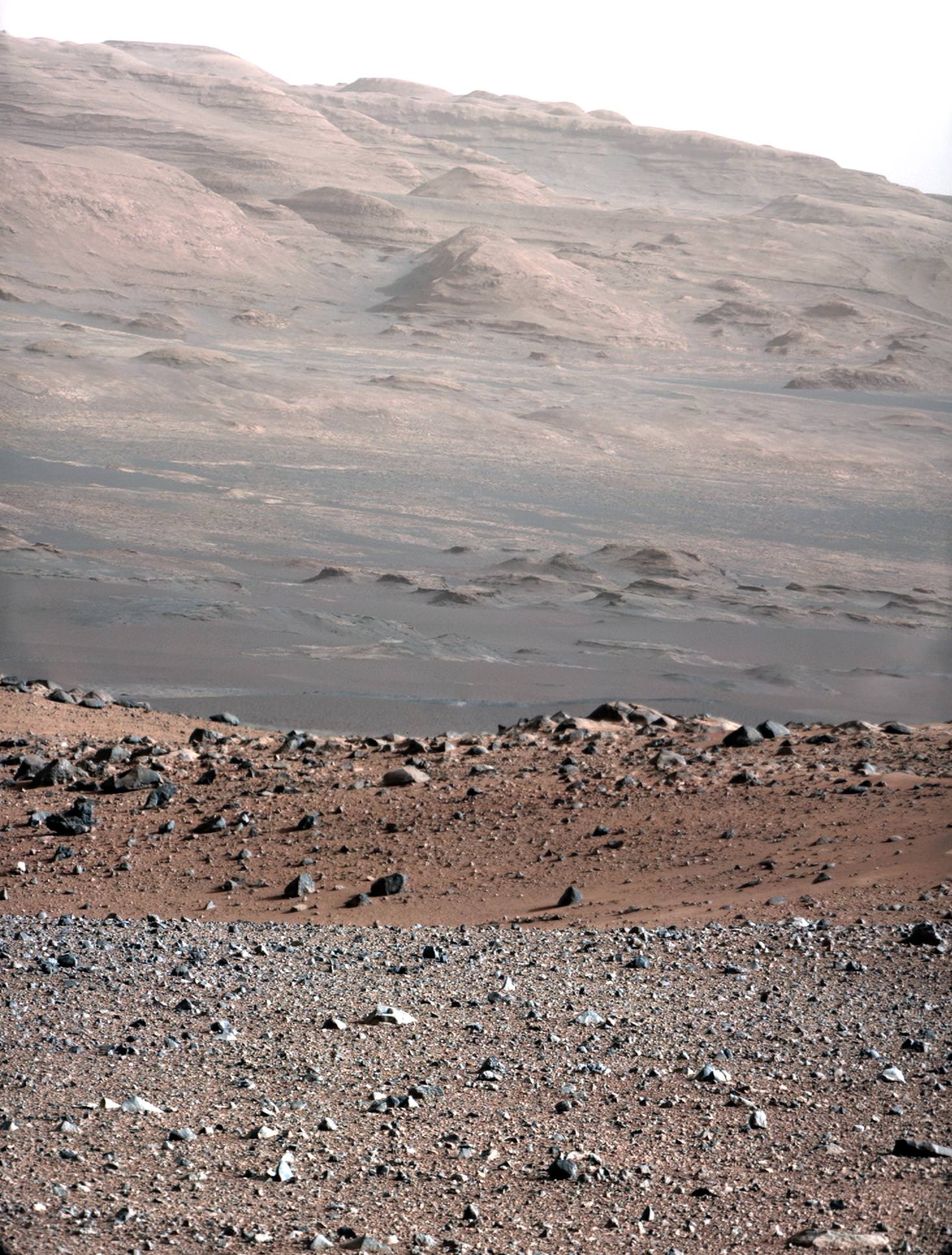
Curiosity made a pinpoint landing inside Gale Crater on Aug. 5/6, just a few miles away from her ultimate destination – the sedimentary lower layers of Mount Sharp holding deposits of hydrated minerals.


Video Caption: This 256 frame video clip shows the 1st sample of Martian material being vibrated inside Curiosity’s table spoon sized scoop on Oct. 7, 2012.

Ken Kremer

Scooping Mars – Shaken Not Stirred ! – Color Video

Image Caption: Scooping Mars at ‘Rocknest’ mosaic shows a before and after view of the spot where Curiosity dug up her 1st Martian soil sample on Sol 61 (Oct 7. 2012). Navcam camera mosaic at left shows the arm at work during scooping operations. Image at right shows the tiny scooped trench measuring about 1.8 inches (4.5 centimeters) wide. See NASA JPL scooped sample vibration video below. Credit: NASA/JPL-Caltech/Ken Kremer/Marco Di Lorenzo

“Here’s the scoop: I like my regolith shaken!” tweeted NASA’s Curiosity Mars rover a short while ago in a nod to the 50th anniversary of the premiere of the 1st James Bond action flick.

And the “proof” is in the video as they say. See below a short NASA video clip showing the 1st Martian material collected using the small table spoon sized scoop on Curiosity’s robotic arm and subsequently being vibrated inside the scoop after it was lifted from the ground of Gale Crater this past weekend on Sol 61, Oct. 7, 2012.

Scooping Mars at ‘Rocknest’ mosaic above shows a before and after view of the spot where Curiosity was working at on Sol 61.

“So excited to dig in! One scoop of regolith ripple, coming right up!” she tweeted in the midst of the action.


Video Caption: This 256 frame video clip of Mastcam images shows the 1st sample of Martian material being vibrated inside Curiosity’s table spoon sized scoop on Oct. 7, 2012. Credit: NASA/JPL-Caltech/MSSS

Yeah baby ! Just as the rover’s science and engineers announced last week, the 6 wheeled mega robot Curiosity scored a major success by scooping up her very first sample of windblown Martian sand from the ‘Rocknest’ ripple she arrived at just last week.

The plan ahead is to use the collected “Red Planet” material to cleanse the interior of the rover’s sample-handling system of a residual layer of oily contamination of “Home Planet” material that could interfere with unambiguously interpreting the results.

For sure the science team doesn’t want any false positives with respect to any potential detection of the long sought organic compounds that could shed light on whether a habitant supporting Martian microbes ever existed in the past or present.

The newly collected material will be vibrated at 8 G’s and then be fed into Curiosity’s Collection and Handling for In-Situ Martian Rock Analysis (CHIMRA) device on the robotic arm turret.

Curiosity’s motorized scoop measures 1.8 inches (4.5 centimeters) wide, 2.8 inches (7 centimeters) long. The images reveal the scoop left behind a small hole about 1.8 inches (4.5 centimeters) wide.

Image Caption: Sol 61 Navcam raw image shows the hole dug up by Curioisty’s scoop on Oct. 7, 2012 Credit: NASA/JPL-Caltech

Image Caption: Mastcam 100 telephoto close up image of Rocknest trench on Sol 61. Credit: NASA/JPL-Caltech/MSSS

At last week’s Oct. 4 media briefing, the rover team said they would make three deliveries of scooped soil to cleanse out the sample acquisition system over the next two week or so before pouring sieved Mars material into the SAM and Chemin analytical chemistry labs on the rover’s deck for detailed evaluation of the elemental and mineralogical composition.

Ken Kremer

Curiosity Set for 1st Martian Scooping at ‘Rocknest’ Ripple

Image caption: Context view of Curiosity working at ‘Rocknest’ Ripple. Curiosity’s maneuvers robotic arm for close- up examination of ‘Rocknest’ ripple site and inspects sandy material at “bootlike” wheel scuff mark with the APXS (Alpha Particle X-Ray Spectrometer) and MAHLI (Mars Hand Lens Imager) instruments positioned on the rotatable turret at the arm’s terminus. Mosaic was stitched together from Sol 57 & 58 Navcam raw images and shows the arm extended to fine grained sand ripple in context with the surrounding terrain and eroded rim of Gale Crater rim on the horizon. Rocknest patch measures about 8 feet by 16 feet (2.5 meters by 5 meters).See NASA JPL test scooping video below. Credit: NASA/JPL-Caltech/Ken Kremer/Marco Di Lorenzo

NASA’s Curiosity rover is set to scoop up her 1st sample of Martian soil this weekend at a soil patch nicknamed ‘Rocknest’ -see our context mosaic above – and will funtion as a sort of circulatory system cleanser for all the critical samples to follow. This marks a major milestone on the path to delivering Mars material to the sample acquisition and processing system for high powered analysis by the robots chemistry labs and looking for the ingredients of life, said the science and engineering team leading the mission at a media briefing on Thursday, Oct 4.

Since landing on the Red Planet two months ago on Aug. 5/6, Curiosity has trekked over 500 yards eastwards across Gale crater towards an intriguing area named “Glenelg” where three different types of geologic terrain intersect.

This week on Oct. 2 (Sol 56), the rover finally found a wind driven patch of dunes at ‘Rocknest’ with exactly the type of fine grained sand that the team was looking for and that’s best suited as the first soil to scoop and injest into the sample acquisition system.

See NASA JPL earthly test scooping video below to visualize how it works:

“We now have reached an important phase that will get the first solid samples into the analytical instruments in about two weeks,” said Mission Manager Michael Watkins of NASA’s Jet Propulsion Laboratory in Pasadena, Calif.

The rover used its wheels to purposely scuff the sand and expose fresh soil – and it sure looked like the first human “bootprint” left on the Moon by Apollo 11 astronauts Neil Armstrong and Buzz Aldrin.

Curiosity will remain at the “Rocknest” location for the next two to three weeks as the team fully tests and cleans the walls of most of the sample collection, handling and analysis hardware – except for the drilling equipment – specifically to remove residual contaminants from Earth.

Image caption: ‘Rocknest’ From Sol 52 Location on Sept. 28, 2012, four sols before the rover arrived at Rocknest. The Rocknest patch is about 8 feet by 16 feet (1.5 meters by 5 meters). Credit: NASA/JPL-Caltech/MSSS

The purpose of this initial scoop is to use the sandy material to thoroughly clean out, rinse and scrub all the plumbing pipes, chambers, labyrinths and interfaces housed inside the complex CHIMRA sampling system and the SAM and CheMin chemistry labs of an accumulation of a very thin and fine oily layer that could cause spurious, interfering readings when the truly important samples of Martian soil and rocks are collected for analysis starting in the near future.

The scientists especially do not want any false signals of organic compounds or other inorganic materials and minerals stemming from Earthly contamination while the rover and its instruments were assembled together and processed for launch.

“Even though we make this hardware super squeaky clean when it’s delivered and assembled at the Jet Propulsion Laboratory, by virtue of its just being on Earth you get a kind of residual oily film that is impossible to avoid,” said Daniel Limonadi of JPL, lead systems engineer for Curiosity’s surface sampling and science system. “And the Sample Analysis at Mars instrument is so sensitive we really have to scrub away this layer of oils that accumulates on Earth.”

The team plans to conduct three scoop and rinse trials – dubbed rinse and discard – of the sample acquisition systems. So it won’t be until the 3rd and 4th soil scooping at Rocknest that a Martian sample would actually be delivered for entry into the SAM and CheMin analytical chemistry instruments located on the rover deck.

“What we’re doing at the site is we take the sand sample, this fine-grained material and we effectively use it to rinse our mouth three times and then kind of spit out,” Limonadi said. “We will take a scoop, we will vibrate that sand on all the different surfaces inside CHIMRA to effectively sand-blast those surfaces, then we dump that material out and we rinse and repeat three times to finish cleaning everything out. Our Earth-based testing has found that to be super effective at cleaning.”

Limondi said the first scooping is likely to be run this Saturday (Oct 6) on Sol 61, if things proceed as planned. Scoop samples will be vibrated at 8 G’s to break them down to a very fine particle size that can be easily passed through a 150 micron sieve before entering the analytical instruments.

The team is being cautious, allowing plenty of margin time and will not proceed forward with undue haste.

“We’re being deliberately slow and incredibly careful,” said Watkins. “We’re taking a lot of extra steps here to make sure we understand exactly what’s going on, that we won’t have to do every time we do a scoop in the future.”

Curiosity’s motorized, clamshell-shaped scoop measures 1.8 inches (4.5 centimeters) wide, 2.8 inches (7 centimeters) long, and can sample to a depth of about 1.4 inches (3.5 centimeters). It is part of the CHIMRA collection and handling device located on the tool turret at the end of the rover’s arm.

“The scoop is about the size of an oversized table spoon,” said Limonadi.

Image caption: Curiosity extends 7 foot long arm to investigate ‘Bathurst Inlet’ rock outcrop with the MAHLI camera and APXS chemical element spectrometer in this mosaic of Navcam images assembled from Sols 53 & 54 (Sept. 29 & 30, 2012). Mount Sharp, the rover’s eventual destination is visible on the horizon. Thereafter the rover drove more than 77 feet (23 meters) eastwards to reach the ‘Rocknest’ sand ripple. Credit: NASA/JPL-Caltech/Ken Kremer/Marco Di Lorenzo

During the lengthy stay at Rocknest, the rover will conduct extensive investigations of the surrounding rocks and terrain with the cameras, ChemCam laser, DAN, RAD as well as weather monitoring with the REMS instrument.

After finishing her work at Rocknest, Curiosity will resume driving eastward to Glenelg, some 100 meters (yards) away where the team will select the first targets and rock outcrops to drill, sample and analyze.

At Glenelg and elsewhere, researchers hope to find more evidence for the ancient Martian stream bed they discovered at rock outcrops at three different locations that Curiosity has already visited.

Curiosity is searching for organic molecules and evidence of potential habitable environments to determine whether Mars could have supported Martian microbial life forms, past or present.

Ken Kremer

Image caption: Curiosity’s Travels Through Sol 56 – Oct. 2, 2012

Roving Curiosity at Work on Mars Searching for Ingredients of Life

Image Caption: Curiosity at work on Mars inside Gale Crater. Panoramic mosaic showing Curiosity in action with her wheel tracks and the surrounding terrain snapped from the location the rover drove to on Sol 29 (Sept 4). The time lapse imagery highlights post drive wheel tracks at left, movement of the robotic arm from the stowed to deployed position with pointing instrument turret at right with Mt Sharp and a self portrait of Curiosity’s instrument packed deck top at center. This colorized mosaic was assembled from navigation camera (Navcam) images taken over multiple Martian days while stationary beginning on Sol 29. Click to Enlarge. Credit: NASA/JPL-Caltech/Ken Kremer/Marco Di Lorenzo

NASA’s Mega Martian Rover Curiosity is swiftly trekking across the Red Planet’s science rich terrain inside Gale Crater as she approaches the two month anniversary since the daring atmospheric plunge and pinpoint touchdown on Aug. 5/6 beside her eventual destination of the richly layered mountainside of Mount Sharp.

In this ultra short span of time, Curiosity has already fulfilled on her stated goal of seeking the signs of life and potentially habitable environments by discovering evidence for an ancient Martian stream bed at three different locations – at the landing site and stops along her traverse route – where hip deep liquid water once vigorously flowed billions of years ago. Liquid water is a prerequisite for the origin of life.

Curiosity discovered a trio of outcrops of stones cemented into a layer of conglomerate rock – initially at “Goulburn” scour as exposed by the landing thrusters and later at the “Link” and “Hottah” outcrops during the first 40 sols of the mission.

If they find another water related outcrop, Curiosity Mars Science Laboratory (MSL) Project Manager John Grotzinger told me that the robotic arm will be deployed to examine it.

“We would do all the arm-based contact science first, and then make the decision on whether to drill. If we’re still uncertain, then we still have time to deliberate,” Grotzinger told me.

Image caption: Remnants of Ancient Streambed on Mars. NASA’s Curiosity rover found evidence for an ancient, flowing stream on Mars at a few sites, including the rock outcrop pictured here, which the science team has named “Hottah” after Hottah Lake in Canada’s Northwest Territories. It may look like a broken sidewalk, but this geological feature on Mars is actually exposed bedrock made up of smaller fragments cemented together, or what geologists call a sedimentary conglomerate. Scientists theorize that the bedrock was disrupted in the past, giving it the titled angle, most likely via impacts from meteorites. This image mosaic was taken by the 100-millimeter Mastcam telephoto lens on Sol 39 (Sept. 14, 2012). Credit: NASA/JPL-Caltech/MSSS

“This is the first time we’re actually seeing water-transported gravel on Mars. This is a transition from speculation about the size of streambed material to direct observation of it,” said Curiosity science co-investigator William Dietrich of the University of California, Berkeley.

Image Caption: Curiosity conducts 1st contact science experiment at “Jake” rock on Mars. This 360 degree panoramic mosaic of images from Sols 44 to 47 (Sept 20-23) shows Curiosity arriving near Jake rock on Sol 44. The robot then drove closer. Inset image from Sol 47 shows the robotic arm extended to place the science instruments on the rock and carry out the first detailed contact science examination of a Martian rock with the equipment positioned on the turret at the arms terminus. Jake rock is named in honor of recently deceased team member Jake Matijevic. This mosaic was created in tribute to Jake and his outstanding contributions. Click to Enlarge. Credit: NASA/JPL-Caltech/Ken Kremer/Marco Di Lorenzo

The one-ton robot soon departed from her touchdown vicinity at “Bradbury Landing” and set off on a multi-week eastwards traverse to her first science target which the team has dubbed “Glenelg”.

See our panoramic Curiosity mosaics herein showing the rovers movements on various Sols as created by Ken Kremer and Marco Di Lorenzo from NASA raw images.

Curiosity is also now closing in on the spot from which she will reach out with the advanced 7 foot long (2.1 meter) robotic arm to scoop up her very first Martian soil material and deliver samples to the on board chemistry labs.

At a Sept. 27 briefing for reporters, Grotzinger, of Caltech in Pasadena, Calif., said the team hopes to find a suitable location to collect loose, gravelly Martian soil within the next few sols that can be easily sifted into the analytical labs. Curiosity will then spend about 2 or 3 weeks investigating the precious material and her surroundings, before continuing on to Glenelg.

The science team chose Glenelg as the first target for detailed investigation because it sits at the intersection of three distinct types of geologic terrain, affording the researchers the opportunity to comprehensively explore the diverse geology inside the Gale Crater landing site long before arriving at the base of Mount Sharp. That’s important because the rover team estimates it will take a year or more before Curiosity reaches Mount Sharp, which lies some 10 kilometers (6 miles) away as the Martian crow flies.

As of today, Sol 53, Curiosity has driven a total distance of 0.28 mile (0.45 kilometer) or more than ¾ of the way towards Glenelg. Yestersol (Sol 52), the six wheeled robot drove about 122 feet (37.3 meters) toward the Glenelg area and is using visual odometry to assess her progress and adjust for any wheel slippage that could hint at sand traps or other dangerous obstacles.

The longest drive to date just occurred on Sol 50 with the robot rolling about 160 feet (48.9 meters).

Curiosity recently conducted her first detailed rock contact science investigation with the robotic arm at a rock named “Jake”, in honor of Jake Matijevic, a recently deceased MSL team member who played a key and leading role on all 3 generations of NASA’s Mars rovers. See our 360 degree panoramic “Jake rock” mosaic created in tribute to Jake Matijevic.

Curiosity is searching for hydrated minerals, organic molecules and signs of habitats favorable for past or present microbial life on Mars.

Ken Kremer

Image Caption: “Hottah” water related outcrop. Context mosaic shows location of Hottah” outcrop (bottom right) sticking out from the floor of Gale Crater as imaged by Curiosity Navcam on Sol 38 with Mount Sharp in the background. The Glenelg science target lies in the terrain towards Mt Sharp. This is what an astronaut geologist would see on Mars. Credit: NASA/JPL-Caltech/Ken Kremer/Marco Di Lorenzo

Alluvial Fan Where Water Flowed Downslope. This image shows the topography, with shading added, around the area where NASA’s Curiosity rover landed on Aug. 5 PDT (Aug. 6 EDT). The black oval indicates the targeted landing area for the rover known as the “landing ellipse,” and the cross shows where the rover actually landed.An alluvial fan, or fan-shaped deposit where debris spreads out downslope, has been highlighted in lighter colors for better viewing. On Earth, alluvial fans often are formed by water flowing downslope. New observations from Curiosity of rounded pebbles embedded with rocky outcrops provide concrete evidence that water did flow in this region on Mars, creating the alluvial fan. Credit: NASA/JPL-Caltech/UofA

In Fact It’s Cold As Hell: Mars Isn’t As Earthlike As It Might Look

The slopes of Gale Crater as seen by Curiosity are reminiscent of the American southwest (NASA/JPL-Caltech)

“Mars ain’t no kind of place to raise your kids; in fact it’s cold as hell” sang Elton John in “Rocket Man”, and although the song was released in 1972 — four years before the first successful landing on Mars — his weather forecast was spot-on. Even though the fantastic images that are being returned from NASA’s Curiosity rover show a rocky, ruddy landscape that could easily be mistaken for an arid region of the American Southwest one must remember three things: this is Mars, we’re looking around the inside of an impact crater billions of years old, and it’s cold out there.

Mars Exploration Program blogger Jeffrey Marlow writes in his latest “Martian Diaries” post:

Over the first 30 sols, air temperature has ranged from approximately -103 degrees Fahrenheit (-75 Celsius) at night to roughly 32 degrees Fahrenheit (0 Celsius) in the afternoon. Two factors conspire to cause such a wide daily range (most day-night fluctuations on Earth are about 10 to 30 degrees Fahrenheit). The martian atmosphere is very thin; with fewer molecules in the air to heat up and cool down, there’s more solar power to go around during the day, and less atmospheric warmth at night, so the magnitude of temperature shifts is amplified. There is also very little water vapor; water is particularly good at retaining its heat, and the dryness makes the temperature swings even more pronounced. 

In that way Mars is like an Earthly desert; even after a blisteringly hot day the temperatures can plummet at night, leaving an ill-prepared camper shivering beneath the cold glow of starlight. Except on Mars, where the Sun is only 50% as bright as on Earth and the atmosphere only 1% as dense, the nighttime lows dip to Arctic depths.

“Deserts on Earth have very extreme temperature ranges,” says Mars Science Laboratory Deputy Project Scientist, Ashwin Vasavada. “So if you take a desert on Earth and put it in a very thin atmosphere 50% farther from the Sun, you’d have something like what we’re seeing at Gale Crater.”

And although the afternoon temperatures in Gale may climb slightly above freezing that doesn’t mean liquid water will be found pooling about in any large amounts. Curiosity’s in no danger from flash floods on Mars… not these days, anyway.

With atmospheric pressure just above water’s thermodynamic triple point, and temperatures occasionally hovering around the freezing point, it is likely that local niches are seeing above-zero temperatures, and Vasavada acknowledges, “liquid water could exist here over a tiny range of conditions.” But don’t expect a Culligan water plant in Gale Crater any time soon. “We wouldn’t expect for Curiosity to see liquid water, because it would evaporate or re-freeze too quickly,” explains Vasavada. “With so little water vapor in the atmosphere, any liquid water molecules on the surface would quickly turn to gas.”

So when on Mars, drink your coffee quickly. (And pack a blanket.)

“Gale Crater may look like the dusty, basaltic basins of the American southwest, but one look at the thermometer will send you running for the winter coat.”

– Jeffrey Marlow, Martian Diaries

Read Marlow’s full article here.

Image: Sunset on Mars seen by the MER Spirit from Gusev Crater in 2005 (NASA/JPL-Caltech)

Clay Deposits Don’t Prove Existence of Ancient Martian Lakes

HiRISE image of branching features in the floor of Antoniadi Crater thought to contain clay material. (NASA/JPL/University of Arizona)

In the hunt for evidence of a warmer, wetter past on Mars, clay deposits have been viewed as good indications that stable liquid water existed on its surface for some time — perhaps even long enough to allow life to develop. But new research conducted here on Earth shows that some clays don’t necessarily need lakes of liquid water to form. Instead they can be the result of volcanic activity, which is not nearly so hospitable to life.

A research team led by Alain Meunier of the Université de Poitiers in France studied lavas containing iron and magnesium — similar to ancient clays identified on the surface of Mars — in the French Polynesian atoll of Moruroa. The team’s findings show that the same types of clay outcrops can be caused by the solidifying of water-rich magma in a volcanic environment, and don’t require Earthlike aquatic conditions at all.

The results also correlate to the deuterium-to-hydrogen (D/H) ratio within clays found in Martian meteorites.

Read: Life from Mars Could Have Polluted Earth

“To crystallize, clays need water but not necessarily liquid water,” said Alain Meunier to the Agençe France-Presse (AFP). “Consequently, they cannot be used to prove that the planet was habitable or not during its early history.”

Additionally, the clay deposits found on Mars can be several hundred meters thick, which seems to be more indicative of upwelling magma than interactions with water.

“[This] new hypothesis proposes that the minerals instead formed during brief periods of magmatic degassing, diminishing the prospects for signs of life in these settings,” wrote Brian Hynek from the Department of Geological Sciences at the University of Colorado, in response to the paper by Meunier et al. which was published in the September 9 edition of the journal Nature Geoscience.

This does not necessarily mean that all Martian clays weren’t formed in the presence of water, however. Gale Crater — where NASA’s Curiosity rover is now exploring — could very well have been the site of a Martian lake, billions of years in the past. Clays found there could have been created by water.

Read: Take a Trip to Explore Gale Crater

According to Bethany Ehlmann of the California Institute of Technology, co-author of the study, “there are particular characteristics of texture” to clays formed under different conditions, and “Gale is a different flavor of Mars.”

Perhaps Curiosity will yet discover if Gale’s original flavor was more cool and wet than hot and spicy.

Read more on New Scientist and Cosmos Magazine.

Inset image: Moruroa Atoll (NASA) 

Curiosity Snaps Evocative Self Portrait

Image Cation: Curiosity takes Self Portrait on Sol 32 with the Mars Hand Lens Imager (MAHLI). Image has been rotated up and enhanced by JPL. Credit: NASA/JPL-Caltech/Malin Space Science Systems

Curiosity has snapped an evocative new color self-portrait – and it’s totally unique, being the 1st head shot pose, showing the top of the Remote Sensing Mast (RSM).

You’ll notice it’s a bit dusty ! That’s because it was acquired through the transparent dust cover protecting the high resolution Mars Hand Lens Imager (MAHLI) camera positioned on the turret at the end of Curiosity’s 7 foot (2.1 meter) long robotic arm.

The gorgeous new image was taken on Sol 32 (Sept. 7, 2012) with the dust cover closed over the camera lens and thus provides a taste of even more spectacular views yet to come. The picture beautifully shows the Mastcam, Chemcam and Navcam cameras with the rim of Gale Crater in the background.

The MAHLI image above has been enhanced and rotated – to right side up. See the MAHLI raw image below.

The image was taken as JPL engineers were inspecting and moving the arm turret holding MAHLI and the other science instruments and tools and looking back to image them in turn using the Mast’s cameras.

NASA’s mega Martian rover is pausing for about a week or two at this location reached after driving on Sol 29 (Sept. 2) and will thoroughly check out the robotic arm and several science instruments.

So far Curiosity has driven about 358 feet (109 meters) and is sitting roughly 270 feet from the “Bradbury Landing” touchdown spot as the Martian crow flies.

The car sized robot is about a quarter of the way to Glenelg, the destination of her first lengthy science stop where three different types of geologic terrain intersect and are easily accessible for a detailed science survey using all 10 state of the art instruments including the rock drill and soil sampling mechanisms.

Ken Kremer

Bradbury Landing on Mars Chronicled in 3-D

Image Caption:3-D View from Bradbury Landing- from Navcam cameras.. See the full panorama below. Credit: NASA/JPL-Caltech

Now you can enjoy the thrills of Curiosity’s touchdown site at Bradbury Landing as if you there – chronicled in stunning 3 D !! Check out this glorious 360-degree stereo panorama just released by JPL.

The pano was assembled by JPL from individual right and left eye images snapped by the rover’s mast mounted navigation cameras on sols 2 and 12 of the mission – Aug. 8 and 18, 2012.

So whip out your handy-dandy, red-blue (cyan) anaglyph glasses and start exploring the magnificent home of NASA’s newest Mars rover inside Gale Crater.

Image Caption: Complete 360 degree Panoramic 3-D View from Bradbury Landing by NASA’s Curiosity Mars rover. Credit: NASA/JPL-Caltech

The mosaic shows Curiosity’s eventual mountain destination – Mount Sharp – to its visible peak at the right, as well as the eroded rim of Gale Crater and a rover partial self portrait. Curiosity cannot see the actual summit from the floor of Gale Crater at Bradbury landing.

In about a year, the 1 ton behemoth will begin climbing up the side of Mount Sharp – a layered mountain some 3.4 miles (5.5 kilometers) high that contains deposits of hydrated minerals.

Curiosity will investigate and sample soils and rocks with her powerful suite of 10 state of the art science instruments.

See below JPL’s individual right and left eye pano’s from which the 3-D mosaic was created.

Image Caption: Complete 360 degree Panoramic left eye View from Bradbury Landing by NASA’s Curiosity Mars rover – from Navcam cameras. Credit: NASA/JPL-Caltech

Image Caption: Complete 360 degree Panoramic right eye View from Bradbury Landing by NASA’s Curiosity Mars rover- from Navcam cameras. Credit: NASA/JPL-Caltech

The rover has now departed Bradbury landing and begun her long Martian Trek on an easterly path to Glenelg – her first stop designated for a lengthy science investigation.

Glenelg lies at the intersection of three distinct types of geologic terrain.

So far Curiosity has driven 358 feet (109 meters) and is in excellent health.

Ken Kremer

Mars Trek begins for Curiosity

Image Caption: Martian Soil caked on Curiosity’s right middle and rear wheels after Sol 22 Drive. Credit: NASA/JPL-Caltech

Mars Trek has begun for NASA’s Curiosity rover. The mega rover has departed from her touchdown vicinity at “Bradbury Landing” and set off on a multi-week eastwards traverse to her first science target which the team has dubbed “Glenelg”

Glenelg lies about a quarter mile (400 meters) away and the car-sized rover drove about 52 feet (16 meters) on Tuesday, Aug 28 or Sol 22 of the mission.

The science team selected Glenelg as the first target for detailed investigation because it sits at the intersection of three types of geologic terrain, affording the researchers the chance to get a much more comprehensive look at the diversity of geology inside the Gale Crater landing site.

The Sol 22 drive was the third overall for Curiosity and the farthest so far. At this new location, some 33 feet ( 10 m) from Bradbury Landing , the Mastcam color camera is collecting high resolution images to create a 3 D map of features off in the distance that will aid the rover drivers in planning a safe traverse route.

“This drive really begins our journey toward the first major driving destination, Glenelg, and it’s nice to see some Martian soil on our wheels,” said mission manager Arthur Amador of NASA’s Jet Propulsion Laboratory in Pasadena, Calif. “The drive went beautifully, just as our rover planners designed it.”

In about a week, the science team plans to deploy the 7 ft (2.1 meter) long robotic arm and test the science instruments in the turret positioned at the terminus of the arm.

“We are on our way, though Glenelg is still many weeks away,” said Curiosity Project Scientist John Grotzinger of the California Institute of Technology in Pasadena. “We plan to stop for just a day at the location we just reached, but in the next week or so we will make a longer stop.”

Perhaps in about a year or so, Curiosity will reach the base of Mount Sharp, her ultimate destination, and begin climbing up the side of the 3.6 mile (5.5 km) high mound in search of hydrated minerals that will shed light on the duration of Mars watery past.

The goal is to determine if Mars ever had habitats capable of supporting microbial life in the past or present during the 2 year long primary mission phase. Curiosity is equipped with a sophisticated array of 10 state of the art science instruments far beyond any prior rover.

Ken Kremer

Image Caption: Curiosity Points to her ultimate drive destination – Mount Sharp – with unstowed robotic arm on Aug. 20. This navigation camera (Navcam) mosaic was assembled from images on multiple Sols. Curiosity will search for hydrated minerals using the robotic arm and a neutron detector on the body. Image stitching and processing by Ken Kremer and Marco Di Lorenzo. Featured at APOD on 27 Aug 2012. Credit: NASA/JPL-Caltech/Ken Kremer/Marco Di Lorenzo

Curiosity Sends Back Incredible Hi-Res Views of Mt. Sharp

Wow — what a view! This image, released today, is a high-resolution shot of the Curiosity rover’s ultimate goal: the stratified flanks of Gale Crater’s 3.4-mile (5.5-km) high central peak, Mount Sharp. The image was taken with Curiosity’s 100mm telephoto Mastcam as a calibration test… if views like this are what we can expect from the MSL mission, all I can say is (and I’ve said it before) GO CURIOSITY!


“This is an area on Mount Sharp where Curiosity will go,” said Mastcam principal investigator Michael Malin of Malin Space Science Systems. “Those layers are our ultimate objective. The dark dune field is between us and those layers. In front of the dark sand you see redder sand, with a different composition suggested by its different color. The rocks in the foreground show diversity — some rounded, some angular, with different histories. This is a very rich geological site to look at and eventually to drive through.”

Read more: Take a Trip to Explore Gale Crater

The gravel-strewn region in the foreground is Curiosity’s immediate landing area. Then the ground dips into a low depression called a swale, then rises up again to the edge of a crater that’s rimmed with larger rocks. Quite a bit beyond that (about 2.2 miles/3.7 km away) are fields of dunes composed of darker material, and then the hummocky base of Mount Sharp itself begins to rise up about 3.4 miles (5.5 km) in the distance.

The topmost ridges of Mount Sharp visible above are actually 10 miles (16.2 km) away.

A crop of the full-size image shows a large rock at the foot of a knoll that’s about the same size as Curiosity (which is this big compared to a person and previous rovers):

The rocky mound just behind the boulder in that image is itself about 1,000 feet (300 meters) across and 300 feet (100 meters) high. Gale Crater isn’t a place for a faint-hearted rover!

The colors have been modified from the original image in order to help better discern landforms and differences in surface materials. Here, the images look more like what we’d see under natural Earthly lighting.

Curiosity already is returning more data from the Martian surface than have all of NASA’s earlier rovers combined.

“We have an international network of telecommunications relay orbiters bringing data back from Curiosity,” said JPL’s Chad Edwards, chief telecommunications engineer for NASA’s Mars Exploration Program. “Curiosity is boosting its data return by using a new capability for adjusting its transmission rate.”

See more images from Curiosity here, and keep up to date on the mission at the MSL website here.

“The knowledge we hope to gain from our observation and analysis of Gale Crater will tell us much about the possibility of life on Mars as well as the past and future possibilities for our own planet. Curiosity will bring benefits to Earth and inspire a new generation of scientists and explorers, as it prepares the way for a human mission in the not too distant future.”

– NASA Administrator Charles Bolden in a message transmitted to the Curiosity rover and then back to Earth, August 27, 2012

Images: NASA/JPL-Caltech