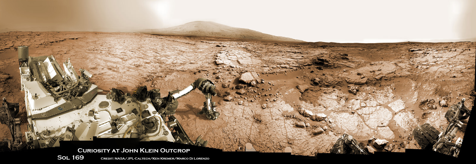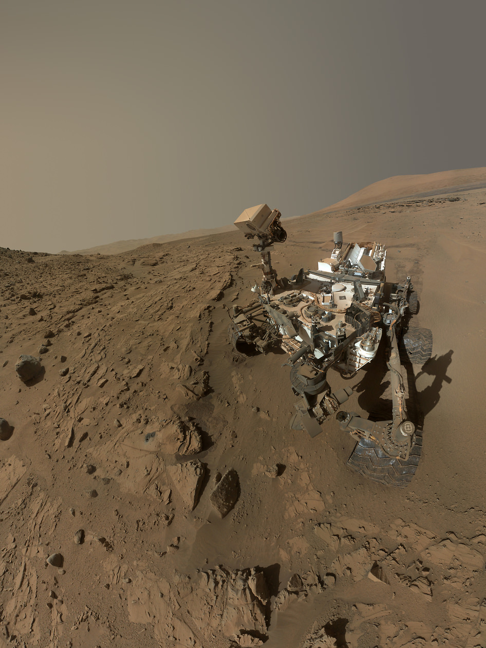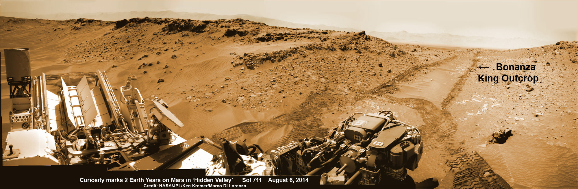
NASA’s Curiosity rover looks back to ramp with 4th drill site target at ‘Bonanza King’ rock outcrop in ‘Hidden Valley’ at site marking her 2nd anniversary on Mars, as shown in this photo mosaic view captured on Aug. 6, 2014, Sol 711. Note the rover’s partial selfie, valley walls, deep wheel tracks in the sand dunes and distant rim of Gale crater beyond the ramp. Navcam camera raw images stitched and colorized.
Credit: NASA/JPL-Caltech/Ken Kremer-kenkremer.com/Marco Di Lorenzo[/caption]
Not wanting to get stuck in a rut, Curiosity’s handlers have commanded NASA’s SUV-sized rover to reverse course and drive out of a potentially hazardous Martian valley of slippery sand with poor wheel traction and instead backtrack towards an enticing nearby spot that the team feels could be the fourth candidate for rock drilling – and thereby widen the scope of the story of habitable environments on the Red Planet.
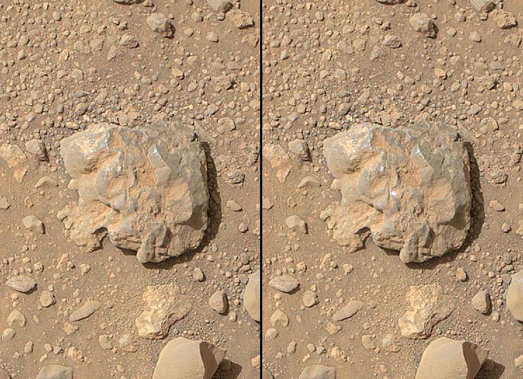
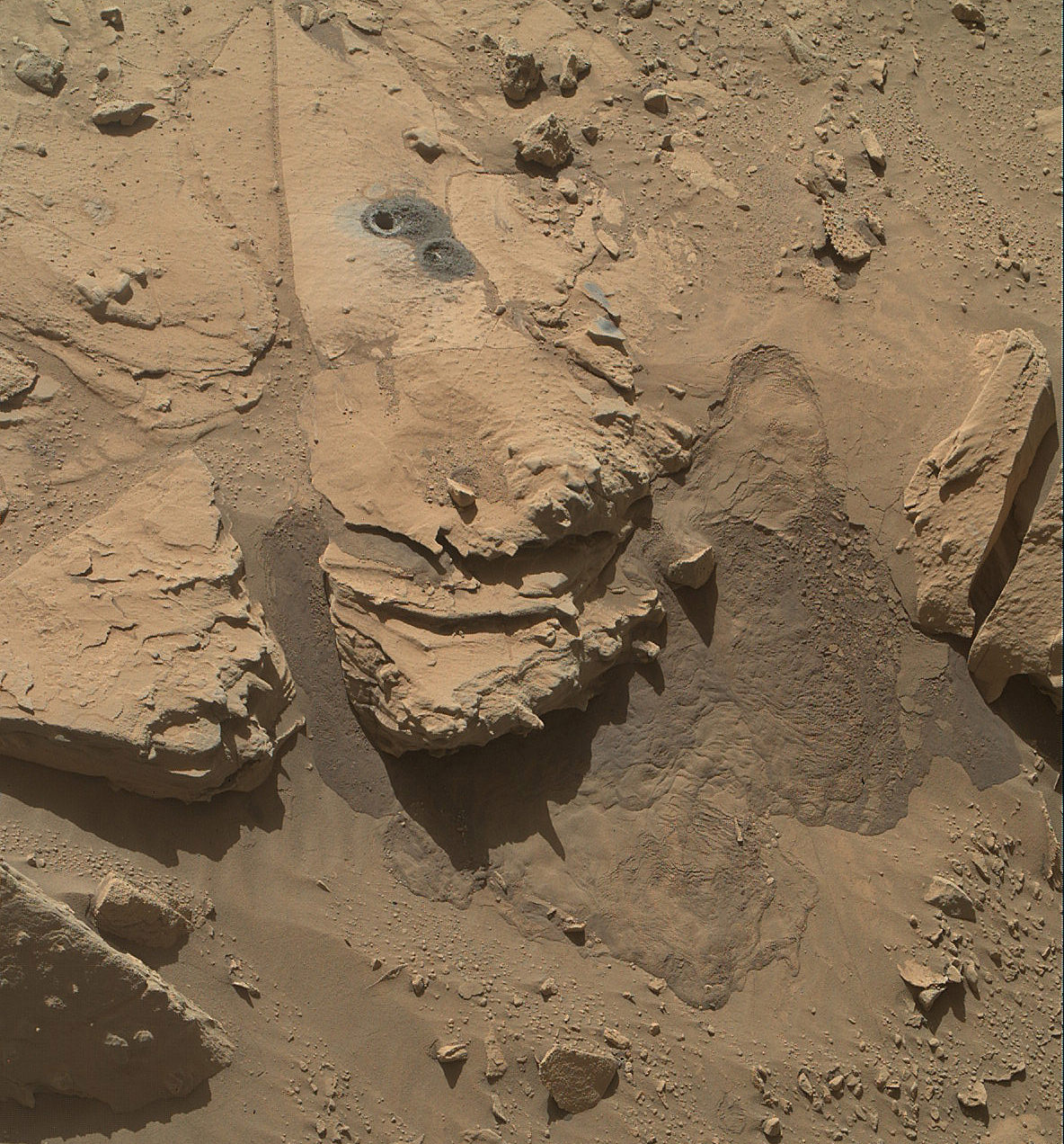
The new drilling target under up close evaluation right now is named ‘Bonanza King’ – shown in our photo mosaic above.
Bonanza King was chosen after the six wheeled rover unexpectedly experienced significant wheel slippage in the past week while driving over an extended dune field of sandy ripples that basically stopped forward movement inside the Martian valley.
The team was thus in a quandary over whether to push forward on a route through the loose sands of “Hidden Valley” and possibly risk getting mired in a hidden sand trap or drive backwards over a field of sharp rocks on the “Zabriskie plateau” and beyond that are certain to tear further holes in the wheels.

As reported here last week on the occasion of her 2nd anniversary on Mars since the dramatic touchdown inside Gale Crater on Aug. 6, 2012, Curiosity had been driving merrily through the supposed safe valley of sandy ripples of “Hidden Valley.” She was approaching a bedrock unit named “Pahrump Hills” that for the first time is actually part of the humongous mountain named Mount Sharp she will soon scale and which is the primary science destination of the mission.
But rather soon after driving over a low hump from Zabriskie plateau (see our mosaic below) into Hidden Valley, the robot experienced wheel slippage in the ripples of sand filling the crater floor which was much higher than anticipated. And even worse than comparable test drives in a practice sand lot at JPL.
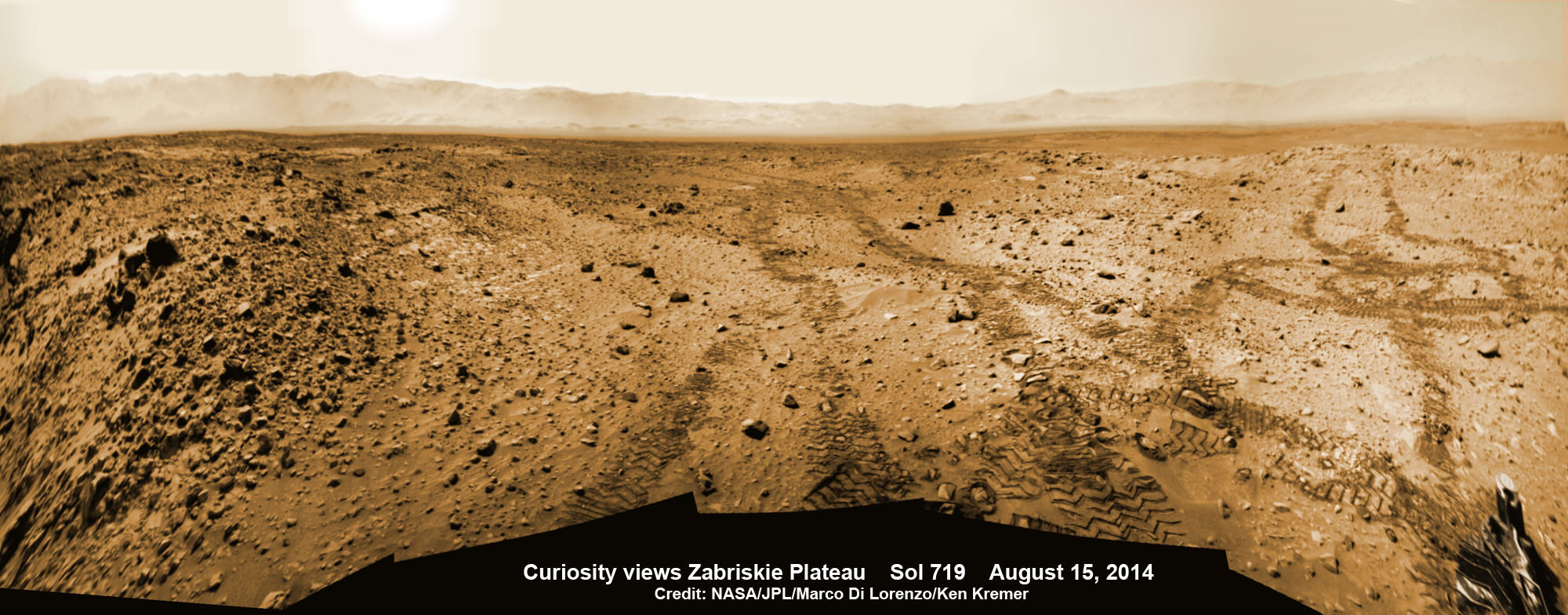
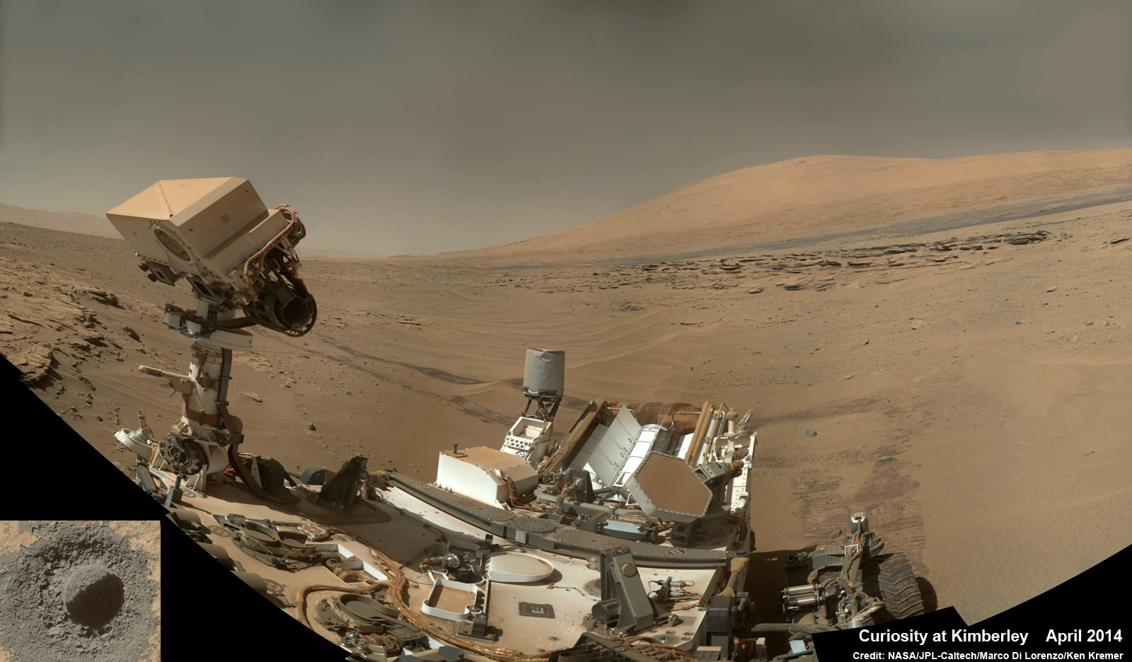
Credit: NASA/JPL-Caltech/Marco Di Lorenzo/Ken Kremer-kenkremer.com
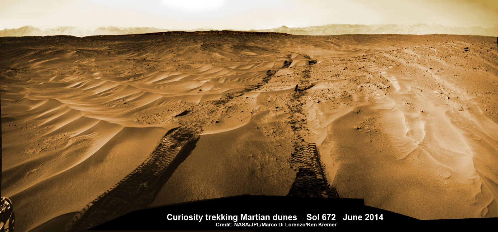
The sandy ripples extend out to the sloping valley walls with no end in sight.
“We need to gain a better understanding of the interaction between the wheels and Martian sand ripples, and Hidden Valley is not a good location for experimenting,” said Curiosity Project Manager Jim Erickson of NASA’s Jet Propulsion Laboratory in Pasadena, California, in a statement.
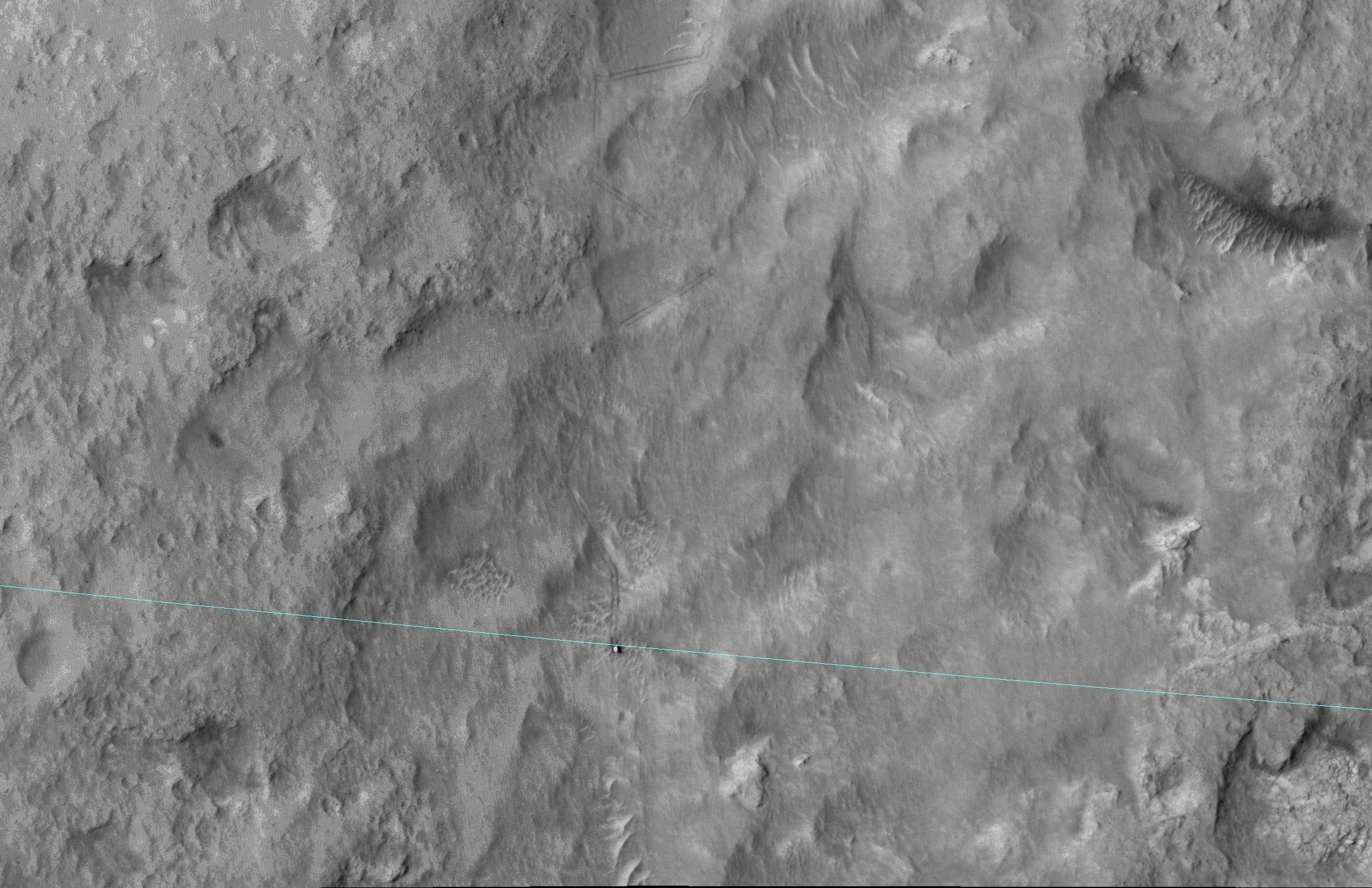
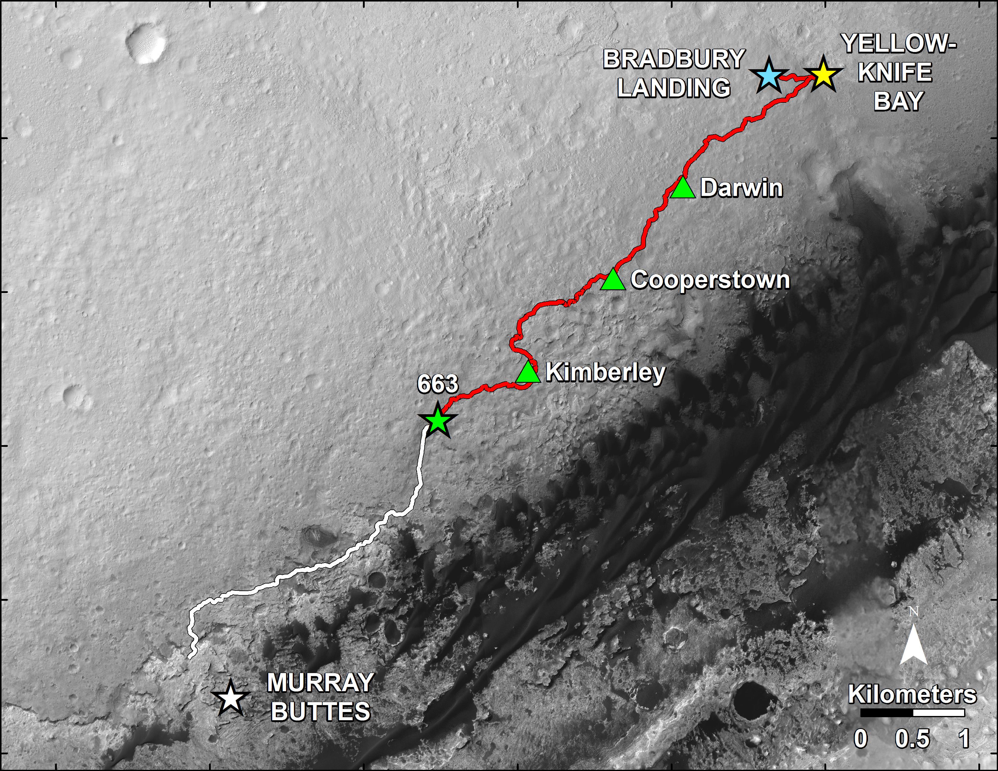
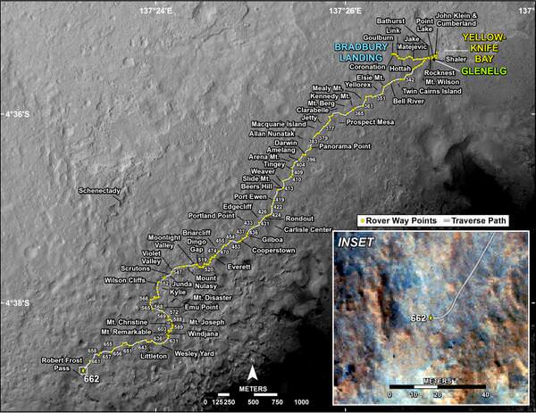
And since Hidden Valley is as long as a football field and has only two navigable exits at the northeastern and southwestern ends (see map below), the team was forced to drive back to the entrance way at the northern end to consider an alternative route forward to the base of Mount Sharp.
In the meantime while they evaluate the way forward, the team decided that Bonanza King offers similar science to what scientists anticipate at the outcrops at “Pahrump Hills”- a preview of a geological unit that is part of the base of Mount Sharp for the first time since landing rather than still belonging to the floor of Gale Crater.
“Geologically speaking, we can tie the Bonanza King rocks to those at Pahrump Hills. Studying them here will give us a head start in understanding how they fit into the bigger picture of Gale Crater and Mount Sharp,” said Curiosity Deputy Project Scientist Ashwin Vasavada of JPL, in a statement.
Bonanza King sits in an bright outcrop on the low ramp leading in and out of Hidden Valley.
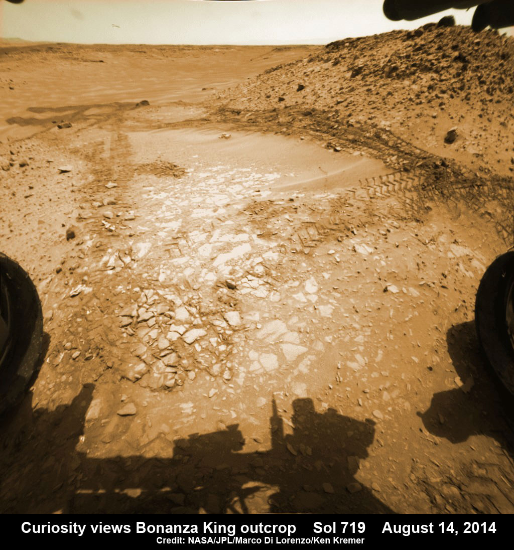
It looks like a pale paving stone. Since its location within the geological layers visible on the ramp is similar to what was expected at the Pahrump Hills outcrop, it’s very appealing to the science team.
Furthermore when one of the rovers wheel’s drove over the outcrop, it cracked open one of the rocks and exposed bright interior material, possibly from mineral veins – which is super exciting from a science perspective as a potential marker for flowing liquid water.
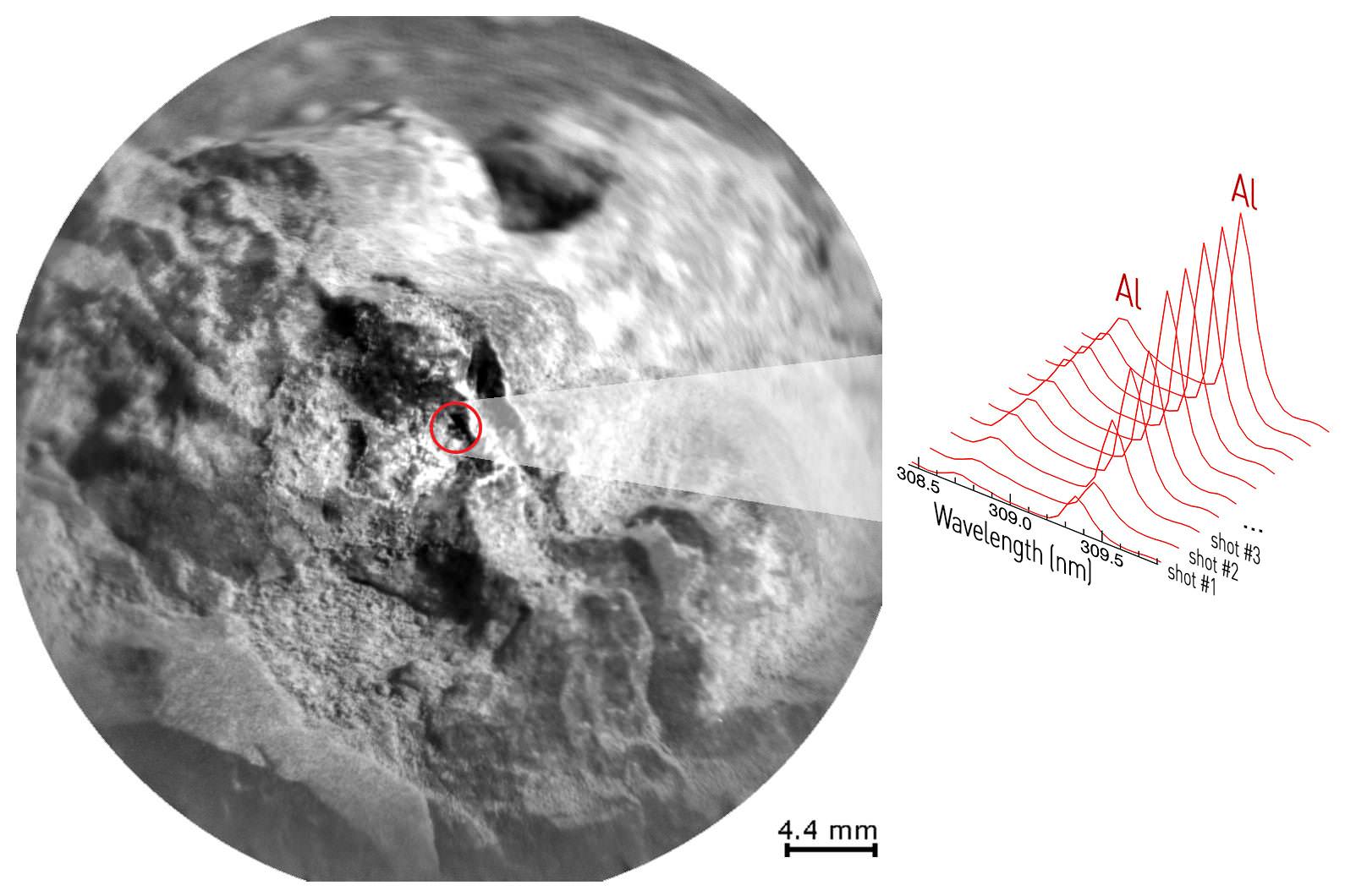
Right now the team is collecting spectral data with the science instruments to assess its science utility and is planning a super fast drilling campaign, far shorter than the prior three.
The plan would be to core a sample from the interior of the dinner plate sized rock slab for delivery to Curiosity’s pair of the onboard chemistry labs, SAM and CheMin to analyze for the chemical ingredients to support miartin microbes, if they ever existed.
“This outcrop on the ramp is too appealing to pass up,” Vasavada said.
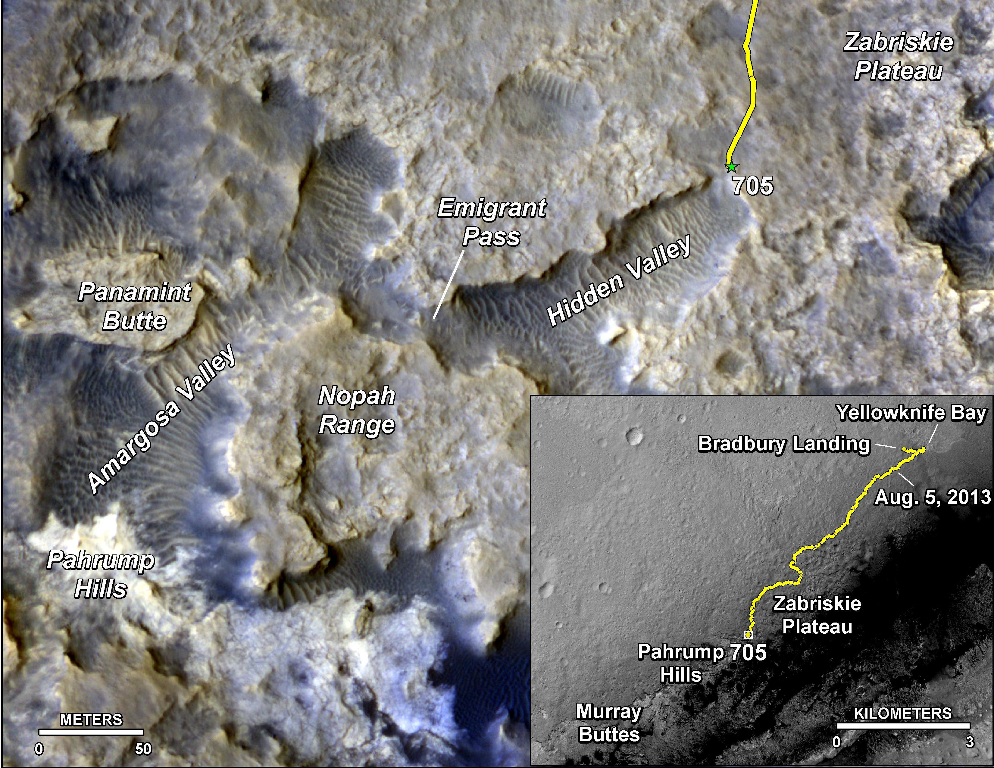
To date, Curiosity’s odometer totals over 5.5 miles (9.0 kilometers) since landing inside Gale Crater on Mars in August 2012. She has taken over 178,000 images.
Curiosity still has about another 2 miles (3 kilometers) to go to reach the entry way at a gap in the treacherous sand dunes at the foothills of Mount Sharp sometime later this year.
Mount Sharp is a layered mountain that dominates most of Gale Crater and towers 3.4 miles (5.5 kilometers) into the Martian sky and is taller than Mount Rainier.
“Getting to Mount Sharp is the next big step for Curiosity and we expect that in the Fall of this year,” Dr. Jim Green, NASA’s Director of Planetary Sciences at NASA Headquarters, Washington, DC, told me in an interview making the 2nd anniversary on Aug. 6.

Stay tuned here for Ken’s continuing Rosetta, Curiosity, Opportunity, Orion, SpaceX, Boeing, Orbital Sciences, Dream Chaser, commercial space, MAVEN, MOM, Mars and more planetary and human spaceflight news.
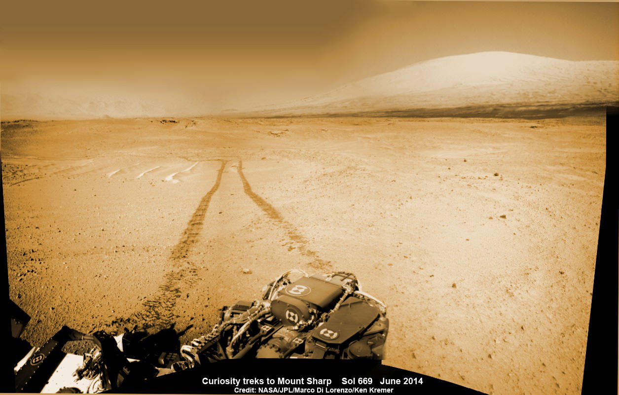
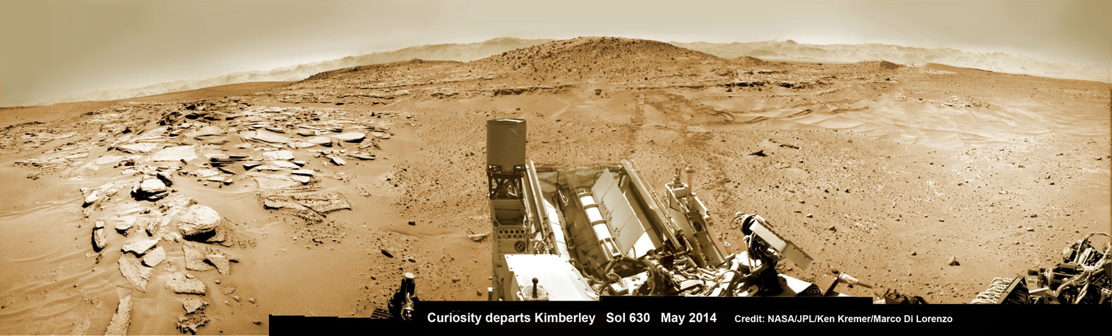
Curiosity treks to Mount Sharp in this photo mosaic view captured on Sol 669, June 24, 2014. Navcam camera raw images stitched and colorized. Credit: NASA/JPL-Caltech/Marco Di Lorenzo/Ken Kremer – kenkremer.com