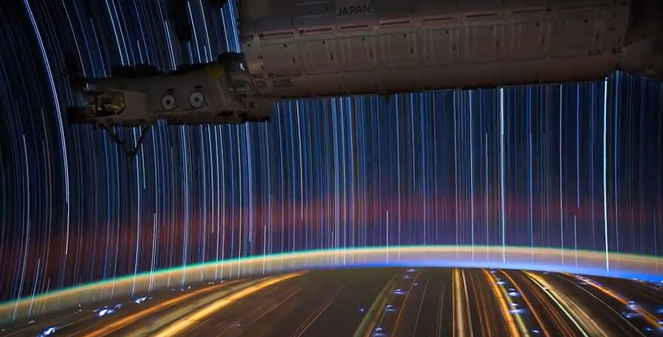
A timelapse photo taken by Don Pettit on the International Space Station. Credit: Don Pettit/NASA
When you’re flying above Earth in a spaceship or space station, taking a clear picture below is more than a point-and-shoot job. As NASA astronaut Don Pettit explains in this video, you need to account for the motion of your little craft to get the best pictures below. And Pettit should know, being a photographer who captured many stunning timelapses in space.
“Apart from everything else an astronaut does on orbit, photography is actually part of our job,” Pettit said in the video. “We take pictures of Earth and the surroundings of Earth, the upper atmosphere. These pictures, in themselves, represent a scientific dataset, recorded now for over 14 years.”
The video is called “From Above” and is a production of SmugMug films, who also did an interview with Pettit. As it turns out, much of the photography taken in space is not of Earth — it’s engineering photography of window smudges or electrical connections to help diagnose problems happening in space.
“These things need to be documented so the images can be downlinked for engineers on the ground to assess what’s happening to the systems on space station,” Pettit said in the interview. “We get training specifically on doing these engineering images, which, for the most part, are not really interesting to the public.”
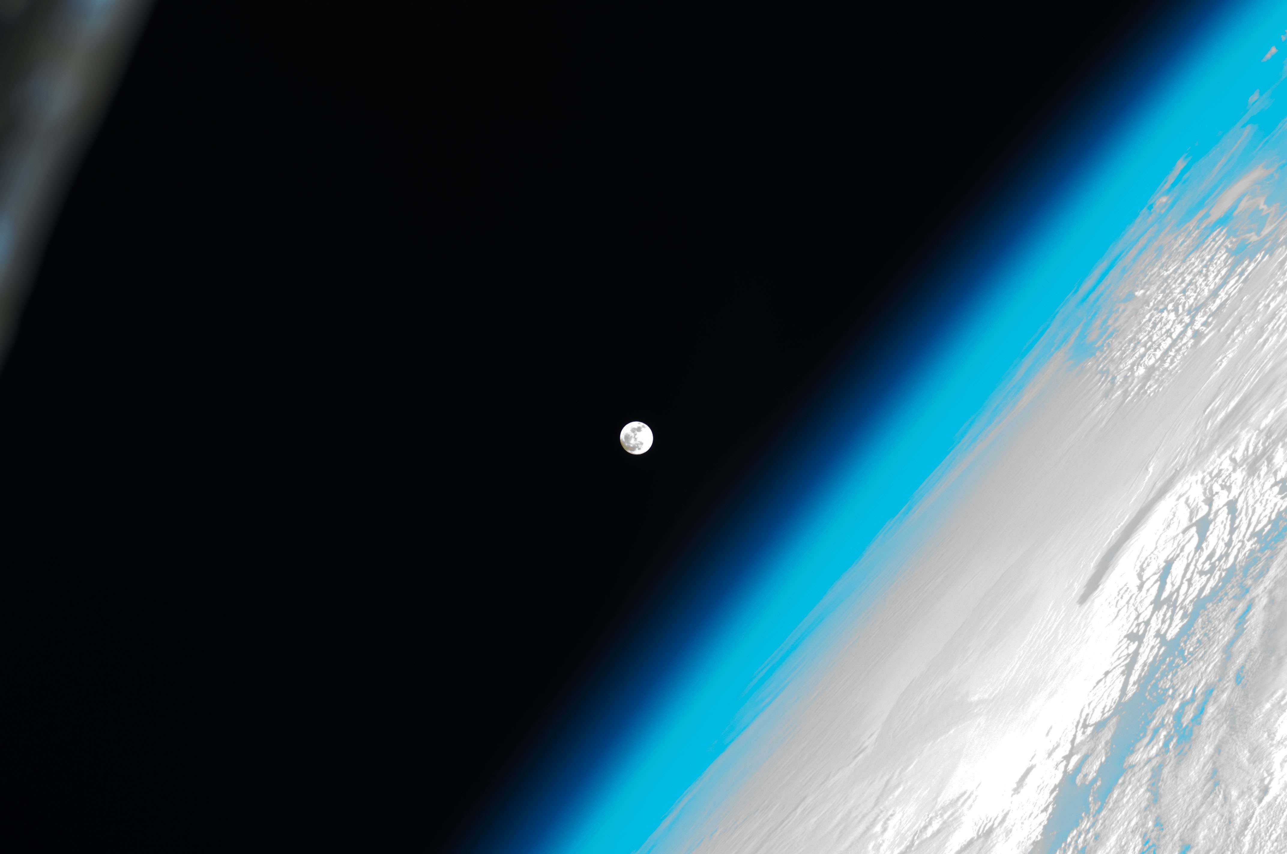
The Moon hovers Earth's atmosphere as seen from the International Space Station. Credit: NASA/ESA/Expedition 30 crew
[/caption]
A lovely view for the start of your week: The Moon and Earth’s atmosphere as seen from the International Space Station, taken by a member of the current Expedition 30 crew. See more images from the crew here.
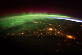
Aurora Borealis over Western Canada from the ISS Expedition 30 crew. Credit: NASA
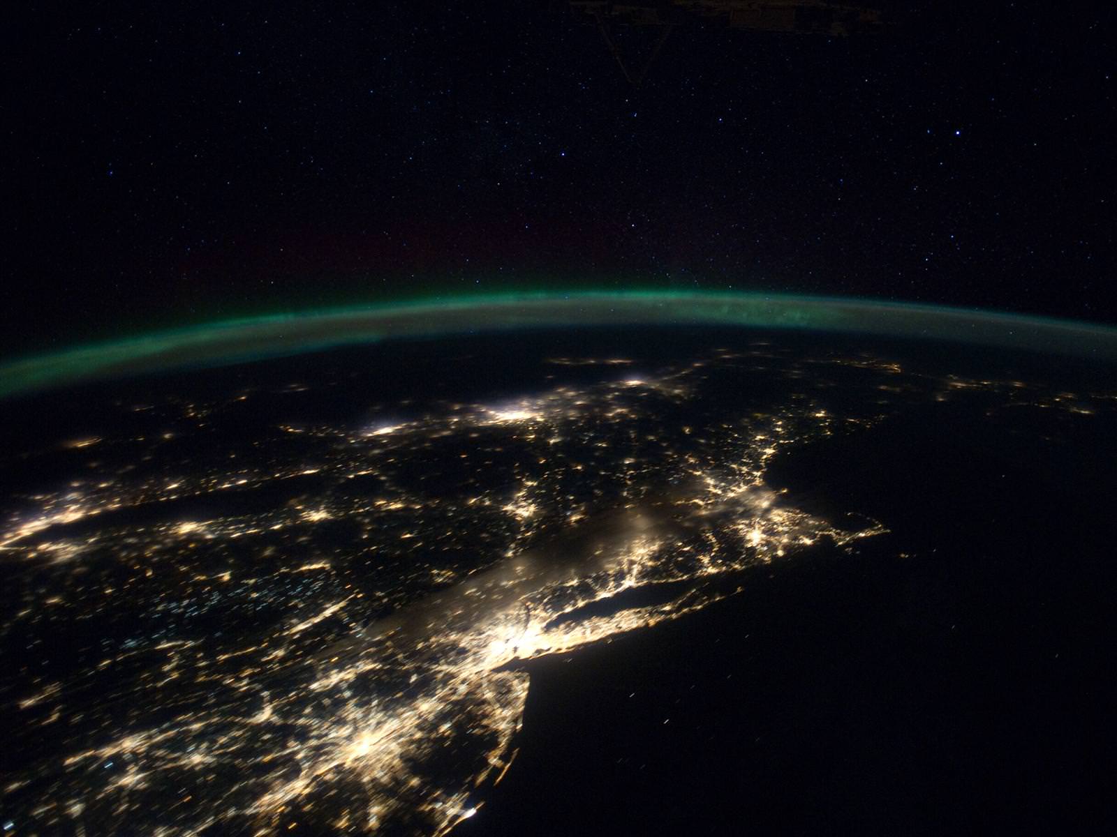
Video Caption: Up the East Coast of North America. Credit: NASA
The North American continent is literally set ablaze in a confluence of Auroral and Manmade light captured in spectacular new videos snapped by the astronauts serving aboard the International Space Station (ISS).
The Expedition 30 crew has recently filmed lengthy sequences of images that are among the most stunning ever taken by astronauts flying in orbit some 240 miles (385 kilometers) over the United States and Canada.
[/caption]
Teams working at the Crew Earth Observations center at NASA’s Johnson Space Center in Houston, Texas have assembled hundreds of individual still images taken onboard the ISS into a series of amazing videos.
Two videos collected here focus on the East and West coasts of North America and show the path traveled by the station from the crew’s perspective as they photographed the light emitted by hundreds of millions of humans living below and the brilliant light of the Aurora Borealis shining above them.
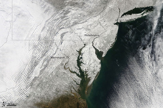
Night time Panorama of US East Coast from the ISS
Astronauts captured this stunning nighttime panorama of the major cities along the East Coast of the United States on Jan. 29. Credit: NASA
Now the NASA team has assembled the entire sequence of images taken on January 29, 2012 from 05:33:11 to 05:48:10 GMT into a video -see above.
The orbital pass runs from Central America just southwest of Mexico and continues to the North Atlantic Ocean, northeast of Newfoundland. It begins by looking over Central America towards the Gulf of Mexico and the southeastern United States. As the ISS travels northeast over the gulf, some southeastern United States cities can be distinguished, like New Orleans, Mobile, Jacksonville, and Atlanta. Continuing up the east coast, some northeastern states, like Washington, D.C., Baltimore, Philadelphia, and New York City stand out brightly along the coastline. The Aurora Borealis shines in the background as the pass finishes near Newfoundland
The 2nd video is titled “Across Southwest Canada at Night”
This sequence of shots was taken January 25, 2012 from 12:34:11 to 12:36:28 GMT, on a pass from near the border of British Columbia, Canada and Washington state, near Vancouver Island, to southern Alberta, near Calgary.
The main focus of this video is the Aurora Borealis over Canada, which appears very near the ISS during this short and exciting video.
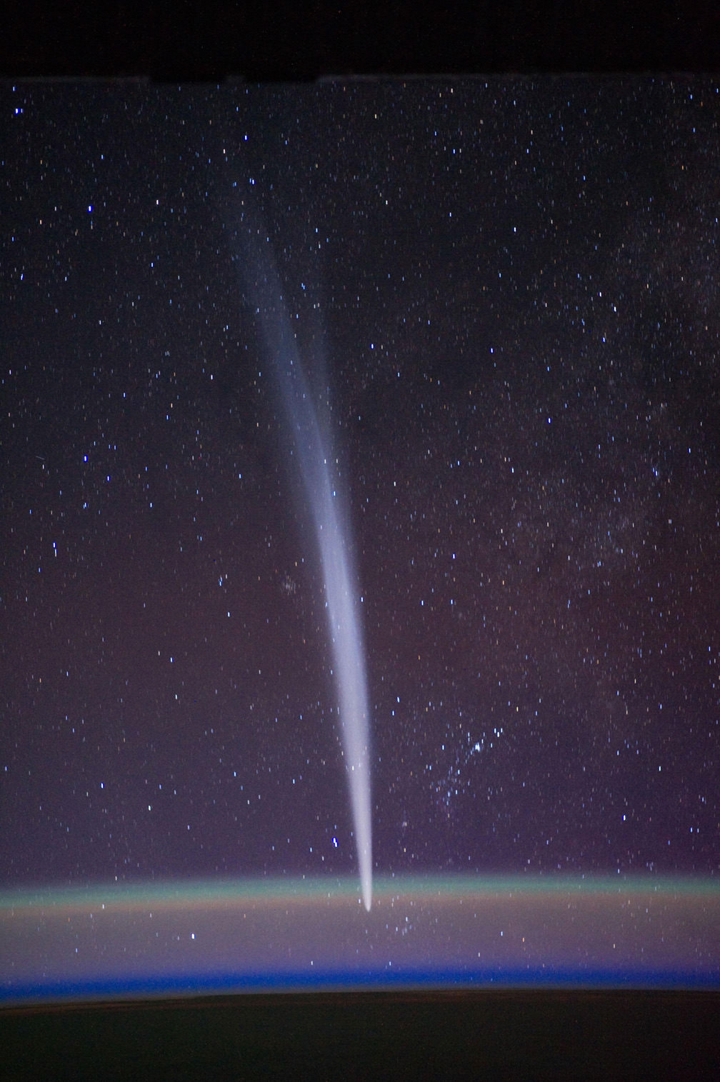
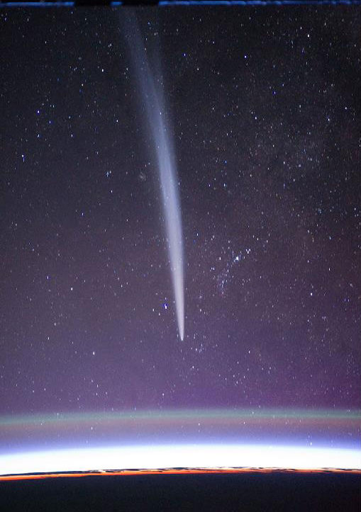
And don’t forget the fabulous ISS shots of Comet Lovejoy taken in December 2011 by Expedition 30 Commander Dan Burbank.
Comet Lovejoy on 22 Dec. 2011 from the International Space Station. Comet Lovejoy is visible near Earth’s horizon in this nighttime image photographed by NASA astronaut Dan Burbank, Expedition 30 commander, onboard the International Space Station on Dec. 22, 2011. Credit: NASA/Dan Burbank
For an otherworldly and eerie perspective, click here to see what a Manmade artifact on the surface of Mars looks like as seen from Mars Orbit – also taken just a few days ago on Jan. 29, 2012, but this time by a robot in place of a human !
Nighttime Panorama of US East Coast from the ISS. Astronauts aboard the International Space Station (ISS) captured this stunning nighttime panorama of the major cities along the East Coast of the United States on Jan. 29. Credit: NASA
[/caption]
Do you live here?
Tens of millions of Earthlings live and work in the bustling and seemingly intertwined American mega-metropolis of the Philadelphia-New York City-Boston corridor (bottom-center splotch) captured in this stunning “Cities at Night” panorama of the East Coast of the United States along the Atlantic seaboard (image above).
Look northward and you’ll see the home to millions more Earthlings inhabiting the brilliantly lit Canadian cities of Toronto (launch site for “Lego Man in Space“) and Montreal to the west of Lake Ontario (dark oval at left-center).
The gorgeous panorama showing a portion of the Earth at Night and the atmospheric limb and light activity from the Aurora Borealis was snapped by the Expedition 30 crew living and working aboard the million pound International Space Station (ISS) on Jan. 29.
Lately, the 6 man international crew of Expedition 30 from Russia, Holland and the US have been on a roll taking one after another magnificent Nighttime pictures of our Home Planet, Auroras’ and celestial wonders like Comet Lovejoy.
Be sure to take a comparative look at the recent panorama of Western Europe at Night snapped by the ISS crew a week before on Jan 22 – here.
To test your geography smarts, here’s a map of the US East Coast highlighting much of what’s visible in the ISS panorama.
This Earthling has lived in cities on the US East Coast and Western Europe – images above and below Western Europe at Night
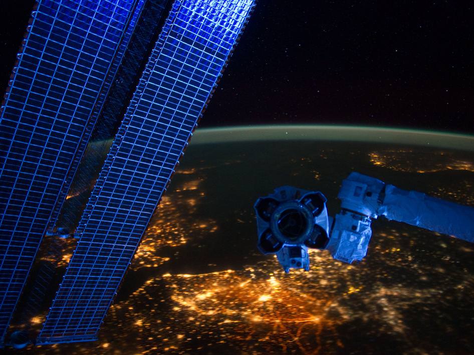
European ‘Cities at Night’ from the ISS with station solar arrays and robotic hand in foreground. Credit: NASA
Two years ago in Feb. 2010, the US East Coast was struck by “Snowmageddon”, and this is how we looked from space
Meanwhile, two of the Expedition 30 crew members, Russian Flight Engineers Oleg Kononenko and Anton Shkaplerov, are preparing for a spacewalk on Friday, Feb. 16. They will be installing equipment outside the ISS on the Russian Pirs, Poisk and Zvezda modules.
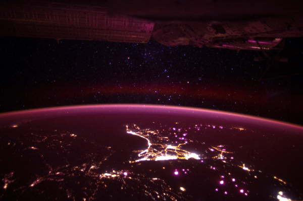
Western Europe at Night With hardware from the Earth-orbiting International Space Station appearing in the near foreground, a night time European panorama reveals city lights from Belgium and the Netherlands at bottom center. the British Isles partially obscured by solar array panels at left, the North Sea at left center, and Scandinavia at right center beneath the end effector of the Space Station Remote Manipulator System or Canadarm2. This image was taken by the station crew on Jan. 22, 2012. Credit: NASA
[/caption]
An amazing panorama revealing Western Europe’s ‘Cities at Night’ with hardware from the stations robotic ‘hand’ and solar arrays in the foreground was captured by the crew in a beautiful new image showing millions of Earth’s inhabitants from the Earth-orbiting International Space Station (ISS).
The sweeping panoramic vista shows several Western European countries starting with the British Isles partially obscured by twin solar arrays at left, the North Sea at left center, Belgium and the Netherlands (Holland) at bottom center, and the Scandinavian land mass at right center by the hand, or end effector, of the Canadian-built ISS robotic arm known as the Space Station Remote Manipulator System (SSRMS) or Canadarm2.
European Space Agency astronaut Andre Kuipers gazing at Earth from the Cupola dome of the ISS
Coincidentally European Space Agency astronaut Andre Kuipers from Holland (photo at left) is currently aboard the ISS, soaring some 400 kilometers (250 miles) overhead.
The panoramic image was taken by the ISS residents on January 22, 2012.
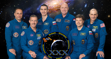
The Expedition 30 crew of six men currently serving aboard the ISS (photo below) hail from the US, Russia and Holland.
“Cities at Night” – Here’s a portion of a relevant ISS Blog post from NASA astronaut Don Pettit on Jan. 27, 2012:
“Cities at night are different from their drab daytime counterparts. They present a most spectacular display that rivals a Broadway marquee. And cities around the world are different. Some show blue-green, while others show yellow-orange. Some have rectangular grids, while others look like a fractal-snapshot from Mandelbrot space.”
“Patterns in the countryside are different in Europe, North America, and South America. In space, you can see political boundaries that show up only at night. As if a beacon for humanity, Las Vegas is truly the brightest spot on Earth. Cities at night may very well be the most beautiful unintentional consequence of human activity,” writes NASA astronaut Don Pettit currently residing aboard the ISS.
Comet Lovejoy on 22 Dec. 2011 from the International Space Station. Comet Lovejoy is visible near Earth’s horizon in this nighttime image photographed by NASA astronaut Dan Burbank, Expedition 30 commander, onboard the International Space Station on Dec. 22, 2011. Credit: NASA/Dan BurbankExpedition 30 Crew: Pictured on the front row are NASA astronaut Dan Burbank, commander; and Russian cosmonaut Oleg Kononenko, flight engineer. Pictured from the left (back row) are Russian cosmonauts Anton Shkaplerov and Anatoly Ivanishin; along with European Space Agency astronaut Andre Kuipers and NASA astronaut Don Pettit, all flight engineers. Photo credit: NASA and International Space Station partners
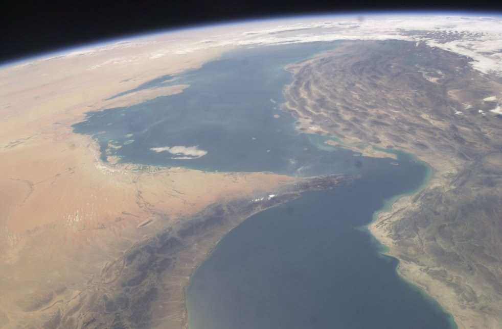
Christmas Eve photo of the Strait of Hormuz from the International Space Station. The image of the Strait of Hormuz (center) and the Persian Gulf region was shot on Christmas Eve, 24 December 2011. 20% of the world’ s oil supply passes through the Strait every day. Iran has threatened to close the Strait to oil shipments. Note the thin atmosphere and curvature of the Earth. ISS module above. Photo Credit: NASA
[/caption]A beautiful and peaceful Christmas-time picture of The Strait of Hormuz was shot from the International Space Station (ISS) soaring some 250 miles (400 kilometers) overhead on Christmas Eve, 24 Dec 2011.
Today, the economically vital Strait of Hormuz is a ‘Flashpoint of Tension’ between Iran and the US and much of the rest of the world community because of official threats by Iranian government officials to shut the highly strategic waterway to crude oil tankers that transport the lifeblood of the world’s economy.
The timely image above was just tweeted by NASA Astronaut Ron Garan who wrote; “Interesting peaceful pic of the #StraightofHormuz #FromSpace taken on Christmas Eve (12/24/11) from the #ISS”. Garan served aboard the ISS from April to September 2011 as a member of the Expedition 27/28 crews.
The Strait of Hormuz lies at the mouth of the Persian Gulf between Iran and the Arabian Peninsula and is a major chokehold of the world’s energy consumption.
At its narrowest point, the Strait is only 34 miles (54 kilometers) wide. The vital shipping lanes span barely 2 miles (3 kilometers) in width in each direction (see maps below).
See more ISS photos of the Persian Gulf region and the Strait, below.
Image of the Strait of Hormuz and Persian Gulf region
Taken from the International Space Station on Sept. 30, 2003. United Arab Emirates, Oman and Saudi Arabia at left, Iran at right. Credit: NASA
Each and every day, about 20% of the world’s daily petroleum consumption is shipped through the extremely narrow channel on gigantic Oil tankers. Any disruption of petroleum shipments would instantly send crude oil prices skyrocketing to exhorbitant levels that could wreak havoc and rapidly lead to a worldwide economic depression and a devastating war between Iran and the US and its allies.
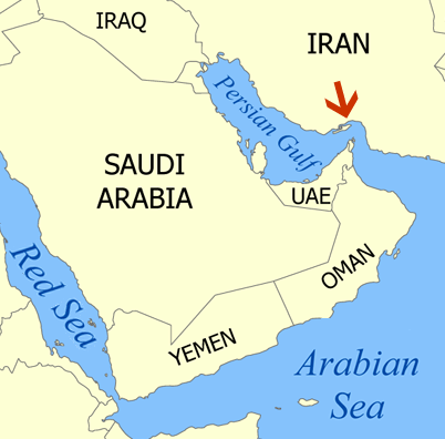
Red arrow indicates location of the Strait of Hormuz in relation to the Arabian Peninsula.
In recent days Iranian boats have approached US Naval warships at high speeds while they were heading through the Strait of Hormuz – playing a potentially deadly game of cat and mouse that could spin out of control in a single misstep, even if unintentional.
Clashes would easily disrupt the crude oil tanker shipping traffic.
Several Iranian speedboats came within about 800 yards of the US vessels in recent days as a war of words has flared over oil and Iran’s nuclear program as tensions escalate.
Video Caption: Iranian speedboats closely approach US Navy ships at high speed in the Strait of Hormuz on Jan. 6, 2012. Credit: US Dept of Defense
The US and allied fleet operates in the Gulf region to protect the oil shipments and the oil installations of a number of Arab countries including Saudi Arabia.
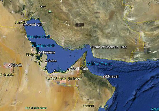
Persian Gulf and Strait of Hormuz from cargo bay of NASA Space Shuttle - May 27, 2000. Credit: NASA Map of Strait of Hormuz showing political boundaries and narrow maritime shipping lanes. Wikipedia
An international crew of six men from the US, Russia and Holland are currently in residence aboard the ISS running science experiments.
ISS Expedition 30 Commander and US astronaut Dan Burbank snapped gorgeous photos of Comet Lovejoy during this Christmas season – look here.
Strait of Hormuz and Persian Gulf region
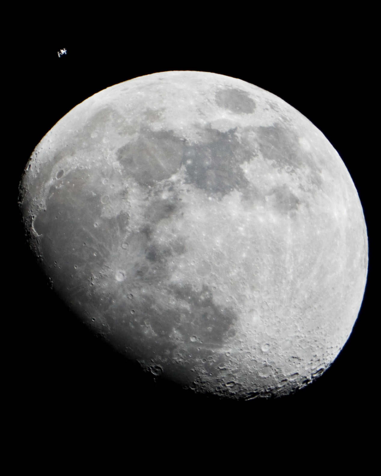
Look here for dazzling photos of the ISS crossing the Moon – shot just days ago from NASA’s Johnson Space Center in Houston
Moon and International Space Station from NASA Johnson Space Center, Houston, Texas. This photo was taken in the early evening of Jan. 4. Equipment: Nikon D3S, 600mm lens and 2x converter, Heavy Duty Bogen Tripod with sandbag and a trigger cable to minimize camera shake. Camera settings: 1/1600 @ f/8, ISO 2500 on High Continuous Burst. Credit: NASA
[/caption]
Has the International Space Station (ISS) secretly joined NASA’s newly arrived GRAIL lunar twins orbiting the Moon?
No – but you might think so gazing at these dazzling new images of the Moon and the ISS snapped by a NASA photographer yesterday (Jan. 4) operating from the Johnson Space Center in Houston, Texas.
Check out this remarkable series of NASA photos above and below showing the ISS and her crew of six humans crossing the face of Earth’s Moon above the skies over Houston, Texas. And see my shot below of the Moon near Jupiter – in conjunction- taken just after the two GRAIL spacecraft achieved lunar orbit on New Year’s weekend.
In the photo above, the ISS is visible at the upper left during the early evening of Jan. 4, and almost looks like it’s in orbit around the Moon. In fact the ISS is still circling about 248 miles (391 kilometers) above Earth with the multinational Expedition 30 crew of astronauts and cosmonauts hailing from the US, Russia and Holland.
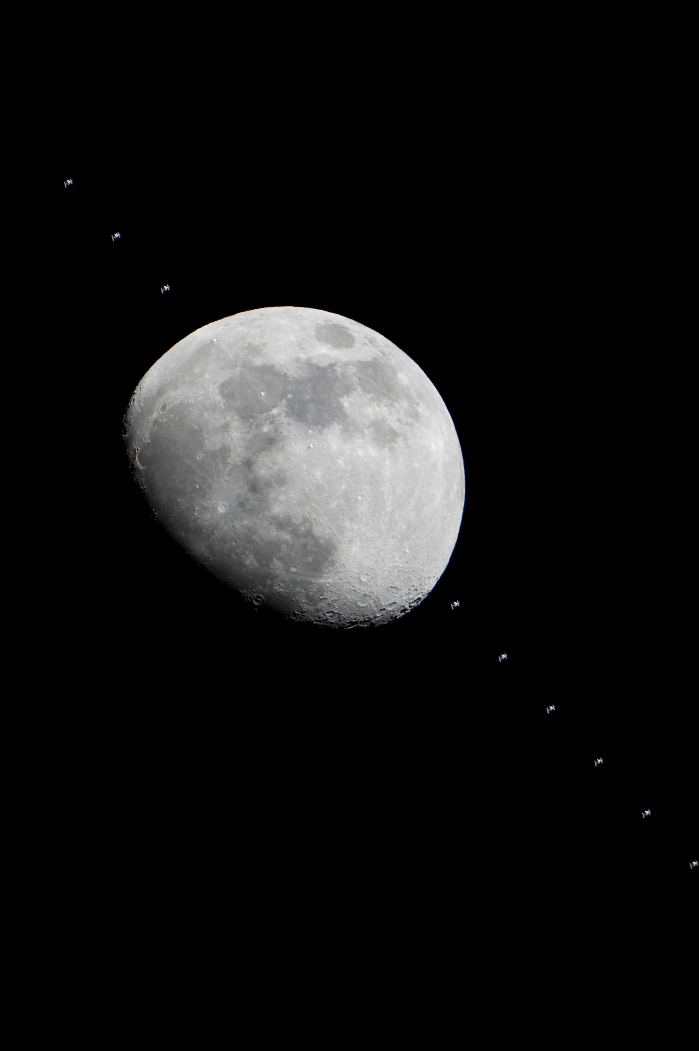
Space Station Crossing Face of Moon
This composite of images of the International Space Station flying over the Houston area show the progress of the station as it crossed the face of the moon in the early evening of Jan. 4, 2012 over NASA’s Johnson Space Center, Houston, Texas. Credit: NASA
click to enlarge
The amazing photo here is a composite image showing the ISS transiting the Moon’s near side above Houston in the evening hours of Jan 4.
The ISS is the brightest object in the night sky and easily visible to the naked eye if it’s in sight.
With a pair of binoculars, it’s even possible to see some of the stations structure like the solar panels, truss segments and modules.
Check this NASA Website for ISS viewing in your area.
How many of you have witnessed a sighting of the ISS?
It’s a very cool experience !
NASA says that some especially good and long views of the ISS lasting up to 6 minutes may be possible in the central time zone on Friday, Jan 6 – depending on the weather and your location.
And don’t forget to check out the spectacular photos of Comet Lovejoy recently shot by Expedition 30 Commander Dan Burbank aboard the ISS – through the Darth Vader like Cupola dome, and collected here
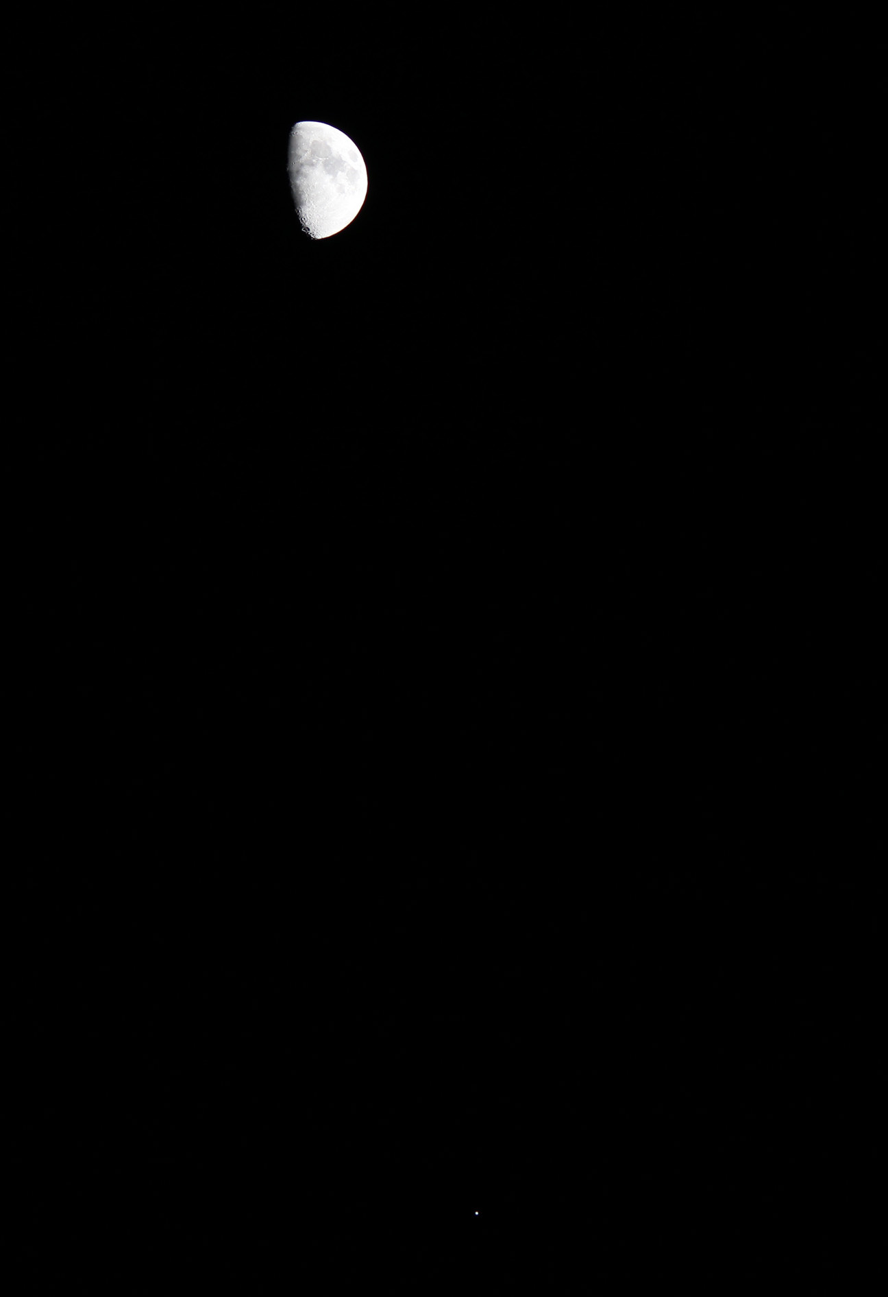
Moon and International Space Station (at lower right) on Jan 4, 2012 from NASA Johnson Space Center, Houston, Texas. Credit: NASA click to emlargeMoon, Jupiter and 2 GRAILs on Jan. 2, 2012
Taken near Princeton, NJ after both GRAIL spacecraft achieved lunar orbit after LOI - Lunar Orbit Insertion- burns on New Year’s weekend 2012. Credit: Ken Kremer
The three Expedition 29 astronauts have safely returned to Earth after spending nearly six months on the International Space Station. They landed to a cold and snowy Kazakhstan at 8:26 p.m. CST Nov. 21 (8:26 a.m. Kazakhstan time, Nov. 22). Video cameras on the space station captured the dramatic re-entry of the Soyuz capsule, and the fiery show was also visible to bystanders on the ground on the Russian central steppe. Continue reading “Video Shows Rare View of Soyuz Capsule Returning to Earth”