Did You Know the Earth Has a Second Magnetic Field? Its Oceans

The magnetic field and electric currents in and around Earth generate complex forces that have immeasurable impact on every day life. Credit: ESA/ATG medialab

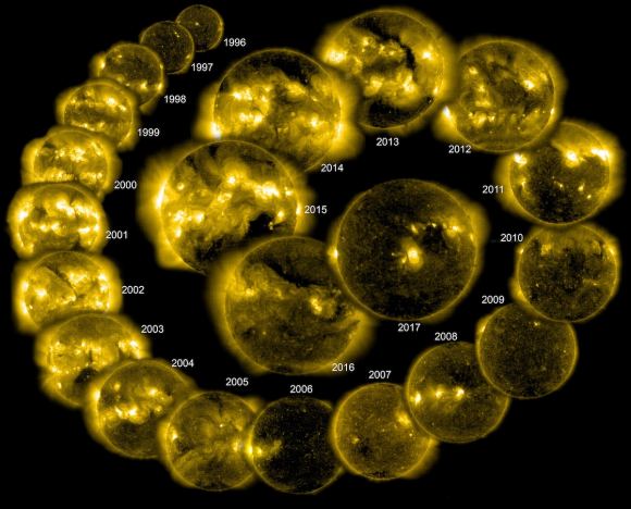
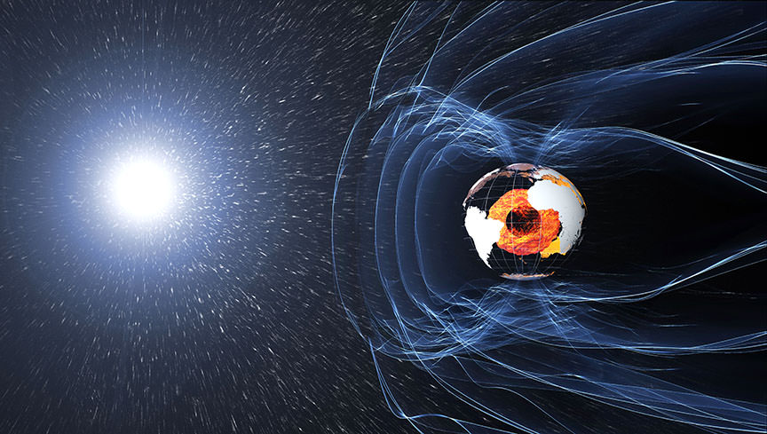
Earth’s magnetic field is one of the most mysterious features of our planet. It is also essential to life as we know it, ensuring that our atmosphere is not stripped away by solar wind and shielding life on Earth from harmful radiation. For some time, scientists have theorized that it is the result of a dynamo action in our core, where the liquid outer core revolves around the solid inner core and in the opposite direction of the Earth’s rotation.

In addition, Earth’s magnetic field is affected by other factors, such as magnetized rocks in the crust and the flow of the ocean. For this reason, the European Space Agency’s (ESA) Swarm satellites, which have been continually monitoring Earth’s magnetic field since its deployment, recently began monitoring Earth’s oceans – the first results of which were presented at this year’s European Geosciences Union meeting in Vienna, Austria.

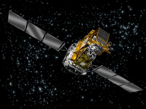
The Swarm mission, which consists of three Earth-observation satellites, was launched in 2013 for the sake of providing high-precision and high-resolution measurements of Earth’s magnetic field. The purpose of this mission is not only to determine how Earth’s magnetic field is generated and changing, but also to allow us to learn more about Earth’s composition and interior processes.

Artist’s impression of the ESA’s Swarm satellites, which are designed to measure the magnetic signals from Earth’s core, mantle, crust, oceans, ionosphere and magnetosphere. Credit: ESA/AOES Medialab

Beyond this, another aim of the mission is to increase our knowledge of atmospheric processes and ocean circulation patterns that affect climate and weather. The ocean is also an important subject of study to the Swarm mission because of the small ways in which it contributes to Earth’s magnetic field. Basically, as the ocean’s salty water flows through Earth’s magnetic field, it generates an electric current that induces a magnetic signal.

Because this field is so small, it is extremely difficult to measure. However, the Swarm mission has managed to do just that in remarkable detail. These results, which were presented at the EGU 2018 meeting, were turned into an animation (shown below), which shows how the tidal magnetic signal changes over a 24 hour period.

As you can see, the animation shows temperature changes in the Earth’s oceans over the course of the day, shifting from north to south and ranging from deeper depths to shallower, coastal regions. These changes have a minute effect on Earth’s magnetic field, ranging from 2.5 to -2.5 microtesla. As Nils Olsen, from the Technical University of Denmark, explained in a ESA press release:

“We have used Swarm to measure the magnetic signals of tides from the ocean surface to the seabed, which gives us a truly global picture of how the ocean flows at all depths – and this is new. Since oceans absorb heat from the air, tracking how this heat is being distributed and stored, particularly at depth, is important for understanding our changing climate. In addition, because this tidal magnetic signal also induces a weak magnetic response deep under the seabed, these results will be used to learn more about the electrical properties of Earth’s lithosphere and upper mantle.”

By learning more about Earth’s magnetic field, scientists will able to learn more about Earth’s internal processes, which are essential to life as we know it. This, in turn, will allow us to learn more about the kinds of geological processes that have shaped other planets, as well as determining what other planets could be capable of supporting life.

Be sure to check out this comic that explains how the Swarm mission works, courtesy of the ESA.

Further Reading: ESA

Tiangong-1 Splashes Down in the Pacific Ocean

Radar images acquired of China's Tiangong-1 space station by the Tracking and Imaging Radar system, which is operated by Germany’s Fraunhofer FHR research institute at Wachtberg. Credit: Fraunhofer FHR

Over the weekend, multiple space agencies’ had their instruments fixed on the skies as they waited for the Tiangong-1 space station to reenter our atmosphere. For the sake of tracking the station’s reentry, the ESA hosted the 2018 Inter Agency Space Debris Coordination Committee, an annual exercise that consists of experts from 13 space agencies taking part in a joint tracking exercise.

And on April 2nd, 02:16 CEST (April 1st, 17:16 PST), the US Air Force confirmed the reentry of the Tiangong-1 over the Pacific Ocean. As hoped, the station crashed down close to the South Pacific Ocean Unpopulated Area (SPOUA), otherwise known as the “Spaceship Cemetery”. This region of the Pacific Ocean has long been used by space agencies to dispose of spent spacecraft after a controlled reentry.

The confirmation came from the Joint Force Space Component Command (JFSCC) on April 2nd, 0:400 CEST (April 1st, 19:00 PST). Using the Space Surveillance Network sensors and their orbital analysis system, they were able to refine their predictions and provide more accurate tracking as the station’s reentry time approached. The USAF regularly shares information with the ESA regarding its satellites and debris tracking.

Artist’s illustration of China’s 8-ton Tiangong-1 space station, which is expected to fall to Earth in late 2017. Credit: CMSE

As with the ESA’s coordination with other space agencies and European member states, JFSCC’s efforts include counterparts in Australia, Canada, France, Germany, Italy, Japan, South Korea, and the United Kingdom. As Maj. Gen. Stephen Whiting, the Deputy Commander of the JFSCC and Commander of the 14th Air Force, indicated in a USAF press release:

“The JFSCC used the Space Surveillance Network sensors and their orbital analysis system to confirm Tiangong-1’s reentry, and to refine its prediction and ultimately provide more fidelity as the reentry time approached. This information is publicly-available on USSTRATCOM’s website www.Space-Track.org. The JFSCC also confirmed reentry through coordination with counterparts in Australia, Canada, France, Germany, Italy, Japan, South Korea, and the United Kingdom.”

The information is available on U.S. Strategic Command’s (USSTRATCOM) website – www.Space-Track.org. Holger Krag, the head of ESA’s Space Debris Office, confirmed the reentry of Tiangong-1 shortly thereafter on the ESA’s Rocket Science Blog. As he stated, the reentry was well within ESA’s earlier reentry forecast window – which ran from April 1st 23:00 UTC to 03:00 UTC on April 2nd (April 2nd, 01:00 CEST to 05:00 CEST):

“According to our experience, their assessment is very reliable. This corresponds to a geographic latitude of 13.6 degrees South and 164.3 degrees West – near American Samoa in the Pacific, near the international date Line. Both time and location are well within ESA’s last prediction window.”


Artist’s illustration of China’s 8-ton Tiangong-1 space space station. Credit: CMSE.

China’s Manned Space Agency (CMSA) also made a public statement about the station’s reenty:

“According to the announcement of China Manned Space Agency (CMSA), through monitoring and analysis by Beijing Aerospace Control Center (BACC) and related agencies, Tiangong-1 reentered the atmosphere at about 8:15 am, 2 April, Beijing time. The reentry falling area located in the central region of South Pacific. Most of the devices were ablated during the reentry process.”

As Krag noted, the ESA’s monitoring efforts were very much reliant on its campaign partners from around the world. In fact, due to when the station entered the Earth’s atmosphere, it was no longer visible to the Fraunhofer FHR institute’s Tracking and Imaging (TIRA) radar, which provides tracking services for the ESA’s Space Debris Office (SDO).

Had the station still been in orbit by 06:05 CEST (21:00 PST), it would have still been visible to the institute’s TIRA radar. Some unexpected space weather also played a role in the station’s reentry. On March 31st, the Sun’s activity spontaneously dropped, which delayed the Tiangong-1’s entry by about a day.

“This illustrates again the dependence that Europe has on non-European sources of information to properly and accurately manage space traffic, detect reentries such as Tiangong-1 and track space debris that remains in orbit – which routinely threatens ESA, European and other national civil, meteorological, scientific, telecomm and navigation satellites,” said Krag.

While news of the Tiangong-1’s orbital decay caused its share of concern, the reentry happened almost entirely as predicted and resulted in no harm. And once again, it demonstrated how international cooperation and public outreach is the best defense against space-related hazards.


Further Reading: Vandenburg Air Force Base,

Did You Know That a Satellite Crashes Back to Earth About Once a Week, on Average?

Artist's impression of all the space junk in Earth orbit. Credit: NASA

This past weekend, a lot of attention was focused on the Tiangong-1 space station. For some time, space agencies and satellite trackers from around the world had been predicting when this station would fall to Earth. And now that it has safely landed in the Pacific Ocean, many people are breathing a sigh of relief. While there was very little chance that any debris would fall to Earth, the mere possibility that some might caused its share of anxiety.

Interestingly enough, concerns about how and when Tiangong-1 would fall to Earth has helped to bring the larger issue of orbital debris and reentry into perspective. According to the SDO, on average, about 100 tonnes of space junk burns up in Earth’s atmosphere every year. Monitoring these reentries and warning the public about possible hazards has become routine work for space debris experts.

This junk takes the form of defunct satellites, uncontrolled spacecraft, the upper stages of spent rockets, and various discarded items (like payload covers). Over time, this debris is slowed down by Earth’s upper atmosphere and then succumbs to Earth’s gravitational pull. Where larger objects are concerned, some pieces survive the fiery reentry process and reach the surface.

Radar images acquired by the Tracking and Imaging Radar system – one of the world’s most capable – operated by Germany’s Fraunhofer FHR research institute. Credit: Fraunhofer FHR

In most cases, this debris falls into the ocean or lands somewhere far away from human settlement. While still in orbit, these objects are tracked by a US military radar network, the ESA’s Space Debris Office, and other agencies and independent satellite trackers. This information is shared in order to ensure that margins of error can be minimized and predicted reentry windows can be kept narrow.

For the SDO team, these efforts are based on data and updates provided by ESA member states and civil authorities they are partnered with, while additional information is provided by telescopes and other detectors operated by institutional and private researchers. One example is the Tracking and Imaging Radar (TIRA) operated by the Fraunhofer Institute for High Frequency Physics and Radar Techniques near Bonn, Germany.

This is a challenging task, and often subject to a measure of imprecision and guesswork. As Holger Krag, the head of ESA’s Space Debris Office, explained:

“With our current knowledge and state-of-the-art technology, we are not able to make very precise predictions. There will always be an uncertainty of a few hours in all predictions – even just days before the reentry, the uncertainty window can be very large. The high speeds of returning satellites mean they can travel thousands of kilometres during that time window, and that makes it very hard to predict a precise location of reentry.”

Tiangong-1 as seen in a a composite of three separate exposures taken on May 25, 2013. Credit and copyright: David Murr.

Of the 100 tonnes that enters our atmosphere every year, the vast majority are small pieces of debris that burn up very quickly – and therefore pose no threat to people or infrastructure. The larger descents, of which there are about 50 per year, sometimes result in debris reaching the surface, but these generally land in the ocean or remote areas. In fact, in the history of spaceflight, no casualties have ever been confirmed by falling space debris.

The ESA also takes part in a joint tracking campaign run by the Inter Agency Space Debris Coordination Committee, which consists of experts from 13 space agencies. In addition to the ESA, this committee includes several European space agencies, NASA, Roscosmos, the Canadian Space Agency, the Japanese Aerospace Exploration Agency, the Indian Space Research Organization, the China National Space Agency, and the State Space Agency of Ukraine.

The purpose of these campaigns is for space agencies to pool their respective tracking information from radar and other sources. In so doing, they are able to analyze and verify each other’s data and improve prediction accuracy for all members. The ESA hosted the 2018 campaign, which followed the reentry of China’s Tiangong-1 space station as it entered Earth’s atmosphere this weekend – the details of which are posted on the ESA’s Rocket Science blog.

“Today, everyone in Europe relies on the US military for space debris orbit data – we lack the radar network and other detectors needed to perform independent tracking and monitoring of objects in space,” said Krag. “This is needed to allow meaningful European participation in the global efforts for space safety.”

While predicting when and where space debris will reenter our atmosphere may not yet be an exact science, it does have one thing going for it – its 100% safety record. And as the Tiangong-1 descent showed, early warning and active tracking ensure that potential threats are recognized well in advance.

In the meantime, be sure to enjoy this video on the Space Debris Office’s reentry monitoring, courtesy of the ESA:

Further Reading: ESA

Here’s How to Follow the De-Orbit of Tiangong-1, now Estimated to Happen Between March 30 and April 2

Artist's illustration of China's 8-ton Tiangong-1 space station, which is expected to fall to Earth in late 2017. Credit: CMSE.

China’s Tiangong-1 space station has been the focus of a lot of international attention lately. In 2016, after four and half years in orbit, this prototype space station officially ended its mission. By September of 2017, the Agency acknowledged that the station’s orbit was decaying and that it would fall to Earth later in the year. Since then, estimates on when it will enter out atmosphere have been extended a few times.

According to satellite trackers, it was predicted that the station would fall to Earth in mid-March. But in a recent statement (which is no joke) the Chinese National Space Agency (CNSA) has indicated that Tiangong-1 will fall to Earth around April 1st – aka. April Fool’s Day. While the agency and others insists that it is very unlikely, there is a small chance that the re-entry could lead to some debris falling to Earth.

For the sake of ensuring public safety, the European Space Agency’s (ESA) Space Debris Office (SDO) has been providing regular updates on the station’s decay. According to the SDO, the reentry window is highly variable and spans from the morning of March 31st to the afternoon of April 1st (in UTC time). This works out to the evening of March 30th or March 31st for people living on the West Coast.

The possible re-entry region of the Tiangong-1 space station, indicated in green. Credit: ESA/SDO

As the ESA stated on their rocket science blog:

“Reentry will take place anywhere between 43ºN and 43ºS. Areas above or below these latitudes can be excluded. At no time will a precise time/location prediction from ESA be possible. This forecast was updated approximately weekly through to mid-March, and is now being updated every 1~2 days.”

In other words, if any debris does fall to the surface, it could happen anywhere from the Northern US, Southern Europe, Central Asia or China to the tip of Argentina/Chile, South Africa, or Australia. Basically, it could land just about anywhere on the planet. On the other hand, back in January, the US-based Aerospace Corporation released a comprehensive analysis on Tiangong-1s orbital decay.

Their analysis included a map (shown below) which illustrated the zones of highest risk. Whereas the blue areas (that make up one-third of the Earth’s surface) indicate zones of zero probability, the green area indicates a zone of lower probability. The yellow areas, meanwhile, indicates zones that have a higher probability, which extend a few degrees south of 42.7° N and north of 42.7° S latitude, respectively.

The Aerospace Corporations predicted reentry for Tiangong-1. Credit: aerospace.org

The Aerospace Corporation has also created a dashboard for tracking Tiangong-1 (which is refreshed every few minutes) and has come to similar conclusions about the station’s orbital decay. Their latest prediction is that the station will descend into our atmosphere on April 1st, at 04:35 UTC (March 30th 08:35 PST), with a margin of error of about 24 hours – in other words, between March 30th to April 2nd.

And they are hardly alone when it comes to monitoring Tiangong-1’s orbit and predicting its descent. The China Human Spaceflight Agency (CMSA) recently began providing daily updates on the orbital status of Tiangong-1. As they reported on March 28th: “Tiangong-1 stayed at an average altitude of about 202.3 km. The estimated reentry window is between 31 March and 2 April, Beijing time.”

The US Space Surveillance Network, which is responsible for tracking artificial objects in Earth’s orbit, has also been monitoring Tiangong-1 and providing daily updates. Based on their latest tracking data, they estimate that the station will enter our atmosphere no later than midnight on April 3rd.

Naturally, one cannot help but notice that these predictions vary and are subject to a margin of error. In addition, trackers cannot say with any accuracy where debris – if any – will land on the planet. As Max Fagin – an aerospace engineer and space camp alumni – explained in a recent Youtube video (posted below), all of this arises from two factors: the station’s flight path and the Earth’s atmosphere.

Basically, the station is still moving at a velocity of 7.8 km/sec (4.8 mi/s) horizontally while it is descending by about 3 cm/sec. In addition, the Earth’s atmosphere shrinks and expands throughout the day in response to the Sun’s heating, which results in changes in air resistance. This makes the process of knowing where the station’s will make its descent difficult to predict, not to mention where debris could fall.

However, as Fagin goes on to explain, once the station reaches an altitude of 150 km (93 mi) – i.e. within the Thermosphere – it will begin falling much faster. At that point, it be much easier to determine where debris (if any) will fall. However, as the ESA, CNSA, and other trackers have emphasized repeatedly, the odds of any debris making it to the surface is highly unlikely.

If any debris does survive re-entry, it is also statistically likely to fall into the ocean or in a remote area – far away from any population centers. But in all likelihood, the station will break up completely in our atmosphere and produce a beautiful streaking effect across the sky. So if you’re checking the updates regularly and are in a part of the world where it can be seen, be sure to get outside and see it!

Further Reading: GB Times

This Bizarre Image is a 3D Scan of a Cave Network in Spain. This Technology Could be Used to Map Out Lava Tubes on the Moon and Mars

The intricate 3D map of the La Cueva de Los Verdes lava tube system in Lanzarote, Spain. Credit: Vigea – Tommaso Santagata

For some time, scientists have known that the Moon and Mars have some fascinating similarities to Earth. In addition to being similar in composition, there is ample evidence that both bodies had active geological pasts. This includes stable lava tubes which are very similar to those that exist here on Earth. And in the future, these tubes could be an ideal location for outposts and colonies.

However, before we can begin choosing where to settle, these locations need to be mapped out to determining which would be suitable for human habitation. Luckily, a team of speleologists (cave specialists), geologists and ESA astronauts recently created the largest 3D image of a lava tube ever created. As part of the ESA’s PANGAEA program, this technology could one day help scientists map out cave systems on the Moon and Mars.

The lava tube in question was the La Cueva de Los Verdes, a famous tourist destination in Lanzarote, Spain. In addition to ESA astronaut Matthias Mauer, the team consisted of Tommaso Santagata (a speleologist from the University of Padova and the co-founder of the Virtual Geographic Agency), Umberto Del Vecchio and Marta Lazzaroni – a geologists and a masters student from the University of Padova, respectively.

Testing out the Leica BLK360 in La Cueva de los Verdes lava tube in Lanzarote, Spain. Credit and Copyright: ESA – Alessio Romeo

Last year, the team mapped the path of this cave system as part of the ESA’s 2017 Pangaea-X campaign. As one of many ESA Spaceflight Analog field campaigns, the purpose of Pangaea-X is to conduct experiments designed to improve the future of the ESA’s Planetary ANalogue Geological and Astrobiological Exercise for Astronauts (PANGAEA) training course.

For five days in November 2017, this campaign mobilized 50 people, four space agencies and 18 organizations in five different locations. The La Cueva de los Verdes lava tube was of particular importance since it is one of the world’s largest volcanic cave complexes, measuring roughly 8 km in length. Some of these caves are even large enough to accommodate residential streets and houses.

During the campaign, Mauer, Santagata, Vecchio and Lazzaroni relied on two instruments to map the lava tube in detail. These included the Pegasus Backpack, a wearable mapping solution that collects geometric data without a satellite ad synchronizes images collected by five cameras and two 3D imaging laser profilers, and the Leica BLK360 – the smallest and lightest imaging scanner on the market.

In less than three hours, the team managed to map all the contours of the lava tube. And while the results of the campaign continue to be analyzed, the team chose to use the data they obtained to produce a 3D visual of all the twists and turns of the lava tube. The scan that resulted covers a 1.3 km section of the cave system with an unprecedented resolution of a few centimeters.

Santagata and the Virtual Geography Agency also turned their 3D visual into a lovely video titled “Lave tube fly-through”, which beautifully illustrates the winding and organic nature of the lava tube system.  This video was posted to the ESA’s twitter feed on Tuesday, March 13th (shown above). This video, like the scans that preceded it, represent a breakthrough in geological mapping and astronaut training.

While lava tubes have been mapped since the 1970s, a clear view of this subterranean passage has remained elusive until now. Beyond being the first, the scans the team conducted could also help scientists to study the origins of the cave system, its peculiar formations, and assist local institutions in protecting the subterranean environment. As intended, the scans could also assist future space exploration and colonization efforts.

Pangaea-X arrives at the entrance to La Cueva de los Verdes lava tube. Credit and Copyright: ESA–Robbie Shone

For instance, the 8 km lava tube has both dry and water-filled sections. In the six-kilometer dry section, the lava tube has natural openings (jameos), that are aligned along the top of the cave pathway. These formations are very similar to “skylights” that have been observed on the Moon and Mars, which are holes in the surface that open into stable lava tubes.

Such structures are considered to be a good place for building outposts and colonies since they are naturally shielded from radiation and micrometeorites. Lava tubes also have a constant temperature, therefore offering protection against environmental extremes, and could provide access to underground sources of water ice. Some sections could also be sealed off and pressurized to create a colony.

As such, exploring such environments here on Earth is a good way to train astronauts to explore them on other bodies. As all astronauts know, mapping an environment is the first step in exploration, especially when you are looking for a place to establish a base camp. And in time, this information can be used to establish more permanent settlements, giving rise to eventual colonization.

Further Reading: ESA, Blogs ESA

Air-Breathing Electric Thruster Could Keep Satellites in Low Earth Orbit for Years

An ESA-led team has built and fired an electric thruster to ingest scarce air molecules from the top of the atmosphere as propellant, opening the way to satellites flying in very low orbits for years on end. Credit: ESA/Sitael

When it comes to the future of space exploration, one of the greatest challenges is coming up with engines that can maximize performance while also ensuring fuel efficiency. This will not only reduce the cost of individual missions, it will ensure that robotic spacecraft (and even crewed spacecraft) can operate for extended periods of time in space without having to refuel.

In recent years, this challenge has led to some truly innovative concepts, one of which was recently build and tested for the very first time by an ESA team. This engine concept consists of an electric thruster that is capable of “scooping” scarce air molecules from the tops of atmospheres and using them as propellant. This development will open the way for all kinds of satellites that can operate in very low orbits around planets for years at a time.

The concept of an air-breathing thruster (aka. Ram-Electric Propulsion) is relatively simple. In short, the engine works on the same principles as a ramscoop (where interstellar hydrogen is collected to provide fuel) and an ion engine – where collected particles are charged and ejected. Such an engine would do away with onboard propellant by taking in atmospheric molecules as it passed through the top of a planet’s atmosphere.

The test set-up for the air-breathing electric propulsion thruster recently developed by Sitael and QuinteScience in conjunction with the ESA. Credit: ESA/Sitael

The concept was the subject of a study titled “RAM Electric Propulsion for Low Earth Orbit Operation: An ESA Study“, which was presented at the 30th International Electric Propulsion Conference in 2007. The study emphasized how “Low Earth orbit satellites are subject to atmospheric drag and thus their lifetimes are limited with current propulsion technologies by the amount of propellant they can carry to compensate for it.”

The study’s authors also indicated how satellites using high specific impulse electric propulsion would be capable of compensating for drag during low altitude operation for an extended period of time. But as they conclude, such a mission would also be limited to the amount of fuel it could carry. This was certainly the case for the ESA’s Gravity field and steady-state Ocean Circulation Explorer (GOCE) gravity-mapper satellite,

While GOCE remained in orbit of Earth for more than four years and operated at altitudes as low as 250 km (155 mi), its mission ended the moment it exhausted its 40 kg (88 lbs) supply of xenon as propellant. As such, the concept of an electric propulsion system that an utilize atmospheric molecules as propellant has also been investigated. As Dr. Louis Walpot of the ESA explained in an ESA press release:

“This project began with a novel design to scoop up air molecules as propellant from the top of Earth’s atmosphere at around 200 km altitude with a typical speed of 7.8 km/s.”

Diagram illustrated how air-breathing electric propulsion works. Credit: ESA–A. Di Giacomo

To develop this concept, the Italian aerospace company Sitael and the Polish aerospace company QuinteScience teamed up to create a novel intake and thruster design. Whereas QuinteScience built an intake that would collect and compress incoming atmospheric particles, Sitael developed a dual-stage thruster that would charge and accelerate these particles to generate thrust.

The team then ran computer simulations to see how particles would behave across a range of intake options. But in the end, they chose to conduct a practice test to see if the combined intake and thruster would work together or not. To do this, the team tested it in a vacuum chamber at one of Sitael’s test facilities. The chamber simulated an environment at 200 km altitude while a “particle flow generator” provided the oncoming high-speed molecules.

To provide a more complete test and make sure the thruster would function in a low-pressure environment, the team began by igniting it with xenon-propellant. As Dr. Walpot explained:

“Instead of simply measuring the resulting density at the collector to check the intake design, we decided to attach an electric thruster. In this way, we proved that we could indeed collect and compress the air molecules to a level where thruster ignition could take place, and measure the actual thrust. At first we checked our thruster could be ignited repeatedly with xenon gathered from the particle beam generator.”

Fired at first using standard xenon propellant, the test thruster was then shifted to atmospheric air, proving the principle of air-breathing electric propulsion. Credit: ESA

As a next step, the team partially replace xenon with a nitrogen-oxygen air mixture to simulate Earth’s upper atmosphere. As hoped, the engine kept firing, and the only thing that changed was the color of the thrust.

“When the xenon-based blue color of the engine plume changed to purple, we knew we’d succeeded,” said Dr. Walpot. “The system was finally ignited repeatedly solely with atmospheric propellant to prove the concept’s feasibility. This result means air-breathing electric propulsion is no longer simply a theory but a tangible, working concept, ready to be developed, to serve one day as the basis of a new class of missions.”

The development of air-breathing electric thrusters could allow for an entirely new class of satellite that could operate with the fringes of Mars’, Titan’s and other bodies atmospheres for years at a time. With this kind of operational lifespan, these satellites could gather volumes of data on these bodies’ meteorological conditions, seasonal changes, and the history of their climates.

Such satellites would also be very useful when it comes to observing Earth. Since they would be able to operate at lower altitudes than previous missions, and would not be limited by the amount of propellant they could carry, satellites equipped with air-breathing thrusters could operate for extended periods of time. As a result, they could offer more in-depth analyses on Climate Change, and monitor meteorological patterns, geological changes, and natural disasters more closely.

Further Reading: ESA

Astronomers See A Dead Star Come Back To Life Thanks To A Donor Star

The ESA INTEGRA observatory has witnessed a "zombie" neutron star being re-energized by the solar wind of its companion red giant star, and coming back to life in a burst of x-rays. Image: ESA

It’s not exactly an organ donor, but a star in the direction of the hyper-populated core of the Milky Way donating some of its mass to a dormant neighbor. The result? The dormant neighbor sprung back to life with an X-ray burst captured by the ESA‘s INTEGRAL (INTErnational Gamma-Ray Astrophysics Laboratory) space observatory.

“INTEGRAL caught a unique moment in the birth of a rare binary system” – Enrico Bozzo, University of Geneva.

The neighbors have likely been paired together for billions of years, which is not in itself noteworthy: stars often live in binary pairs. But the pair spotted by INTEGRAL on August 13th 2017 is very unusual. The donor star is a red giant, and the recipient is a neutron star. So far, astronomers only know of 10 of these pairs, called ‘symbiotic X-ray binaries’.

To understand what’s happening between these neighbors, we have to look at stellar evolution.

The donor star is in its red giant phase. That’s when a star in the same mass range as our star reaches the later stage of its life. As its mass is depleted, gravity can’t hold the star together in the same way it has for the early part of its life. The star expands outwards by millions of kilometers. As it does so, it sheds stellar material from its outer layers in a solar wind that travels several hundreds of km/sec.

The red giant and the neutron star may have traveled different evolutionary pathways, but proximity made them partners. Image: ESA

Its neighbor is in a different state. It’s a star that had an initial mass of about 25 to 30 times the Sun. When a star this big approaches the end of its life, it suffers a different fate. Stars this large live fast, and burn through their fuel quickly. Then, they explode as supernovae, in this case leaving a corpse behind. In the binary system captured by INTEGRAL, the corpse is a spinning neutron star with a magnetic field.

Neutron stars are dense. In fact, they’re some of the densest stellar objects we know of, packing as much mass as one-and-a-half of our Suns into an object that’s only about 10 km across.
When the red giant’s stellar wind met the neutron star, the neutron star slowed its rate of spin, and burst into life, emitting high-energy x-rays.

“INTEGRAL caught a unique moment in the birth of a rare binary system,” says Enrico Bozzo from University of Geneva and lead author of the paper that describes the discovery. “The red giant released a sufficiently dense slow wind to feed its neutron star companion, giving rise to high-energy emission from the dead stellar core for the first time.”

After INTEGRAL spotted the x-ray burst from the binary, other observations quickly followed. The ESA’s XMM Newton and NASA’s NuSTAR and Swift space telescopes got to work, along with ground-based telescopes. These observations confirmed what initial observations showed: this is a very peculiar pair of stars.

“…we believe we saw the X-rays turning on for the first time.” – Erik Kuulkers, ESA INTEGRAL Project Scientist.

The neutron star spins very slowly, taking about 2 hours to revolve, which is remarkable since other neutron stars can spin many times per second. The magnetic field of the neutron star was also much stronger than expected. But the magnetic field around a neutron star is thought to weaken over time, making this a relatively young neutron star. And a red giant is old, so this is a very odd pairing of old red giant with young neutron star.

One possible explanation is that the neutron star didn’t form from a supernova, but from a white dwarf. In that scenario, the white dwarf would’ve collapsed into a neutron star after a very long period of feeding on material from the red giant. That would explain the disparity in ages of the two stars in the system.

An artist’s illustration of ESA’s INTEGRAL space observatory. INTEGRAL was launched in 2002 to study some of the most energetic phenomena in the universe. Image: ESA.

“These objects are puzzling,” says Enrico. “It might be that either the neutron star magnetic field does not decay substantially with time after all, or the neutron star actually formed later in the history of the binary system. That would mean it collapsed from a white dwarf into a neutron star as a result of feeding off the red giant over a long time, rather than becoming a neutron star as a result of a more traditional supernova explosion of a short-lived massive star.”

The next question is how long will this process go on? Is it short-lived, or the beginning of a long-term relationship?

“We haven’t seen this object before in the past 15 years of our observations with INTEGRAL, so we believe we saw the X-rays turning on for the first time,” says Erik Kuulkers, ESA’s INTEGRAL project scientist. “We’ll continue to watch how it behaves in case it is just a long ‘burp’ of winds, but so far we haven’t seen any significant changes.”

The INTEGRAL space observatory was launched in 2002 to study some of the most energetic phenomena in the universe. It focuses on things like black holes, neutron stars, active galactic nuclei and supernovae. INTEGRAL is a European Space Agency mission in cooperation with the United States and Russia. Its projected end date is December, 2018.

Astronaut Scott Tingle Was Able To Control A Ground-Based Robot… From Space.

The artificially intelligent robot Justin cleans the solar panels in the simulated Martian landscape after being instructed to do so by American astronaut Scott Tingle aboard the ISS. Image: (DLR) German Aerospace Center (CC-BY 3.0)

If something called “Project METERON” sounds to you like a sinister project involving astronauts, robots, the International Space Station, and artificial intelligence, I don’t blame you. Because that’s what it is (except for the sinister part.) In fact, the Meteron Project (Multi-Purpose End-to-End Robotic Operation Network) is not sinister at all, but a friendly collaboration between the European Space Agency (ESA) and the German Aerospace Center (DLR.)

The idea behind the project is to place an artificially intelligent robot here on Earth under the direct control of an astronaut 400 km above the Earth, and to get the two to work together.

“Artificial intelligence allows the robot to perform many tasks independently, making us less susceptible to communication delays that would make continuous control more difficult at such a great distance.” – Neil Lii, DLR Project Manager.

On March 2nd, engineers at the DLR Institute of Robotics and Mechatronics set up the robot called Justin in a simulated Martian environment. Justin was given a simulated task to carry out, with as few instructions as necessary. The maintenance of solar panels was the chosen task, since they’re common on landers and rovers, and since Mars can get kind of dusty.

Justin is a pretty cool looking robot. Image: (DLR) German Aerospace Center (CC-BY 3.0)

The first test of the METERON Project was done in August. But this latest test was more demanding for both the robot and the astronaut issuing the commands. The pair had worked together before, but since then, Justin was programmed with more abstract commands that the operator could choose from.

American astronaut Scott Tingle issued commands to Justin from a tablet aboard the ISS, and the same tablet also displayed what Justin was seeing. The human-robot team had practiced together before, but this test was designed to push the pair into more challenging tasks. Tingle had no advance knowledge of the tasks in the test, and he also had no advance knowledge of Justin’s new capabilities. On-board the ISS, Tingle quickly realized that the panels in the simulation down here were dusty. They were also not pointed in the optimal direction.

This was a new situation for Tingle and for Justin, and Tingle had to choose from a range of commands on the tablet. The team on the ground monitored his choices. The level of complexity meant that Justin couldn’t just perform the task and report it completed, it meant that Tingle and the robot also had to estimate how clean the panels were after being cleaned.

“Our team closely observed how the astronaut accomplished these tasks, without being aware of these problems in advance and without any knowledge of the robot’s new capabilities,” says DLR engineer Daniel Leidner.

Streaks of dust or sand on NASA’s Mars rover Opportunity show what can happen to solar panels on the red planet. For any more permanent structures that we may put on Mars, an artificially intelligent maintenance robot under the control of an astronaut in orbit could be the perfect solution to the maintenance of solar panels. Credits: NASA/JPL-Caltech

The next test will take place in Summer 2018 and will push the system even further. Justin will have an even more complex task before him, in this case selecting a component on behalf of the astronaut and installing it on the solar panels. The German ESA astronaut Alexander Gerst will be the operator.

If the whole point of this is not immediately clear to you, think Mars exploration. We have rovers and landers working on the surface of Mars to study the planet in increasing detail. And one day, humans will visit the planet. But right now, we’re restricted to surface craft being controlled from Earth.

What METERON and other endeavours like it are doing, is developing robots that can do our work for us. But they’ll be smart robots that don’t need to be told every little thing. They are just given a task and they go about doing it. And the humans issuing the commands could be in orbit around Mars, rather than being exposed to all the risks on the surface.

“Artificial intelligence allows the robot to perform many tasks independently, making us less susceptible to communication delays that would make continuous control more difficult at such a great distance,” explained Neil Lii, DLR Project Manager. “And we also reduce the workload of the astronaut, who can transfer tasks to the robot.” To do this, however, astronauts and robots must cooperate seamlessly and also complement one another.

These two images from the camera on NASA’s Mars Global Surveyor show the effect that a global dust storm has on Mars. On the left is a normal view of Mars, on the right is Mars obscured by the haze from a dust storm. Image: NASA/JPL/MSSS

That’s why these tests are important. Getting the astronaut and the robot to perform well together is critical.

“This is a significant step closer to a manned planetary mission with robotic support,” says Alin Albu-Schäffer, head of the DLR Institute of Robotics and Mechatronics. It’s expensive and risky to maintain a human presence on the surface of Mars. Why risk human life to perform tasks like cleaning solar panels?

“The astronaut would therefore not be exposed to the risk of landing, and we could use more robotic assistants to build and maintain infrastructure, for example, with limited human resources.” In this scenario, the robot would no longer simply be the extended arm of the astronaut: “It would be more like a partner on the ground.”

22 Years Of The Sun From Soho

The magnetic field of the Sun operates on a 22 year cycle. It takes 11 years for the orientation of the field to flip between the northern and southern hemisphere, and another 11 years to flip back to its original orientation. This composite image is made up of snapshots of the Sun taken with the Extreme ultraviolet Imaging Telescope on SOHO. Image: SOHO (ESA & NASA)

The Solar and Heliospheric Observatory (SOHO) is celebrating 22 years of observing the Sun, marking one complete solar magnetic cycle in the life of our star. SOHO is a joint project between NASA and the ESA and its mission is to study the internal structure of the sun, its extensive outer atmosphere, and the origin of the solar wind.

The activity cycle in the life of the Sun is based on the increase and decrease of sunspots. We’ve been watching this activity for about 250 years, but SOHO has taken that observing to a whole new level.

Though sunspot cycles work on an 11-year period, they’re caused by deeper magnetic changes in the Sun. Over the course of 22 years, the Sun’s polarity gradually shifts. At the 11 year mark, the orientation of the Sun’s magnetic field flips between the northern and southern hemispheres. At the end of the 22 year cycle, the field has shifted back to its original orientation. SOHO has now watched that cycle in its entirety.

The magnetic field of the Sun operates on a 22 year cycle. It takes 11 years for the orientation of the field to flip between the northern and southern hemisphere, and another 11 years to flip back to its original orientation. This composite image is made up of snapshots of the Sun taken with the Extreme ultraviolet Imaging Telescope on SOHO. Image: SOHO (ESA & NASA)

SOHO is a real success story. It was launched in 1995 and was designed to operate until 1998. But it’s been so successful that its mission has been prolonged and extended several times.

An artist’s illustration of the SOHO spacecraft. Image: NASA

SOHO’s 22 years of observation has turbo-charged our space weather forecasting ability. Space weather is heavily influenced by solar activity, mostly in the form of Coronal Mass Ejections (CMEs). SOHO has observed well over 20,000 of these CMEs.

Space weather affects key aspects of our modern technological world. Space-based telecommunications, broadcasting, weather services and navigation are all affected by space weather. So are things like power distribution and terrestrial communications, especially at northern latitudes. Solar weather can also degrade not only the performance, but the lifespan, of communication satellites.

Besides improving our ability to forecast space weather, SOHO has made other important discoveries. After 40 years of searching, it was SOHO that finally found evidence of seismic waves in the Sun. Called g-modes, these waves revealed that the core of the Sun is rotating 4 times faster than the surface. When this discovery came to light, Bernhard Fleck, ESA SOHO project scientist said, “This is certainly the biggest result of SOHO in the last decade, and one of SOHO’s all-time top discoveries.”

Data from SOHO revealed that the core of the Sun rotates 4 times faster than the surface. Image: ESA

SOHO also has a front row seat for comet viewing. The observatory has witnessed over 3,000 comets as they’ve sped past the Sun. Though this was never part of SOHO’s mandate, its exceptional view of the Sun and its surroundings allows it to excel at comet-finding. It’s especially good at finding sun-grazer comets because it’s so close to the Sun.

“But nobody dreamed we’d approach 200 (comets) a year.” – Joe Gurman, mission scientist for SOHO.

“SOHO has a view of about 12-and-a-half million miles beyond the sun,” said Joe Gurman in 2015, mission scientist for SOHO at NASA’s Goddard Space Flight Center in Greenbelt, Maryland. “So we expected it might from time to time see a bright comet near the sun. But nobody dreamed we’d approach 200 a year.”

A front-row seat for sun-grazing comets allows SOHO to observe other aspects of the Sun’s surface. Comets are primitive relics of the early Solar System, and observing them with SOHO can tell scientists quite a bit about where they formed. If a comet has made other trips around the Sun, then scientists can learn something about the far-flung regions of the Solar System that they’ve traveled through.

Watching these sun-grazers as they pass close to the Sun also teaches scientists about the Sun. The ionized gas in their tails can illuminate the magnetic fields around the Sun. They’re like tracers that help observers watch these invisible magnetic fields. Sometimes, the magnetic fields have torn off these tails of ionized gas, and scientists have been able to watch these tails get blown around in the solar wind. This gives them an unprecedented view of the details in the movement of the wind itself.

It’s hard to make out, but the dot in the cross-hairs is a comet streaming toward the Sun. This image is from 2015, and the comet is the 3,000th one discovered by SOHO since it was launched. Image: SOHO/ESA/NASA

SOHO is still going strong, and keeping an eye on the Sun from its location about 1.5 million km from Earth. There, it travels in a halo orbit around LaGrange point 1. (It’s orbit is adjusted so that it can communicate clearly with Earth without interference from the Sun.)

Beyond the important science that SOHO provides, it’s also a source of amazing images. There’s a whole gallery of images here, and a selection of videos here.

In 2003, SOHO captured this image of a massive solar flare, the third most powerful ever observed in X-ray wavelengths. Very spooky. Image: NASA/ESA/SOHO

You can also check out daily views of the Sun from SOHO here.

Special Skinsuits Could Help Astronauts Avoid Back Pain When Their Spines Expand In Space

The microgravity in space makes astronauts' spines grow, and causes back pain. A new SkinSuit being developed by the ESA is helping. This image shows student test subjects wearing the suit. Image: Kings College London, Centre for Human Aerospace Physiological Sciences

The microgravity in space causes a number of problems for astronauts, including bone density loss and muscle atrophy. But there’s another problem: weightlessness allows astronauts’ spines to expand, making them taller. The height gain is permanent while they’re in space, and causes back pain.

A new SkinSuit being tested in a study at King’s College in London may bring some relief. The study has not been published yet.

The constant 24 hour microgravity that astronauts live with in space is different from the natural 24 hour cycle that humans go through on Earth. Down here, the spine goes through a natural cycle associated with sleep.

Sleeping in a supine position allows the discs in the spine to expand with fluid. When we wake up in the morning, we’re at our tallest. As we go about our day, gravity compresses the spinal discs and we lose about 1.5 cm (0.6 inches) in height. Then we sleep again, and the spine expands again. But in space, astronauts spines have been known to grow up to 7 cm. (2.75 in.)

Study leader David A. Green explains it: “On Earth your spine is compressed by gravity as you’re on your feet, then you go to bed at night and your spine unloads – it’s a normal cyclic process.”

In microgravity, the spine of an astronaut is never compressed by gravity, and stays unloaded. The resulting expansion causes pain. As Green says, “In space there’s no gravitational loading. Thus the discs in your spine may continue to swell, the natural curves of the spine may be reduced and the supporting ligaments and muscles — no longer required to resist gravity – may become loose and weak.”

The SkinSuit being developed by the Space Medicine Office of ESA’s European Astronaut Centre and the King’s College in London is based on work done by the Massachusetts Institute of Technology (MIT). It’s a spandex-based garment that simulates gravity by squeezing the body from the shoulders to the feet.

ESA astronauts have tested the SkinSuit both in weightless parabolic flights, and on-board the ISS. Image: CNES/Novespace, 2014

The Skinsuits were tested on-board the International Space Station by ESA astronauts Andreas Mogensen and Thomas Pesquet. But they could only be worn for a short period of time. “The first concepts were really uncomfortable, providing some 80% equivalent gravity loading, and so could only be worn for a couple of hours,” said researcher Philip Carvil.

Back on Earth, the researchers worked on the suit to improve it. They used a waterbed half-filled with water rich in magnesium salts. This re-created the microgravity that astronauts face in space. The researchers were inspired by the Dead Sea, where the high salt content allows swimmers to float on the surface.

“During our longer trials we’ve seen similar increases in stature to those experienced in orbit, which suggests it is a valid representation of microgravity in terms of the effects on the spine,” explains researcher Philip Carvil.

The SkinSuit has evolved through several designs to make it more wearable, comfortable, and effective. Image: Kings College London/Philip Carvill

Studies using students as test subjects have helped with the development of the SkinSuit. After lying on the microgravity-simulating waterbed both with and without the SkinSuit, subjects were scanned with MRI’s to test the SkinSuit’s effectiveness. The suit has gone through several design revisions to make it more comfortable, wearable, and effective. It’s now up to the Mark VI design.

“The Mark VI Skinsuit is extremely comfortable, to the point where it can be worn unobtrusively for long periods of normal activity or while sleeping,” say Carvil. “The Mk VI provides around 20% loading – slightly more than lunar gravity, which is enough to bring back forces similar to those that the spine is used to having.”

“The results have yet to be published, but it does look like the Mk VI Skinsuit is effective in mitigating spine lengthening,” says Philip. “In addition we’re learning more about the fundamental physiological processes involved, and the importance of reloading the spine for everyone.”