LRO/LCROSS Ready for Launch to the Moon

The Atlas V with LRO and LCROSS at the pad. Credit: NASA

[/caption]
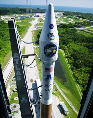
NASA is going back to the Moon today! The Lunar Reconnaissance Orbiter (LRO) and a piggyback mission called the Lunar Crater Observation and Sensing Satellite (LCROSS) are at the launch pad, ready to blast off on an Atlas V today (Thursday June 18), with launch windows at 5:12 p.m., 5:22 p.m. or 5:32 p.m. EDT. (9:12, 9:22 or 9:32 GMT). The dual mission will provide detailed lunar maps to aid in returning humans to the moon, while searching for water ice in permanently shaded craters at the moon’s poles.

LRO is scheduled for a one-year prime mission, exploring the moon from a polar orbit of about 31 miles, or 50 kilometers, the closest any spacecraft has orbited the moon. Its primary objective is to conduct investigations to prepare for future explorations of the moon.

“LRO will circle the moon every two hours,” Craig Tooley, LRO project manager explained at a press briefing earlier this week. “As moon rotates, LRO will be able to see the entire surface, so every month, we will map the entire surface of moon. There will be gaps in our measurements because the view of the instruments are very narrow beneath the satellite ground track. Over the course of an entire year, we can fill in these gaps to have a global measurement of the moon and a new set of data, a new atlas so to speak showing temperature, minerals, images and other data.”

Artist concept of LRO in lunar orbit. Credit: NASA

Tooley said that the Apollo missions accepted the risk of not knowing details of the landing sites. “They had safe landings, but we want to return to moon with repeated landings and have a higher degree of safety.”

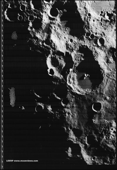
LRO will be able to look at the distribution of rocks, boulders, and craters, with its 50 cm spatial resolution camera. “We’ll be able to see small boulders and know where it is safe to land,” said Rich Vondrak, project scientist. “NASA has identified fifty high priority sites that are potential landing sites for astronauts.”

LRO has a Narrow Angle Camera (NAC) and a Wide Angle Camera (WAC). NAC is dedicated to high resolution, and Vondrak said the high priority regions will be mapped in high res the first year, and they are working with science community for areas to study during an extended mission.

The Lunar Oribter Laser Altimeter (LOLA) will provide a high resolution 3-D relief map of moon. “LOLA resolution will be 10 times better than what we currently have,” said Vondrak. “We’re looking forward to mapping Aiken Basin, a huge depression, very carefully, and the polar regions are of high interest. We’ll have new eyes on the moon to get new views to prepare for future exploration of the moon.”

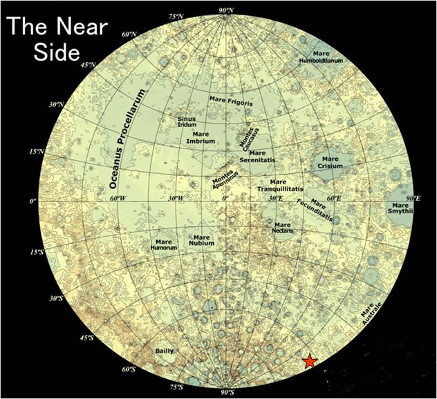
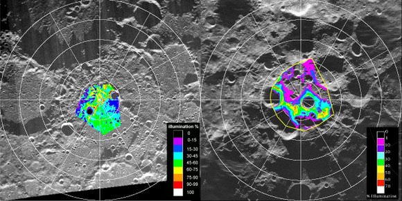
Regions near the pole have nearly continuous sunlight, which could be a source of warmth and power for future explorers. There are also regions inside polar craters that are continuously dark and very cold, and previous missions have found evidence of hydrogen, which scientists expect to be associated with water ice, a potential resource for future explorers.

“We’ll do the best possible attempt of determining the characteristic of the lunar surface from orbit, but to really understand the water content of the surface, you would like to land there,” said Vondrak. “We are fortunate that LRO will carry a companion mission, LCROSS, to seek water on the moon.”

Artist concept of LCROSS and Centaur stage heading for impact. Credit: NASA

LCROSS will search for water ice on the moon by sending the spent upper-stage Centaur rocket to impact part of a polar crater in permanent shadows. LCROSS will fly into the plume of dust left by the impact and measure the properties before also colliding with the lunar surface.

“LCROSS will shepherd the Centaur to the precise orbit, and accelerate it into the moon,” said LCROSS project scientist Tony Colaprete. “The two will separate, with LCROSS following the Centaur by four minutes, taking live “bent pipe” meausrments, sendin back live video (which will be shown live via webcast) taking measurements of the lunar regolith characteristics, looking for lunar water vapor or ice characteristics, then impacting the lunar surface itself. LCROSS will be a smashing success.”

The impact will take place about 100 days after launch, and the science team hopes to recruit amateur astronomers and students to help watch the impact from Earth. “This should be very engaging for the public, and their observations will help us, too,” said Colaprete.

If launch slips to Friday, June 19, the launch opportunities would be 6:41 p.m., 6:51 p.m. and 7:01 p.m EDT (10:41, 10;51 and 11:01 GMT).

Several videos about LRO and LCROSS.

Follow LRO’s Launch Blog.

Watch KSC video feeds of launch prep and launch.

More Photos From the Lunar Time Machine

Lunar South pole 1967. Credit: LOIRP and MoonViews.com

[/caption]
More images have been released by the Lunar Orbiter Imagery Recovery Project (LOIRP), the endeavor that has been called a “time machine” by team member Keith Cowing of NASA Watch. In 1966 and 1967, NASA sent five Lunar Orbiter missions to photograph the lunar surface to prepare for the Apollo missions to land humans on moon. Data were recorded on large magnetic tapes, and a special machine was needed to just to view the images. The LOIRP team is working on digitizing the data, and restoring the images to their full resolution. These images are especially timely, given the upcoming launch of the Lunar Reconnaissance Orbiter, hopefully this week. NASA can compare detailed high-resolution images from 1966 to the present and see what changes occurred in 40-plus years. “What this gives you is literally before and after photos,” Cowing said.

The above image was taken by Lunar Orbiter IV in May 1967 and shows the south pole of the Moon. This image shows the region without labels, and below, the image shows major features plus notation regarding processing artifacts from the spacecraft’s film processing system. The moon’s south pole is located near the rim of Shackleton Crater. The moon’s polar regions are currently of great interest as the Lunar CRater Observation and Sensing Satellite (LCROSS) will be targeted to impact at the moon’s south pole, to occur in October if LRO/LCROSS launches this week.

Lunar south pole, annotated. Credit: LOIRP and MoonViews.com


Apollo 12 site annotated. Credit: LOIRP and MoonViews.com

This image LO3-154-H was taken by Lunar Orbiter III on 20 February 1967 and shows the landing site for both Surveyor III, which landed on April 20, 1967 and Apollo 12, which landed on November 19, 1969. The annotations show major features plus EVA routes taken by the astronauts Pete Conrad and Allan Bean.

For more images and information see the LOIRP website, Moon Views.

LRO/LCROSS Gives Up Launch Date for STS-127

LRO on the launchpad. Credit: NASA

It’s a crowded dance floor and someone had to step aside. Because of Saturday’s launch delay for STS-127, the shuttle and the upcoming dual mission to the moon — the Lunar Reconnaissance Orbiter (LRO) and Crater Observation and Sensing Satellite (LCROSS) — were both vying to launch from Kennedy Space Center on the same day, which is not a possibility (usually there needs to be at least 48 hours between launches as the Air Force’s Eastern Range that monitors needs that amount of time to reconfigure the systems.) At a press conference today, NASA launch manager at KSC, Chuck Dovale announced LRO/LRCROSS will give up their originally schedule launch date of June 17 so that the shuttle can go. “We are relinquishing the June 17 date to the shuttle,” he said. “However, we will maintain June 18 as the earliest possible date for LRO/LCROSS. We will monitor the shuttle’s progress, and if they were to scrub the launch for any reason before midnight on the 16th, we can still maintain launch on the 18th.” But there’s a lot that has to go right for the optimum and hoped for launch schedules to happen.
Continue reading “LRO/LCROSS Gives Up Launch Date for STS-127”

Kaguya Will Impact the Moon on June 10

Lunar map showing Kaguya impact site. Credit: JAXA

[/caption]
The Japanese lunar orbiter Kaguya will end its two-year mission with a controlled impact on the Moon’s surface on June 10th at 18:30 Universal Time. The impact location is near the southeast limb at 80ºE, 63ºS. If you live in Asia and Australia, you may have the opportunity to observe the impact event, and the Japanese Space Agency –JAXA – wants to hear from you if you plan on watching for the impact. The event may be visible with a bright flash or plume. JAXA is making available precise information on the projected time and location of the event. If you are interested in observing the impact, contact JAXA at [email protected] and provide your name, location, and planned observation method.

For more information about the event, see this article on Lunar Photo of the Day.

Here’s JAXA’s page on the mission.

One of the visual highlights of the Kaguya mission was a high definition “Earthrise” movie:

Ice on the Moon? NASA, ISRO May Collaborate to Find Out

Maps of the lunar poles from the Clementine mission. Credit: NASA

[/caption]
The debate has endured since the early 1960’s: could there be water ice hiding in deep, dark craters near the Moon’s poles, left untouched by sunlight? Several spacecraft orbiting the moon have tried to peer into these craters to find out, but so far no definitive data has been obtained either way. But now NASA and the Indian Space Research Organization (ISRO) are looking to team up two spacecraft to try and answer the question once and for all. “When it happens, it is going to be a unique experiment and will be the first of its kind,” said Dr. Mylswamy Annadurai, project director for the Chandrayaan-I orbiter.

ISRO’s Chandrayaan-I, already in lunar orbit and NASA’s Lunar Reconnaissance Orbiter (LRO), scheduled to launch later this month would be maneuvered to orbit simultaneously over the lunar poles, and the data from the both spacecrafts’ radar instruments would be shared and exchanged. Details of the collaboration are still being worked out, but officials hope to finalize the plans within a month.

Artist concept of Chandrayaan-1 orbiting the moon. Credit: ISRO

The master plan for the experiment was developed Paul Spudis of the Lunar and Planetary Institute of Houston, who also led the team of US scientists in the Chandrayaan-I project.

“Our experiment should answer first the broad questions about the existence of lunar polar ice, its extent and purity,” Spudis wrote in his paper published in Lunar and Planetary Science journal.

As the first step, on May 19 ISRO scientists shifted Chandrayaan-I to a new orbit 200 km away, lifting it from the 100 km orbit it had been in previously.

“In contrast to some recent claims, this debate is still open and nothing has occurred in the last few years to cause participants in the debate to abandon their positions,” Spudis wrote in an article for the National Space Society in 2006. “No single piece of evidence for lunar ice is decisive, but I think the preponderance of evidence indicates that water ice exists in permanently dark areas near the poles.”

Finding ice in the moon’s polar region would be significant in many respects. The ice could be an abundant water source for future colonists on the moon, as well as being used for producing propellants. However, Spudis said that although polar ice is important, it is not a requirement to successfully live and work on the Moon.

Additionally, any ice on the moon would hold clues to the evolution of the solar system, as the water was likely the product of comets that crashed onto the moon over a billion years ago.

Sources: Bharat Chronicle, NSS

China Looking Towards Manned Lunar Landing

Artist concept of a Chinese lunar mission. Credit: Xinhua

[/caption]
A Chinese space scientist said that his country is considering the feasibility of a manned lunar landing mission sometime between 2025 and 2030. China is also planning a sample return mission to the Moon by 2017, said Ye Peijian, chief designer of the China’s Chang’e Project. “Through the development of lunar probes, we have made constant progress of the ability to explore the outer space,” Ye was quoted as saying by the China News Service.

Chang’e -1 launched successfully in 2007 and orbited the Moon for 16 months before conducting a controlled impact on the Moon’s surface earlier this year. The satellite mapped and created three-dimensional images of the lunar surface. Several performance tests were carried out while Chang’e-1 was in orbit to give engineers experience in orbit adjustment, and to test the spacecraft’s capability.

According to Ye, China will launch the second lunar probe Chang’e-2 in 2010 which will conduct research at a 100-kilometer-high moon orbit as the preparation for a soft landing by using variable thrusters with the Chang’e-3, which will include a lunar rover, currently in development.

The rover will work on the moon’s surface for three months, Ye said, adding scientists have decided to adopt isotope generator to provide energy for the rover when it is in lunar nights when temperatures drop to 200 Celsius degrees below zero.

The sample return mission will be able to gather two kilograms of lunar samples and launch a return capsule from the Moon back to Earth.

All of these incremental steps would lead to a human mission to the moon, likely to be similar to NASA’s Apollo missions. During the timeframe China is hoping to bring humans to the moon, the US is also hoping to return to the lunar surface with long duration missions with the new Constellation program.

Source: People’s Daily Online

Dual Purpose “Blanket” Could Protect Astronauts, Generate Power on Moon

Artist concept of the Lunar Texsheild. Credit: North Carolina State University

[/caption]

If we’re ever going to set up bases on the Moon for long-term – or even short term — human habitation, we’ll need to overcome the problems of radiation from cosmic rays and solar flares. Another issue for lunar outposts is setting up usable power generating systems. Recently, a group of students at North Carolina State University potentially tackled both problems by developing a “blanket” that covers lunar outposts to provide protection for astronauts against radiation while also generating and storing power.

Space radiation has long been known to be a problem for lunar explorers. The Apollo astronauts had little protection, but were only on the Moon for a short time. NASA is hoping to return to the Moon by 2020 for longer sorties and eventually to build a lunar outpost.

The cosmic rays are bad enough themselves, but when they hit matter, they also produce a dangerous spray of secondary particles which, when penetrating human flesh, can damage DNA, boosting the risk of cancer and other maladies.

Michael Sieber, Ryan Boyle and Anne Tomasevich, all recent graduates of the textile engineering program at NC State came up with a design called a “lunar texshield.” The blanket-like cover is made from a lightweight polymer material that has a layer of radiation shielding that deflects or absorbs the radiation so astronauts are only exposed to a safe amount. The outermost surface of the shield includes a layer of solar cells to generate electricity, backed up by layers of radiation-absorbing materials. The advantages of the materials used in the design include flexibility, large surface area, ease of transportation, ease of construction and the ability to have multiple layers of independent functional fabrics.

The Lunar Texshield. Credit: North Carolina State University

The students’ design was reviewed by a panel of industry experts and chosen as one of 10 undergraduate abstract finalists in the Revolutionary Aerospace Systems Concepts Academic Linkage (RASC-AL) competition. This competition is sponsored by NASA and the National Institute of Aerospace, and challenges university students to think about what sorts of conditions astronauts will face when returning to the moon, then design projects that might become part of actual lunar exploration.

“We had many factors to consider in developing this outpost cover – not just being able to protect against radiation,” Sieber says. “The product needed to be as lightweight as possible to feasibly fit on the transportation module, and have the ability to be easily erected by a minimum number of astronauts for immediate use once landing on the moon.”

“These obstacles are where our knowledge of textile properties will give us an advantage,” added Dr. Warren Jasper, professor of textile engineering and advisor for the project. “This is a competition aimed at aerospace engineering students, but we understand the properties associated with different textile materials, and that gives us unique insight on how to troubleshoot some of these issues.”

The students will present their lunar texshield at the 2009 RASC-AL Forum held June 1-3 in Cocoa Beach, Fla. The project will be judged by a steering committee made up of experts from NASA, industry and universities.

“We aren’t even sure what the prize is for being named first place – but that wasn’t what was important to us,” Sieber says. “We used what we’ve learned throughout our college careers and were able to apply that logic to provide a solution a real-world problem. That is what is cool to us.”

Source: North Caroline State University

Spacecraft Searching for Remains of Mystery Planet

Diagram of the Earths orbit around the Sun. Credit: NASA/H. Zell

[/caption]

How did our Moon form? The leading hypothesis, the Giant Impact Theory, proposes that in the formative years of the Solar System, a Mars-sized protoplanet crashed into Earth. Debris from the collision, a mixture of material from both bodies, spun out into Earth orbit and coalesced into the Moon. Soon, this theory will be tested, perhaps answering the question of how our Moon was born. Two identical NASA spacecraft are preparing to enter areas in space known as the Lagrangian points where remains of this mystery protoplanet may be hiding. The spacecraft duo, called Solar Terrestrial Relations Observatory, or Stereo, will pass by the L4 and L5 points where the gravity of the sun and Earth combine to form gravitational wells where asteroids and space dust tend to gather.

During their journey, the two spacecraft will use a wide-field-of-view telescope to look for asteroids orbiting the region. Scientists will be able to identify if a dot of light is an asteroid because it will shift its position against stars in the background as it moves in its orbit.

The Giant Impact Theory explains many aspects of lunar geology including the size of the Moon’s core and the density and isotopic composition of moon rocks. A modification of the Giant Impact Theory is the “Theia hypothesis,” a brainchild of Princeton theorists Edward Belbruno and Richard Gott.

“About 4.5 billion years ago when the planets were still growing,” said Michael Kaiser, Stereo project scientist at Goddard Space Flight Center, “a hypothetical world called Theia may have been nudged out of L4 or L5 by the increasing gravity of other developing planets like Venus, sending it on a collision course with Earth. The resulting impact blasted the outer layers of Theia and Earth into orbit, which eventually coalesced under their own gravity to form the moon.”

The 18th-century mathematician Joseph-Louis Lagrange realized there were five such wells in the sun-Earth system. The twin probes are approaching L4 and L5.

“These points may hold small asteroids, which could be leftovers from a Mars-sized planet that formed billions of years ago,” said Kaiser.

Deployment of STEREO Spacecraft Panels. Credit: 2002-Johns Hopkins University Applied Physics Laboratory. Credit: Dr C.J.Eyles, University of Birmingham

The theory explains puzzling properties of the moon, such as its relatively small iron core. At the time of the giant impact, Theia and Earth would have been large enough to be molten, enabling heavier elements, like iron, to sink to the center to form their cores. An impact would have stripped away the outer layers of the two worlds, containing mostly lighter elements like silicon. The moon eventually formed from this material.

Stereo’s primary mission is to give three-dimensional views of space weather by observing the sun from the two points where the spacecraft are located. Images and other data are then combined for study and analysis. Space weather produces disturbances in electromagnetic fields on Earth that can induce extreme currents in wires, disrupting power lines and causing wide-spread blackouts. It also can affect communications and navigation systems. Space weather has been recognized as causing problems with new technology since the invention of the telegraph in the 19th century.

Sources: Goddard Space Flight Center, Science@NASA

Moon Reveals New Way to Find Oceans, Land on Other Earths

[/caption]

An Australian doctoral researcher using a backyard telescope has made a potentially big discovery: Earth’s oceans and continents shine differently on the dark side of the moon.

Now, Sally Langford, a doctoral candidate in physics at the University of Melbourne, is suggesting the “earthshine” of planets around other stars could provide long-distance windows into their surface features.

langford-rig
Langford's setup for moon observing. Credit: Stuart Wyithe, second author, also a physicist at the University of Melbourne.

Langford and her colleagues, from Melbourne as well as Princeton University, have shown for the first time that the difference in reflection of light from the Earth’s land masses and oceans can be seen on the dark side of the moon, a phenomenon known as earthshine. Their paper appears in this week’s edition of the international journal Astrobiology.

This is the first study in the world to use the reflection of the Earth to measure the effect of continents and oceans on the apparent brightness of a planet. Other studies have used a color spectrum and infrared sensors to identify vegetation, or for climate monitoring.

The researchers peered at the dark side of the crescent moon using a 20 cm (8 inch) telescope, on the bigger side of what most amateur astronomers use in their yards.

For three years, Langford took images of the Moon to measure the earth’s brightness as it rotated. Observations of the Moon were made from Mount Macedon in Victoria, for around three days each month when the Moon was rising or setting. The study was conducted so that in the evening, when the Moon was a waxing crescent, the reflected earthshine originated from Indian Ocean and Africa’s east coast. In the morning, when the Moon was a waning crescent, it originated only from the Pacific Ocean.

“When we observe earthshine from the Moon in the early evening we see the bright reflection from the Indian Ocean, then as the Earth rotates the continent of Africa blocks this reflection, and the Moon becomes darker,” Langford said.

Langford said the variation revealed the difference between the intense mirror-like reflections of the ocean compared to the dimmer land.

“In the future, astronomers hope to find planets like the Earth around other stars,” Langford said. “However these planets will be too small to allow an image to be made of their surface. We can use earthshine, together with our knowledge of the Earth’s surface, to help interpret the physical makeup of new planets.” 

LEAD IMAGE CAPTION: Earthshine on a crescent moon. Credit: Edward W. Szczepanski, Houston Astronomical Society (click on the photo to visit Szczepanski’s page)

Source: University of Melbourne. The paper is available here.

Latest Images from Chandrayaan-1

Chandrayaan-1 captured this view of a nearly full Earth on March 25, 2009 at 07:03:03 UTC. India is at the center of the image. Credit: ISRO. Click for larger version

[/caption]
ISRO and NASA have recently released some of the latest images taken by the Chandrayaan-1 spacecraft orbiting the Moon. Above, Chandrayaan 1 looks back at Earth, and fittingly, India is at the center of the image. And here’s a link to another similar image, taken about an hour earlier. Below, are images taken by the Mini-SAR, the imaging radar instrument that NASA has tagging along on the Chandrayaan-1 orbiter. “The new radar images are not only visually arresting, but they will be extremely useful in unraveling the complex geological history of the Moon as a whole,” said Dr. Paul Spudis, principal investigator for Mini-SAR. “We are hard at work finishing the calibration of our instrument, which is required in order to make definite statements about the nature of the radar backscatter signature, the tell-tale sign of the presence or absence of water ice.”


Rozhdestvensky crater on the Moon. Credit: ISRO/NASA/JHUAPL/LPI

As you can see, the Mini-SAR gathers data in strips as it orbits the Moon, which are later assembled to create larger images. This composite shows Rozhdestvensky K, a moderately sized (42-kilometer [26-mile] diameter) impact crater on the southern rim of the larger crater Rozhdestvensky, near the moon’s north pole. These Mini-SAR images show massive slumping, as result of wall collapse caused by gravity. NASA says these images demonstrate that Mini-SAR images will be of great value in deciphering the geological evolution of the moon.
A new crater on the Moon. Credit: ISRO/NASA/JHUAPL/LPI


Here’s a very young, fresh impact crater (3 kilometers [nearly 2 miles] in diameter) on the western limb of the moon near the crater Sylvester, taken by the Mini-SAR instrument aboard India’s Chandrayaan-1 lunar orbiter. Fresh features on the moon display “radar bright” (i.e., high backscatter) material around them. This is caused by the presence of very fresh ejecta, which includes many angular blocks and rough material. These deposits are the cause of high radar backscatter.
Mini-SAR's coverage of the Moon so far. Credit: ISRO/NASA/JHUAPL/LPI

Coverage maps of the Mini-SAR experiment aboard India’s Chandrayaan-1 lunar orbiter as of mid-March 2009. Mini-SAR has mapped about 80% of both of the moon’s poles. The polar excluded zone is a consequence of the side-looking nature of the instrument; these zones will be filled by both scatterometry (in which the instrument views the moon straight downward at low resolution) and high-angle SAR, in which operators roll the spacecraft 9 to 12 degrees to look at areas closer to the ground track.

For more images check out ISRO’s Chandrayaan-1 webpages, and NASA’s Mini-SAR site, and for more detail about the Mini-SAR images, check out Dr. Spudis’ blog.