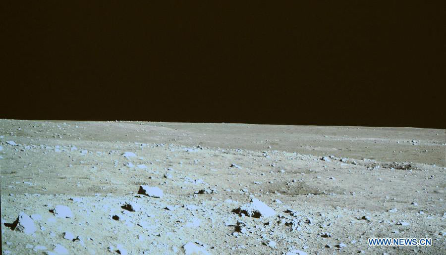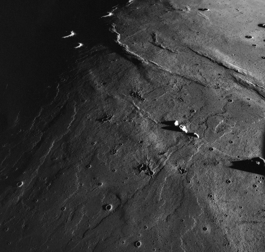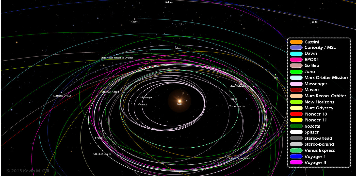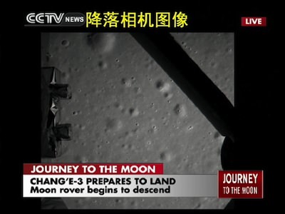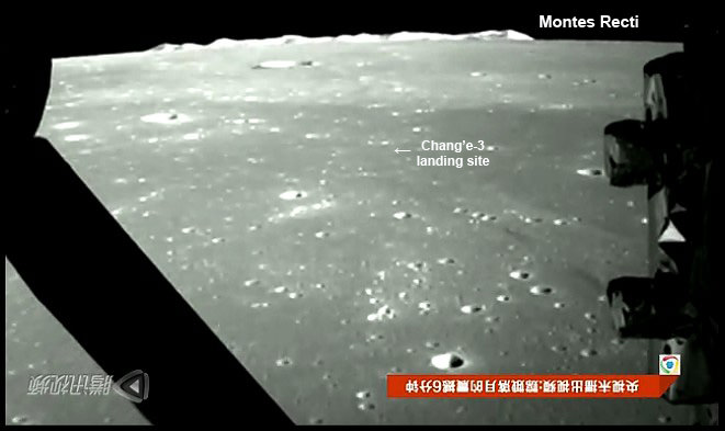
This screen shot from one photo of many of the moons surface snapped by the on-board descent imaging camera of the Chinese lunar probe Chang’e-3 on Dec. 14, 2013 shows the probe approaching the Montes Recti mountain ridge and approximate location of the landing site in Mare Imbrium. This marks the first time that China has sent a spacecraft to soft land on the surface of an extraterrestrial body. Image and video rotated 180 degrees.
Credit: Xinhua/CCTV/post processing and annotations Marco Di Lorenzo /Ken Kremer
See the entire stunning Chang’e-3 lunar landing video – below
Story updated
[/caption]
China accomplished a major technological and scientific feat when the country’s ambitious Chang’e-3 robotic spacecraft successfully soft landed on the Moon on Dec. 14 – on their very first attempt to conduct a landing on an extraterrestrial body.
Along the way the descent imaging camera aboard the Chang’e-3 lander was furiously snapping photos during the last minutes of the computer guided descent.
For a firsthand look at all the thrilling action, be sure to check out the stunning landing video, below, which gives an astronauts eye view of the dramatic descent and touchdown by China’s inaugural lunar lander and rover mission.
The video was produced from a compilation of descent camera imagery. The version here has been rotated 180 degrees – so you don’t have to flip yourself over to enjoy the ride.
And it truly harkens back to the glory days of NASA’s manned Apollo lunar landing program of the 1960’s and 1970’s.
See the entire stunning Chang’e-3 lunar landing video – herein
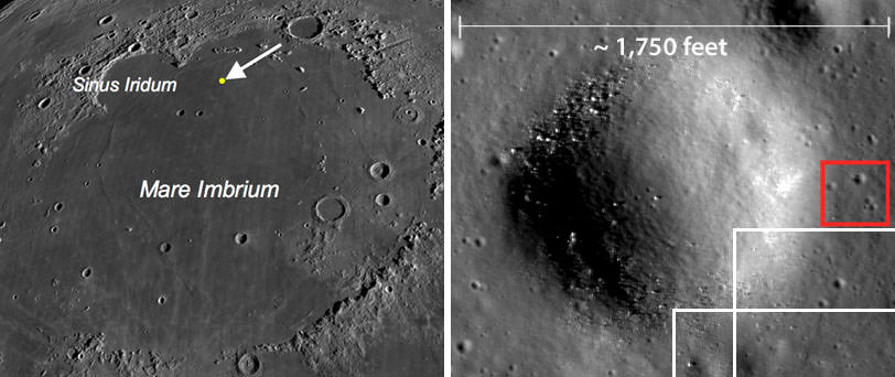
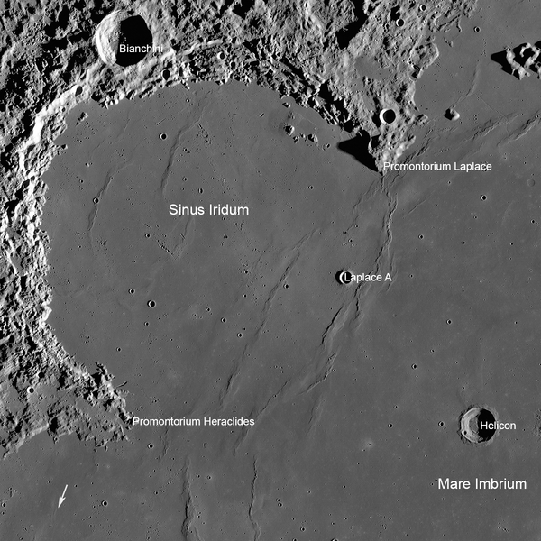
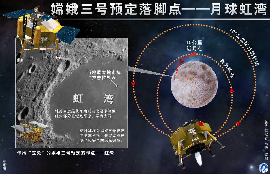
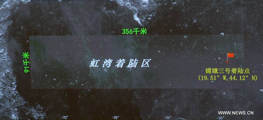
The dramatic Chang’e-3 soft landing took place at Mare Imbrium at 8:11 am EST, 9:11 p.m. Beijing local time, 1311 GMT, which is to the east of the announced landing site on the lava filled plains of the Bay of Rainbows, or Sinus Iridum region.
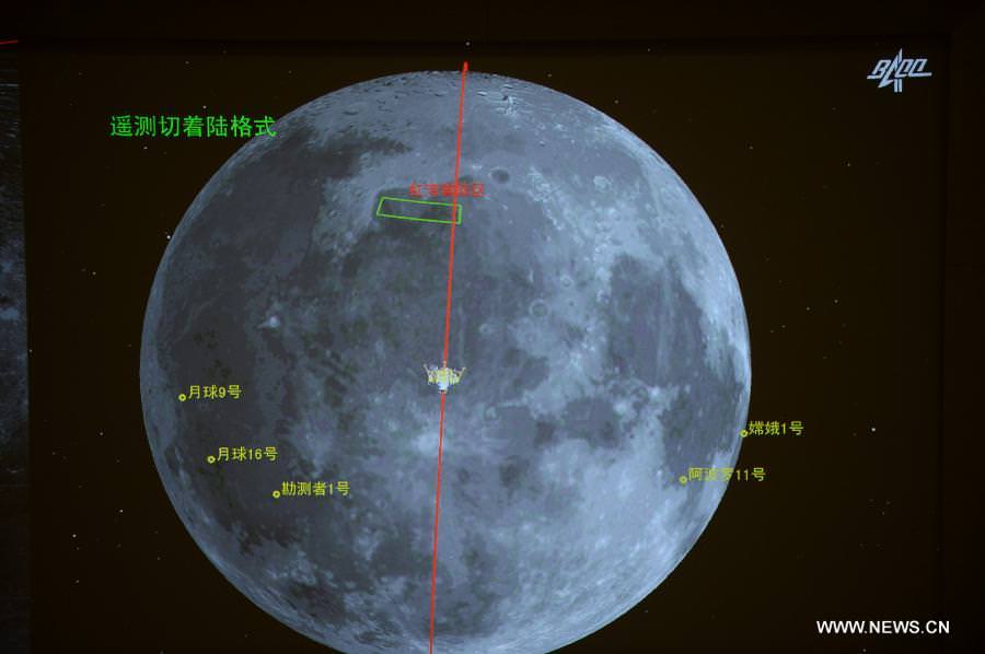
The precise landing coordinates were 44.1260°N and 19.5014°W -located below the Montes Recti mountain ridge and about 40 kilometers south of the 6 kilometer diameter crater known as Laplace F – see image below.
The video begins as Chang’e-3 is approaching the Montes Recti mountain ridge which is about 90 km in length. Its peaks rise to nearly 2 km.
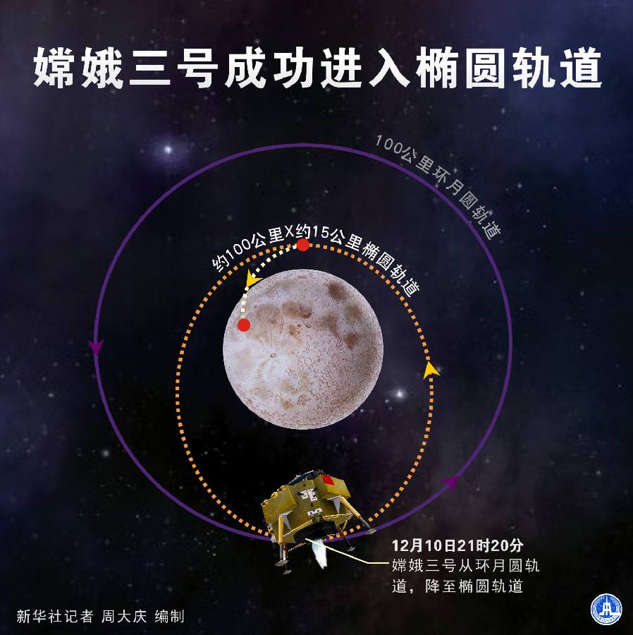
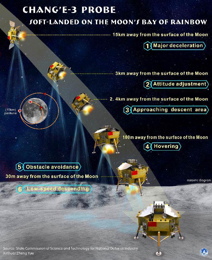
Chang’e-3 carried out the rocket powered descent to the Moon’s surface by firing the landing thrusters starting at the altitude of 15 km (9 mi) for a soft landing targeted to a preselected area in Mare Imbrium.
The vehicles thrusters then fire to pivot the lander towards the surface at about the 2:40 minute mark when it’s at an altitude of roughly 3 km.
The powered descent was autonomous and preprogrammed and controlled by the probe itself, not by mission controllers on Earth stationed at the Beijing Aerospace Control Center (BACC) in Beijing.
Altogether it took about 12 minutes using the variable thrust engine which can continuously vary its thrust power between 1,500 to 7,500 newtons.
The variable thrust engine enabled Chang’e-3 to reduce its deceleration as it approached the moons rugged surface.
The 1200 kg lander was equipped with unprecedented terrain recognition equipment and software to hover above the landing site and confirm it was safe before proceeding.
This enabled the craft to avoid hazardous rock and boulder fields as well as craters in the pockmarked terrain that could spell catastrophe even in the final seconds before touchdown, if the vehicle were to land directly on top of them.
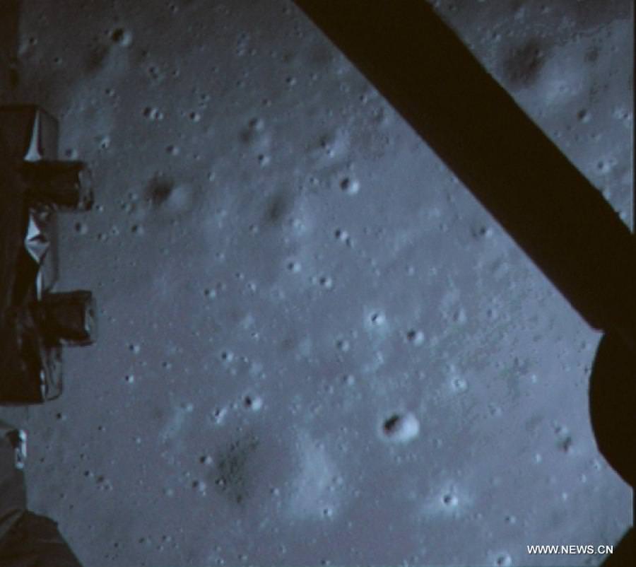
The descent engine continued firing to lower the lander until it was hovering some 100 meters above the lunar surface – at about the 5:10 minute mark.
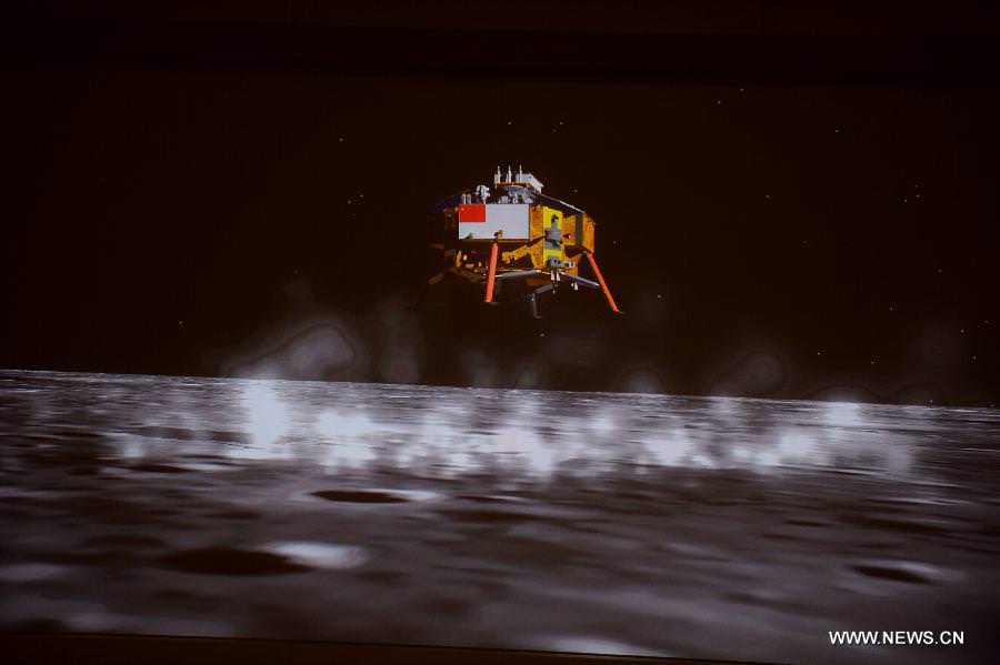
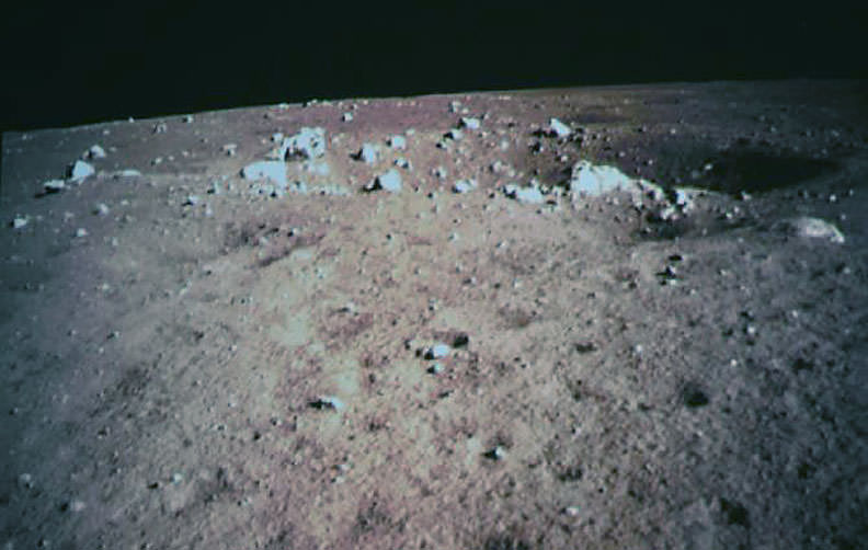
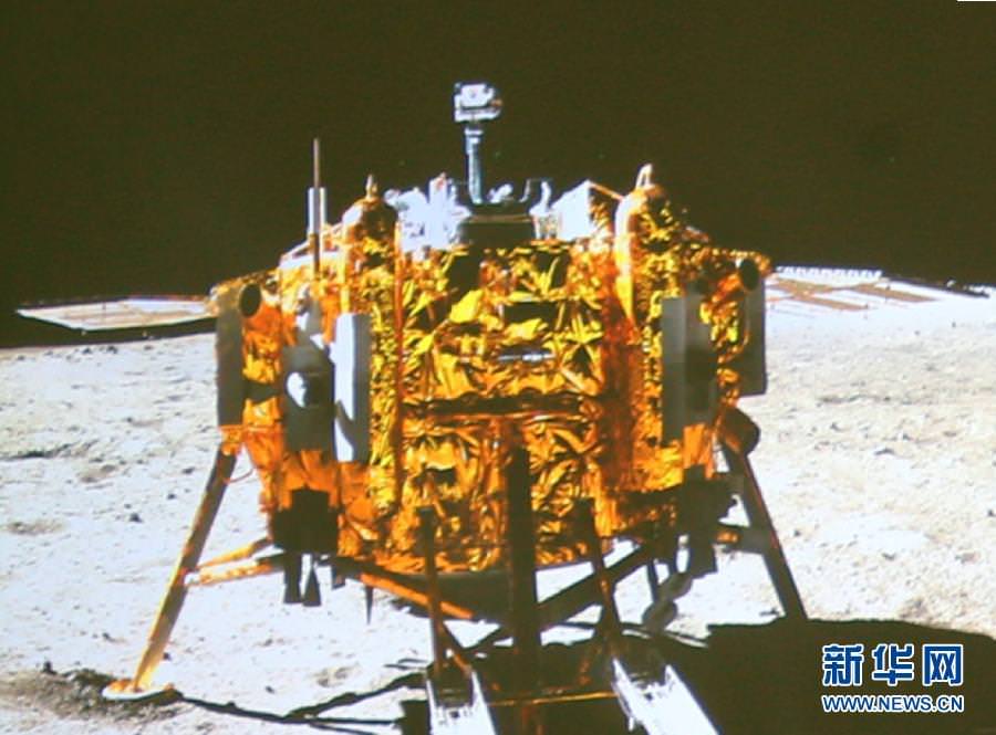
After hovering for about 20 seconds and determining it was safe to proceed, the lander descended further to about 3 meters. The engine then cut off and the lander free fell the remaining distance. The impact was cushioned by shock absorbers.
There is a noticeable dust cloud visible on impact as the Chang’e-3 mothership touched down atop the plains of Mare Imbrium.
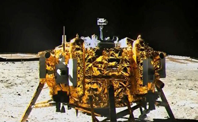
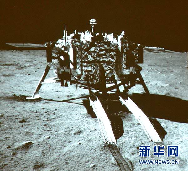
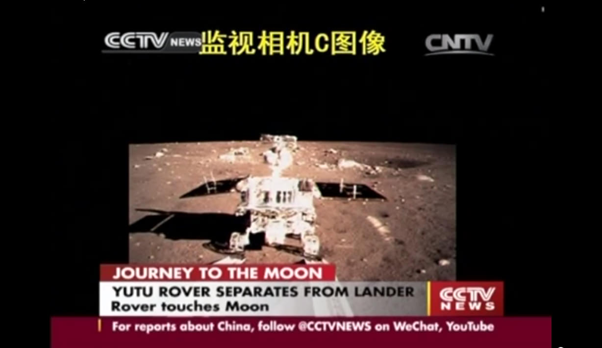
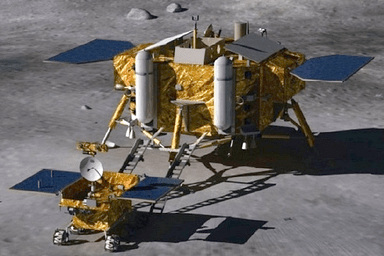
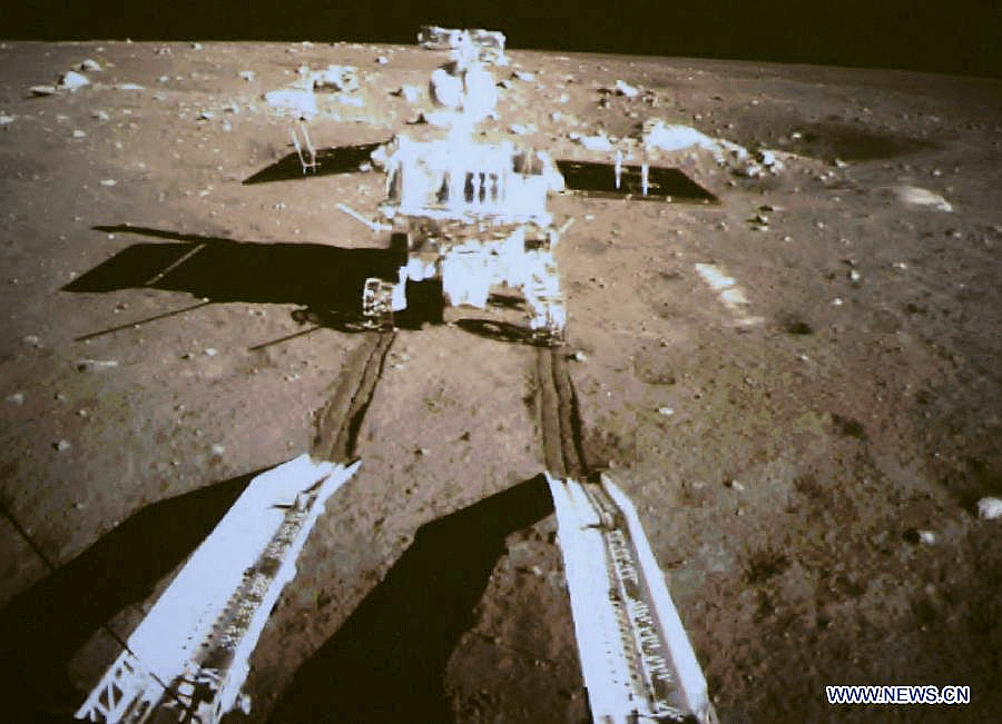
Barely 7 hours later, China’s first ever lunar rover ‘Yutu’ rolled majestically down a pair of ramps and onto the Moon’s soil on Sunday, Dec. 15 at 4:35 a.m. Beijing local time.
The six wheeled ‘Yutu’, or Jade Rabbit, rover drove straight off the ramps and sped right into the history books as it left a noticeably deep pair of tire tracks behind in the loose lunar dirt.
The stunning feat was broadcast on China’s state run CCTV.
China thus became only the 3rd country in the world to successfully soft land a spacecraft on Earth’s nearest neighbor after the United States and the Soviet Union.
It’s been nearly four decades since the prior lunar landing was accomplished by the Soviet Union’s Luna 24 sample return spacecraft back in 1976.
America’s last visit to the Moon’s surface occurred with the manned Apollo 17 landing mission – crewed by astronauts Gene Cernan and Harrison ‘Jack’ Schmitt , who coincidentally ascended from the lunar soil on Dec. 14, 1972 – exactly 41 years ago.
China’s Chang’e-3 probe joins NASA’s newly arrived LADEE lunar probe which entered lunar orbit on Oct. 6 following a spectacular night time blastoff from NASA’s Wallops Flight Facility in Virginia.
Stay tuned here for Ken’s continuing Chang’e-3, LADEE, MAVEN, MOM, Mars rover and more news.
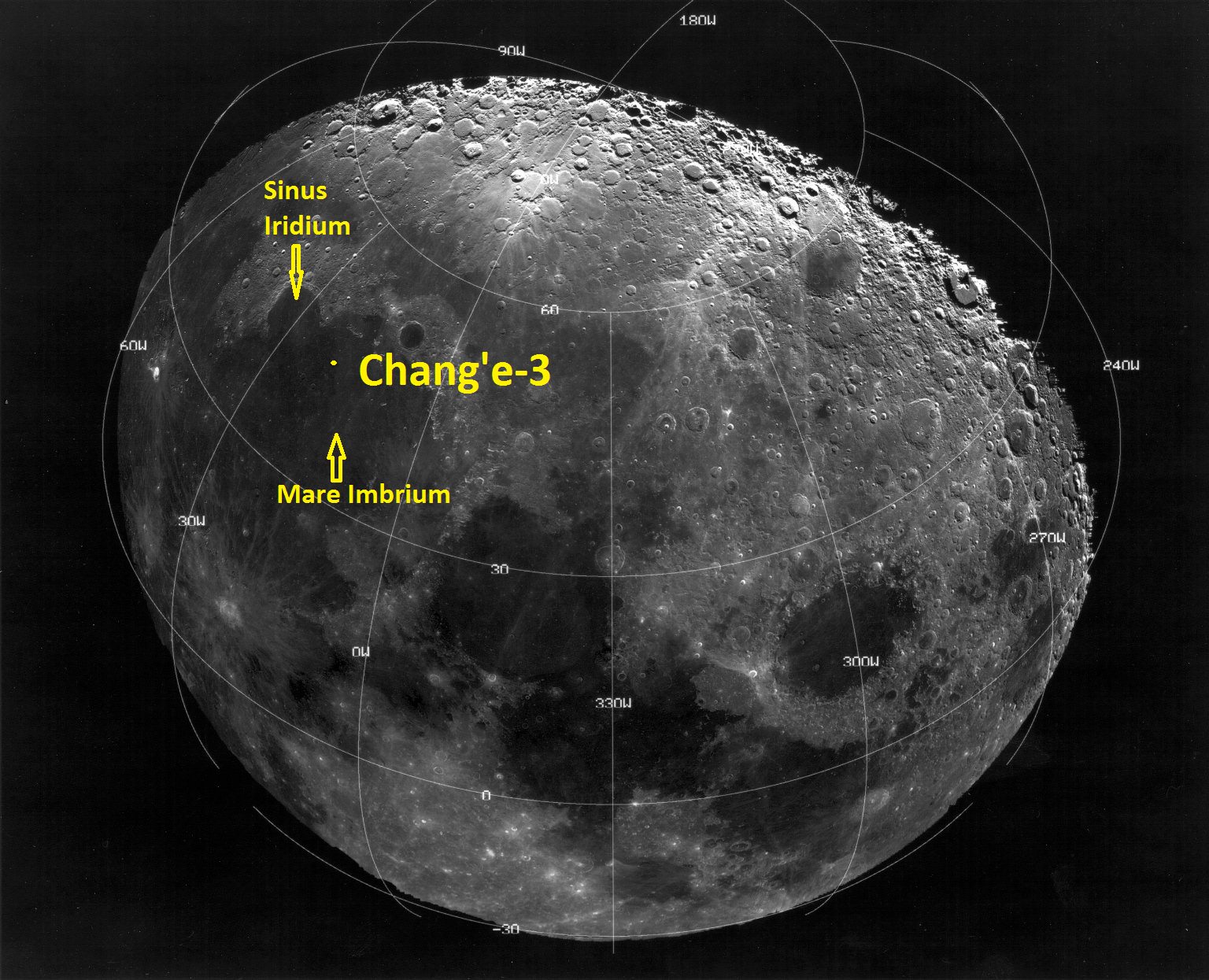
Ken Kremer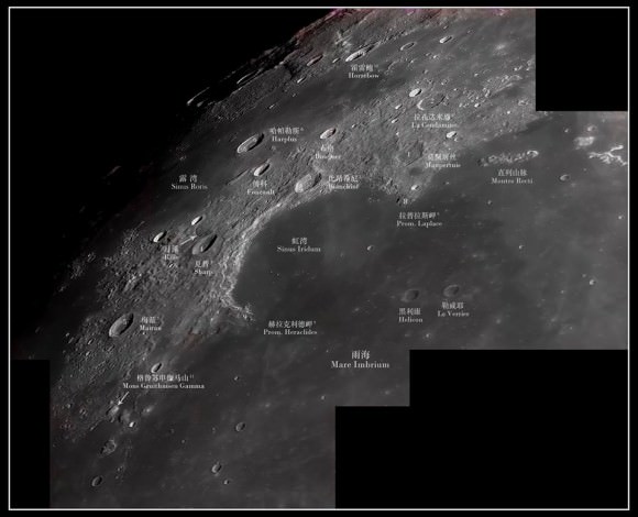 Moon map showing landing site of Chinese lunar probe Chang’e-3 on Dec. 14, 2013 below Montes Recti in Mare Imbrium beside Sinus Iridum, or the Bay of Rainbows . Credit: China Space[/caption]