NASA’s first spacecraft dedicated to studying Earth’s atmospheric climate changing carbon dioxide (CO2) levels and its carbon cycle has reached its final observing orbit and taken its first science measurements as the leader of the world’s first constellation of Earth science satellites known as the International “A-Train.”
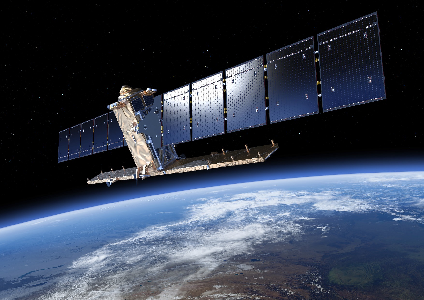
The Orbiting Carbon Observatory-2 (OCO-2) is a research satellite tasked with collecting the first global measurements of atmospheric carbon dioxide (CO2) – the leading human-produced greenhouse gas and the principal human-produced driver of climate change.
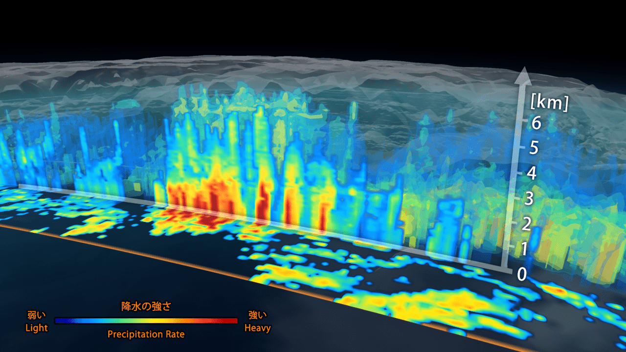
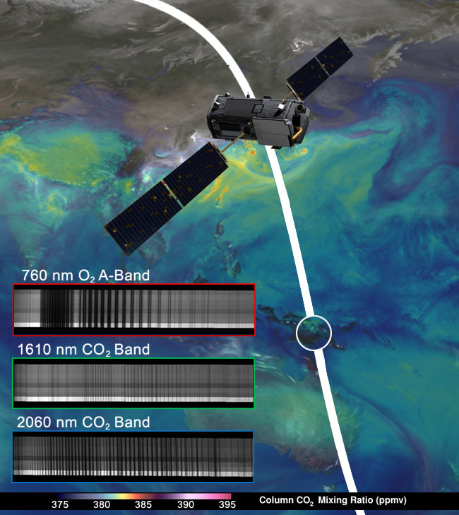
The ‘first light’ measurements were conducted on Aug. 6 as the observatory flew over central Papua New Guinea and confirmed the health of the science instrument. See graphic below.
NASA/JPL-Caltech/NASA GSFC
Before the measurements could begin, mission controllers had to cool the observatory’s three-spectrometer instrument to its operating temperatures.
“The spectrometer’s optical components must be cooled to near 21 degrees Fahrenheit (minus 6 degrees Celsius) to bring them into focus and limit the amount of heat they radiate. The instrument’s detectors must be even cooler, near minus 243 degrees Fahrenheit (minus 153 degrees Celsius), to maximize their sensitivity,” according to a NASA statement.
The team still has to complete a significant amount of calibration work before the observatory is declared fully operational.
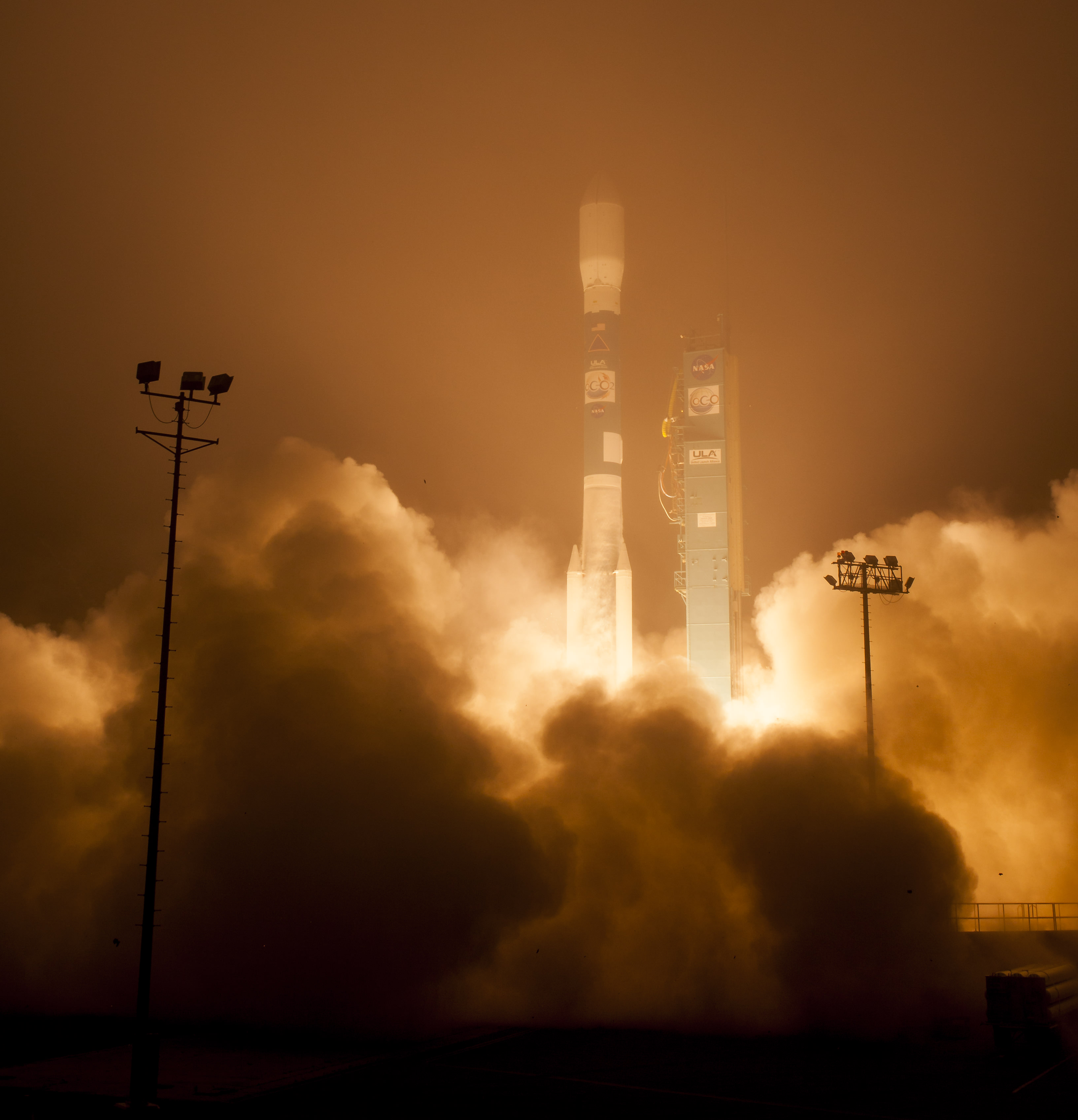
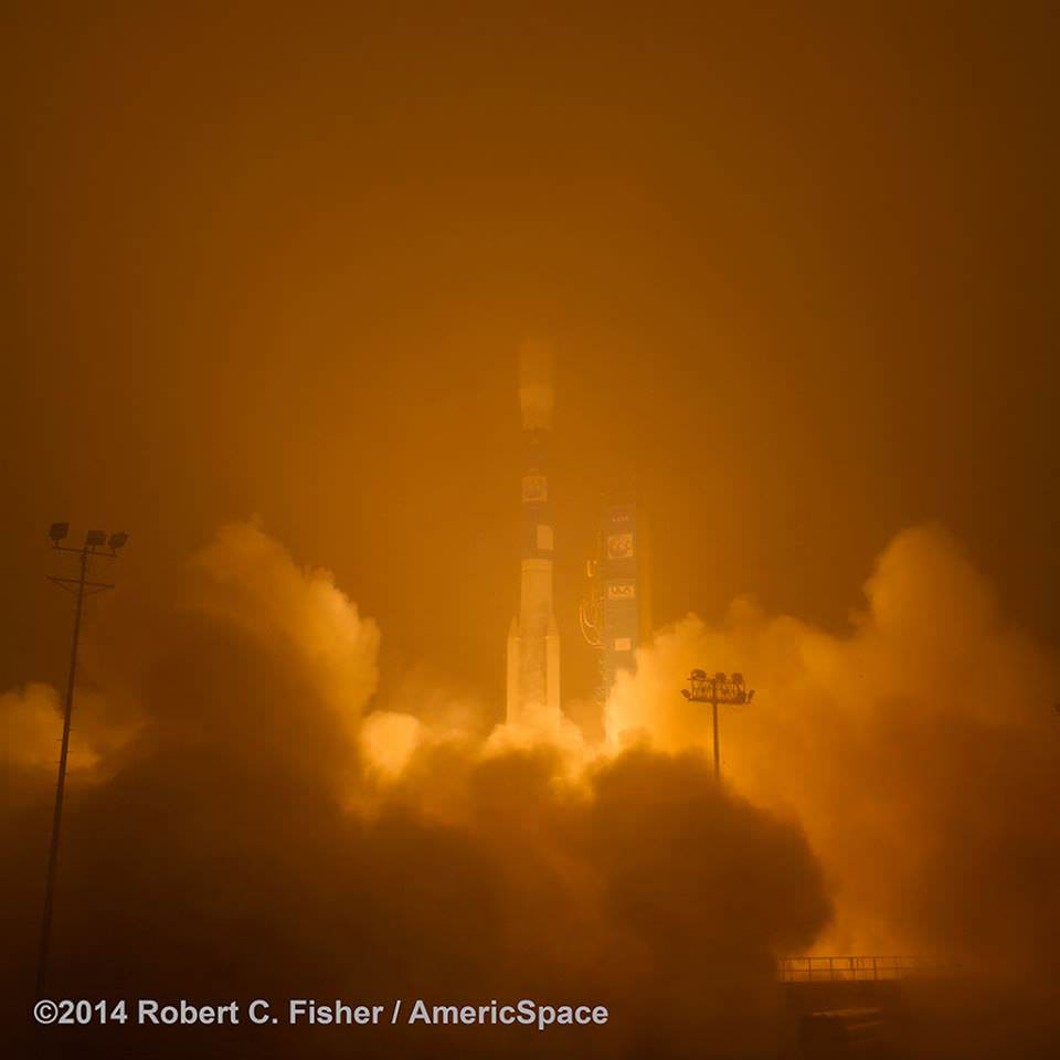
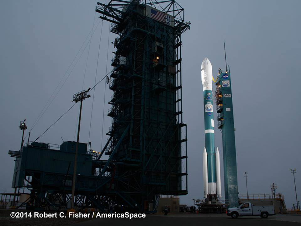
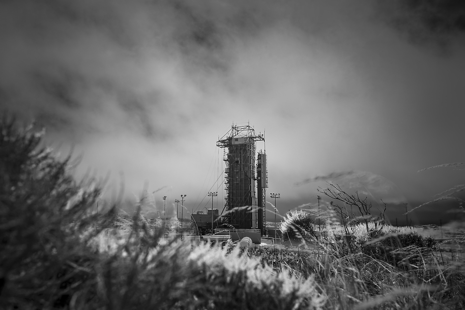
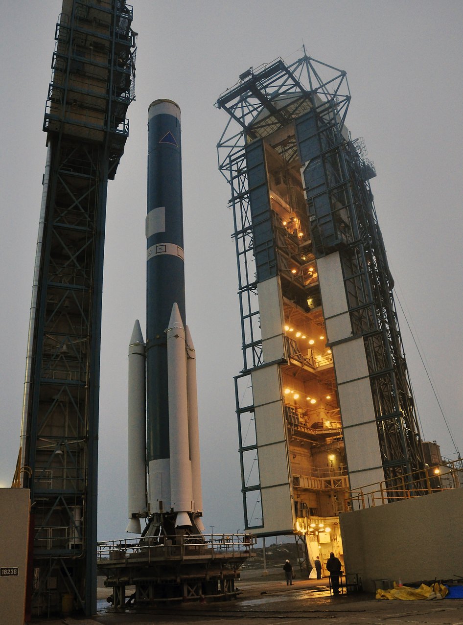
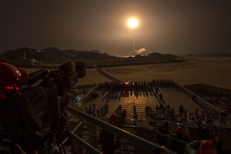
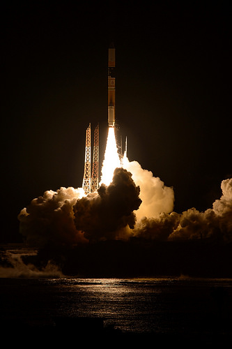
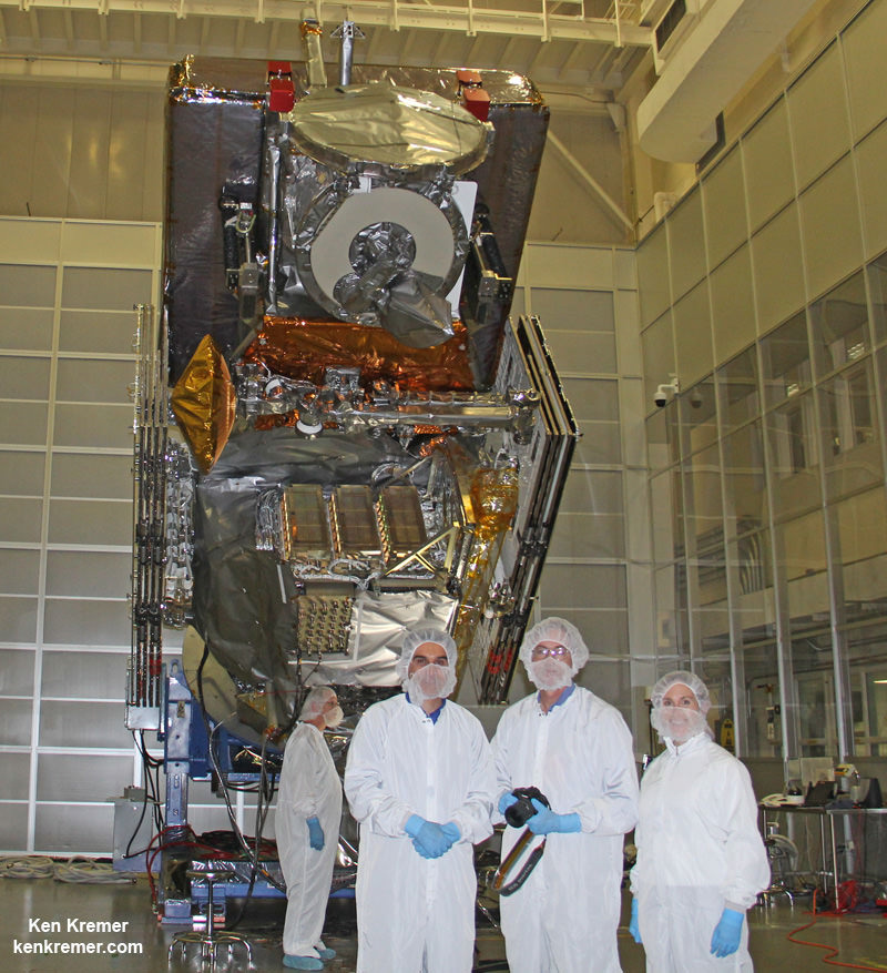
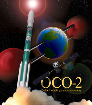
OCO-2 was launched just over a month ago during a spectacular nighttime blastoff on July 2, 2014, from Vandenberg Air Force Base, California, atop a the venerable United Launch Alliance Delta II rocket.
OCO-2 arrived at its final 438-mile (705-kilometer) altitude, near-polar orbit on Aug. 3 at the head of the international A-Train following a series of propulsive burns during July. Engineers also performed a thorough checkout of all of OCO-2’s systems to ensure they were functioning properly.
“The initial data from OCO-2 appear exactly as expected — the spectral lines are well resolved, sharp and deep,” said OCO-2 chief architect and calibration lead Randy Pollock of JPL, in a statement.
“We still have a lot of work to do to go from having a working instrument to having a well-calibrated and scientifically useful instrument, but this was an important milestone on this journey.”
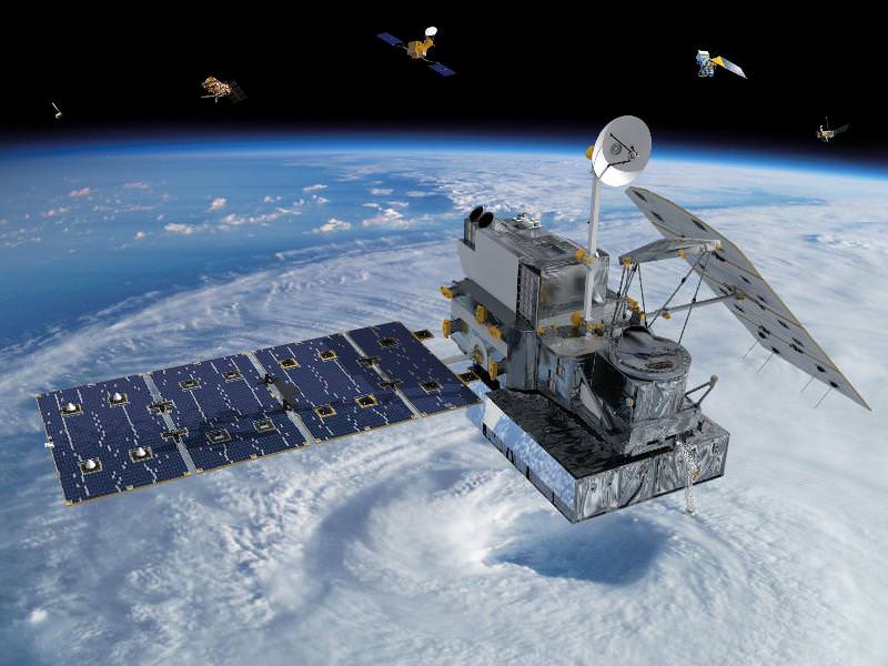
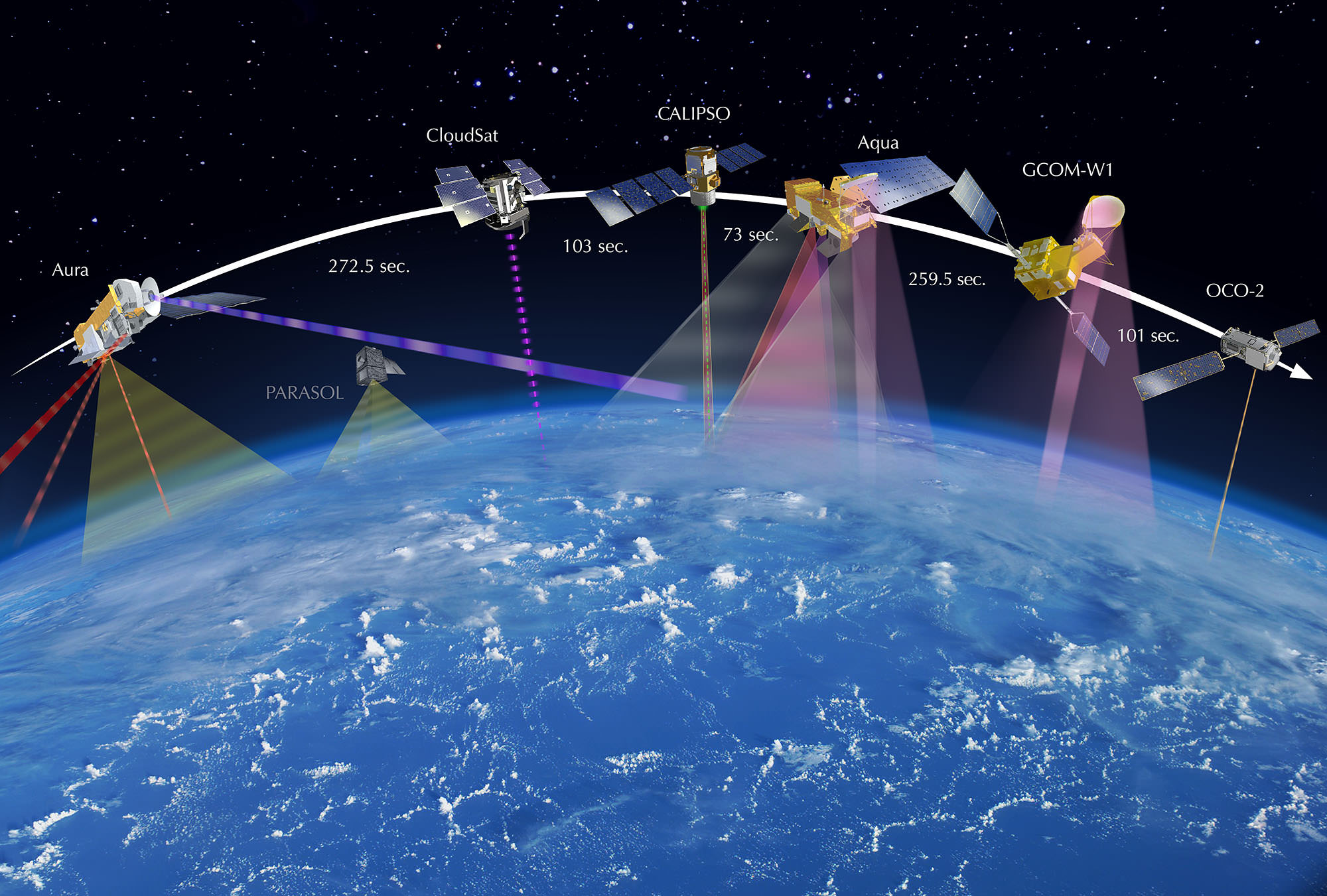
OCO-2 now leads the A-Train constellation, comprising five other international Earth orbiting monitoring satellites that constitute the world’s first formation-flying “super observatory” that collects an unprecedented quantity of nearly simultaneous climate and weather measurements.
Scientists will use the huge quantities of data to record the health of Earth’s atmosphere and surface environment as never before possible.
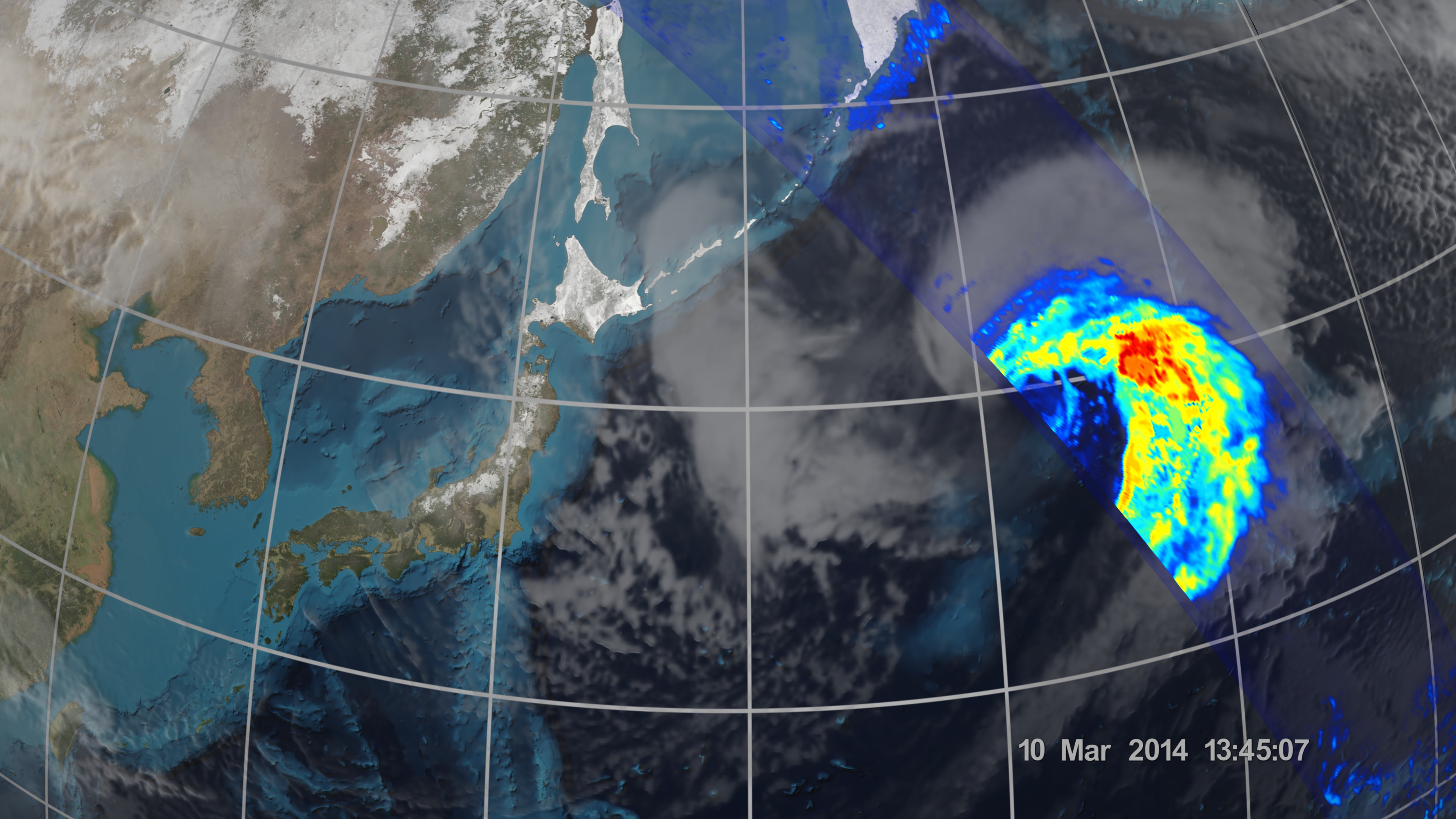
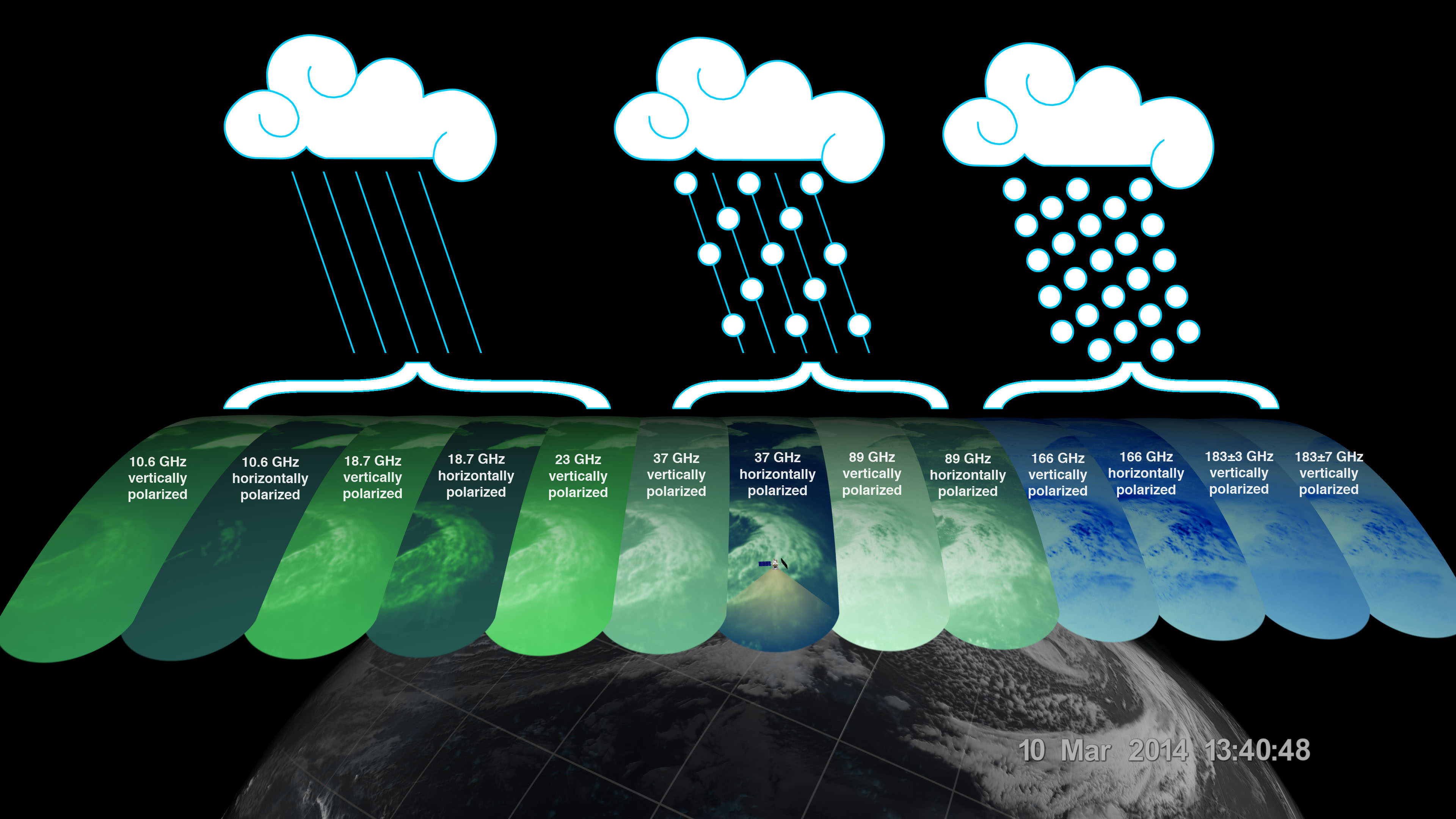
OCO-2 is followed in orbit by the Japanese GCOM-W1 satellite, and then by NASA’s Aqua, CALIPSO, CloudSat and Aura spacecraft, respectively. All six satellites fly over the same point on Earth within 16 minutes of each other. OCO-2 currently crosses the equator at 1:36 p.m. local time.
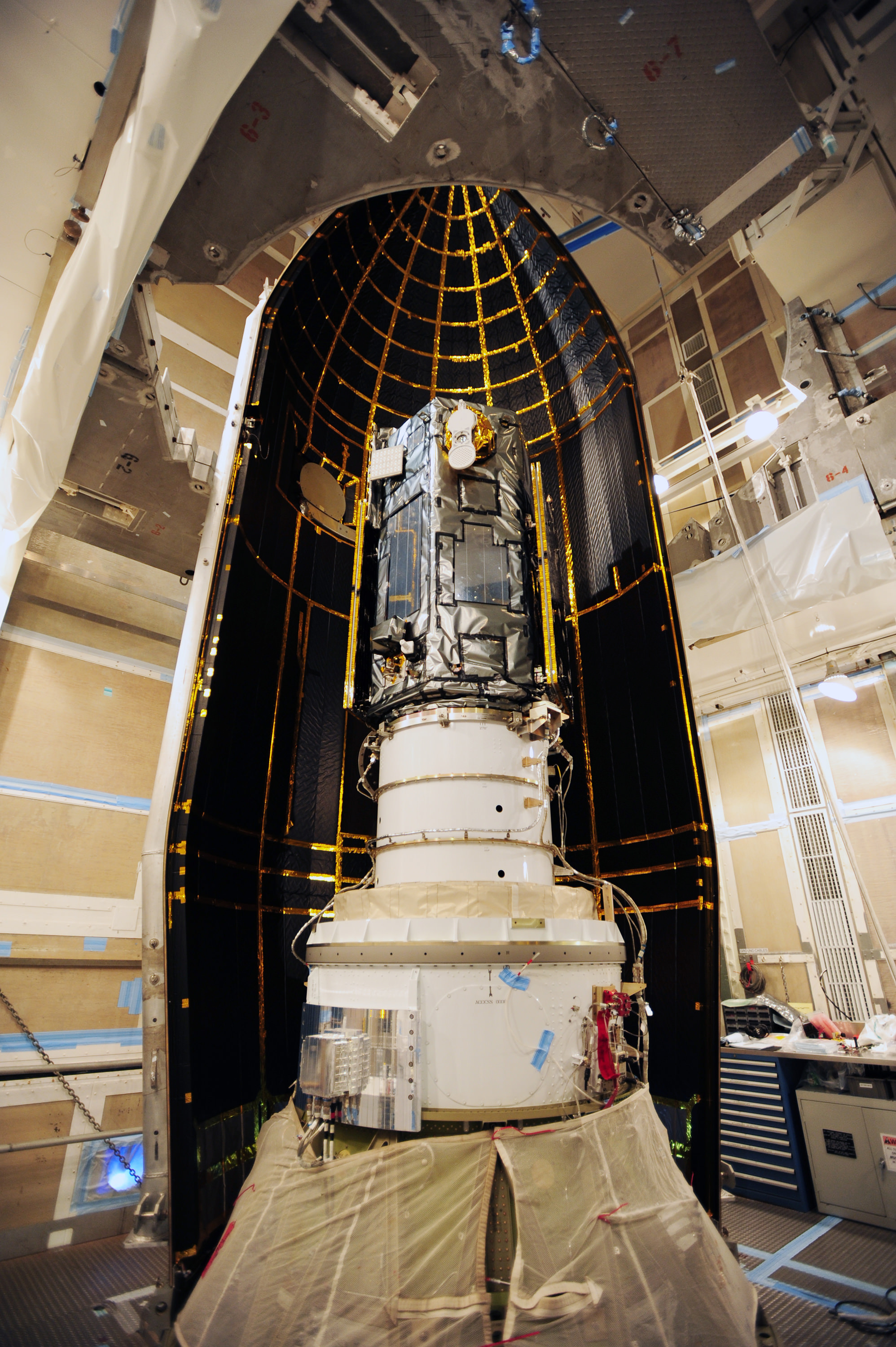
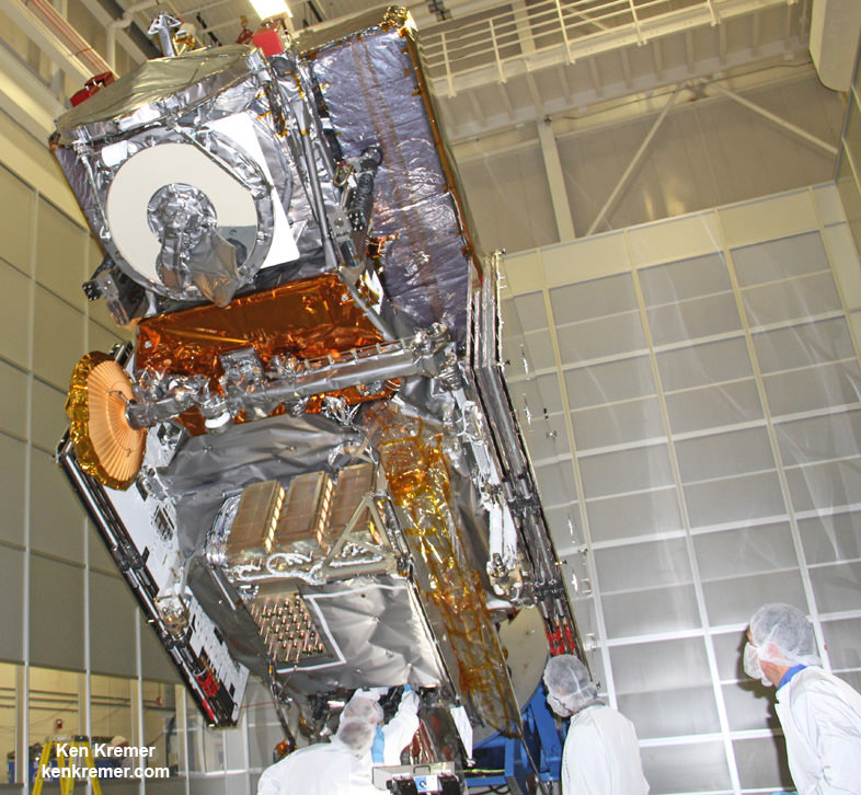
The 999 pound (454 kilogram) observatory is the size of a phone booth.
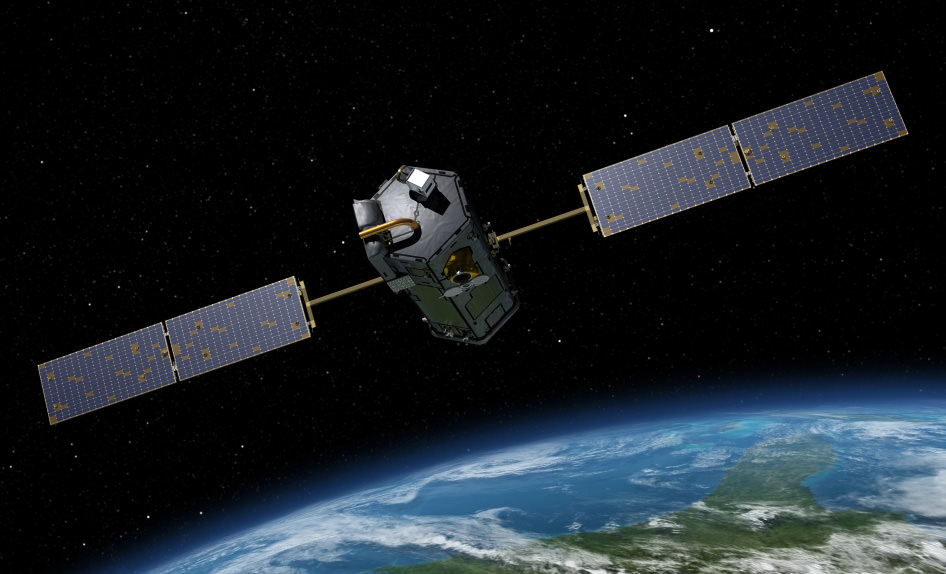
OCO-2 is equipped with a single science instrument consisting of three high-resolution, near-infrared spectrometers fed by a common telescope. It will collect global measurements of atmospheric CO2 to provide scientists with a better idea of how CO2 impacts climate change and is responsible for Earth’s warming.
During a minimum two-year mission the $467.7 million OCO-2 will take near global measurements to locate the sources and storage places, or ‘sinks’, for atmospheric carbon dioxide, which is a critical component of the planet’s carbon cycle.
OCO-2 was built by Orbital Sciences as a replacement for the original OCO which was destroyed during the failed launch of a Taurus XL rocket from Vandenberg back in February 2009 when the payload fairing failed to open properly and the spacecraft plunged into the ocean.
The OCO-2 mission will provide a global picture of the human and natural sources of carbon dioxide, as well as their “sinks,” the natural ocean and land processes by which carbon dioxide is pulled out of Earth’s atmosphere and stored, according to NASA.
Here’s a NASA description of how OCO-2 collects measurements.
As OCO-2 flies over Earth’s sunlit hemisphere, each spectrometer collects a “frame” three times each second, for a total of about 9,000 frames from each orbit. Each frame is divided into eight spectra, or chemical signatures, that record the amount of molecular oxygen or carbon dioxide over adjacent ground footprints. Each footprint is about 1.3 miles (2.25 kilometers) long and a few hundred yards (meters) wide. When displayed as an image, the eight spectra appear like bar codes — bright bands of light broken by sharp dark lines. The dark lines indicate absorption by molecular oxygen or carbon dioxide.
It will record around 100,000 precise individual CO2 measurements around the worlds entire sunlit hemisphere every day and help determine its source and fate in an effort to understand how human activities impact climate change and how we can mitigate its effects.

At the dawn of the Industrial Revolution, there were about 280 parts per million (ppm) of carbon dioxide in Earth’s atmosphere. As of today the CO2 level has risen to about 400 parts per million, which is the most in at least 800,000 years, says NASA.
OCO-2 is the second of NASA’s five new Earth science missions planned to launch in 2014 and is designed to operate for at least two years during its primary mission. It follows the successful blastoff of the joint NASA/JAXA Global Precipitation Measurement (GPM) Core Observatory satellite on Feb 27.
Stay tuned here for Ken’s continuing Earth and Planetary science and human spaceflight news.