Will Gaia Be Our Next Big Exoplanet Hunter?

ESA's Gaia is currently on a five-year mission to map the stars of the Milky Way. Image credit: ESA/ATG medialab; background: ESO/S. Brunier.

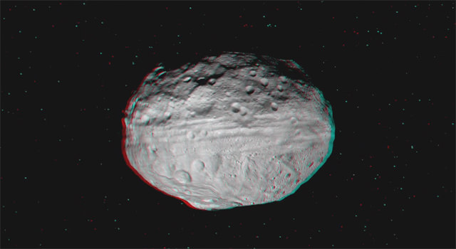
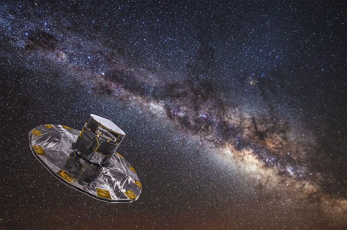
Early on the morning of Dec. 19, 2013, the pre-dawn sky above the coastal town of Kourou in French Guiana was briefly sliced by the brilliant exhaust of a Soyuz VS06 rocket as it ferried ESA’s “billion-star surveyor” Gaia into space, on its way to begin a five-year mission to map the precise locations of our galaxy’s stars. From its position in orbit around L2 Gaia will ultimately catalog the positions of over a billion stars… and in the meantime it will also locate a surprising amount of Jupiter-sized exoplanets – an estimated 21,000 by the end of its primary mission in 2019.

And, should Gaia continue observations in extended missions beyond 2019 improvements in detection methods will likely turn up even more exoplanets, anywhere from 50,000 to 90,000 over the course of a ten-year mission. Gaia could very well far surpass NASA’s Kepler spacecraft for exoplanet big game hunting!

“It is not just the number of expected exoplanet discoveries that is impressive”, said former mission project scientist Michael Perryman, lead author on a report titled Astrometric Exoplanet Detection with Gaia. “This particular measurement method will give us planet masses, a complete exoplanet survey around all types of stars in our Galaxy, and will advance our knowledge of the existence of massive planets orbiting far out from their host stars”.

Watch: ESA’s Gaia Launches to Map the Milky Way

Artist's impression of a Jupiter-sized exoplanet orbiting an M-dwarf star
Artist’s impression of a Jupiter-sized exoplanet orbiting an M-dwarf star

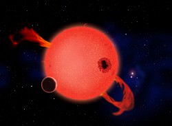
The planets Gaia will be able to spot are expected to be anywhere from 1 to fifteen times the mass of Jupiter in orbit around Sun-like stars out to a distance of about 500 parsecs (1,630 light-years) from our own Solar System. Exoplanets orbiting smaller red dwarf stars will also be detectable, but only within about a fifth of that distance.

While other space observatories like NASA’s Kepler and CNES/ESA’s CoRoT were designed to detect exoplanets through the transit method, whereby a star’s brightness is dimmed ever-so-slightly by the silhouette of a passing planet, Gaia will detect particularly high-mass exoplanets by the gravitational wobble they impart to their host stars as they travel around them in orbit. This is known as the astrometric method.

A select few of those exoplanets will also be transiting their host stars as seen from Earth – anywhere from 25 to 50 of them – and so will be observable by Gaia as well as from many ground-based transit-detection observatories.

Read more: Gaia is “Go” for Science After a Few Minor Hiccups

After some issues with stray light sneaking into its optics, Gaia was finally given the green light to begin science observations at the end of July and has since been diligently scanning the stars from L2, 1.5 million km from Earth.

With the incredible ability to measure the positions of a billion stars each to an accuracy of 24 microarcseconds – that’s like measuring the width of a human hair from 1,000 km – Gaia won’t be “just” an unprecedented galactic mapmaker but also a world-class exoplanet detector! Get more facts about the Gaia mission here. 

The team’s findings have been accepted for publication in The Astrophysical Journal.

Source: ESA

How an Ancient Angled Impact Created Vesta’s Groovy Belt

Vivid Vesta Vista in Vibrant 3 D from NASA’s Dawn Asteroid Orbiter. Vesta is the second most massive asteroid and is 330 miles (530 km) in diameter. Credit: NASA/JPL-Caltech/UCLA/MPS/DLR/IDA

When NASA’s Dawn spacecraft arrived at Vesta in July 2011, two features immediately jumped out at planetary scientists who had been so eagerly anticipating a good look at the giant asteroid. One was a series of long troughs encircling Vesta’s equator, and the other was the enormous crater at its southern pole. Named Rheasilvia, the centrally-peaked basin spans 500 kilometers in width and it was hypothesized that the impact event that created it was also responsible for the deep Grand Canyon-sized grooves gouging Vesta’s middle.

Now, research led by a Brown University professor and a former graduate student reveal how it all probably happened.

“Vesta got hammered,” said Peter Schultz, professor of earth, environmental, and planetary sciences at Brown and the study’s senior author. “The whole interior was reverberating, and what we see on the surface is the manifestation of what happened in the interior.”

Using a 4-meter-long air-powered cannon at NASA’s Ames Vertical Gun Range, Peter Schultz and Brown graduate Angela Stickle – now a researcher at the Johns Hopkins University Applied Physics Laboratory – recreated cosmic impact events with small pellets fired at softball-sized acrylic spheres at the type of velocities you’d find in space.

The impacts were captured on super-high-speed camera. What Stickle and Schultz saw were stress fractures occurring not only at the points of impact on the acrylic spheres but also at the point directly opposite them, and then rapidly propagating toward the midlines of the spheres… their “equators,” if you will.

Scaled up to Vesta size and composition, these levels of forces would have created precisely the types of deep troughs seen today running askew around Vesta’s midsection.

Watch a million-fps video of a test impact below:

So why is Vesta’s trough belt slanted? According to the researchers’ abstract, “experimental and numerical results reveal that the offset angle is a natural consequence of oblique impacts into a spherical target.” That is, the impactor that struck Vesta’s south pole likely came in at an angle, which made for uneven propagation of stress fracturing outward across the protoplanet (and smashed its south pole so much that scientists had initially said it was “missing!”)

Close-ups of Vesta's equatorial troughs obtained by Dawn's framing camera in August and September 2011. (NASA/ JPL-Caltech/ UCLA/ MPS/ DLR/ IDA)
Close-ups of Vesta’s equatorial troughs obtained by Dawn’s framing camera in August and September 2011. (NASA/ JPL-Caltech/ UCLA/ MPS/ DLR/ IDA)

That angle of incidence — estimated to be less than 40 degrees — not only left Vesta with a slanted belt of grooves, but also probably kept it from getting blasted apart altogether.

“Vesta was lucky,” said Schultz. “If this collision had been straight on, there would have been one less large asteroid and only a family of fragments left behind.”

Watch a video tour of Vesta made from data acquired by Dawn in 2011 and 2012 below:

The team’s findings will be published in the February 2015 issue of the journal Icarus and are currently available online here (paywall, sorry). Also you can see many more images of Vesta from the Dawn mission here and find out the latest news from the ongoing mission to Ceres on the Dawn Journal.

Source: Brown University news

Making the Moon: The Practice Crater Fields of Flagstaff, Arizona

Apollo 15 astronauts David Scott and James Irwin practice LRV operations in Arizona, Nov. 2 1970 (Credit: NASA. Research by J.L. Pickering)

Between the years of 1969 and 1972 the astronauts of the Apollo missions personally explored the alien landscape of the lunar surface, shuffling, bounding, digging, and roving across six sites on the Moon. In order to prepare for their off-world adventures though, they needed to practice extensively here on Earth so they would be ready to execute the long laundry lists of activities they were required to accomplish during their lunar EVAs. But where on Earth could they find the type of landscape that resembles the Moon’s rugged, dusty, and — most importantly — cratered terrain?

Enter the Cinder Lakes Crater Fields of Flagstaff, Arizona.

The Cinder Lakes Crater Fields northeast of Flagstaff, near the famous San Francisco peaks and just south of the Sunset Crater volcano, were used for Apollo-era training because of the inherently lunar-like volcanic landscape. LRV practice as well as hand tool geology and lunar morphology training were performed there, as well as ALSEP – Apollo Lunar Surface Experiment Package – placement and setup practice.

The photo above shows Apollo 15 astronauts Dave Scott and Jim Irwin driving a test LRV nicknamed Grover along the rim of a small “lunar crater.” (This particular exercise was performed on Nov. 2, 1970… 44 years ago today!)

Detonation of a "lunar crater" in 1967 (USGS)
Detonation of a “lunar crater” in 1967 (USGS)

Although the craters might look similar to the ones found on the Moon, they were actually created by the USGS in 1967 by digging holes and filling them with various amounts of explosives, which were detonated to simulate different-sized lunar impact craters. The human-made craters ranged in size from 5-40 feet (1.5-12 meters) in diameter.

The two crater field sites at Cinder Lakes were chosen because of the specific surface geology: a layer of basaltic cinders covering clay beds, left over from an eruption of the Sunset Crater volcano 950 years ago. After the explosions the excavated lighter clay material spread out from the blast craters and across the fields, like ejecta from actual meteorite impacts. A total of 497 craters were made within two sites comprising 2,000 square feet.

Detonations were done in series to simulate ejected debris from cratering events of different ages. And one of the areas of Cinder Lakes was designed to specifically replicate craters found within a particular region of the Apollo 11 Mare Tranquillitatis landing site.

Watch a contemporary educational film from the USGS showing the crater field detonations here. (HT to spaceflight archivist David S. F. Portree for the link.)

The completed Cinder Lakes Crater Field #1 in October 1967 (USGS)

Today only the largest craters can be distinguished at all in the publicly-accessible Cinder Lakes field, which has become popular with ATV enthusiasts. But a smaller field, fenced off to vehicles, still contains many of the original craters used by Apollo astronauts, softened by time and weather but still visible.

A couple of other areas were used as lunar analogue training fields as well, such as the nearby Merriam Crater and Black Canyon fields — the latter of which is now covered by a housing development. Geology field training exercises by Apollo astronauts were also performed at locations in Texas, New Mexico, Nevada, Oregon, Alaska, Idaho, Iceland, Mexico, the Grand Canyon, and the lava fields of Hawaii. But only in Arizona were actual craters made to specifically simulate the Moon!

Read more about the Cinder Lakes Crater Field in a presentation document (my main article source) by LPI’s Dr. David Kring, and you can find more recent photos of the Crater Lakes sites on this page by LPI’s Jim Scotti.

Top photo research: J.L. Pickering. Source: The Project Apollo Image Archive. 

Apollo 12 astronauts Pete Conrad and Alan Bean during geology training at Cinder Lakes on October 10, 1969 (NASA)

Orbiting Solar Observatory Sees It Burn, Burn, Burn: The Ring of Fire

Image of the Oct. 23, 2014 eclipse acquired with the Hinode spacecraft's X-ray telescope. (NASA/JAXA/SAO)

Did you catch the solar eclipse on October 23? If so, you saw the Moon “take a bite” out of the Sun (to various extents, depending on your location) during what was a partial eclipse for viewers on Earth. But for the Hinode (pronunciation alert: that’s “HEE-no-day”) solar observatory satellite, in its Sun-synchronous orbit around Earth at an altitude of 600 km (373 miles), the eclipse was annular – a “ring of fire.”

The image above was captured with Hinode’s X-ray Telescope at the moment of maximum annularity. Want to watch it burn, burn, burn like Hinode did? Check out a video below:

Not to be confused with “annual,” meaning yearly, an annular eclipse occurs when the Moon passes directly in front of the Sun but at such a distance from Earth to not quite manage to fully cover the Sun’s disk. The bright ring of visible Sun around the Moon’s silhouette gives the event its name: annular is from the Latin word anulus, meaning ring.

The next annular eclipse to be visible from Earth will occur on Sept. 1, 2016.

Led by the Japan Aerospace Exploration Agency (JAXA), the Hinode mission is a collaboration between the space agencies of Japan, the United States, the United Kingdom, and Europe, and is now in its eighth year. NASA helped in the development, funding, and assembly of the spacecraft’s three science instruments. Learn more about the mission here.

Image and video credits: NASA/JAXA/SAO

This Is the Very First Photo of Earth From Space

The first photo of Earth from space was taken on Oct. 24, 1947 (Credit: White Sands Missile Range/Applied Physics Laboratory)

These days we see photos of our planet taken from space literally every day. Astronauts living aboard the International Space Station, weather and Earth-observing satellites in various orbits, even distant spacecraft exploring other planets in our Solar System… all have captured images of Earth from both near and far. But there was a time not that long ago when there were no pictures of Earth from space, when a view of our planet against the blackness of the cosmos was limited to the imagination of dreamers and artists and there was nothing but the Moon orbiting our world.

On this day in 1946, before Apollo, before Mercury, even before Sputnik, that was no longer the case.

The image above shows the first photo captured of Earth from space, taken by a camera mounted to a V-2 rocket that was launched from the U.S. Army’s White Sands Missile Range in New Mexico. Taken to the United States by the dozen from Germany after the end of World War II, the V-2 (for “Vergeltungswaffe 2”) missiles were used by the Army to improve on their own rocket designs and also by scientists who were permitted to fill their payloads with experiments.

On October 24, 1946, a V-2 was launched from the Missile Range while a mounted 35mm movie camera captured images every 1.5 seconds. It reached an altitude of 65 miles before crashing back to Earth and, while the camera was destroyed on impact, the film cassette survived. The grainy photo seen above was on that roll, one of our first views of Earth from above the atmosphere.

(Okay, technically there’s still atmosphere above 65 miles — even the ISS orbiting at 260-plus statute miles has to give itself a boost to compensate for drag now and again — but the official aeronautical delineation of “space” begins at about 62 miles, or 100 km: the Kármán Line. V-2 #13 passed that mark in 1946 by 3 miles.)

In the following years more V-2 rockets would be launched, some reaching heights of 100 miles, giving us many more detailed views of our planet as it looks from space and prompting Clyde Holliday, the APL engineer who developed the mounted film cameras, to envision that “the entire land area of the globe might be mapped in this way.”

Assembled panorama of V-2 images taken from an altitude of 60 miles in 1948 (JHUAPL/US Navy)

Now, 68 years later, seeing pictures of Earth from space are a much more common, if no less amazing, occurrence. But it all started with that one launch of a missile designed for war but repurposed for science.

Read more here in an article for Smithsonian’s Air & Space by Tony Reichhardt, and watch a contemporary news reel below about the 1946 V-2 launch:

Source: Air & Space

No, This Is Not a Photo of India on Diwali

Yes, it's India, but it's not a photo captured from space during Diwali night. (Credit: NASA)

Diwali, the Indian festival of lights, falls on Thursday, Oct. 23 this year and with it come celebrations, gift-giving, and brilliant lighting and firework displays all across the subcontinent of India… but this isn’t a picture of that. What is it exactly? Find out below…

Over the past several years this image has repeatedly resurfaced online, especially around the time of Diwali. And understandably so: it’s a beautiful view of India seemingly decorated for the festival… one can easily imagine the entire country awash in colorful lights from shore to shore.

But it’s not a photo at all, or even a singular image. Rather it’s a composite of many images acquired from a USAF Defense Meteorological Satellite Program (DMSP) satellite over the course of several years, and assembled by NOAA scientist Chris Elvidge to show the country’s growing population and urban areas.

In a 2012 article by Robert Johnson on Business Insider a NASA spokesperson described the colors in the image: “The white lights were the only illumination visible before 1992. The blue lights appeared in 1992. The green lights in 1998. And the red lights appeared in 2003.”

So what does India look like at night during the five-day-long Diwali festival? Click here and see.

While city lighting in India is definitely visible from space, it’s not the rainbow explosion of neon colors that Internet hoaxers and uninformed online enthusiasts would eagerly have you believe. According to Adam Voiland on the NASA Earth Observatory site, “in reality, any extra light produced during Diwali is so subtle that it is likely imperceptible when observed from space.”

So this year, don’t fall for any false descriptions of this picture… and, Happy Diwali!

Sources: Business Insider, Mashable, NASA Earth Observatory, EarthSky. Read more about the 2014 celebration of Diwali here.

HT to Peter Caltner on Twitter for re-alerting me of this.

Awesome Photo Shows Monster Sunspot Aiming Our Way

Visible light image of the Sun captured on Oct. 19, 2014. © Alan Friedman. All rights reserved.

It’s a-comin’: a “monster” sunspot is steadily rotating around the Sun’s southern hemisphere and will soon be in position to fire flares and CMEs in our direction — and this past weekend master solar photographer Alan Friedman captured it on camera!

The image above was taken in full-spectrum visible light on Sunday, Oct. 19 by Alan from his backyard in Buffalo, New York. Sunspots 2186 (at the top limb), 2187 (upper center), 2193 (the small middle cluster) and the enormous AR2192 are easily visible as dark blotches – “cooler” regions on the Sun’s surface where upwelling magnetic fields interrupt the convective processes that drive the Sun’s energy output.

This particular image was a single frame of video, unlike some of Alan’s other photographs. According to Alan the air turbulence was particularly bad that day, shooting between the clouds, so only this one frame was usable. Click the image for full-scale “wow” factor.

(And if you think AR2192 looks scary in that image, check it out in CaK bands here!)

Scale size of Earth compared to AR2192 on Oct. 20 (NASA/SDO/AIA. Edit by J. Major.)
Scale size of Earth compared to AR2192 on Oct. 20 (NASA/SDO/AIA. Diagram by J. Major.)

According to Spaceweather.com AR2192 has grown considerably over the past few days and has the potential to unleash M- and X-class flares in our direction now that it’s moving into Earth-facing position. It’s currently many times larger than Earth and will likely get even bigger… in fact, during this week’s partial solar eclipse AR2192 should be visible with the naked (but not unprotected!) eye for viewers across much of North America.

See more of Alan’s photography on his Averted Imagination site here (with prints available for purchase) and watch a TEDx presentation by Alan on how and why he does solar photography.

Image © Alan Friedman. Used with permission.

Here’s a High-Res Look at Philae’s Landing Spot

Mosaic of OSIRIS images of landing site "J" on Comet 67P/CG. Credits: ESA/Rosetta/MPS for OSIRIS Team MPS/UPD/LAM/IAA/SSO/INTA/UPM/DASP/IDA

The long-awaited deployment of the Philae lander, currently “piggybacked” aboard ESA’s Rosetta spacecraft orbiting the nucleus of Comet 67P/Churyumov-Gerasimenko, will occur in less than a month and we now have our best look yet at the area now green-lighted for touchdown. The picture above, made from two images acquired by Rosetta’s OSIRIS imaging instrument, shows a 500-meter circle centered on “Site J,” a spot on the comet’s “head” carefully chosen by mission scientists as the best place in which Philae should land, explore, and ultimately travel around the Sun for the rest of its days. And as of today, it’s a GO!

Site J was selected from among five other possible sites and was chosen because of the relative safety of its surface, its accessibility to consistent solar illumination, and the scientific and observational data it can make available to Philae’s suite of onboard instruments.

“None of the candidate landing sites met all of the operational criteria at the 100% level, but Site J is clearly the best solution,” said Stephan Ulamec, Philae Lander Manager at the DLR German Aerospace Center.

Illustration of the Rosetta Missions Philae lander on final approach to a comet surface. The date is now set for landing, November 12. (Photo: ESA)

Read more: Comet’s Head Selected as Landing Site for Rosetta’s Historic Philae Lander

The mosaic above comprises two images taken by Rosetta’s OSIRIS (Optical, Spectroscopic, and Infrared Remote Imaging System) narrow-angle camera on Sept. 14 from a distance of about 30 km (18.6 miles). Image scale is 0.5 m/pixel.

As Comet 67P/CG continues toward perihelion its outgassing and sublimation jetting will undoubtedly increase, and Philae will be getting a front-row seat to the action.

“Site J is just 500-600 meters away from some pits and an area of comet outgassing activity,” said Holger Sierks, principal investigator for Rosetta’s OSIRIS camera from the Max Planck Institute for Solar System Research in Gottingen, Germany. “They will become more active as we get closer to the Sun.”

Watch “Landing on a Comet: the Trailer”

After completing a series of “Go/No-go” decisions by Rosetta’s flight dynamics team, Philae’s separation from Rosetta will occur on Nov. 12 at 08:35 GMT. It will land about seven hours later at around 15:30 GMT. Because of the distance to the comet and spacecraft — about 509 million km — confirmation of a successful touchdown won’t be received on Earth until 28 minutes and 20 seconds later. (And you thought Curiosity’s “seven minutes of terror” was nerve-wracking!)

Read more here on ESA’s Rosetta blog.

On Scarves, Squirrels, and the Fate of the Universe

Are you scared of the dark, personal failure, or just feeling a tad nihilistic? Maybe you’re worried about asteroids, solar flares, or the heat death of the Universe… or perhaps you’ve just misplaced your favorite winter accessory and it’s driving you… er, nuts. If any of these are applicable (or even if none is) be sure to watch the ridiculously award-winning video above by animator Eoin Duffy. (And if you’re wondering why I’m sharing this on Universe Today, well… you’ll see.)

Click. Play. Now.

Credit: Eoin Duffy. HT to the Observation Deck @io9.

Landing on a Comet: The Trailer

Artist's impression of the 100-kg Philae lander (screenshot) Credit: ESA/DLR

In less than a month, on November 12, 2014, the 100-kg Philae lander will separate from ESA’s Rosetta spacecraft and descend several kilometers down to the dark, dusty and frozen surface of Comet 67P/Churyumov-Gerasimenko, its three spindly legs and rocket-powered harpoon all that will keep it from crashing or bouncing hopelessly back out into space. It will be the culmination of a decade-long voyage across the inner Solar System, a testament to human ingenuity and inventiveness and a shining example of the incredible things we can achieve through collaboration. But first, Philae has to get there… it has to touch down safely and successfully become, as designed, the first human-made object to soft-land on the nucleus of a comet. How will the little spacecraft pull off such a daring maneuver around a tumbling chunk of icy rubble traveling over 18 km/s nearly 509 million km away? The German Aerospace Center (DLR) has released a “trailer” for the event, worthy of the best sci-fi film. Check it out below.

Want to see more? Of course you do. Keep an eye out for the 11-minute short film “Landing on a Comet – The Rosetta Mission” to be released soon on YouTube here, and follow the latest news from the Rosetta mission here (and here on Universe Today, too!)

“The reason we’re at this comet is for science, no other reason. We’re doing this to get the best science. To characterize this comet has never been done before.”

Original Material: DLR (CC-BY 3.0)
Footage: ESA
Credit 67P image: ESA/Rosetta/MPS for OSIRIS Team MPS/UPD/LAM/IAA/SSO/INTA/UPM/DASP/IDA
Music: Omega by TimMcMorris

Source: DLR