Mississippi River Flooding As Seen from the Space Station
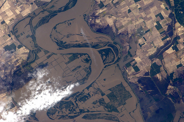
Flood water from the Mississippi river near New Madrid, Missouri, as seen by Paolo Nespoli on board the International Space Station. Credit:ESA/NASA
[/caption]
Big Muddy, as the Mississippi River is known, looks especially big and muddy these days with record flooding occurring along the largest river in the US. The Mississippi has risen to levels not seen in since the 1920’s and 30’s, fed by heavy spring rains and the spring thaw from heavy snows in the northern US this winter. Here are some new images taken by International Space Station astronaut Paolo Nespoli, which show surprising detail of how the river has spread across farmland and through cities and towns. The image above shows the area around New Madrid, Missouri, along the border of Kentucky.
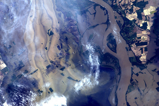
In this image, levees are visible which are containing the flood near Ridgely, Tennessee.
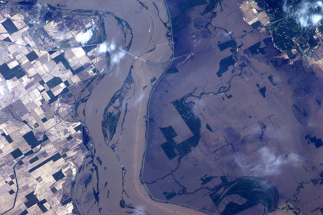
Last week, the US Army Corps of Engineers opened floodways in Missouri to keep pressure off levees protecting the town of Cairo, Illinois, flooding thousands of acres of farmland. This week, the Corp is preparing to flood up to three million acres in southern Louisiana in hopes of protecting large cities along the Mississippi River such as Baton Rouge and New Orleans, Louisiana. More than 25,000 people are preparing to leave the region before the spillways would be opened.
Recent Posts
Dinkinesh's Moonlet is Only 2-3 Million Years Old
Last November, NASA's Lucy mission conducted a flyby of the asteroid Dinkinish, one of the…
The Universe Could Be Filled With Ultralight Black Holes That Can't Die
Steven Hawking famously calculated that black holes should evaporate, converting into particles and energy over…

Starlink on Mars? NASA Is Paying SpaceX to Look Into the Idea
NASA has given the go-ahead for SpaceX to work out a plan to adapt its…
Did You Hear Webb Found Life on an Exoplanet? Not so Fast…
The JWST is astronomers' best tool for probing exoplanet atmospheres. Its capable instruments can dissect…
Vera Rubin’s Primary Mirror Gets its First Reflective Coating
First light for the Vera Rubin Observatory (VRO) is quickly approaching and the telescope is…
Two Stars in a Binary System are Very Different. It's Because There Used to be Three
A beautiful nebula in the southern hemisphere with a binary star at it's center seems…