Satellite Photos Before and After of Japan’s Earthquake, Tsunami
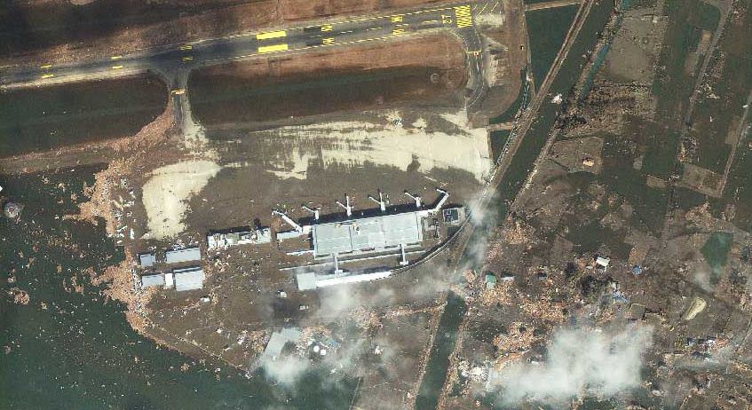
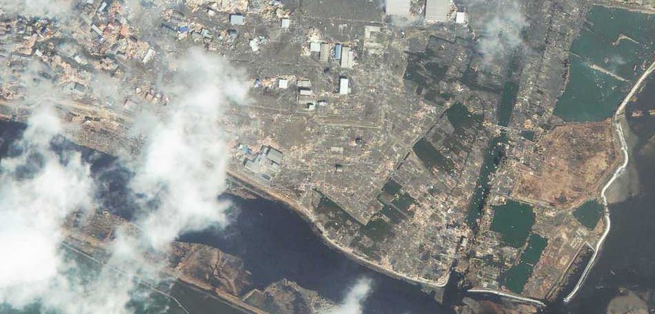
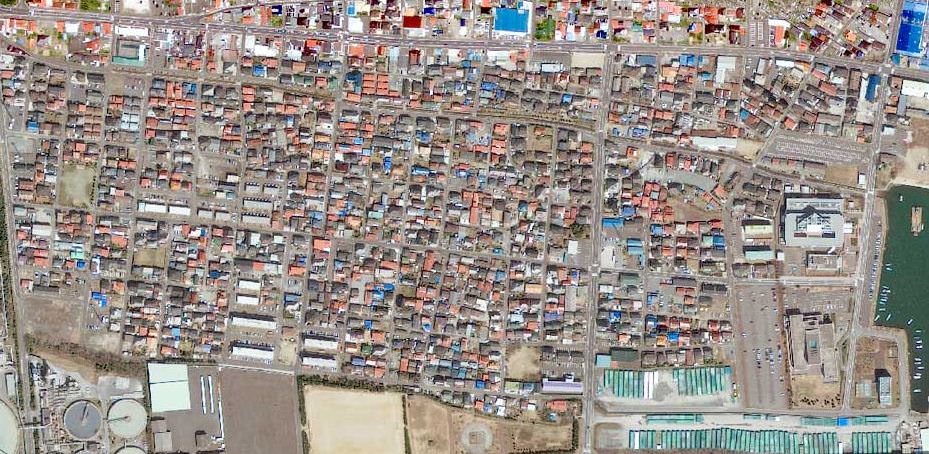
Sendai, Japan after the disaster. Satellite image courtesy of GeoEye.
[/caption]
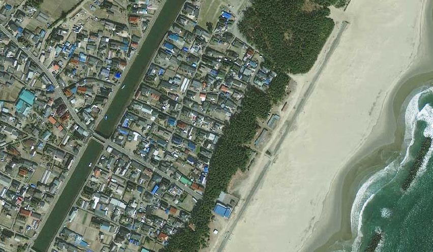
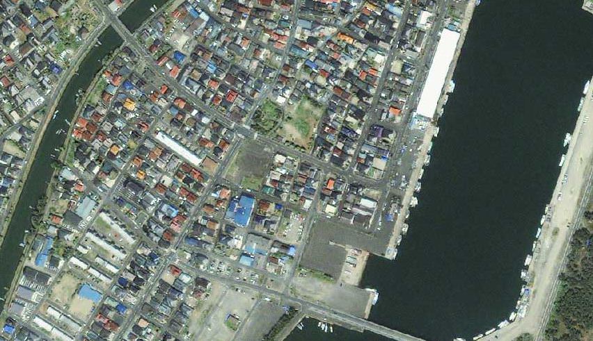
Photos from the GeoEye satellite imaging company from before and after the March 11 earthquake and tsunami in Japan show sobering views from above of the disaster. Above is the town of Sendai, Japan after the quake, below is how it looked before catastrophe struck.
See more below.
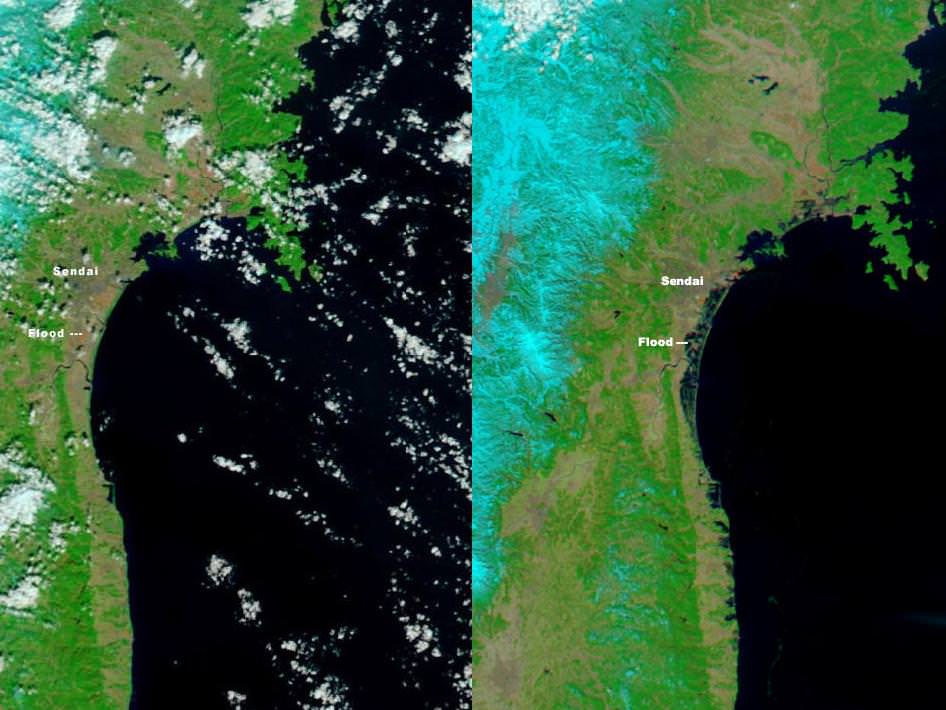
Below is an images from the MODIS Rapid Response System, which is producing twice-daily images of Japan in response to the disaster.
These two images, from the MODIS instrument on NASA’s Aqua satellite from Mar. 13, 2011 on the right, and the the MODIS sensor on NASA’s Terra satellite from Feb. 26, 2011 on the left before the earthquake and tsunami. Both images were made with infrared and visible light to highlight the presence of water on the ground. Plant-covered land is bright green, bare earth is tan-pink, and snow is blue. The city of Sendai is brown.
At this level of detail, the flooding along the coastline is the most obvious sign of the destructive earthquake and tsunami that struck Japan on March 11. A bright orange-red spot near the city of Sendai is the thermal signature from a fire, also likely caused by the earthquake. The photo-like true-color version of the image shows a plume of black smoke extending east over the ocean.
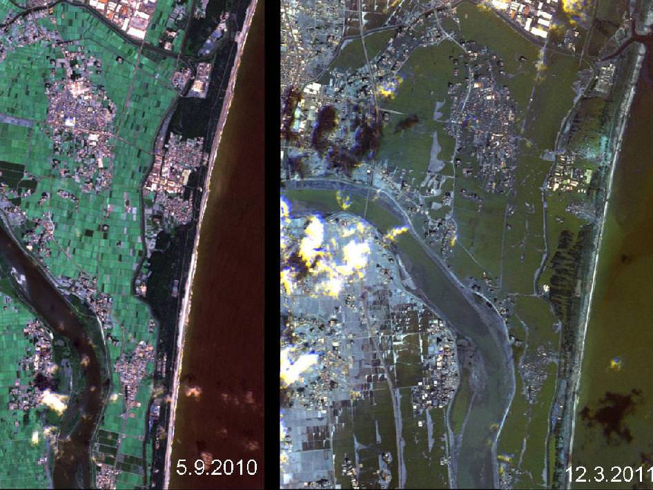
The German Aerospace Center (Deutsches Zentrum fur Luft- und Raumfahrt; DLR) is responding through its Center for Satellite Based Crisis Information (Zentrum fur Satellitengestutzte Kriseninformation; ZKI), based at its site in Oberpfaffenhofen, and provided the image below.
Sources: GeoEye, New York Times, NASA, Space Daily
Recent Posts
41,000 Years Ago Earth’s Shield Went Down
Earth is naked without its protective barrier. The planet's magnetic shield surrounds Earth and shelters…
Fall Into a Black Hole With this New NASA Simulation
No human being will ever encounter a black hole. But we can't stop wondering what…

Solar Max is Coming. The Sun Just Released Three X-Class Flares
The Sun is increasing its intensity on schedule, continuing its approach to solar maximum. In…
New Evidence for Our Solar System’s Ghost: Planet Nine
Does another undetected planet languish in our Solar System's distant reaches? Does it follow a…
NASA Takes Six Advanced Tech Concepts to Phase II
It's that time again. NIAC (NASA Innovative Advanced Concepts) has announced six concepts that will…
China is Going Back to the Moon Again With Chang'e-6
On Friday, May 3rd, the sixth mission in the Chinese Lunar Exploration Program (Chang'e-6) launched…