[/caption]
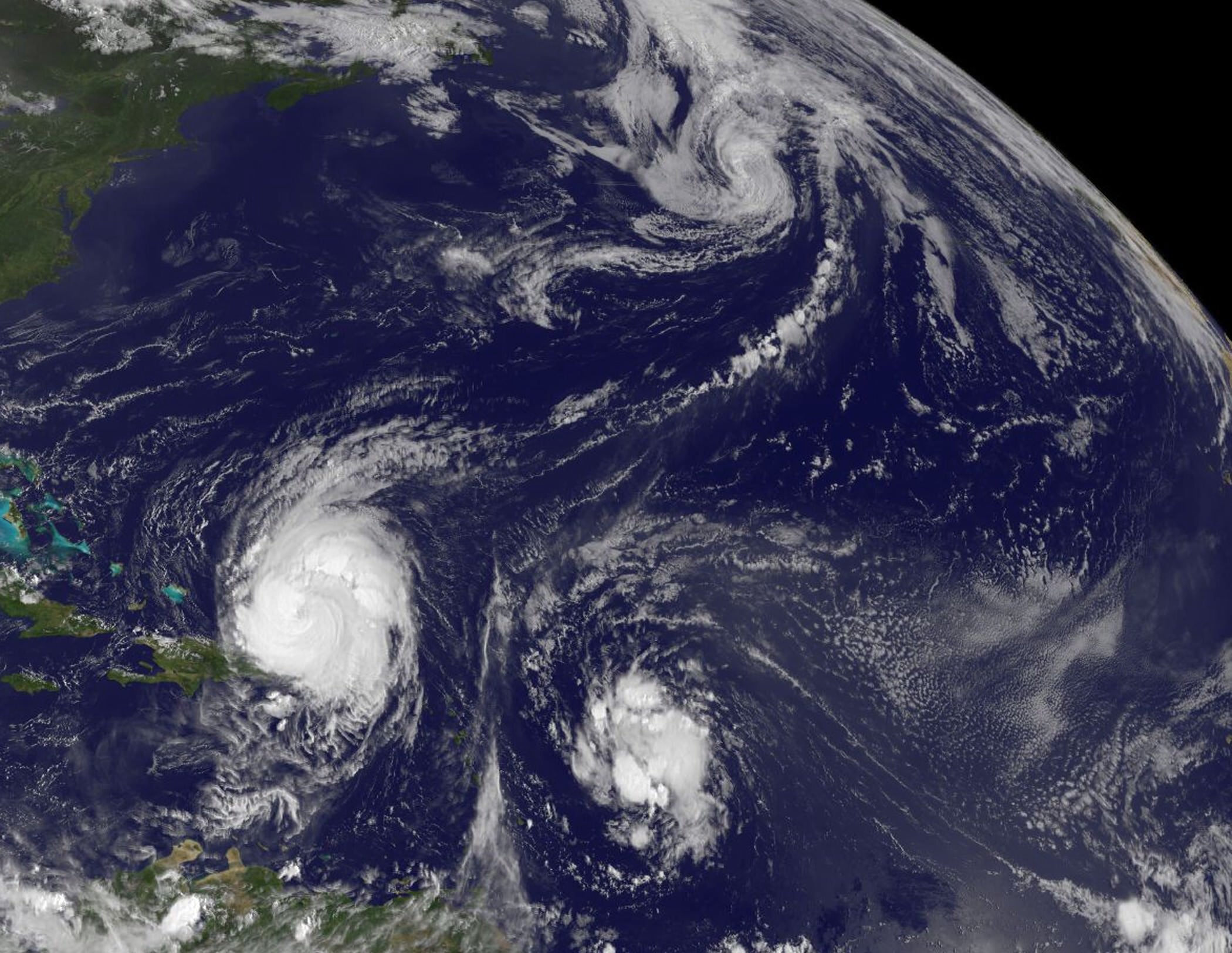
My father had a favorite adage when life was hectic: "There's lots of commotion in the ocean." That saying was never more true than the current situation in the busy Atlantic Ocean. The GOES-13 satellite captured this image earlier today (Tuesday Aug. 31) and visible are three areas of tropical commotion. The large and powerful Hurricane Earl (lower left) is passing Puerto Rico, Tropical Storm Fiona located to Earl's east, and Tropical Storm Danielle far in the Northern Atlantic. Below is footage taken by the International Space Station of the action.
Hurricane Earl is a storm that's about 640 km (400 miles) in diameter and the hurricane force winds are about 225 km (140 miles) in diameter from side-to-side of the storm's eye. Earl is still a Category Four hurricane on the Saffir-Simpson scale, one category stronger than Hurricane Katrina was when she made landfall in Mississippi in 2005.
A tropical storm warning is in effect for Turks and Caicos Islands and a tropical storm watch is in effect for the southeastern Bahamas. Meanwhile, residents from the Carolinas northward to New England in the US should be watchful of where Earl is heading. A hurricane watch could be required for portions of the mid-Atlantic coast later today.
Tropical Storm Fiona is moving through the same areas that Hurricane Earl battered a few days ago, but with less force. A tropical storm warning is in effect for St. Martin and St. Barthelemy. A tropical storm watch is in effect for, Antigua, Barbuda, Montserrat, St. Kitts, Nevis, and Anguilla and St. Maarten, Saba, and St. Eustatius. The National Hurricane Center noted in its forecast this morning, August 31, that Tropical storm conditions could spread over portions of the Northern Leeward Islands tonight or early Wednesday.
At 11 a.m. EDT, Tropical Storm Fiona had maximum sustained winds near 65 kph (40 mph) and some strengthening is possible. Fiona is moving west-northwest near 38 kph (24 mph) and is expected to slow down.
Tropical cyclones are warm-core systems, so when the core temperatures change, the dynamics of the system also changes. Today, Danielle transitioned into a cold-core low pressure area in the Northern Atlantic Ocean. Her sustained winds were near 112 kph (70 mph), but waning.
Danielle's effects are being felt along the shores of Newfoundland with heavy surf and waves up to 3 meters (10 feet).
The Geostationary Operational Environmental Satellite project was developed by NASA for the National Oceanic and Atmospheric Administration (NOAA). The GOES satellites are funded by NOAA, while the Goddard Space Flight Center procures and manages the development and launch of the GOES satellites while NOAA manages the operational environmental satellite program and establishes requirements, provides all funding and distributes environmental satellite data for the United States.
Source:
NASA