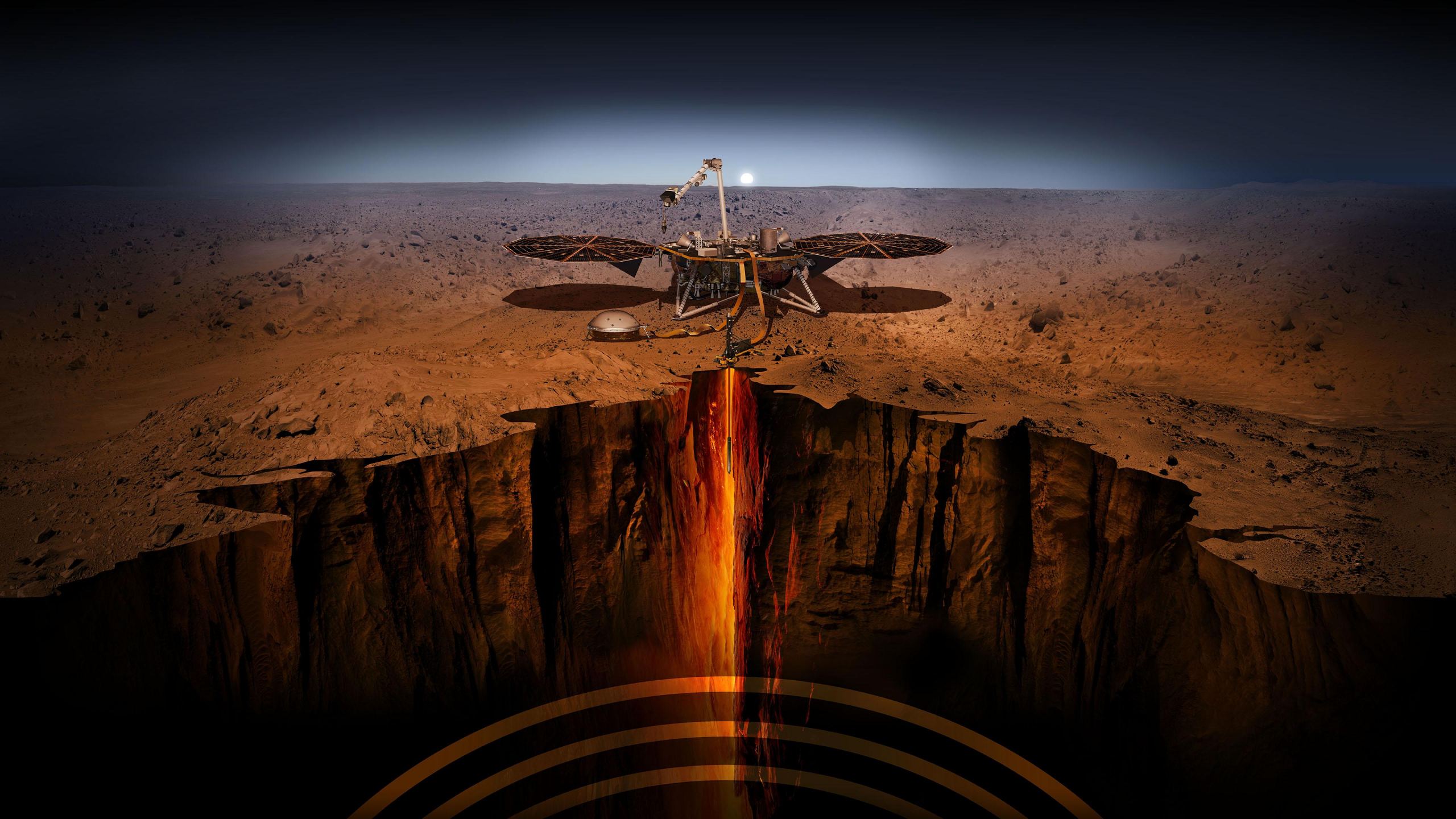
The InSight lander has been on Mars, gathering data for a thousand days now, working to give us a better understanding of the planet's interior. It's at Elysium Planitia, the second largest volcanic region on Mars. A newly-published paper based on seismic data from the lander shows something unexpected underground: a layer of sediment sandwiched between layers of lava flows.
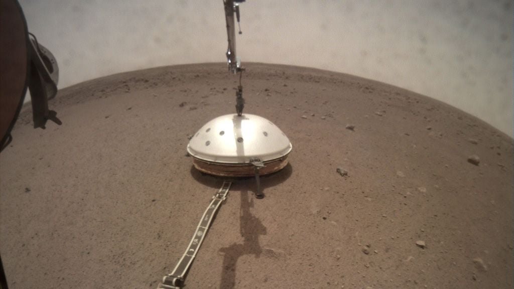
Much of InSight's media coverage has centred around the lander's Heat Flow and Physical Properties Package (HP3), also called the Mole. Its job was to measure the heat coming from the planet's interior to the surface. After an epic struggle to get the instrument working, NASA and the DLR ( German Aerospace Center) announced in January 2021 that the Mole's mission was over before it got started.
But the Mole isn't InSight's only instrument. Its other main science instrument is called the Seismic Experiment for Interior Structure (SEIS.) SEIS is working fine and has already delivered some solid science. This new paper rests on seismic data from SEIS.
The new paper is titled " The shallow structure of Mars at the InSight landing site from inversion of ambient vibrations." It's published in the journal Nature Communications, and the authors are an international team of scientists.
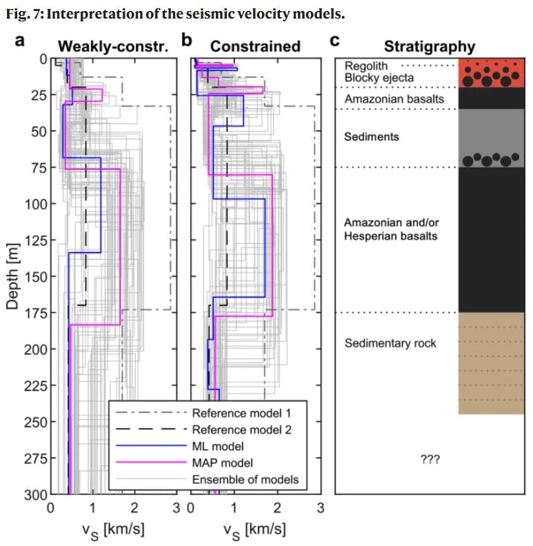
The team used seismic data from InSight's SEIS lander to analyze the sub-surface structure at Elysium Planitia to a depth of 200 meters. Directly beneath the lander, they found a three-meter layer of sandy material that makes up the regolith. Beneath that, there's a 15-meter layer of material described as coarse, rocky ejecta. That material is debris from a meteorite impact, thrown up into the air before falling back to Mars.
Then it gets interesting.
Below the ejecta layer, InSight found a 150-meter region of layered basaltic material made of solidified lava. That layer is in line with expectations. But there's something unexpected between the basaltic rock. Between 30 to 75 meters, there's a "seismic low-velocity zone" that the team interpreted as a layer of less dense sedimentary material.
InSight has made progress probing Mars' deeper planetary structure, and it's studied the shallow subsurface to a depth of 10 to 20 meters. But it hasn't studied the first few tens or hundreds of meters before. This data is helping build a detailed model of the near-surface region that will help explain the formation of Elysium Planitia.
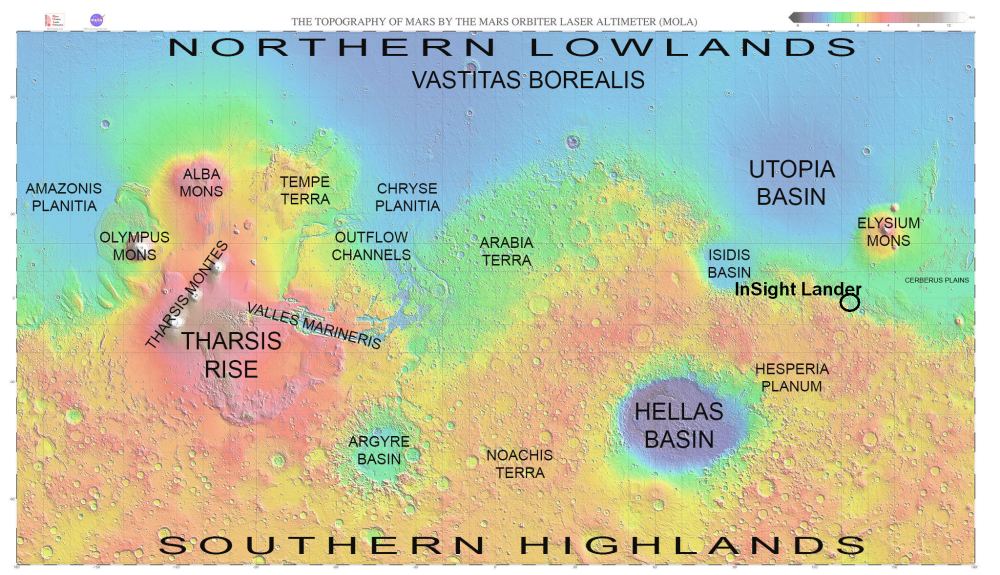
InSight's mission focuses on the Martian sub-surface, so it landed at Elysium Planitia, which is relatively flat and featureless. It's not easy landing a spacecraft on Mars, which made it a safer spot to land. Still, the lander is near the border of two regions: the ancient southern heavily cratered highlands and low-standing younger, smoother northern plains.
There is a sharp distinction between Mars' younger northern plains and its much older southern highlands. This distinction is known as the Martian Dichotomy, and it's one of the planet's enduring mysteries. The region between the two types of geography is also quite complex, and scientists hope that InSight can help build a stronger understanding of what's going on there. Three competing hypotheses explain the Martian Dichotomy: the single impact hypothesis, the multiple impact hypothesis, and the plate tectonics hypothesis.
By studying the near-surface region, InSight should help scientists "...understand the stratigraphy and the role of volcanism as well as sedimentation in the transition zone..." between the older and younger areas.
The researchers wanted to date the shallow lava flows, and for that, they turned to crater counts. On a basic level, the more craters there are, the older the surface area is. An area with fewer craters must be younger. Scientists use this basic fact to date rocks. Also, when a crater is deeper, it allows scientists to date the deeper rock, and the reverse is true for shallower craters.
The team was able to date the pair of solidified lava flows that sandwich the sedimentary layer. They found that the shallower lava layer is about 1.7 billion years old when Mars was in its Amazonian Period. The deeper layer is about 3.6 billion years old, from Mars' Hesperian period when the planet was undergoing widespread volcanic activity. The authors think that the sedimentary layer is either between the basaltic layers or embedded within the deeper, older layer.

This study is the first time scientists have compared Mars' near-surface region to models mainly based on remote data. InSight data shows that there's additional layering and more porous rocks.
One of the paper's authors is Dr. Knapmeyer-Endrun from the Institute of Geology and Mineralogy at the University of Cologne. In a press release, she said, "While the results help to better understand the geological processes in Elysium Planitia, comparison with pre-landing models is also valuable for future landed missions since it can help to refine predictions." A better understanding of the load-bearing conditions and travelling conditions for rovers will help with planning. It may also help locate sub-surface water ice.
Seismic study on Mars is different than on Earth. Scientists can probe the structure here on Earth by sending seismic signals into the ground and reading how they bounce back to sensors. But on Mars, the SEIS instrument reads ambient vibrations. Those ambient vibrations come from interactions between the wind and the planet's surface. But the thin atmosphere, the lower solar irradiation, and the lack of oceans make the ambient vibrations much weaker than here on Earth.
The InSight lander has been on Mars since November 26th, 2018. Its mission length was set at 709 sols but has reached 1070 sols. The lander is solar-powered, so it could conceivably last much longer. InSight stands for Interior Exploration using Seismic Investigations, Geodesy and Heat Transport. It's a joint mission between NASA and European space agencies, most notably Germany's DLR.
More:
- Press Release: Analysis of Mars’s wind-induced vibrations sheds light on the planet’s subsurface properties
- Research Paper: The shallow structure of Mars at the InSight landing site from inversion of ambient vibrations
- Universe Today: After a Challenging First Year on Mars, InSight Shows Us that Mars is Seismically Active