
Extreme winter weather hit Texas hard this February. An air mass from the arctic extended deep into the United States from Canada, with disastrous results for the ordinarily warm state. Along with snow and unusually low temperatures, the state's capacity for power generation was significantly reduced by weather-related equipment failures. Images hosted by NASA's Earth Observatory show the effect of controlled, rolling blackouts across the Greater Houston Area.
One image, taken on February 7th, shows Houston before the arctic weather system, and another picture taken on the 16th shows large swaths of the city in darkness. Earth Observatory has conveniently layered the two images with a vertical slider allowing users to slide back and forth, highlighting (or low-lighting as it were) the blackouts' impact.
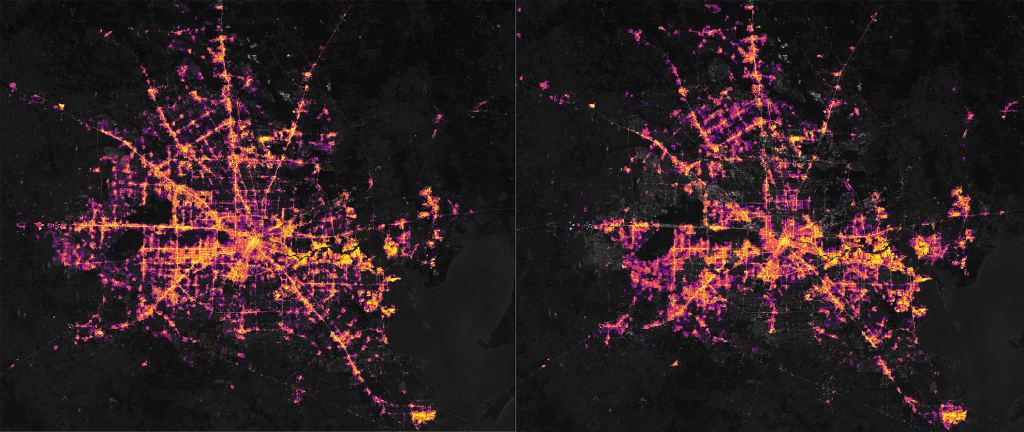
Each of these images is composed of nighttime lights data overlaid on Landsat imagery to allow the city structure to be recognizable under the lights. The nighttime lights data is from the Visible Infrared Imaging Radiometer Suite or VIIRS. This instrumentation suite rides aboard the Suomi National Polar-Orbiting Partnership (Suomi NPP) spacecraft.
VIIRS data is also utilized in NASA's Black Marble, a program studying the Earth at night. Nighttime lights data is collected and processed by Black Marble in a variety of situations and for various events, such as the 2019 Hurricane Dorian’s devastating impact on the Bahamas.
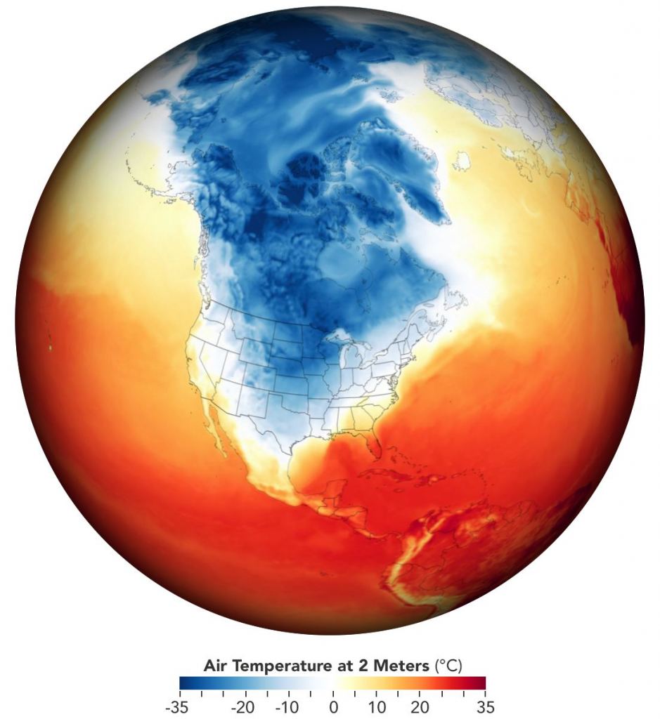
Along with the February 2021 images of rolling blackouts in Texas, the Earth Observatory published a global temperature map focused on North America for February 15. In this dramatic image, the extent of the extreme cold of the arctic air mass can be seen carving through the heart of the continent. Dallas recorded a chilling temperature of a mere -16°C (4°F), which is lower than most of the high temperatures recorded at Gale Crater on Mars by the Curiosity Rover!
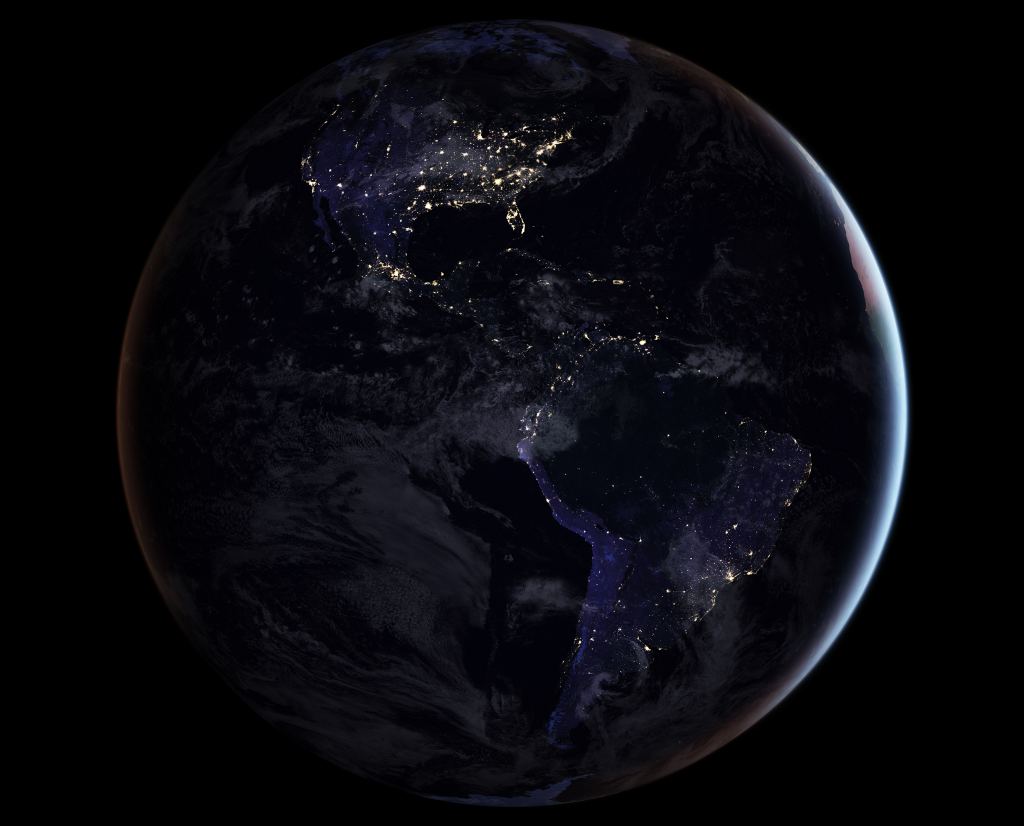
For those fascinated by satellite imagery of the earth, it is worth digging deeper into what Earth Observatory is up to. For instance, users can explore this extraordinary global map. It features spectacular images and the associated stories for points around the world. Thousands of interactive points allow you to explore unbelievably detailed satellite images for hours and hours. If you have a habit of falling down Wikipedia rabbit holes, this will surely scratch a similar itch.

The side-by-side imagery of Houston's power outages highlights the importance of scientific instrumentation in orbit pointed back home. When some people think about the space program, interplanetary missions like Mars Perseverance or cosmic observers like the Hubble Space Telescope often get the vast bulk of their attention. While Perseverance and Hubble are undoubtedly remarkable and valuable programs, we often overlook the significance of Earth-focused missions. When was the last time you saw a big news headline about the Suomi National Polar-Orbiting Partnership, let alone VIIRS? Programs like this are deserving of support and praise. There's something compelling about seeing such breathtaking images of our world, and the value of the scientific understanding that comes along with it is immeasurable.
Follow Ralph Crewe on Twitter @RalphCrewe
Watch Ralph Crewe explore unusual and fascinating topics on YouTube
MORE
