
A surtseyan eruption is a volcanic eruption in shallow water. It's named after the island Surtsey, off the coast of iceland. In 2015, a surtseyan eruption in the Tongan Archipelago created the island Hunga Tonga-Hunga Ha‘apai. Despite the odds, that island is still there almost five years later.
Fortunately, scientists have a wealth of resources at their disposal to study this whole phenomenon. These types of eruptions are difficult to study, since they occur underwater, and often in remote locations. They also tend to get eroded away quickly. But Earth-observing satellites are changing that, and Hunga Tonga-Hunga Ha'apai is the first of its kind to be studied intensively, especially during its formation.
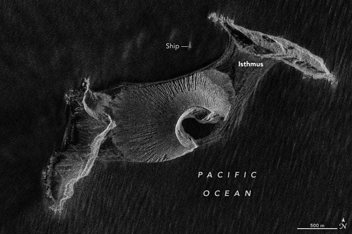
Jim Garvin and Dan Slayback are two NASA scientists who have studied the volcanic island. They've relied on radar imaging satellites to do so, using a type of radar called synthetic aperture radar (SAR.) SAR can see through clouds, and can see at night, providing high-resolution images of the island. In 2018, Garvin, Slayback, and other scientists published a paper on their observations in the AGU journal Geophysical Letters. The paper is titled " Monitoring and Modeling the Rapid Evolution of Earth's Newest Volcanic Island: Hunga Tonga Hunga Ha'apai (Tonga) Using High Spatial Resolution Satellite Observations."
The image below shows how effective SAR is.
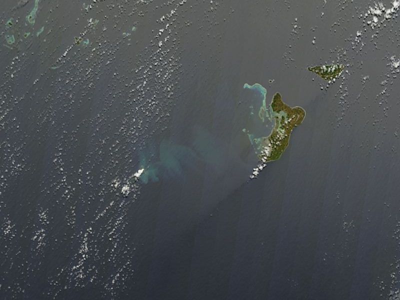
Before the eruption there were two small islands nearby. They were in a relatively isolated location, about 30 km (19 miles) from the Tongan island of Fonuafo?ou. On December 19th, 2014, fishermen spotted a plume of white steam rising from under the water. Satellite images from December 29th show the plume. Eventually, an ash cloud rose 3 km into the sky on January 9th, 2015. By January 11th, the plume reached 9 km (30,000 ft) high.
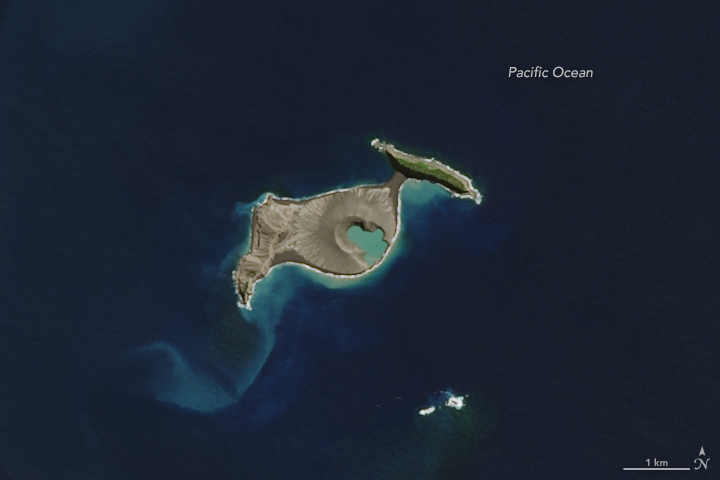
By January 26th, Tongan officials declared the eruption over. By that time, the island was 1 to 2 km (0.62 to 1.24 mi) wide, 2 km (1.2 mi) long, and 120 metres (390 ft) high.
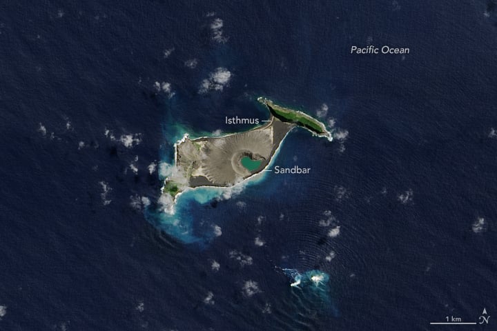
During 2015, the island stabilized somewhat, thanks to redistribution of volcanic material, and "hydrothermal alteration" of the same. The island had a crater lake in the middle, which was eventually eroded away. Then a sandbar formed, sealing it off again, and protecting it from ocean waves. Eventually, ash and sediment widened the isthmus connecting it to Hunga Tonga to the northeast.
The team studying this volcanic island have developed two scenarios for its future.
The first sees accelerated erosion due to ocean waves, and in six or seven years, only the land bridge connecting the two island would be left. What's called the "tuff cone" would be eroded. The second scenario sees slower erosion, with the tuff cone intact for up to 30 years.
The volcanic island changed the most in its first six months. At that time, Slayback and Garvin thought that the island might disappear pretty quickly. When the barrier protecting the crater lake and the tuff cone was washed away, they thought the island's demise was near. But the sandbar reappeared.
"Those cliffs of volcanic ash are pretty unstable," said remote sensing specialist and co-author Dan Slayback of NASA Goddard, in a press release.
This new volcanic island, and its neighbors, are situated above the north rim of a caldera of a much larger underwater volcano. That whole complex rises 1400 meters (4,593 feet) above the ocean floor, and the larger caldera is about 5 km (3 miles) across.
In 2017, NASA scientist Jim Garvin said, "Volcanic islands are some of the simplest landforms to make. Our interest is to calculate how much the three-dimensional landscape changes over time, particularly its volume, which has only been measured a few times at other such islands. It is the first step to understanding erosion rates and processes and deciphering why the island has persisted longer than most people expected."
Dan Slayback visited the island in October 2019, and wrote in a blog post: "We made many useful observations, collected some good data, and gained a more practical human-scale understanding of the topography of the place (such as that the adjacent pre-existing islands, and their rocky shorelines, are almost fortress-like in their inaccessibility). We also saw things not accessible from space, such as the hundreds of nesting sooty terns, and details of the emergent vegetation."
A Martian Connection?
Garvin and Slayback think that their study of this volcano is not only useful for understanding our own planet. They think it might shed light on processes on Mars.
"Using the Earth to understand Mars is of course something we do," Garvin said, noting the similarities in erosion on the island and scars left by ancient eruptions through shallow seas on Mars. "Mars may not have a place exactly like this, but still, it bespeaks the planet's history of persistent water."
Mars is not without volcanoes. In fact, it's home to the largest volcano in the Solar System, now dormant. Olympus Mons rises almost 22 km (13.6 mi or 72,000 ft) above the surface of Mars. It's the grand-daddy of volcanoes. But NASA's Mars Reconnaissance Orbiter (MRO) has found fields of smaller volcanoes. These volcanoes may once have erupted into the Martian oceans, deep in that planet's geological past. Those surviving landscapes could tell us something about how those ancient volcanoes responded the Mars' own active environment.
