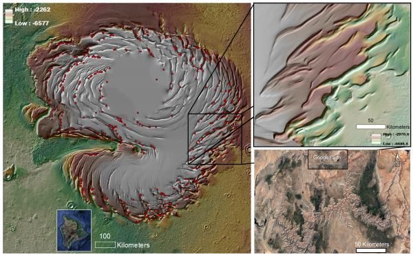
Erosion can take many forms. Most commonly known is water wearing away the sides of creeks or lakes. But wind can erode just as effectively, especially if it carries dust particles that can eat away at otherwise solid objects. While this wind-driven process is most commonly observed on Earth, it plays a role in the history of most other rocky bodies that have an atmosphere. Recently, a team lead scientists from the Planetary Science Institute found evidence for some erosion from between 50,000 and a few million years ago in Mars’s polar ice cap. That is a blink of the eye by geological standards.
Continue reading “Clear Signs of Recent Erosion on Mars”How Old is the Ice at Mars’ North Pole?
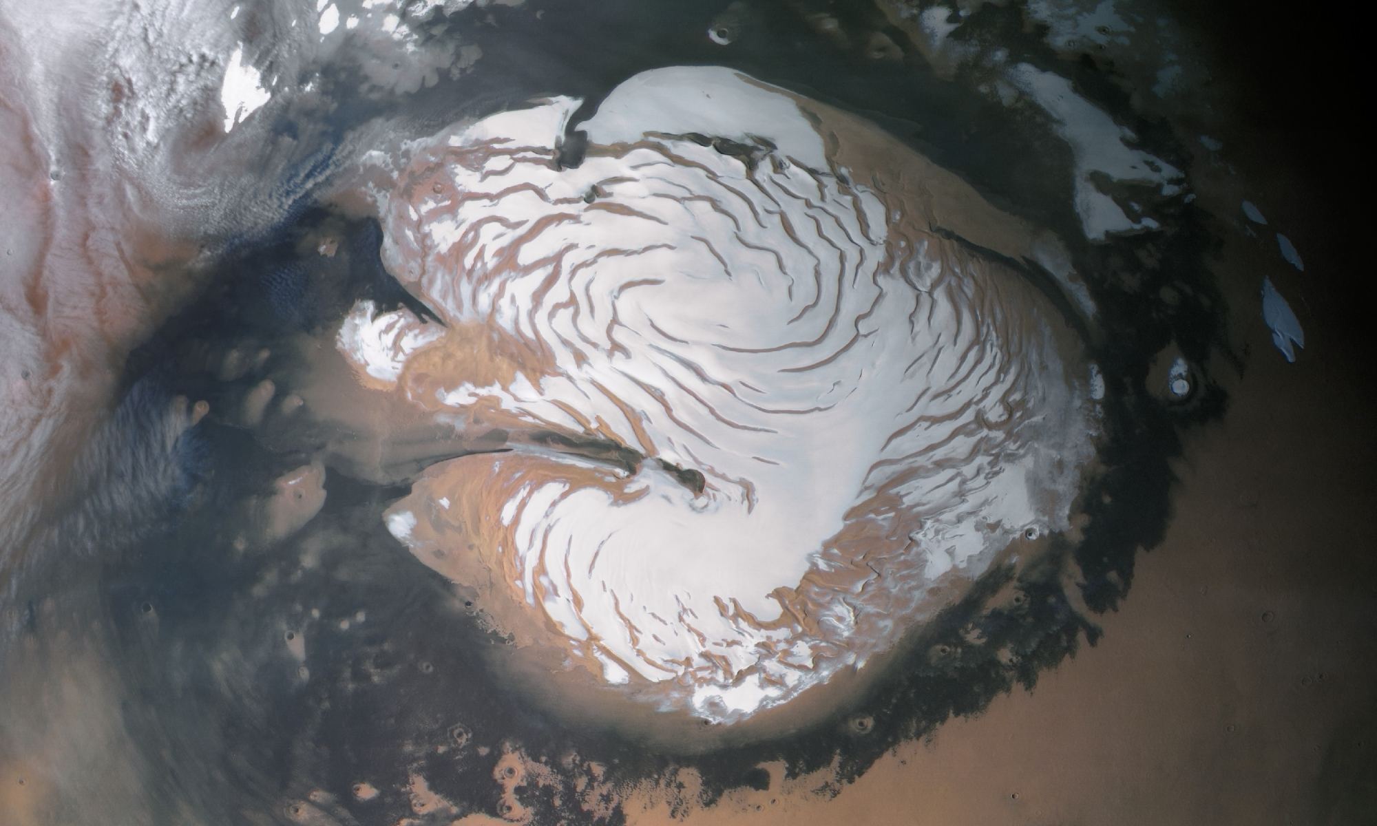
On Earth, the study of ice core samples is one of many methods scientists use to reconstruct the history of our past climate change. The same is true of Mars’ northern polar ice cap, which is made up of many layers of frozen water that have accumulated over eons. The study of these layers could provide scientists with a better understanding of how the Martian climate changed over time.
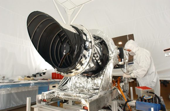
This remains a challenge since the only way we are able to study the Martian polar ice caps right now is from orbit. Luckily, a team of researchers from UC Boulder was able to use data obtained by the High-Resolution Imaging Science Experiment (HiRISE) aboard the Mars Reconnaissance Orbiter (MRO) to chart how the northern polar ice caps’ evolved over the past few million years.
Continue reading “How Old is the Ice at Mars’ North Pole?”New layers of water ice have been found beneath Mars’ North Pole

One of the most profound similarities between Earth and Mars, one which makes it a popular target for research and exploration, is the presence of water ice on its surface (mainly in the form of its polar ice caps). But perhaps even more interesting is the presence of glaciers beneath the surface, which is something scientists have speculated about long before their presence was confirmed.
These caches of subsurface water could tell us a great deal about Martian history, and could even be an invaluable resource if humans ever choose to make Mars their home someday. According to a recent study by a pair of scientists from the Universities of Texas at Austin and Arizona, there are also layers of ice beneath the northern polar ice cap that could be the largest reservoir of water on the planet.
Continue reading “New layers of water ice have been found beneath Mars’ North Pole”Some Active Process is Cracking Open These Faults on Mars. But What is it?
Mars has many characteristics that put one in mind of Earth. Consider its polar ice caps, which are quite similar to the ones in the Arctic and Antarctic circle. But upon closer examination, Mars’ icy polar regions have numerous features that hint at some unusual processes. Consider the northern polar ice cap, which consists predominantly of frozen water ice, but also a seasonal veneer of frozen carbon dioxide (“dry ice”).
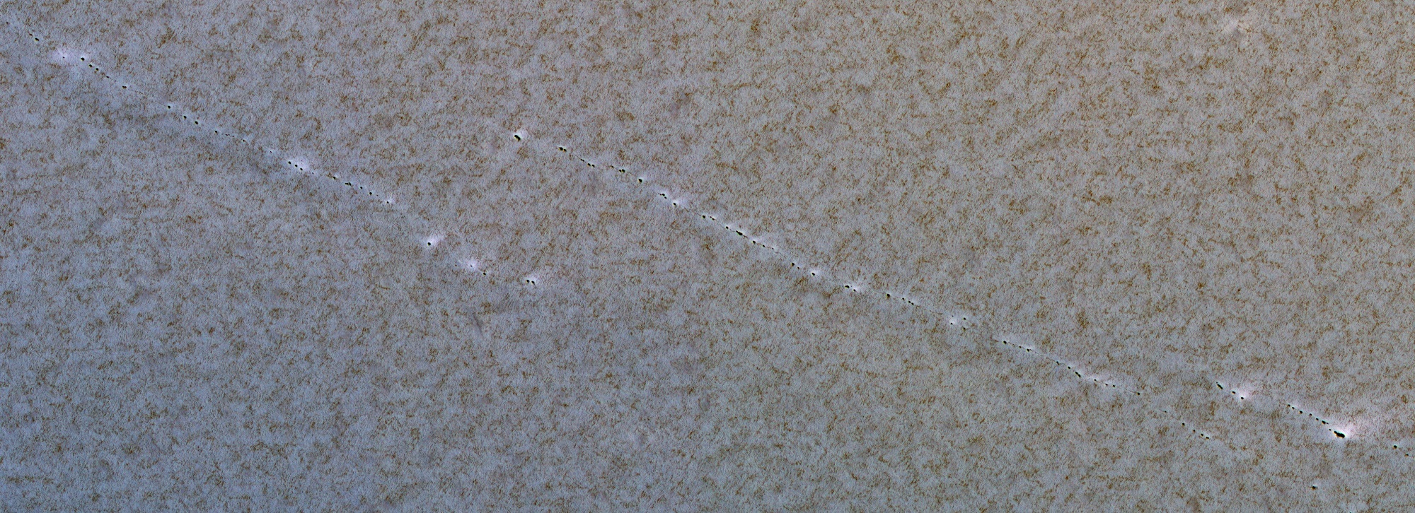
Here, ice is arranged in multicolored layers that are due to seasonal change and weather patterns. And as images taken by the Mars Global Surveyor and the Mars Reconnaissance Orbiter (MRO) have shown, the region is also covered in lines of small pits that measure about 1 meter (3.28 feet) in diameter. While these features have been known to scientists for some time, the process behind them remains something of a mystery.
Layered features around found both in the northern and southern polar regions of Mars, and are the result of seasonal melting and the deposition of ice and dust (from Martian dust storms). Both polar caps also show grooves which appear to be influenced by the amount of dust deposited. The more dust there is, the darker the surface of the grooved feature, which affects the level of seasonal melting that takes place.
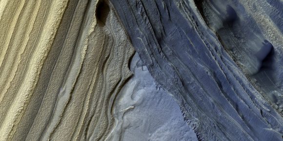
These layered deposits measure around 3-kilometer thick and about 1000 kilometers across. And in many locations, erosion and melting has created scarps and troughs that expose the layering (shown above). However, as NASA’s Mars Global Surveyor revealed through a series of high-resolution images, the northern polar cap also has plenty of pits, cracks, small bumps and knobs that give it a strange, textured look.
These featured have also been imaged in detail by the High Resolution Imaging Science Experiment (HiRISE) instrument aboard the MRO. In 2008, it snapped the image shown at top, which illustrates how the layered features in the northern polar region also have lines of small pits cutting across them. Such small pits should be quickly filled in by seasonal ice and dust, so their existence has been something of a mystery.
What this process could be has been the preoccupation of researchers like Doctor Chris Okubo and Professor Alfred McEwen. In addition to being a planetary geologist from the Lunar and Planetary Laboratory (LPL) at Arizona State University, Prof. McEwen is the Principal Investigator of the High Resolution Imaging Science Experiment (HiRISE).
Dr. Chris Okubo, meanwhile, is a planetary engineer with the LPL who has spent some time examining Mars’ northern polar region, seeking to determine what geological process could account for them. Over time, he also noted that the pits appeared to be enlarging. As he explained to Universe Today via email:
“I monitored some of these pits during northern summer of Mars year 31 (2011-2012). The pits appeared to enlarge over time, starting from depressions roughly centered on the pits observed in in 2008. My interpretation is that these pits are depressions within the residual cap that formed through collapse above a fault or fracture. The pits are buried by seasonal ice in the winter, which then sublimates in the spring/summer leading to an apparent widening and exposure of the pits until they are reburied by seasonal ice in the subsequent winter.”
Since the MRO reached Mars in 2006, the LPL has been responsible for processing and interpreting images sent back by its HiRISE instrument. As for these pits, the theory that they are the result of faults pulling apart the icy layers is the most currently-favored one. Naturally, it will have to be tested as more data comes, in showing how seasonal changes play out in Mars’ northern polar region.
“I plan to re-monitor the same pits I looked at in MY31 during this upcoming northern summer to see if this pattern has changed substantially,” said Okubo. “Re-imaging these after several Mars years may also reveal changes to the size/distribution of the pits within the residual cap – if such changes are observed, then that would suggest that the underlying fractures are active.”
One thing is clear though; the layered appearance of Mars polar ice caps and its strange surface features are just another indication of the dynamic processes taking place on Mars. In addition to seasonal change, these interesting features are thought to be related to changes in Mars’ obliquity and axial tilt. Just one more way in which Mars and Earth are similar!
Further Reading: HIRISE

