Ever wonder what it would be like on board the Starship Enterprise when Capt. Kirk commands Mr. Sulu to fire the thrusters, only to have the artificial gravity turn off at the same time? We’ve got our own 21st century equivalent of a big spaceship — the International Space Station — firing its thrusters in order to stay in a good orbit around Earth. And since we haven’t invented artificial gravity yet, you can see what happens. In the video are Expedition 29 Commander Mike Fossum and Flight Engineers Satoshi Furukawa and Sergei Volkov, demonstrating what it is like to experience the acceleration from firing the thrusters.
What did the three astronauts do on the ISS this past week? Here’s an update from NASA on the research and activities on the International Space Station for October 17-21, 2011. Includes updates on the upcoming Progress and Soyuz launches.
Recent photo from the ISS showing the airglow layer
[/caption]
In many of the photos that we have featured recently from astronauts aboard the International Space Station, a glowing greenish-yellow band can be seen just above Earth’s limb. I’ve been asked before what this is, so I thought I’d explain it here. This is a phenomenon known as “airglow”.
A photochemical reaction that occurs high in the atmosphere, airglow is the result of various atoms, molecules and ions that get excited (chemistry-excited, that is… not “whee!”-excited) by ultraviolet radiation from the Sun and then release that energy as visible – as well as infrared – light when they return to their “normal” state. It’s not entirely unlike glow-in-the-dark toys or paint!
This light is most visible to the crew of the ISS when it is orbiting over the night side of the planet, and thus is seen in images like the one above. It appears like a thin band because viewing the atmosphere at a shallow angle – rather than directly down through it – increases the airglow layer’s relative visibility.
Most of visible airglow comes from oxygen atoms and molecules, which glow green… as commonly seen in the aurora. Other contributing elements include sodium and nitrogen. While present in the atmosphere at all layers, the region that glows visibly is typically constrained to a narrow band 85 – 95km (53-60 miles) high. The band itself is usually about 6 – 10km (4-6 miles) wide. The reason for this is that below those heights the atoms and molecules are more concentrated and collide more readily, releasing their energy sooner, and above it the density of the atoms is too low to do much colliding at all (to put it very simply.)
There are a lot of other factors involved with airglow as well, such as temperature and altitude, as well as different kinds of airglow depending on when in the day they occur. Nightglow is not exactly the same as dayglow, and then there’s even twilightglow… one could say there’s a lot glowingon in the upper atmosphere!
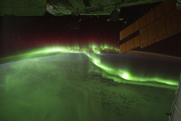
The aurora australis seen from the ISS on September 17, 2011. Credit: NASA.
[/caption]
With all of the activity that’s been occurring on the Sun recently, the aurorae have been exceptionally bright and have created quite a show to viewers – both on Earth as well as above it!
The image above was taken over the southern Indian Ocean by astronauts aboard the International Space Station. The southern lights – a.k.a. aurora australis – glow bright green and red in the upper layers of the atmosphere, creating a dazzling aerial display. (Click here to watch a movie of this.)
Shortly after, fires can be seen on the ground as the ISS passes over Australia:
Wildfires in Australia seen from orbit. Credit: NASA.
Astronauts on the International Space Station (ISS) used a digital camera to capture several hundred photographs of the aurora australis, or “southern lights,” while passing over the Indian Ocean on September 17, 2011. You can see the flowing ribbons and rays below as the ISS passed from south of Madagascar to just north of Australia between 17:22 and 17:45 Universal Time. Solar panels and other sections of the ISS fill some of the upper right side of the photograph.
Auroras are a spectacular sign that our planet is electrically and magnetically connected to the Sun. These light shows are provoked by energy from the Sun and fueled by electrically charged particles trapped in Earth’s magnetic field, or magnetosphere. In this case, the space around Earth was stirred up by an explosion of hot, ionized gas from the Sun — a coronal mass ejection — that left the Sun on September 14, 2011.
In the second image above, and in the last frames of the movie, light from the ground replaces the light show in the sky. Wildfires and perhaps some intentionally set agricultural fires burn on the continent of Australia,with smoke plumes faintly visible in the night sky. A gold and green halo of atmospheric airglow hangs above the horizon in the distance.
______________
Airglow is created by particles in the upper atmosphere that have been charged by UV light from the Sun during the day releasing the energy at night as greenish-yellow visible light.
Fires on the ground, fires in the sky… the stars blazing all around, the Sun in its full glory and a never-ending view of our entire planet… what an incredible place the ISS must be to work in! Absolutely amazing!
And the skies of night were alive with light, with a throbbing, thrilling flame; Amber and rose and violet, opal and gold it came. It swept the sky like a giant scythe, it quivered back to a wedge; Argently bright, it cleft the night with a wavy golden edge.
— “The Ballad of the Northern Lights”, Robert Service
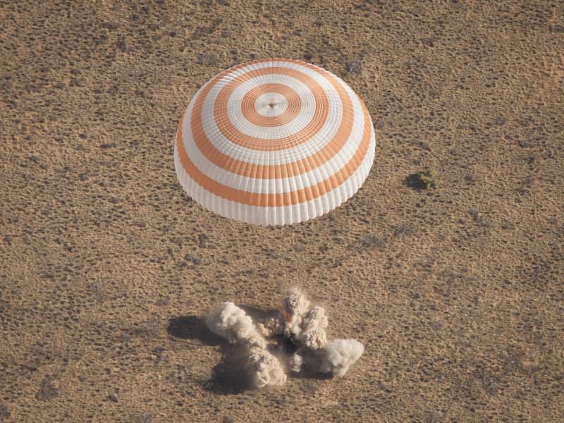
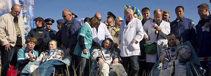
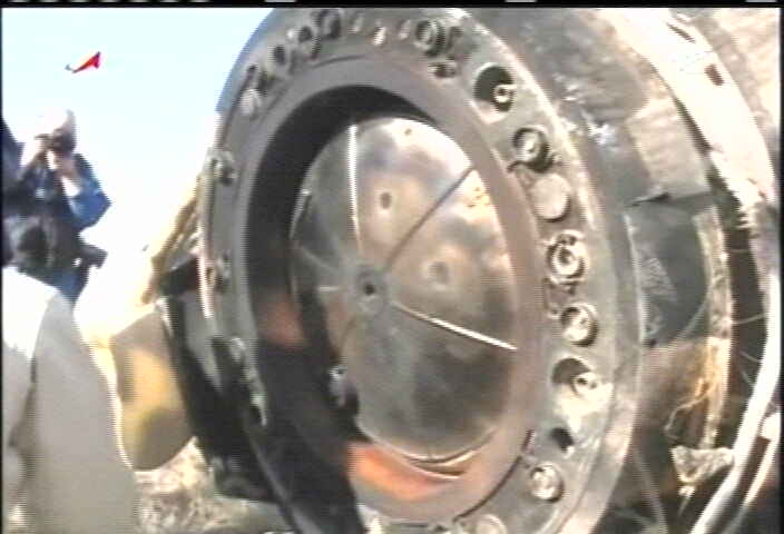
Expedition 28 Lands. The Soyuz TMA-21 spacecraft is seen as it lands with Expedition 28 Commander Andrey Borisenko, and Flight Engineers Ron Garan, and Alexander Samokutyaev in a remote area outside of the town of Zhezkazgan, Kazakhstan, on Friday, Sept. 16, 2011. NASA Astronaut Garan, Russian Cosmonauts Borisenko and Samokutyaev are returning from more than five months onboard the International Space Station where they served as members of the Expedition 27 and 28 crews. Photo Credit: (NASA/Bill Ingalls)
[/caption]
The three man Soyuz TMA-21 crew of cosmonauts and astronauts comprising of Commander Alexander Samokutyaev, Expedition 28 commander Andrey Borisenko and NASA flight engineer Ronald Garan made a pinpoint landing following a flawless descent and touched down safely in the southern steppes of Kazakhstan at 12:00 AM EDT today, Sept. 16, (10 AM local time), thereby wrapping up a nearly six month tour of duty at the International Space Station.
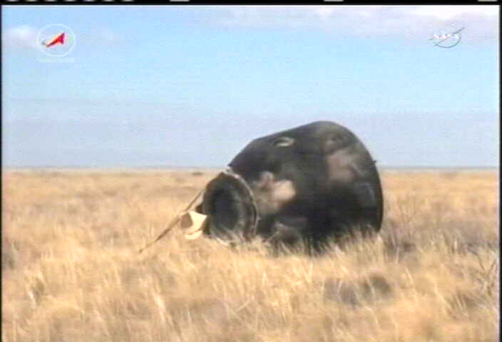
The Soyuz capsule landed on its side as it is frequently wont to do, about three hours after sunrise. The soft landing engines fired within seconds of touchdown to cushion the shock.
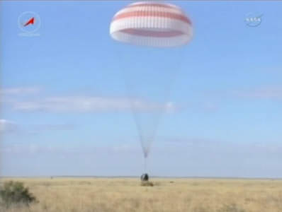
Soyuz TMA-21 lands safely in Kazakhstan on Sept. 16 with Russian-American trio of spaceflyers. Credit: NASA TV
A phalanx of twelve Russian search and recovery helicopters swooped in quickly after landing. The Russian forces had established two way communications and visual sighting with the space flyers in the last minutes of the descent.
Russian America Soyuz TMA-21 Crew after safe landing on Sept 16, 2011 and extraction from capsule. Expedition 28 Commander Andrey Borisenko, left, Flight Engineers Alexander Samokutyaev, center, and Ron Garan, sit in chairs outside the Soyuz Capsule just minutes after they landed in a remote area outside the town of Zhezkazgan, Kazakhstan, on Friday, Sept. 16, 2011. NASA Astronaut Garan, Russian Cosmonauts Borisenko and Samokutyaev are returning from more than five months onboard the International Space Station where they served as members of the Expedition 27 and 28 crews. Photo Credit: NASA/Bill Ingalls
Russian recovery team quickly reach the Soyuz TMA21 capsule after safe landing. Credit: NASA TV
Weather was perfect with very low winds, few clouds and warm temperatures of nearly 70 degrees Fahrenheit.
Altogether the trio spent 164 days in space, 162 of those were aboard the ISS. Their Soyuz capsule had docked at the ISS on April 7, 2011 following a two day trip after liftoff on April 5 from the Baikonur Cosmodome aboard a capsule dubbed Gagarin. The spaceship was named in honor of Yuri Gagarin, first human to orbit the Earth on the 50th anniversary of his courageous one orbit flight in April 1961 that inaugurated the Era of human spaceflight.
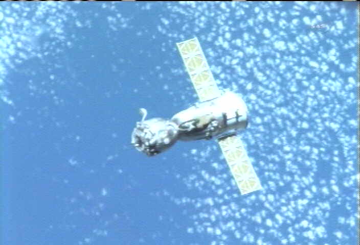
This crew lived aboard the ISS for the arrival of the final two history making flights of the Space Shuttle program as well as the anniversaries of Gagarin and America’s first astronaut in space, Alan Shepard. Soyuz TMA 21 undocks from the ISS.
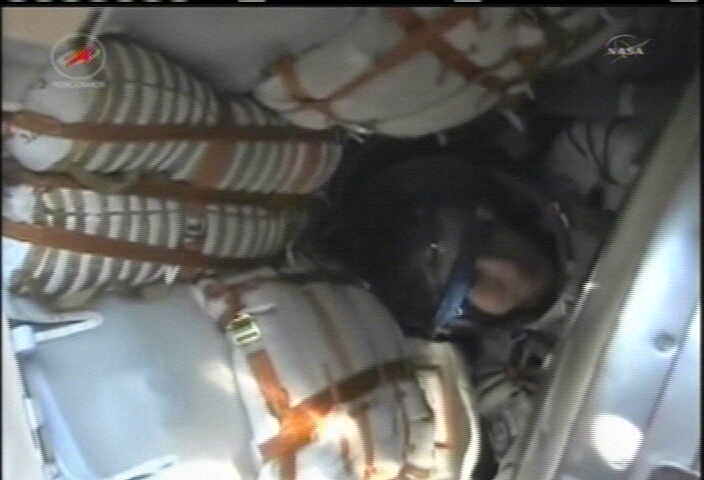
The helicopter recovery team arrived at the Soyuz capsule with seconds of touchdown and began erection of an inflatable medical tent. The Soyuz was rolled to facilitate the safe and proper extraction of the crew.
The astronauts and cosmonauts were quickly extracted from the capsule by the ground crew, checked by doctors and placed in recliners for the two hour trip back to a staging base in Karaganda, Kazakhstan for a traditional Kazakh welcome. Thereafter the crew will split up. Garan will be returning immediately to the US on a flight back to the Mission Control in Houston, Texas. Soyuz departs
Just hours earlier this evening, the trio bagan the process of departing the ISS. They donned their Sokol launch and entry pressure suits, floated into the return capsule and closed the hatches between the Soyuz and the ISS.
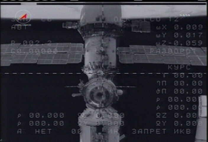
Following leak checks the crew unhooked latches and undocked the Soyuz from the Poisk module at 8:38 p.m. while flying over northern China. Three minutes later thrusters were fired for 15 seconds to separate the two vehicles.
Left behind on the station was the Expedition 29 crew comprising Commander Mike Fossum from the US, cosmonaut Sergei Volkov from Russia and Japanese astronaut Satoshi Furukawa.
Soyuz landing in Kazakhstan on Sept 16, 2011. Credit: NASA TV
As the ISS and Soyuz were flying in tandem, the crew executed the 4 minutes 14 sec “de-orbit burn” which took place exactly on time at 11: 05 p.m. EDT. The critical Soyuz thruster burn slowed the ship by some 258 MPH and enabled the capsule to drop out of orbit, setting up the descent down through the Earth’s atmosphere.
Then the computer commanded pyrotechnic separation of the three Soyuz modules took place some 87 miles above Earth about 22 minutes later at 11:33 p.m., occurring just three minutes prior to re-entry into the Earth’s atmosphere over the heart of Africa. Getting ready to open Soyuz hatch. Credit: NASA TV
The crew landed inside the central descent module less than an hour after completing the burn and less than 30 minutes after module separation.
The ISS will now be tended by only a three man crew for the next two months. That’s an unusually long time to maintain a reduced crew. But it’s all due to the recent failure of the third stage of the Russian Soyuz-U rocket lofting the Progress 44 cargo ship on Aug 24. The failure has been traced to a clogged fuel line. Russia is working to determine exactly how and why this could have happened and taking steps to prevent a repeat which would have disastrous consequences.
The next Soyuz blastoff is provisionally set for Nov.14 with a station arrival on Nov. 16. The three man crew of Anton Shkaplerov, Anatoly Ivanishin and NASA flight engineer Dan Burbank had originally been slated for Sept 22. But it was pushed back following the Progress launch failure.
Mike Fossom’s crew is scheduled to depart just 2 days later. Thus any further Soyuz launch delay wil require the ISS to be at least temporarily “de-manned” for the first time since continuous crewed operations started a dozen years ago.
Opening Soyuz hatch to cramped quarters. Credit: NASA TV
If it turns out that astronauts do have to leave the International Space Station unmanned, at least Dextre, the Canadian Space Agency’s robotic handyman, will be there to take care of things until humans return. Above is a sped-up video showing the work done recently by Dextre, replacing a faulty circuit-breaker box outside the station. Curiously, the robot did most of this work while the astronauts inside were sleeping. Imagine, dozing peacefully inside your sleep station and hearing a knocking sound outside the module…. Continue reading “Robot Works on Repairs While ISS Astronauts Sleep”
What does the International Space Station crew think about the situation they face since the Progress cargo ship mishap? Astronaut Ron Garan wanted to do something light-hearted to let everyone know that “we are all in this together,” so he and his crewmates created a video. Garan said “Despite the seriousness of the possibilities, and while we are all in this period of uncertainty, it doesn’t mean we can’t still have a little fun.”
This video also provides an impromptu tour of the ISS and shows how big the space station is, as it takes fellow astronaut Mike Fossum a long time to find Garan.
It should be noted that they made this video before they got the news of the potential of having the ISS unmanned. “This would have serious implications, and we all hope that it does not come to that,” Garan wrote on his Fragil Oasis blog. You can read Garan’s entire commentary about the video at that link, and take a look around at his other postings, as well. Garan is doing a great job of sharing his experiences in space.
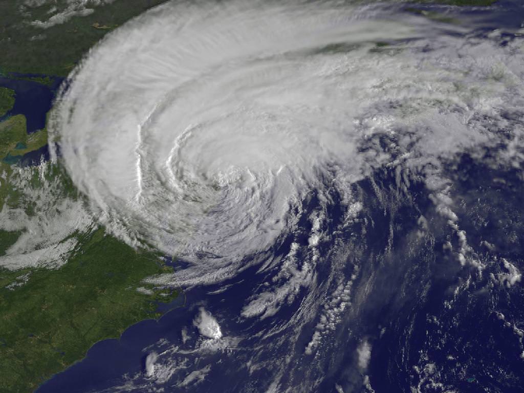
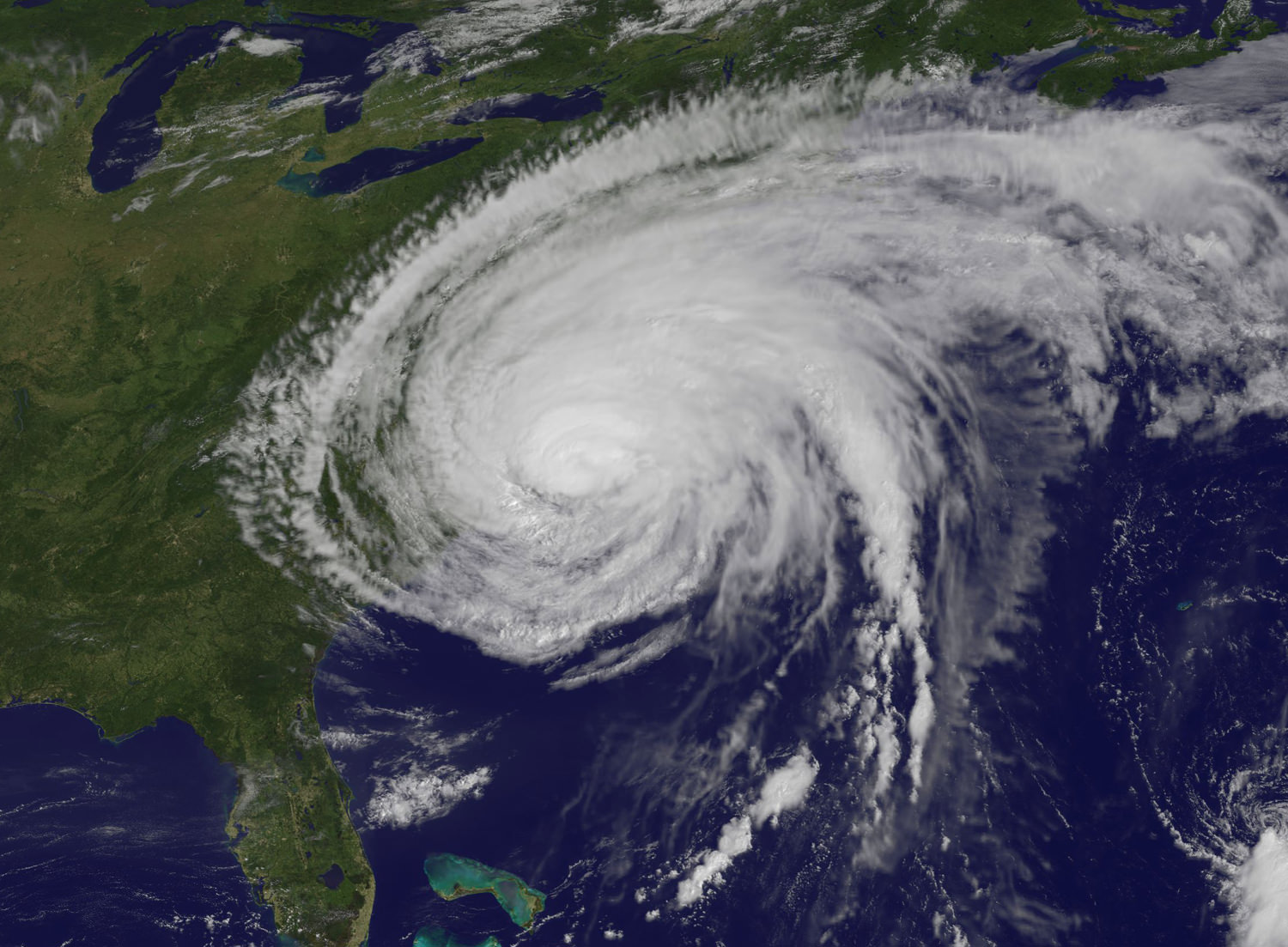
Irene Makes Landfall Over New York. This GOES-13 satellite image is of Hurricane Irene just 28 minutes before the storm made landfall in New York City. The image shows Irene's huge cloud cover blanketing New England, New York and over Toronto, Canada. Shadows in Irene's clouds indicate the bands of thunderstorms that surrounded the storm. Credit: NASA/NOAA GOES Project
NASA Video Caption: The Life of Hurricane Irene from the Caribbean to Canada from August 21 through August 29 seen by NASA/NOAA satellites. Credit: NASA/NOAA/GOES/MODIS
The new NASA animation above shows the birth and subsequent destructive and deadly path followed by Hurricane Irene from August 21 through August 29, 2011 starting in the Caribbean, and then tracking along the US East Cost and up into Canada. The observations combine images taken by NASA and NOAA Earth orbiting satellites.
The cloud images were captured by the NASA/NOAA GOES-13 satellite and overlaid on a true-color NASA MODIS map. Irene followed a lengthy course over Puerto Rico, Hispaniola, the Bahamas, and then along the entire US East with landfalls over North Carolina, New Jersey and New York.
NASA ISS astronaut Ron Garan and cameras flying overhead aboard the International Space Station (ISS) also photographed vivid images showing the magnitude of Irene slamming into the US East coast.
Irene caused widespread property damage. Massive and raging flooding in several US states destroyed houses, crushed businesses and washed away bridges and roads and more. The worst flooding is yet to come to some inland portions of Vermont, New Jersey, New York, Pennsylvania and elsewhere as uncontrollable waters continue to rise at numerous rivers, lakes and even ponds, threatening even more misery in their wake.
[/caption]
So far 41 fatalities in 12 states have been attributed to Irene and more may be expected as searches continue. Some communities have been entirely cut off due to washed out access. Airlifts of food and water have begun. More people are being evacuated from New Jersey towns today, Aug 30.
Brave emergency rescue workers have put their own lives at peril and saved the lives of countless others of all ages from babies to the elderly. Some 8 million customers, including my area, lost power due to extensive flooding, downed trees and electrical wires, and devastated infrastructure.
Hurricane Irene twitpic from the International Space Station on 8/27/11 by NASA Astronaut Ron Garan
Irene From Space and the ISS as it crossed the coast on August 27, 2011 at 3:32pm EST. Hope everyone is OK wrote NASA Astronaut Ron Garan with his twitpic from the ISS. Credit: NASA/Ron Garan aboard the ISS
Emergency crews are hard at work to restore power as quickly as possible, but many thousands of homes and businesses could be without power for up to a week or more. About 3.3 million customers are still without power today.
NASA’s GOES-13 satellite captured a dramatic view of Hurricane Irene just 28 minutes prior to making landfall over New York City. Today’s NASA Image of the day shows the humongous cloud cover spanning the US East coast from the Mid-Atlantic States up to New Jersey, New York, Pennsylvania, and New England and into Toronto, Canada.
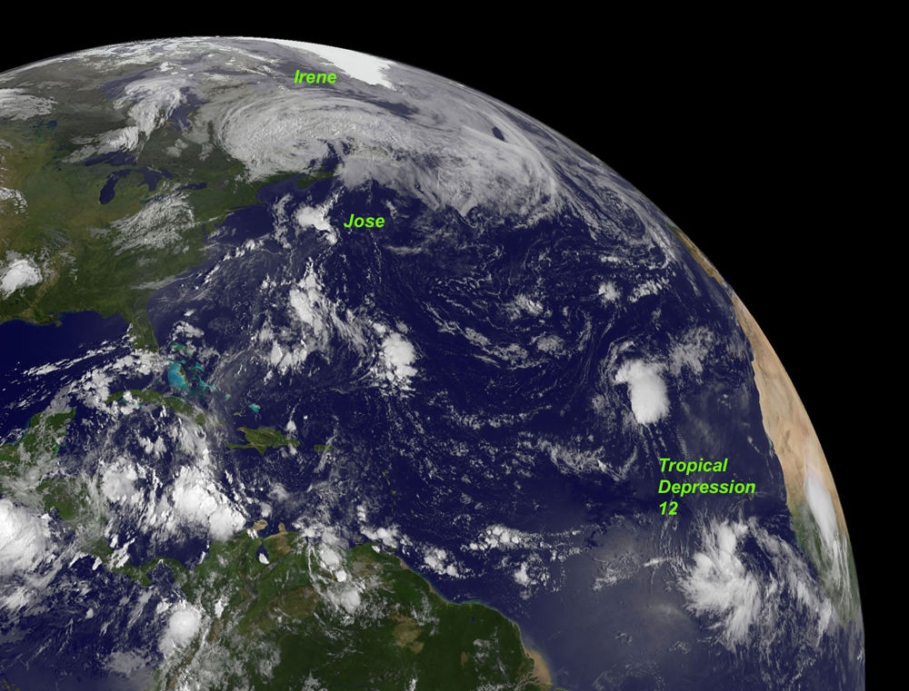
This GOES-13 image from Monday, August 29 at 7:45 a.m. EDT shows an active Atlantic Ocean with the remnants of Hurricane Irene moving into Quebec and Newfoundland (left), Tropical Storm Jose (center) and newly formed Tropical Depression 12 (right). Credit: NASA/NOAA GOES ProjectIrene slams into North Carolina. The GOES-13 satellite saw Hurricane Irene on August 27, 2011 at 10:10 a.m. EDT after it made landfall at 8 a.m. in Cape Lookout, North Carolina. Irene's outer bands had already extended into New England. Credit: NASA/NOAA GOES Project
Many transit systems and airports in Irene’s path were shutdown ahead of the storm.
Send me your photos of Irene’s destruction to post at Universe Today.
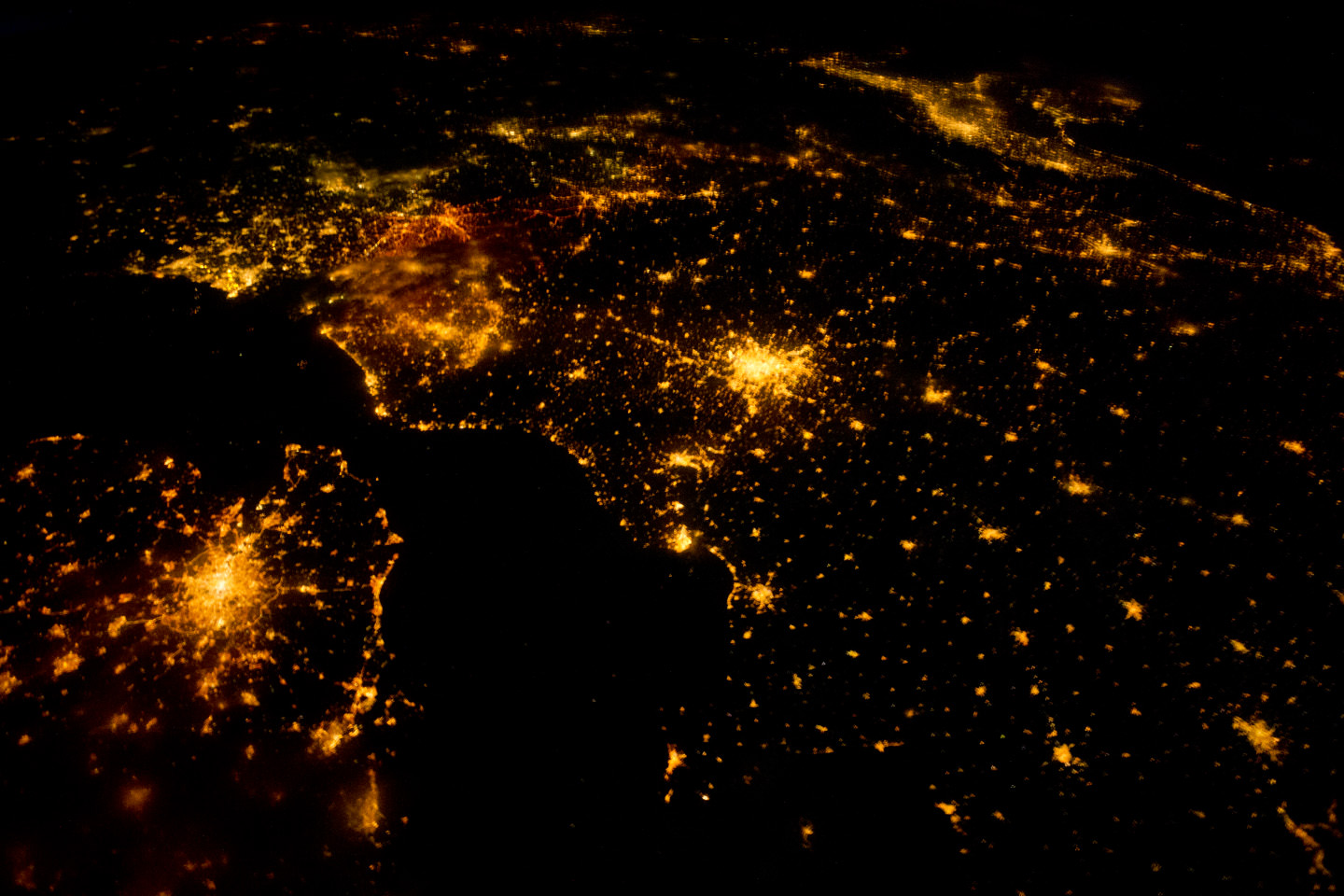
Northwestern Europe at night, as seen from the International Space Station on August 10, 2011. Credit: NASA
[/caption]
Astronauts always say the view of Earth is the best part of being in space. Here’s a beautiful shot of northwestern Europe at night. The landscape is dotted with clusters of lights from individual urban areas; visible are London, Paris, Brussels, Milan and Amsterdam, which stand out due to their large light “footprints,” while the English Channel is completely dark.
This photograph was taken by one of the Expedition 28 crewmembers on the International Space Station (ISS) and was taken with a short camera lens, providing the wide field of view. To give a sense of scale, the centers of the London and Paris metropolitan areas are approximately 340 kilometers (210 miles) from each other.
A view of Hurricane Irene taken by the GOES satellite at 2:55 p.m. Eastern Daylight Time on August 24, 2011. Credit: NASA
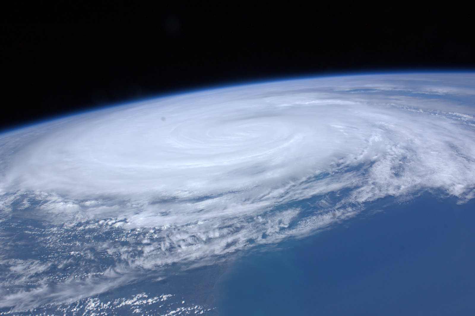
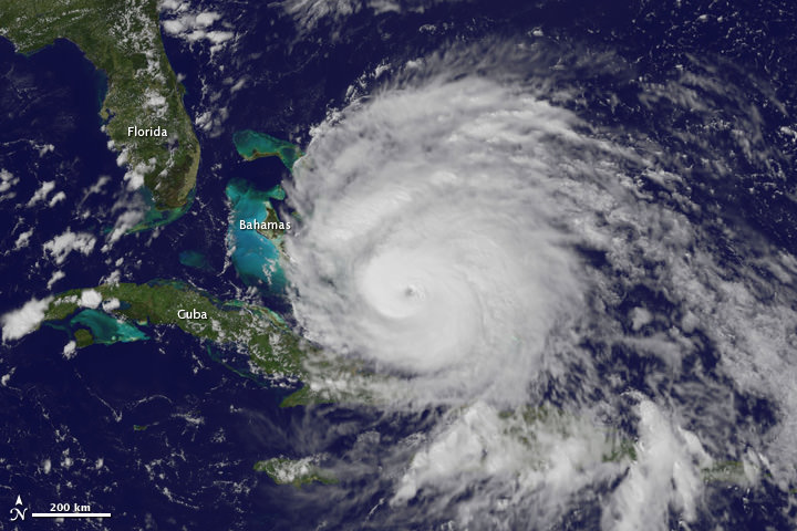
Here are several different views of Hurricane Irene: from 230 miles above the Earth, cameras on the International Space Station captured several views of powerful Hurricane Irene as it churned over the Bahamas at 3:10 p.m. EDT on August 24, 2011. Irene is moving to the northwest as a Category 3 hurricane, packing winds of 120 miles an hour. Irene is expected to strengthen to a Category 4 storm as it heads toward the Outer Banks of North Carolina, the Eastern Seaboard and the middle Atlantic and New England states.
See more from other satellites, below:
[/caption]
This view of Irene was taken by the GOES satellite at 2:55 p.m. Eastern Daylight Time on August 24, 2011. Irene now has a distinct eye and the clouds spiraling around the center are becoming more compact. The image also shows how large Irene has become, measuring several hundred kilometers across.
A three dimensional perspective of Irene, showing rainfall. Credit: NASA/TRMM satellite
This image was taken on August 22, but is a really nifty, three-dimensional view of the precipitation from Irene, as seen by the Tropical Rainfall Measuring Mission. It reveals an area of deep convection (shown in red) near the storm’s center where precipitation-sized particles are being carried aloft. These tall towers are associated with strong thunderstorms responsible for the area of intense rain near the center of Irene seen in the previous image. They can be a precursor to strengthening as they indicate areas within a storm where vast amounts of heat are being released. This heating, known as latent heating, is what is drives a storm’s circulation and intensification.
As of 8 a.m. EDT on August 25, Hurricane Irene was located near 25.5 N and 76.5 W, or 65 miles east-southeast of Nassau, Bahamas. This places it about 670 miles south of Cape Hatteras, N.C. Irene`s top sustained winds remain at 115 mph, and is moving to the northwest at 13 mph.