NASA’s MAVEN Orbiter Discovers Solar Wind Stripped Away Mars Atmosphere Causing Radical Transformation

Artist’s rendering of a solar storm hitting Mars and stripping ions from the planet's upper atmosphere. Credits: NASA/GSFC

NASA’s Mars Atmosphere and Volatile Evolution (MAVEN) orbiter mission has determined that ancient Mars suffered drastic climate change and lost its thick atmosphere and surface bodies of potentially life giving liquid water because it lost tremendous quantities of gas to space via stripping by the solar wind, based on new findings that were announced today, Nov. 5, at a NASA media briefing and in a series of scientific publications.

The process of Mars dramatic transformation from a more Earth-like world to its barren state today started about 4.2 Billion years ago as the shielding effect of the global magnetic field was lost as the planets internal dynamo cooled, Bruce Jakosky, MAVEN principal investigator at the Laboratory for Atmospheric and Space Physics (LASP) at the University of Colorado, Boulder, told Universe Today.

The radical transformation of ancient Mars from a warm world with significant bodies of standing water that could have supported life, to its current state as a cold, arid and desert-like world that’s rather inhospitable to life was caused by the loss of most the planet’s atmosphere as powerful streams of solar wind particles crashed into it and stripped it away due to the loss of the protective magnetic field as the planets core cooled.

“We think that the early magnetic field that Mars had would have protected the planet from direct impact by the solar wind and would have kept it from stripping gas off,” Jakosky told me.

“So it would have been the turn off of the magnetic field, that would have allowed the turn on of stripping of the atmosphere by the solar wind.”

“The evidence suggests that the magnetic field disappeared about 4.2 Billion years ago.”

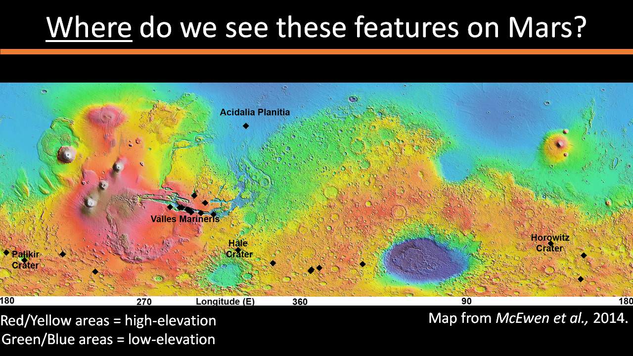
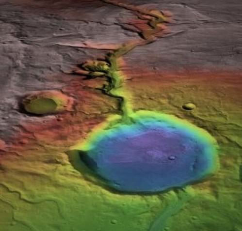
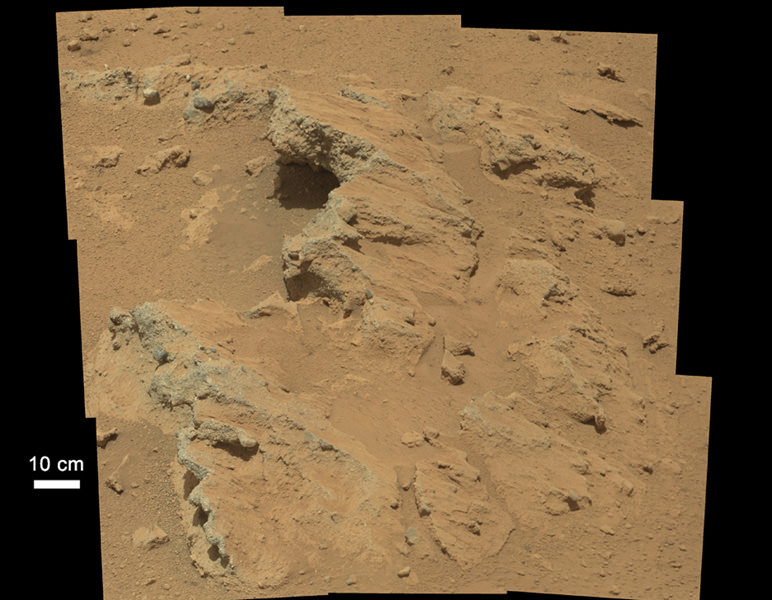
The period of abundant surface water actively carving the Martian geology lasted until about 3.7 Billion years ago. The loss of the atmosphere by stripping of the solar wind took place from about 4.2 to 3.7 Billion years ago.

Billions of years ago, Mars was a very different world. Liquid water flowed in long rivers that emptied into lakes and shallow seas. A thick atmosphere blanketed the planet and kept it warm.  Credit: NASA
Billions of years ago, Mars was a very different world. Liquid water flowed in long rivers that emptied into lakes and shallow seas. A thick atmosphere blanketed the planet and kept it warm. Credit: NASA

With the release of today’s results, the MAVEN science team has accomplished the primary goal of the mission, which was to determine how and why Mars lost its early, thick atmosphere and water over the past four billion years. The atmosphere is composed mostly of carbon dioxide.

Since water is a prerequisite for life as we know it, determining its fate and longevity on Mars is crucial for determining the habitability of the Red Planet and its potential for supporting martian microbes, past of present if they ever existed.

“The NASA Mars exploration program has been focused on finding water,” said Michael Meyer, lead scientist for the Mars Exploration Program at NASA Headquarters.

“Water is the prime ingredient needed for life. It is a major factor in the climate and for shaping geology. And it is a critical resource for future human exploration.”

NASA’s goal is to send humans on a ‘Journey to Mars’ during the 2030s.

This NASA video shows a visualization of the solar wind striking Mars:

Video caption: Created using data from NASA’s Mars Atmosphere and Volatile Evolution (MAVEN) mission, this visualization shows how the solar wind strips ions from the Mars’ upper atmosphere into space. Credits: NASA-GSFC/CU Boulder LASP/University of Iowa

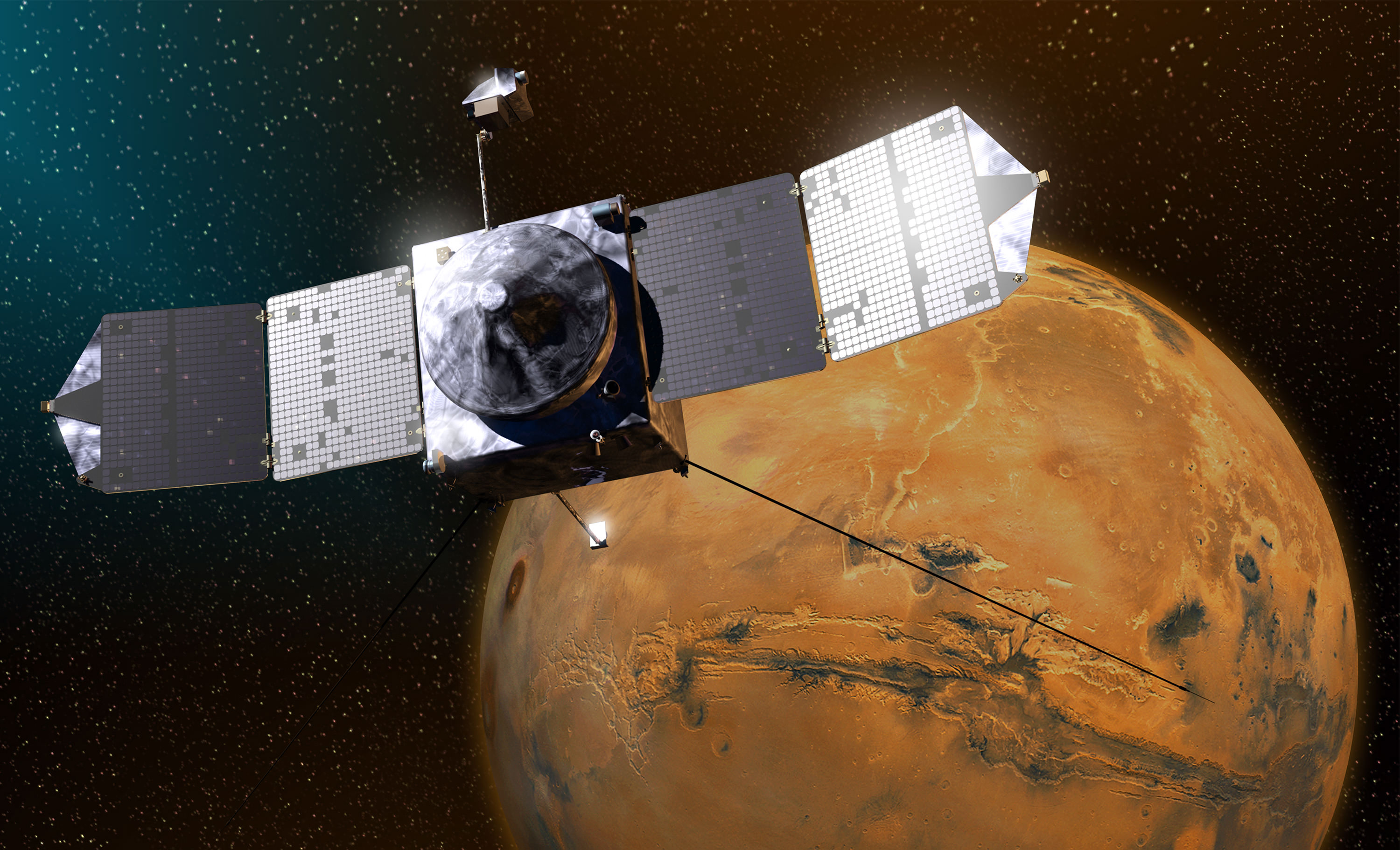
MAVEN arrived in orbit at Mars just over one year ago on Sept. 21, 2014.

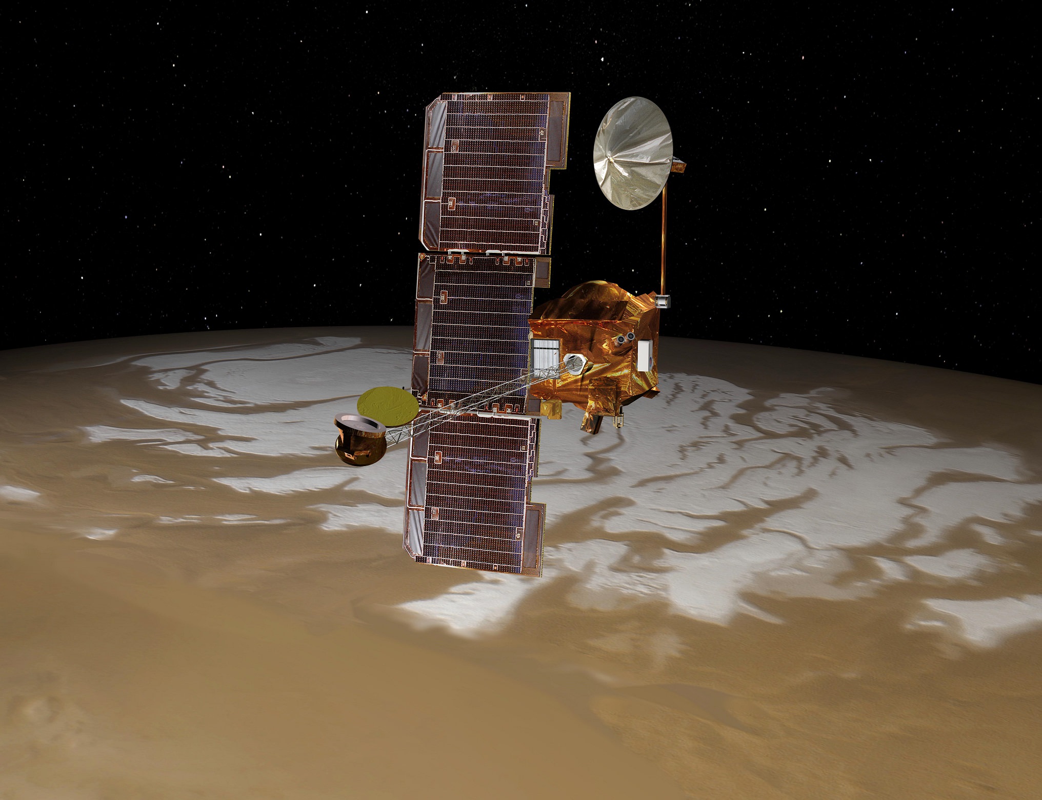
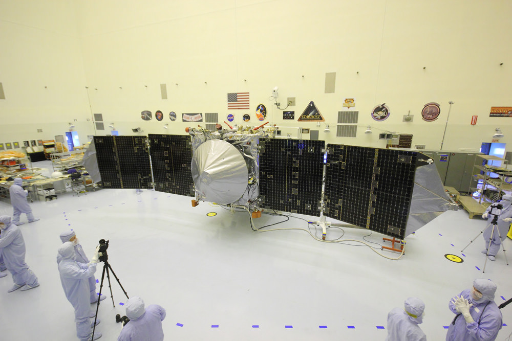
The $671 Million MAVEN spacecraft’s goal is to study Mars tenuous upper atmosphere in detail for the very first time by any spacecraft and to explore the mechanisms of how the planet lost its atmosphere and life giving water over billions of years as well as determine the rate of atmospheric loss.

The new MAVEN data have enabled researchers to measure the rate of Mars atmospheric loss of gas to space via the action of solar wind stripping as well as the erosional effect of solar storms.

Based on measurements from MAVEN’s suite of nine state-of-the-art scientific instruments, the solar wind is stripping away gas at a rate of about 100 grams (equivalent to roughly 1/4 pound) every second today, in the form of carbon dioxide and oxygen, said David Brain, MAVEN co-investigator at LASP.

“Most of the stripping [of the Martian atmosphere] by the solar wind at Mars was thought to have taken place very early in the history of the solar system when the sun was much more active and when the solar wind was more intense. So today the rate of loss at Mars is low,” Jakosky said at the briefing.

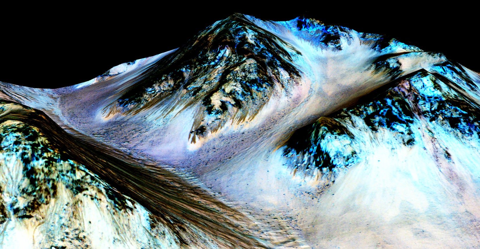
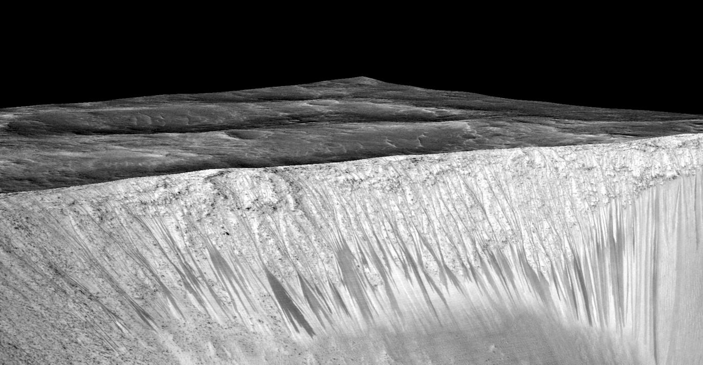
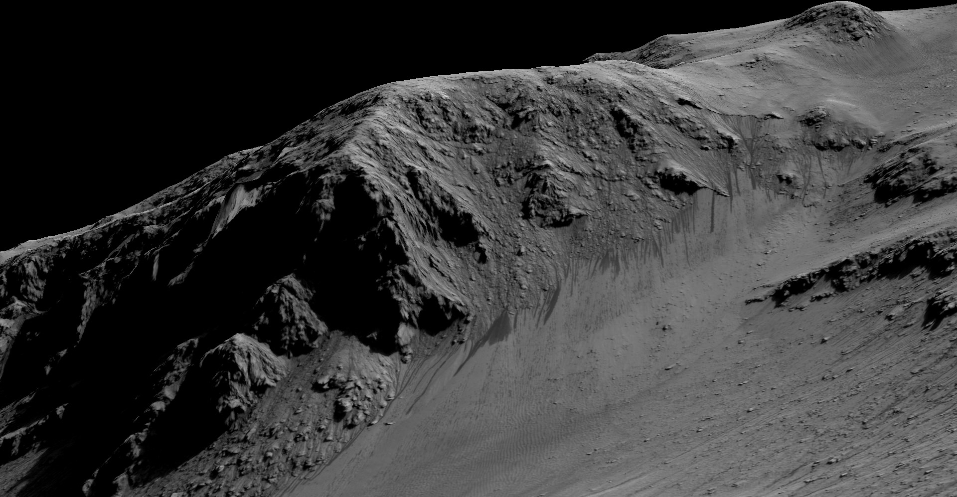
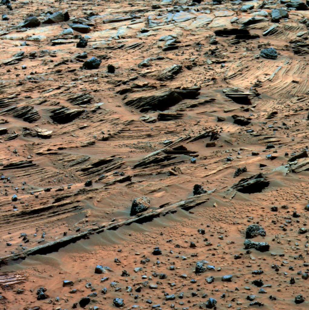
“Today’s Mars is a cold dry desert-like environment. The atmosphere is thin and it’s not capable of sustaining liquid water at the surface today, it would freeze or evaporate very quickly. However when we look at ancient Mars we see a different type of surface, one that had valleys that looked like they were carved by water and lakes that were standing for long periods of time. We see an environment that was much more able to support liquid water.”

The MAVEN results were published today in nearly four dozen scientific papers in the Nov. 5 issues of the journals Science and Geophysical Research Letters.

I asked Jakosky; How much gas would have been lost from ancient Mars and what is the rough estimate for the ancient rate of loss to arrive at Mars thin atmosphere today?

“For the amount of gas that we think you would have to have been removed – let me start with the current Mars atmosphere which has a thickness of 6 millibars, that’s just under 1% as thick as the Earth’s atmosphere,” Jakosky replied.

“So we think you would have to remove an amount of gas that is about equivalent to what’s in Earth’s atmosphere today.”

“So the rate would have to have been a factor of about 100 to 1000 times higher, than today’s loss of 100 grams per second in order to have removed the gas early in that time period, which is consistent with what the models have predicted that the loss rate would have been back then in early history.”

NASA’s Mars Atmosphere and Volatile EvolutioN (MAVEN) spacecraft celebrated one Earth year in orbit around Mars on Sept. 21, 2015.  MAVEN was launched to Mars on Nov. 18, 2013 from Cape Canaveral Air Force Station in Florida and successfully entered Mars’ orbit on Sept. 21, 2014.  Credit: NASA
NASA’s Mars Atmosphere and Volatile EvolutioN (MAVEN) spacecraft celebrated one Earth year in orbit around Mars on Sept. 21, 2015. MAVEN was launched to Mars on Nov. 18, 2013 from Cape Canaveral Air Force Station in Florida and successfully entered Mars’ orbit on Sept. 21, 2014. Credit: NASA

What is the solar wind and how does it strip away the atmosphere?

“The solar wind is a stream of particles, mainly protons and electrons, flowing from the sun’s atmosphere at a speed of about one million miles per hour. The magnetic field carried by the solar wind as it flows past Mars can generate an electric field, much as a turbine on Earth can be used to generate electricity. This electric field accelerates electrically charged gas atoms, called ions, in Mars’ upper atmosphere and shoots them into space,” according to a NASA description.

MAVEN is NASA’s next Mars orbiter and is due to blastoff on Nov. 18 from Cape Canaveral, Florida. It will study the evolution of the Red Planet’s atmosphere and climate. Universe Today visited MAVEN inside the clean room at the Kennedy Space Center.  With solar panels unfurled, this is exactly how MAVEN looks when flying through space and circling Mars.  Credit: Ken Kremer/kenkremer.com
MAVEN is NASA’s next Mars orbiter and is due to blastoff on Nov. 18 from Cape Canaveral, Florida. It will study the evolution of the Red Planet’s atmosphere and climate. Universe Today visited MAVEN inside the clean room at the Kennedy Space Center. With solar panels unfurled, this is exactly how MAVEN looks when flying through space and circling Mars. Credit: Ken Kremer/kenkremer.com

MAVEN is just now completing its primary mission and starts the extended mission phase on Nov. 16.

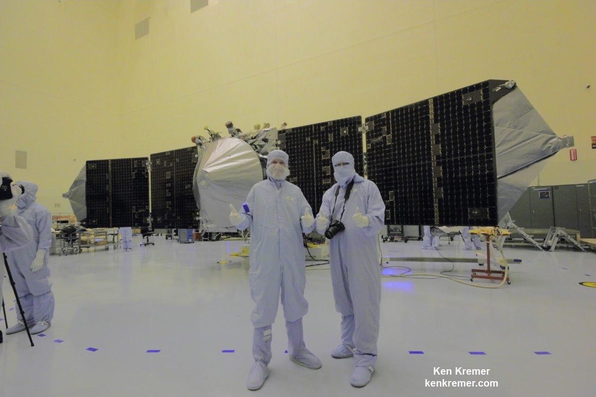
The 5,400 pound MAVEN probe carries nine sensors in three instrument suites to study why and exactly when did Mars undergo the radical climatic transformation.

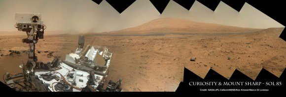
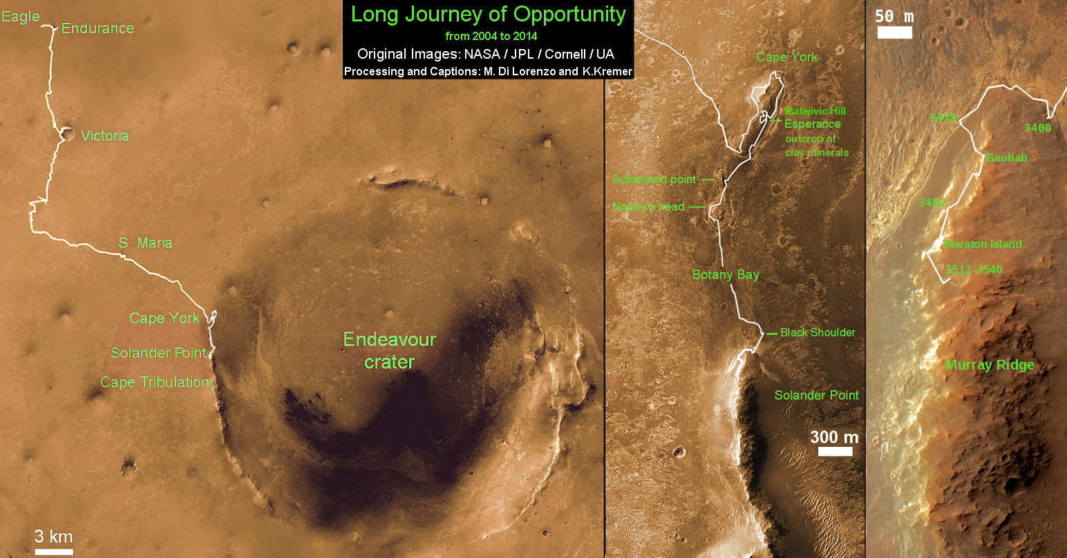
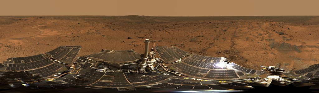
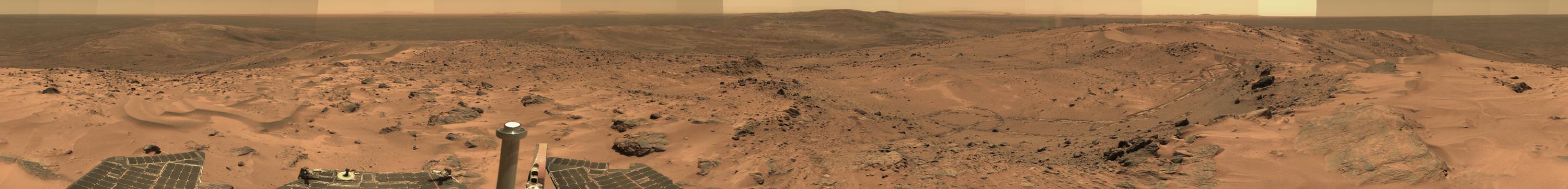
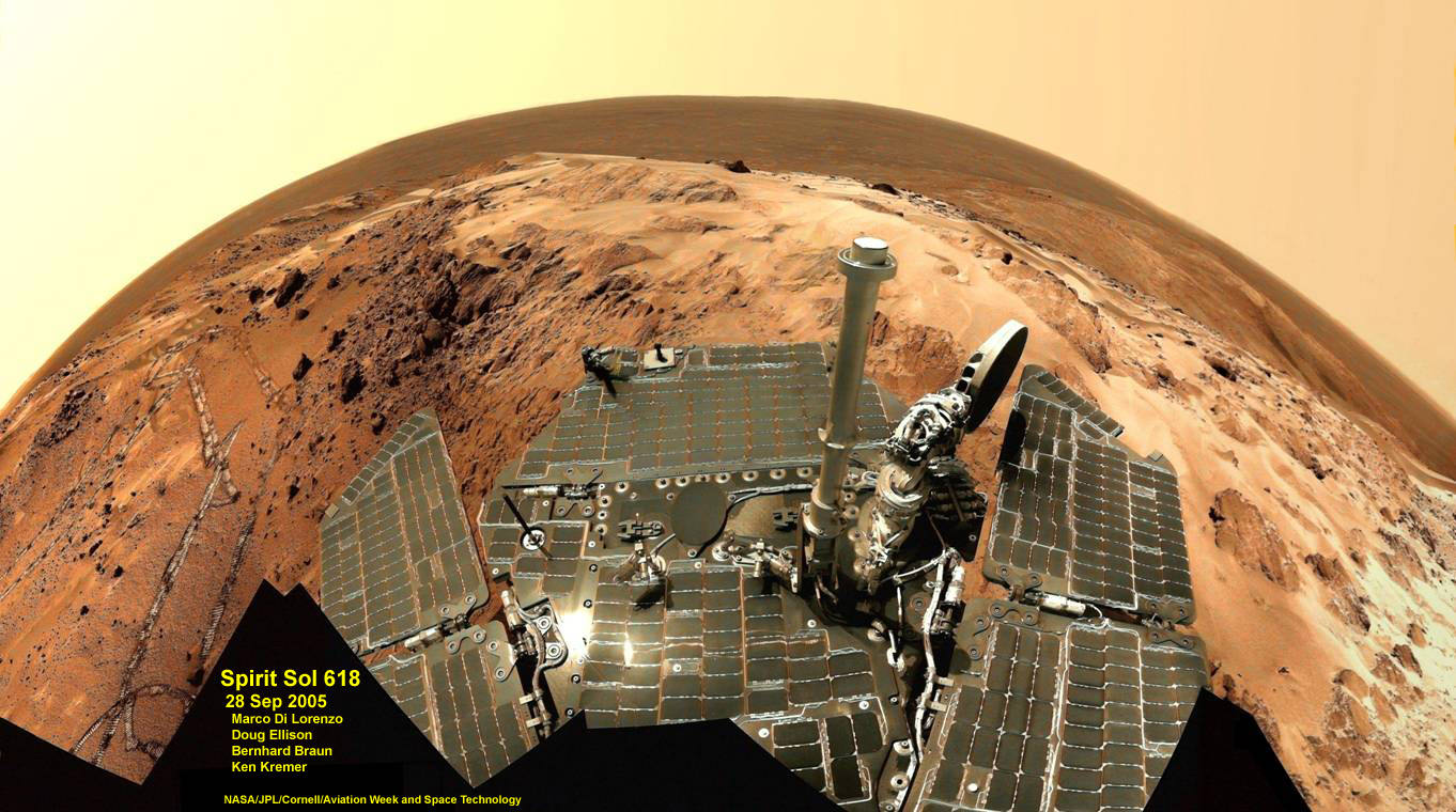
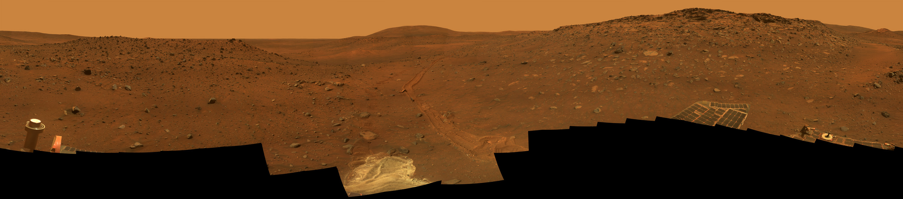
MAVEN’s observations will be tied in with NASA’s ongoing Curiosity and Opportunity surface roving missions as well as MRO and Mars Odyssey to provide the most complete picture of the fourth rock from the sun that humanity has ever had.

MAVEN thundered to space on Nov. 18, 2013 following a flawless blastoff from Cape Canaveral Air Force Station’s Space Launch Complex 41 atop a powerful United Launch Alliance Atlas V rocket.

Stay tuned here for Ken’s continuing Earth and planetary science and human spaceflight news.

Ken Kremer

NASA’s MAVEN Mars orbiter, chief scientist Prof. Bruce Jakosky of CU-Boulder and Ken Kremer of Universe Today inside the clean room at the Kennedy Space Center on Sept. 27, 2013. MAVEN launched to Mars on Nov. 18, 2013 from Florida. Credit: Ken Kremer/kenkremer.com

NASA Discovers Salty Liquid Water Flows Intermittently on Mars Today, Bolstering Chance for Life

These dark, narrow, 100 meter-long streaks called recurring slope lineae flowing downhill on Mars are inferred to have been formed by contemporary flowing water. However, a new study by planetary scientists indicates that these may actually be the result of dry flows. Credits: NASA/JPL/University of Arizona

These dark, narrow, 100 meter-long streaks called recurring slope lineae flowing downhill on Mars are inferred to have been formed by contemporary flowing water. Recently, planetary scientists detected hydrated salts on these slopes at Hale crater, corroborating their original hypothesis that the streaks are indeed formed by liquid water. The blue color seen upslope of the dark streaks are thought not to be related to their formation, but instead are from the presence of the mineral pyroxene.

The image is produced by draping an orthorectified Infrared-Red-Blue/Green(IRB)) false color image on a Digital Terrain Model (DTM). This model was produced by researchers at the University of Arizona, much like the High Resolution Imaging Science Experiment (University of Arizona). The vertical exaggeration is 1.5.

NASA and Mars planetary scientists announced today (Sept. 28) that salty “liquid water flows intermittently” across multiple spots on the surface of today’s Mars – trumpeting a major scientific discovery with far reaching implications regarding the search for life beyond Earth and bolstering the chances for the possible existence of present day Martian microbes.

Utilizing spectroscopic measurements and imaging gathered by NASA’s Mars Reconnaissance Orbiter (MRO), researchers found the first strong evidence confirming that briny water flows on the Red Planet today along dark streaks moving downhill on crater slopes and mountain sides, during warmer seasons.

“Mars is not the dry, arid planet that we thought of in the past. Today we announce that under certain circumstances, liquid water has been found on Mars,” said Jim Green, NASA Planetary Science Director at NASA Headquarters, at a media briefing held today, Sept 28.

“When you look at Earth, water is an essential ingredient. Everywhere we go where there’s liquid water, whether its deep in the Earth or in the arid regions, we find life. This is tremendously exciting.”

“We haven’t been able to answer the question – does life exist beyond Earth? But following the water is a critical element of that. We now have great opportunities to be in the right locations on Mars to thoroughly investigate that,” Green elaborated.

“Water! Strong evidence that liquid water flows on present-day Mars,” NASA officials tweeted about the discovery.

The evidence comes in the form of the detection of mysterious dark streaks, as long as 100 meters, showing signatures of hydrated salt minerals periodically flowing in liquid water down steep slopes on the Red Planet that “appear to ebb and flow over time.”

The source of the water is likely from the shallow subsurface or possibly absorbed from the atmosphere.

Dark narrow streaks called recurring slope lineae emanating out of the walls of Garni crater on Mars. The dark streaks here are up to few hundred meters in length. They are hypothesized to be formed by flow of briny liquid water on Mars. The image is produced by draping an orthorectified (RED) image (ESP_031059_1685) on a Digital Terrain Model (DTM) of the same site produced by High Resolution Imaging Science Experiment (University of Arizona). Vertical exaggeration is 1.5.    Credits: NASA/JPL/University of Arizona
Dark narrow streaks called recurring slope lineae emanating out of the walls of Garni crater on Mars. The dark streaks here are up to few hundred meters in length. They are hypothesized to be formed by flow of briny liquid water on Mars. The image is produced by draping an orthorectified (RED) image (ESP_031059_1685) on a Digital Terrain Model (DTM) of the same site produced by High Resolution Imaging Science Experiment (University of Arizona). Vertical exaggeration is 1.5. Credits: NASA/JPL/University of Arizona

Water is a key prerequisite for the formation and evolution of life as we know it. So the new finding significantly bolsters the chances that present day extant life could exist on the Red Planet.

“Our quest on Mars has been to ‘follow the water,’ in our search for life in the universe, and now we have convincing science that validates what we’ve long suspected,” said John Grunsfeld, astronaut and associate administrator of NASA’s Science Mission Directorate in Washington.

“This is a significant development, as it appears to confirm that water — albeit briny — is flowing today on the surface of Mars.”

“This increases the chance that life could exist on Mars today,” noted Grunsfeld.

The data were gathered by and the conclusions are based on using two scientific instruments – the high resolution imaging spectrometer on MRO known as High Resolution Imaging Science Experiment (HiRISE), as well as MRO’s mineral mapping Compact Reconnaissance Imaging Spectrometer for Mars (CRISM).

The mysterious dark streaks of downhill flows are known as recurring slope lineae (RSL).

They were first detected in 2010 at dozens of sites on the sun facing slopes of deep craters by Lujendra Ojha, then a University of Arizona undergraduate student.

The new finding is highly significant because until today’s announcement, there was no strong evidence that liquid water could actually exist on the Martian surface because the atmospheric pressure was thought to be far too low – its less than one percent of Earth’s.

The flow of water is occasional and not permanent, seasonally variable and dependent on having just the right mix of atmospheric, temperature and surface conditions with salt deposits on Mars.

Portions of Mars were covered with an ocean of water billions of years ago when the planet was far warmer and more hospitable to life. But it underwent a dramatic climate change some 3 billion years ago and lost most of that water.

The RSL with flowing water appear in at least three different locations on Mars – including Hale crater, Horowitz crater and Palikir crater – when temperatures are above minus 10 degrees Fahrenheit (minus 23 Celsius). They appear during warm seasons, fade in cooler seasons and disappear during colder times.

Pure surface water ice would simply sublimate and evaporate away as the temperature rises. Mixing in surface salts lowers the melting point of ice, thereby allowing the water to potentially liquefy on Mars surface for a certain period of time rather than sublimating rapidly away.

“These are dark streaks that form in late spring, grow through the summer and then disappear in the fall,” said Michael Meyer lead scientist for the Mars Exploration Program at NASA Headquarters, at the media briefing.

Years of painstaking effort and laboratory work was required to verify and corroborate the finding of flowing liquid water.

“It took multiple spacecraft over several years to solve this mystery, and now we know there is liquid water on the surface of this cold, desert planet,” said Meyer. “It seems that the more we study Mars, the more we learn how life could be supported and where there are resources to support life in the future.”

The dark, narrow streaks flowing downhill on Mars at sites such as this portion of Horowitz Crater are inferred to be formed by seasonal flow of water on modern-day Mars. The streaks are roughly the length of a football field. These dark features on the slopes are called "recurring slope lineae" or RSL. The imaging and topographical information in this processed view come from the High Resolution Imaging Science Experiment (HiRISE) camera on NASA's Mars Reconnaissance Orbiter.   Credit: NASA/JPL-Caltech/Univ. of Arizona
The dark, narrow streaks flowing downhill on Mars at sites such as this portion of Horowitz Crater are inferred to be formed by seasonal flow of water on modern-day Mars. The streaks are roughly the length of a football field. These dark features on the slopes are called “recurring slope lineae” or RSL. The imaging and topographical information in this processed view come from the High Resolution Imaging Science Experiment (HiRISE) camera on NASA’s Mars Reconnaissance Orbiter. Credit: NASA/JPL-Caltech/Univ. of Arizona

Along with the media announcement, the researchers published their findings today in a refereed scientific paper in the Sept. 28 issue of Nature Geoscience.

“We found the hydrated salts only when the seasonal features were widest, which suggests that either the dark streaks themselves or a process that forms them is the source of the hydration. In either case, the detection of hydrated salts on these slopes means that water plays a vital role in the formation of these streaks,” said Lujendra Ojha, now at the Georgia Institute of Technology (Georgia Tech) in Atlanta, and lead author of the Sept. 28 publication in Nature Geoscience.

The scientists “interpret the spectral signatures as caused by hydrated minerals called perchlorates.”

Ojha said the chemical signatures from CRISM were most consistent with the detection of mixtures of magnesium perchlorate, magnesium chlorate and sodium perchlorate, based on lab experiments.

“Some perchlorates have been shown to keep liquids from freezing even when conditions are as cold as minus 94 degrees Fahrenheit (minus 70 Celsius).”

Perchlorates have previously been detected in Martian soil by two of NASA’s surface missions – the Phoenix lander and the Curiosity rover. There is also some evidence that NASA’s Viking missions in the 1970s measured signatures of these salts.

On Earth concentration of perchlorates are found in deserts.

This also marks the first time perchlorates have been identified from Mars orbit.

Locations of RSL features on Mars

NASA’s overriding agency wide goal is to send humans on a ‘Journey to Mars’ in the 2030s.

So NASA astronaut Mark Kelly exclaimed that he was also super excited about the findings, from his perch serving as Commander aboard the International Space Station (ISS), where he is a member of the first ever “1 Year ISS Mission Crew” aimed at learning how the human body will adapt to the long term missions required to send astronauts to Mars and back.

“One reason why NASA’s discovery of liquid water on #Mars is so exciting: we know anywhere there’s water on Earth, there’s some form of life,” Kelly tweeted today from on board the ISS, upon hearing today’s news.

The discovery of liquid water on Mars could also be a boon to future astronauts who could use it as a natural resource to ‘live off the land’ for sustenance and to make rocket fuel.

“If going to Mars on my Year In Space, I’d arrive soon to find water! H20 > rocket fuel, which means I could find my way back home too!,” Kelly wrote on his Facebook page.

“When most people talk about water on Mars, they’re usually talking about ancient water or frozen water,” Ojha explained.

“Now we know there’s more to the story. This is the first spectral detection that unambiguously supports our liquid water-formation hypotheses for RSL.”

Stay tuned here for Ken’s continuing Earth and planetary science and human spaceflight news.

Ken Kremer

Meteoric Evidence Suggests Mars May Have a Subsurface Reservoir

Scientists were able to gauge the rate of water loss on Mars by measuring the ratio of water and HDO from today and 4.3 billion years ago. Credit: Kevin Gill

It is a scientific fact that water exists on Mars. Though most of it today consists of water ice in the polar regions or in subsurface areas near the temperate zones, the presence of H²O has been confirmed many times over. It is evidenced by the sculpted channels and outflows that still mark the surface, as well as the presence of clay and mineral deposits that could only have been formed by water. Recent geological surveys provide more evidence that Mars’ surface was once home to warm, flowing water billions of years ago.

But where did the water go? And how and when did it disappear exactly? As it turns out, the answers may lie here on Earth, thanks to meteorites from Mars that indicate that it may have a global reservoir of ice that lies beneath the surface.

Together, researchers from the Tokyo Institute of Technology, the Lunar and Planetary Institute in Houston, the Carnegie Institution for Science in Washington and NASA’s Astromaterials Research and Exploration Science Division examined three Martian meteorites. What they found were samples of water that contained hydrogen atoms that had a ratio of isotopes distinct from that found in water in Mars’ mantle and atmosphere.

Mudstone formations in the Gale Crater show the flat bedding of sediments deposited at the bottom of a lakebed. Credit: NASA/JPL-Caltech/MSSS

This new study examined meteors obtained from different periods in Mars’ past. What the researchers found seemed to indicate that water-ice may have existed beneath the crust intact over long periods of time.

As Professor Tomohiro told Universe Today via email, the significance of this find is that “the new hydrogen reservoir (ground ice and/or hydrated crust) potentially accounts for the “missing” surface water on Mars.”

Basically, there is a gap between what is thought to have existed in the past, and what is observed today in the form of water ice. The findings made by Tomohiro and the international research team help to account for this.

“The total inventory of “observable” current surface water (that mostly occurs as polar ice, ~10E6 km3) is more than one order magnitude smaller than the estimated volume of ancient surface water (~10E7 to 10E8 km3) that is thought to have covered the northern lowlands,” said Tomohiro. “The lack of water at the surface today was problematic for advocates of such large paleo-ocean and -lake volume.”

Meteorites from Mars, like NWA 7034 (shown here), contain evidence of Mars' watery past. Credit: NASA
Meteorites from Mars, like NWA 7034 (shown here), contain evidence of Mars’ watery past. Credit: NASA

In their investigation, the researchers compared the water, hydrogen isotopes and other volatile elements within the meteorites. The results of these examinations forced them to consider two possibilities: In one, the newly identified hydrogen reservoir is evidence of a near-surface ice interbedded with sediment. The second possibility, which seemed far more likely, was that they came from hydrated rock that exists near the top of the Martian crust.

“The evidence is the ‘non-atmospheric’ hydrogen isotope composition of this reservoir,” Tomohiro said. “If this reservoir occurs near the surface, it should easily interact with the atmosphere, resulting in “isotopic equilibrium”.  The non-atmospheric signature indicates that this reservoir must be sequestered elsewhere of this red planet, i.e. ground-ice.”

While the issue of the “missing Martian water” remains controversial, this study may help to bridge the gap between Mars supposed warm, wet past and its cold and icy present. Along with other studies performed here on Earth – as well as the massive amounts of data being transmitted from the many rover and orbiters operating on and in orbit of the planet – are helping to pave the way towards a manned mission, which NASA plans to mount by 2030.

The team’s findings are reported in the journal Earth and Planetary Science Letters.

Further Reading: NASA

Warm, Flowing Water on Mars Was Episodic, Study Suggests

Credit: NASA/MRO/Rendering: James Dickson, Brown University

Though the surface of Mars is a dry, dessicated and bitterly cold place today, it is strongly believed that the planet once had rivers, streams, lakes, and flowing water on its surface. Thanks to a combination of spacecraft imagery, remote sensing techniques and surface investigations from landers and rovers, ample evidence has been assembled to support this theory.

However, it is hard to reconcile this view with the latest climate models of Mars which suggest that it should have been a perennially cold and icy place. But according to a new study, the presence of warm, flowing water may have been an episodic occurrence, something that happened for decades or centuries when the planet was warmed sufficiently by volcanic eruptions and greenhouse gases.

The study, which was conducted by scientists from Brown University and Israel’s Weizmann Institute of Science, suggests that warmth and water flow on ancient Mars were probably episodic, related to brief periods of volcanic activity that spewed tons of greenhouse-inducing sulfur dioxide gas into the atmosphere.

The work combines the effect of volcanism with the latest climate models of early Mars and suggests that periods of temperatures warm enough for water to flow likely lasted for only tens or hundreds of years at a time.

The notion that Mars had surface water predates the space age by centuries. Long before Percival Lowell observed what he thought were “canals” on the Martian surface in 1877, the polar ice caps and dark spots on the surface were being observed by astronomers who thought that they were indications of liquid water.

Curiosity found evidence of an ancient, flowing stream on Mars at a few sites, including the "Hottah" rock outcrop pictured here. Credit: NASA/JPL
Curiosity found evidence of an ancient, flowing stream on Mars at a few sites, including the “Hottah” rock outcrop pictured here. Credit: NASA/JPL

But with all that’s been learned about Mars in recent years, the mystery of the planet’s ancient water has only deepened. The latest generation of climate models for early Mars suggests that the atmosphere was too thin to heat the planet enough for water to flow. Billions of years ago, the sun was also much dimmer than it is today, which further complicates this picture of a warmer early Mars.

“These new climate models that predict a cold and ice-covered world have been difficult to reconcile with the abundant evidence that water flowed across the surface to form streams and lakes,” said James W. Head, professor of earth, environmental and planetary sciences at Brown University and co-author of the new paper with Weizmann’s Itay Halevy. “This new analysis provides a mechanism for episodic periods of heating and melting of snow and ice that could have each lasted decades to centuries.”

Halevy and Head explored the idea that heating may have been linked to periodic volcanism. Many of the geological features that suggest water was flowing on the Martian surface have been dated to 3.7 billion years ago, a time when massive volcanoes are thought to have been active.

And whereas on Earth, widespread volcanism has often led to global dimming rather than warming – on account of sulfuric acid particles reflecting the sun’s rays – Head and Halevy think the effects may have been different in Mars’ dusty atmosphere.

To test this theory, they created a model of how sulfuric acid might react with the widespread dust in the Martian atmosphere. The work suggests that those sulfuric acid particles would have glommed onto dust particles and reduced their ability to reflect the sun’s rays. Meanwhile, sulfur dioxide gas would have produced enough greenhouse effect to warm the Martian equatorial region so that water could flow.

Image of the McMurdo Dry Valleys, Antarctica,  acquired by Landsat 7’s Enhanced Thematic Mapper plus (ETM+) instrument. Credit: NASA/EO
Image of the McMurdo Dry Valleys, Antarctica, acquired by Landsat 7’s Enhanced Thematic Mapper plus (ETM+) instrument. Credit: NASA/EO

Head has been doing fieldwork for years in Antarctica and thinks the climate on early Mars may have been very similar to what he has observed in the cold, desert-like.

“The average yearly temperature in the Antarctic Dry Valleys is way below freezing, but peak summer daytime temperatures can exceed the melting point of water, forming transient streams, which then refreeze,” Head said. “In a similar manner, we find that volcanism can bring the temperature on early Mars above the melting point for decades to centuries, causing episodic periods of stream and lake formation.”

As that early active volcanism on Mars ceased, so did the possibility of warmer temperatures and flowing water.

According to Head, this theory might also help in the ongoing search for signs that Mars once hosted life. If it ever did exist, this new research may offer clues as to where the fossilized remnants ended up.

“Life in Antarctica, in the form of algal mats, is very resistant to extremely cold and dry conditions and simply waits for the episodic infusion of water to ‘bloom’ and develop,” he said. “Thus, the ancient and currently dry and barren river and lake floors on Mars may harbor the remnants of similar primitive life, if it ever occurred on Mars.”

The research was published in Nature Geoscience.

Further Reading: Brown University

Could Martian Volcanoes Help With Search For Water On The Red Planet?

Mars volcanoes Ceraunius Tholus and Uranius Tholus, as seen by Mars Express. Credits: ESA/DLR/FU Berlin (G. Neukum). Click for larger version.

Could a Martian volcanic explosion show off the path to water? One research team thinks so. They analyzed volcanic rock samples on Earth and Mars and came up with a way of predicting which ones touched water during their formation.

The Mars results are so far negative: no water using this method was found at the Curiosity rover’s landing site at Gale Crater and the Spirit rover’s former stomping grounds at Gusev Crater. That said, the science team believes this could supplement existing searches for water on Mars in sedimentary rock.

“I think this quantification of volcanic textures is a new facet of the water story that hasn’t yet been explored,” stated Kellie Wall, a geology undergraduate student at Washington State University who led the research.

“Most of the studies searching for water have focused on either looking for sedimentary structures—large- and small-scale—for evidence of water, or looking for rocks like limestones that actually would have formed in a water-rich environment.”

The ultimate Selfie - a self-protrait taken on anoher planet. This is the capability of the Mars Hand Lens Imager (MAHLI) camera, one of 5 instruments on the turret at the end of the 2.1 meter (7 ft), 30 kg (66 lb) Robotic Arm. On numerous occasions, Curiosity has taken self-portraits, many as mosaics. This on is on Sol (Mars day) 85, post landing, showing Curiosity with its destination - Aeolis Mons (Mt. Sharp) in the background. (Credit: NASA/JPL-Caltech/MSSS/Ken Kremer/Marco Di Lorenzo, "Curiosity Celebrates 90 Sols Scooping Mars and Snapping Amazing Self-Portrait with Mount Sharp")
The ultimate Selfie – a self-portrait taken on another planet. This is the capability of the Mars Hand Lens Imager (MAHLI) camera, one of 5 instruments on the turret at the end of the 2.1 meter (7 ft), 30 kg (66 lb) Robotic Arm. On numerous occasions, Curiosity has taken self-portraits, many as mosaics. This on is on Sol (Mars day) 85, post landing, showing Curiosity with its destination – Aeolis Mons (Mt. Sharp) in the background. (Credit: NASA/JPL-Caltech/MSSS/Ken Kremer/Marco Di Lorenzo, “Curiosity Celebrates 90 Sols Scooping Mars and Snapping Amazing Self-Portrait with Mount Sharp”)

There is abundant evidence that water flowed on Mars in the distant past, implying the planet had a thicker atmosphere that allowed liquid water to flow and pool abundantly on the surface. NASA’s rovers and several orbiting vehicles have seen evidence of rocks that formed in water (such as this rock Curiosity recently spotted) as well as features such as chasms that were likely cut by running water, long ago.

But volcanic rock remains a less explored frontier on Mars, the team argues. It’s known that water on Earth can speed up the cooling process of volcanic rock, creating glass. Without water, cooling slows and more crystals are formed. The team then compared observations from two sites on Mars with x-ray diffraction observations they performed on samples they had from New Zealand and Italy’s Mount Etna.

They found that Earth rocks that included water in their formation had crystallinity ranging from 8% to 35%, while those without water had crystals composing 45% of the material and up. And the Mars samples? You guessed it, they had fewer crystals, implying the volcanoes erupted with no water interaction.

A paper based on the research was published in Nature Communications.

Source: Washington State University

The Waters Of Mars: New Map Shows Something Unexpected

A portion of a 2014 Mars map showing the area east of Hellas basin, at midsoutherly latitudes. Credit: USGS

Where did the water on Mars come from, and where did it go? This plot (sort of) formed the basis of one of the best Doctor Who episodes of the modern era, but in all seriousness, it is also driving scientists to examine the Red Planet over and over again.

This means revisiting older information with newer data to see if everything still matches up. From time to time, it doesn’t. The latest example came when scientists at the U.S. Geological Survey created a map of the canyon systems of Waikato Vallis and Reull Vallis, which are in the midsoutherly latitudes of Mars.

They previously believed the canyons were connected, but updating the data from an understanding based on 1980s Viking data revealed a different story.

“These canyons are believed to have formed when underground water was released from plains materials to the surface, causing the ground to collapse. The water could have been stored within the plains in localized aquifers or as ice, which could have melted due to the heat from nearby volcanoes,” the U.S. Geological Survey stated.

Part of the floor of Reull Vallis, a valley east of Hellas Basin on Mars. Picture taken by Mars Global Surveyor. Credit: NASA/JPL/Malin Space Science Systems

But the newer data — looking at information from the Mars Reconnaissance Orbiter, Mars Odyssey, Mars Global Surveyor — revealed the canyons are quite separate, demarcated by a zone called Eridania Planitia in between.

“Careful estimates of the ages of the canyons and the plains reveal a sequence of events starting with the water released from Waikato Vallis, which would have been stored for a time in the plains as a shallow lake. As Reull Vallis was forming separately, the canyon breached a crater rim that was holding back the water in the lake; the lake drained gradually, which can be seen by many smaller channels incised on the floor of Reull Vallis.”

The map was co-produced by Scott Mest and David Crown, who are both of the Planetary Science Institute. You can view the entire map and related materials here.

Source: Planetary Science Institute

Mystery of the Martian ‘Jelly Doughnut’ Rock – Solved

This image from the panoramic camera (Pancam) on NASA’s rover Opportunity shows the location of a rock called "Pinnacle Island" before it appeared in front of the rover in early January 2014. Arrow at lower left. This image was taken during Sol 3567 of Opportunity's work on Mars (Feb. 4, 2014). Credit: NASA/JPL-Caltech/Cornell Univ./Arizona State Univ.

The mystery of the world famous “Jelly Doughnut” rock on Mars has at last been solved by diligent mission scientists toiling away in dank research labs on Earth.

The “Jelly Doughnut” rock achieved worldwide fame, or better yet infamy, when it suddenly appeared out of nowhere in pictures taken by NASA’s renowned Red Planet rover Opportunity in January.

And the answer is – well it’s not heretofore undetected Martian beings or even rocks falling from the sky.

Rather its ‘Alien Space Invaders’ – in some sense at least.

And that ‘Alien Space Invader’ is from – Earth! And her name is – Opportunity!

Indeed sister rover Curiosity may have unwittingly pointed to the culprit and helped resolve the riddle when she snapped a brand new photo of Earth – home planet to Opportunity and Curiosity and all their makers! See the evidence for yourselves – lurking here!

It turns out that the six wheeled Opportunity unknowingly ‘created’ the mystery herself when she drove over a larger rock, crushing it with the force from the wheels and her 400 pound (185 kg) mass.

Fragments were sent hurtling across the summit of the north facing Solander Point mountain top, where she is currently climbing up ‘Murray Ridge’ along the western rim of a vast crater named Endeavour that spans some 22 kilometers (14 miles) in diameter. See traverse map below.

One piece unwittingly rolled downhill.

That rock fragment – now dubbed ‘Pinnacle Island’ – suddenly appeared in pictures taken by Opportunity’s cameras on Jan, 8, 2014 (Sol 3540).

Mosaic of Opportunity and mysterious Pinnacle Island rock by Solander Point peak.  Mysterious Pinnacle Island rock suddenly appeared out of nowhere in images snapped on Sol 3540.  It was absent in earlier images on Sol 3528.  This mosaic shows the rock nearby the solar panels of NASA’s Opportunity rover.  Assembled from Sol 3528 and 3540 pancam raw images.  Credit: NASA/JPL/Cornell/Marco Di Lorenzo/Ken Kremer-kenkremer.com
Mosaic of Opportunity and mysterious Pinnacle Island rock by Solander Point peak. Mysterious Pinnacle Island rock suddenly appeared out of nowhere in images snapped on Sol 3540. It was absent in earlier images on Sol 3528. This mosaic shows the rock nearby the solar panels of NASA’s Opportunity rover. Assembled from Sol 3528 and 3540 pancam raw images. Credit: NASA/JPL/Cornell/Marco Di Lorenzo/Ken Kremer-kenkremer.com

And that exact same spot had been vacant of debris in photos taken barely 4 days earlier – during which time the rover didn’t move a single millimeter.

Pinnacle Island measures only about 1.5 inches wide (4 centimeters) with a noticeable white rim and red center – hence its jelly doughnut nickname.

The Martian riddle was finally resolved when Opportunity roved a tiny stretch and took some look back photographs to document the ‘mysterious scene’ for further scrutiny.

“Once we moved Opportunity a short distance, after inspecting Pinnacle Island, we could see directly uphill an overturned rock that has the same unusual appearance,” said Opportunity Deputy Principal Investigator Ray Arvidson of Washington University in St. Louis, in a NASA statement.

“We drove over it. We can see the track. That’s where Pinnacle Island came from.”

New pictures showed another fragment of the rock – dubbed ‘Stuart Island’ – eerily similar in appearance to the ‘Pinnacle Island’ doughnut.

Opportunity by Solander Point peak – 2nd Mars Decade Starts here!  NASA’s Opportunity rover captured this panoramic mosaic on Dec. 10, 2013 (Sol 3512) near the summit of “Solander Point” on the western rim of Endeavour Crater where she starts Decade 2 on the Red Planet. She is currently investigating outcrops of potential clay minerals formed in liquid water on her 1st mountain climbing adventure. Assembled from Sol 3512 navcam raw images. Credit: NASA/JPL/Cornell/Marco Di Lorenzo/Ken Kremer-kenkremer.com
Opportunity by Solander Point peak – 2nd Mars Decade Starts here! NASA’s Opportunity rover captured this panoramic mosaic on Dec. 10, 2013 (Sol 3512) near the summit of “Solander Point” on the western rim of Endeavour Crater where she starts Decade 2 on the Red Planet. She is currently investigating outcrops of potential clay minerals formed in liquid water on her 1st mountain climbing adventure. Assembled from Sol 3512 navcam raw images. Credit: NASA/JPL/Cornell/Marco Di Lorenzo/Ken Kremer-kenkremer.com

To gather some up-close clues before driving away, the rover deployed its robotic arm to investigate ‘Pinnacle Island’ with her microscopic imager and APXS mineral mapping spectrometer.

The results revealed high levels of the elements manganese and sulfur “suggesting these water-soluble ingredients were concentrated in the rock by the action of water,” says NASA.

“This may have happened just beneath the surface relatively recently,” Arvidson noted, “or it may have happened deeper below ground longer ago and then, by serendipity, erosion stripped away material above it and made it accessible to our wheels.”

This before-and-after pair of images of the same patch of ground in front of NASA's Mars Exploration Rover Opportunity 13 days apart documents the arrival of a bright rock onto the scene.  Credit: NASA/JPL-Caltech/Cornell Univ./Arizona State Univ.
This before-and-after pair of images of the same patch of ground in front of NASA’s Mars Exploration Rover Opportunity 13 days apart documents the arrival of a bright rock onto the scene. Credit: NASA/JPL-Caltech/Cornell Univ./Arizona State Univ.

The Solander Point mountaintop is riven with outcrops of minerals, including clay minerals, that likely formed in flowing liquid neutral water conducive to life – potentially a scientific goldmine.

Opportunity
is NASA’s 1st ever ‘Decade Old’ living Mars rover.

She has been uncovering and solving Mars’ billion years old secrets for over 10 years now since landing back on January 24, 2004 on Meridiani Planum – although she was only expected to function a mere 90 days!

Today, Feb 15, marks Opportunity’s 3578th Sol or Martian Day roving Mars.

So far she has snapped over 188,700 amazing images on the first overland expedition across the Red Planet.

Her total odometry stands at over 24.07 miles (38.73 kilometers) since touchdown on Jan. 24, 2004 at Meridiani Planum.

Read more about sister Spirit – here and here.

Meanwhile on the opposite side of Mars, Opportunity’s younger sister rover Curiosity is trekking towards gigantic Mount Sharp and just crested over the Dingo Gap sand dune. She celebrated 500 Sols on Mars on New Years Day 2014.

And a pair of new orbiters are streaking to the Red Planet to fortify Earth’s invasion fleet- NASA’s MAVEN and India’s MOM.

Finally, China’s Yutu rover has awoken for her 3rd workday on the Moon.

Stay tuned here for Ken’s continuing Opportunity, Curiosity, Chang’e-3, LADEE, MAVEN, Mars rover, MOM and continuing planetary and human spaceflight news.

Ken Kremer

Traverse Map for NASA’s Opportunity rover from 2004 to 2014  This map shows the entire path the rover has driven during a decade on Mars and over 3560 Sols, or Martian days, since landing inside Eagle Crater on Jan 24, 2004 to current location by Solander Point summit at the western rim of Endeavour Crater. Rover will spend 6th winter here atop Solander. Opportunity discovered clay minerals at Esperance – indicative of a habitable zone. Credit: NASA/JPL/Cornell/ASU/Marco Di Lorenzo/Ken Kremer – kenkremer.com
Traverse Map for NASA’s Opportunity rover from 2004 to 2014
This map shows the entire path the rover has driven during a decade on Mars and over 3560 Sols, or Martian days, since landing inside Eagle Crater on Jan 24, 2004 to current location by Solander Point summit at the western rim of Endeavour Crater. Rover will spend 6th winter here atop Solander. Opportunity discovered clay minerals at Esperance – indicative of a habitable zone. Credit: NASA/JPL/Cornell/ASU/Marco Di Lorenzo/Ken Kremer – kenkremer.com

Martian Spacecraft Busts A Move To Glimpse Possible Water Flows

Artist's conception of the Mars Odyssey spacecraft. Credit: NASA/JPL

Just a few days ago, we posted about possibly salty water flows on Mars. Of note, the NASA press release noted, moisture is likely more prevalent in the morning and the Mars Reconnaissance Orbiter does most observations in the afternoon, local time. That’s too bad, we thought. But wait! It turns out that NASA Mars Odyssey spacecraft is going to change its orbit to get a better look.

It’s going to take nearly two years for NASA to maneuver the long-running Odyssey to the right spot, but at that point mission managers expect the spacecraft still has another decade of observations ahead of it based on current fuel consumption. That’s great considering that the spacecraft has been beaming back images since 2001!

Odyssey will be the first spacecraft to do dedicated morning observations of the planet since any NASA orbiter of the 1970s, which dates observations back to the Viking era (except for a few glimpses by European Space Agency spacecraft and previous NASA orbiters). Advances in imaging mean we will get a far clearer view of the ground than ever before.

“The change will enable observation of changing ground temperatures after sunrise and after sunset in thousands of places on Mars,” NASA stated. “Those observations could yield insight about the composition of the ground and about temperature-driven processes, such as warm-season flows observed on some slopes, and geysers fed by spring thawing of carbon-dioxide ice near Mars’ poles.”

Morning water-ice clouds on Mars spotted by Viking 1 in 1976. Mars Odyssey's new orbit will reveal more of these types of morning observations. Credit: NASA/JPL
Morning water-ice clouds on Mars spotted by Viking 1 in 1976. Mars Odyssey’s new orbit will reveal more of these types of morning observations. Credit: NASA/JPL

The first maneuver took place Tuesday (Feb. 11) when a brief firing of Odyssey’s engines got the spacecraft pushing faster for an orbital shift. It will drift in that direction until November 2015, when controllers will do another maneuver to keep it in a stable location.

Right now, Odyssey is in a near-polar orbit that keeps local daylight at the same time below it. There have been a few changes to the timing over its dozen years of operation:

  • First six years (approx. 2001-2007): The orbit was mostly at 5 p.m. local solar time (as it flew north to south) and 5 a.m. local solar time on the south-to-north orbit. “That orbit provided an advantage for the orbiter’s Gamma Ray Spectrometer to have its cooling equipment pointed away from the sun,” NASA stated. At that time, the spectrometer found evidence of water ice, through the spectrum of hydrogen.
  • Next five years (approx. 2007-2012): The orbit shifted to 4 p.m. local solar time on north-to-south, and 4 a.m. south to north. While this allowed the Thermal Emission Imaging System to examine warm ground that made the mineral signatures in infrared pop out more easily, on the flip side of the planet Odyssey’s power system was under more strain because the solar panels couldn’t work as well in predawn light. Odyssey remained in that orbit until about the 2012 landing of the Curiosity rover, then was sent on a maneuver to move its orbit to later in the day to keep the battery functioning.
  • What’s next: Once Odyssey is in the right spot, the spacecraft will flip its daylight observations to scan the ground at 6:45 a.m. on the south-to-north part of the orbit. The spacecraft was in fact going in that direction already, but the new maneuver gets it there a bit sooner.

“We don’t know exactly what we’re going to find when we get to an orbit where we see the morning just after sunrise,” stated Philip Christensen of Arizona State University, who is THEMIS principal investigator and the person who suggested the move. “We can look for seasonal differences. Are fogs more common in winter or spring? We will look systematically. We will observe clouds in visible light and check the temperature of the ground in infrared.”

“We know that in places, carbon dioxide frost forms overnight,” he added. “And then it sublimates immediately after sunrise. What would this process look like in action? How would it behave? We’ve never observed this kind of phenomenon directly.”

Sources: NASA Jet Propulsion Laboratory and Arizona State University

Are These Water Flows On Mars? Quite Possibly, New Observations Reveal

Palikir Crater as seen by the Mars Reconnaissance Orbiter's High Resolution Imaging Science Experiment (HiRISE) camera. Visible are warm-season flows called "recurring slope linea" that could have been created by salty liquid water. Credit: NASA/JPL-Caltech/UA/JHU-APL

What a tangled web of water and water ice stories on Mars. There’s likely some underground. There’s definitely some at the north pole. And we are pretty certain water flowed there in the ancient past. But what about surface water today, right now, in the view of our many orbiting cameras at the Red Planet?

One hotspot of debate are flows called “recurring slope lineae”, which are features that appear in warmer temperatures. These would seem to imply some kind of briny water flowing. A team recently checked out 13 of these sites. While they didn’t find any water or salt evidence in the spectra, they did find more iron-bearing minerals on “RSL slopes” compared to those that aren’t. So what’s going on?

“We still don’t have a smoking gun for existence of water in RSL, although we’re not sure how this process would take place without water,” stated Lujendra Ojha, a graduate student at the Georgia Institute of Technology in Atlanta who led two reports on these features. Pictures were taken using NASA’s Mars Reconnaissance Orbiter’s High Resolution Imaging Science Experiment (HiRISE), which is led by the University of Arizona.

Palikir Crater as seen by the Mars Reconnaissance Orbiter's High Resolution Imaging Science Experiment (HiRISE) camera. Visible are warm-season flows called "recurring slope linea" that could have been created by salty liquid water. Credit: NASA/JPL-Caltech/UA/JHU-APL
Palikir Crater as seen by the Mars Reconnaissance Orbiter’s High Resolution Imaging Science Experiment (HiRISE) camera. Visible are warm-season flows called “recurring slope linea” that could have been created by salty liquid water. Credit: NASA/JPL-Caltech/UA/JHU-APL

It’s possible that the grains are being sorted by size (more plainly speaking, taking the fine dust away and leaving the larger grains behind), which could happen either with water or without it. Or, water might be present but not in a way that is obvious immediately if the area got darker because of moisture, or the minerals became oxidized. Water could be “missing” from these observations because they took place in the afternoon (meaning they could miss morning dew), or because the dark flows are smaller than the sample size in the picture.

While researchers still aren’t sure, the team says they still believe it’s salty water of some sort that is flowing despite very cold temperatures on Mars.

“The flow of water, even briny water, anywhere on Mars today would be a major discovery, impacting our understanding of present climate change on Mars and possibly indicating potential habitats for life near the surface on modern Mars,” said Richard Zurek, MRO project scientist who is at NASA’s Jet Propulsion Laboratory in California.

A related paper also found that RSL sites are rare on Mars, appearing in only 13 of 200 sites surveyed with similar slopes, latitudes and other features. You can read the accepted versions of the reports as they appear in Geophysical Research Letters and Icarus.

Spirit Retrospective: Top Shots on 10th Year Since Mars Touchdown

A Moment Frozen in Time On May 19th, 2005, NASA's Mars Exploration Rover Spirit captured this stunning view as the Sun sank below the rim of Gusev crater on Mars. This Panoramic Camera (Pancam) mosaic was taken around 6:07 in the evening of Sol 489. The terrain in the foreground is the rock outcrop "Jibsheet," a feature that Spirit has been investigating for several weeks (rover tracks are dimly visible leading up to "Jibsheet"). The floor of Gusev crater is visible in the distance, and the Sun is setting behind the wall of Gusev some 80 km (50 miles) in the distance. Credit: NASA/JPL-Caltech/Texas A&M/Cornell

A Moment Frozen in Time
On May 19th, 2005, NASA’s Mars Exploration Rover Spirit captured this stunning view as the Sun sank below the rim of Gusev crater on Mars. This Panoramic Camera (Pancam) mosaic was taken around 6:07 in the evening of Sol 489. The terrain in the foreground is the rock outcrop “Jibsheet,” a feature that Spirit has been investigating for several weeks (rover tracks are dimly visible leading up to “Jibsheet”). The floor of Gusev crater is visible in the distance, and the Sun is setting behind the wall of Gusev some 80 km (50 miles) in the distance.
Credit: NASA/JPL-Caltech/Texas A&M/Cornell
See photo gallery below[/caption]

Today it’s hard to imagine a Mars without Spirit.

But a decade ago, NASA’s six wheeled Spirit rover was but a promise of great things to come. And her rich Martian scientific heritage we know today was but a dream yet to ensue

Jan. 3 marks the 10th anniversary since her touchdown on Mars on Jan. 3, 2004. Her twin sister Opportunity soft landed 3 weeks later on Jan. 24, 2004.

So here’s a collection of some of Spirit’s greatest hits on the Red Planet for all to enjoy and remember her fabulous exploits.

Read my detailed new overview marking ‘Spirits 10 Years on Mars’ – here – with even more spectacular Red Planet imagery!

Empty Nest. Spirit rover images her Lander Platform after egress following touchdown in January 2004.  Lander had 3-petals and airbags. Credit: NASA/JPL-Caltech/Cornell
Empty Nest. Spirit rover images her Lander Platform after egress following touchdown in January 2004. Lander had 3-petals and airbags. Credit: NASA/JPL-Caltech/Cornell

Since the golf cart sized Spirit snapped over 128,000 raw images, drove 4.8 miles and ground into 15 rock targets we can’t show everything.

Here’s a retrospective of some of our favorites.

In this selfie, Spirit shows her solar panels gleaming in the Martian sunlight and carrying only a thin veneer of dust two years after the rover landed and began exploring the red planet. Spirit's panoramic camera took this mosaic of images on Sol 586 (Aug. 27, 2005), as part of a mammoth undertaking. The vertical projection used here produces the best view of the rover deck itself, though it distorts the ground and antennas somewhat. This image is an approximate true-color rendering that combines images taken through the camera's 600-nanometer, 530-nanometer and 480-nanometer filters. Credit: NASA/JPL-Caltech/Cornell
In this selfie, Spirit shows her solar panels gleaming in the Martian sunlight and carrying only a thin veneer of dust two years after the rover landed and began exploring the red planet. Spirit’s panoramic camera took this mosaic of images on Sol 586 (Aug. 27, 2005), as part of a mammoth undertaking. The vertical projection used here produces the best view of the rover deck itself, though it distorts the ground and antennas somewhat. This image is an approximate true-color rendering that combines images taken through the camera’s 600-nanometer, 530-nanometer and 480-nanometer filters. Credit: NASA/JPL-Caltech/Cornell

During her more than six year lifetime spanning until March 2010, Spirit discovered compelling evidence that ancient Mars exhibited hydrothermal activity, hot springs and volcanic explosions flowing with water.

“Spirit’s big scientific accomplishments are the silica deposits at Home Plate, the carbonates at Comanche, and all the evidence for hydrothermal systems and explosive volcanism, Rover Principal Investigator Steve Squyres of Cornell University, explained to me in an earlier interview.

“What we’ve learned is that early Mars at Spirit’s site was a hot, violent place, with hot springs, steam vents, and volcanic explosions. It was extraordinarily different from the Mars of today.”

Meanwhile, NASA’s new Curiosity rover just celebrated 500 Sols on Mars and is speeding towards Mount Sharp from inside Gale Crater – which is about the same size as Gusev crater.

Stay tuned here for Ken’s continuing Mars rover, Curiosity, Chang’e-3, SpaceX, Orbital Sciences, LADEE, MAVEN, MOM and more news.

Ken Kremer

The "Columbia Hills" in Gusev Crater on Mars. "Husband Hill" is 3.1 kilometers distant. Spirit took this mosaic of images with the panoramic camera at the beginning of February, 2004, less than a month after landing on Mars.  Spirit soon drove to the Columbia Hills and climbed to the summit of Husband Hill.  Credit: NASA/JPL-Caltech/Cornell
The “Columbia Hills” in Gusev Crater on Mars. “Husband Hill” is 3.1 kilometers distant. Spirit took this mosaic of images with the panoramic camera at the beginning of February, 2004, less than a month after landing on Mars. Spirit soon drove to the Columbia Hills and climbed to the summit of Husband Hill. Credit: NASA/JPL-Caltech/Cornell
Summit Panorama with Rover Deck  The panoramic camera on Spirit took the hundreds of images combined into this 360-degree view, the "Husband Hill Summit" panorama. The images were acquired on Spirit's sols 583 to 586 (Aug. 24 to 27, 2005), shortly after the rover reached the crest of "Husband Hill" inside Mars' Gusev Crater. The panoramic camera shot 653 separate images in 6 different filters, encompassing the rover's deck and the full 360 degrees of surface rocks and soils visible to the camera from this position. This was the first time the camera has been used to image the entire rover deck and visible surface from the same position. Credit: NASA/JPL-Caltech/Cornell
Summit Panorama with Rover Deck The panoramic camera on Spirit took the hundreds of images combined into this 360-degree view, the “Husband Hill Summit” panorama. The images were acquired on Spirit’s sols 583 to 586 (Aug. 24 to 27, 2005), shortly after the rover reached the crest of “Husband Hill” inside Mars’ Gusev Crater. The panoramic camera shot 653 separate images in 6 different filters, encompassing the rover’s deck and the full 360 degrees of surface rocks and soils visible to the camera from this position. This was the first time the camera has been used to image the entire rover deck and visible surface from the same position. Credit: NASA/JPL-Caltech/Cornell
Carbonate-Containing Martian Rocks discovered by Spirit Mars Rover.  Spirit collected data in late 2005 which confirmed that the Comanche outcrop contains magnesium iron carbonate, a mineral indicating the past environment was wet and non-acidic, possibly favorable to life. This view was captured during Sol 689 on Mars (Dec. 11, 2005). The find at Comanche is the first unambiguous evidence from either Spirit or Opportunity for a past Martian environment that may have been more favorable to life than the wet but acidic conditions indicated by the rovers' earlier finds. Credit: NASA/JPL-Caltech/Cornell University
Carbonate-Containing Martian Rocks discovered by Spirit Mars Rover. Spirit collected data in late 2005 which confirmed that the Comanche outcrop contains magnesium iron carbonate, a mineral indicating the past environment was wet and non-acidic, possibly favorable to life. This view was captured during Sol 689 on Mars (Dec. 11, 2005). The find at Comanche is the first unambiguous evidence from either Spirit or Opportunity for a past Martian environment that may have been more favorable to life than the wet but acidic conditions indicated by the rovers’ earlier finds. Credit: NASA/JPL-Caltech/Cornell University
Everest Panorama from Husband Hill summit. It took Spirit three days, sols 620 to 622 (Oct. 1 to Oct. 3, 2005), to acquire all the images combined into this mosaic, called the "Everest Panorama". Credit: NASA/JPL-Caltech/Cornell University
Everest Panorama from Husband Hill summit. It took Spirit three days, sols 620 to 622 (Oct. 1 to Oct. 3, 2005), to acquire all the images combined into this mosaic, called the “Everest Panorama”. Credit: NASA/JPL-Caltech/Cornell University
Spirit Mars rover - view from Husband Hill summit. Spirit snapped this unique self portrait view from the summit of Husband Hill inside Gusev crater on Sol 618 on 28 September 2005.  The rovers were never designed or intended to climb mountains. It took more than 1 year for Spirit to scale the Martian mountain.  This image was created from numerous raw images by an international team of astronomy enthusiasts and appeared on the cover of the 14 November 2005 issue of Aviation Week & Space Technology magazine and the April 2006 issue of Spaceflight magazine.  Also selected by Astronomy Picture of the Day (APOD) on 28 November 2005. Credit: NASA/JPL/Cornell/ Marco Di Lorenzo/Doug Ellison/Bernhard Braun/Ken Kremer
Spirit Mars rover – view from Husband Hill summit. Spirit snapped this unique self portrait view from the summit of Husband Hill inside Gusev crater on Sol 618 on 28 September 2005. The rovers were never designed or intended to climb mountains. It took more than 1 year for Spirit to scale the Martian mountain. This image was created from numerous raw images by an international team of astronomy enthusiasts and appeared on the cover of the 14 November 2005 issue of Aviation Week & Space Technology magazine and the April 2006 issue of Spaceflight magazine. Also selected by Astronomy Picture of the Day (APOD) on 28 November 2005. Credit: NASA/JPL/Cornell/ Marco Di Lorenzo/Doug Ellison/Bernhard Braun/Ken Kremer-kenkremer.com
'Calypso' Panorama of Spirit's View from 'Troy'. This full-circle view from the panoramic camera (Pancam) on NASA's Mars Exploration Rover Spirit shows the terrain surrounding the location called "Troy," where Spirit became embedded in soft soil during the spring of 2009. The hundreds of images combined into this view were taken beginning on the 1,906th Martian day (or sol) of Spirit's mission on Mars (May 14, 2009) and ending on Sol 1943 (June 20, 2009). Credit: NASA/JPL-Caltech/Cornell University
‘Calypso’ Panorama of Spirit’s View from ‘Troy’. This full-circle view from the panoramic camera (Pancam) on NASA’s Mars Exploration Rover Spirit shows the terrain surrounding the location called “Troy,” where Spirit became embedded in soft soil during the spring of 2009. The hundreds of images combined into this view were taken beginning on the 1,906th Martian day (or sol) of Spirit’s mission on Mars (May 14, 2009) and ending on Sol 1943 (June 20, 2009). Credit: NASA/JPL-Caltech/Cornell University
Spirit examined spectacular layered rocks exposed at "Home Plate." The rover has drove around the northern and eastern edges of Home Plate. Before departing, Spirit took this image showing some of the most complex layering patterns seen so far at this location. Scientists suspect that the rocks at Home Plate were formed in the aftermath of a volcanic explosion or impact event, and they are investigating the possibility that wind may also have played a role in redistributing materials after such an event. Credit: NASA/JPL-Caltech/Cornell
Spirit examined spectacular layered rocks exposed at “Home Plate.” The rover has drove around the northern and eastern edges of Home Plate. Before departing, Spirit took this image showing some of the most complex layering patterns seen so far at this location. Scientists suspect that the rocks at Home Plate were formed in the aftermath of a volcanic explosion or impact event, and they are investigating the possibility that wind may also have played a role in redistributing materials after such an event. Credit: NASA/JPL-Caltech/Cornell
Spirit Rover traverse map from Gusev Crater landing site to Home Plate: 2004 to 2011
Spirit Rover traverse map from Husband Hill to resting place at Home Plate: 2004 to 2011