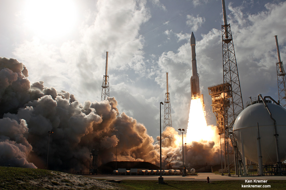
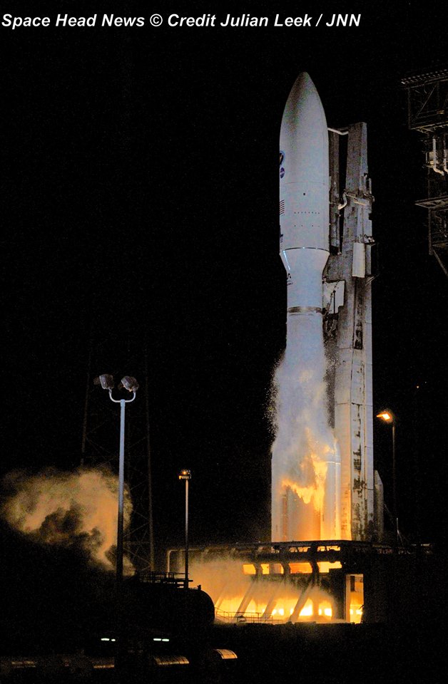
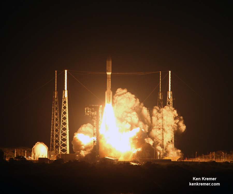
Fiery blastoff of a United Launch Alliance (ULA) Atlas V rocket carrying the EchoStar XIX satellite from Space Launch Complex-41 on Cape Canaveral Air Force Station, Fl., at 2:13 p.m. EST on Dec. 18, 2016. Credit: Ken Kremer/kenkremer.com
Fiery blastoff of a United Launch Alliance (ULA) Atlas V rocket carrying the EchoStar XIX satellite from Space Launch Complex-41 on Cape Canaveral Air Force Station, Fl., at 2:13 p.m. EST on Dec. 18, 2016. Credit: Ken Kremer/kenkremer.com
The 15,000 pound satellite will also delight American home and business subscribers users of HughesNet® – who should soon see dramatic improvements in speed and capability promised by satellite builder Space Systems Loral (SSL).
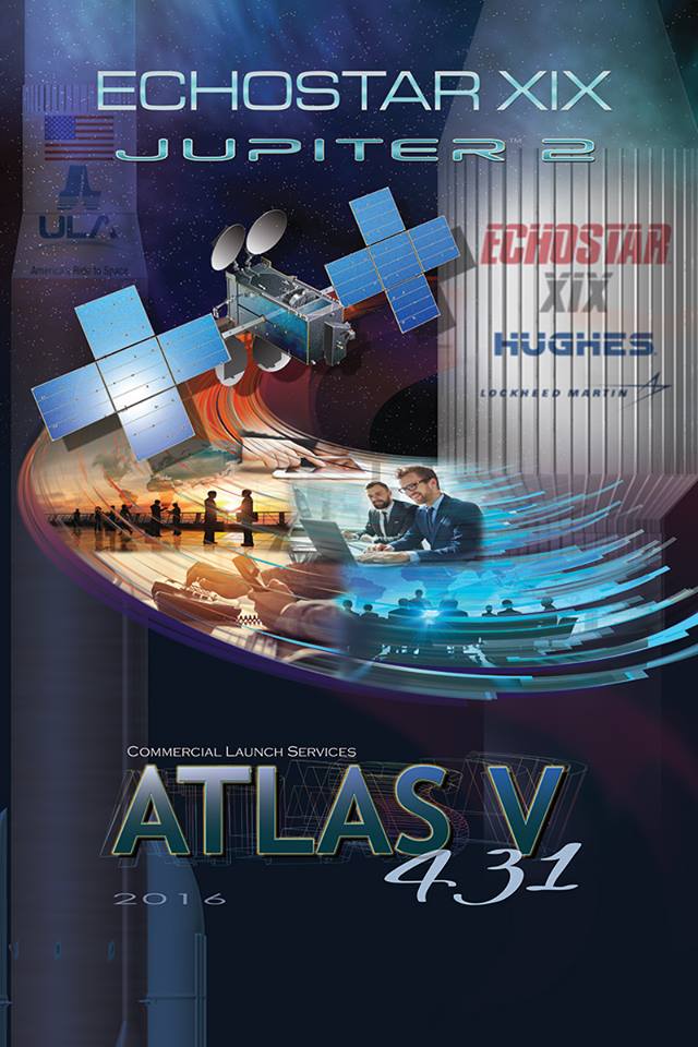
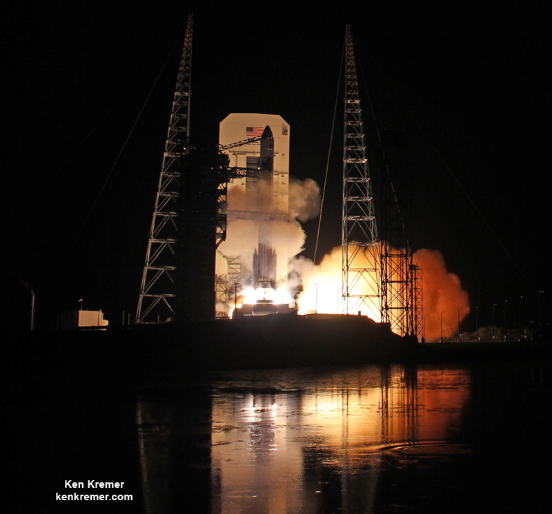
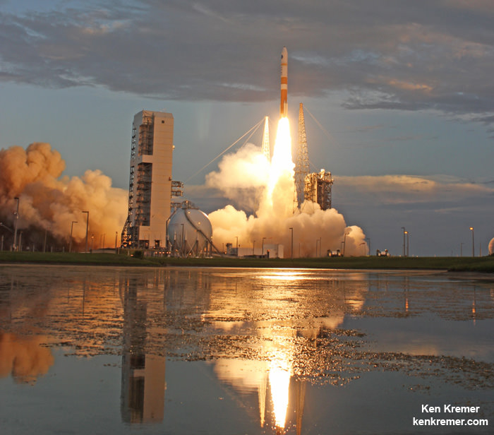
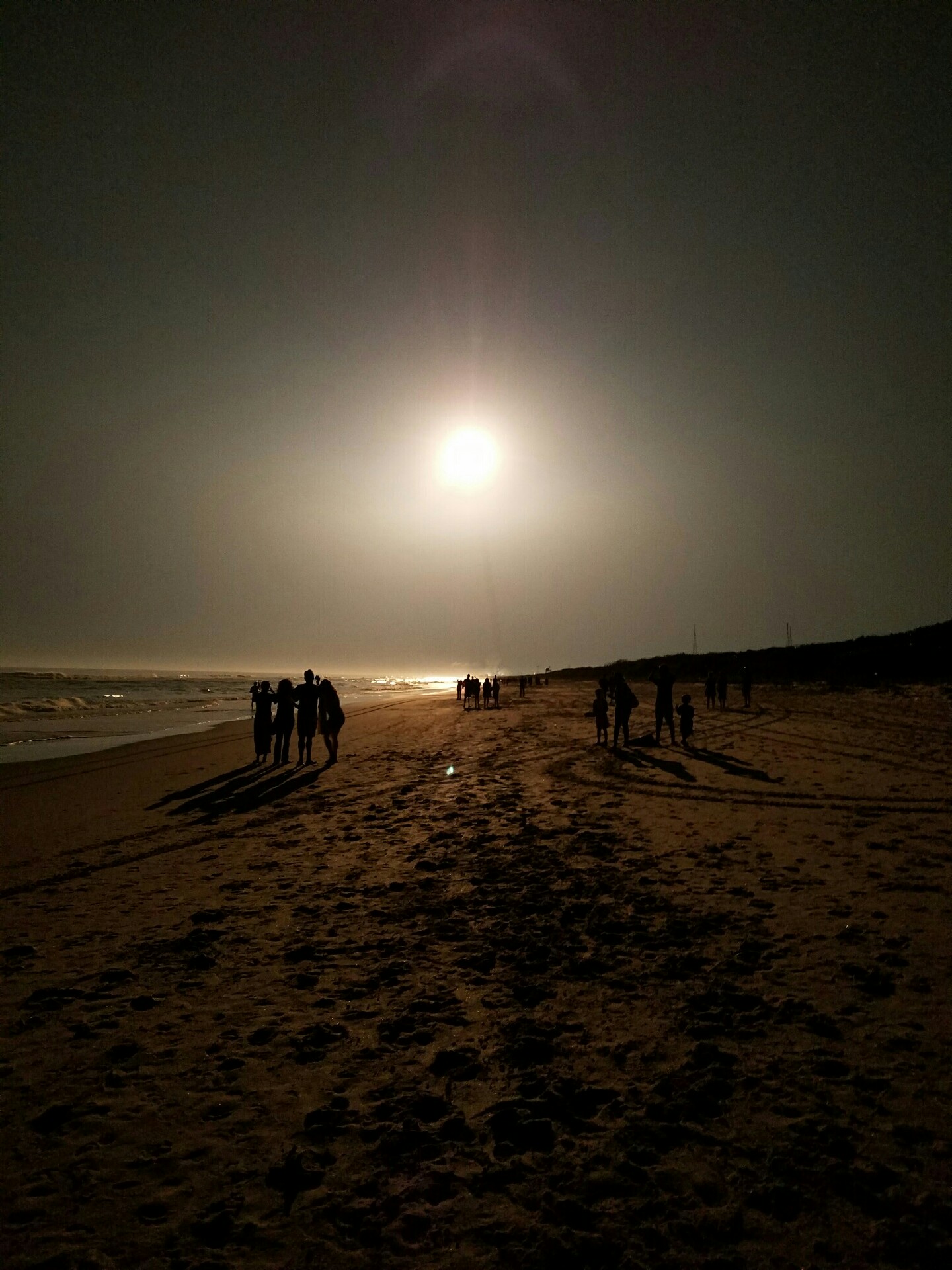
With the fiery blastoff of a United Launch Alliance (ULA) Atlas V rocket, EchoStar XIX – the world’s highest capacity broadband satellite – roared to space off Space Launch Complex-41 on Cape Canaveral Air Force Station, Fl., at 2:13 p.m. EST on Sunday, Dec. 18, 2016.
“EchoStar XIX will dramatically increase capacity for HughesNet® high-speed satellite Internet service to homes and businesses in North America,” according to ULA.
“EchoStar XIX will be the world’s highest capacity broadband satellite in orbit.”
Also known as Jupiter 2, it will deliver more speed, more data and more advanced features to consumers and small businesses from coast to coast, says EchoStar.
Liftoff on the sunny Florida afternoon was delayed some 45 minutes to deal with a technical anomaly that cropped up during the final moments of the countdown with launch originally slated for 1:27 p.m. EST.
Incoming bad weather threatened to delay the blastoff but held off until dark clouds and rains showers hit the Cape about half an hour after the eventual launch at 2:13 p.m.
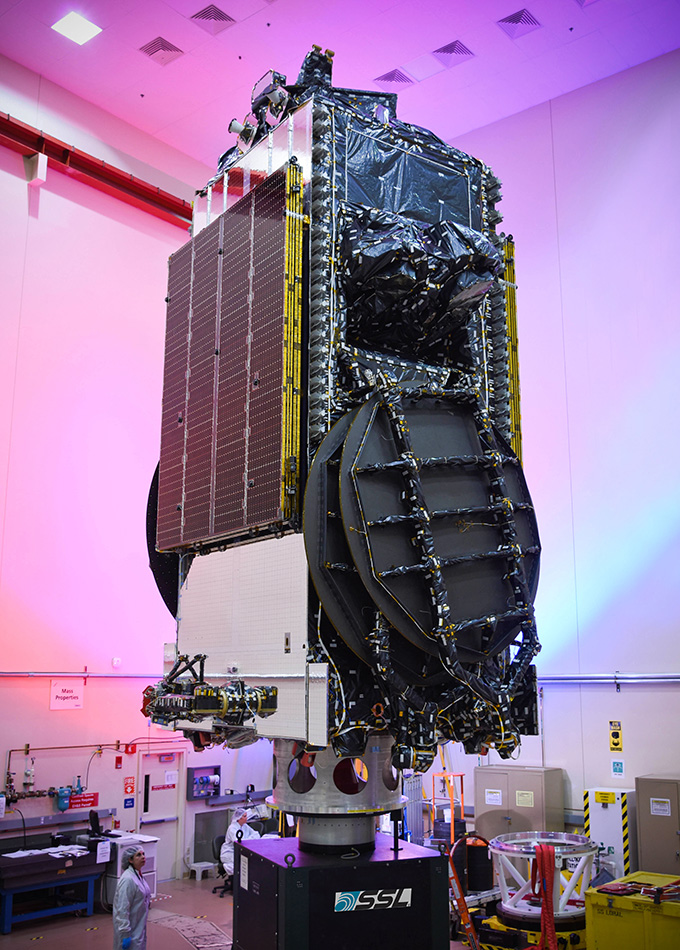
EchoStar 19 is based on the powerful SSL 1300 platform as a multi-spot beam Ka-band satellite.
It is upgraded from the prior series version.
“Building from their experience on the highly successful EchoStar XVII broadband satellite, SSL and Hughes collaboratively engineered the specific design details of this payload for optimum performance.”
EchoStar 19 was delivered to a geosynchronous transfer orbit (GTO). It will be stationed at 97.1 degrees West longitude.
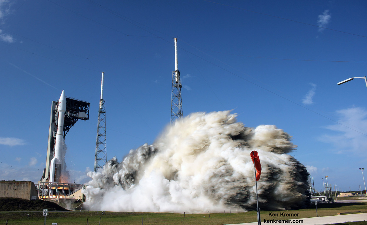
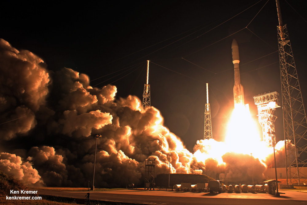
Fiery blastoff of a United Launch Alliance (ULA) Atlas V rocket carrying the EchoStar XIX satellite from Space Launch Complex-41 on Cape Canaveral Air Force Station, Fl., at 2:13 p.m. EST on Dec. 18, 2016. Credit: Ken Kremer/kenkremer.com
EchoStar 19 was ULA’s final mission of 2016, ending another year of 100% success rates stretching back to the company’s founding back in 2006, as a joint venture of Boeing and Lockheed Martin.
This is ULA’s 12th and last launch in 2016 and the 115th successful launch since December 2006.
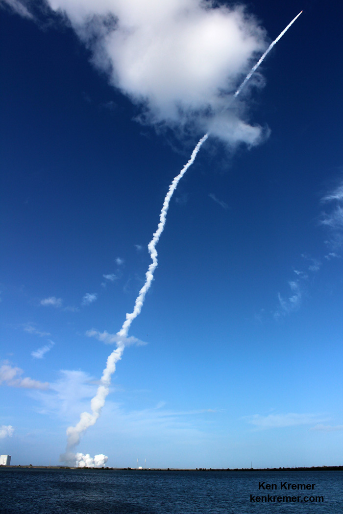
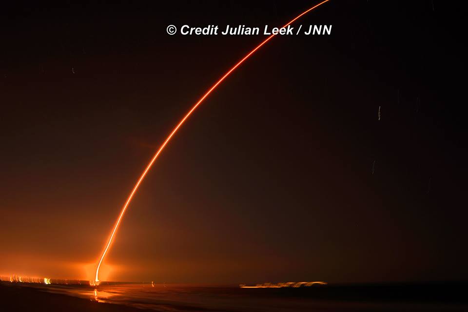
United Launch Alliance (ULA) Atlas V rocket streaks to orbit carrying EchoStar XIX satellite after lift off from Space Launch Complex-41 on Cape Canaveral Air Force Station, Fl., at 2:13 p.m. EST on Dec. 18, 2016. Credit: Ken Kremer/kenkremer.com
“ULA is honored to have been entrusted with the launch of the EchoStar XIX satellite,” said Gary Wentz, ULA vice president of Human and Commercial Systems, in a statement.
“We truly believe that our success is only made possible by the phenomenal teamwork of our employees, customers and industry partners.”
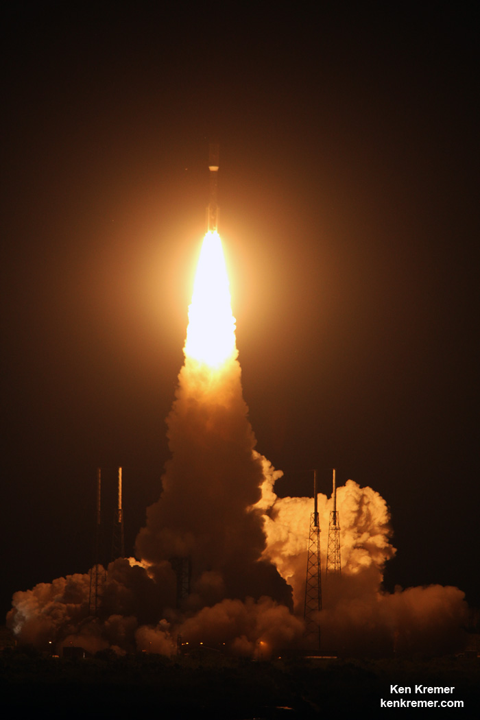
Ignition and liftoff of United Launch Alliance (ULA) Atlas V rocket delivering EchoStar 19 satellite to orbit from Space Launch Complex-41 on Cape Canaveral Air Force Station, Fl., at 2:13 p.m. EST on Dec. 18, 2016. Credit: Ken Kremer/kenkremer.com
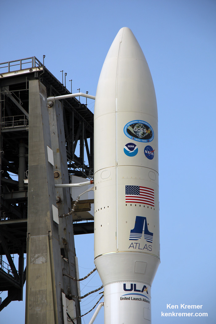
The 194-foot-tall commercial Atlas V booster launched in the 431 rocket configuration with approximately 2 million pounds of first stage thrust. This is the 3rd launch of the 431 configuration – all delivered commercial communications satellites to orbit.
Three solid rocket motors are attached to the Atlas booster to augment the first stage powered by the dual nozzle RD AMROSS RD-180 engine.
The satellite is housed inside a 4-meter diameter extra extended payload fairing (XEPF). The Centaur upper stage was powered by the Aerojet Rocketdyne RL10C engine.
“As we celebrate 10 years, ULA continues to be the nation’s premier launch provider because of our unmatched reliability and mission success,” Wentz elaborated.
“The Atlas V continues to provide the optimum performance to precisely deliver a range of missions. As we move into our second decade, we will maintain our ongoing focus on mission success, one launch at a time even as we transform the space industry, making space more accessible, affordable and commercialized.”
Artwork for ULA Atlas V launch of EchoStar 19 high speed Internet satellite on Dec. 18, 2016 from Canaveral Air Force Station, Florida. Credit: ULA
“Congratulations to ULA and the entire integrated team who ensured the success of our last launch capping off what has been a very busy year,” said Col. Walt Jackim, 45th Space Wing vice commander and mission Launch Decision Authority.
“This mission once again clearly demonstrates the successful collaboration we have with our mission partners as we continue to shape the future of America’s space operations and showcase why the 45th Space Wing is the ‘World’s Premiere Gateway to Space.'”
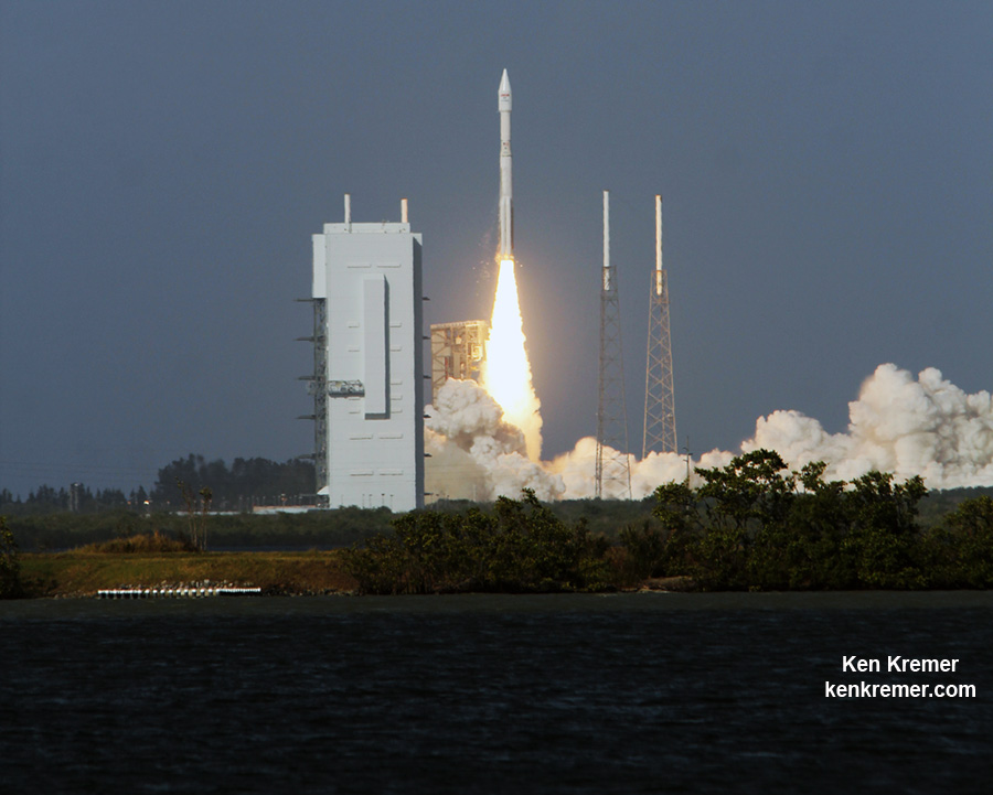
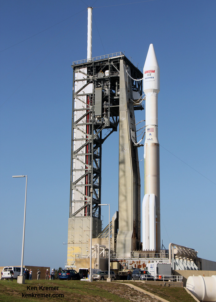
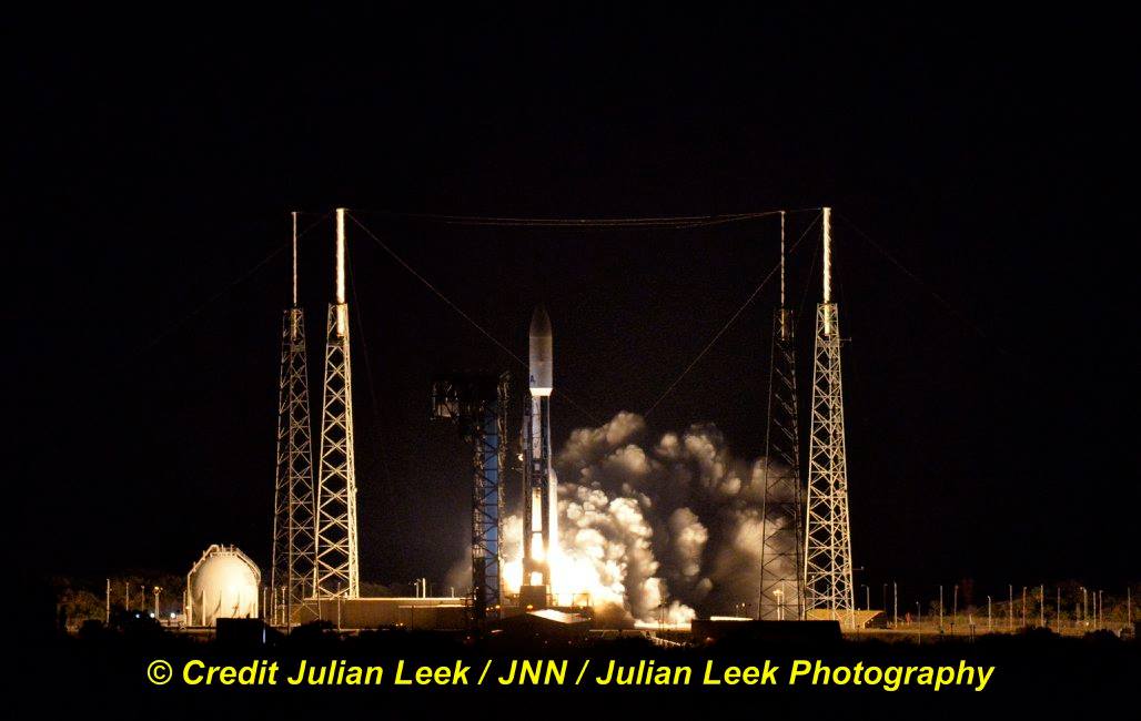
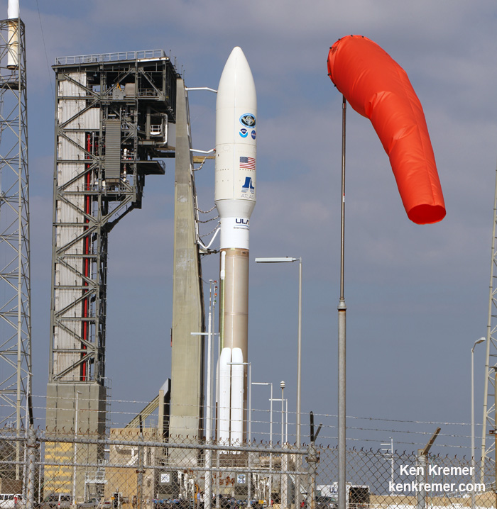
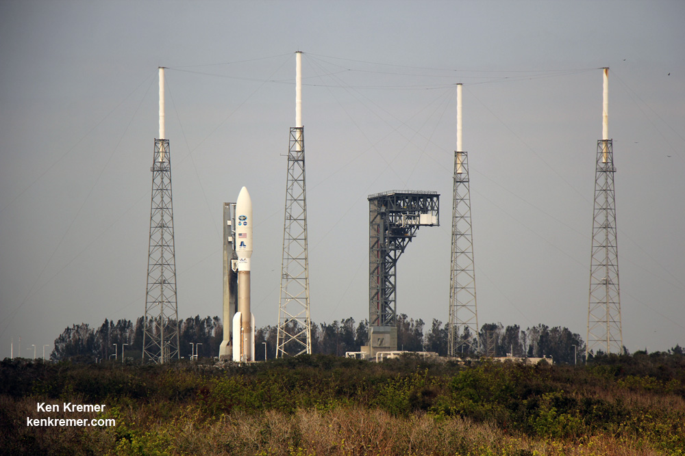
A ULA Atlas V rocket carrying the EchoStar 19 high speed internet satellite is poised for blastoff from Space Launch Complex-41 at Cape Canaveral Air Force Station in Florida on Dec. 18, 2016. Credit: Ken Kremer/kenkremer.com
Stay tuned here for Ken’s continuing Earth and Planetary science and human spaceflight news.
ULA Atlas V rocket carrying the EchoStar 19 high speed internet satellite is poised for blastoff from Space Launch Complex-41 at Cape Canaveral Air Force Station in Florida on Dec. 18, 2016. Credit: Ken Kremer/kenkremer.com
A ULA Atlas V rocket carrying the EchoStar 19 high speed internet satellite is poised for blastoff from Space Launch Complex-41 at Cape Canaveral Air Force Station in Florida on Dec. 18, 2016. Credit: Ken Kremer/kenkremer.com
A ULA Atlas V rocket carrying the EchoStar 19 high speed internet satellite is poised for blastoff from Space Launch Complex-41 at Cape Canaveral Air Force Station in Florida on Dec. 18, 2016. Credit: Ken Kremer/kenkremer.com
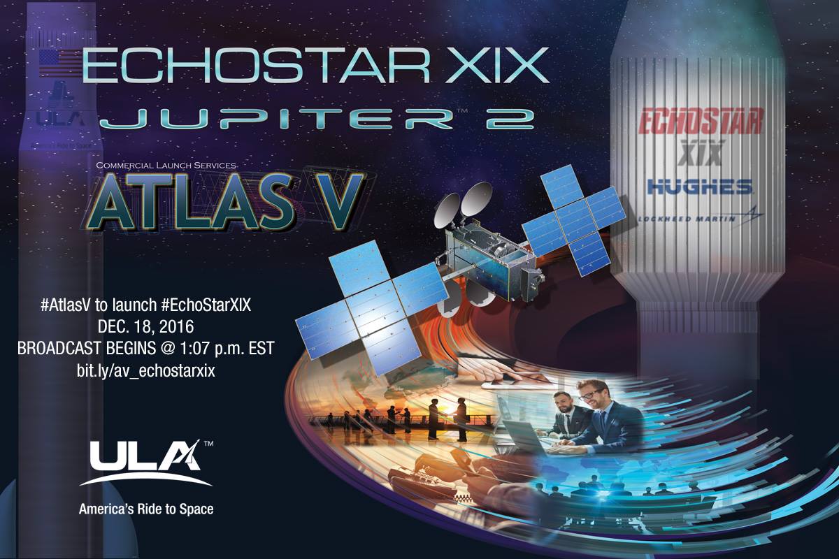
CAPE CANAVERAL AIR FORCE STATION, FL – The highest capacity satellite delivering high speed internet to homes and businesses in North America is scheduled for an early afternoon blastoff on a mighty ULA Atlas V on Sunday, Dec. 18, from the Florida Space Coast.
The lunchtime liftoff should thrill spectators since the venerable United Launch Alliance Atlas V booster carrying EchoStar 19 to orbit is equipped with a trio of solid rocket boosters making for a highly visible plume trailing behind all the way to geosynchronous orbit – weather permitting of course.
“EchoStar XIX will be the world’s highest capacity broadband satellite in orbit, dramatically increasing capacity for HughesNet® high-speed satellite Internet service to homes and businesses in North America,” according to ULA.
Also known as Jupiter 2, it will deliver more speed, more data and more advanced features to consumers and small businesses from coast to coast, says EchoStar.
EchoStar 19 satellite being processed
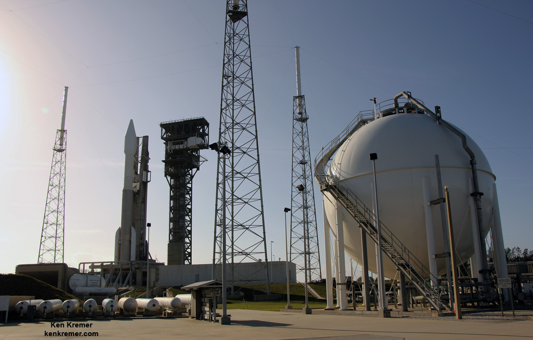
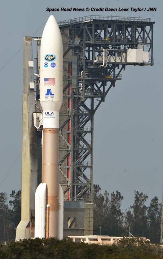
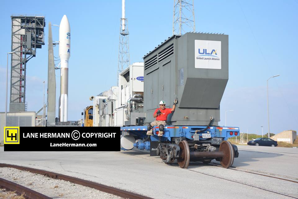
The ULA Atlas V was rolled out to the launch pad this morning ahead of tomorrows launch of the EchoStar XIX mission for Hughes from Space Launch Complex (SLC)-41 at Cape Canaveral Air Force Station, Florida, on Sunday, Dec. 18, 2016.
The launch window opens at 1:27 p.m. EST.
The launch window extends for two hours from 1:27 to 3:37 p.m. EST.
You can watch the Atlas launch live via a ULA webcast. The live launch broadcast will begin about 20 minutes before the planned liftoff at 1:07 p.m. EST here:
Artwork for ULA Atlas V launch of EchoStar 19 high speed Internet satellite on Dec. 18, 2016 from Canaveral Air Force Station, Florida. Credit: ULA
Because of the added solids, the soar to space should be spectacular for locals and tourists gathering from around the world to view the launch now slated for just a day away.
And since the liftoff is taking place on a weekend at lunchtime, that makes it perfectly convenient for a family outing in the sunshine state amidst this Christmas holiday season – which is currently sunny!!
The weather forecast for Sunday, Dec. 18, calls for a 70 percent chance of acceptable weather conditions at launch time.
The primary concerns are for thick clouds and cumlulus clouds.
ULA Atlas V rocket carrying the EchoStar 19 high speed internet satellite is poised for blastoff from Space Launch Complex-41 at Cape Canaveral Air Force Station in Florida on Dec. 18, 2016. Credit: Ken Kremer/kenkremer.com
EchoStar 19 will be delivered to a geosynchronous transfer orbit (GTO) atop the United Launch Alliance Atlas V booster.
It will be stationed at 97.1 degrees West longitude.
EchoStar 19 was built by Space Systems Loral (SSL) and is based on the powerful SSL 1300 platform as a multi-spot beam Ka-band satellite.
It is upgraded from the prior series version.
“Building from their experience on the highly successful EchoStar XVII broadband satellite, SSL and Hughes collaboratively engineered the specific design details of this payload for optimum performance.”
The 194-foot-tall commercial Atlas V booster will launch in the 431 rocket configuration with three solid rocket motors attached to augment the first stage thrust of approximately 2 million pounds.
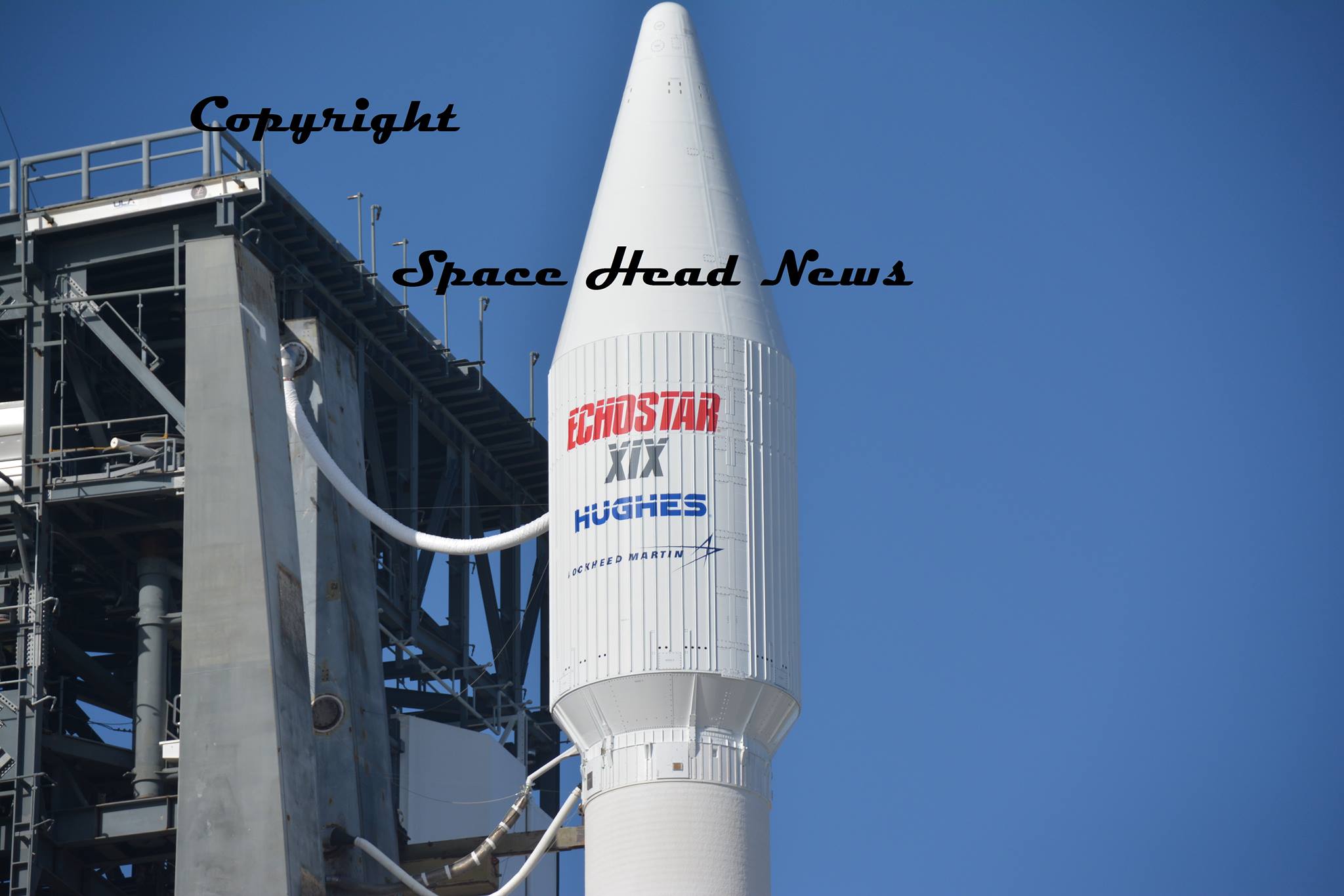
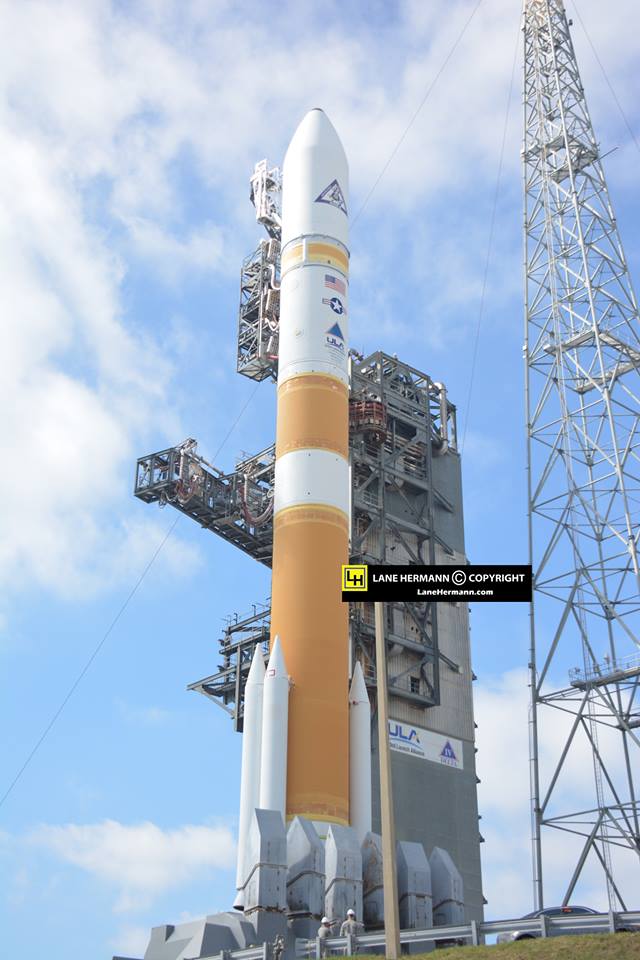
Up close look at the payload fairing housing EchoStar 19 internet sat atop ULA Atlas V rocket set for launch from pad 41 at Cape Canaveral Air Force Station, Fl. Credit: Lane Hermann
Stay tuned here for Ken’s continuing Earth and Planetary science and human spaceflight news.
Learn more about ULA Atlas V EchoStar 19 comsat launch, GOES-R launch, Heroes and Legends at KSCVC, OSIRIS-REx, InSight Mars lander, ULA, SpaceX and Orbital ATK missions, Juno at Jupiter, SpaceX AMOS-6 & CRS-9 rocket launch, ISS, ULA Atlas and Delta rockets, Orbital ATK Cygnus, Boeing, Space Taxis, Mars rovers, Orion, SLS, Antares, NASA missions and more at Ken’s upcoming outreach events:
Dec. 16-18: “ULA Atlas V EchoStar 19 comsat launch,GOES-R weather satellite launch, OSIRIS-Rex, SpaceX and Orbital ATK missions to the ISS, Juno at Jupiter, ULA Delta 4 Heavy spy satellite, SLS, Orion, Commercial crew, Curiosity explores Mars, Pluto and more,” Kennedy Space Center Quality Inn, Titusville, FL, evenings
Artwork for ULA Atlas V launch of EchoStar 19 high speed Internet satellite on Dec. 18, 2016 from Canaveral Air Force Station, Florida. Credit: ULA
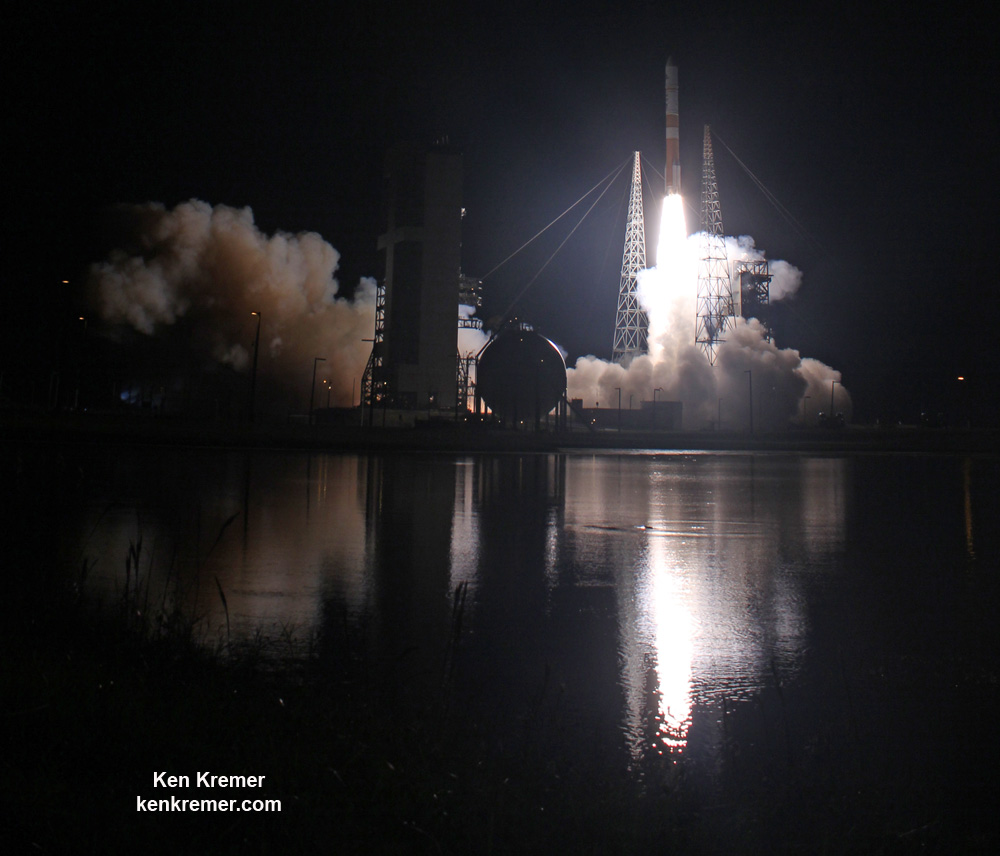
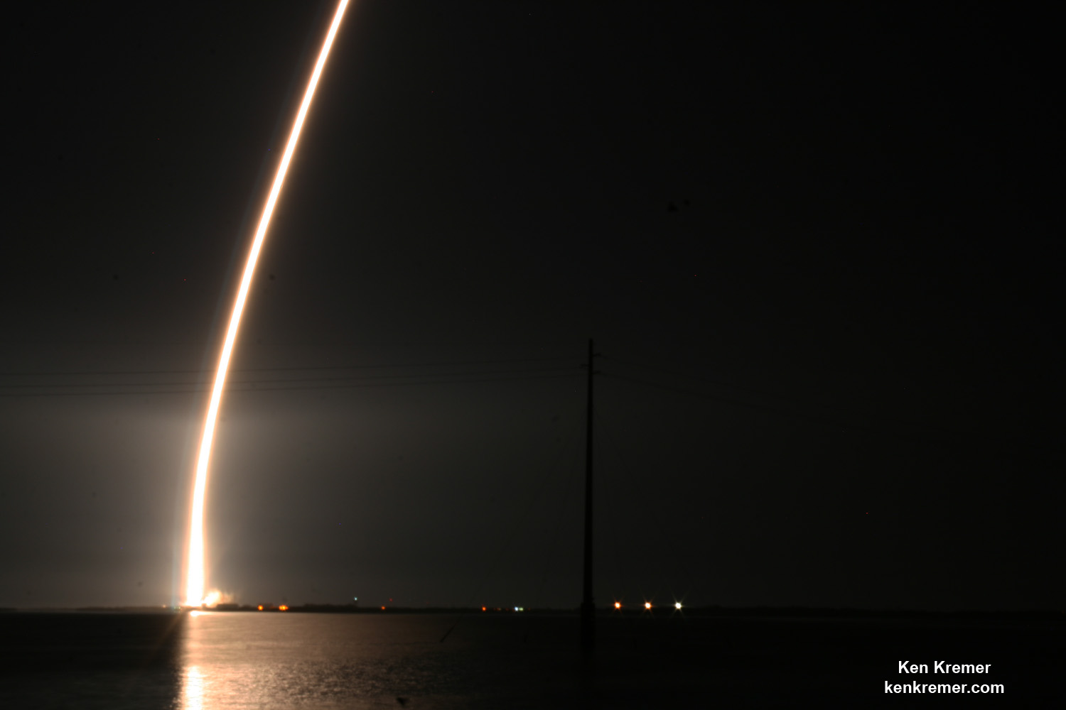
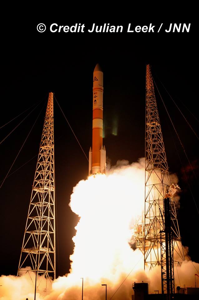
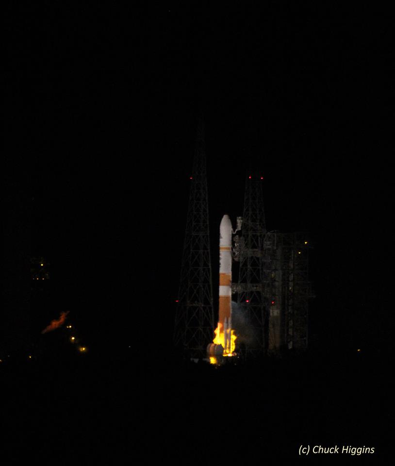
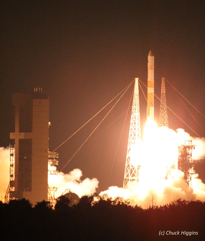
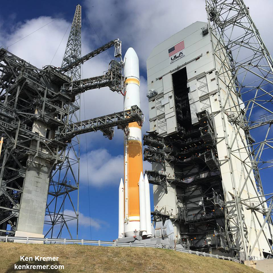
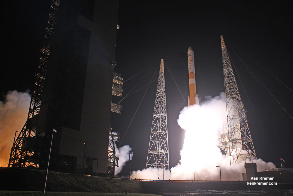
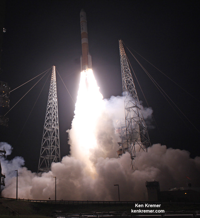
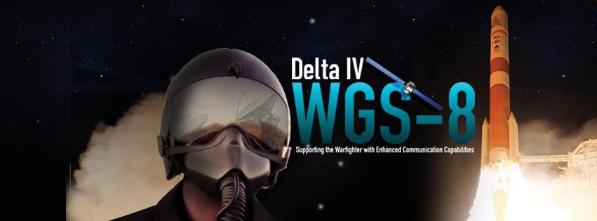
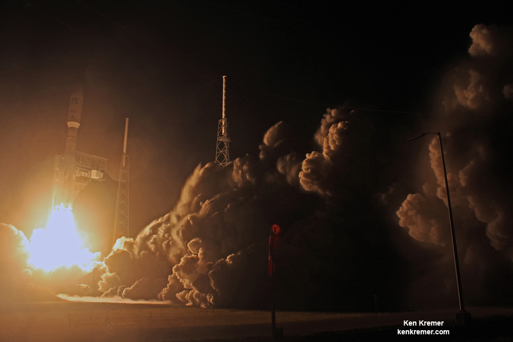
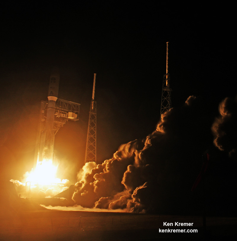
Ignition and liftoff of the United Launch Alliance (ULA) Delta IV rocket carrying the WGS-8 highest capacity satcom to orbit for the U.S. Air Force at 6:53 p.m EDT on Dec. 7, 2016 from Cape Canaveral Air Force Station, Fl. Credit: Ken Kremer/kenkremer.com
Ignition and liftoff of the United Launch Alliance (ULA) Delta IV rocket carrying the WGS-8 highest capacity satcom to orbit for the U.S. Air Force at 6:53 p.m EDT on Dec. 7, 2016 from Cape Canaveral Air Force Station, Fl. Credit: Ken Kremer/kenkremer.com
CAPE CANAVERAL AIR FORCE STATION, FL – The most powerful US Air Force military communications satellite ever built was propelled to orbit by a ULA Delta IV rocket that provided a dinnertime launch delight Wednesday evening for the crowds of spectators gathered around America’s premier gateway to space.
Check out this expanding gallery of launch photos and videos from several space journalist colleagues and friends and myself- spread throughout the Florida Space Coast region – giving a comprehensive look as the Wideband Global SATCOM (WGS-8) mission streaked to orbit atop a United Launch Alliance Delta IV rocket from Space Launch Complex 37 (SLC-37) on Cape Canaveral Air Force Station at 6:53 p.m. EST on Dec. 7, 2016.
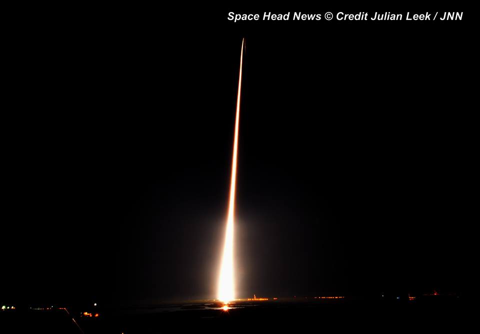
ULA Delta IV rocket and WGS-8 USAF sitcom streak to orbit at 6:53 p.m EDT on Dec. 7, 2016 from Cape Canaveral Air Force Station, Fl, as seen from Melbourne, FL. Credit: Julian Leek
The United Launch Alliance Delta IV Medium+ rocket successfully streaked to the heavens through nearly crystal clear skies to deliver WGS-8 to a supersynchronous transfer orbit.
Spectators were rewarded with a picture perfect view of the rocket as it ascended quickly and arced over to the African continent.
A United Launch Alliance (ULA) Delta IV rocket carrying the Wideband Global SATCOM (WGS-8) mission lifts off from Space Launch Complex-37 at 6:53 p.m EDT on Dec. 7, 2016 from Cape Canaveral Air Force Station, Fla. Credit: Ken Kremer/kenkremer.com
WGS-8 is the first in a newly upgraded series of a trio of WGS satellites built by Boeing that will nearly double the communications bandwidth of prior WGS models.
United Launch Alliance (ULA) Delta IV rocket streaks to orbit after blastoff at 6:53 p.m EDT on Dec. 7, 2016 from Cape Canaveral Air Force Station, Fl, carrying USAF WGS-8 tactical sitcom. Credit: Ken Kremer/kenkremer.comA United Launch Alliance (ULA) Delta IV rocket carrying the WGS-8 mission lifts off from Space Launch Complex-37 at 6:53 p.m EDT on Dec. 7, 2016 from Cape Canaveral Air Force Station, Fla. Credit: Ken Kremer/kenkremer.comLiftoff of ULA Delta IV rocket carrying WGS-8 satcom to orbit for USAF at 6:53 p.m EDT on Dec. 7, 2016 from Cape Canaveral Air Force Station, Fl. Credit: Julian Leek
Watch this video compilation showing the launch from several different vantage points.
Video Caption: A collage of up-close video cameras ringed around Space launch Complex 37 capture Delta 4 launch of the WGS-8 satellite on 12/7/2016 from Pad 37 of the CCAFS, FL. Credit: Jeff Seibert
ULA Delta IV rocket lifts off carrying WGS-8 satcom to orbit for USAF at 6:53 p.m EDT on Dec. 7, 2016 from Cape Canaveral Air Force Station, Fl., as seen from LC-39 gantry. Credit: Chuck HigginsULA Delta IV rocket lifts off carrying WGS-8 satcom to orbit for USAF at 6:53 p.m EDT on Dec. 7, 2016 from Cape Canaveral Air Force Station, Fl., as seen from LC-39 gantry. Credit: Chuck Higgins
WGS-8 is the first of three launches from the Cape this December. A Pegasus XL rocket will launch on Dec. 12 carrying NASA’s CGYNSS hurricane monitoring satellites. And an Atlas V will launch on Dec. 18 with the EchoStar 19 comsat.
ULA Delta IV poised for blastoff with the WGS-8 mission for the U.S. Air Force from Cape Canaveral Air Force Station, Fl, on Dec. 7, 2016. Credit: Lane Hermann
Stay tuned here for Ken’s continuing Earth and planetary science and human spaceflight news.
Blastoff of ULA Delta IV rocket with USAF WGS-8 satcom at 6:53 p.m EDT on Dec. 7, 2016 from Cape Canaveral Air Force Station, Fl., as seen from Titusville. Credit: Ashley CrouchBlastoff of ULA Delta IV rocket with USAF WGS-8 satcom at 6:53 p.m EDT on Dec. 7, 2016 from Cape Canaveral Air Force Station, Fl., as seen from Titusville. Credit: Ashley CrouchULA Delta IV rocket poised for blastoff with the WGS-8 mission for the U.S. Air Force from pad 37 on Cape Canaveral Air Force Station, Fl, on Dec. 7, 2016. Credit: Ken Kremer/kenkremer.comA United Launch Alliance (ULA) Delta IV rocket carrying the WGS-8 mission lifts off from Space Launch Complex-37 at 6:53 p.m EDT on Dec. 16, 2016 from Cape Canaveral Air Force Station, Fla. Credit: Ken Kremer/kenkremer.comUnited Launch Alliance (ULA) Delta IV rocket carrying the WGS-8 mission for the U.S. Air Force launches at 6:53 p.m EDT on Dec. 16, 2016 from Cape Canaveral Air Force Station, Fl. Credit: Ken Kremer/kenkremer.com
A United Launch Alliance (ULA) Delta IV rocket carrying the WGS-8 mission lifts off from Space Launch Complex-37 at 6:53 p.m EDT on Dec. 7, 2016 from Cape Canaveral Air Force Station, Fla. Credit: Ken Kremer/kenkremer.com
A United Launch Alliance (ULA) Delta IV rocket carrying the WGS-8 mission lifts off from Space Launch Complex-37 at 6:53 p.m EDT on Dec. 7, 2016 from Cape Canaveral Air Force Station, Fla. Credit: Ken Kremer/kenkremer.com
CAPE CANAVERAL AIR FORCE STATION, FL – The highest-capacity US Air Force communications system thundered to orbit during a fabulous nighttime blastoff from the Florida Space Coast, Wednesday evening offering a picture perfect spectacle in addition to a significant boost to military point to point communications.
Hordes of spectators lined space coast beaches and viewing areas to witness the dinnertime launch of the Wideband Global SATCOM (WGS-8) mission for the U.S. Air Force on a United Launch Alliance Delta IV Medium+ rocket at 6:53 p.m. EST on Wednesday, Dec. 7, 2016.
The on time Delta liftoff took place from Space Launch Complex-37 at Cape Canaveral Air Force Station, Florida at the opening of the 49 minute long launch window.
United Launch Alliance (ULA) Delta IV rocket carrying the WGS-8 mission for the U.S. Air Force launches at 6:53 p.m EDT on Dec. 7, 2016 from Cape Canaveral Air Force Station, Fl. Credit: Ken Kremer/kenkremer.com
“Thank you to the U.S. Air Force and industry team whose flawless execution enabled today’s successful launch of the WGS-8 mission,” said Laura Maginnis, ULA vice president of Custom Services, in a statement.
“Last week ULA celebrated our anniversary and 10 years of 100% mission success. This evening’s launch epitomizes why our customers continue to entrust ULA to deliver our nation’s most crucial space capabilities.”
WGS-8 was delivered to a supersynchronous transfer orbit atop the United Launch Alliance Delta IV Medium+ rocket.
WGS-8 is the first in a newly upgraded series of a trio of WGS satellites built by Boeing that will nearly double the communications bandwidth of prior WGS models.
The major upgrade is inclusion of the Wideband Digital Channelizer, awarded to Boeing in June 2012.
“Boeing’s eighth Wideband Global SATCOM (WGS) satellite will provide nearly twice as much communications bandwidth as previous WGS satellites due to an upgraded digital payload,” said Boeing in a statement.
The Wideband Digital Channelizer will provide a 90 percent improvement in satellite bandwidth for US military forces.
“Using leading commercial digital circuit technology, the newly upgraded satellite will aid in fulfilling the increasing demand for high-data rate communications of warfighters around the globe.”
WGS-8 was also built for a significantly cheaper price compared to the prior WGS series. WGS-8 cost about $426 million vs. about $570 million for the WGS 7 satellite.
“Not only does WGS-8’s cutting edge digital payload nearly double the satellite’s bandwidth, but the U.S. government was able to realize more than $150 million in savings for WGS-7 through WGS-10 through fixed-price block purchases and commercial operating practices,” said Dan Hart, Boeing vice president, Government Satellite Systems, in a statement.
“We’ve been able to both increase the capability and reduce the per-unit cost with each new WGS satellite we’ve delivered, making WGS, by far, the most cost-effective asset for military communications.”
The 217 foot tall Delta IV Medium+ rocket launched in the (5,4) configuration with a 5 meter diameter payload fairing and powered by one common booster core and four solid rocket motors built by Orbital ATK to augment the first stage.
The common booster core was powered by an RS-68A liquid hydrogen/liquid oxygen engine producing 705,250 pounds of thrust at sea level. A single RL10B-2 liquid hydrogen/liquid oxygen engine powered the second stage.
The booster and upper stage engines are both built by Aerojet Rocketdyne. ULA constructed the Delta IV Medium+ (5,4) launch vehicle in Decatur, Alabama.
The is the sixth flight in the Medium+ (5,4) configuration; all of which were for prior WGS missions.
ULA Delta IV rocket poised for blastoff with the WGS-8 mission for the U.S. Air Force from pad 37 on Cape Canaveral Air Force Station, Fl, on Dec. 7, 2016. Credit: Ken Kremer/kenkremer.com
WGS-8 also counts as the first of three launches from the Cape this December. A Pegasus XL rocket will launch on Dec. 12 carrying NASA’s CGYNSS hurricane monitoring satellites. And an Atlas V will launch on Dec. 12 with the EchoStar 23 comsat.
Stay tuned here for Ken’s continuing Earth and planetary science and human spaceflight news.
ULA Delta IV rocket poised for blastoff with the WGS-7 mission for the U.S. Air Force from Cape Canaveral Air Force Station, Fl, on July 23, 2015. Credit: Ken Kremer/kenkremer.com
ULA Delta IV rocket poised for blastoff with the WGS-7 mission for the U.S. Air Force from Cape Canaveral Air Force Station, Fl, on July 23, 2015. Credit: Ken Kremer/kenkremer.com
CAPE CANAVERAL AIR FORCE STATION, FL – Less than 24 hours from now the evening skies along the Florida Space Coast will light up with a spectacular burst of fire and fury as a Delta rocket roars to space with a super advanced tactical satcom for the U.S. Air Force that will provide a huge increase in communications bandwidth for American forces around the globe.
Blastoff of the Wideband Global SATCOM (WGS-8) mission for the U.S. Air Force is slated for 6:53 p.m. EST on Wednesday, Dec. 7, 2016 from Space Launch Complex-37 at Cape Canaveral Air Force Station, Florida.
WGS-8 will be delivered to a supersynchronous transfer orbit atop a United Launch Alliance Delta IV Medium+ rocket. The launch window runs for 49 minutes from 6:53-7:42 p.m. EST.
You can watch the Delta launch live on a ULA webcast. The live launch broadcast will begin at 6:33 p.m. EST here:
http://www.ulalaunch.com/webcast.aspx
The weather forecast for Wednesday Dec. 6, calls for an 80 percent chance of acceptable weather conditions at launch time.
In case of a scrub for any reason the chances for a favorable launch drop slightly to 60% GO.
WGS-8 is the first in a newly upgraded series of a trio of WGS satellites built by Boeing.
The major upgrade is inclusion of the Wideband Digital Channelizer, awarded to Boeing in June 2012.
The Wideband Digital Channelizer will provide a 90 percent improvement in satellite bandwidth for US forces.
It is also the only military satellite communications system that can support simultaneous X and Ka band communications.
WGS-8 can instantaneously filter and downlink up to 8.088 GHz of bandwidth compared to 4.410 GHz for the earlier Block I and II satellite series.
The prior Wideband Global SATCOM-7 (WGS-7) communications satellite was launched on July 23, 2015 from Space Launch Complex-37.
A United Launch Alliance (ULA) Delta IV rocket carrying the WGS-7 mission for the U.S. Air Force launches from Cape Canaveral Air Force Station, Fl, on July 23, 2015. Credit: Ken Kremer/kenkremer.com
The Wideband Global SATCOM system provides “anytime, anywhere communication” for allied military forces “through broadcast, multicast and point to point connections,” according to ULA.
The $426 million WGS 8 satellite is part of a significant upgraded constellation of high capacity communications satellites providing enhanced communications capabilities to American and allied troops in the field for the coming two decades.
“WGS provides essential communications services, allowing Combatant Commanders to exert command and control of their tactical forces, from peace time to military operations.”
WGS-8 is the eighth in a series of high capacity communication satellites that will broaden tactical communications for U.S. and allied forces at both a significantly higher capacity and lower cost.
“WGS satellites are important elements of a high-capacity satellite communications system providing enhanced communications capabilities to America’s troops in the field for the next decade and beyond,” according to a ULA factsheet.
“WGS enables more robust and flexible execution of Command and Control, Communications Computers, Intelligence, Surveillance, and Reconnaissance (C4ISR), as well as battle management and combat support information functions. The WGS constellation augments the existing service available through the UHF Follow-on satellite by providing enhanced information broadcast capabilities.”
The 217 foot tall Delta IV Medium+ rocket will launch in the 5,4 configuration with a 5 meter diameter payload fairing and 4 solid rocket boosters to augment the first stage.
The is the sixth flight in the Medium+ (5,4) configuration; all of which were for prior WGS missions.
WGS-8 logo
WGS-8 also counts as the first of three launches from the Cape this December. A Pegasus XL rocket will launch on Dec. 12 carrying NASA’s CGYNSS hurricane monitoring satellites. And an Atlas V will launch on Dec. 12 with the EchoStar 23 comsat.
Stay tuned here for Ken’s continuing Earth and planetary science and human spaceflight news.
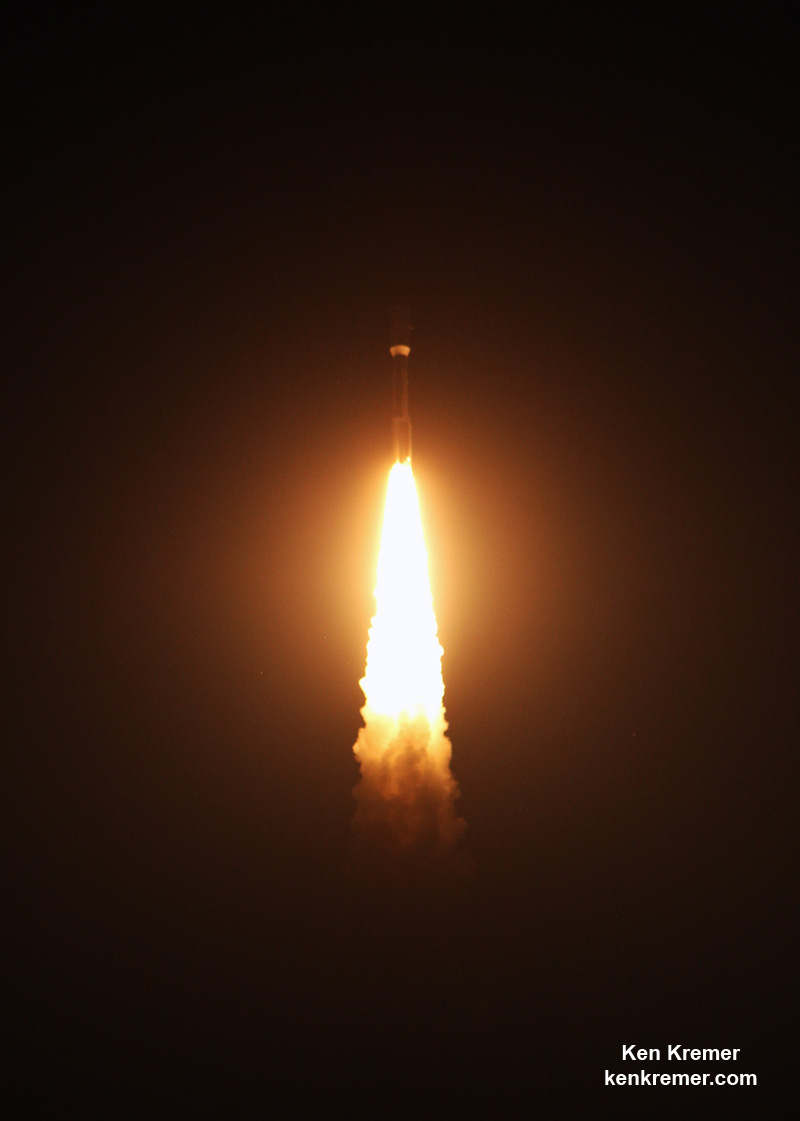
Blastoff of revolutionary NASA/NOAA GOES-R weather satellite on ULA Atlas V on Nov. 19, 2016 - as seen from remote camera at Space Launch Complex 41 (SLC-41) on Cape Canaveral Air Force Station, Florida. GOES-R will deliver a quantum leap in America’s weather forecasting capabilities. Credit: Ken Kremer/kenkremer.com
Blastoff of revolutionary NASA/NOAA GOES-R weather satellite on ULA Atlas V on Nov. 19, 2016 – as seen from remote camera at Space Launch Complex 41 (SLC-41) on Cape Canaveral Air Force Station, Florida. GOES-R will deliver a quantum leap in America’s weather forecasting capabilities. Credit: Ken Kremer/kenkremer.com
KENNEDY SPACE CENTER, FL – The fire and fury of the mighty ULA Atlas V got the gorgeous NASA/NOAA GOES-R weather observatory to geostationary orbit just days ago – as a ‘Thanksgiving’ present to all the people of Earth through the combined efforts of the government/industry/university science and engineering teams of hard working folks who made it possible.
Check out this dazzling photo and video gallery from myself and several space journalist colleagues showing how GOES got going – from prelaunch to launch atop a United Launch Alliance Atlas V rocket from Space Launch Complex 41 (SLC-41) Cape Canaveral Air Force Station at 6:42 p.m. EST in the evening on Saturday, Nov. 19, 2016.
Three and a half hours after liftoff, the bus sized spacecraft successfully separated from the Atlas Centaur upper stage and deployed its life giving solar arrays.
ULA Atlas V rocket and GOES-R weather observatory streak to orbit from launch pad 41 at Cape Canaveral, Florida. Credit: Julian Leek
GOES-R is the most advanced and powerful weather observatory ever built and will bring about a ‘quantum leap’ in weather forecasting.
It’s dramatic new imagery will show the weather in real time enabling critical life and property forecasting, help pinpoint evacuation zones and also save people’s lives in impacted areas of severe weather including hurricanes and tornadoes.
Here’s a pair of beautiful launch videos from space colleague Jeff Seibert and myself:
Video Caption: 5 views from the launch of the NOAA/NASA GOES-R weather satellite on 11/19/2016 from Pad 41 CCAFS on a ULA Atlas. Credit: Jeff Seibert
Video Caption: Launch of the NOAA/NASA GOES-R weather observatory satellite on Nov. 19, 2016 from pad 41 on Cape Canaveral Air Force Station on a ULA Atlas V rocket – as seen in this remote video taken at the pad. Credit: Ken Kremer/kenkremer.com
GOES-R is the first in a new series of revolutionary NASA/NOAA geostationary weather satellites that will soon lead to more accurate and timely forecasts, watches and warnings for the Earth’s Western Hemisphere when it becomes fully operational in about a year.
Ignition of ULA Atlas V rocket and GOES-R weather observatory at launch pad 41 at Cape Canaveral, Florida. Credit: Julian Leek
GOES-R, which stands for Geostationary Operational Environmental Satellite – R Series – is a new and advanced transformational weather satellite that will vastly enhance the quality, speed and accuracy of weather forecasting available to forecasters for Earth’s Western Hemisphere.
The 11,000 pound satellite was built by prime contractor Lockheed Martin and is the first of a quartet of four identical satellites – comprising GOES-R, S, T, and U – at an overall cost of about $11 Billion. This will keep the GOES satellite system operational through 2036.
Blastoff of revolutionary NASA/NOAA GOES-R weather satellite on ULA Atlas V on Nov. 19, 2016 – as seen from remote camera at Space Launch Complex 41 (SLC-41) on Cape Canaveral Air Force Station, Florida. Credit: Ken Kremer/kenkremer.com
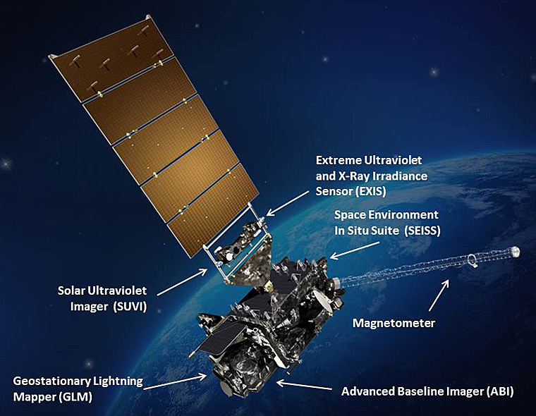
The science suite includes the Advanced Baseline Imager (ABI) built by Harris Corporation, the Geostationary Lightning Mapper (GLM) built by Lockheed Martin, Solar Ultraviolet Imager (SUVI), Extreme Ultraviolet and X-Ray Irradiance Sensors (EXIS), Space Environment In-Situ Suite (SEISS), and the Magnetometer (MAG).
ABI is the primary instrument and will collect 3 times more spectral data with 4 times greater resolution and scans 5 times faster than ever before – via the primary Advanced Baseline Imager (ABI) instrument – compared to the current GOES satellites.
Atlas V and GOES-R aloft after Nov. 19, 2016 liftoff of the powerful NASA/NOAA weather observatory on ULA Atlas V from pad 41 on Cape Canaveral Air Force Station, Florida – as seen from the VAB roof. Credit: Ken Kremer/kenkremer.com
GOES-R launched on the massively powerful Atlas V 541 configuration vehicle, augmented by four solid rocket boosters on the first stage.
The payload fairing is 5 meters (16.4 feet) in diameter. The first stage is powered by the Russian built duel nozzle RD AMROSS RD-180 engine. And the Centaur upper stage is powered by a single-engine Aerojet Rocketdyne RL10C engine.
This was only the fourth Atlas V launch employing the 541 configuration.
ULA Atlas V rocket and GOES-R weather observatory at launch pad 41 at Cape Canaveral, Florida. Credit: Dawn Leek Taylor
Stay tuned here for Ken’s continuing Earth and Planetary science and human spaceflight news.
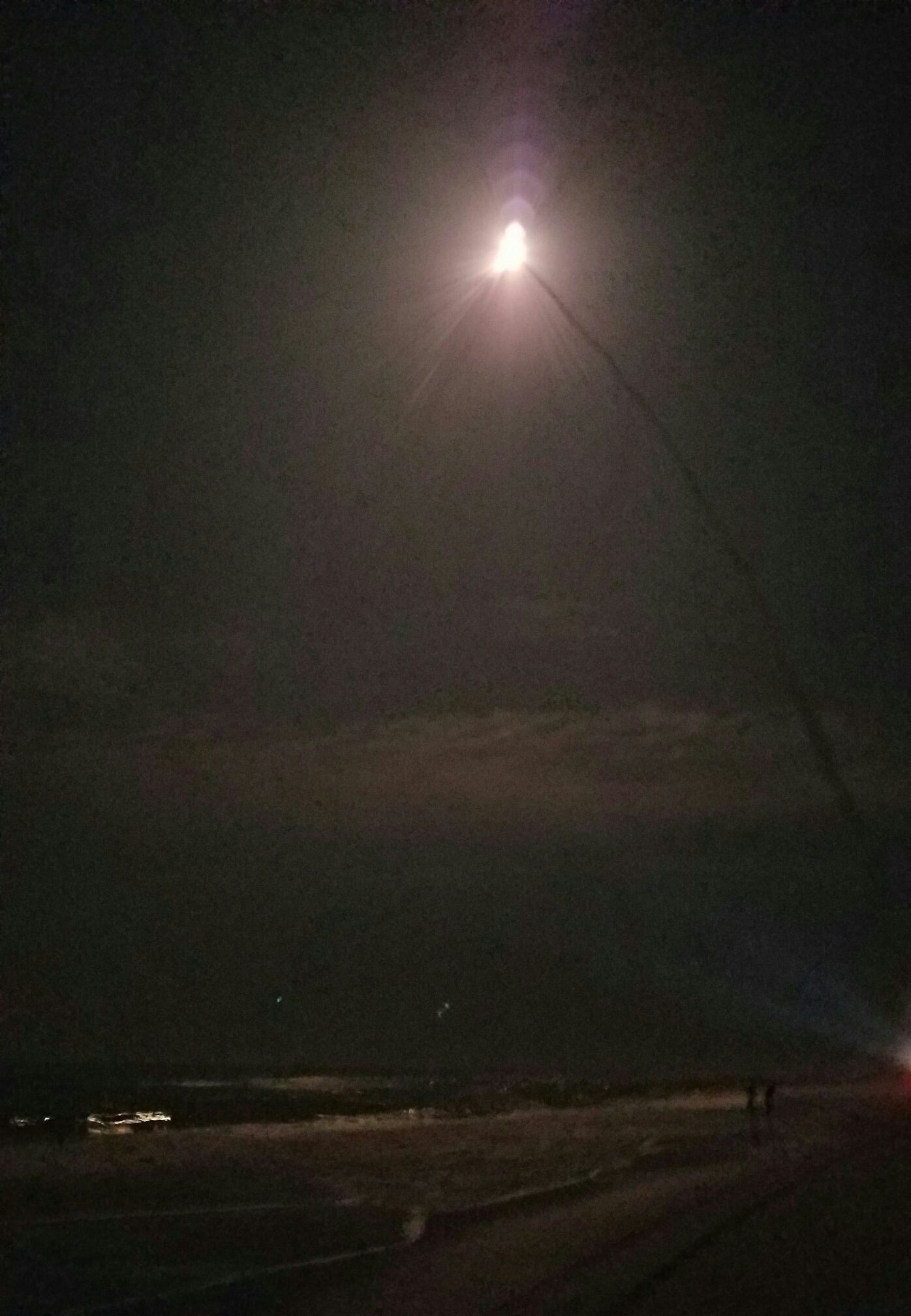
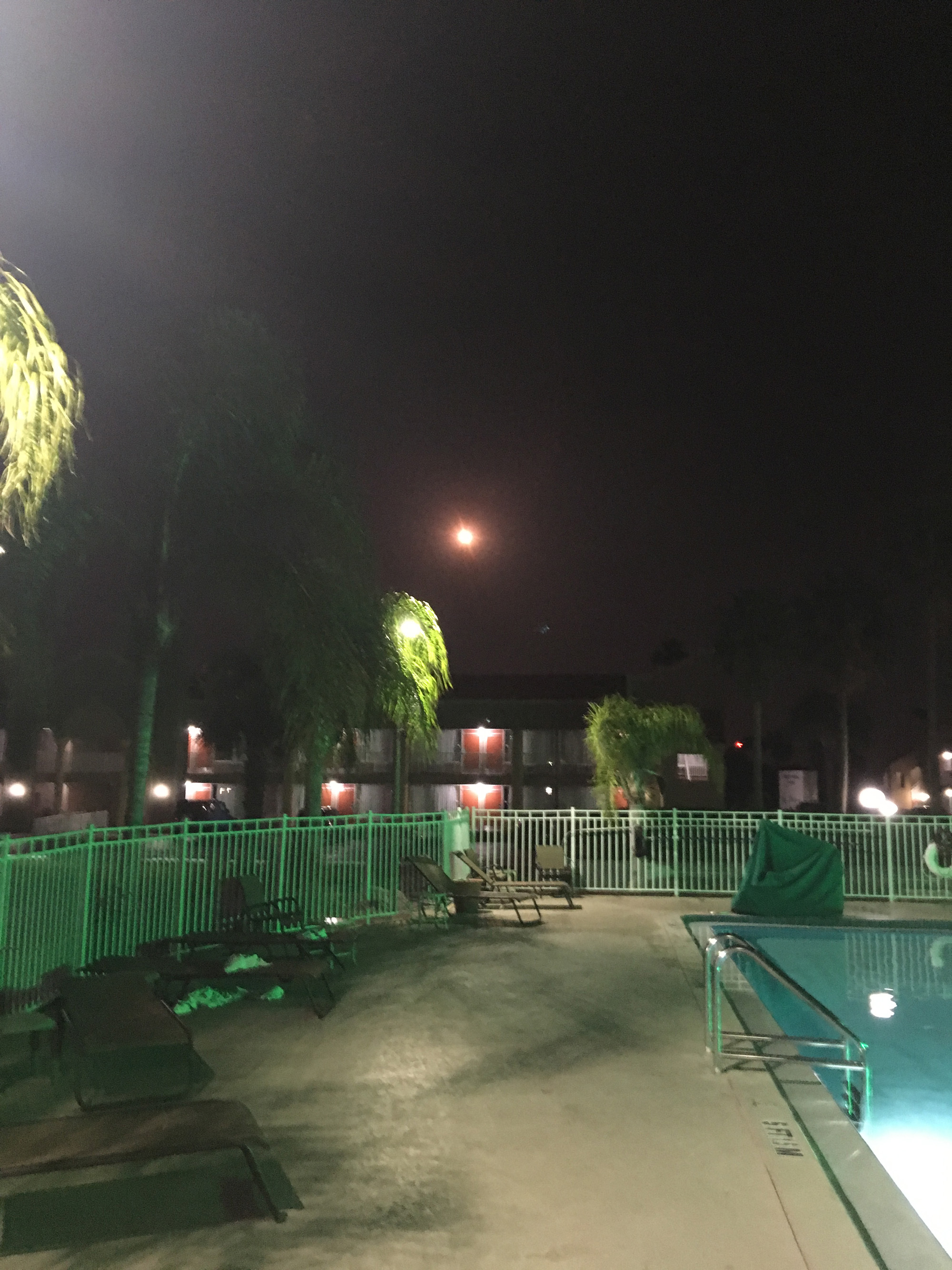
Track mobile used to push ULS Atlas V and NASA/NOAA GOES-R to pad 41 from VIF processing facility. Credit: Lane HermannLaunch of NASA/NOAA GOES-R weather observatory on ULA Atlas V on Nov. 19, 2016 from pad 41 on Cape Canaveral Air Force Station, Florida, as seen from Playalinda beach. Credit: Jillian LaudickAtlas V/GOES-R launch as seen rising over neighbor houses in Titusville, Florida on Nov. 19, 2016. Credit: Melissa BaylesAtlas V rocket and GOES-R nighttime launch soars over the swimming pool at the Quality Inn Kennedy Space Center in Titusville, Florida on Nov. 19, 2016. Credit: Wesley BaskinThe NASA/NOAA GOES-R (Geostationary Operational Environmental Satellite – R Series) being processed at Astrotech Space Operations, in Titusville, FL, in advance of launch on a ULA Atlas V on Nov. 19, 2016. GOES-R will be America’s most advanced weather satellite. Credit: Ken Kremer/kenkremer.com
Blastoff of revolutionary NASA/NOAA GOES-R (Geostationary Operational Environmental Satellite - R Series) on a ULA Atlas V from Space Launch Complex 41 (SLC-41) on Cape Canaveral Air Force Station, Florida on Nov. 19, 2016 - as seen from the VAB roof. GOES-R will soon deliver a quantum leap in America’s weather forecasting capabilities. Credit: Ken Kremer/kenkremer.com
Blastoff of revolutionary NASA/NOAA GOES-R (Geostationary Operational Environmental Satellite – R Series) on a ULA Atlas V from Space Launch Complex 41 (SLC-41) on Cape Canaveral Air Force Station, Florida on Nov. 19, 2016 – as seen from the VAB roof. GOES-R will soon deliver a quantum leap in America’s weather forecasting capabilities. Credit: Ken Kremer/kenkremer.com
Liftoff of the highly advanced Geostationary Operational Environmental Satellite-R (GOES-R) weather observatory bolted atop a ULA Atlas V rocket came at 6:42 p.m. EST on Saturday, Nov. 19, 2016 from Space Launch Complex 41 (SLC-41) on Cape Canaveral Air Force Station, Florida.
The launch was delayed for an hour until the very end of the launch window to deal with unexpected technical and Eastern range issues, that only added more drama and changed the sunset launch into a night launch for the hordes of spectators who gathered here from around the world – appropriate since this probe will touch the lives of humans world wide.
“It’s a dramatic leap in capability – like moving from black and white TV to HDTV,” explained Greg Mandt, the NOAA GOES-R program manager during a prelaunch media briefing in the cleanroom processing facility at Astrotech.
“This is a very exciting time,” explained Greg Mandt, the NOAA GOES-R program manager during the Astrotech cleanroom briefing.
“This is the culmination of about 15 years of intense work for the great team of NOAA and NASA and our contractors Lockheed Martin and Harris.”
“We are bringing the nation a new capability. The GOES program has been around for about 40 years and most every American sees it every night on the weather broadcasts when they see go to the satellite imagery. And what’s really exciting is that for the first time in that 40 years we are really end to end replacing the entire GOES system. The weather community is really excited about what we are bringing.”
GOES-R will bring about a “quantum leap” in weather forecasting capabilities that will soon lead to more accurate and timely forecasts, watches and warnings for the Earth’s Western Hemisphere when it becomes fully operational in about a year.
But the first images are expected within weeks! And both researchers and weather forecasters can’t wait to see, analyze and put to practical use the sophisticated new images and data that will improve forecasts and save lives during extreme weather events that are occurring with increasing frequency.
Blastoff of revolutionary NASA/NOAA GOES-R (Geostationary Operational Environmental Satellite – R Series) on ULA Atlas V from Space Launch Complex 41 (SLC-41) on Cape Canaveral Air Force Station, Florida on Nov. 19, 2016. GOES-R will deliver a quantum leap in America’s weather forecasting capabilities. Credit: Ken Kremer/kenkremer.com
GOES-R will be renamed GOES-16 after it reaches its final orbit 22,000 above Earth about two weeks from now.
Over the next year, teams of engineers and scientists will check out and validate the state of the art suite of six science instruments that also includes the first operational lightning mapper in geostationary orbit – dubbed the Geostationary Lightning Mapper (GLM).
“The launch of GOES-R represents a major step forward in terms of our ability to provide more timely and accurate information that is critical for life-saving weather forecasts and warnings,” said Thomas Zurbuchen, associate administrator for NASA’s Science Mission Directorate in Washington.
“It also continues a decades-long partnership between NASA and NOAA to successfully build and launch geostationary environmental satellites.”
GOES-R, which stands for Geostationary Operational Environmental Satellite – R Series – is a new and advanced transformational weather satellite that will vastly enhance the quality, speed and accuracy of weather forecasting available to forecasters for Earth’s Western Hemisphere.
The science suite includes the Advanced Baseline Imager (ABI), Geostationary Lightning Mapper (GLM), Solar Ultraviolet Imager (SUVI), Extreme Ultraviolet and X-Ray Irradiance Sensors (EXIS), Space Environment In-Situ Suite (SEISS), and the Magnetometer (MAG).
ABI is the primary instrument and will collect 3 times more spectral data with 4 times greater resolution and scans 5 times faster than ever before – via the primary Advanced Baseline Imager (ABI) instrument – compared to the current GOES satellites.
So instead of seeing weather as it was, viewers will see weather as it is.
Whereas the current GOES-NOP imagers scan the full hemispheric disk in 26 minutes, the new GOES-ABI can simultaneously scan the Western Hemisphere every 15 minutes, the Continental U.S. every 5 minutes and areas of severe weather every 30-60 seconds.
Launch of NASA/NOAA GOES-R weather observatory on ULA Atlas V on Nov. 19, 2016 from pad 41 on Cape Canaveral Air Force Station, Florida. Credit: Julian Leek
“The next generation of weather satellites is finally here,” said NOAA Administrator Kathryn Sullivan.
“GOES-R will strengthen NOAA’s ability to issue life-saving forecasts and warnings and make the United States an even stronger, more resilient weather-ready nation.”
Blastoff of revolutionary NASA/NOAA GOES-R (Geostationary Operational Environmental Satellite – R Series) on a ULA Atlas V from Space Launch Complex 41 (SLC-41) on Cape Canaveral Air Force Station, Florida on Nov. 19, 2016 – as seen from the VAB roof. GOES-R will soon deliver a quantum leap in America’s weather forecasting capabilities. Credit: Ken Kremer/kenkremer.com
It is designed to last for a 15 year orbital lifetime.
The 11,000 pound satellite was built by prime contractor Lockheed Martin and is the first of a quartet of four identical satellites – comprising GOES-R, S, T, and U – at an overall cost of about $11 Billion. This will keep the GOES satellite system operational through 2036.
Today’s launch was the 10th of the year for ULA and the 113th straight successful launch since the company was formed in December 2006.
GOES-R launched on the Atlas V 541 configuration vehicle, augmented by four solid rocket boosters on the first stage. The payload fairing is 5 meters (16.4 feet) in diameter. The first stage is powered by the RD AMROSS RD-180 engine. And the Centaur upper stage is powered by a single-engine Aerojet Rocketdyne RL10C engine.
This was only the fourth Atlas V launch employing the 541 configuration.
Stay tuned here for Ken’s continuing Earth and Planetary science and human spaceflight news.
The NASA/NOAA GOES-R (Geostationary Operational Environmental Satellite – R Series) is poised for launch on a ULA Atlas V from Cape Canaveral, Florida on Nov. 19, 2016. GOES-R will be America’s most advanced weather satellite. Credit: Ken Kremer/kenkremer.comLaunch of NASA/NOAA GOES-R weather observatory on ULA Atlas V on Nov. 19, 2016 from pad 41 on Cape Canaveral Air Force Station, Florida, as seen from Playalinda beach. Credit: Jillian Laudick
………….
Learn more about GOES-R weather satellite, Heroes and Legends at KSCVC, OSIRIS-REx, InSight Mars lander, ULA, SpaceX and Orbital ATK missions, Juno at Jupiter, SpaceX AMOS-6 & CRS-9 rocket launch, ISS, ULA Atlas and Delta rockets, Orbital ATK Cygnus, Boeing, Space Taxis, Mars rovers, Orion, SLS, Antares, NASA missions and more at Ken’s upcoming outreach events:
Nov 19-20: “GOES-R weather satellite launch, OSIRIS-Rex, SpaceX and Orbital ATK missions to the ISS, Juno at Jupiter, ULA Delta 4 Heavy spy satellite, SLS, Orion, Commercial crew, Curiosity explores Mars, Pluto and more,” Kennedy Space Center Quality Inn, Titusville, FL, evenings
The NASA/NOAA GOES-R (Geostationary Operational Environmental Satellite - R Series) is poised for launch on a ULA Atlas V from Cape Canaveral, Florida on Nov. 19, 2016. GOES-R will be America’s most advanced weather satellite. Credit: Ken Kremer/kenkremer.com
The NASA/NOAA GOES-R (Geostationary Operational Environmental Satellite – R Series) is poised for launch on a ULA Atlas V from Cape Canaveral, Florida on Nov. 19, 2016. GOES-R will be America’s most advanced weather satellite. Credit: Ken Kremer/kenkremer.com
KENNEDY SPACE CENTER, FL – From both the technical and weather standpoint, the outlook is outstanding for Saturdays sunset blastoff of the NASA/NOAA GOES-R geostationary weather observation satellite that’s set to deliver a ‘quantum leap’ in weather forecasting on Nov. 19.
Everything is progressing as planned toward liftoff of the school bus sized GOES-R weather satellite atop a United Launch Alliance (ULA) Atlas V rocket on Saturday, Nov. 19 at 5:42 p.m. from Space Launch Complex 41 (SLC-41) on Cape Canaveral Air Force Station, just about 17 minutes after sunset.
“GOES-R offers a quantum leap above prior weather satellites, the greatest in 40 years,” said Steve Volz, assistant administrator, NOAA’s Satellite and Information Service, at the prelaunch news briefing at NASA’s Kennedy Space Center.
“GOES-R will be revolutionary with faster, more accurate forecasts and more lives saved.”
“It will take our capability for life saving forecasts to a new level and it will be a game changer.”
GOES-R, which stands for Geostationary Operational Environmental Satellite – R Series – is a new and advanced transformational weather satellite that will vastly enhance the quality, speed and accuracy of weather forecasting available to forecasters for Earth’s Western Hemisphere.
It will collect 3 times more spectral data with 4 times greater resolution and scans 5 times faster than ever before – via the primary Advanced Baseline Imager (ABI) instrument instrument – compared to the current GOES satellites.
So instead of seeing weather as it was, viewers will see weather as it is.
Whereas the current GOES-NOP imagers scan the full hemispheric disk in 26 minutes, the new GOES-ABI can simultaneously scan the Western Hemisphere every 15 minutes, the Continental U.S. every 5 minutes and areas of severe weather every 30-60 seconds.
The soar to space should be spectacular for locals and tourists gathering from around the world to view the launch now slated for less than 24 hours from now.
The launch window opens at 5:42 p.m.
The launch window extends for an hour from 5:42-6:42 p.m. EST.
Following a short delay, the Atlas V with GOES bolted on top was rolled out to pad 41 this morning, Friday, November. 18.
GOES-R is GO for launch.
NASA’s GOES-R launch coverage will be broadcast on NASA TV beginning at 4:45 p.m. EDT Nov. 19.
Coverage will conclude after spacecraft separation from the Centaur and the GOES-R solar arrays are deployed, which occurs approximately 3 ½ hours after launch. At that time the spacecraft initial state of health can be determined and will be confirmed on the air. There is no planned post-launch news conference.
The NASA/NOAA GOES-R (Geostationary Operational Environmental Satellite – R Series) is encapsulated in the nose cone of a ULA Atlas V and rolls out for launch from Space Launch Complex-41 on Cape Canaveral Air Force Station, Florida on Nov. 19, 2016. GOES-R will be America’s most advanced weather satellite. Credit: Ken Kremer/kenkremer.com
The weather forecast shows a 90 percent chance of favorable weather conditions for Saturday’s sunset blastoff. The primary concern is for cumulous clouds.
In the event of a 24 hour delay, the weather forecast shows an 80 percent chance of favorable weather conditions on Sunday, Nov. 20.
The NASA/NOAA GOES-R (Geostationary Operational Environmental Satellite – R Series) is encapsulated in the nose cone of a ULA Atlas V set for launch from Space Launch Complex-41 on Cape Canaveral Air Force Station, Florida on Nov. 19, 2016. GOES-R will be America’s most advanced weather satellite. Credit: Ken Kremer/kenkremer.com
GOES-R is the first in a new series of American’s most powerful and most advanced next generation weather observation satellites. It is designed to last for a 15 year orbital lifetime.
The 11,000 pound satellite was built by prime contractor Lockheed Martin and is the first of a quartet of four identical satellites – comprising GOES-R, S, T, and U – at an overall cost of about $11 Billion. This will keep the GOES satellite system operational through 2036.
GOES-R will blastoff on a ULA Atlas V in the very powerful 541 configuration, augmented by four solid rocket boosters on the first stage. The payload fairing is 5 meters (16.4 feet) in diameter and the upper stage is powered by a single-engine Centaur.
It will be launched to a Geostationary orbit some 22,300 miles above Earth.
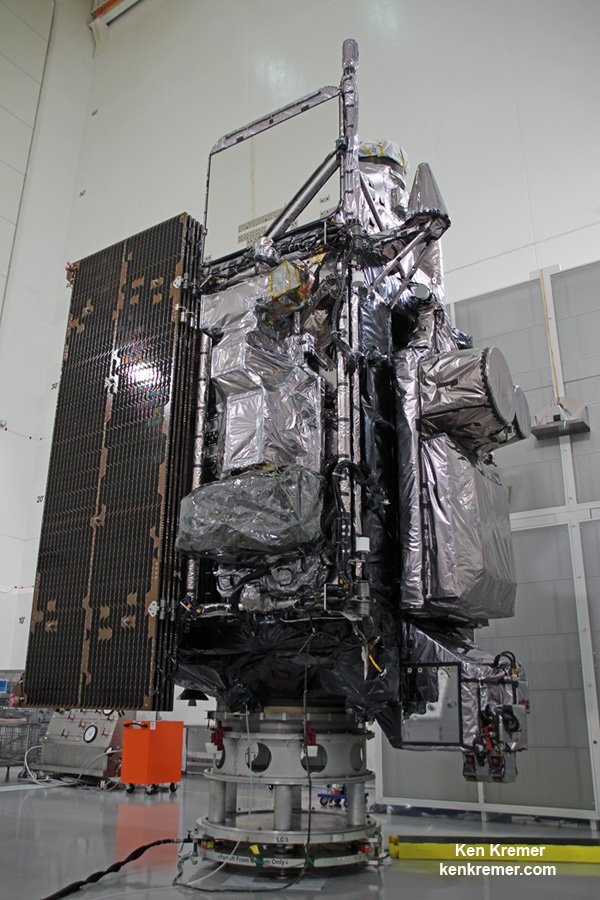
Side view of NASA/NOAA GOES-R next gen weather observation satellite showing solar panels and instruments inside Astrotech Space Operations cleanroom, in Titusville, FL. Launch is set for Nov. 19, 2016. Credit: Ken Kremer/kenkremer.com
The gigantic school bus sized satellite is equipped with a suite of six instruments or sensors that are the most advanced of their kind. They will be used for three types of observations: Earth sensing, solar imaging, and space environment measuring. They will point to the Earth, the Sun and the in-situ environment of the spacecraft.
The suite includes the Advanced Baseline Imager (ABI), Geostationary Lightning Mapper (GLM), Solar Ultraviolet Imager (SUVI), Extreme Ultraviolet and X-Ray Irradiance Sensors (EXIS), Space Environment In-Situ Suite (SEISS), and the Magnetometer (MAG).
Stay tuned here for Ken’s continuing Earth and Planetary science and human spaceflight news.
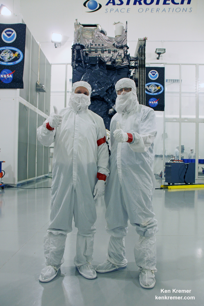
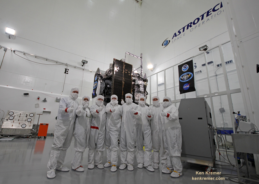
GOES-R weather observation satellite instrument suite. Credit: NASA/NOAATim Gasparinni, GOES-R program manager for Lockheed Martin, and Ken Kremer/University Today pose with GOES-R revolutionary weather satellite inside Astrotech Space Operations cleanroom, in Titusville, FL, and built by NASA/NOAA/Lockheed Martin/Harris. Credit: Ken Kremer/kenkremer.com
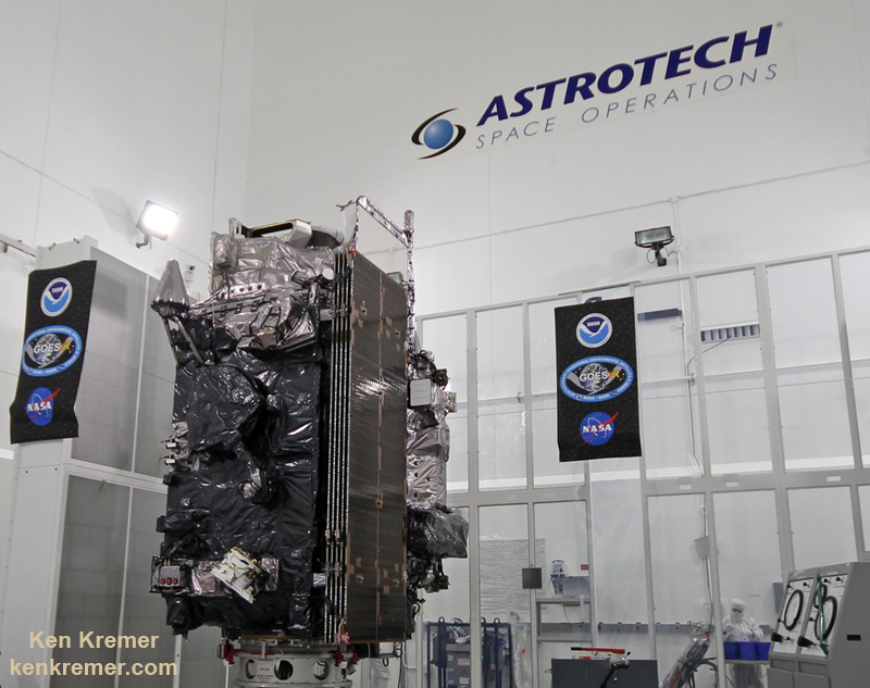
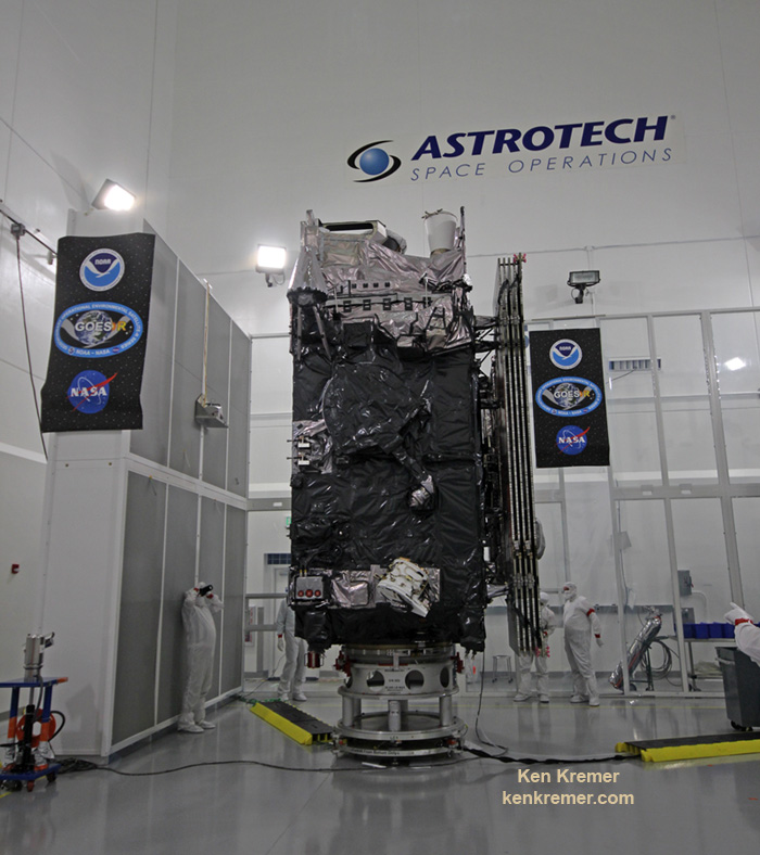
The NASA/NOAA GOES-R (Geostationary Operational Environmental Satellite - R Series) being processed at Astrotech Space Operations, in Titusville, FL, in advance of launch on a ULA Atlas V on Nov. 19, 2016. GOES-R will be America’s most advanced weather satellite. Credit: Ken Kremer/kenkremer.com
The NASA/NOAA GOES-R (Geostationary Operational Environmental Satellite – R Series) being processed at Astrotech Space Operations, in Titusville, FL, in advance of planned launch on a ULA Atlas V slated for Nov. 19, 2016. GOES-R will be America’s most advanced weather satellite. Credit: Ken Kremer/kenkremer.com
KENNEDY SPACE CENTER, FL – After an ironic detour due to Hurricane Matthew, liftoff of the game changing NASA/NOAA next generation GOES-R geostationary weather observation satellite offering a “dramatic leap in capability” is finally on track for this weekend on Nov. 19 from the Florida Space Coast.
And Universe Today recently got an up close look and briefing about the massive probe inside the cleanroom processing facility at Astrotech Space Operations in Titusville, Fl.
“We are bringing the nation a new capability .. that’s a dramatic leap .. to scan the entire hemisphere in about 5 minutes,” said Greg Mandt, NOAA GOES-R program manager during a briefing in the Astrotech cleanroom.
“GOES-R has both weather and space weather detection capabilities!” Tim Gasparrini, GOES-R program manager for Lockheed Martin, told Universe Today during a cleanroom interview.
Astrotech is located just a few miles down the road from NASA’s Kennedy Space Center and the KSC Visitor Complex housing the finest exhibits of numerous spaceships, hardware items and space artifacts.
The NASA/NOAA GOES-R (Geostationary Operational Environmental Satellite – R Series) being processed at Astrotech Space Operations, in Titusville, FL, in advance of planned launch on a ULA Atlas V slated for Nov. 19, 2016. GOES-R will be America’s most advanced weather satellite. Credit: Ken Kremer/kenkremer.com
GOES-R, which stands for Geostationary Operational Environmental Satellite – R Series – is a new and advanced transformational weather satellite that will vastly enhance the quality, speed and accuracy of weather forecasting available to forecasters for Earth’s Western Hemisphere.
Liftoff of the NASA/NOAA GOES-R weather satellite atop a United Launch Alliance (ULA) Atlas V rocket is now scheduled for Saturday, Nov. 19 at 5:42 p.m. from Space Launch Complex 41 (SLC-41) on Cape Canaveral Air Force Station, shortly after sunset.
The launch window extends for an hour from 5:42-6:42 p.m. EST.
GOES-R is the first in a new series of American’s most powerful and most advanced next generation weather observation satellites. It is designed to last for a 15 year orbital lifetime.
Once in orbit it will be known as GOES-16. TV viewers are presently accustomed to seeing daily streams of imagery from the GOES-East and GOES-West weather observation satellites currently in orbit.
What’s the big deal about GOES-R?
Audiences will notice big changes from GOES-R once it becomes operational because it will provide images of weather patterns and severe storms as regularly as every five minutes or as frequently as every 30 seconds.
“These images can be used to aid in weather forecasts, severe weather outlooks, watches and warnings, lightning conditions, maritime forecasts and aviation forecasts.
“It also will assist in longer term forecasting, such as in seasonal predictions and drought outlooks. In addition, space weather conditions will be monitored constantly, including the effects of solar flares to provide advance notice of potential communication and navigation disruptions. It also will assist researchers in understanding the interactions between land, oceans, the atmosphere and climate.”
GOES-R was built by prime contractor Lockheed Martin and is the first of a four satellite series – comprising GOES-R, S, T, and U that will be keep the GOES satellite system operational through 2036.
All four of the revolutionary 11,000 pound satellites are identical. The overall cost is about $11 Billion.
“This is a very exciting time,” explained Greg Mandt, the NOAA GOES-R program manager during the Astrotech cleanroom briefing.
“This is the culmination of about 15 years of intense work for the great team of NOAA and NASA and our contractors Lockheed Martin and Harris.”
“We are bringing the nation a new capability. The GOES program has been around for about 40 years and most every American sees it every night on the weather broadcasts when they see go to the satellite imagery. And what’s really exciting is that for the first time in that 40 years we are really end to end replacing the entire GOES system. The weather community is really excited about what we are bringing.”
“It’s a dramatic leap in capability – like moving from black and white TV to HDTV.”
“We will be able to scan the entire hemisphere in about 5 minutes and do things so much faster with double the resolution.”
The NASA/NOAA/Lockheed Martin/Harris GOES-R team gives a big thumbs up for the dramatic leap in capability this next gen weather observation satellite will provide – during media briefing at Astrotech Space Operations, in Titusville, FL. Launch is set for Nov. 19, 2016. Credit: Ken Kremer/kenkremer.com
It was built in facilities in Bucks County, Pennsylvania and Denver, Colorado. It arrived at Astrotech in August for final processing and checkouts of the spacecraft and instruments.
The gigantic school bus sized satellite is equipped with a suite of six instruments or sensors that are the most advanced of their kind. They will be used for three types of observations: Earth sensing, solar imaging, and space environment measuring. They will point to the Earth, the Sun and the in-situ environment of the spacecraft.
The suite includes the Advanced Baseline Imager (ABI), Geostationary Lightning Mapper (GLM), Solar Ultraviolet Imager (SUVI), Extreme Ultraviolet and X-Ray Irradiance Sensors (EXIS), Space Environment In-Situ Suite (SEISS), and the Magnetometer (MAG).
The two Earth-pointing instruments are on the top of the spacecraft – namely ABI and GLM.
“ABI is the premier instrument on the spacecraft. When you turn on the news and see a severe storm picture, that’s the one it comes from. It takes pictures in the visible as well as the infrared (IR), near infrared (IR),” Tim Gasparrini, GOES-R program manager for Lockheed Martin, told Universe Today during a cleanroom interview.
“It is looking for things like moisture, vegetation, aerosols and fire. So it looks across a broad spectrum to determine the environmental conditions on Earth.”
ABI offers 3 times more spectral channels with 4 times greater resolution and scans 5 times faster than ever before, compared to the current GOES satellites.
The GOES-R ABI will view the Earth with 16 different spectral bands (compared to five on current GOES), including two visible channels, four near-infrared channels, and ten infrared channels, according to the mission fact sheet.
It will also carry the first operational lightning mapper ever flown in space – GLM – built by Lockheed Martin. It has a single-channel, near-infrared optical transient detector.
“This is the first lightning mapper in space and at geostationary orbit.”
“GLM takes a picture of a scene on the Earth 500 times per second. And it compares those images for a change in the scene that can detect lightning, using an algorithm,” Gasparrini told me.
“The importance of that is lightning is a precursor to severe weather. So they are hoping that GLM will up to double the tornado warning time. So instead of 10 minutes warning you get 20 minutes warning, for example.”
GLM will measure total lightning (in-cloud, cloud-to-cloud and cloud-to-ground) activity continuously over the Americas and adjacent ocean regions with near-uniform spatial resolution of approximately 10 km.
Side view of NASA/NOAA GOES-R next gen weather observation satellite showing solar panels and instruments inside Astrotech Space Operations cleanroom, in Titusville, FL. Launch is set for Nov. 19, 2016. Credit: Ken Kremer/kenkremer.com
“The two solar pointing instruments are located on a platform that constantly points them at the sun – SUVI (built by Lockheed Martin and EXIS. SUVI looks at the sun in the ultraviolet and EXIS looks at the x-ray wavelengths.”
The instruments work in concert.
“SUVI detects a solar flare on he sun and EXIS measures the intensity of the flare. As it comes towards the Earth, NOAA then uses the DSCOVR satellite [launched last year] as sort of a warning buoy about 30 minutes before the Earth. This gives a warning that a geomagnetic storm is heading toward the Earth.”
“When the storm reaches the Earth, the magnetometer instrument (MAG) on GOES-R then measures the influence of the magnetic storm on the magnetic field of the Earth.”
“Then the SEISS instrument, a charged particle detector, measures the charged particle effect of the storm on the Earth at geostationary orbit.”
“So GOES-R has both weather and space weather detection capabilities!” Gasparini elaborated.
The huge bus sized satellite measures 6.1 m x 5.6 m x 3.9 m (20.0 ft x 18.4 ft x 12.8 ft) with a three-axis stabilized spacecraft bus.
It has a dry mass of 2,857 kg (6,299 lbs) and a fueled mass of 5,192 kg (11,446 lbs) at launch.
The instruments are very sensitive to contamination and the team is taking great care to limit particulate and molecular contaminants in the cleanroom. Some of the instruments have contamination budget limits of less than 10 angstroms – smaller than the diameter of a typical molecule. So there can’t even be a single layer of molecules on the instruments surface after 15 years on orbit.
GOES-R can also multitask according to a NASA/NOAA factsheet.
“It can scan the Western Hemisphere every 15 minutes, the Continental U.S. every 5 minutes and areas of severe weather every 30-60 seconds. All at the same time!”
GOES-R will blastoff on a ULA Atlas V in the very powerful 541 configuration, augmented by four solid rocket boosters on the first stage. The payload fairing is 5 meters (16.4 feet) in diameter and the upper stage is powered by a single-engine Centaur.
It will be launched to a Geostationary orbit some 22,300 miles above Earth.
The Atlas V booster has been assembled inside the Vertical Integration Facility (VIF) at SLC-41 and will be rolled out to the launch pad Friday morning, Nov. 18 with the GOES-R weather satellite encapsulated inside the nose cone.
The weather forecast shows a 80 percent chance of favorable weather conditions for Saturday’s sunset blastoff.
GOES-R logo. Credit: NASA/NOAA
Stay tuned here for Ken’s continuing Earth and Planetary science and human spaceflight news.
Learn more about GOES-R weather satellite, Heroes and Legends at KSCVC, OSIRIS-REx, InSight Mars lander, ULA, SpaceX and Orbital ATK missions, Juno at Jupiter, SpaceX AMOS-6 & CRS-9 rocket launch, ISS, ULA Atlas and Delta rockets, Orbital ATK Cygnus, Boeing, Space Taxis, Mars rovers, Orion, SLS, Antares, NASA missions and more at Ken’s upcoming outreach events:
Nov 17-20: “GOES-R weather satellite launch, OSIRIS-Rex, SpaceX and Orbital ATK missions to the ISS, Juno at Jupiter, ULA Delta 4 Heavy spy satellite, SLS, Orion, Commercial crew, Curiosity explores Mars, Pluto and more,” Kennedy Space Center Quality Inn, Titusville, FL, evenings
GOES-R infographicTim Gasparinni, GOES-R program manager for Lockheed Martin, and Ken Kremer/University Today pose with GOES-R revolutionary weather satellite inside Astrotech Space Operations cleanroom, in Titusville, FL, and built by NASA/NOAA/Lockheed Martin/Harris. Credit: Ken Kremer/kenkremer.com
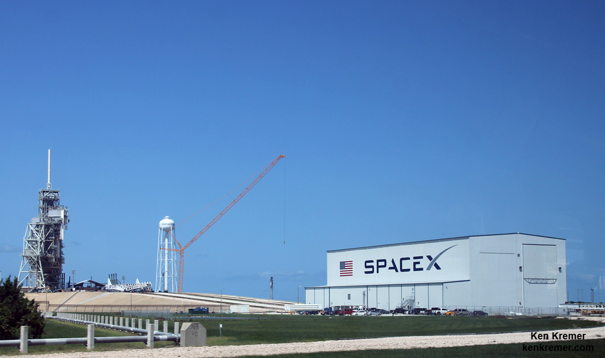
SpaceX is renovating Launch Complex 39A at the Kennedy Space Center for launches of the Falcon Heavy and human rated Falcon 9. Credit: Ken Kremer/kenkremer.com
SpaceX is renovating Launch Complex 39A at the Kennedy Space Center for launches of the Falcon Heavy and human rated Falcon 9. Credit: Ken Kremer/kenkremer.com
“Hurricane Matthew caused some damage to the exterior of SpaceX’s payload processing facility [PPF] at Space Launch Complex-40 at Cape Canaveral Air Force Station,” SpaceX spokesman John Taylor told Universe Today.
The payload processing facility (PPF) is the facility where the satellites and payloads are processed to prepare them for flight and launches on the firm’s commercial Falcon 9 rockets.
Some exterior panels were apparently blown out by the storm.
The looming threat of a direct hit by the Category 4 storm Hurricane Matthew on Friday, Oct. 7, on Cape Canaveral and the Kennedy Space Center (KSC) forced the closure of both facilities before the storm hit. They remained closed over the weekend except to emergency personal.
The deadly storm also caused some minor damage to the Kennedy Space Center and USAF facilities on the base.
Meanwhile competitor ULA also told me their facilities suffered only minor damage.
The PPF is located on Cape Canaveral Air Force Station, a few miles south of the Falcon 9 launch pad at Space Launch Complex-40 (SLC-40).
The PPF is inside the former USAF Solid Motor Assembly Building (SMAB) used for the now retired Titan IV rockets.
Fortunately, SpaceX has another back-up facility at pad 40 where technicians and engineers can work to prepare the rocket payload for flight.
“The company has a ready and fully capable back-up for processing payloads at its SLC-40 hangar annex building,” Taylor elaborated.
SpaceX Falcon 9 rocket on pad 40 with backup processing hanger visible, prior to launch of SES-9 communications satellite in March 2016 at Cape Canaveral Air Force Station, FL. Credit: Ken Kremer/kenkremer.com
And except for the minor damage to the PPF facility where payloads are processed, SpaceX says there was no other damage to infrastructure at pad 40 or to Launch Complex 39A at the Kennedy Space Center.
“There was no damage the company’s facilities at Pad 39A at Kennedy Space Center,” Taylor told me.
SpaceX Falcon 9 rocket moments after catastrophic explosion destroys the rocket and Amos-6 Israeli satellite payload at launch pad 40 at Cape Canaveral Air Force Station, FL, on Sept. 1, 2016. A static hot fire test was planned ahead of scheduled launch on Sept. 3, 2016. Credit: USLaunchReport
However SLC-40 is not operational at this time, since it was heavily damaged during the Sept. 1 launch pad disaster when a Falcon 9 topped with the Israeli Amos-9 comsat exploded on the launch pad during a routine prelaunch fueling operation and a planned first stage static fire engine test.
Mangled SpaceX Falcon 9 strongback with dangling cables (at right) as seen on Sept. 7 after prelaunch explosion destroyed the rocket and AMOS-6 payload at Space Launch Complex-40 at Cape Canaveral Air Force Station, FL on Sept. 1, 2016. Credit: Ken Kremer/kenkremer.com
As SpaceX was launching Falcon 9 rockets from pad 40, they have been simultaneously renovating and refurbishing NASA’s former shuttle launch pad at Launch Complex 39A at the Kennedy Space Center (KSC) which they leased from NASA.
SpaceX plans to start launching their new Falcon Heavy booster from pad 39A in 2017 as well as human rated launches of the Falcon 9 with the Crew Dragon to the ISS.
However, following the pad 40 disaster, SpaceX announced plans to press pad 39A into service for commercial Falcon 9 satellite launches as well.
SpaceX President Gwynne Shotwell recently said that the company hoped to resume launches in November while they search for a root cause to the pad 40 catastrophe – as I reported here.
Speaking at the annual meeting of the National Academy of Engineering in Washington, D.C. on Oct. 9 Shotwell indicated that investigators are making progress to determine the cause of the mishap.
“We’re homing in on what happened,” she said, according to a story by Space News. “I think it’s going to point not to a vehicle issue or an engineering design issue but more of a business process issue.”
Space News said that she did not elaborate further.
Stay tuned here for Ken’s continuing Earth and Planetary science and human spaceflight news.