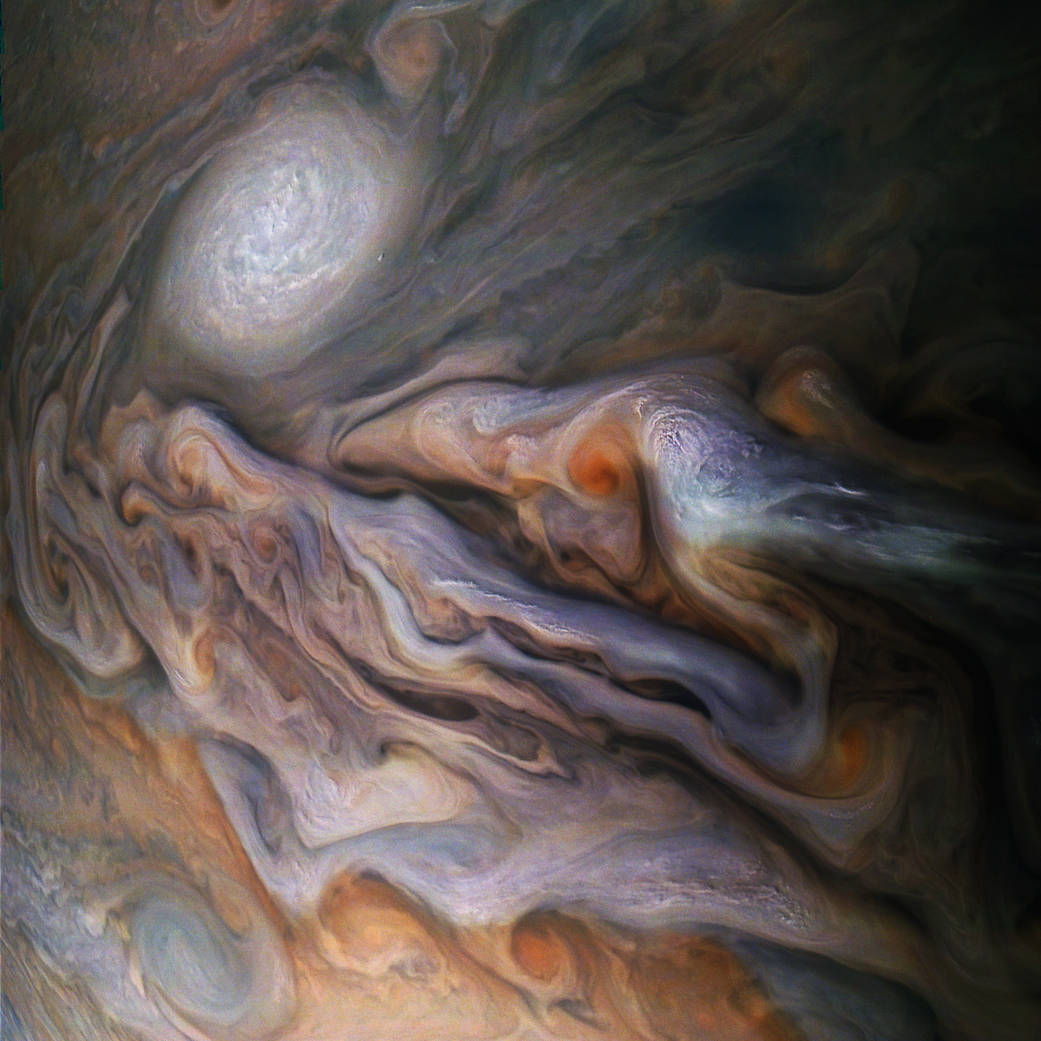
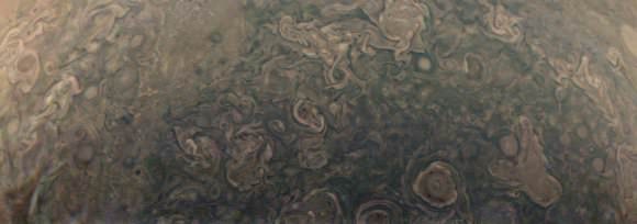
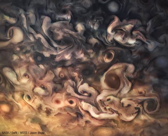
A multitude of swirling clouds in Jupiter's dynamic North North Temperate Belt is captured in this image from NASA's Juno spacecraft. Appearing in the scene are several bright-white “pop-up” clouds as well as an anticyclonic storm, known as a white oval. This color-enhanced image was taken at 4:58 p.m. EDT on Oct. 29, 2018, as the spacecraft performed its 16th close flyby of Jupiter. At the time, Juno was about 4,400 miles from the planet's cloud tops, at a latitude of approximately 40 degrees north. Citizen scientists Gerald Eichstädt and Seán Doran created this image using data from the spacecraft's JunoCam imager.
Image Credit: Enhanced image by Gerald Eichstädt and Sean Doran (CC BY-NC-SA) based on images provided courtesy of NASA/JPL-Caltech/SwRI/MSSS
Confucius said, “Everything has beauty, but not everyone sees it.”
When it comes to Jupiter, Gerald Eichstädt and Seán Doran can certainly see it. And lucky for us, they have the skill to bring that beauty to the fore for the rest of us to enjoy.
Jupiter as seen by the Juno spacecraft during the Perijove 5 pass on March 27, 2017. Processed using raw data. Credit: NASA/JPL-Caltech/SwRI/MSSS/Kevin M. Gill.
The original plans for the Juno mission to Jupiter didn’t include a color camera. You don’t need color images when the mission’s main goals are to map Jupiter’s magnetic and gravity fields, determine the planet’s internal composition, and explore the magnetosphere.
But a camera was added to the manifest, and the incredible images from the JunoCam have been grabbing the spotlight.
As an instrument where students and the public can choose the targets, JunoCam is a “public outreach” camera, meant to educate and captivate everyday people.
“The whole endeavor of JunoCam was to get the public to participate in a meaningful way,” said Candy Hansen, Juno co-investigator at the Planetary Science Institute in Tucson, Arizona, speaking at a press conference last week to showcase Juno’s science and images.
And participate they have. Hundreds of ‘amateur’ image processing enthusiasts have been processing raw data from the JunoCam, turning them into stunning images, many reminiscent of a swirling Van Gogh ‘starry night’ or a cloudscape by Monet.
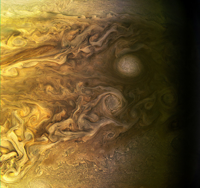
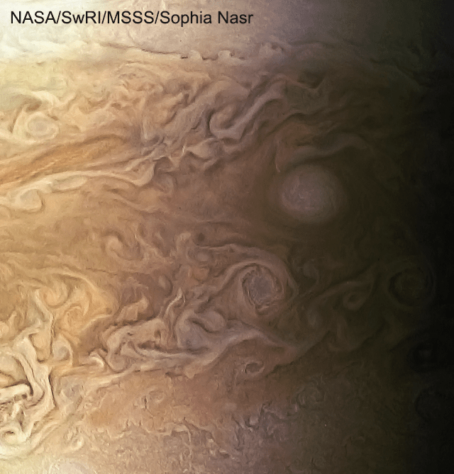
The swirling cloudtops of Jupiter, as seen by Juno during Perijove 5 on March 27, 2017. Credit: NASA/JPL-Caltech/SwRI/MSSS/Sophia Nasr.
“The contributions of the amateurs are essential,” Hansen said. “I cannot overstate how important the contributions are. We don’t have a way to plan our data without the contributions of the amateur astronomers. We don’t have a big image processing team, so we are completely relying on the help of our citizen scientists.”
Jupiter as seen by Juno during Perijove 6 in May, 2017. Credit: NASA/SwRI/MSSS/Gerald Eichstädt / Seán Doran.
Click on this image to have access to a 125 Megapixel upscaled print portrait.
Featured here are images processed by Seán Doran, Sophia Nasr, Kevin Gill and Jason Major. Like hundreds of others around the world, they anxiously await for data to arrive to Earth, where it is uploaded to the public Juno website. Then they set to work to turn the data into images.
“What I find the most phenomenal of all is that this takes real work,” Hansen said. “When you download a JunoCam image and process it, it’s not something you do in five minutes. The pictures that we get that people upload back onto our site, they’ve invested hours and hours of their own time, and then generously returned that to us.”
This video shows Juno’s trajectory from Perijove 6, and is based on work by Gerald Eichstädt, compiled and edited by Seán Doran. “This is real imagery projected along orbit trajectory,” Doran explained on Twitter.
Intricate swirls on Jupiter Jupiter, from Juno’s Perijove 6 pass on May 19, 2017. Credit: NASA/JPL-Caltech/SwRI /MSSS/Kevin M. Gill.
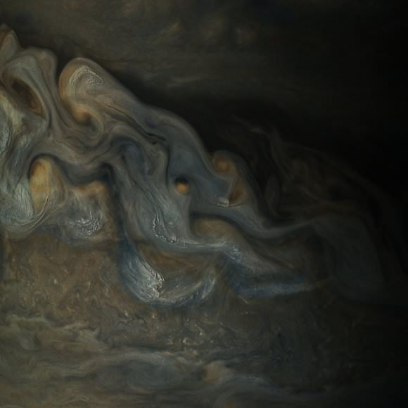
Details of Jupiter’s swirling gas clouds, as seen by Juno during the Perijove 6 pass in May, 2017. Credit: NASA / SwRI / MSSS / Gerald Eichstädt / Seán Doran.
JunoCam was built by Malin Space Science Systems, which has cameras on previous missions like the Curiosity Mars Rover, the Mars Global Surveyor and the Mars Color Imager on the Mars Reconnaissance Orbiter. To withstand the harsh radiation environment at Jupiter, the camera required special protection and a reinforced lens.
Whenever new images arrive, many of us feel exactly like editing enthusiast Björn Jónsson:
I never expected I'd ever say this but: The latest @NASAJuno images of Jupiter are the most spectacular images of Jupiter I've ever seen. pic.twitter.com/7HawZ9RSwe
Even the science team has expressed their amazement at these images.
“Jupiter looks different than what we expected,” said Scott Bolton, Juno’s principal investigator at the Southwest Research Institute. “Jupiter from the poles doesn’t look anything like it does from the equator. And the fact the north and south pole don’t look like each other, makes us wonder if the storms are stable, if they going to stay that way for years and years like the the Great Red Spot. Only time will tell us what is true.”
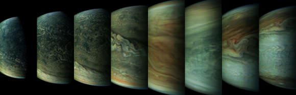
A sequence of images of Jupiter from Juno’s Perijove 6 pass during May, 2017. Credit: NASA / SwRI / MSSS / Gerald Eichstädt / Seán Doran.
Part of what makes these images so stunning is that Juno is closer to Jupiter than any previous spacecraft.
“Juno has an elliptical orbit that brings it between the inner edges of Jupiter’s radiation belt and the planet, passing only 5,000 km above the cloud tops,” Juno Project Manager Rick Nybakken told me in my book ‘Incredible Stories From Space: A Behind-the-Scenes Look at the Missions Changing Our View of the Cosmos.’ “This close proximity to Jupiter is unprecedented, as no other mission has conducted their science mission this close to the planet. We’re right on top of Jupiter, so to speak.”
Juno engineers designed the mission to enable the use of solar panels, which prior to Juno, have never been used on a spacecraft going so far from the Sun. Juno orbits Jupiter in a way that the solar panels are always pointed towards the Sun and the spacecraft never goes behind the planet. Juno’s orbital design not only enabled an historic solar-powered mission, it also established Juno’s unique science orbit.
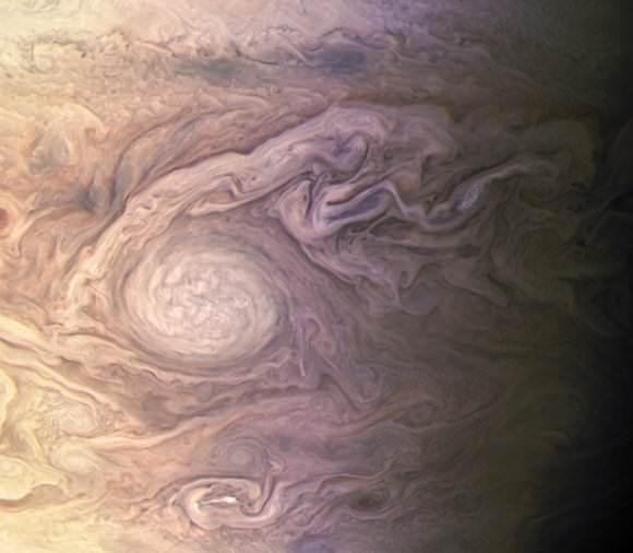
White oval on Jupiter during Juno’s Perijove 4 pass on February 2, 2017. Processed from raw data. Credit: NASA/JPL-Caltech/SwRI/MSSS/Kevin M. Gill.
Uncalibrated, processed raw image from Juno’s Perijove 6 pass of Jupiter on May 19, 2017. Credit: NASA/SwRI/MSSS/Jason Major.
Juno spacecraft launched from Cape Canaveral on August 5, 2011. After traveling five years and 1.7 billion miles Juno arrived in orbit at Jupiter on July 4, 2016. The mission will last until at least February 2018, making 11 science orbits around Jupiter, instead of the 32 laps originally planned. Last year, engineers detected a problem with check valves in the propulsion system, and NASA decided to forego an engine burn to move Juno into a tighter 14-day orbit around Jupiter. The current 53.4 day orbit will be maintained, but depending on how the spacecraft responds, NASA could extend the mission another three years to give Juno more flybys near Jupiter.
The next science flyby will occur on July 11, when Juno will get some close-up views of the famous Great Red Spot.
Thanks to everyone who works on these images.
Animation of six images acquired by NASA’s Juno spacecraft on March 27, 2017. Credit: NASA/JPL-Caltech/SwRI/MSSS/Jason Major.
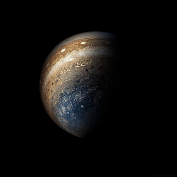
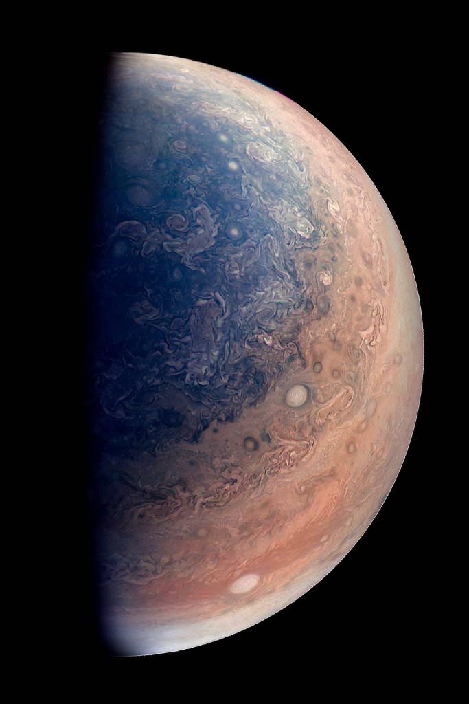
This enhanced color view of Jupiter’s south pole was created by citizen scientist Gabriel Fiset using data from the JunoCam instrument on NASA’s Juno spacecraft. Oval storms dot the cloudscape. Approaching the pole, the organized turbulence of Jupiter’s belts and zones transitions into clusters of unorganized filamentary structures, streams of air that resemble giant tangled strings. The image was taken on Dec. 11, 2016 at 9:44 a.m. PST (12:44 p.m. EST), from an altitude of about 32,400 miles (52,200 kilometers) above the planet’s beautiful cloud tops. Credits: NASA/JPL-Caltech/SwRI/MSSS/Gabriel Fiset
The Mars rover Curiosity on the road to Hematite Ridge. Credit: NASA/JPl-Caltech/MSSS/Seán Doran.
We all love the ‘selfies’ the Curiosity rover takes of itself sitting on Mars. We love them because it’s so amazing to see a human-made object on another world, and these images give us hope that one day we might have pictures of ourselves standing on the surface of the Red Planet.
But wouldn’t it be great if we see Curiosity ‘in action’ on Mars, and be like a fly on a rock, watching the rover roll past us?
Thanks to creative artist Seán Doran, we can do just that. Take a look at this absolutely amazing video Seán created, using real images of the Mars landscape from Curiosity and the HiRISE camera on the Mars Reconnaissance Orbiter, with a GCI Curiosity roving around.
Please note that Curiosity doesn’t actually move this fast, as in the video it is going about 8 kph, whereas in reality, the rover travels at a top speed of about .16 kph. But still, this is just fantastic!
“As much as I enjoy looking at the images from Mars, it is difficult to get a real sense of the scene as there is no obvious Earthly scale cue,” Seán told Universe Today via email. “No trees, plants, buildings or humans. So, I decided to put Curiosity into her own photographs to help us relate to them.”
Seán has provided a glimpse at how to do this, and says there are two ways of achieving these results.
One, is the easy way:
Create a photomosaic of a scene where tracks are present.
https://flic.kr/p/FnJqxE
Render a 3D model of Curiosity to the same relative angle of the tracks and composite this into the image.
https://flic.kr/p/GfSDzm
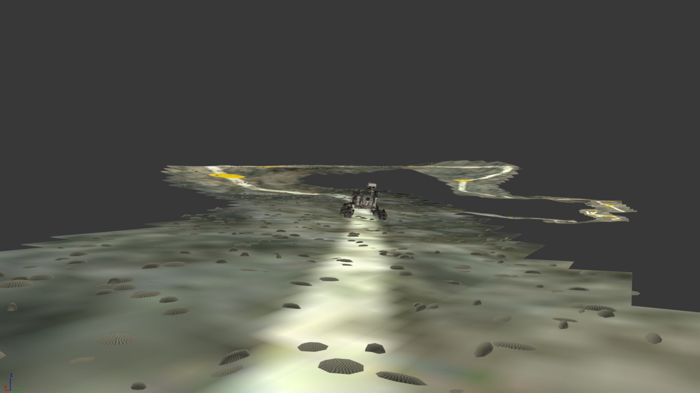
Or, there’s the hard way, a process which allows Seán to ‘drive’ Curiosity across the field of view of any photomosaic the rover has taken, whether there are tracks or not. This process involves using the what are called Digital Terrain Model (DTM) data from HiRISE, which provide elevation and terrain information (more info about DTMs in our recent article here) and by mapping with a virtual camera.
But to make everything realistic, your virtual rover needs to be the right size and even the right weight.
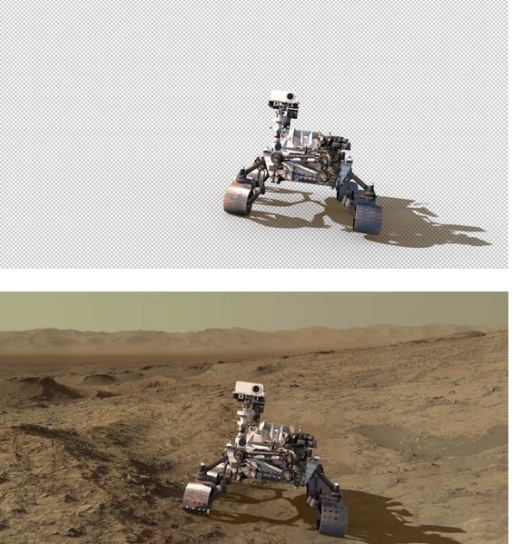
“It is critical to accurately determine the size of Curiosity in the virtual scene and this is done by comparing images of the rover taken by HiRISE and making sure they match,” Seán said. “By matching the viewpoint and the field of view it is possible to derive an accurate scale for Curiosity at any point in the scene.”
So by using this view from HiRISE of Curiosity sitting on the Naukluft Plateau:
HiRISE image of the Curiosity rover on the surface of Mars, on the Naukluft Plateau. Credit: NASA/JPL/University of Arizona
And then using Curiosity’s image of the same location, he can put a true-to-size rover in the image:
A true-to-size CGI rover inserted in the view of the Naukluft Plateau. Credit: NASA/JPL/University of Arizona/Seán Doran.
Then he ‘builds’ the route and terrain to make it even more realistic.
“Before I drive Curiosity I need to build a rocky collision course so she can physically interact with the environment,” he said. “This really helps to sell the final shot.”
Simulated terrain and rover on the Naukluft Plateau. Credit: Seán Doran.
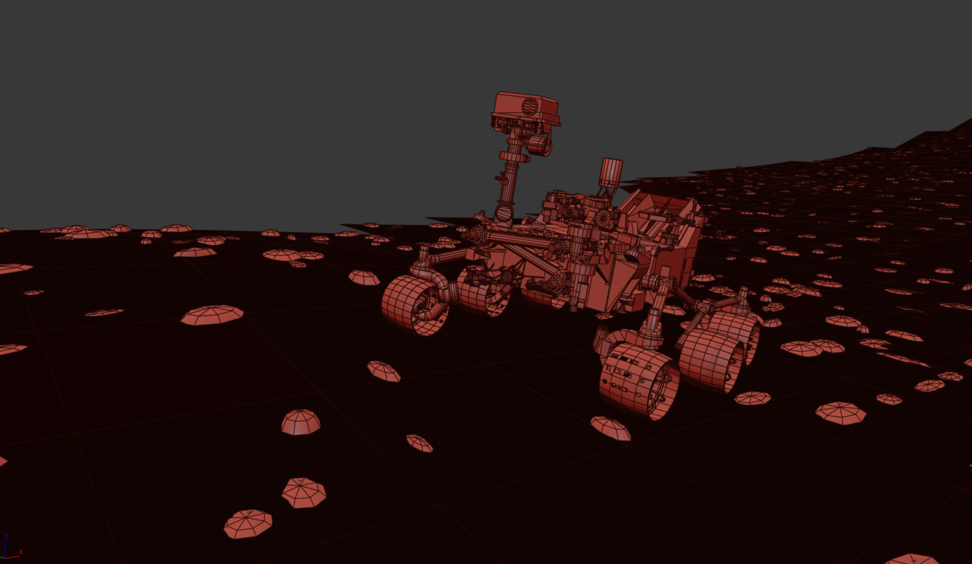
Then Seán builds a ‘car rig’ for Curiosity and drives her across the scene, in line with the actual route taken. Seán says good choices for doing this are using MadCar and DriveMaster for 3DS Max.
Simulated Curiosity rover on the Martian terrain, created using MadCar & DriveMaster for 3DS Max. Credit: Seán Doran.
Then he takes a look at the big picture, taking the HiRISE image of the area and using the DTM files to create elevation and texture, and adds the route the rover will take so he knows where to ‘drive’ the rover:
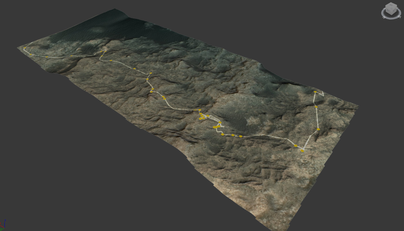
Full extent of Naukluft Plateau built with HiRISE elevation and texture data, with the route superimposed. Credit: NASA/JPL/University of Arizona/Seán Doran.
Then comes the time-consuming part, where once he has a good animation, he needs to render out each shot, plus he matches the Sun position so the virtual shadows cast will match those in the photomosaic. (Wow!)
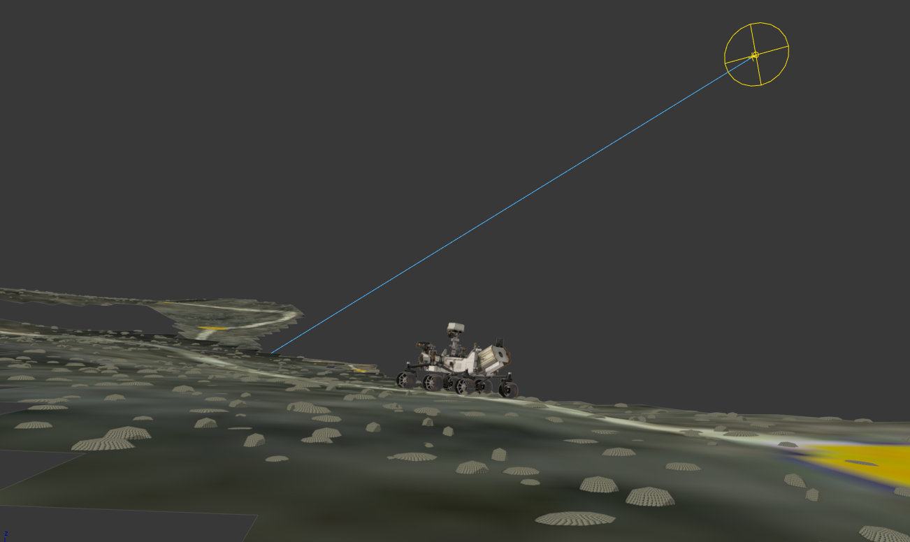
Simulated rover and terrain with position of the Sun. Credit: Seán Doran.
“I render separate passes for the background photomosaic and the foreground Curiosity,” Seán explained. “The HiRISE physics model is rendered with a Shadow Matte material which only catches shadows, this enables the rover to be easily blended in the final stage of the build.”
Then, everything is brought together in Adobe After Effects, where further image processing is used to blend both render elements together.
Simulated rover inserted in the scene with Adobe After Effects. Credit: Seán Doran.
We thank Seán Doran not only for completing this intricate process we can all enjoy, but for sharing the details!
“There is nothing trivial about building these assets, they are made out of fascination with the material and desire to communicate the excitement of being ‘present’ on another planet,” Seán said. “But I think it a great way to help people engage with such an exciting mission.”