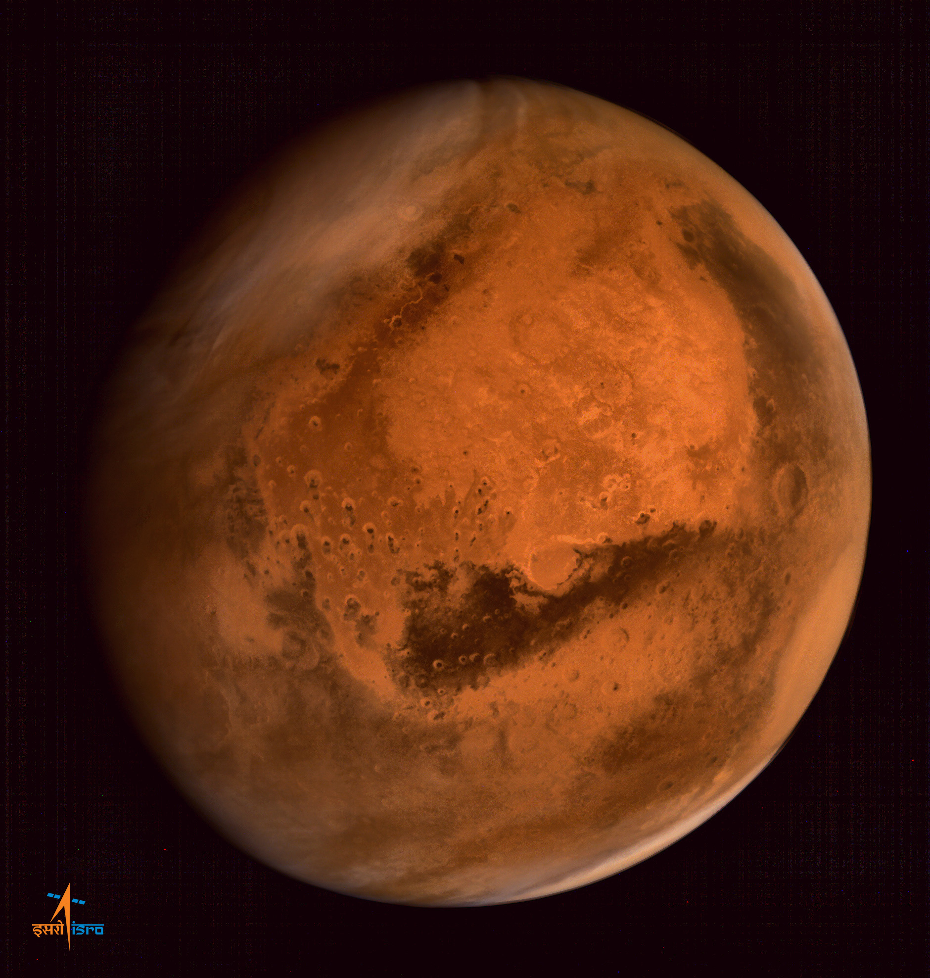
India’s space agency has released a spectacular new batch of images taken by everyone’s favorite MOM – the Mars Orbiter Mission – the nation’s first probe ever dispatched to the Red Planet and which achieved orbit nearly a year ago.
The Indian Space Research Organization (ISRO) has published a beautiful gallery of images featuring a steep and stunning Martian canyon and the landing site of NASA’s Curiosity Mars Science Laboratory rover, and more.
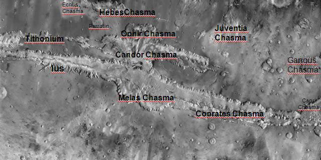
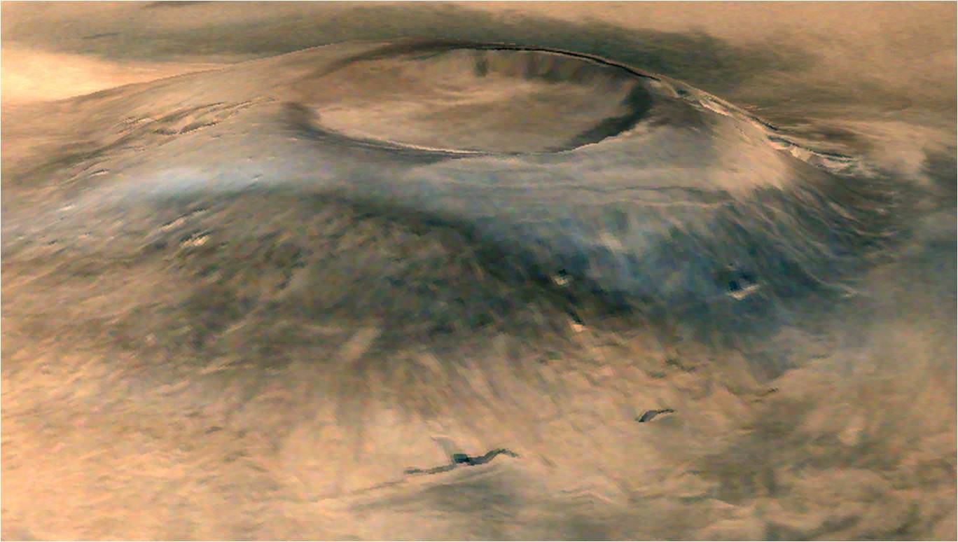
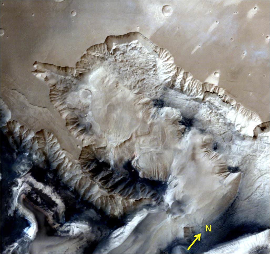
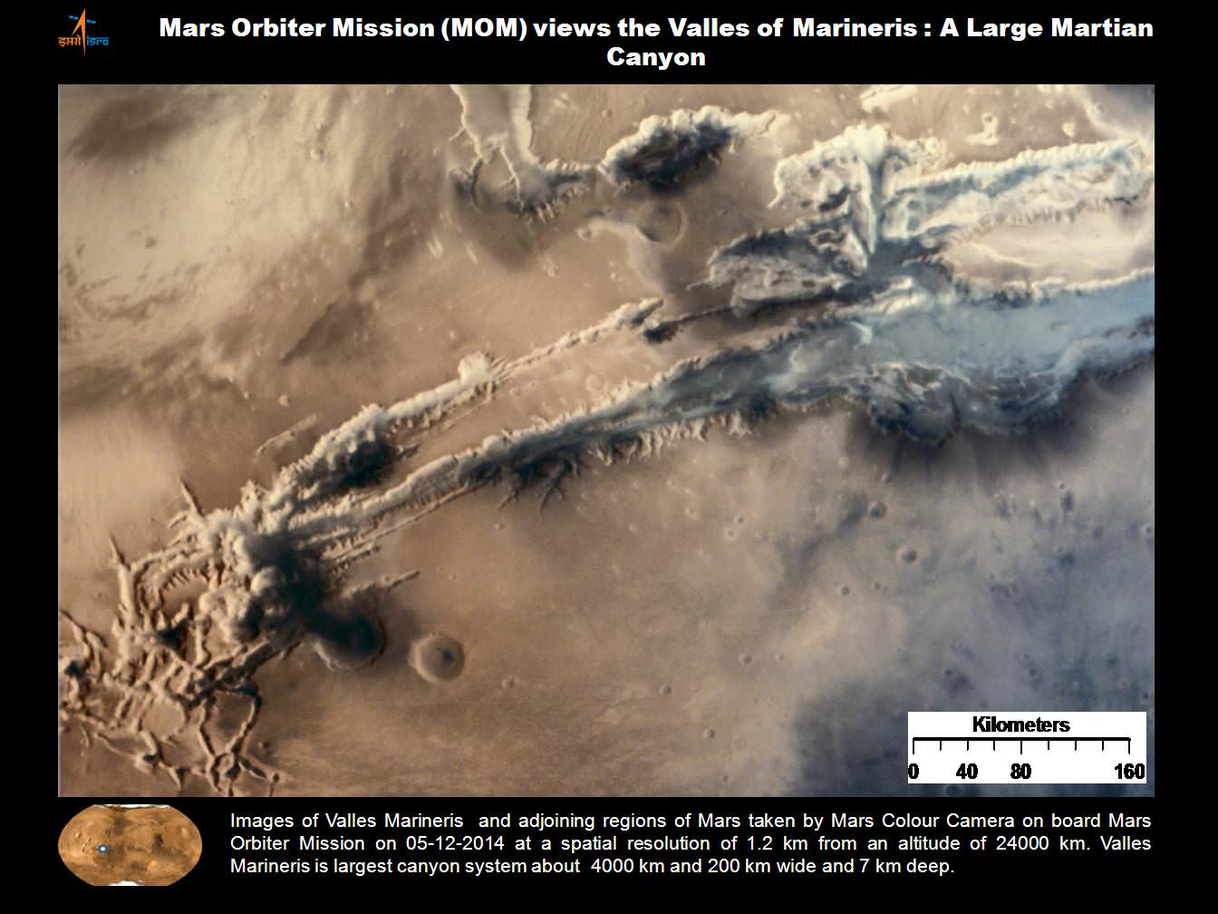
The lead image was taken over the Ophir Chasma canyon on the Martian surface by the Mars Colour Camera aboard India’s Mars Orbiter Mission.
Ophir Chasma is a canyon in the Coprates quadrangle located at 4° south latitude and 72.5° west longitude. It is part of the Valles Marineris – the ‘Grand Canyon of Mars’ – and the largest known canyon in the Solar System.
The image was captured on July 19, 2015 from an altitude of 1857 kilometers (1154 miles). It has with a resolution of 96 meters.
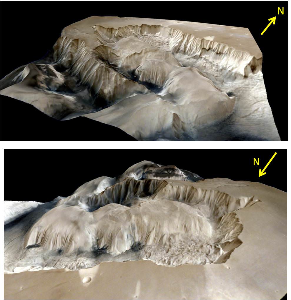
The steep walled Ophir Chasma canyon contains many layers and the floors contain large deposits of layered materials, perhaps even sulfates.
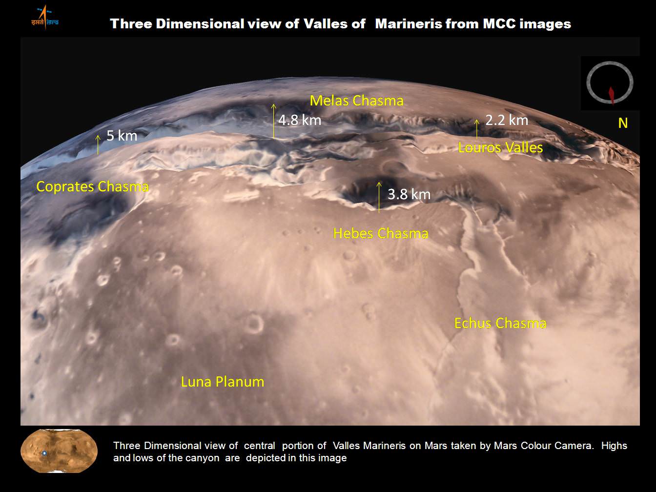
Ophir Chasma is about 317 kilometers long and about 8 to 10 kilometers deep located near the center of Valles Marineris – see map below.
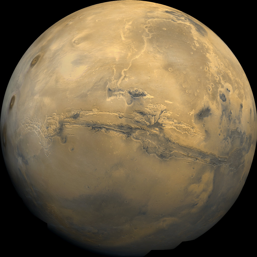
Valles Marineris stretches over 4,000 km (2,500 mi) across the Red Planet, is as much as 600 km wide and measures as much as 10 kilometers (6 mi) deep. It is nearly as wide as the United States.
Here’s an illuminating and magnificent 3D portrayal of Ophir Chasma created by Indian scientists that gives a sense of the canyons scale, sheer walls and cliffs and depth:
The newest images were snapped after the spacecraft exited the communications blackout encountered by all of Earth’s invasion fleet of Red Planet orbiters and rovers during the recent conjunction period when Mars was behind the sun during much of June.
See the prior image release from ISRO in my MOM story – here.
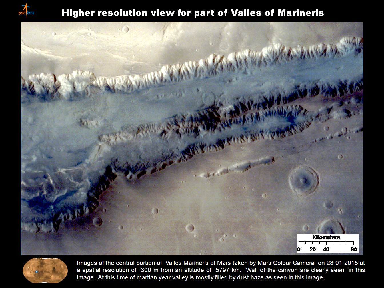
Here’s a wider view of Valles Marineris showing Ophir Chasma in a previously published MOM image from ISRO.
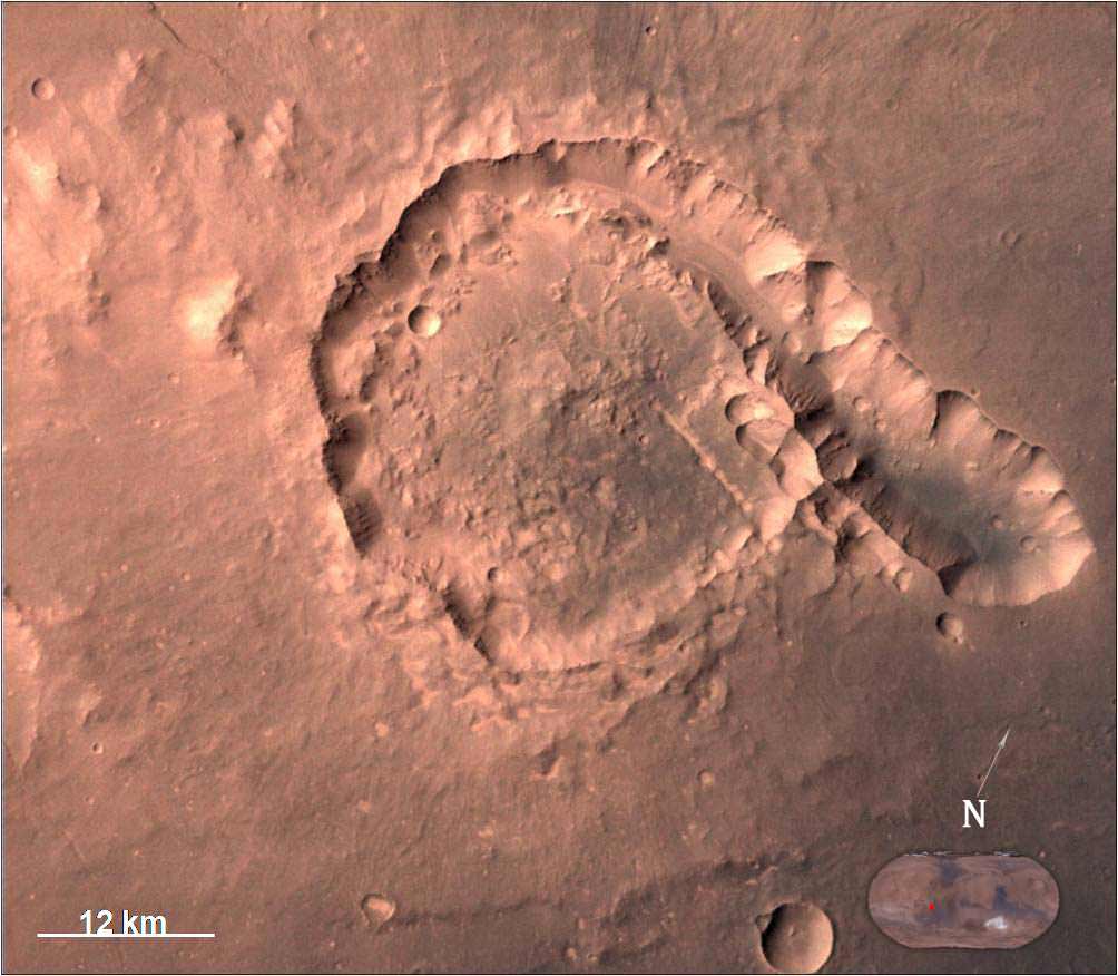
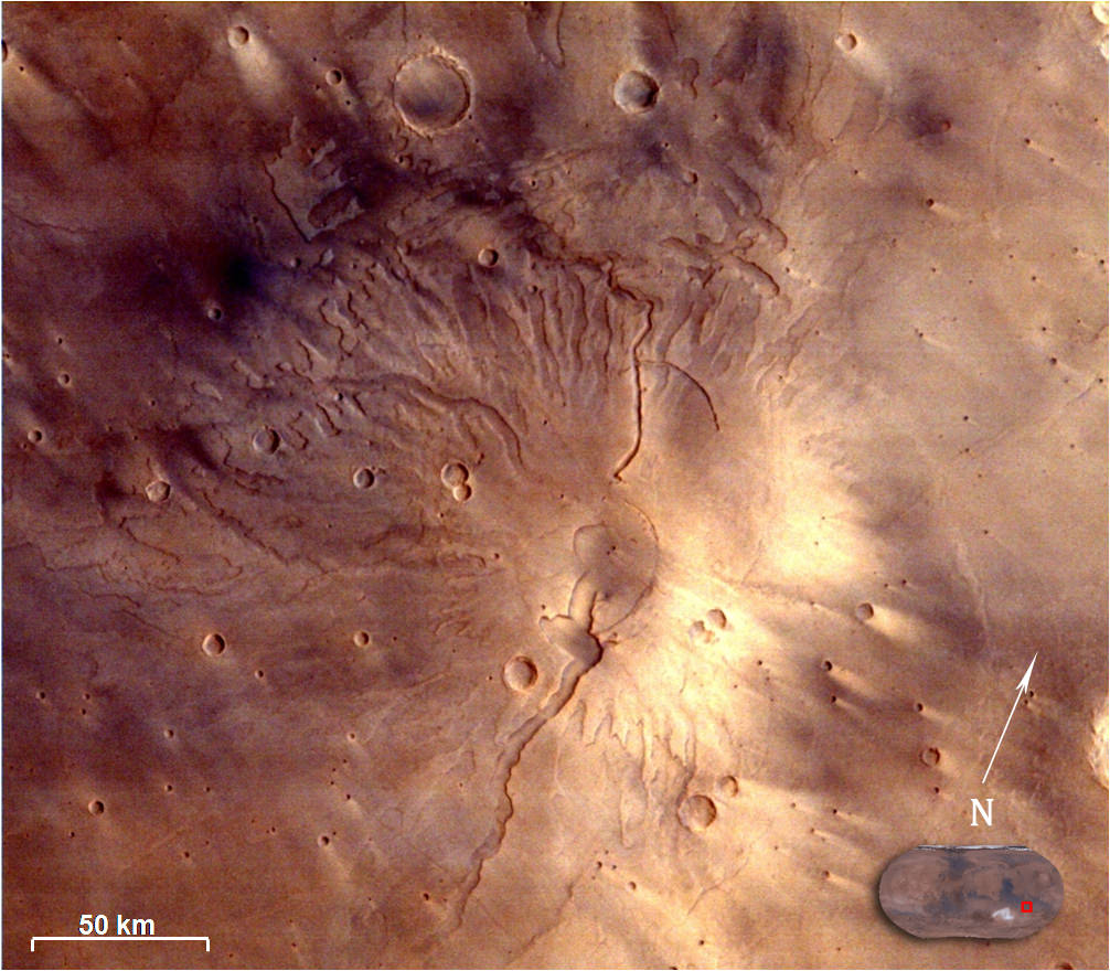
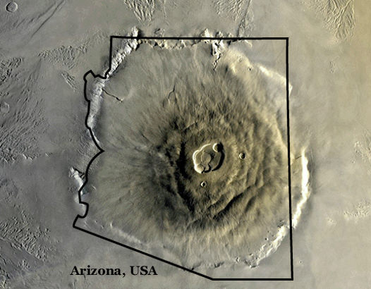
ISRO also released a delightful new image of Gale Crater and the surrounding vicinity.
Gale Crater is the landing site of NASA’s Curiosity rover. MOM took the image from an altitude of 9004 kilometers.
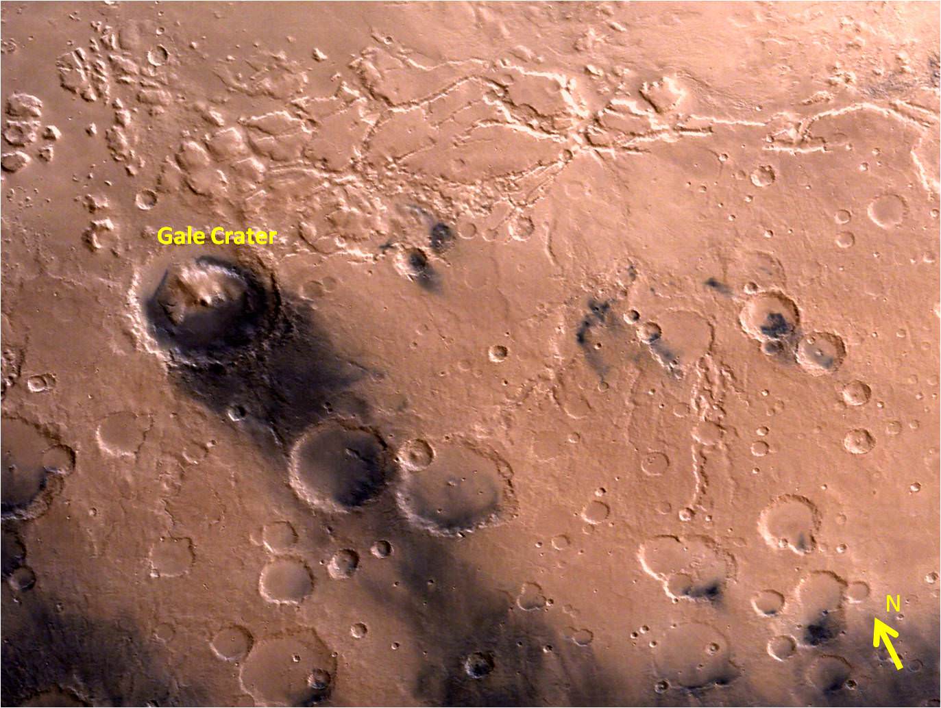
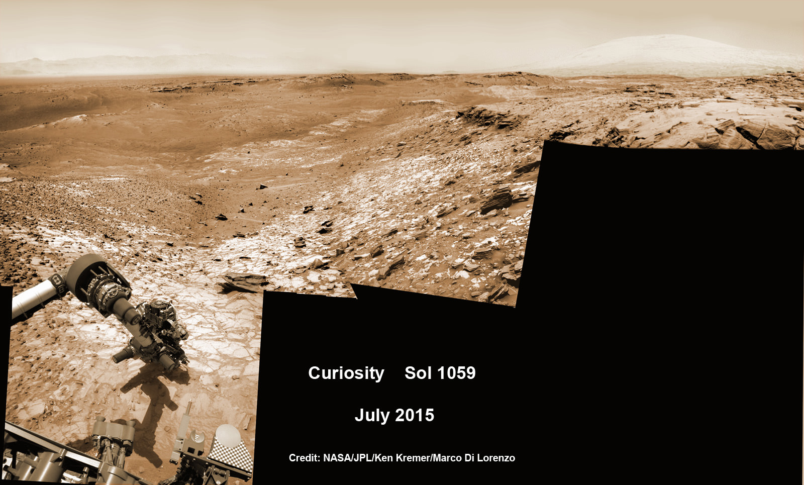
Gale Crater is home to humongous Mount Sharp, a mountain that rises 5.5 kilometers (3.4 miles) from the crater floor and is easily visible in the photo from MOM. The crater is 154 kilometers (96 mi) wide.
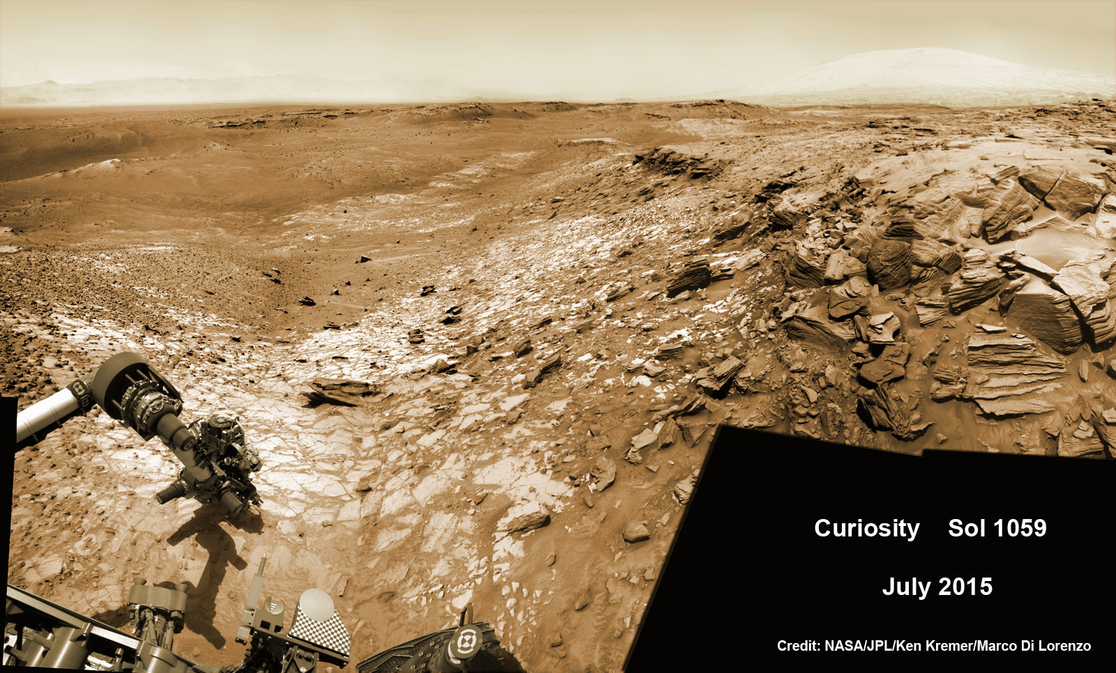
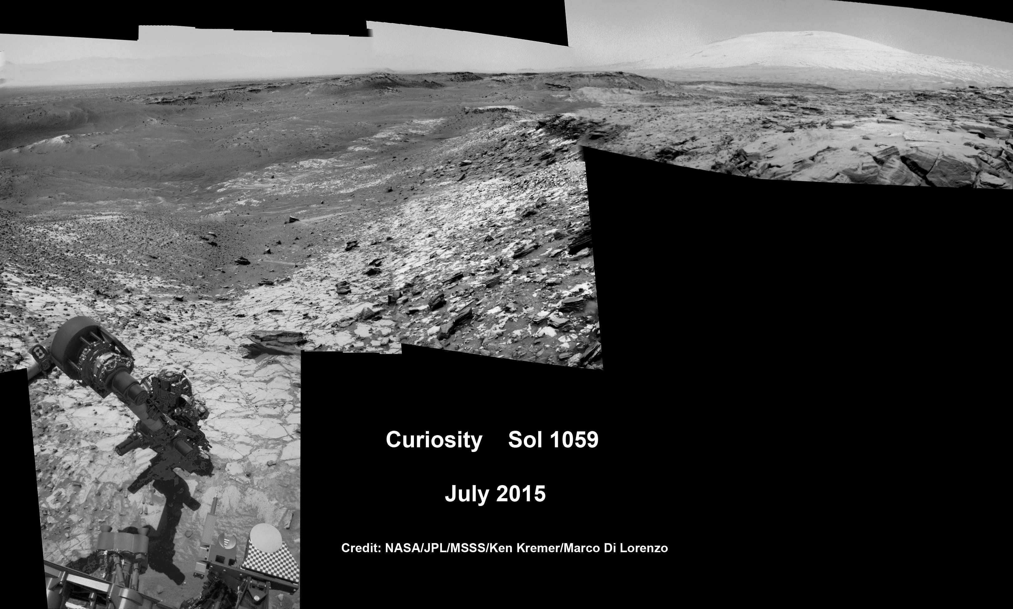
Curiosity is currently exploring the foothills of Mount Sharp around the top of the image – which shows a rather different perspective from what we’ve seen from prior familiar orbital imagery snapped by several NASA and ESA orbiters.
The 1 ton rover recently celebrated the 3rd anniversary since its nailbiting touchdown inside Gale crater. And the new wider angle image from MOM gives a fabulous sense of exactly why a highly precise landing was essential – otherwise it would have been doomed.
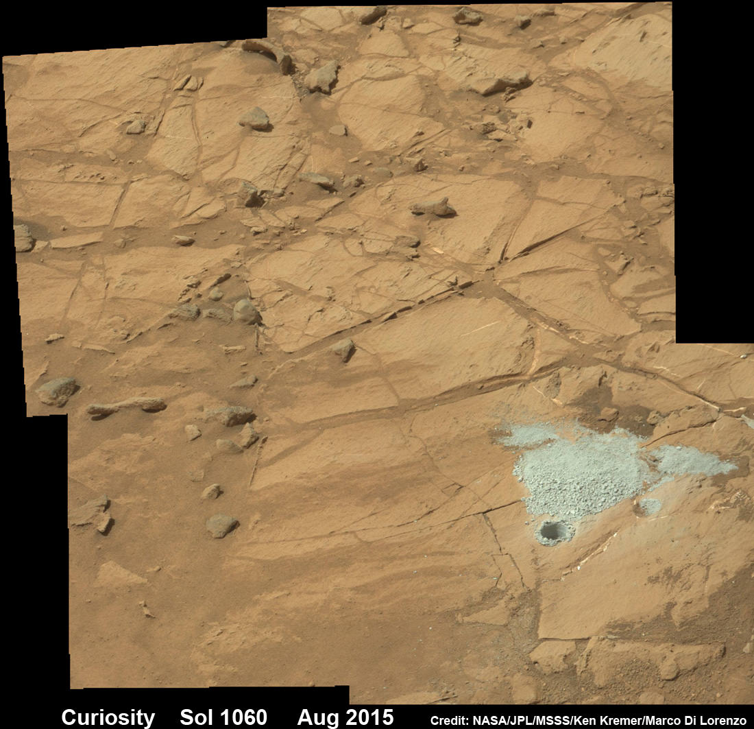
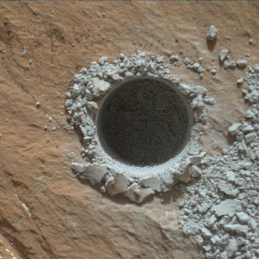
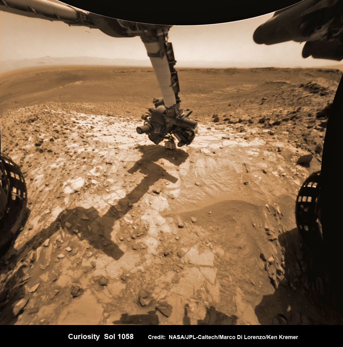
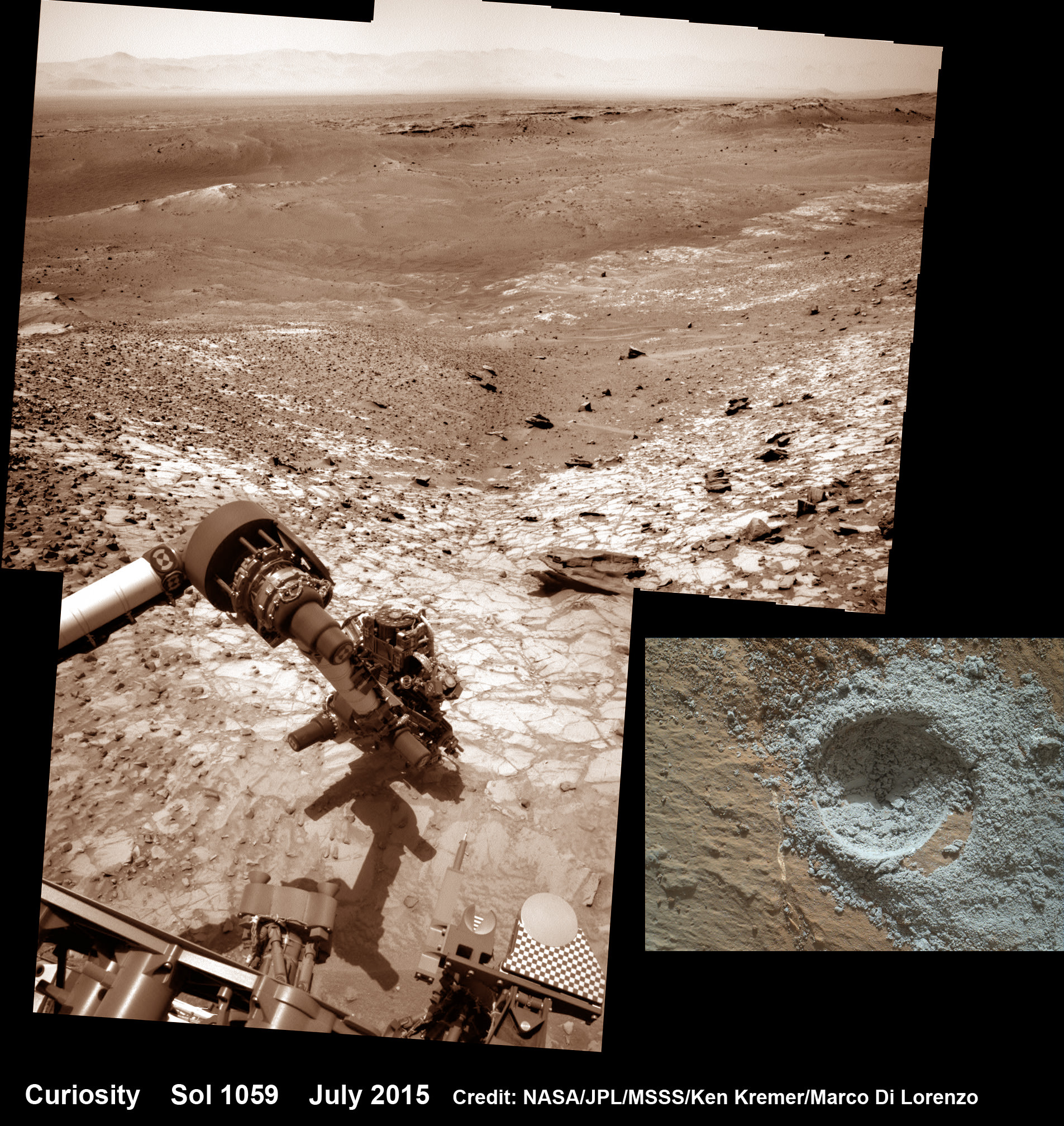
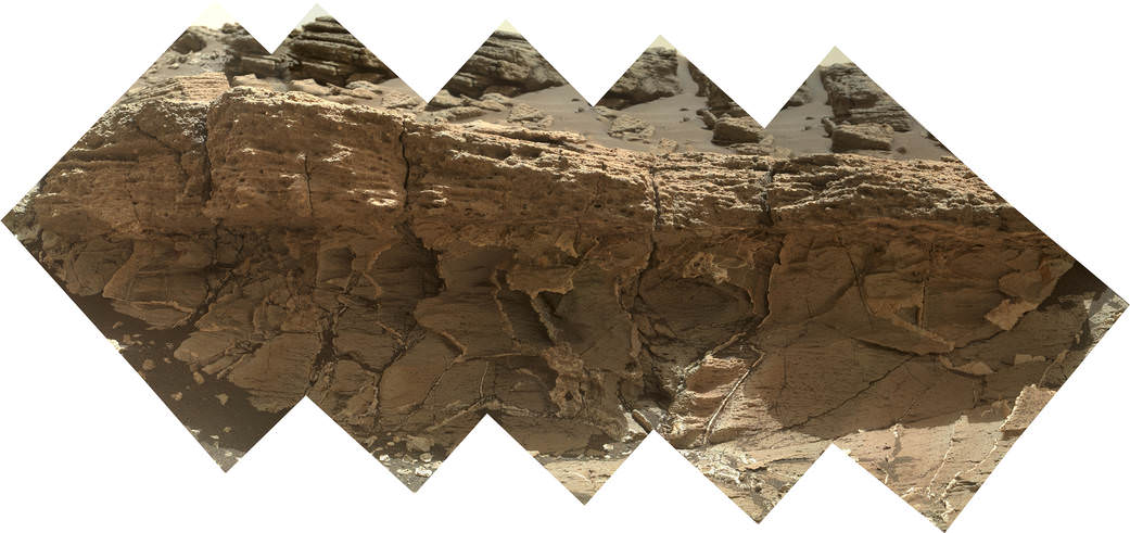
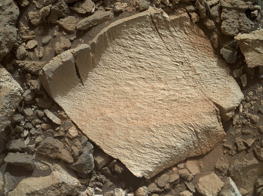
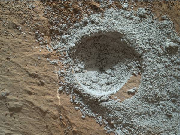
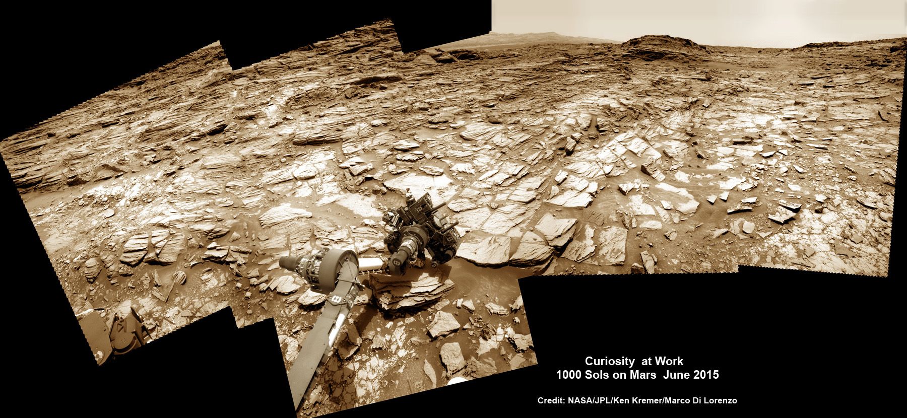
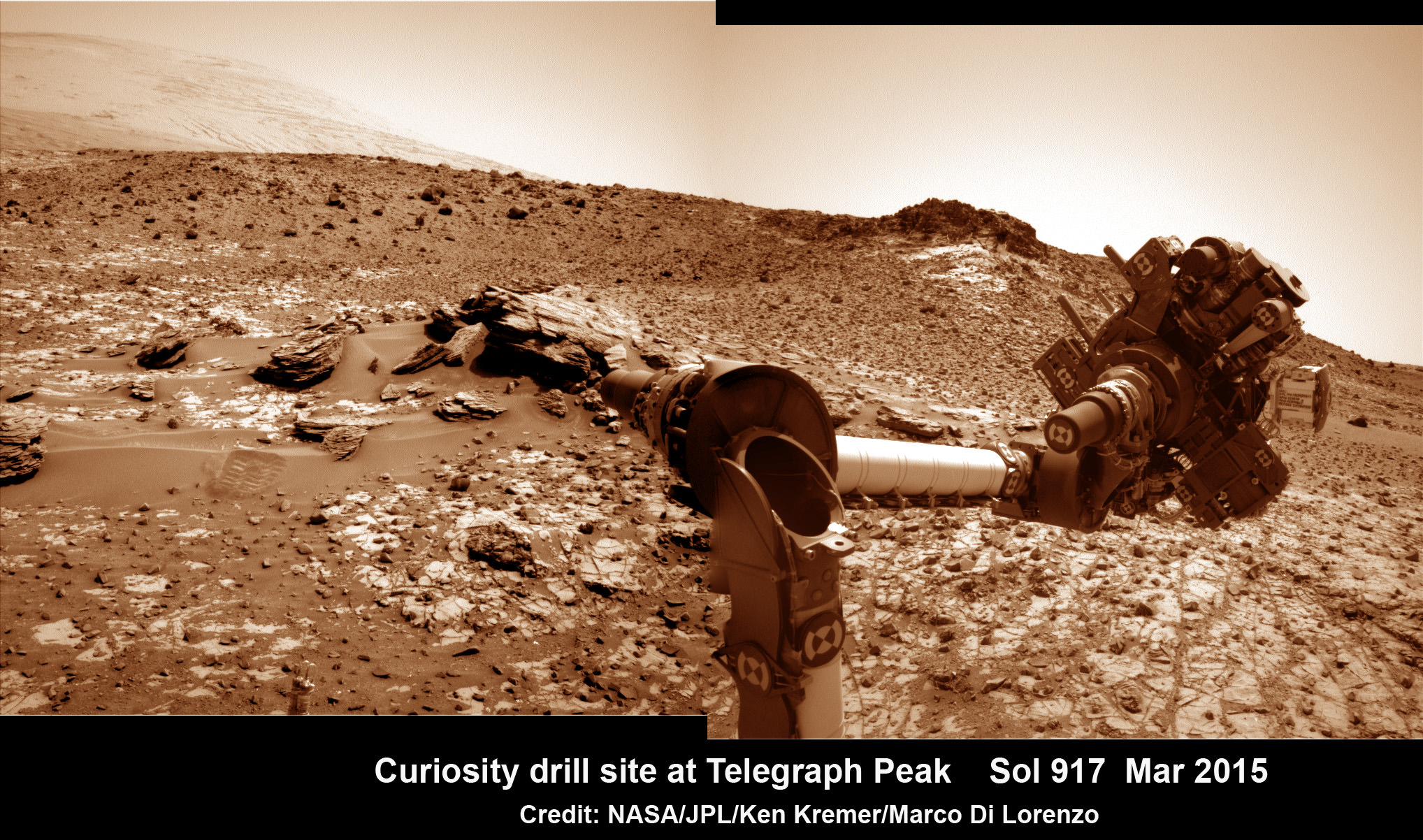
Curiosity recently drilled into the “Buckskin” target at an outcrop at the foothills of Mount Sharp. See the mountain in our ground level mosaic from the crater floor. And its kind of neat to actually imagine Curiosity sitting there while perusing MOM’s photo.

MOM’s goal is to study Mars atmosphere, surface environments, morphology, and mineralogy with a 15 kg (33 lb) suite of five indigenously built science instruments. It is also sniffing for methane, a potential marker for biological activity.
MOM is India’s first deep space voyager to explore beyond the confines of her home planets influence and successfully arrived at the Red Planet after the “history creating” orbital insertion maneuver on Sept. 23/24, 2014 following a ten month journey from Earth.
The Indian probe arrived just after NASA’s MAVEN Mars orbiter, the first mission specifically targeted to study Mars tenuous upper atmosphere and the escape rates of atmospheric constituents.
MOM swoops around Mars in a highly elliptical orbit whose nearest point to the planet (periapsis) is at about 421 km and farthest point (apoapsis) at about 76,000 km, according to ISRO.
It takes MOM about 3.2 Earth days or 72 hours to orbit the Red Planet.
MOM was launched on Nov. 5, 2013 from India’s spaceport at the Satish Dhawan Space Centre, Sriharikota, atop the nations indigenous four stage Polar Satellite Launch Vehicle (PSLV) which placed the probe into its initial Earth parking orbit.
The $73 million MOM mission was expected to last at least six months. In March, ISRO extended the mission duration for another six months since its healthy, the five science instruments are operating fine and it has sufficient fuel reserves.
Including MOM, Earth’s invasion fleet at the Red Planet numbers a total of seven spacecraft comprising five orbiters from NASA, ESA and ISRO as well as the sister pair of mobile surface rovers from NASA – Curiosity and Opportunity.
Stay tuned here for Ken’s continuing Earth and planetary science and human spaceflight news.