
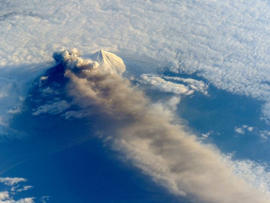
The Pavlof Volcano began erupting on May 13, 2013, shooting lava into the air and spewing an ash cloud 20,000 feet (6,000 meters) high. This image from the International Space Station was taken on May 18, and provides a unique oblique (sideways) glance at the action. When the photograph was taken, the space station was about 475 miles south-southeast of the volcano (49.1° North latitude, 157.4° West longitude). The volcanic plume extended southeastward over the North Pacific Ocean.
NASA says the oblique perspective reveals the three dimensional structure of the ash plume, which is usually not visible from the top-down views of most remote sensing satellites.
If the volcano keeps erupting and spewing ash at those heights, it could interfere with airline traffic. Pavlov is one of the most frequently erupting volcanoes in the Aleutian arc. It last erupted in August of 2007; it previously had not been active since 1996.
There’s more information — and an impressive set of ground-based images — on the Pavlov Volcano at the Alaska Volcano Observatory website, and here’s a helicopter video of the eruption:
There are also a few more ISS images of the volcano at the NASA Earth Observatory website.