
[/caption]
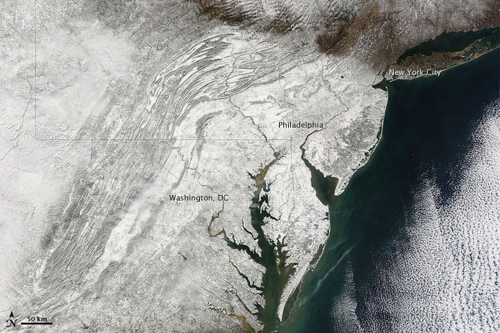
Did you live through what has been called “snowmageddon” or “snowpocalypse?” Here’s a satellite’s-eye view of the exceptionally severe winter storm in the Eastern US that dropped several feet of snow on Feb. 6 and 7. Reports of crashed and abandoned cars and hundreds of cancelled flights were interspersed with stories of massive snowball fights. The huge snowfall may hinder highway traffic into midweek, and hundreds of thousands lost electricity. The image comes from the Moderate Resolution Imaging Spectroradiometer (MODIS) on NASA’s Terra satellite. Snow blankets the area hundreds of kilometers inland from the Atlantic coastline.
Source: NASA Earth Observatory