NASA announced the winners of the high stakes science instrument competition to fly aboard the Mars 2020 rover at a briefing held today, Thursday, July 31, at the agency’s headquarters in Washington, D.C.
The 2020 rover’s instruments goals are to search for signs of organic molecules and past life and help pave the way for future human explorers.
Seven carefully-selected payloads were chosen from a total of 58 proposals received in January 2014 from science teams worldwide, which is twice the usual number for instrument competitions and demonstrates the extraordinary interest in Mars by the science community.
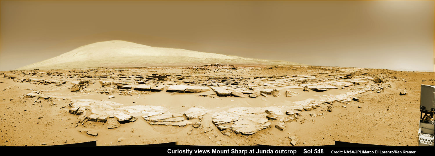
The 2020 rover architecture is based on NASA’s hugely successful Mars Science Laboratory (MSL) Curiosity rover which safely touched down a one ton mass on Mars on Aug. 5, 2012 using the nail-biting and never before used skycrane rocket assisted descent system.
The seven instruments will conduct unprecedented science and technology investigations on the Red Planet that’s aimed for the first time at simultaneously advancing both NASA’s unmanned robotic exploration searching for extraterrestrial life and plans for human missions to Mars in the 2030’s.
The instruments will have the capability to detect low levels of organic molecules that are essential precursors to life.
A technology demonstration experiment will use Mars natural resources to generate oxygen from atmospheric carbon dioxide that can be used as rocket fuel or for human explorers. This will save enormous costs by enabling astronauts to ‘live off the land’ rather than having to bring everything needed for survival from Earth.
NASA said that the development cost for the chosen instruments is approximately $130 million out of a total cost of $1.9 Billion.
This overall cost is less than Curiosity’s approximate $2.4 Billion cost since the team is rebuilding the rover and landing architecture – sort of an MSL 2 so to speak – developed for Curiosity and also using several left over MSL flight spares.
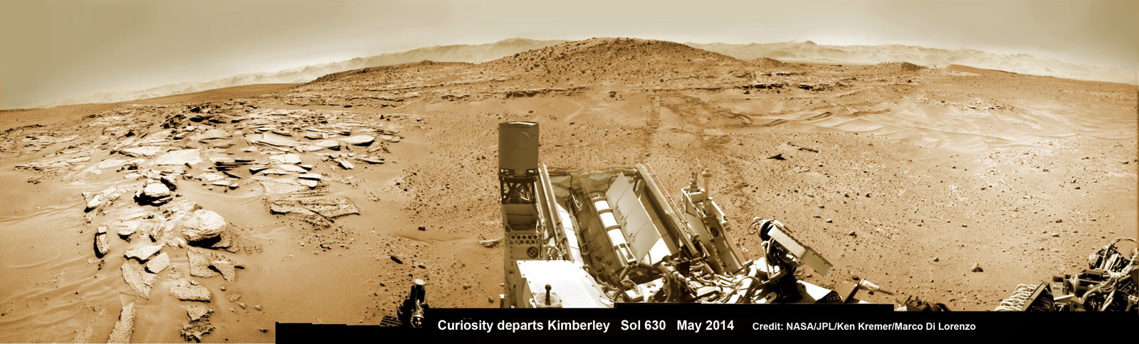
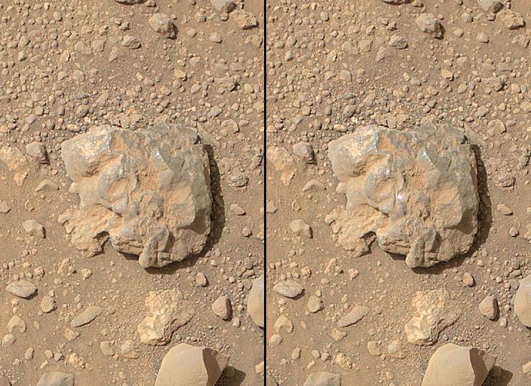
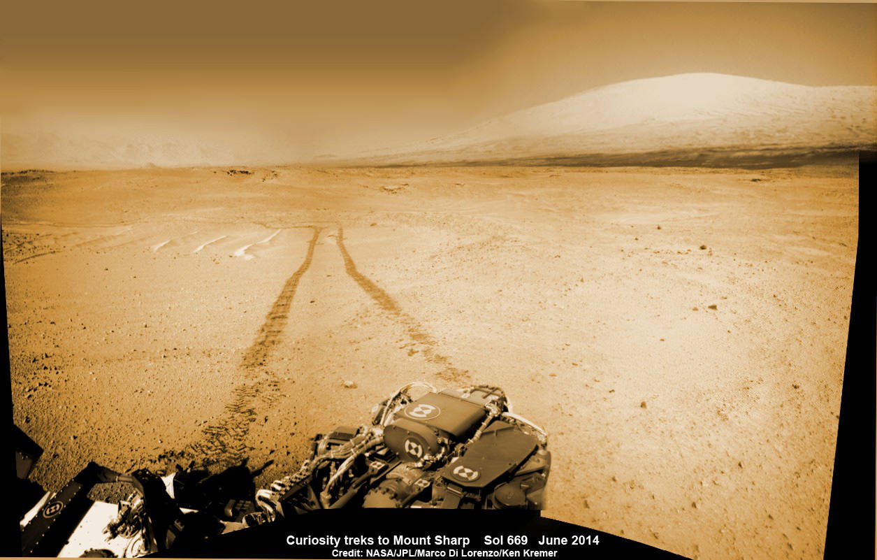
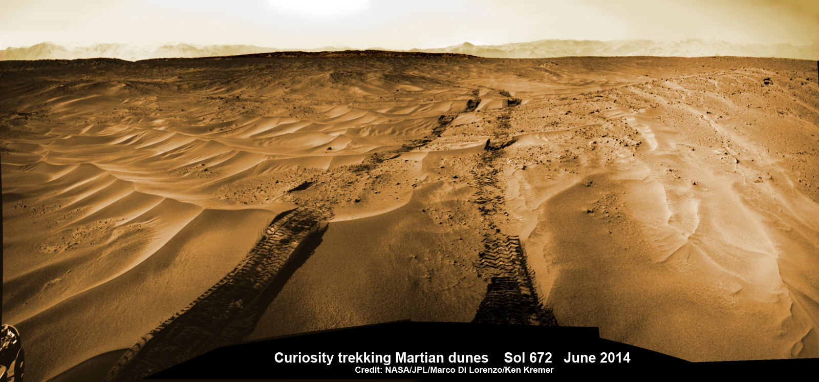
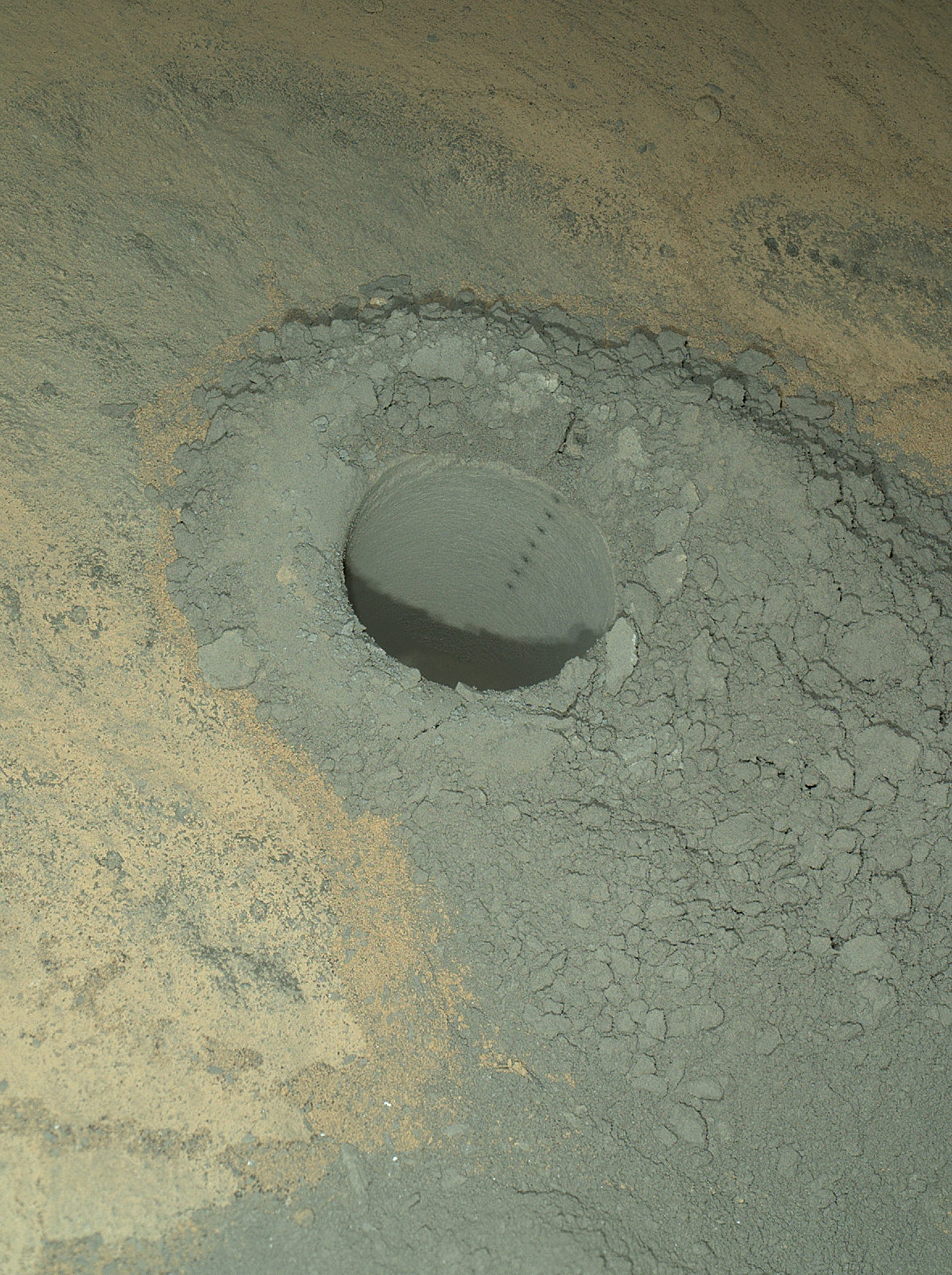
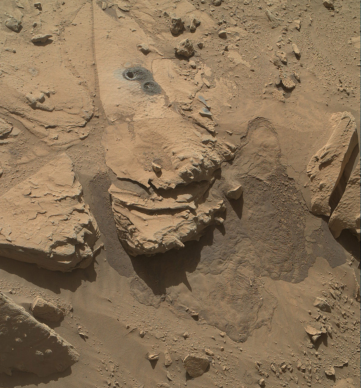
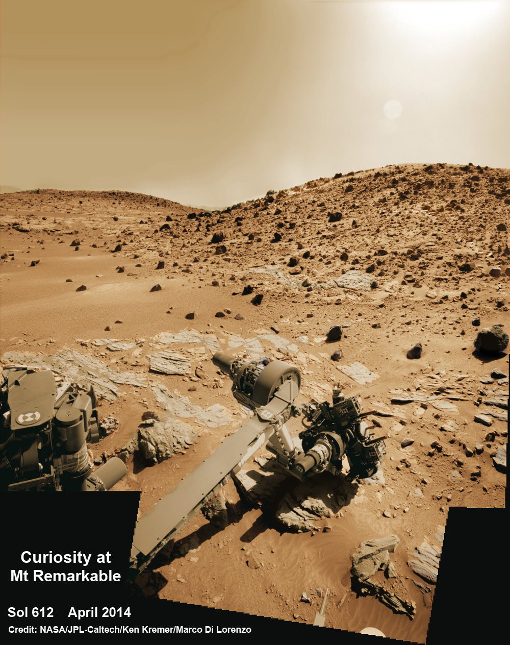
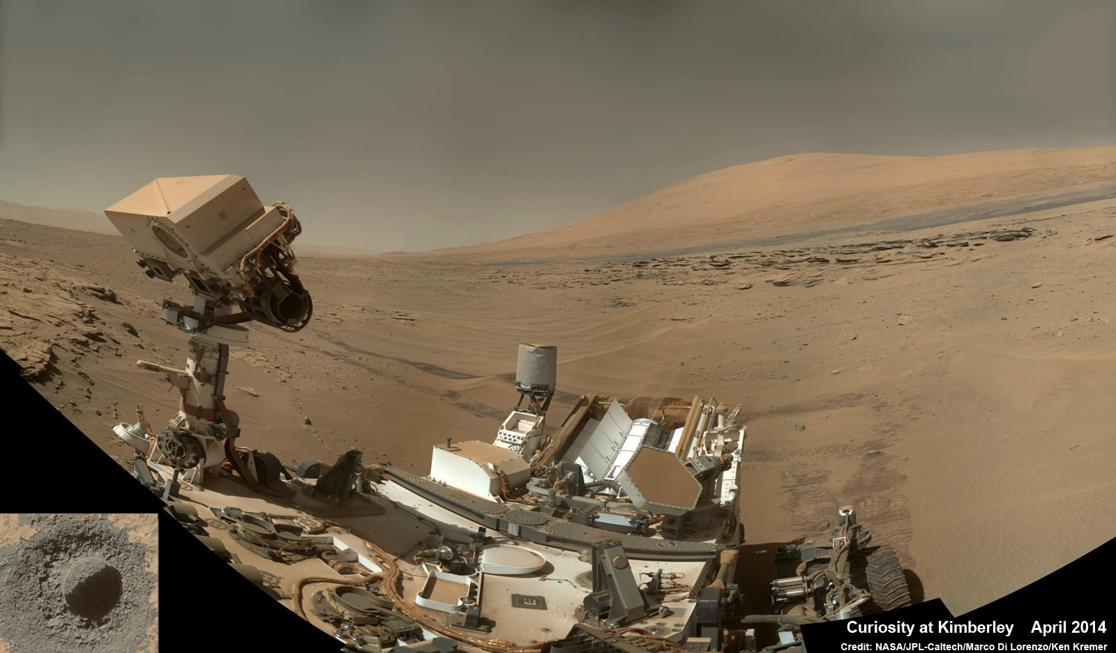
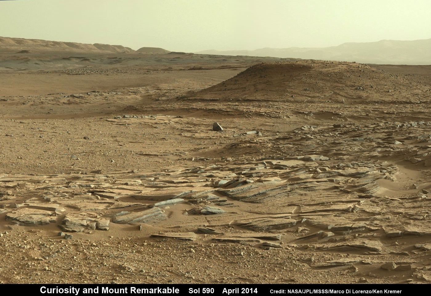
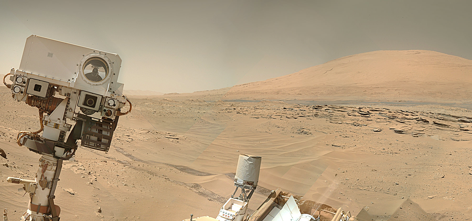
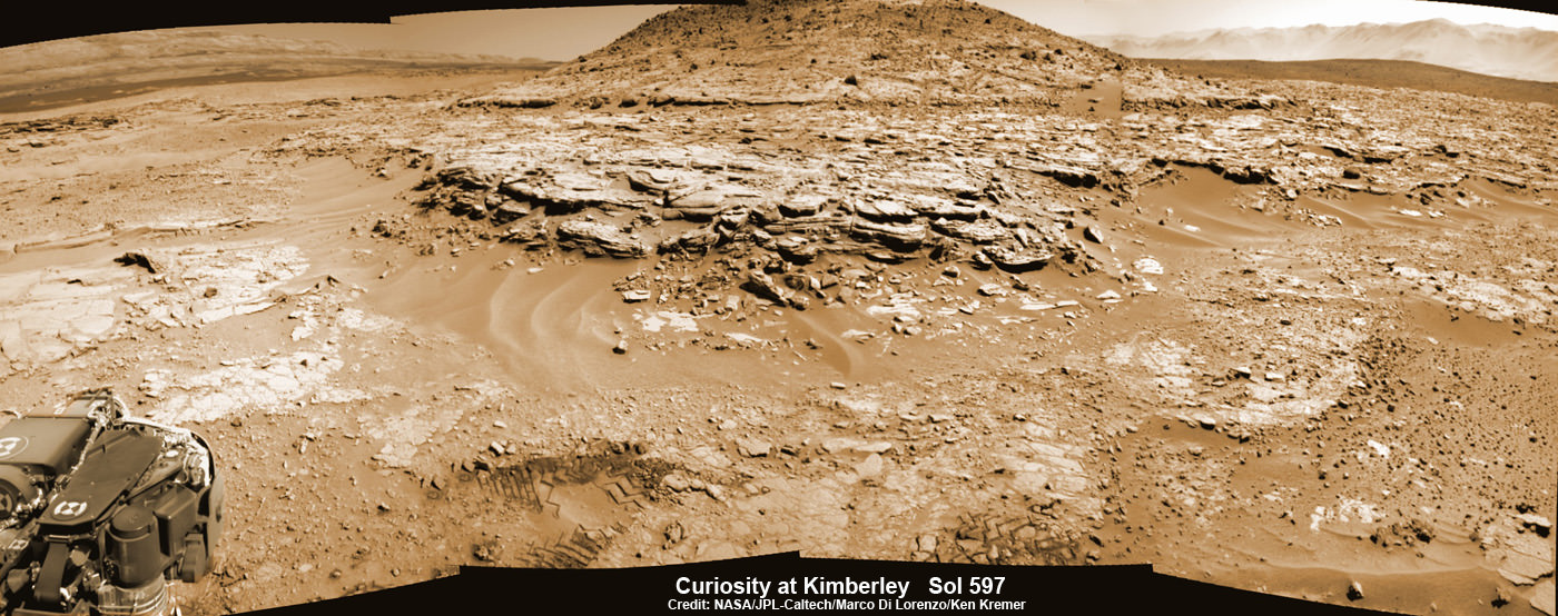
Curiosity’s panoramic view departing Mount Remarkable and ‘The Kimberley Waypoint’ where rover conducted 3rd drilling campaign inside Gale Crater on Mars. The navcam raw images were taken on Sol 630, May 15, 2014, stitched and colorized. Credit: NASA/JPL-Caltech/Ken Kremer – kenkremer.com/Marco Di Lorenzo
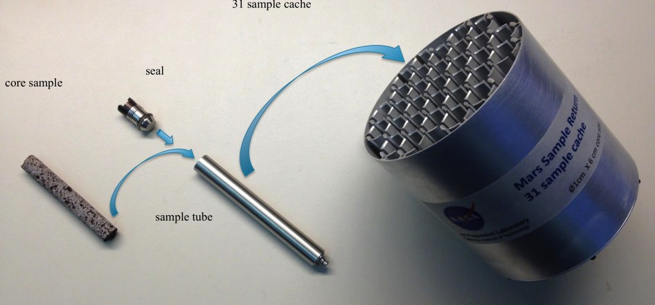
The Mars 2020 rover will also have a sample cacher with the ability to store core samples collected by the rover’s drill for later retrieval and return to Earth at an as yet unspecified time.
“The Mars 2020 rover, with these new advanced scientific instruments, including those from our international partners, holds the promise to unlock more mysteries of Mars’ past as revealed in the geological record,” said John Grunsfeld, astronaut and associate administrator of NASA’s Science Mission Directorate in Washington.
“This mission will further our search for life in the universe and also offer opportunities to advance new capabilities in exploration technology.”

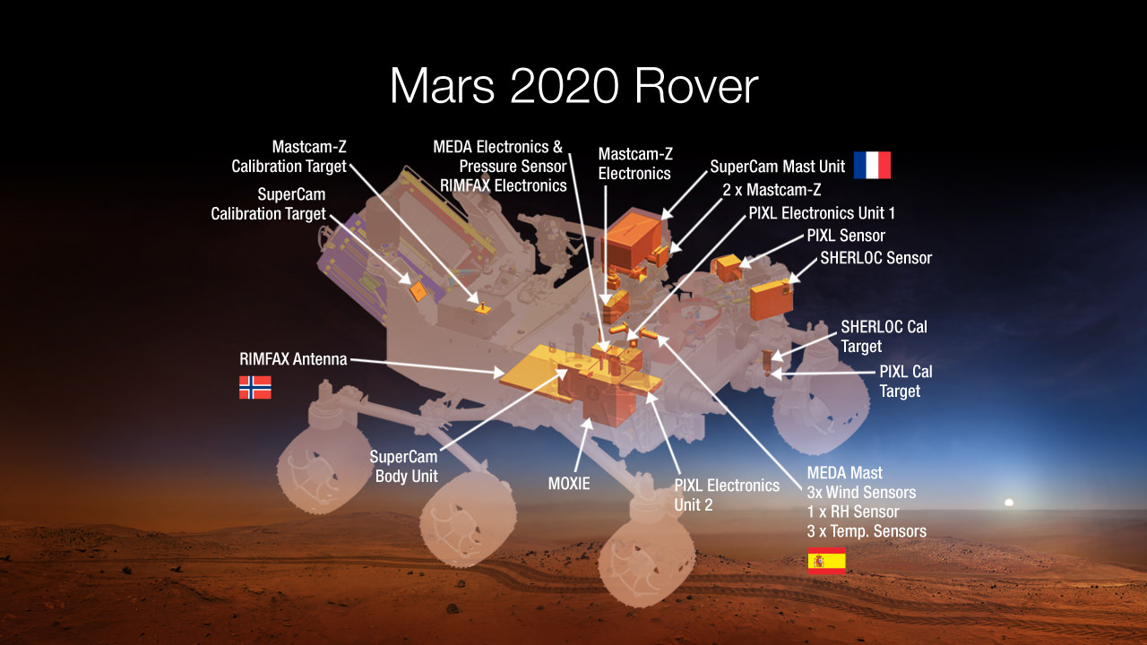
Mastcam-Z, an advanced camera system with panoramic and stereoscopic imaging capability with the ability to zoom. The instrument also will determine mineralogy of the Martian surface and assist with rover operations. The principal investigator is James Bell, Arizona State University in Phoenix.
SuperCam, an instrument that can provide imaging, chemical composition analysis, and mineralogy. The instrument will also be able to detect the presence of organic compounds in rocks and regolith from a distance. The principal investigator is Roger Wiens, Los Alamos National Laboratory, Los Alamos, New Mexico. This instrument also has a significant contribution from the Centre National d’Etudes Spatiales,Institut de Recherche en Astrophysique et Planetologie (CNES/IRAP) France.
Planetary Instrument for X-ray Lithochemistry (PIXL), an X-ray fluorescence spectrometer that will also contain an imager with high resolution to determine the fine scale elemental composition of Martian surface materials. PIXL will provide capabilities that permit more detailed detection and analysis of chemical elements than ever before. The principal investigator is Abigail Allwood, NASA’s Jet Propulsion Laboratory (JPL) in Pasadena, California.
Scanning Habitable Environments with Raman & Luminescence for Organics and Chemicals (SHERLOC), a spectrometer that will provide fine-scale imaging and uses an ultraviolet (UV) laser to determine fine-scale mineralogy and detect organic compounds. SHERLOC will be the first UV Raman spectrometer to fly to the surface of Mars and will provide complementary measurements with other instruments in the payload. The principal investigator is Luther Beegle, JPL.
The Mars Oxygen ISRU Experiment (MOXIE), an exploration technology investigation that will produce oxygen from Martian atmospheric carbon dioxide. The principal investigator is Michael Hecht, Massachusetts Institute of Technology, Cambridge, Massachusetts.
Mars Environmental Dynamics Analyzer (MEDA), a set of sensors that will provide measurements of temperature, wind speed and direction, pressure, relative humidity and dust size and shape. The principal investigator is Jose Rodriguez-Manfredi, Centro de Astrobiologia, Instituto Nacional de Tecnica Aeroespacial, Spain.
The Radar Imager for Mars’ Subsurface Exploration (RIMFAX), a ground-penetrating radar that will provide centimeter-scale resolution of the geologic structure of the subsurface. The principal investigator is Svein-Erik Hamran, Forsvarets Forskning Institute, Norway.
So the instruments are more sophisticated, upgraded hardware versions as well as new instruments to conduct geological assessments of the rover’s landing site, determine the potential habitability of the environment, and directly search for signs of ancient Martian life, according to NASA.
“Today we take another important step on our journey to Mars,” said NASA Administrator Charles Bolden.
“While getting to and landing on Mars is hard, Curiosity was an iconic example of how our robotic scientific explorers are paving the way for humans to pioneer Mars and beyond. Mars exploration will be this generation’s legacy, and the Mars 2020 rover will be another critical step on humans’ journey to the Red Planet.”
Stay tuned here for Ken’s continuing Curiosity, Opportunity, Orion, SpaceX, Boeing, Orbital Sciences, commercial space, MAVEN, MOM, Mars and more Earth and Planetary science and human spaceflight news.