Map displaying water content across the lunar surface, which was the focus of this study as researchers examined how the Earth’s magnetic field contributes to water on the Moon. As the data indicates, lunar water is primarily concentrated near the lunar poles. (Credit: Li, et al., 2023)
A recent study published in Nature Astronomy examines how processes within the Earth’s magnetic field could be contributing to the formation of water on the surface of the Moon. This study was led by the University of Hawai’i (UH) and comes during an increased interest in finding water ice across the lunar surface, which has previously been confirmed to exist within the permanently shadowed regions (PSRs) of the lunar north and south poles due to the Moon’s small axial tilt of only 1.5 degrees compared to the Earth’s 23.5 degrees. Additionally, better understanding the lunar surface water content could also help scientists gain better insights into the Moon’s formation and evolution, which is currently hypothesized to have formed from a Mars-sized object colliding with the Earth approximately 4.5 billion years ago, or approximately 100 million years after the Earth formed.
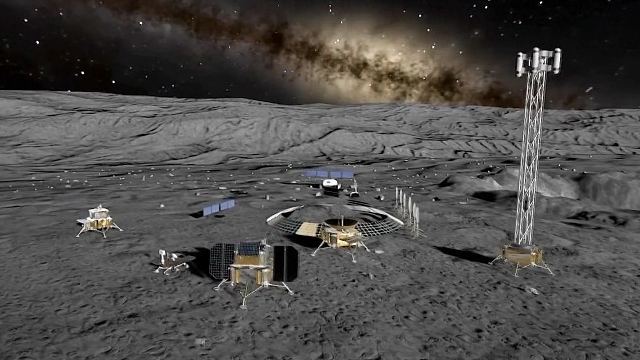
Artist rendition of potential future facilities on the lunar surface. (Credit: CFP)
Researchers from the Chinese Academy of Sciences and the Chinese National Space Administration recently published a study in the journal Space: Science & Technology outlining how the upcoming Chang’e-7 mission, due to launch in 2026, will use a combination of orbital observations and in-situ analyses to help identify the location, amount, and dispersion of water-ice in the permanently-shadowed regions (PSRs) of the Moon, specifically at the lunar south pole.
NASA recently selected a new science payload that will travel to the Moon through a series of robotic missions via the agency’s Artemis program. This instrument suite, known as the Dating an Irregular Mare Patch with a Lunar Explorer (DIMPLE), will have the task of studying the Ina Irregular Mare Patch, also known as Ina, which is a small depression that could provide insights into the Moon’s volcanic history. It was discovered using orbital images from the Apollo 15 crew, and despite several past studies, its origin remains unclear.
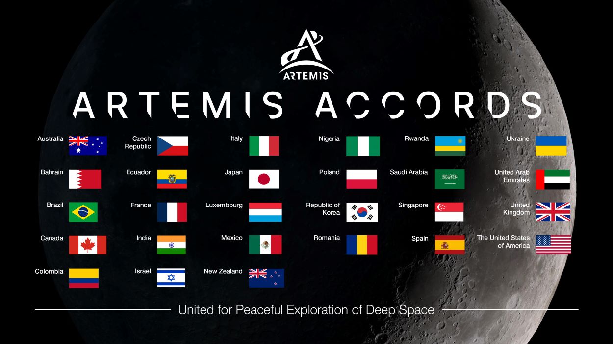
The current list of the 27 signatory countries for the Artemis Accords. (Credit: NASA)
NASA recently welcomed the newest signatories of the Artemis Accords as Spain, Ecuador, and India became the 25th, 26th, and 27th countries, respectively, to sign on to the historic agreement for cooperation and partnership for space exploration, specifically pertaining to NASA’s Artemis program.
Artist rendition of NASA's next-generation Lunar Terrain Vehicle traversing the lunar surface.
(Credit: NASA)
As Artemis II gets ready to launch in November 2024, NASA recently announced it is pursuing contract proposals from private companies for the development of a next-generation Lunar Terrain Vehicle (LTV) to be used for crewed missions starting with Artemis V, which is currently scheduled for 2029. NASA has set a due date for the proposals of July 10, 2023, at 1:30pm Central Time, with the announcement for rewarded contracts to occur in November 2023.
This Saturday September 22, 2012 marks the 3rd annual International Observe the Moon Night (InOMN), when people all over the world will gather to observe the Moon. But what do you do the rest of the year? Luckily, in today’s internet age, there is a great deal of lunar data, from a range of missions, available on-line for you to look at. Also, some great tools have been developed that make data easy to access, put into context, and interpret, giving everyone the power to explore the Moon like a scientist. All you need to do it click on the URL and you’re off…
InOMN was originally started in as a celebration of the wonderful lunar data that was being returned by missions such as the Lunar Reconaissance Orbiter, Chandrayaan-1, and other spacecraft. Since then it has grown to phenomenal proportions, with hundreds of individual events hosted literally all over the world. To learn more about InOMN, or to find the event nearest you, visit the InOMN website.
But what do you do if there is no event being hosted near you, or if the weather turns cloudy in your geographic region? You can always join the CosmoQuest InOMN Hangout on Google+.
However, a true passion and interest in the Moon is not a one day thing. What if you want to look at the Moon on some other day, or see details that are too small to be resolved by even the largest telescopes on Earth? As it happens, data from those same missions that inspired the very first InOMN is very easy for the average person to see, any time they want to. Lunar Reconnaissance Orbiter Camera (LROC) data from the Lunar Reconnaissance Orbiter and Moon Mineralogy Mapper (M3) data from the Chandrayaan-1 spacecraft can be accessed on-line using the ACT-REACT Quick Map tool.
ACT-REACT Quick Map (http://target.lroc.asu.edu/da/qmap.html) places skinny little strips of high resolution data from the Lunar Reconnaissance Orbiter Camera into context on the Moon. Credit: NASA/GSFC/Arizona State University.
This LROC version of the ACT-REACT Quick Map tool (there is also a MESSENGER version for Mercury data) was originally developed by the LROC team to place skinny little strips of LROC Narrow Angle Camera data into context on the Moon, and to help with targeting for further high resolution data collection. They partnered with software firm Applied Coherent Technology (ACT) to create this relatively user friendly on-line tool, and then made it accessible for anyone who wants to use it!
The interface of the ACT-REACT Quick Map tool is fairly intuitive. If you have used Google Maps, you should be able to navigate your way around fairly quickly. For more details on the available features, check out the LROC data user tutorial and the M3 data user tutorial. Though, one of the first things you might want to know how to do is to turn off the bright colours that represent elevation (uncheck the LROC WAC Color Shaded Relief checkbox). This shaded relief layer is great when you want to understand the topography of fairly large features, but is more distracting than helpful when looking at highest resolution data.
The colour shaded relief data is great at showing off the elevation of large features, but is less useful when zoomed in to smaller scales. Turn it off by unchecking the LROC WAC Color Shaded Relief checkbox. Credit: NASA/GSFC/Arizona State University
The most exciting thing about the ACT-REACT Quick Map tool is that it makes these amazing lunar data sets available to the public in a way that was never possible before. Anyone sitting at their computer at home can study the Moon, viewing large lunar features, like impact basins and maria, and then zooming into to see details as small as their desk. This kind of technological advance opens the door for every enthusiast to conduct their own personal explorations of the Moon, and gives them an opportunity to see and think like the scientists who are currently working with this data to discover new and exciting information about our Moon.
Zooming in allows you to see spectacular landslides along the walls of a crater. At the highest resolutions, individual boulders can be seen. Credit: NASA/GSFC/Arizona State University
So, after International Observe the Moon Night is over, don’t wait until next year to look at the Moon again. Head over to ACT-REACT Quick Map and start exploring!