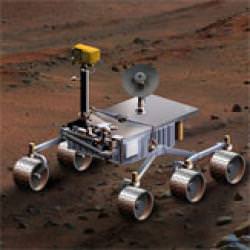
Where should the next spacecraft land on Mars? The Mars Science Laboratory (MSL) rover is scheduled to launch in the fall of 2009. MSL is a long-range rover that will explore a region on Mars with the goal of determining if Mars has or ever had conditions capable of supporting microbial life. Over fifty landing sites have been proposed by various planetary scientists, and recently, the selection committee narrowed the field down to six possible sites. The final site and a backup will be selected in September of 2008. Here’s a look at the six final candidates:
Mawrth Vallis: Location:Northern Plains, east of Pathfinder rover site (24.65°N, 340.10°E)
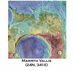
This is an ancient channel carved by catastrophic floods. Spectrometers on the Mars Reconnaissance Orbiter (MRO) have detected clay minerals which contain water, and may also preserve organic materials, so there is great interest in studying these deposits to understand past environments that could have supported life. Images from the MRO HiRise camera show hills with several layers and intriguing boulders.
Nili Fossae Trough: Location: Near Isidis Planitia, and near the Beagle 2 intended landing site. (21°N, 74.2°E)
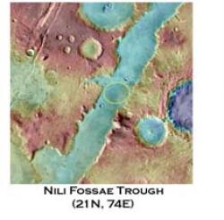
This region has one of the largest and most diverse exposures of clays minerals that have been detected from orbit. Again, clay minerals contain water, and possibly organic materials. The area is a linear depression about 25 km wide that was created from tectonic activity.
Holden Crater: Location: South of Vallis Marineris (26.4°S, 325.3°E)
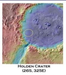
This crater contains deep gullies carved by running water as well as examples of what are assumed to be lake beds and sediments deposited by streams. These deposits are more than three billion years old, which dates back to a wetter period on Mars. Scientists believe Holden Crater once was a lake, and when the water disappeared, wind eroded the surface and formed the ripples and dunes that have been imaged by the HiRise instrument.
Eberswalde Crater: Location: South of Vallis Marineris (23.20°S, 326.75°E)
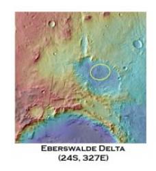
The Eberswalde delta is the most convincing evidence on Mars for the persistent flow of a river into a standing body of water. HiRise images show many channels within the delta that have become inverted, which occurs as sediments deposited by flowing water solidify over time and become resistant to erosion. High resolution HiRise images show individual boulders breaking off from the channel deposits.
Miyamoto Crater: Location: Merdiani Planum, near Opportunity Rover site. (1.7°S, 352.4°E)

Located along the western boundary of Meridiani Planum, this 150-km crater has hematite and sulfate-bearing minerals, possibly created from lakes or groundwater. The southwestern part of the crater floor has been stripped by erosion, revealing clay minerals.
Northern Meridiani: Location: Meridiani Planum,2.34°N, 6.69°E
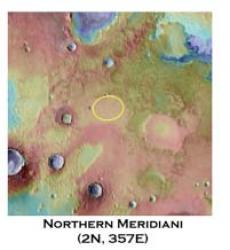
This is the same area that the Opportunity rover has studied. By landing here, the MSL rover could increase our knowledge of the Meridiani region, which Opportunity has revealed to have a complex geologic history that involves flowing water, groundwater, lakes and wind. If chosen as a landing site, the MSL rover would study the smooth plains before driving to the ridged plains to the north.
MSL will arrive on Mars in 2010. Once on the surface, the rover will be able to roll over obstacles up to 75 centimeters (29 inches) high and travel up to 90 meters (295 feet) per hour. On average, the rover is expected to travel about 30 meters (98 feet) per hour, based on power levels, slippage, steepness of the terrain, visibility, and other variables. The science instruments on board include cameras, spectrometers, radiation detectors and environmental sensors.
Original News Source: HiRise Blog

