Because of Extreme Drought, Lake Powell is Barely a Lake Anymore

This Copernicus Sentinel-2 image allows us a wider view of Lake Powell and its dwindling water levels amidst the climate crisis. Contains modified Copernicus Sentinel data (2022), processed by ESA.

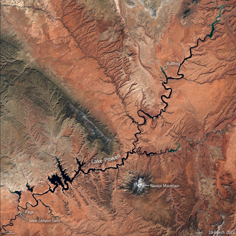
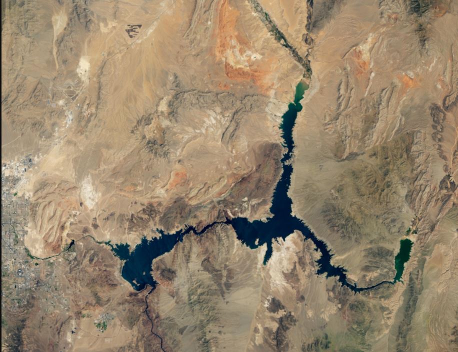
The two largest reservoirs in the United States are now at their lowest levels since they were first created. After several decades of drought – with the past two years classified as intense drought in the US Southwest — both Lake Powell and Lake Mead are shrinking. Recent satellite images show just how dramatic the changes have been, due to the ongoing the climate crisis..

Continue reading “Because of Extreme Drought, Lake Powell is Barely a Lake Anymore”

Here’s Lake Mead’s Record Low Water Levels Seen From Space

Lake Mead at record low levels, as seen on August 9, 2021 by the Landsat 8 satellite. Credit: NASA/NOAA

How bad is the drought in the western United States? A stunning depiction of the record dry spell comes in images of Lake Mead, the reservoir formed by the Hoover Dam on the Colorado River. NASA satellite images, below, from Landsat 7 and Landsat 8 show the difference in lake levels between August 2000 and August 2021.

Continue reading “Here’s Lake Mead’s Record Low Water Levels Seen From Space”