
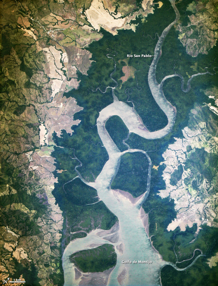
As we reported in January, a new telescope was installed on the International Space Station – not to observe the stars, but instead look back to Earth to acquire imagery of specific areas of the world for disaster analysis and environmental studies. Called ISERV (International Space Station SERVIR Environmental Research and Visualization System), it has now taken its first image. Above is the “first light” from the new ISERV, taken at 1:44 p.m. local time on February 16, 2013.
No, this is not a giant tree trunk! It is the Rio San Pablo as it empties into the Golfo de Montijo in Veraguas, Panama.
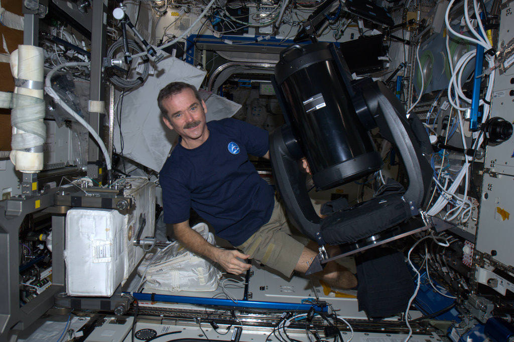
The telescope is a modified off-the-shelf Celestron telescope, the Celestron CPC 925, a 9.25? diffraction limited Schmidt-Cassegrain telescope and if you were to buy a un-modified version, it would cost $2,500 including the mount.
The ISERV version was modified at the Marshall Space Flight Center, which is where it is controlled from, as well. It is installed in the Window Observational Research Facility (WORF) in the station’s Destiny laboratory. With a resolution down to 3.2 meters (10 feet), it will be possible to spot fairly small details and objects.
This ISERV Pathfinder is intended as an engineering exercise, with the long-term goal of developing a system for providing imagery to developing nations as they monitor natural disasters and environmental concerns.
“ISERV’s full potential is yet to be seen, but we hope it will really make a difference in people’s lives,” said principal investigator Burgess Howell of NASA’s Marshall Space Flight Center. “For example, if an earthen dam gives way in Bhutan, we want to be able to show officials where the bridge is out or where a road is washed out or a power substation is inundated. This kind of information is critical to focus and speed rescue efforts.”
The system will use on positioning software to know where the space station is at each moment and to calculate the next chance to view a particular area on the ground. If there’s a good viewing opportunity, the SERVIR team will instruct the camera to take high-resolution photographs at 3 to 7 frames per second, totaling as many as 100 images per pass.
The current mission will test the limitations of this ISERV system and identify measures for improvements in a more permanent system. For instance, the engineering team is working to determine how the geometry of the ISS window affects the imagery; how much sunlight is needed to capture clear images; and how the atmosphere affects that clarity. This characterization phase will last several weeks to a few months. Eventually, ISERV should be made available to the natural hazards community and to basic research scientists.
Source: NASA Earth Observatory