
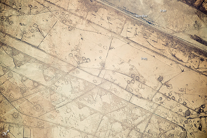
There’s an oft-used idiom that you can’t see political borders from space, but we’ve known for a while it’s no longer true. Between higher resolution cameras and the increase in human activity, there have been several examples of borders visible from space. Here’s one more.
Astronauts aboard the International Space Station took this photograph in November of 2014 of a 20-kilometer (12-mile) stretch of the Iraq-Iran border, near the coast of the Persian Gulf. Clearly visible is the border between the two countries, along with signs of fortification: circular gun emplacements, systems of large curved earthworks and straight connecting roads that run parallel to the border.
NASA said the ISS team that analyzes astronaut photos first thought the circular features to be oil-pad installations (like ones seen in Texas here). But they said the “strategic location of these formations along the international boundary made it easier to see these as patterns of military fortifications. This region of oil refining and exporting was the center of numerous military actions during the war in the 1980s, especially during the defense of the southern city of Basra.”
Back in 2011, we featured an image from astronaut Ron Garan which clearly showed the human-made border between India and Pakistan. Since 2003, India has illuminated the border with Pakistan by floodlights in attempt to prevent ammunition trafficking and the infiltration of terrorists.

“Realizing what this picture depicted had a big impact on me,” Garan said. “When viewed from space, Earth almost always looks beautiful and peaceful. However, this picture is an example of man-made changes to the landscape in response to a threat, clearly visible from space. This was a big surprise to me.”
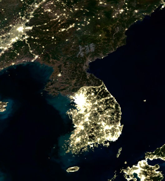
There’s also a satellite photo from the M-Sat Planet Observer showing the clear border and demilitarized zone between North and South Korea.
Sources: NASA, Fragile Oasis, M-Sat Planet Observer