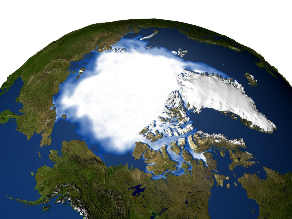
One of the most worrisome aspects of Climate Change is the role played by positive feedback mechanisms. In addition to global temperatures rising because of increased carbon dioxide and greenhouse gas emissions, there is the added push created by deforestation, ocean acidification, and (most notably) the disappearance of the Arctic Polar Ice Cap.
However, according to a new study by a team of researchers from the School of Earth and Space Exploration at Arizona State University, it might be possible to refreeze parts of the Arctic ice sheet. Through a geoengineering technique that would rely on wind-powered pumps, they believe one of the largest positive feedback mechanisms on the planet can be neutralized.
Their study, titled “Arctic Ice Management“, appeared recently in Earth’s Future, an online journal published by the American Geophysical Union. As they indicate, the current rate at which Arctic ice is disappearing it quite disconcerting. Moreover, humanity is not likely to be able to combat rising global temperatures in the coming decades without the presence of the polar ice cap.

Of particular concern is the rate at which polar ice has been disappearing, which has been quite pronounced in recent decades. The rate of loss has been estimated at being between 3.5% and 4.1% per decade, with in an overall decrease of at least 15% since 1979 (when satellite measurements began). To make things worse, the rate at which ice is being lost is accelerating.
From a baseline of about 3% per decade between 1978-1999, the rate of loss since the 2000s has climbed considerably – to the point that the extent of sea-ice in 2016 was the second lowest ever recorded. As they state in their Introduction (and with the support of numerous sources), the problem is only likely to get worse between now and the mid-21st century:
“Global average temperatures have been observed to rise linearly with cumulative CO2 emissions and are predicted to continue to do so, resulting in temperature increases of perhaps 3°C or more by the end of the century. The Arctic region will continue to warm more rapidly than the global mean. Year-round reductions in Arctic sea ice are projected in virtually all scenarios, and a nearly ice-free (<106 km2 sea-ice extent for five consecutive years) Arctic Ocean is considered “likely” by 2050 in a business-as-usual scenario.”
One of the reasons the Arctic is warming faster than the rest of the planet has to do with strong ice-albedo feedback. Basically, fresh snow ice reflects up to 90% of sunlight while sea ice reflects sunlight with albedo up to 0.7, whereas open water (which has an albedo of close to 0.06) absorbs most sunlight. Ergo, as more ice melts, the more sunlight is absorbed, driving temperatures in the Arctic up further.
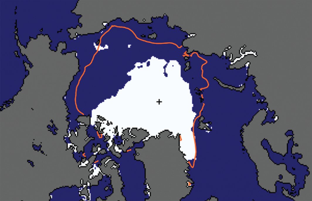
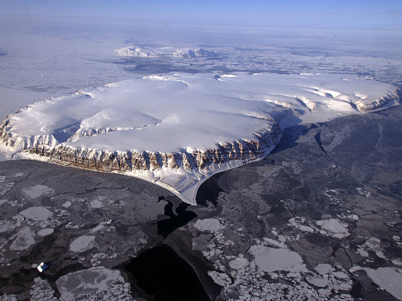
Arctic sea-ice extent (area covered at least 15% by sea ice) in September 2007 (white area). The red curve denotes the 1981–2010 average. Credit: National Snow and Ice Data CenterTo address this concern, the research team – led by Steven J. Desch, a professor from the School of Earth and Space Exploration – considered how the melting is connected to seasonal fluctuations. Essentially, the Arctic sea ice is getting thinner over time because new ice (aka. “first-year ice”), which is created with every passing winter, is typically just 1 meter (3.28 ft) thick.
Ice that survives the summer in the Arctic is capable of growing and becoming “multiyear ice”, with a typical thickness of 2 to 4 meters (6.56 to 13.12 ft). But thanks to the current trend, where summers are getting progressively warmer, “first-year ice” has been succumbing to summer melts and fracturing before it can grow. Whereas multiyear ice comprised 50 to 60% of all ice in the Arctic Ocean in the 1980s, by 2010, it made up just 15%.
With this in mind, Desch and his colleagues considered a possible solution that would ensure that “first-year ice” would have a better chance of surviving the summer. By placing machines that would use wind power to generate pumps, they estimate that water could be brought to the surface over the course of an Arctic winter, when it would have the best chance of freezing.
Based on calculations of wind speed in the Arctic, they calculate that a wind turbine with 6-meter diameter blades would generate sufficient electricity so that a single pump could raise water to a height of 7 meters, and at a rate of 27 metric tons (29.76 US tons) per hour. The net effect of this would be thicker sheets of ice in the entire affected area, which would have a better chance of surviving the summer.
Over time, the negative feedback created by more ice would cause less sunlight to be absorbed by the Arctic ocean, thus leading to more cooling and more ice accumulation. This, they claim, could be done on a relatively modest budget of $500 billion per year for the entire Arctic, or $50 billion per year for 10% of the Arctic.
While this may sounds like a huge figure, they are quick to point out that the cast covering the entire Arctic with ice-creating pumps – which could save trillions in GDP and countless lives- is equivalent to just 0.64% of current world gross domestic product (GDP) of $78 trillion. For a country like the United States, it represents just 13% of the current federal budget ($3.8 trillion).
And while there are several aspects of this proposal that still need to be worked out (which Desch and his team fully acknowledge), the concept does appear to be theoretically sound. Not only does it take into account the way seasonal change and Climate Change are linked in the Arctic, it acknowledges how humanity is not likely to be be able to address Climate Change without resorting to geoengineering techniques.
And since Arctic ice is one of the most important things when it comes to regulating global temperatures, it makes perfect sense to start here.
Further Reading: Earth’s Future