
“It’s a big one!” said International Space Station commander Mike Fossum as the space station flew over Hurricane Rina at 2:39 p.m. EDT on Oct. 25, 2011. External cameras on the ISS captured these views as the station flew 248 miles over the Caribbean Sea east of Belize.
Rina’s maximum sustained winds remained steady at about 110 mph early Wednesday, said the U.S. National Hurricane Center in Miami, making it a Category 2 storm. Forecasters predict it will strengthen to a major hurricane as it nears the Mexican coast Wednesday night before rolling over the island of Cozumel, then along the coast to Cancun.
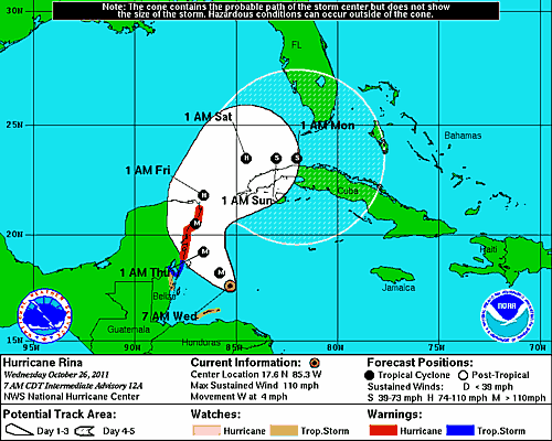
See a map of the Hurricane’s projected path below.
The late season hurricane, which continues to intensify, was located 300 miles east-southeast of Chetumal, Mexico, barely moving west-northwest at a glacial three miles an hour. Hurricane warnings have been issued for the Yucatan from north of Punta Gruesa, Mexico, to Cancun.
[/caption]