CYGNSS Constellation of Hurricane Monitoring MicroSats Set for Dec. 12 Launch – Watch Live

Artist's concept of the deployment of the eight Cyclone Global Navigation Satellite System (CYGNSS) microsatellite observatories in space. Credits: NASA
Artist's concept of the deployment of the eight Cyclone Global Navigation Satellite System (CYGNSS) microsatellite observatories in space.  Credits: NASA
Artist’s concept of the deployment of the eight Cyclone Global Navigation Satellite System (CYGNSS) microsatellite observatories in space. Credits: NASA

KENNEDY SPACE CENTER, FL – An exciting new chapter in hurricane monitoring and forecasting intensity prediction is due to open Monday morning at NASA’s Kennedy Space Center when a new constellation of microsatellites dubbed CYGNSS are slated to be deployed from an air-launched Orbital ATK Pegasus XL rocket.

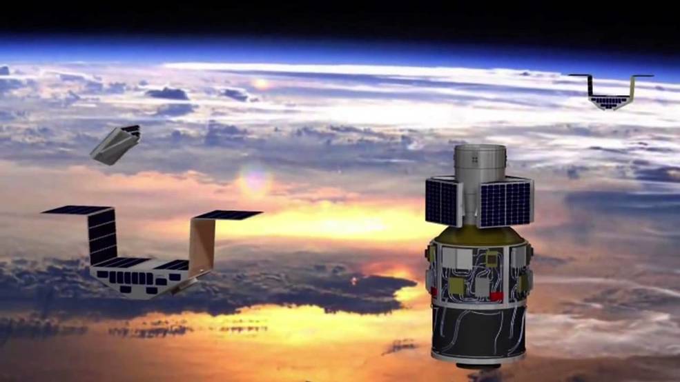
The fleet of eight identical spacecraft comprising the Cyclone Global Navigation Satellite System (CYGNSS) system will be delivered to Earth orbit by an Orbital ATK Pegasus XL rocket.

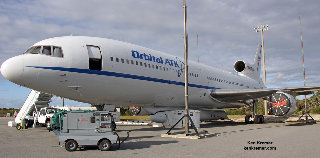
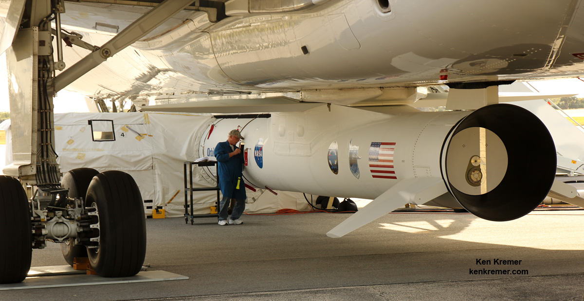
The Pegasus/CYGNSS vehicle is attached to the bottom of the Orbital ATK L-1011 Stargazer carrier aircraft.

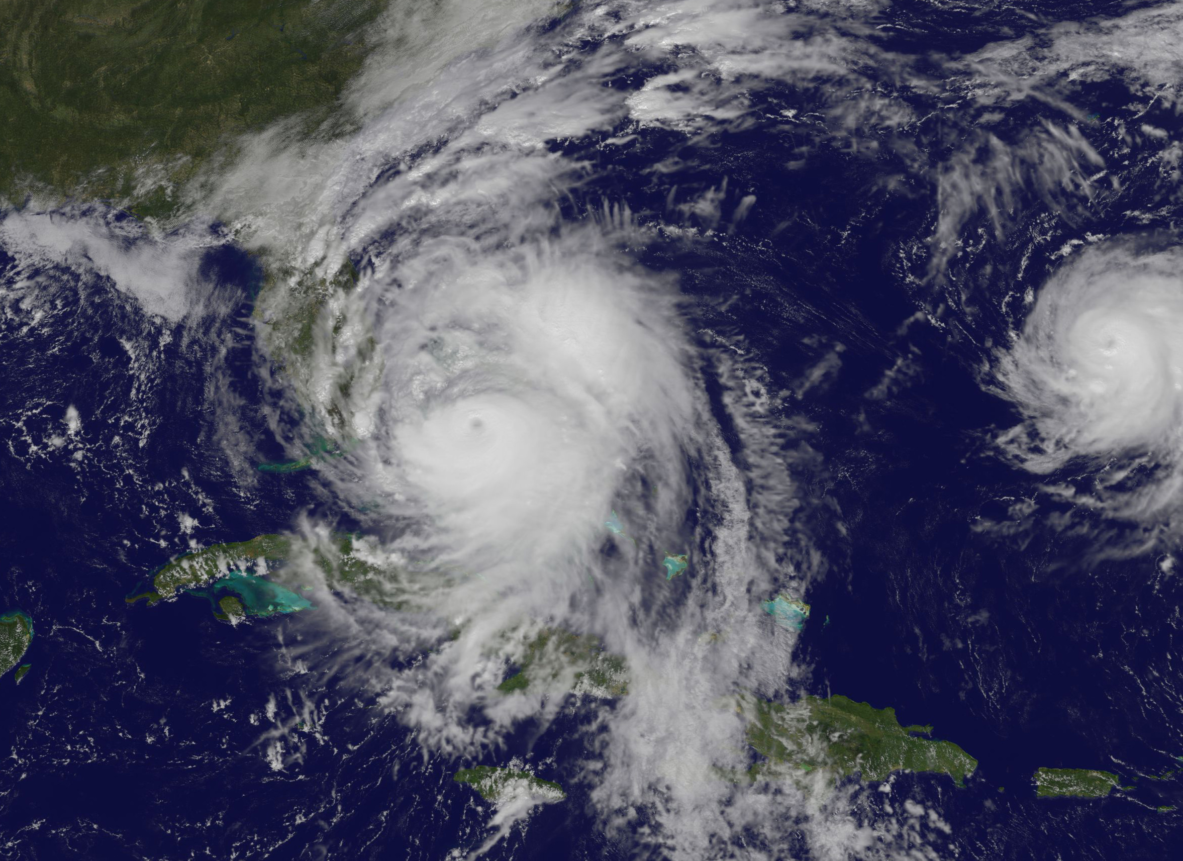
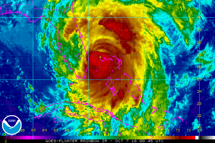
“The CYGNSS constellation consists of eight microsatellite observatories that will measure surface winds in and near a hurricane’s inner core, including regions beneath the eyewall and intense inner rainbands that previously could not be measured from space,” according to a NASA factsheet.

The data obtained by studying the inner core of tropical cyclones “will help scientists and meteorologists better understand and predict the path of a hurricane.”

Improved hurricane forecasts can help protect lives and mitigate property damage in coastal areas under threat from hurricanes and cyclones.

The Orbital ATK L-1011 Stargazer aircraft at the Skid Strip at Cape Canaveral Air Force Station in Florida. Attached beneath the Stargazer is the Orbital ATK Pegasus XL with NASA's CYGNSS payload on board, being processed for launch on Dec. 12, 2016.  Credit: Ken Kremer/kenkremer.com
The Orbital ATK L-1011 Stargazer aircraft at the Skid Strip at Cape Canaveral Air Force Station in Florida. Attached beneath the Stargazer is the Orbital ATK Pegasus XL with NASA’s CYGNSS payload on board, being processed for launch on Dec. 12, 2016. Credit: Ken Kremer/kenkremer.com

CYGNSS is an experimental mission to demonstrate proof-of-concept that could eventually turn operational in a future follow-up mission if the resulting data returns turn out as well as the researchers hope.

The Pegasus XL rocket with the eight observatories are tucked inside the nose cone will be air-launched by dropping them from the belly of Orbital’s modified L-1011 carrier aircraft, nicknamed Stargazer, after taking off from the “Skid Strip” runway at Cape Canaveral Air Force Station in Florida.

If all goes well, the rocket will be dropped from Stargazer’s belly for the launch currently planned for Monday, Dec. 12 at 8:24 a.m. EST.

Five seconds after the rocket is deployed at 39,000 feet, the solid fueled Pegasus XL first stage engine with ignite for the trip to low earth orbit.

They will be deployed from a dispenser at an altitude of about 510 km and an inclination of 35 degrees above the equator.

Technician works on Orbital ATK Pegasus XL rocket with NASA's CYGNSS payload on board on Dec. 10, 2016 in this rear side view showing the first stage engine. They are mated to the bottom of the Orbital ATK L-1011 Stargazer aircraft at the Skid Strip at Cape Canaveral Air Force Station in Florida.  Launch is slated for Dec. 12, 2016.  Credit: Ken Kremer/kenkremer.com
Technician works on Orbital ATK Pegasus XL rocket with NASA’s CYGNSS payload on board on Dec. 10, 2016 in this rear side view showing the first stage engine. They are mated to the bottom of the Orbital ATK L-1011 Stargazer aircraft at the Skid Strip at Cape Canaveral Air Force Station in Florida. Launch is slated for Dec. 12, 2016. Credit: Ken Kremer/kenkremer.com

The launch window lasts 1 hour with the actual deployment timed to occur 5 minutes into the window.

NASA’s Pegasus/CYGNUS launch coverage and commentary will be carried live on NASA TV – beginning at 6:45 a.m. EDT

You can watch the launch live on NASA TV at – http://www.nasa.gov/nasatv

Live countdown coverage on NASA’s Launch Blog begins at 6:30 a.m. Dec. 12.

The weather forecast from the Air Force’s 45th Weather Squadron at Cape Canaveral is currently predicting a 40% chance of favorable conditions on Monday Dec 12.

The primary weather concerns are for flight through precipitation and cumulus clouds.

The Pegasus rocket cannot fly through rain or clouds due to a negative impact on the thermal protection system.

In the event of a delay, the range is also reserved for Tuesday, Dec. 13 where the daily outlook increases significantly to an 80% chance of favorable weather conditions.

After Stargazer takes off from the Skid Strip early Monday morning around 6:30 a.m. EST, it will fly north to a designated point about 126 miles east of Daytona Beach, Florida over the Atlantic Ocean. The crew can search for a favorable launch point if needed.

The rocket will be dropped for a short freefall of about 5 seconds. It launches horizontally in midair with ignition of the first stage engine burn, and then tilts up to space to begin the trek to LEO.

The $157 million CYGNSS constellation works in coordination with the Global Positioning System (GPS) satellite constellation.

The eight satellite CYGNSS fleet “will team up with the Global Positioning System (GPS) constellation to measure wind speeds over Earth’s oceans and air-sea interactions, information expected to help scientists better understand tropical cyclones, ultimately leading to improved hurricane intensity forecasts.”

They will receive direct and reflected signals from GPS satellites.

“The direct signals pinpoint CYGNSS observatory positions, while the reflected signals respond to ocean surface roughness, from which wind speed is retrieved.”

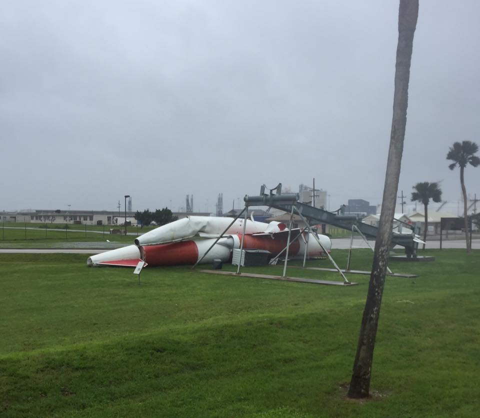
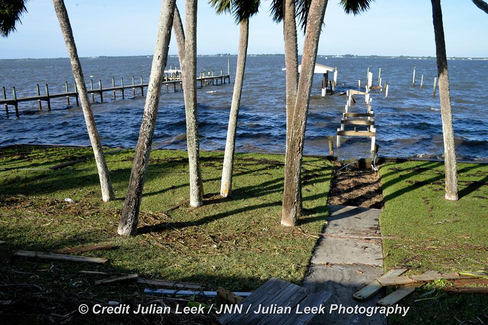
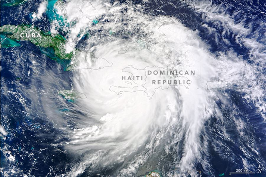
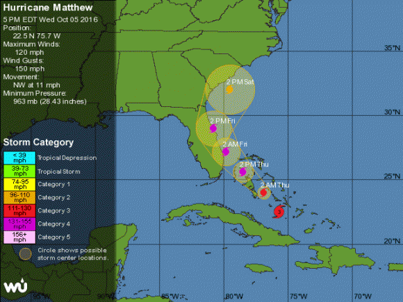
“Forecasting capabilities are going to be greatly increased,” NASA Launch Manager Tim Dunn said at the prelaunch media briefing at the Kennedy Space Center on Dec. 10. “As a Floridian, I will really appreciate that, certainly based on what we had to do this fall with Hurricane Matthew.”

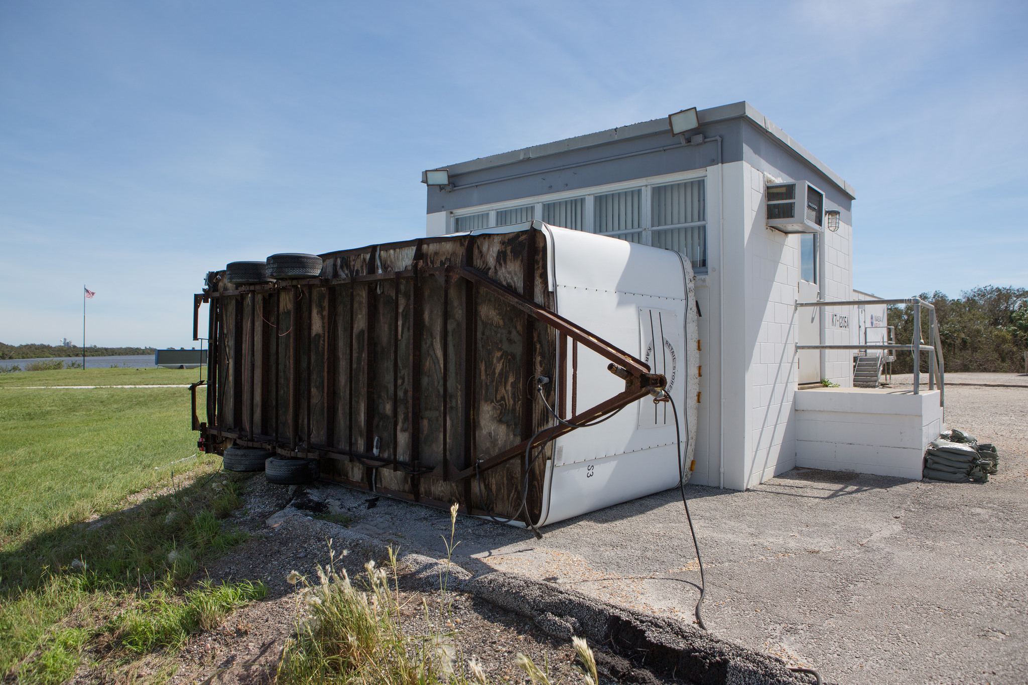
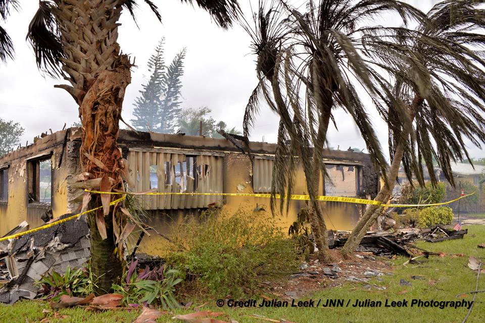
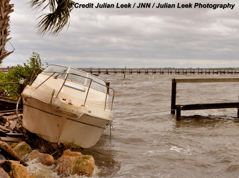
Indeed the CYGNSS launch was delayed by Hurricane Matthew, just like the NASA/NOAA GOES-R launch was also delayed from early to mid-November by the deadly Cat 4 storm.

The nominal mission lifetime for CYGNSS is two years but the team says they could potentially last as long as five years or more if the spacecraft continue functioning.

Pegasus launches from the Florida Space Coast are infrequent. The last once took place over 13 years ago.

Typically they take place from Vandenberg Air Force Base in California or the Reagan Test Range on the Kwajalein Atoll.

CYGNSS counts as the 20th Pegasus mission for NASA.

Flight deck of the Orbital ATK L-1011 Stargazer aircraft that will launch the Orbital ATK Pegasus XL rocket carrying NASA's CYGNSS payload to low Earth orbit.  Credit: Julian Leek
Flight deck of the Orbital ATK L-1011 Stargazer aircraft that will launch the Orbital ATK Pegasus XL rocket carrying NASA’s CYGNSS payload to low Earth orbit. Credit: Julian Leek

The CYGNSS spacecraft were built by Southwest Research Institute in San Antonio, Texas. Each one weighs approx 29 kg. The deployed solar panels measure 1.65 meters in length.

The Space Physics Research Laboratory at the University of Michigan College of Engineering in Ann Arbor leads overall mission execution in partnership with the Southwest Research Institute in San Antonio, Texas.

The Climate and Space Sciences and Engineering Department at the University of Michigan leads the science investigation, and the Earth Science Division of NASA’s Science Mission Directorate oversees the mission.

Stay tuned here for Ken’s continuing Earth and Planetary science and human spaceflight news.

Ken Kremer

An Orbital ATK technician checks the installation of two of the eight the CYGNSS microsatellites on their deployment module at Vandenberg Air Force Base in California.  Credits: Photo credit: USAF
An Orbital ATK technician checks the installation of two of the eight the CYGNSS microsatellites on their deployment module at Vandenberg Air Force Base in California. Credits: Photo credit: USAF
Flight crew for the Orbital ATK L-1011 Stargazer aircraft at the Skid Strip at Cape Canaveral Air Force Station in Florida who will drop and deploy Orbital ATK Pegasus XL rocket delivering NASA’s CYGUS micro satellites to LEO. Credit: Ken Kremer/kenkremer.com

SpaceX’s Space Coast Launch Facilities Escape Hurricane Matthew’s Wrath, May Resume Launches this Year

SpaceX is renovating Launch Complex 39A at the Kennedy Space Center for launches of the Falcon Heavy and human rated Falcon 9. Credit: Ken Kremer/kenkremer.com
SpaceX is renovating Launch Complex 39A at the Kennedy Space Center for launches of the Falcon Heavy and human rated Falcon 9.  Credit: Ken Kremer/kenkremer.com
SpaceX is renovating Launch Complex 39A at the Kennedy Space Center for launches of the Falcon Heavy and human rated Falcon 9. Credit: Ken Kremer/kenkremer.com

SpaceX’s key launch facilities on the Florida Space Coast escaped the wrath of Hurricane Matthew’s 100 mph wind gusts late last week, suffering only some exterior damage to the satellite processing building, a company spokesman confirmed to Universe Today.

Furthermore, the aerospace firm still hopes to resume launches of their Falcon 9 rocket before the end of this year following September’s rocket explosion, according to remarks made by SpaceX President Gwynne Shotwell over the weekend.

“Hurricane Matthew caused some damage to the exterior of SpaceX’s payload processing facility [PPF] at Space Launch Complex-40 at Cape Canaveral Air Force Station,” SpaceX spokesman John Taylor told Universe Today.

The payload processing facility (PPF) is the facility where the satellites and payloads are processed to prepare them for flight and launches on the firm’s commercial Falcon 9 rockets.

Some exterior panels were apparently blown out by the storm.

The looming threat of a direct hit by the Category 4 storm Hurricane Matthew on Friday, Oct. 7, on Cape Canaveral and the Kennedy Space Center (KSC) forced the closure of both facilities before the storm hit. They remained closed over the weekend except to emergency personal.

The deadly storm also caused some minor damage to the Kennedy Space Center and USAF facilities on the base.

Meanwhile competitor ULA also told me their facilities suffered only minor damage.

However the base closure will likely result in a few days launch delay of the ULA Atlas V rocket carrying the NASA/NOAA GOES-R weather satellite to geostationary orbit, which had been slated for Nov. 4.

The PPF is located on Cape Canaveral Air Force Station, a few miles south of the Falcon 9 launch pad at Space Launch Complex-40 (SLC-40).

The PPF is inside the former USAF Solid Motor Assembly Building (SMAB) used for the now retired Titan IV rockets.

Fortunately, SpaceX has another back-up facility at pad 40 where technicians and engineers can work to prepare the rocket payload for flight.

“The company has a ready and fully capable back-up for processing payloads at its SLC-40 hangar annex building,” Taylor elaborated.

SpaceX Falcon 9 rocket venting prior to launch scrub for SES-9 communications satellite on Feb. 26, 2016 from Pad 40 at Cape Canaveral, FL. Credit: Ken Kremer/kenkremer.com
SpaceX Falcon 9 rocket on pad 40 with backup processing hanger visible, prior to launch of SES-9 communications satellite in March 2016 at Cape Canaveral Air Force Station, FL. Credit: Ken Kremer/kenkremer.com

And except for the minor damage to the PPF facility where payloads are processed, SpaceX says there was no other damage to infrastructure at pad 40 or to Launch Complex 39A at the Kennedy Space Center.

“There was no damage the company’s facilities at Pad 39A at Kennedy Space Center,” Taylor told me.

SpaceX Falcon 9 rocket moments after catastrophic explosion destroys the rocket and Amos-6 Israeli satellite payload at launch pad 40 at Cape Canaveral Air Force Station, FL,  on Sept. 1, 2016.  A static hot fire test was planned ahead of scheduled launch on Sept. 3, 2016. Credit: USLaunchReport
SpaceX Falcon 9 rocket moments after catastrophic explosion destroys the rocket and Amos-6 Israeli satellite payload at launch pad 40 at Cape Canaveral Air Force Station, FL, on Sept. 1, 2016. A static hot fire test was planned ahead of scheduled launch on Sept. 3, 2016. Credit: USLaunchReport

However SLC-40 is not operational at this time, since it was heavily damaged during the Sept. 1 launch pad disaster when a Falcon 9 topped with the Israeli Amos-9 comsat exploded on the launch pad during a routine prelaunch fueling operation and a planned first stage static fire engine test.

Mangled SpaceX Falcon 9 strongback with dangling cables (at right) as seen on Sept. 7 after prelaunch explosion destroyed the rocket and AMOS-6 payload at Space Launch Complex-40 at Cape Canaveral Air Force Station, FL on Sept. 1, 2016 . Credit: Ken Kremer/kenkremer.com
Mangled SpaceX Falcon 9 strongback with dangling cables (at right) as seen on Sept. 7 after prelaunch explosion destroyed the rocket and AMOS-6 payload at Space Launch Complex-40 at Cape Canaveral Air Force Station, FL on Sept. 1, 2016. Credit: Ken Kremer/kenkremer.com

As SpaceX was launching Falcon 9 rockets from pad 40, they have been simultaneously renovating and refurbishing NASA’s former shuttle launch pad at Launch Complex 39A at the Kennedy Space Center (KSC) which they leased from NASA.

SpaceX plans to start launching their new Falcon Heavy booster from pad 39A in 2017 as well as human rated launches of the Falcon 9 with the Crew Dragon to the ISS.

However, following the pad 40 disaster, SpaceX announced plans to press pad 39A into service for commercial Falcon 9 satellite launches as well.

SpaceX President Gwynne Shotwell recently said that the company hoped to resume launches in November while they search for a root cause to the pad 40 catastrophe – as I reported here.

Speaking at the annual meeting of the National Academy of Engineering in Washington, D.C. on Oct. 9 Shotwell indicated that investigators are making progress to determine the cause of the mishap.

“We’re homing in on what happened,” she said, according to a story by Space News. “I think it’s going to point not to a vehicle issue or an engineering design issue but more of a business process issue.”

Space News said that she did not elaborate further.

Stay tuned here for Ken’s continuing Earth and Planetary science and human spaceflight news.

Ken Kremer

Launch of GOES-R Transformational Weather Satellite Likely Delayed by Hurricane Matthew

The NASA/NOAA GOES-R (Geostationary Operational Environmental Satellite - R Series) being processed at Astrotech Space Operations, in Titusville, FL, in advance of launch on a ULA Atlas V on Nov. 19, 2016. GOES-R will be America’s most advanced weather satellite. Credit: Ken Kremer/kenkremer.com
The NASA/NOAA GOES-R (Geostationary Operational Environmental Satellite - R Series) being processed at Astrotech Space Operations, in Titusville, FL, in advance of the planned launch on a ULS Atlas V on Nov 4, 2016.  GOES-R will be America’s most advanced weather satellite. Credit: Ken Kremer/kenkremer.com
The NASA/NOAA GOES-R (Geostationary Operational Environmental Satellite – R Series) being processed at Astrotech Space Operations, in Titusville, FL, in advance of the planned launch on a ULA Atlas V likely delayed from Nov 4, 2016 by Hurricane Matthew. GOES-R will be America’s most advanced weather satellite. Credit: Ken Kremer/kenkremer.com

Next month’s launch of GOES-R – a new and advanced transformational weather satellite that will vastly enhance the quality, speed and accuracy of weather forecasting – will likely be delayed a few days due to lingering storm related effects of deadly Hurricane Matthew on launch preparations at Cape Canaveral Air Force Station and the Kennedy Space Center (KSC), Universe Today confirmed with launch provider United Launch Alliance (ULA).

“The GOES-R launch will likely be delayed due to Hurricane Matthew,” ULA spokeswoman Lyn Chassagne told Universe Today.

Liftoff of the NASA/NOAA GOES-R (Geostationary Operational Environmental Satellite – R Series) weather satellite atop a United Launch Alliance (ULA) Atlas V rocket had been scheduled for Nov. 4 at 5:40 p.m. from Space Launch Complex 41 (SLC-41) on Cape Canaveral Air Force Station.

GOES-R is the first in a new series of American’s most powerful and most advanced next generation weather observation satellites.

It’s ironic that awful weather is impacting the launch of this critical weather satellite.

It’s not known how long any postponement would be – perhaps only a few days since preliminary indications are that the base suffered only minor damage and there are no reports of major damage.

“Our teams are still doing a damage assessment. So we don’t have a status about all of our infrastructure yet,” Chassagne told me.

“A preliminary assessment shows that we have some minor damage to a few of our facilities. We had no rockets on the pads. So there is no damage to hardware.”

Damage assessment teams are evaluating the launch pad and launch facilities in detail right now.

“Since we still have emergency response teams in assessing, we don’t know how long the delay will be until we get those assessments.”

The NASA/NOAA GOES-R (Geostationary Operational Environmental Satellite - R Series) being processed at Astrotech Space Operations, in Titusville, FL, in advance of the planned launch on a ULA Atlas V likely delayed from Nov 4, 2016 by Hurricane Matthew.  GOES-R will be America’s most advanced weather satellite. Credit: Ken Kremer/kenkremer.com
The NASA/NOAA GOES-R (Geostationary Operational Environmental Satellite – R Series) being processed at Astrotech Space Operations, in Titusville, FL, in advance of the planned launch on a ULA Atlas V likely delayed from Nov 4, 2016 by Hurricane Matthew. GOES-R will be America’s most advanced weather satellite. Credit: Ken Kremer/kenkremer.com

The looming threat of a direct hit on Cape Canaveral and KSC from the Category 4 storm Hurricane Matthew on Friday, Oct. 7, forced the closure of both facilities before the storm hit. They remained closed this weekend except to emergency personal.

“Got in today to assess. Light to moderate damage to our facilities. No damage to any flight assets,” tweeted ULA CEO Tory Bruno.

The base closures therefore also forced a halt to launch preparations at the Cape and pad 41.

The storm grazed by the Kennedy Space Center (KSC), Cape Canaveral Air Force Station (CCAFS) and the major population centers along the Florida Space Coast with wind gusts up to 107 mph – rather than making a direct impact as feared.

“Hurricane Matthew passed Cape Canaveral and Kennedy Space Center …. with sustained winds of 90 mph with gusts to 107 mph,” on Friday, NASA officials reported.

The storm passed “the space center about 26 miles off the tip of Cape Canaveral.”

Cat 4 Hurricane Matthew track during the late evening of 6 Oct 2016.  Credit: NASA/NOAA
Cat 4 Hurricane Matthew track during the late evening of 6 Oct 2016. Credit: NASA/NOAA

The launch ULA facilities are now being thoroughly inspected before any launch preparation can proceed.

The satellite is in the final stages of preparation at the Astrotech Space Operations Facility in Titusville, FL as I recently observed during an up close visit in the High Bay cleanroom.

Check out this amazing rooftop video showing the high winds pummeling Titusville during Hurricane Matthew just a few miles away from Astrotech and the GOES-R satellite – from my space colleague Jeff Seibert.

Video caption: Before we bailed out on Thursday afternoon, I clamped one of my launch pad remote cameras to the power service post on our roof. Wind is blocked a lot by trees but none fell on the house. The highest recorded wind speed was 51mph at 7:30AM on Oct. 7, 2016. The minimum barometric pressure was 28.79″ from 8:20 – 9 AM. We got 5.9″ of rain. The ridge line faces due east. We never lost power. Credit: Jeff Seibert

Lockheed Martin is the prime contractor for GOES-R.

United Launch Alliance Atlas V rocket lifts off from Space Launch Complex 41 at Cape Canaveral Air Force Station carrying NASA’s Origins, Spectral Interpretation, Resource Identification, Security-Regolith Explorer, or OSIRIS-REx spacecraft on the first U.S. mission to sample an asteroid, retrieve at least two ounces of surface material and return it to Earth for study.  Liftoff was at 7:05 p.m. EDT on September 8, 2016 in this remote camera view taken from inside the launch pad perimeter.  Note the newly install crew access arm and white room for astronaut flights atop Atlas starting in early 2018.   Credit: Ken Kremer/kenkremer.com
United Launch Alliance Atlas V rocket lifts off from Space Launch Complex 41 at Cape Canaveral Air Force Station carrying NASA’s Origins, Spectral Interpretation, Resource Identification, Security-Regolith Explorer, or OSIRIS-REx spacecraft on the first U.S. mission to sample an asteroid on September 8, 2016. GOES-R launch on an Atlas V planned for Nov. 4 is likely delayed due to Hurricane Matthew. Credit: Ken Kremer/kenkremer.com

Whenever it does launch, GOES-R will blast off on a ULA Atlas V in the very powerful 541 configuration, augmented by four solid rocket booster on the first stage.

It will be launched to a Geostationary orbit some 22,300 miles above Earth.

But ULA has not yet begun assembling the Atlas V booster inside the Vertical Integration Facility (VIF) at SLC-41 due to the storm.

Because of Hurricane Matthew, the first stage arrival had to be postponed. The second stage is already in port at the Delta operations center and being integrated.

“The first stage booster is not yet at the Cape,” Chassagne confirmed.

However, conditions at the Cape have improved sufficiently for the US Air Force to clear its shipment into port, as of this evening.

“We just cleared CCAFS to be able to accept a booster for the GOES-R launch–how appropriate that GOES is a weather satellite!” wrote Brig. Gen. Wayne Monteith, commander of the Air Force’s 45th Space Wing at Patrick Air Force Base, in a Facebook update late today, Oct. 9.

“We are returning to full mission capability and our status as the World’s Premier Gateway to Space.”

Artists concept for  NASA/NOAA GOES-R (Geostationary Operational Environmental Satellite - R Series) advanced weather satellite in Earth orbit. Credit: NASA/NOAA
Artists concept for NASA/NOAA GOES-R (Geostationary Operational Environmental Satellite – R Series) advanced weather satellite in Earth orbit. Credit: NASA/NOAA

Stay tuned here for Ken’s continuing Earth and Planetary science and human spaceflight news.

Ken Kremer

GOES-R logo.  Credit: NASA/NOAA
GOES-R logo. Credit: NASA/NOAA

Hurricane Matthew Grazes Kennedy Space Center and Cape Canaveral

Aerial view of the Vehicle Assembly Building (VAB) at NASA’s Kennedy Space Center (KSC) on Oct. 8, 2016 by damage assessment and recovery team surveying the damage at KSC the day after Hurricane Matthew passed by Cape Canaveral on Oct. 7, 2016 packing sustained winds of 90 mph with gusts to 107 mph. Credit: NASA/Cory Huston
Aerial view of the Vehicle Assembly Building (VAB) at NASA’s Kennedy Space Center (KSC) on Oct. 8, 2016 by damage assessment and recovery team surveying the damage at KSC the day after Hurricane Matthew passed by Cape Canaveral on Oct. 7, 2016 packing sustained winds of 90 mph with gusts to 107 mph.  Credit: NASA/Cory Huston
Aerial view of the Vehicle Assembly Building (VAB) at NASA’s Kennedy Space Center (KSC) on Oct. 8, 2016 by damage assessment and recovery team surveying the damage at KSC the day after Hurricane Matthew passed by Cape Canaveral on Oct. 7, 2016 packing sustained winds of 90 mph with gusts to 107 mph. Credit: NASA/Cory Huston

The Kennedy Space Center (KSC), Cape Canaveral Air Force Station (CCAFS) and the major population centers along the Florida Space Coast were spared from major damage to infrastructure, homes and business after the deadly Cat 4 Hurricane Matthew grazed the region with 107 mph winds rather than making a direct impact as feared.

Although some of the base and Space Coast coastal and residential areas did suffer significant destruction most were very lucky to have escaped the hurricanes onslaught in relatively good shape, when it stayed at sea rather than making the forecast direct hit.

KSC’s iconic 525 foot tall Vehicle Assembly Building (VAB), the Complex 39 launch pads and the active launch pads at CCAFS are all standing and intact – as damage evaluations are currently underway by damage assessment and recovery teams from NASA and the US Air Force.

As Hurricane Matthew approached from the south Friday morning Oct. 7 along Florida’s Atlantic coastline, it wobbled east and west, until it finally veered ever so slightly some 5 miles to the East – thus saving much of the Space Coast launch facilities and hundreds of thousands of home and businesses from catastrophic damage from the expected winds and storm surges.

“Hurricane Matthew passed Cape Canaveral and Kennedy Space Center …. with sustained winds of 90 mph with gusts to 107 mph,” on Friday, NASA officials reported.

The storm passed “the space center about 26 miles off the tip of Cape Canaveral.”

Cat 4 Hurricane Matthew track during the late evening of 6 Oct 2016.  Credit: NASA/NOAA
Cat 4 Hurricane Matthew track during the late evening of 6 Oct 2016. Credit: NASA/NOAA

KSC and CCAFS did suffer some damage to buildings, downed power lines and some flooding and remains closed.

The Damage Assessment and Recovery Teams have entered the facilities today, Oct. 8, and are surveying the areas right now to learn the extent of the damage and report on when they can reopen for normal operations.

“After the initial inspection flight Saturday morning, it was determined that the center received some isolated roof damage, damaged support buildings, a few downed power lines, and limited water intrusion,” NASA reported late today.

Hurricane force wind from Hurricane Matthew throw a concession stand up against the Spaceflight Now building at the LC 39 Press Site at the Kennedy Space Center in Florida on Oct. 7, 2016.  Credit: NASA/Cory Huston
Hurricane force wind from Hurricane Matthew throw a concession stand up against the Spaceflight Now building at the LC 39 Press Site at the Kennedy Space Center in Florida on Oct. 7, 2016. Credit: NASA/Cory Huston

Inspection teams are methodically going from building to building this weekend to assess Matthew’s impact.

“Since safety is our utmost concern, teams of inspectors are going from building-to-building assessing damage.”

It will take time to determine when the center can resume operations.

“Due to the complexity of this effort, teams need time to thoroughly inspect all buildings and roads prior to opening the Kennedy Space Center for regular business operations.”

Not until after a full inspection of the center will a list of damaged buildings and equipment be available. The next update will be available no earlier than Sunday afternoon.

A “ride-out team” of 116 remained at KSC and at work inside the emergency operations center in the Launch Control Center located adjacent to the VAB during the entire Hurricane period.

View of the Vehicle Assembly Building (VAB), Launch Control Center and Mobile Launcher from the KSC Launch Complex 39 Press Site.   NASA is upgrading the VAB with new platforms to assemble and launch  NASA’s Space Launch System rocket at the Kennedy Space Center in Florida.  Credit: Ken Kremer/kenkremer.com
View of the Vehicle Assembly Building (VAB), Launch Control Center and Mobile Launcher from the KSC Launch Complex 39 Press Site. NASA is upgrading the VAB with new platforms to assemble and launch NASA’s Space Launch System rocket at the Kennedy Space Center in Florida. Credit: Ken Kremer/kenkremer.com

It took until Friday afternoon for winds to drop below 40 knots start preliminary damage assessments.

“KSC is now in a “Weather Safe” condition as of 2 p.m. Friday. While there is damage to numerous facilities at KSC, it consists largely roof damage, window damage, water intrusion, damage to modular buildings and to building siding.”

Teams are also assessing the CCAFS launch pads, buildings and infrastructure. Some buildings suffered severe damage.

“We have survived a catastrophic event that could have easily been cataclysmic. It is only by grace and a slight turn in Matthew’s path that our base and our barrier island homes were not destroyed or covered in seven feet of water,” wrote Brig. Gen. Wayne Monteith, commander of the Air Force’s 45th Space Wing at Patrick Air Force Base, in a Facebook update.

“There is a lot of debris throughout the base.”

“We are still experiencing deficiencies in critical infrastructure, consistent power, emergency services, communications and hazardous material inspections that make portions of our base uninhabitable or potentially dangerous.”

Severely damaged building on Cape Canaveral Air Force Station.  Credit: 45th Space Wing
Severely damaged building on Cape Canaveral Air Force Station. Credit: 45th Space Wing

Of particular importance is Space Launch Complex 41 (SLC-41) where the next scheduled liftoff is slated for Nov. 4.

The launch involves America’s newest and most advanced weather satellite on Nov 4. It’s named GOES-R and was slated for blastoff from Cape Canaveral Air Force Station pad 41 atop a United Launch Alliance (ULA) Atlas V rocket.

The launch facilities will have to be thoroughly inspected before the launch can proceed.

The satellite is in the final stages of preparation at the Astrotech Space Operations Facility in Titusville, FL as I recently observed during an up close visit in the High Bay cleanroom.

The NASA/NOAA GOES-R (Geostationary Operational Environmental Satellite - R Series) being processed at Astrotech Space Operations, in Titusville, FL, in advance of the planned launch on a ULS Atlas V on Nov 4, 2016.  GOES-R will be America’s most advanced weather satellite. Credit: Ken Kremer/kenkremer.com
The NASA/NOAA GOES-R (Geostationary Operational Environmental Satellite – R Series) being processed at Astrotech Space Operations, in Titusville, FL, in advance of the planned launch on a ULA Atlas V on Nov 4, 2016. GOES-R will be America’s most advanced weather satellite. Credit: Ken Kremer/kenkremer.com

The major Space Coast cities in Brevard county suffered much less damage then feared, although some 500,000 residents lost power.

Local government officials allowed most causeway bridges to the barrier islands to be reopened by Friday evening, several local colleagues told me.

Here’s some images of damage to the coastal piers, town and a destroyed house from the Melbourne Beach and Satellite Beach areas from my space colleague Julian Leek.

Home destroyed by fire in Satellite Beach. Credit: Julian Leek
Local damage in South Melbourne Beach. Credit: Julian Leek

Stay tuned here for Ken’s continuing Earth and Planetary science and human spaceflight news.

Ken Kremer

Navaho missile on display at the CCAFS south gate suffered severe damage from Hurricane Matthew and crumpled to the ground.  Credit: 45th Space Wing
Navaho missile on display at the CCAFS south gate suffered severe damage from Hurricane Matthew and crumpled to the ground. Credit: 45th Space Wing
Local damage in South Melbourne Beach. Credit: Julian Leek

Imminent Impact of Deadly Cat 4 Hurricane Matthew Forces Closure of Kennedy Space Center and Mass Coastal Evacuations

Cat 4 Hurricane Matthew track during the late evening of 6 Oct 2016. Credit: NASA/NOAA
Cat 4 Hurricane Matthew track during the late evening of 6 Oct 2016.  Credit: NASA/NOAA
Cat 4 Hurricane Matthew track during the late evening of 6 Oct 2016. Credit: NASA/NOAA

The imminent impact of the already deadly Category 4 Hurricane Matthew along the Florida Space Coast tonight, Thursday, October 6, has forced the closure of NASA’s Kennedy Space Center (KSC) and mass evacuations along the US East coast from Florida, to Georgia to the Carolinas.

“Hurricane Matthew, currently an extremely dangerous Category 4 storm on the Saffir-Simpson Hurricane Wind Scale, continues to bear down on the southeastern United States,” says NASA in an update today.

NASA has closed KSC for today and tomorrow, at a minimum and the center has entered HurrCon 1 status.

“Under the current storm track, peak winds are forecast to be 125 mph sustained with gusts to 150 mph, however a shift in the track even slightly could improve the wind forecast somewhat,” wrote NASA’s Brian Dunbar.

“The Kennedy Space Center is closed today, Oct. 6, and Friday for Hurricane Matthew. Kennedy Space Center is now in HurrCon 1 status, meaning a hurricane is imminent.”

The Kennedy Space Center on Florida’s Space Coast is home to the iconic Vehicle Assembly Building (VAB) – the most well known building at NASA – as well as Launch Complex’s 39 A and B which launched American astronauts to Moon and thereafter Space Shuttles for three decades.

The launch pads sit precariously close to the Atlantic Ocean shoreline – just a few hundred yards (meters) away!

View of the VAB and Mobile Launcher from the KSC Launch Complex 39 Press Site.   NASA is upgrading the VAB with new platforms to assemble and launch  NASA’s Space Launch System rocket at the Kennedy Space Center in Florida.  Credit: Ken Kremer/kenkremer.com
View of the VAB and Mobile Launcher from the KSC Launch Complex 39 Press Site. NASA is upgrading the VAB with new platforms to assemble and launch NASA’s Space Launch System rocket at the Kennedy Space Center in Florida. Credit: Ken Kremer/kenkremer.com

“Across the spaceport, essential personnel are preparing facilities for the storm’s arrival,” according to George Diller, NASA Kennedy Space Center Public Affairs Officer.

“Hurricane Matthew is expected to make its closest approach to the Cape Canaveral/Kennedy area overnight Thursday and into Friday morning, bringing with it the potential for heavy rain, storm surge and hurricane-force winds.”

The last time a major Hurricane impacted near KSC and the Space Coast was in 2004. The VAB suffered some outside damage.

The Kennedy Space Center Visitor Complex is also closed on Thursday, October 6 and Friday, October 7.

Hurricane Matthew is bearing down on the US East Coast right now at Florida’s Peninsula and is tracking north.

This visible image on Oct. 6 at 1:00 p.m. EDT from NOAA's GOES-East satellite shows Hurricane Matthew as it regained Category 4 Hurricane Status.  Credits: NASA/NOAA GOES Project
This visible image on Oct. 6 at 1:00 p.m. EDT from NOAA’s GOES-East satellite shows Hurricane Matthew as it regained Category 4 Hurricane Status. Credits: NASA/NOAA GOES Project

Herein is the latest satellite imagery from NASA and NOAA of this evening.

Mass evacuations have been ordered and States of Emergencies declared by the Governors of Florida, Georgia and North and South Carolina.

The high winds, storm surge of potentially 5 to 11 feet, drenching rains and extensive flooding is expected to cause massive damage and devastation to homes, businesses and infrastructure.

Cat 4 Hurricane Matthew track during the late evening of 6 Oct 2016.  Credit: NASA/NOAA
Cat 4 Hurricane Matthew track during the late evening of 6 Oct 2016. Credit: NASA/NOAA

Hundreds of thousands of folks have left their home over the past 2 days. Many gas stations are dry and grocery store shelves emptied.

Matthew will cause a wide swath of destruction and potentially deaths along hundreds of miles of US shoreline and inland areas as the massive storm hugs the coast like none before in recorded history.

Furthermore, hundreds of thousands of folks are expected to lose power as well, for days and perhaps weeks.

Hundreds of deaths and massive destruction in Haiti, Cuba and elsewhere in the Caribbean can already be blamed on Hurricane Matthew – a storm like none other and by far the worst since Superstorm Sandy and Hurricane Katrina.

After the storm passes KSC will evaluate all its facilities.

“Once the storm has passed, center facilities and infrastructure will be assessed and employees will be cleared to return when it is safe to do so,” Diller.

Indeed NASA was preparing to launch America’s newest and most advanced weather satellite on Nov 4. It’s named GOES-R and was slated for blastoff from Cape Canaveral Air Force Station atop a ULA Atlas V on Nov. 4.

The launch facilities will have to be thoroughly inspected before the launch can proceed.

The satellite is in the final stages of preparation at the Astrotech Space Operations Facility in Titusville, FL as I recently observed during an up close visit in the High Bay cleanroom.

Titusville and Astrotech could suffer a direct hit from Matthew. But the satellite has been secured.

The NASA/NOAA GOES-R (Geostationary Operational Environmental Satellite - R Series) being processed at Astrotech Space Operations, in Titusville, FL, in advance of the planned launch on a ULS Atlas V on Nov 4, 2016.  GOES-R will be America’s most advanced weather satellite. Credit: Ken Kremer/kenkremer.com
The NASA/NOAA GOES-R (Geostationary Operational Environmental Satellite – R Series) being processed at Astrotech Space Operations, in Titusville, FL, in advance of the planned launch on a ULS Atlas V on Nov 4, 2016. GOES-R will be America’s most advanced weather satellite. Credit: Ken Kremer/kenkremer.com

Here is the latest Advisory from the National Hurricane Center (NHC) as of 8 PM EDT Oct 6.

At 800 PM EDT (0000 UTC), the eye of Hurricane Matthew was located over the western end of Grand Bahama Island near latitude 26.6 North, longitude 78.9 West. The hurricane is moving toward the northwest near 13 mph (20 km/h), and this general motion is expected to continue tonight with a turn toward the north-northwest early Friday. On the forecast track, the eye of Matthew should move away from Grand Bahama Island during the next few hours, and move close to or over the east coast of the Florida peninsula through Friday night.

Reports from a NOAA Hurricane Hunter aircraft indicate that maximum sustained winds are now near 130 mph (210 km/h) with higher gusts. Matthew is a category 4 hurricane on the Saffir-Simpson Hurricane Wind Scale. Some fluctuations in intensity are likely while the hurricane moves toward the coast of Florida.

Hurricane-force winds extend outward up to 60 miles (95 km) from the center and tropical-storm-force winds extend outward up to 185 miles (295 km). Settlement Point in the Bahamas recently reported a sustained wind of 79 mph (128 km/h) with a gust of 105 mph (169 km/hr). The Lake Worth Pier near Palm Beach, Florida, recently reported a sustained wind of 46 mph (74 km/h) and a wind gust of 60 mph (96 km/h).

The minimum central pressure estimated from NOAA Hurricane Hunter data is 939 mb (27.73 inches).

…….

The latest weather briefing indicates that “tropical storm force winds beginning at Cape Canaveral tonight at midnight with hurricane force winds starting at about 6 a.m.

A hurricane ride-out crew of 116 has arrived at KSC this evening to prepare for Matthew.

“All facilities at Kennedy Space Center and Cape Canaveral Air Force Station have been secured.”

SpaceX is currently renovating and refurbishing pad 39A to launch their commercial Falcon 9 and Falcon Heavy rockets as well the Crew Dragon with astronauts on mission to the ISS.

The eye of the storm is barreling towards KSC at this moment. Stay tuned for the outcome.

SpaceX is renovating Launch Complex 39A at the Kennedy Space Center for launches of the Falcon Heavy and human rated Falcon 9.  Credit: Ken Kremer/kenkremer.com
SpaceX is renovating Launch Complex 39A at the Kennedy Space Center for launches of the Falcon Heavy and human rated Falcon 9. Credit: Ken Kremer/kenkremer.com

Stay tuned here for Ken’s continuing Earth and Planetary science and human spaceflight news.

Ken Kremer

Satellite Views Show Hurricane Matthew Moving Towards U.S.

On October 4, 2016, Hurricane Matthew made landfall on southwestern Haiti as a category-4 storm—the strongest storm to hit the Caribbean nation in more than 50 years. Just hours after landfall, the Moderate Resolution Imaging Spectroradiometer (MODIS) on NASA’s Terra satellite acquired this natural-color image. At the time, Matthew had top sustained winds of about 230 kilometers (145 miles) per hour. Credit: NASA Earth Observatory image by Joshua Stevens

As Hurricane Matthew approaches the east coast of Florida, the evacuation of hundreds of thousands of people is taking place in Florida and South Carolina. Forecasters say the conditions appear to be favorable for the storm to restrengthen after it caused major damage to western Haiti and eastern Cuba. Matthew is now heading toward Florida, bringing with it the potential for heavy rain, storm surges and hurricane-force winds. The expected maximum sustained winds could be 130 mph (210 km/hr), and it could be the strongest hurricane to hit the region in 11 years

The National Hurricane Center said “Matthew is moving toward the northwest near 12 mph (19 kph), and this motion is expected to continue during the next 24 to 48 hours. On this track, Matthew will be moving across the Bahamas through Thursday, and is expected to be very near the east coast of Florida by Thursday evening, Oct. 6.”

The image above was taken by NASA’s Terra satellite on October 4, 2016, showing the hurricane over the eastern tip of Cuba and the eastern-most extent over Puerto Rico. Reports say it was the strongest storm to hit the Caribbean nation in more than 50 years.

Cameras on board the International Space Station captured these views of Hurricane Matthew today (October 5) as the now Category 3 storm moved to the north of Cuba:

NASA’s Kennedy Space Center released a statement that they closed at 1 p.m. today due to the approach of the hurricane, with essential personnel preparing facilities for the storm’s arrival.

Stu Ostro, a senior meteorologist at The Weather Channel, tweeted a satellite image of the hurricane, which has gone viral, which some say shows a face with a fiery eye, teeth and a sinister smile.

WeatherUnderground is tracking the storm and as of 6:00 pm ET on October 5, this was the projected path of the storm. You can click the image (or this link) to get the current tracking data on WeatherUnderground.

Projected path for Hurricane Matthew as of October 5, 2016. Click for updated map on WeatherUnderground.com.

This animation of NOAA’s GOES-East satellite imagery from Oct. 3 to Oct. 5 shows Hurricane Matthew make landfall on Oct. 4 in western Haiti and move toward the Bahamas on Oct. 5.

NOAA said tropical storm or hurricane conditions could affect South Carolina and North Carolina later this week or this weekend, even if the center of Matthew remains offshore, adding that “it is too soon to determine what, if any, land areas might be directly affected by Matthew next week. At a minimum, dangerous beach and boating conditions are
likely along much of the U.S. east coast during the next several days.”

For additional information see:
NASA’s page on Hurricane Matthew
NASA’s Earth Observatory website
National Hurricane Center