Here’s What Really Happened to That Camera That Melted During a Rocket Launch

NASA Photographer Bill Ingalls's camera after it was caught in brushfire caused by the launch of the NASA/German GRACE-FO from Vandenberg Air Force Base on May 22, 2018. Credits: NASA/Bill Ingalls

NASA photographers have always understood that taking pictures of space launches is a risky business. No one is more familiar with this than Bill Ingalls, a NASA photographer who has taking pictures for the agency for the past 30 years. Both within the agency and without, his creativity and efforts are well known, as his ability to always know exactly where to set up his cameras to get the perfect shots.

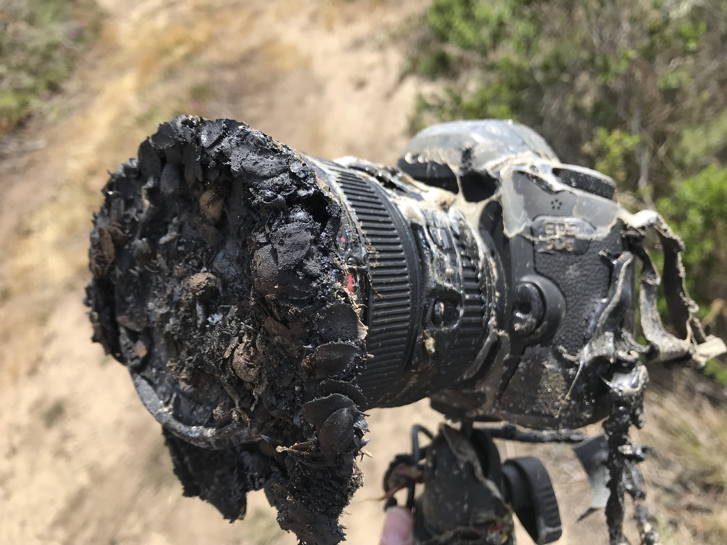
Which naturally begs the question, what happened to the camera featured in the image above? This photograph, which shows one of Ingalls remote cameras thoroughly-melted, has been making the rounds on social media of late. As the accompanying gif (seen below) shows, the camera was not far from the launch pad and was then quickly consumed by the resulting fire.

As Ingalls explained in a recent NASA press release, the destruction of the camera was the result of an unexpected brush fire that was triggered when flames from the launching rocket set some of the nearby grass on fire.

“I had six remotes, two outside the launch pad safety perimeter and four inside,” he said. “Unfortunately, the launch started a grass fire that toasted one of the cameras outside the perimeter.”

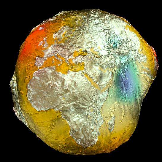
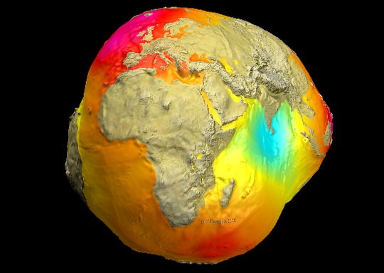
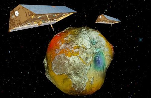
The event he was photographing was the launch of the NASA/German Gravity Recovery and Climate Experiment Follow-on (GRACE-FO) satellite, which took place at Vandenberg Air Force Base on May 22nd, 2018. As part of a partnership between NASA and the German Research Center for Geosciences (GFZ), this satellite is the successor to the original GRACE mission, which began orbiting Earth on March 17th, 2002.

Unfortunately, the launch triggered a brush fire which engulfed the camera and cause its body to melt. Firefighters reported to the scene to put out the fire, who then met Ingalls where he returned to the site. Luckily for Ingalls, and the viewing public, he was able to force open the body and retrieve the memory card, which had not been damaged. As a result, the footage of the fire as it approached the camera was caught.

NASA Photographer Bill Ingalls’s remote camera setup before the NASA/German GRACE-FO launch from Vandenberg Air Force Base on May 22, 2018. Credits: NASA/Bill Ingalls

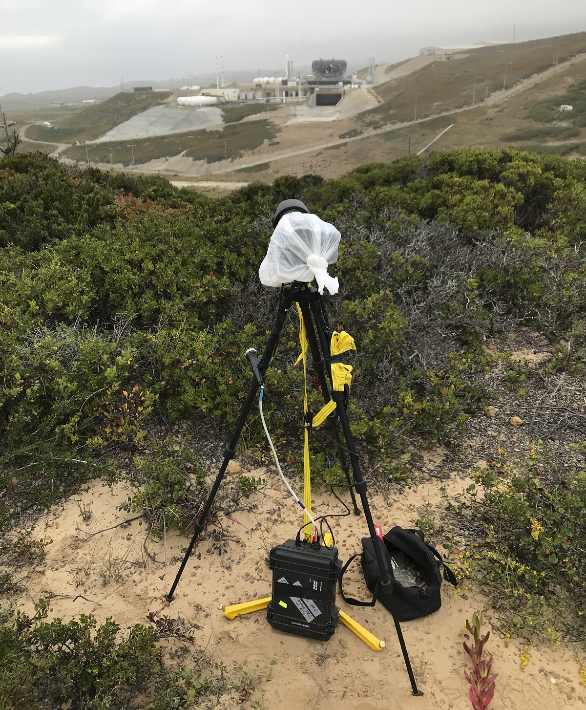
Oddly enough, this camera was the one posted furthest from the launch pad, about 400 meters (a quarter of a mile) away. The four other cameras that were set up inside the perimeter were undamaged, as was the other remote camera. But before anyone starts thinking that this remote was the unfortunate one, the “toasty” camera, as Ingalls calls it, is likely to put on display at NASA Headquarters in Washington, DC.

In the meantime, Ingalls will be traveling to Kazakhstan to photograph the June 3rd landing of the International Space Station’s Expedition 55 crew. He anticipates that that assignment, unlike this last one, will have no surprises!

Further Reading: NASA

The “Potsdam Gravity Potato” Shows Variations in Earth’s Gravity

The Geoid 2011 model, based on data from LAGEOS, GRACE, GOCE and surface data. Credit: GFZ

People tend to think of gravity here on Earth as a uniform and consistent thing. Stand anywhere on the globe, at any time of year, and you’ll feel the same downward pull of a single G. But in fact, Earth’s gravitational field is subject to variations that occur over time. This is due to a combination of factors, such as the uneven distributions of mass in the oceans, continents, and deep interior, as well as climate-related variables like the water balance of continents, and the melting or growing of glaciers.

And now, for the first time ever, these variations have been captured in the image known as the “Potsdam Gravity Potato” –  a visualization of the Earth’s gravity field model produced by the German Research Center for Geophysics’ (GFZ) Helmholtz’s Center in Potsdam, Germany.

And as you can see from the image above, it bears a striking resemblance to a potato. But what is more striking is the fact that through these models, the Earth’s gravitational field is depicted not as a solid body, but as a dynamic surface that varies over time.This new gravity field model (which is designated EIGEN-6C) was made using measurements obtained from the LAGEOS, GRACE, and GOCE satellites, as well as ground-based gravity measurements and data from the satellite altimetry.

The Geoid 2005 model, which was based on data of two satellites (CHAMP and GRACE) plus surface data. Credit: GFZ
The 2005 model, which was based on data from the CHAMP and GRACE satellites and surface data, was less refined than the latest one. Credit: GFZ

Compared to the previous model obtained in 2005 (shown above), EIGEN-6C has a fourfold increase in spatial resolution.

“Of particular importance is the inclusion of measurements from the satellite GOCE, from which the GFZ did its own calculation of the gravitational field,” says Dr. Christoph Foerste who directs the gravity field work group at GFZ along with Dr. Frank Flechtner.

The ESA mission GOCE (Gravity Field and Steady-State Ocean Circulation Explorer) was launched in mid-March 2009 and has since been measuring the Earth’s gravitational field using satellite gradiometry – the study and measurement of variations in the acceleration due to gravity.

“This allows the measurement of gravity in inaccessible regions with unprecedented accuracy, for example in Central Africa and the Himalayas,” said Dr. Flechtner. In addition, the GOCE satellites offers advantages when it comes to measuring the oceans.

Within the many open spaces that lie under the sea, the Earth’s gravity field shows variations. GOCE is able to better map these, as well as deviations in the ocean’s surface – a factor known as “dynamic ocean topography” – which is a result of Earth’s gravity affecting the ocean’s surface equilibrium.

Twin-satellites GRACE with the earth's gravity field (vertically enhanceded) calculated from CHAMP data. Credit: GFZ
Twin-satellites GRACE with the earth’s gravity field (vertically enhanced) calculated from CHAMP data. Credit: GFZ

Long-term measurement data from the GFZ’s twin-satellite mission GRACE (Gravity Recovery And Climate Experiment) were also included in the model. By monitoring climate-based variables like the melting of large glaciers in the polar regions and the amount of seasonal water stored in large river systems, GRACE was able to determine the influence of large-scale temporal changes on the gravitational field.

Given the temporal nature of climate-related processes – not to mention the role played by Climate Change – ongoing missions are needed to see how they effect our planet long-term. Especially since the GRACE mission is scheduled to end in 2015.

In total, some 800 million observations went into the computation of the final model which is composed of more than 75,000 parameters representing the global gravitational field. The GOCE satellite alone made 27,000 orbits during its period of service (between March 2009 and November 2013) in order to collect data on the variations in the Earth’s gravitational field.

The final result achieved centimeter accuracy, and can serve as a global reference for sea levels and heights. Beyond the “gravity community,” the research has also piqued the interest of researchers in aerospace engineering, atmospheric sciences, and space debris.

But above all else, it offers scientists a way of imaging the world that is different from, but still complimentary to, approaches based on light, magnetism, and seismic waves. And it could be used for everything from determining the speed of ocean currents from space, monitoring rising sea levels and melting ice sheets, to uncovering hidden features of continental geology and even peeking at the convection force driving plate tectonics.

Further Reading: GFZ