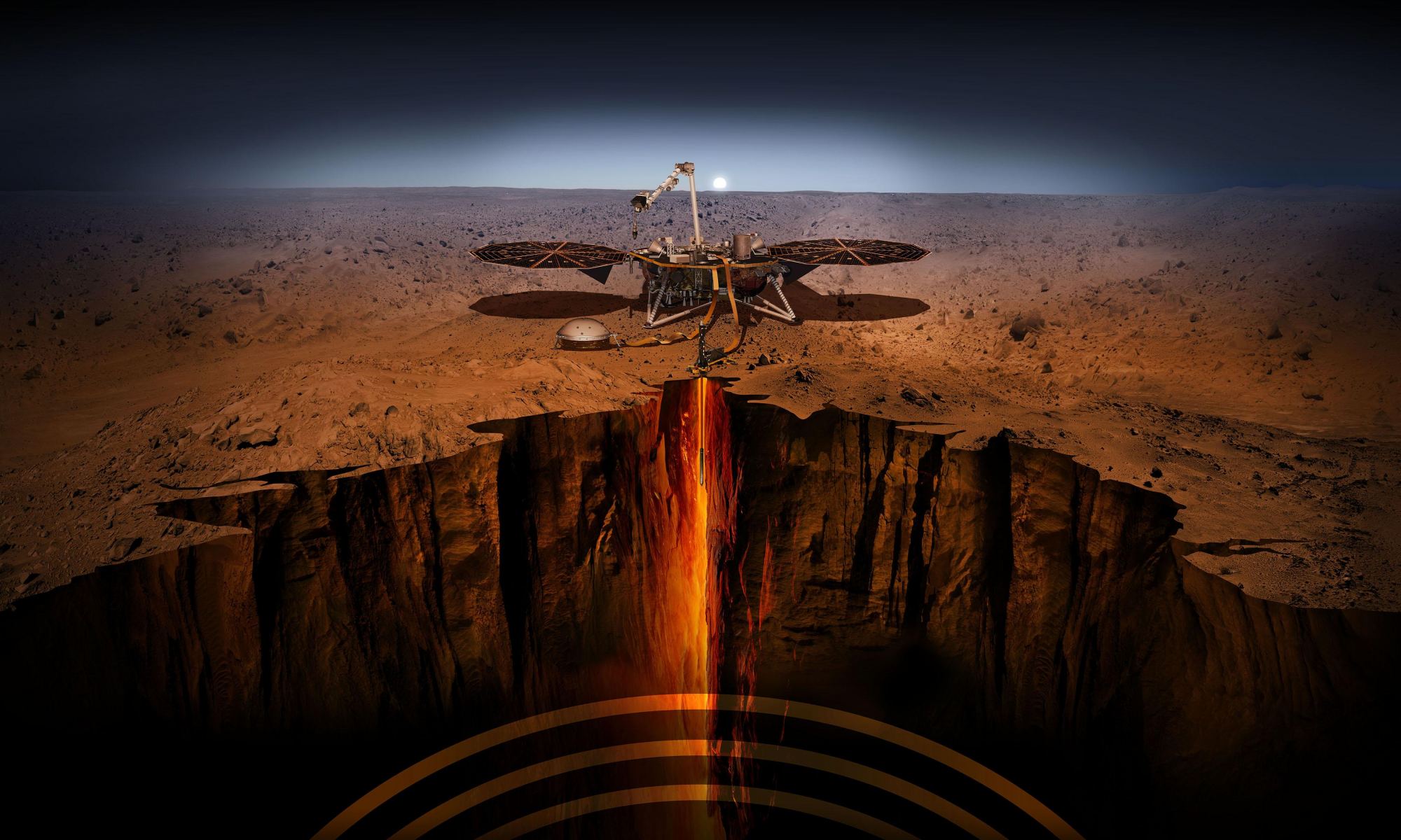
Artist's concept of InSight "taking the pulse of Mars". Credit: NASA/JPL-Caltech
On November 26th, 2018, NASA’s Interior Exploration using Seismic Investigations, Geodesy, and Heat Transport (InSight) mission landed on Mars. This was a major milestone in Mars exploration since it was the first time a research station had been deployed to the surface to probe the planet’s interior. One of the most important instruments InSight would use to do this was the Heat Flow and Physical Properties Package (HP3) developed by the German Aerospace Center (DLR). Also known as the Martian Mole, this instrument measured the heat flow from deep inside the planet for four years.
The HP3 was designed to dig up to five meters (~16.5 ft) into the surface to sense heat deeper in Mars’ interior. Unfortunately, the Mole struggled to burrow itself and eventually got just beneath the surface, which was a surprise to scientists. Nevertheless, the Mole gathered considerable data on the daily and seasonal fluctuations below the surface. Analysis of this data by a team from the German Aerospace Center (DLR) has yielded new insight into why Martian soil is so “crusty.” According to their findings, temperatures in the top 40 cm (~16 inches) of the Martian surface lead to the formation of salt films that harden the soil.
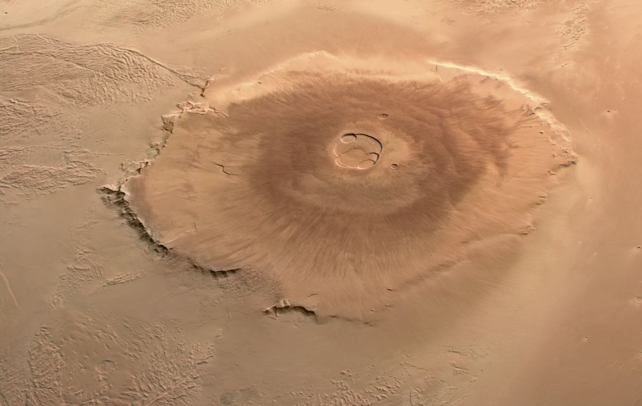
Olympus Mons, captured by the ESA's Mars Express mission from orbit. Credit: ESA/DLR/FUBerlin/AndreaLuck
Olympus Mons, located at the northwest edge of the Tharsis Montes region on Mars, was appropriately named. Based on readings obtained by the Mars Orbiter Laser Altimeter (MOLA), an instrument aboard NASA’s Mars Global Surveyor (MGS), this mountain is the tallest in the Solar System, standing 21.9 km (13.6 mi) tall – about two and a half times the height of Mount Everest (8.85 km; 5.5 mi). According to current estimates, this extinct shield volcano formed during Mars’ Hesperian Period (ca. 3.7 to 3 billion years ago), which was characterized by widespread volcanic activity and catastrophic flooding.
This coincides with a period when Mars had a denser atmosphere, a warmer environment, and flowing water on its surface. This included a global ocean that spanned much of the northern hemisphere, known today as the Northern Lowlands, encompassing Olympus Mons. According to a recent study led by researchers from the Centre National de Recherches Scientifique (CNRS), features found on the slopes of Olympus Mons indicate that it could have been a massive volcanic island where volcanic eruptions flowed into the ocean, similar to ones found on Earth.
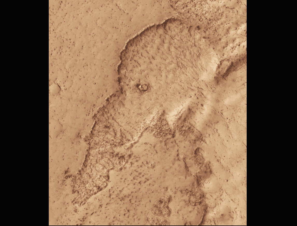
Lava flows in Mars' Elysium Planitia region have left a rather good likeness of a woolly mammoth or elephant. The region is known for some of the planet's youngest lavas - this one may formed in the past 100 million years.
Billions of years ago, Mars was a much different place than it is today. Its atmosphere was thicker and warmer, liquid water flowed on its surface, and the planet was geologically active. Due to its lower gravity, this activity led to the largest volcanoes in the Solar System (Olympus Mons and the Thetis Mons region) and the longest, deepest canyon in the world (Valles Marineris). Unfortunately, Mars’ interior began to cool rapidly, its inner core solidified, and geological activity largely stopped. For some time, geologists have believed that Mars was essentially “dead” in the geological sense.
However, recent studies have provided seismic and geophysical evidence that Mars may still be “slightly alive.” In a recent study, scientists from the University of Arizona (ASU) challenged conventional views of Martian geodynamic evolution by discovering evidence of an active mantle plume pushing its way through the crust, causing earthquakes and volcanic eruptions. Combined with some serious marsquakes recorded by NASA’s InSight lander, these finding suggests that there is still some powerful volcanic action beneath the surface of Mars.
Artist's concept of InSight "taking the pulse of Mars". Credit: NASA/JPL-Caltech
Since February 2019, NASA’s Interior Exploration using Seismic Investigations, Geodesy and Heat Transport (InSight) lander has been making the first-ever measurements of tectonics on another planet. The key to this is InSight’s Seismic Experiment for Interior Structure (SEIS) instrument (developed by seismologists and geophysicists at ETH Zurich), which has been on the surface listening for signs of “marsquakes.” The dataset it has gathered (over 1,300 seismic events) has largely confirmed what planetary scientists have long suspected: that Mars is largely quiet.
However, a research team led by ETH Zurich recently analyzed a cluster of more than 20 recent marsquakes, which revealed something very interesting. Based on the location and spectral character of these events, they determined that most of Mars’ widely distributed surface faults are not seismically active. Nevertheless, most of the 20 seismic events observed originated in the vicinity of Cerberus Fossae, a region consisting of rifts (or graben). These results suggest that geological activity and volcanism still play an active role in shaping the Martian surface.
A topographic map of the region around Jezero Crater. Image Credit: ESA/DLR/FU CC BY-SA 3.0 IGO
Geologists love fieldwork. They love getting their specialized hammers and chisels into seams in the rock, exposing unweathered surfaces and teasing out the rock’s secrets. Mars would be the ultimate field trip for many of them, but sadly, that’s not possible.
Instead, we’ve sent the Perseverance rover on the field trip. But if a geologist were along for the ride, what would it look like to them?
This image shows a small portion of Mawrth Vallis, one of the many outflow channels feeding north into the Chryse Basin. This ancient valley once hosted flowing water. The erosive power of the flowing water rapidly cut down into the underlying layers of rock to expose a host of diverse geologic landforms visible today. Image Credit: NASA/JPL/UArizona
Here on Earth, geologists seek out deep channels into Earth’s rock, carved over the ages by flowing water. The exposed rock walls are like a visual timeline of a region’s geological history. On Mars, the surface water is long gone. But it flowed long enough to expose layers of rock just like here on Earth.
One of those water-exposed areas on Mars is Mawrth Vallis, an outflow channel that feeds into the Chryse Basin.
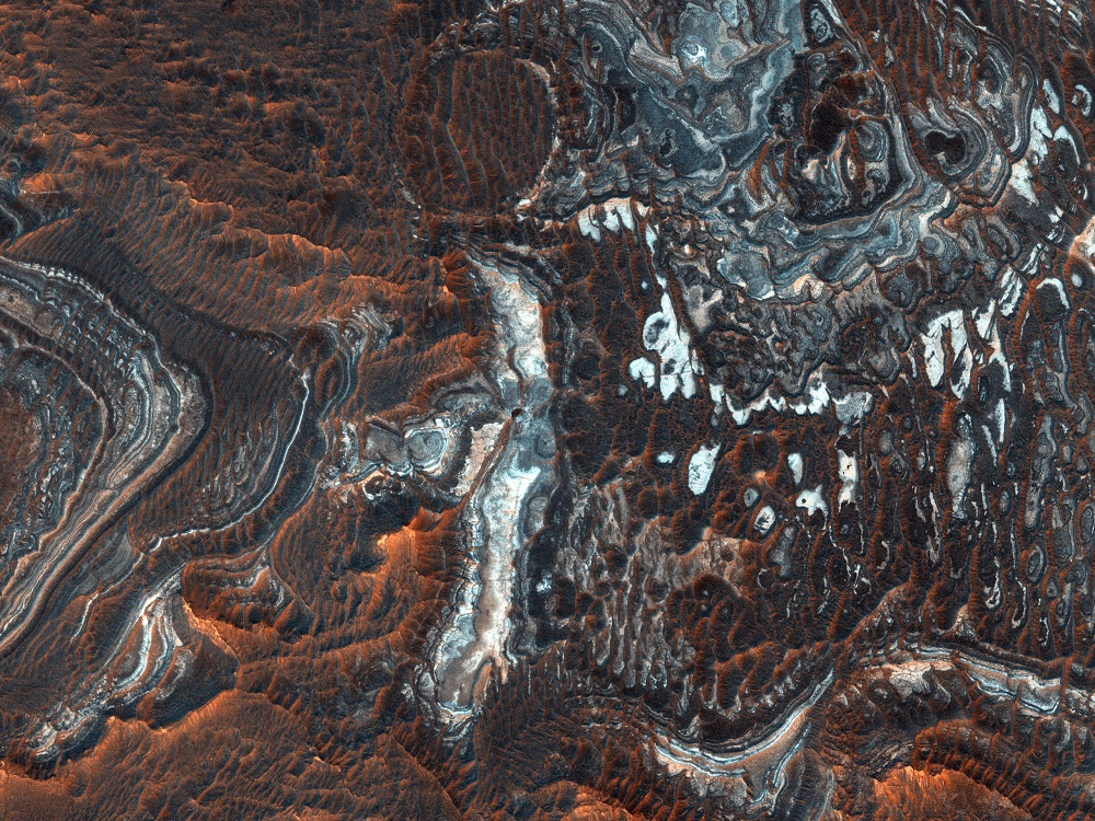
HiRISE image showing the terrain in Juventae Chasma. Credit: NASA/JPL/UArizona
The Mars Reconnaissance Orbiter (MRO) delivers once again! Using its advanced imaging instrument, the High Resolution Imaging Experiment (HiRISE) camera, the orbiter captured a breathtaking image (shown below) of the plains north of Juventae Chasma. This region constitutes the southwestern part of Valles Marineris, the gigantic canyon system that runs along the Martian equator.
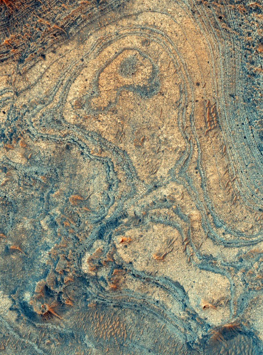
An olivine-rich deposit near Nili Fossae on the Martian surface. Image Credit: NASA/MRO
A strange feature on the surface of Mars has kept scientists guessing about its origin. It’s a surface deposit of a mineral which is more common in the interiors of planets. A new study shows that this interior mineral was probably brought to the surface by an ancient explosive volcano.
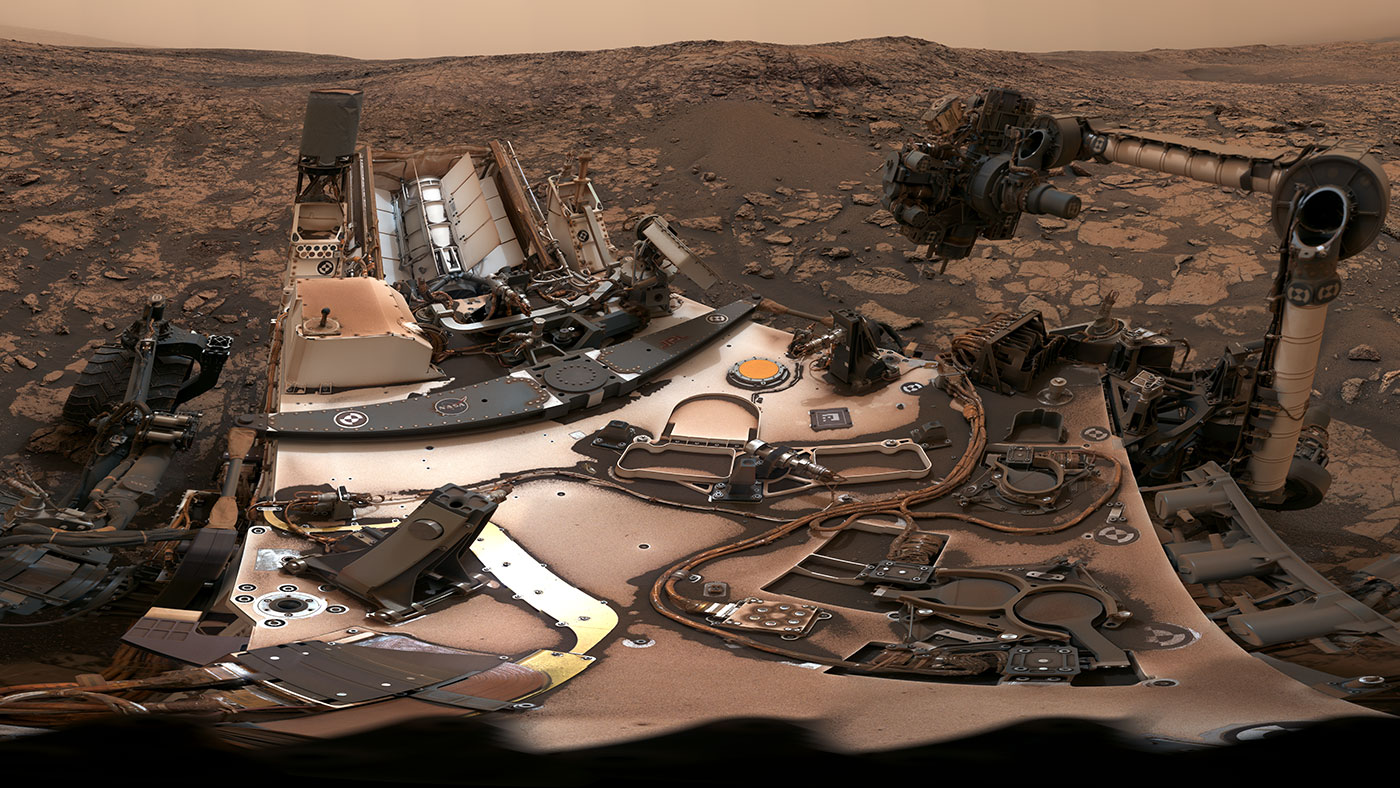
This 360-degree panorama was taken on Aug. 9 by NASA's Curiosity rover at its location on Vera Rubin Ridge. Credit: NASA/JPL-Caltech/MSSS
Ever since it landed on the Red Planet in 2012, the Curiosity rover has showed no signs of slowing down! For the past six years, it has ventured across the Gale Crater, scaled Mount Sharp, and taken numerous drill samples. And in the process, it has found evidence that liquid water (and possibly even life) once existed on the Martian surface.
It has also taken many breathtaking pictures that have catalogued its progress. Last month (on Aug. 9th), the rover took another 360-degree panoramic photo of its location. In addition to showing how the skies were still darkened by the fading dust storm and the rover’s dust-covered body, the picture also captured and the site where the latest drill sample was obtained.
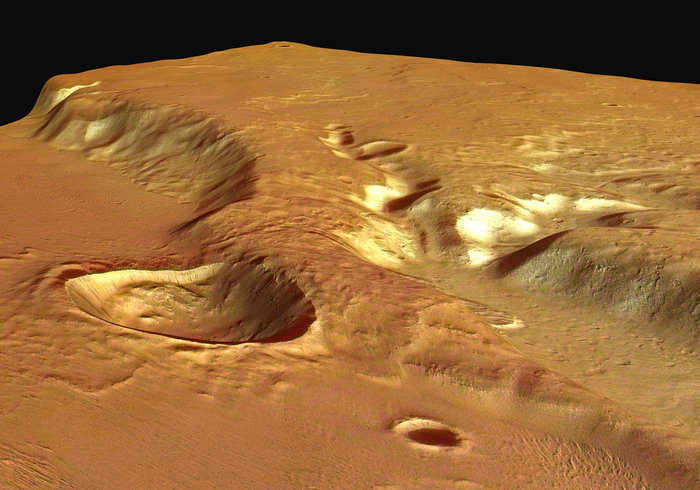
A 13-kilometer (8-mile) diameter crater being infilled by the Medusae Fossae Formation. Credit: High Resolution Stereo Camera/European Space Agency.
Scientists first observed the Medusae Fossae Formation (MFF) in the 1960s, thanks to the efforts of the Mariner spacecraft. This massive deposit of soft, sedimentary rock extends for roughly 1,000 km (621 mi) along the equator and consists of undulating hills, abrupt mesas, and curious ridges (aka. yardangs) that appear to be the result of wind erosion. What’s more, an unusual bump on top of this formation also gave rise to a UFO conspiracy theory.
Needless to say, the formation has been a source of scientific curiosity, with many geologists attempting to explain how it could have formed. According to a new study from Johns Hopkins University, the region was the result of volcanic activity that took place on the Red Planet more than 3 billion years ago. These findings could have drastic implications for scientists’ understanding of Mars’ interior and even its past potential for habitability.
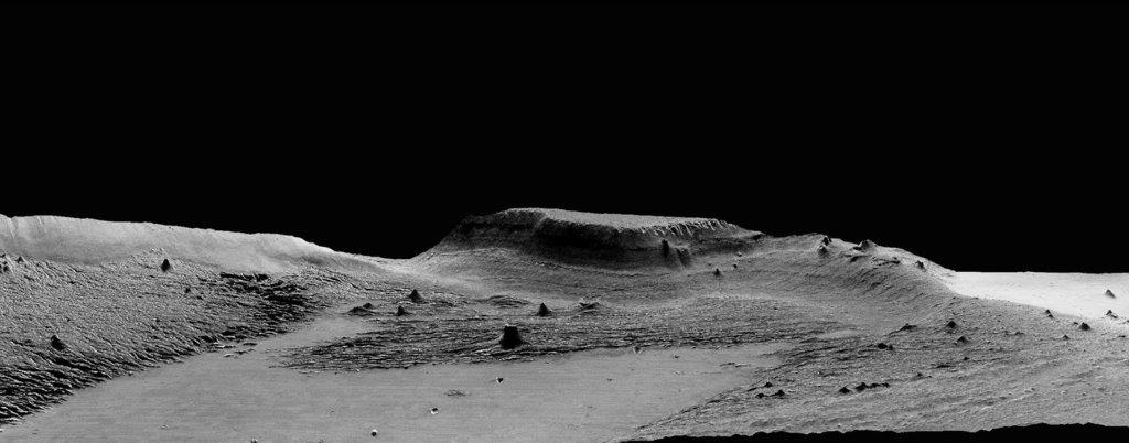
Perspective view of Medusa Fossae looking south-east. Copyright: ESA/DLR/FU Berlin (G. Neukum)
Ojha’s past work includes finding evidence that water on Mars occurs in seasonal brine flows on the surface, which he discovered in 2010 as an undergraduate student. Lewis, meanwhile, has dedicated much of his academic carreer to the in-depth study of the nature of sedimentary rock on Mars for the sake of determining what this geological record can tell us about that planet’s past climate and habitability.
As Ojha explained, the study of the Medusa Fossae Formation is central to understanding Mars geological history. Much like the Tharsus Montes region, this formation was formed at a time when the planet was still geologically active. “This is a massive deposit, not only on a Martian scale, but also in terms of the solar system, because we do not know of any other deposit that is like this,” he said.
Basically, sedimentary rock is the result of rock dust and debris accumulating on a planet’s surface and becoming hardened and layered over time. These layers serve as a geological record, indicating what types of processes where taking place on the surface at the time that the layers were deposited. When it comes to the Medusae Fossae Formation, scientists were unsure whether wind, water, ice or volcanic eruptions were responsible for the deposits.
In the past, radar measurements were made of the formation that suggested that Medusae Fosssae had an unusual composition. However, scientists were unsure whether the formation was made of highly porous rock or a mixture of rock and ice. For the sake of their study, Ojha and Lewis used gravity data from various Mars orbiters to measure the formation’s density for the first time.
An isolated hill in the Medusae Fossae Formation. The effect of wind erosion on this hill is evident by its streamlined shape. Credit: High Resolution Stereo Camera/European Space Agency
What they found was that the rock is unusually porous and about two-thirds as dense as the rest of the Martian crust. They also used radar and gravity data to show that the Formation’s density was too great to be explained by the presence of ice. From this, they concluded that the heavily-porous rock had to have been deposited by volcanic eruptions when Mars was still geologically active – ca. 3 billion years ago.
As these volcanoes exploded, casting ash and rock into the atmosphere, the material would have then fallen back to the surface, building up layers and streaming down hills. After enough time, the ash would have cemented into rock, which was slowly eroded over time by Martian winds and dust storms, leaving the Formation scientists see there today. According to Ojha, these new findings suggest that Mars’ interior is more complex than previously thought.
While scientists have known for some time that Mars has some volatiles – i.e. water, carbon dioxide and other elements that become gas with slight increases in temperature – in its crust that allow for periodic explosive eruptions to occur on the surface, the kind of eruption needed to create the Medusa Fossae region would have been immense. This indicates that the planet may have massive amounts of volatiles in its interior. As Ojha explained:
“If you were to distribute the Medusae Fossae globally, it would make a 9.7-meter (32-foot) thick layer. Given the sheer magnitude of this deposit, it really is incredible because it implies that the magma was not only rich in volatiles and also that it had to be volatile-rich for long periods of time.”
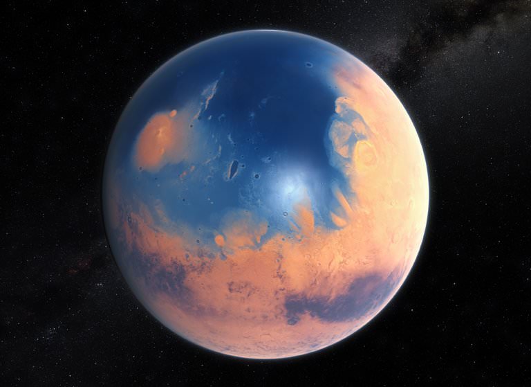
According to Ojha and Lewis’ study, the eruption that created the Medusa Fossae Formation would have covered Mars in a global ocean. Image: ESO/M. Kornmesser, via N. Risinger
In addition, this activity would have had a drastic impact on Mars’ past habitability. Basically, the formation of the Medusae Fossae Formation would have occurred during a pivotal point in Mars’ history. After the eruption occurred, massive amounts of carbon dioxide and (most likely) methane would have been ejected into the atmosphere, causing a significant greenhouse effect.
In addition, the authors indicated that the eruption would have ejected enough water to cover Mars in a global ocean more than 9 cm (4 inches) in thickness. This resulting greenhouse effect would have been enough to keep Mars’ surface warm to the point that the water would remain in a liquid state. At the same time, the expulsion of volcanic gases like hydrogen sulfide and sulfur dioxide would have altered the chemistry of Mars’ surface and atmosphere.
All of this would have had a drastic impact on the planet’s potential habitability. What’s more, as Kevin Lewis indicated, the new study shows that gravity surveys have the potential to interpret Mars’ geological record. “Future gravity surveys could help distinguish between ice, sediments and igneous rocks in the upper crust of the planet,” he said.
Studying Mars surface features and geological history is a lot like peeling an onion. With every layer we peel back, we get another piece of the puzzle, which together adds up to a rich and varied history. In the coming years and decades, more robotic missions will be studying the Red Planet’s surface and atmosphere in preparation for an eventual crewed mission by the 2030s.
All of these missions will allow us to learn more about Mars warmer, wetter past and whether or not may have existed there at some time (or perhaps, still does!)