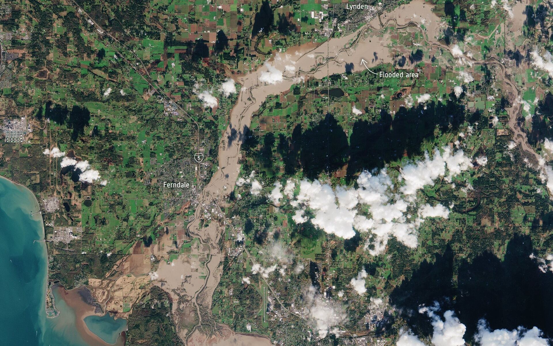
The State of Washington and the Province of BC are in a state of emergency following days of severe wind, rain, and flooding. The situation began when an “atmospheric river” (a plume of moisture) extended over the Pacific Northwest, triggering severe rainfall that caused already-rising rivers to overflow. This led to blocked roads, mudslides, fallen bridges, and thousands of animals drowning in farmland areas.
This extensive damage was photographed from space by Earth observation satellites, one of which was the European Space Agency’s (ESA) Copernicus Sentinel mission and the International Space Station (ISS). These images captured the extent of the floods in the Nooksack and Fraser River valleys this week, which both spilled over their banks this week, leading to washed-out roads and forcing the evacuation of thousands of people.
Continue reading “The Severe Pacific Northwest Flooding Seen From Space”