This Bizarre Image is a 3D Scan of a Cave Network in Spain. This Technology Could be Used to Map Out Lava Tubes on the Moon and Mars

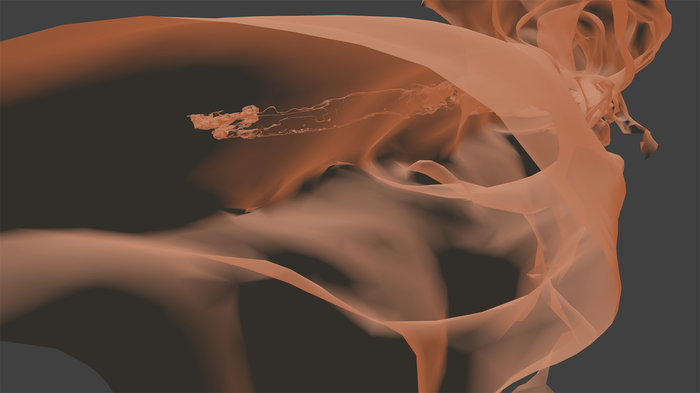
The intricate 3D map of the La Cueva de Los Verdes lava tube system in Lanzarote, Spain. Credit: Vigea – Tommaso Santagata

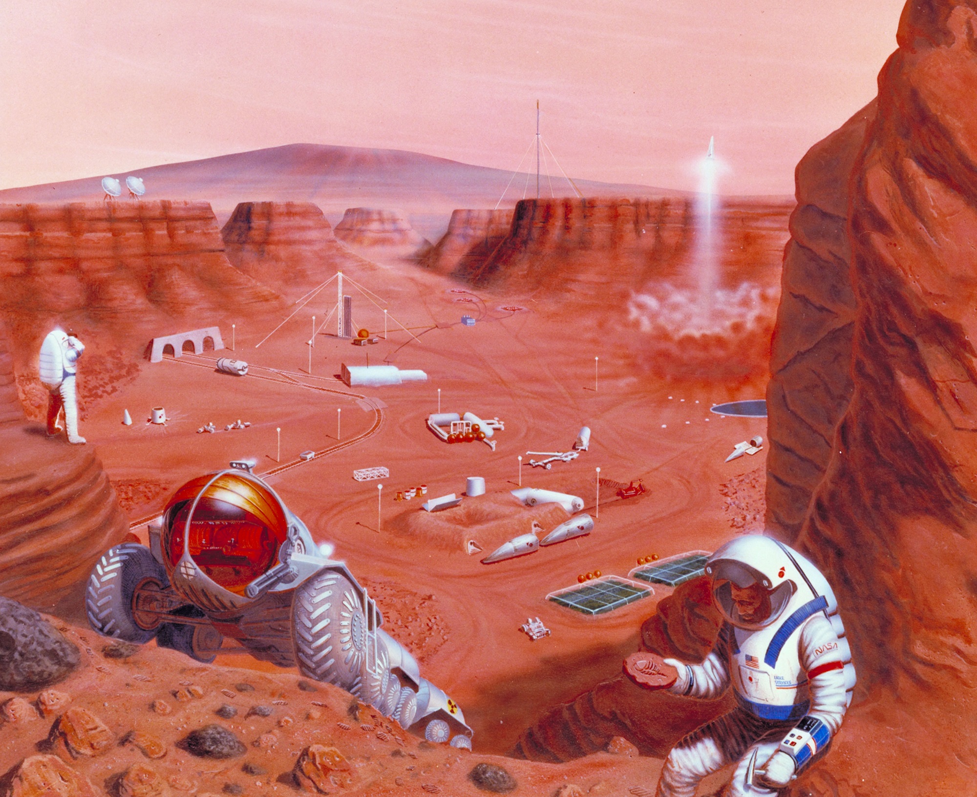
For some time, scientists have known that the Moon and Mars have some fascinating similarities to Earth. In addition to being similar in composition, there is ample evidence that both bodies had active geological pasts. This includes stable lava tubes which are very similar to those that exist here on Earth. And in the future, these tubes could be an ideal location for outposts and colonies.

However, before we can begin choosing where to settle, these locations need to be mapped out to determining which would be suitable for human habitation. Luckily, a team of speleologists (cave specialists), geologists and ESA astronauts recently created the largest 3D image of a lava tube ever created. As part of the ESA’s PANGAEA program, this technology could one day help scientists map out cave systems on the Moon and Mars.

The lava tube in question was the La Cueva de Los Verdes, a famous tourist destination in Lanzarote, Spain. In addition to ESA astronaut Matthias Mauer, the team consisted of Tommaso Santagata (a speleologist from the University of Padova and the co-founder of the Virtual Geographic Agency), Umberto Del Vecchio and Marta Lazzaroni – a geologists and a masters student from the University of Padova, respectively.
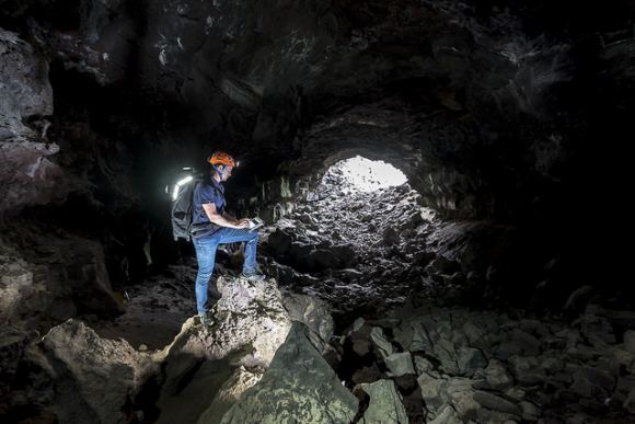
Testing out the Leica BLK360 in La Cueva de los Verdes lava tube in Lanzarote, Spain. Credit and Copyright: ESA – Alessio Romeo

Last year, the team mapped the path of this cave system as part of the ESA’s 2017 Pangaea-X campaign. As one of many ESA Spaceflight Analog field campaigns, the purpose of Pangaea-X is to conduct experiments designed to improve the future of the ESA’s Planetary ANalogue Geological and Astrobiological Exercise for Astronauts (PANGAEA) training course.

For five days in November 2017, this campaign mobilized 50 people, four space agencies and 18 organizations in five different locations. The La Cueva de los Verdes lava tube was of particular importance since it is one of the world’s largest volcanic cave complexes, measuring roughly 8 km in length. Some of these caves are even large enough to accommodate residential streets and houses.

During the campaign, Mauer, Santagata, Vecchio and Lazzaroni relied on two instruments to map the lava tube in detail. These included the Pegasus Backpack, a wearable mapping solution that collects geometric data without a satellite ad synchronizes images collected by five cameras and two 3D imaging laser profilers, and the Leica BLK360 – the smallest and lightest imaging scanner on the market.

In less than three hours, the team managed to map all the contours of the lava tube. And while the results of the campaign continue to be analyzed, the team chose to use the data they obtained to produce a 3D visual of all the twists and turns of the lava tube. The scan that resulted covers a 1.3 km section of the cave system with an unprecedented resolution of a few centimeters.

Santagata and the Virtual Geography Agency also turned their 3D visual into a lovely video titled “Lave tube fly-through”, which beautifully illustrates the winding and organic nature of the lava tube system.  This video was posted to the ESA’s twitter feed on Tuesday, March 13th (shown above). This video, like the scans that preceded it, represent a breakthrough in geological mapping and astronaut training.

While lava tubes have been mapped since the 1970s, a clear view of this subterranean passage has remained elusive until now. Beyond being the first, the scans the team conducted could also help scientists to study the origins of the cave system, its peculiar formations, and assist local institutions in protecting the subterranean environment. As intended, the scans could also assist future space exploration and colonization efforts.
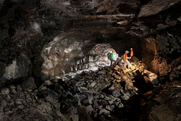
Pangaea-X arrives at the entrance to La Cueva de los Verdes lava tube. Credit and Copyright: ESA–Robbie Shone

For instance, the 8 km lava tube has both dry and water-filled sections. In the six-kilometer dry section, the lava tube has natural openings (jameos), that are aligned along the top of the cave pathway. These formations are very similar to “skylights” that have been observed on the Moon and Mars, which are holes in the surface that open into stable lava tubes.

Such structures are considered to be a good place for building outposts and colonies since they are naturally shielded from radiation and micrometeorites. Lava tubes also have a constant temperature, therefore offering protection against environmental extremes, and could provide access to underground sources of water ice. Some sections could also be sealed off and pressurized to create a colony.

As such, exploring such environments here on Earth is a good way to train astronauts to explore them on other bodies. As all astronauts know, mapping an environment is the first step in exploration, especially when you are looking for a place to establish a base camp. And in time, this information can be used to establish more permanent settlements, giving rise to eventual colonization.

Further Reading: ESA, Blogs ESA

Get That Geologist A Flight Suit!

Future missions to Mars and other locations in the Solar System may depend heavily on the skills of planetary geologists. Credit: NASA Ames Research Center

In the coming decades, the world’s largest space agencies all have some rather big plans. Between NASA, the European Space Agency (ESA), Roscosmos, the Indian Space Research Organisation (ISRO), or the China National Space Administration (CNSA), there are plans to return to the Moon, crewed missions to Mars, and crewed missions to Near-Earth Objects (NEOs).

In all cases, geological studies are going to be a major aspect of the mission. For this reason, the ESA recently unveiled a new training program known as the Pangaea course, a study program which focuses on identifying planetary geological features. This program showcases just how important planetary geologists will be to future missions.

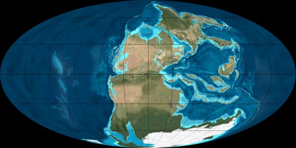
Pangaea takes its name from the super-continent that that existed during the late Paleozoic and early Mesozoic eras (300 to 175 million years ago). Due to convection in Earth’s mantle, this continent eventually broke up, giving rise to the seven continents that we are familiar with today.

The super-continent Pangea during the Permian period (300 - 250 million years ago). Credit: NAU Geology/Ron Blakey
The super-continent Pangea during the Permian period (300 – 250 million years ago). Credit: NAU Geology/Ron Blakey

Francesco Sauro – a field geologist, explorer and the designer of the course – explained the purpose of Pangaea in an ESA press release:

“This Pangaea course – named after the ancient supercontinent – will help astronauts to find interesting rock samples as well as to assess the most likely places to find traces of life on other planets. We created a course that enables astronauts on future missions to other planetary bodies to spot the best areas for exploration and the most scientifically interesting rocks to take samples for further analysis by the scientists back on Earth.”

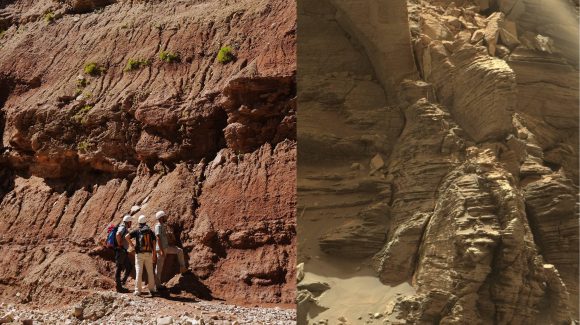
This first part of the course will take place this week, where astronaut trainer Matthias Maurer and astronauts Luca Parmitano and Pedro Duque will be learning from a panel of planetary geology experts. These lessons will include how to recognize certain types of rock, how to draw landscapes, and the exploration of a canyon that has sedimentary features similar to the ones observed in the Murray Buttes region, which was recently imaged by the Curiosity rover.

The geology panel will include such luminaries as Matteo Messironi (a geologist working on the Rosetta and ExoMars missions), Harald Hiesinger (an expert in lunar geology), Anna Maria Fioretti (a meteorite expert), and Nicolas Mangold (a Mars expert currently working with NASA’s Curiosity team).

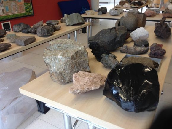
Rock samples on display at ESA's Pangaea training for astronauts in identifying planetary geological features for future missions to the Moon, Mars and asteroids. Credit: ESA/L. Bessone
Rock samples on display at ESA’s Pangaea training course, which is intended to help astronauts in identify planetary geological features for future missions to the Moon, Mars and asteroids. Credit: ESA/L. Bessone

Once this phase of the course is complete, a series of field trips will follow to locations that were chosen because their geological features resemble those of other planets. This will include the town of Bressanone in northeastern Italy, which lies a few kilometers outside of the Brenner Pass (the part of the Alps that lies between Italy and Austria).

In many ways, the Pangaea course picks up where the Cooperative Adventure for Valuing and Exercising Human Behaviour and Performance Skills (CAVES) program left off. For several years now, the ESA has been conducting training missions in underground caverns in order to teach astronauts about working in challenging environments.

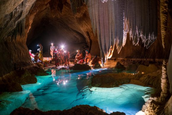
This past summer, the latest program involved a team of six international astronauts spending two weeks in a cave network in Sardinia, Italy. In this environment,  800-meters (2625 ft) beneath the surface, the team carried out a series of research and exploration activities designed to recreate aspects of a space expedition.

As the teams explore the caves of Sardinia, they encountered caverns, underground lakes and examples of strange microscopic life – all things they could encounter in extra-terrestrial environments. While doing this, they also get the change to test out new technologies and methods for research and experiments.

Sedimentary outcroppings in the Bressanoe region (left), compared to sedimentary deposits in the Murray Buttes region on Mars (right). Credit: ESA/I. Drozdovsky (left); NASA (right)

In a way that is similar to expeditions aboard the ISS, the program was designed to teach an international team of astronauts how to address the challenges of living and working in confined spaces. These include limited privacy, less equipment for hygiene and comfort, difficult conditions, variable temperatures and humidity, and extremely difficult emergency evacuation procedures.

Above all, the program attempts to foster teamwork, communication skills, decision-making, problem-solving, and leadership. This program is now an integral part of the ESA’s astronaut training and is conducted once a year. And as project leader Loredana Bessone explained, the Pangaea course fits with the aims of the CAVES program quite well.

“Pangaea complements our CAVES underground training,” she said. “CAVES focuses on team behaviour and operational aspects of a space mission, whereas Pangaea focuses on developing knowledge and skills for planetary geology and astrobiology.”

From all of these efforts, it is clear that the ESA, NASA and other space agencies want to make sure that future generations of astronauts are trained to conduct field geology and will be able to identify targets for scientific research. But of course, understanding the importance planetary geology in space exploration is not exactly a new phenomenon.

The six-member CAVES team in Sardinia, Italy, observing an underground pool. Credit: ESA/V.Crobu
The six-member CAVES team in Sardinia, Italy, observing an underground pool. Credit: ESA/V. Crobu

In fact, the study of planetary geology is rooted in the Apollo era, when it became a field separate from other fields of geological research. And geology experts played a very pivotal role when it came to selecting the landing sites of the Apollo missions. As Emily Lakdawalla, the Senior Editor of The Planetary Society (and a geologist herself), told Universe Today in a phone interview:

“The Apollo astronauts received training in field geology before they went to the Moon. Jim Head at Brown University, who was my advisor, was one person who provided that training. Before there were missions, the Lunar Orbiter program returned photos that geologists used to map the surface of the Moon and find good landing sites.”

This tradition is being carried on today with instruments like the Mars Global Surveyor. Before the Spirit and Opportunity rovers were deployed to the Martian surface, NASA scientists studied images taken by this orbiter to determine which potential landing sites would prove to be the valuable for conducting research.

And thanks to the experience gained by the Apollo missions and improvements made in both technology and instrumentation, the process has become much more sophisticated. Compared to the Apollo-era, today’s NASA mission planners have much more detailed information to go on.

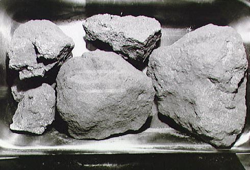
Moon rocks from the Apollo 11 mission. Credit: NASA

“These days, the orbiter photos have such high resolutions that its just like having aerial photographs, which is something Earth geologists have always used as a tool to scope out an area before going to study it,” Lakdawalla said. “With these  photos, we can map out an area in detail before we send a rover, and determine where the most high-value samples will be.”

Looking ahead, everything that’s learned from sending astronauts to the Moon – and from the study of the lunar rocks they brought back – is going to play a vital role when it comes time to explore Mars, go back to the Moon, and investigate NEOs. As Lakdawalla explained, in each case, the purpose of the geological studies will be a bit different.

“The goal in obtaining samples from the Moon was about understanding the chronology of the Moon. The timescale we have developed for the Moon are anchored in the Apollo samples. But we think that the samples have been sampling one major impact – the Imbrium impact. The next Moon samples will attempt to sample other time periods so we can determine if our time scales are correct.”

“On Mars, the questions is, ‘what are the history of water on Mars’. You try to find rocks from orbit that will answer that questions – rocks that have either been altered by water or formed in water. And that is how you select your landing zone.”

And with future missions to NEOs, astronauts will be tasked with examining geological samples which date back to the formation of the Solar System. From this, we are likely to get a better understanding of how our Solar System formed and evolved over the many billion years it has existed.

Clearly, it is a good time to be a geologist, as their expertise will be called upon for future missions to space. Hope they like tang!

Further Reading: ESA, CSA

Why Is This Astronaut Working Survivor-Style In The Arctic?

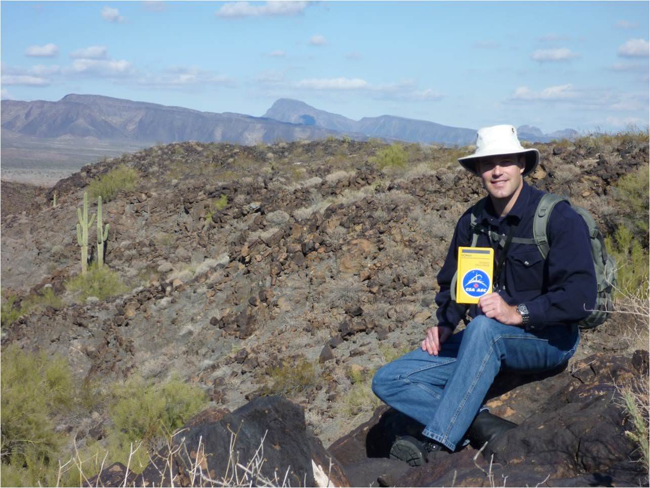
Canadian astronaut Jeremy Hansen during 2010 geology training near Gila Bend, Arizona. Credit: Canadian Space Agency

This week, Canadian astronaut Jeremy Hansen is on his way to a remote island in the Canadian Arctic. We realize this sounds like the opening episode for Survivor, but his purpose up there is more scientific: to conduct field geology.

Geology work, and training for sample collection is not as easy as simply picking up whatever you see on the ground. It’s important to get a range of rocks that represent the geology of the area. You also need to photograph and otherwise document the area in such a way that geologists can learn more about how it was formed, among other duties.

A trained observer can come to preliminary conclusions while wandering around in the field, and possibly change his or her sample-gathering strategy in accordance with that. The Apollo moon missions were replete with examples of this, with one of the more famous ones perhaps being when Harrison Schmitt (who, unlike his colleagues, had a Ph.D. in geology) stumbled across some orange soil during Apollo 17. This was probably evidence of an ancient fire-fountain of lava on the moon.

But Schmitt certainly wasn’t expecting to see that when he walked on the surface. Check out his reaction around 1:50 in this video:

Field geology was a common feature among the Apollo astronauts, and it could come in handy for planetary exploration again some time: there is some chatter about bringing people to asteroids or (eventually) Mars in the coming decades.

Hansen will join a Western University group to study “impact cratering processes while learning methods and techniques for conducting geological fieldwork that can be applied to sites beyond our planet,” stated the Canadian Space Agency. To make it feel more space mission-like, the group will be working with limited supplies and support.

Geology training isn’t important just on the ground, but also in observing from space. As Hansen points out on this video, from time to time astronauts on the International Space Station are called upon to observe features from their orbital perches. If they understand the processes behind what they see, their descriptions, videos and photos will be more scientific.

Hansen will stay on Devon Island until about July 25, studying impact crater processes along with the rest of the team. Updates should be available on his Twitter feed as well as through the Canadian Space Agency.

And by the way, Canada was also useful to astronauts during the Apollo years. One famous geology site was at Sudbury, Ont. This website highlights the activities of the Apollo 16 crew, which was looking at craters in the area.

Source: Canadian Space Agency