
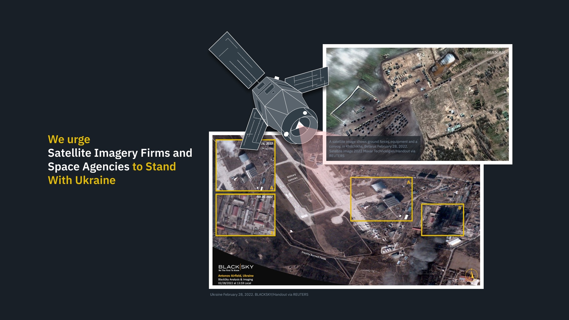
On the morning of February 24th, after years of proxy conflict in the border region, Russia invaded the neighboring country of Ukraine. This invasion was the culmination of eight years of conflict that began with the removal of Ukrainian President Viktor Yanukovych (a long-time ally of Russian President Vladimir Putin) and Russia’s subsequent annexation of Crimea. This invasion has prompted the global community to mobilize and find ways to support Ukraine!
For instance, you have Earth Observatory System Data Analytics (EOSDA), a California-based “all-in-one cloud workspace” for Earth observation solutions. In a recent statement, EOSDA CEO Max Polyakov appealed to satellite imagery firms and space agencies worldwide to share their recent and real-time high-to-medium resolution optical and radar satellite imagery with EOSDA to assist military and humanitarian aid efforts in the region.
Continue reading “Ukrainians urge satellites to publicly share real-time images of the Russian invasion”