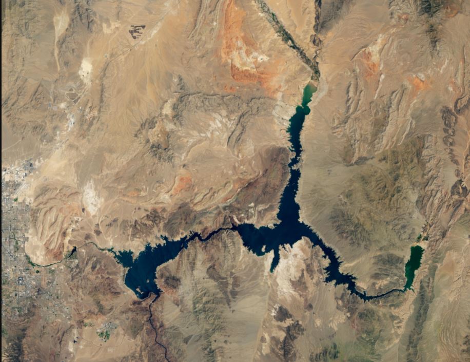
How bad is the drought in the western United States? A stunning depiction of the record dry spell comes in images of Lake Mead, the reservoir formed by the Hoover Dam on the Colorado River. NASA satellite images, below, from Landsat 7 and Landsat 8 show the difference in lake levels between August 2000 and August 2021.
Continue reading “Here’s Lake Mead’s Record Low Water Levels Seen From Space”Here’s Lake Mead’s Record Low Water Levels Seen From Space